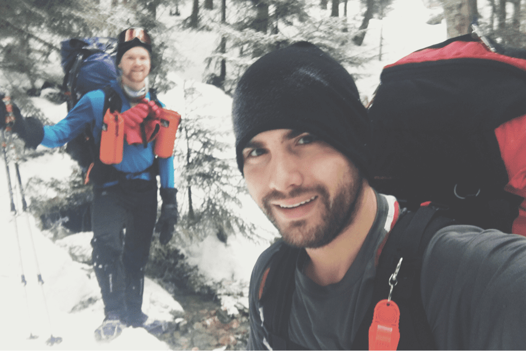
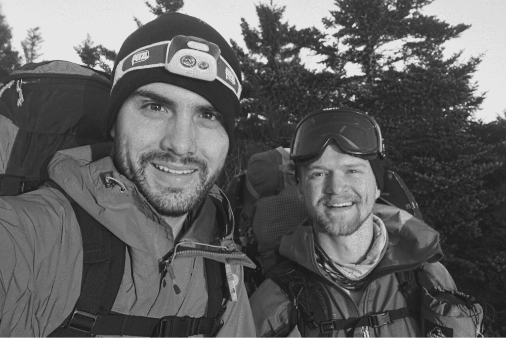
2180miles
  • Home
  • Adventure Blog
  • Overland
    • Meet The Jeep
    • Mods & Installs
    • Overland Gear
    • Trip Reports & Videos >
      • Allagash Winter 2019
      • Greece Adventures 2019
      • Overland Expo East 2018
      • Allagash Wilderness 2018
      • Trans-Canada Overland 2017
      • QB-5 Adventure 2017
  • Long Trail
    • Trip Summary
    • Photojournal
    • Hike Statistics
  • Appalachian Trail
    • Trip Summary
    • Photojournal
    • Gear Talk
    • Hike Statistics
    • Financial Planning
  • Bicycling America
    • Trip Summary
    • Photojournal

Slow & Steady

12/31/2016

2 Comments

 
Day #12
Mileage: 8.8
Long Trail Mileage: 124.1
Time: 9 hours
Day / Night Temp: 28 / 19 F
--
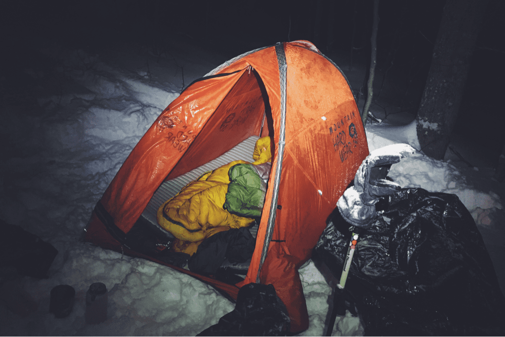
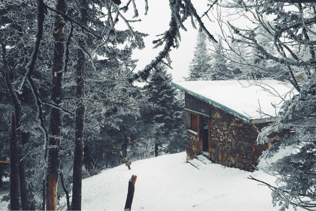
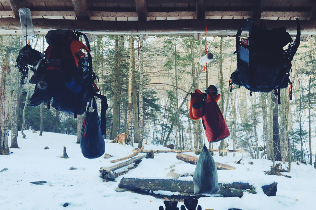
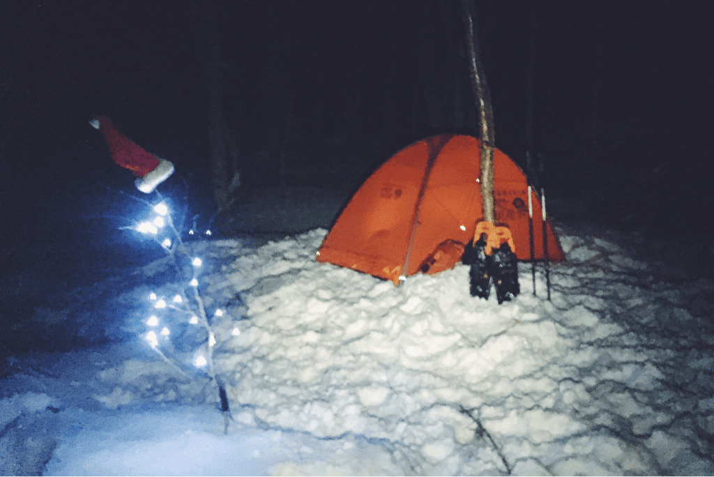
Our port in the storm worked wonders last night, keeping us out of the elements and warm as another 4+ inches of snow fell on the forest floor around us. Due to our location on the inside slope of the ridge, however, we were exposed to very little cross breeze which in turn with our body heat created a fair bit of moisture inside the tent and on our sleeping bags. While the snow subsided around midnight, it picked up again around 0330hrs, the noise of flakes hitting the tent waking me from an otherwise dead sleep. From then on the night and any hope of quality rest was lost on me. Around three hours later Santa awoke, encouraging me to get up as well so we could get started on the day.

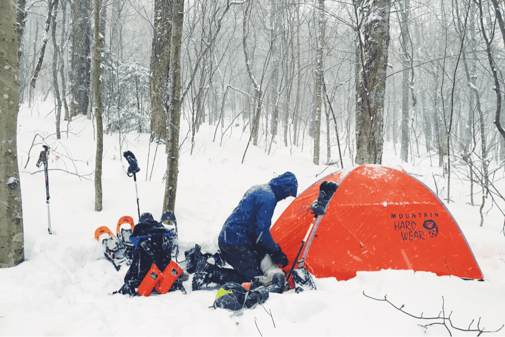
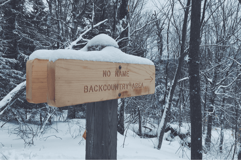
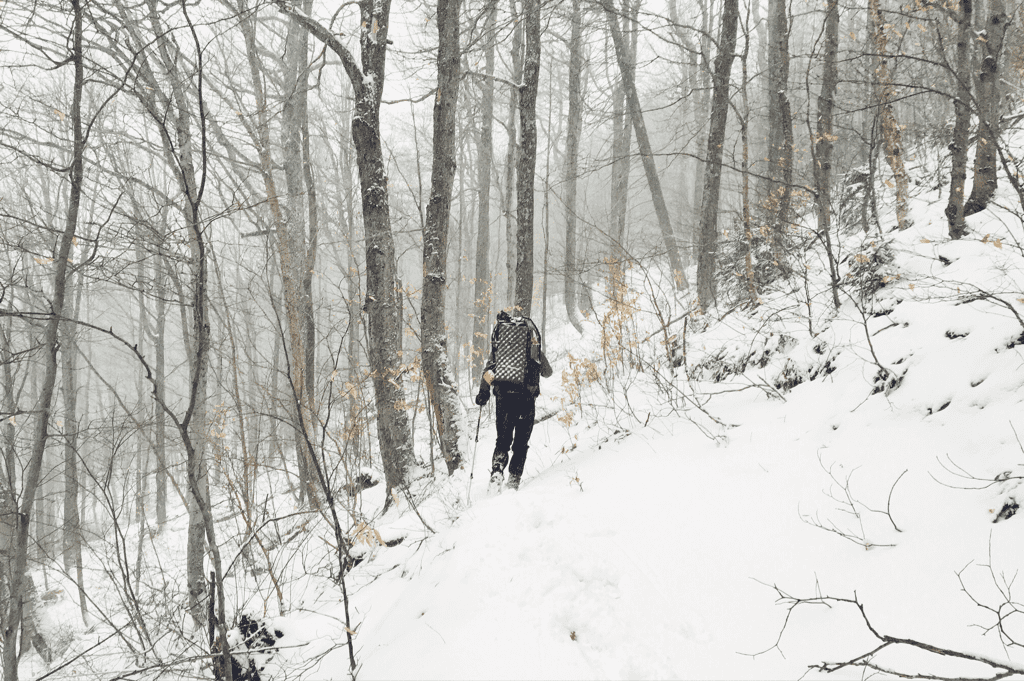
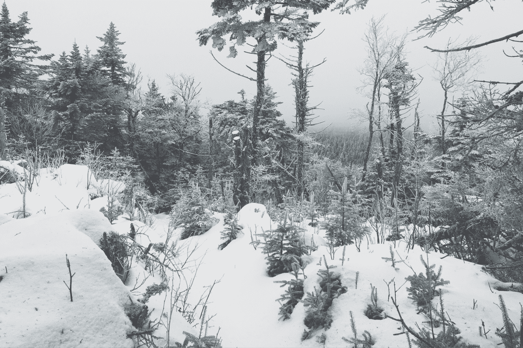
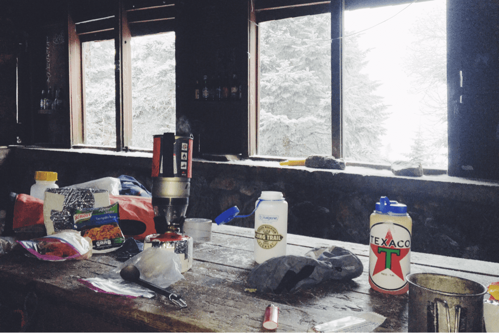
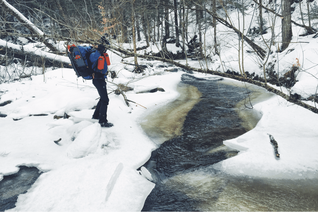
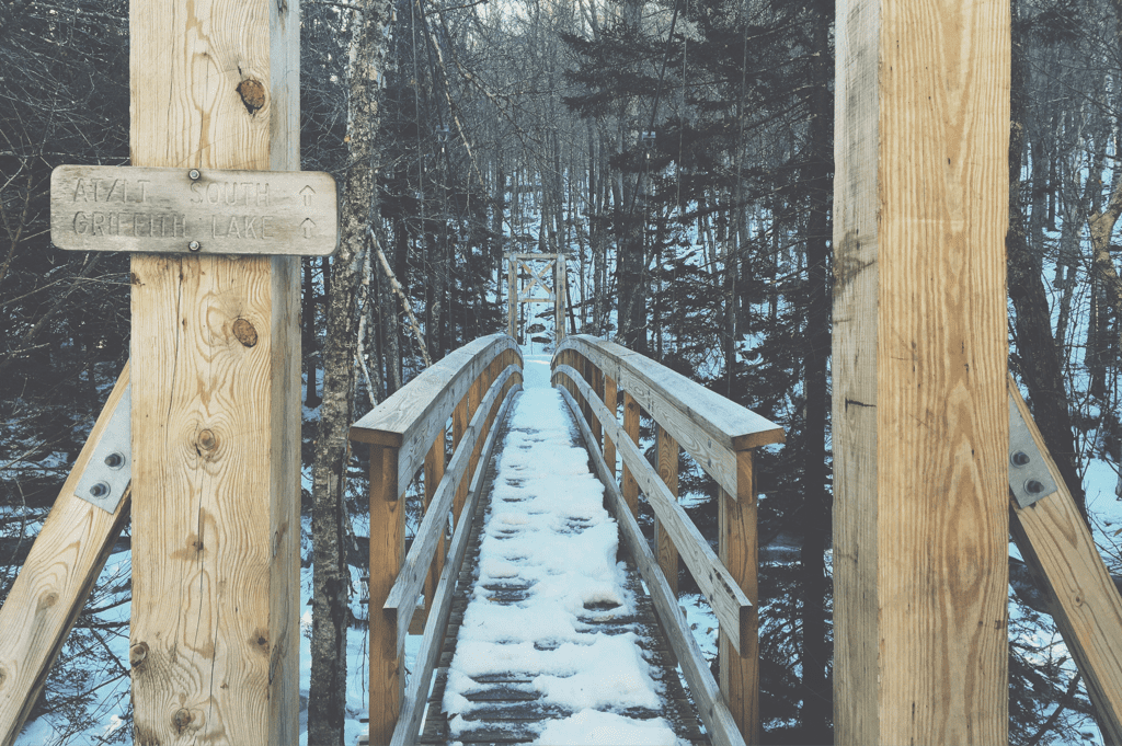
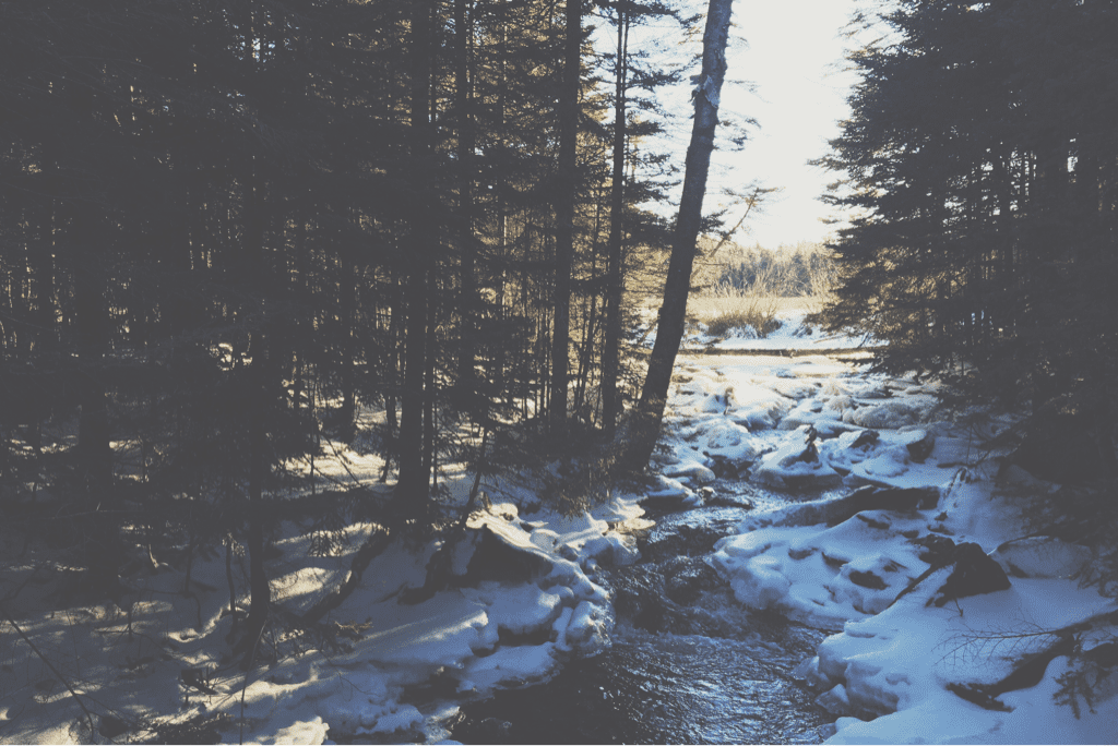
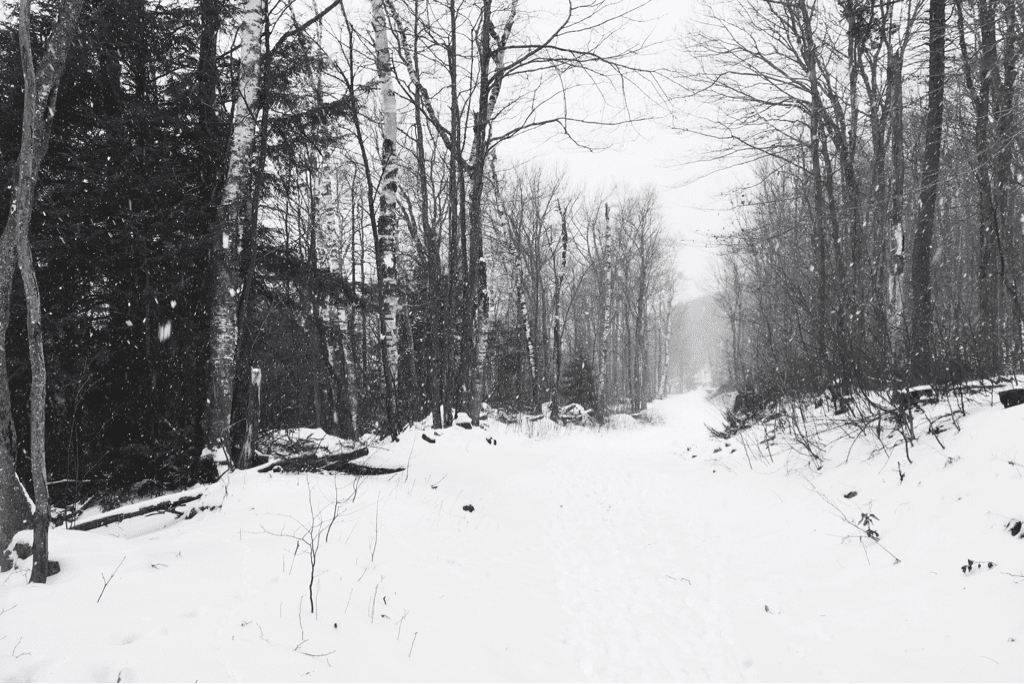
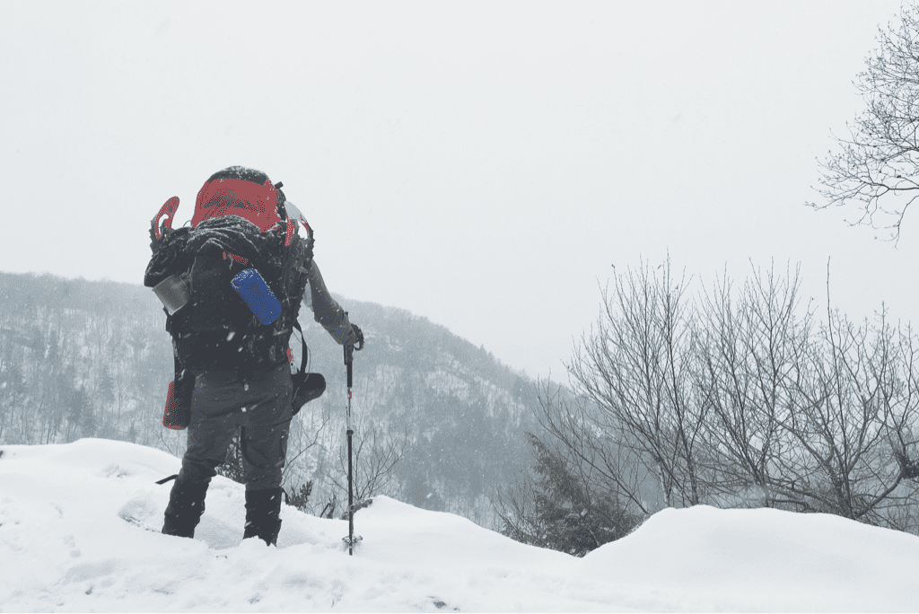
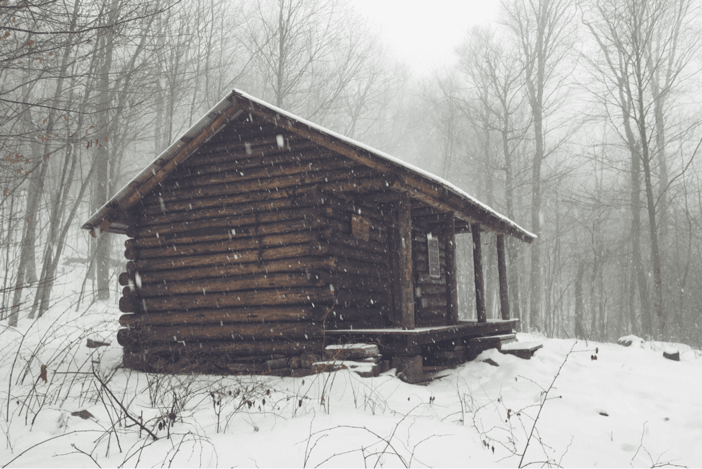
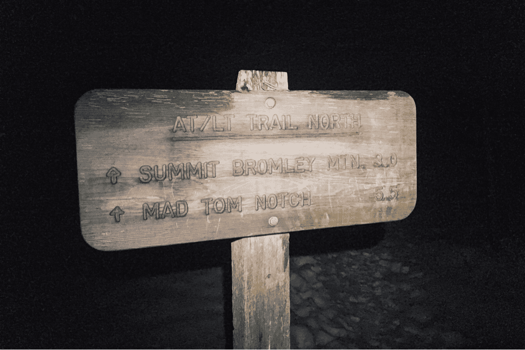
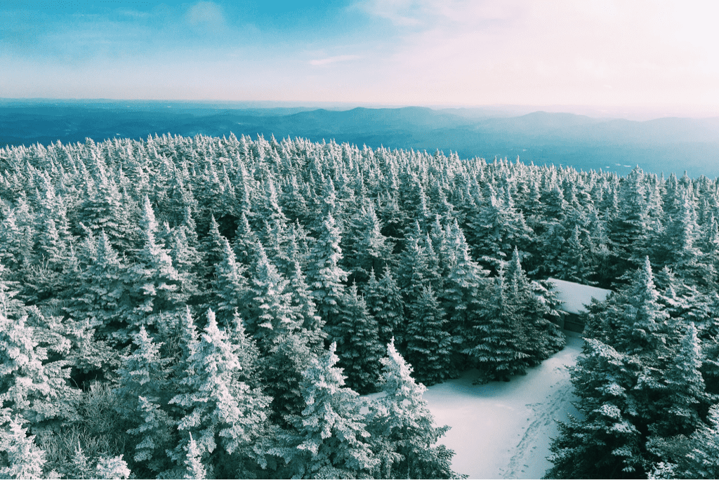
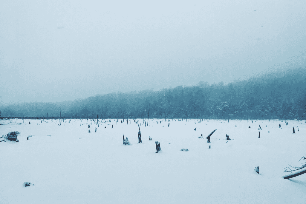
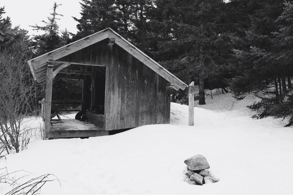
Packing up the tent and all of our gear proved rather difficult to do as the second coming of the winter storm fell directly on top of us. Cold wind made itself present, and we hurried to pack the tent up and get a move on. The plan for the day was an ambitious thirteen mile trek to the Sucker Brook shelter. After putting on our gloves and frozen shell jackets, we began searching for the nearest white blaze that marked the Long Trail's path north. It took only a few minutes before we found such a thing, faded but present nonetheless on the bark of a birch tree a mere 25' uphill from where our tent was set the night before. We had been so close to the trail, but in the pitch black of night with snow flying sideways and headlamps glaring back at us in the reflection of said snow, there was no way we'd ever have found the blaze nor the trail. This began our game of searching out the woods for the trail itself; with the help of ambient light from the sun as it rose above the ridge line we followed the curvature of snow that is unmistakably the trail as it wound through trees and over hills. Despite every ounce of energy being devoted to hiking and route finding, it took us nearly 90 minutes to arrive at the side trail for the David Logan shelter where we had intended to spend the night before. There is no way on earth we would have made it there in the dark. Having no water left due to our emergent place of residence the night before, we pulled in to eat an early lunch and fill our water bottles. Scoping out the shelter's nearby streams we discovered them both dry, realizing that for the first time in our 116 miles of trekking, we'd need to boil snow to hydrate.

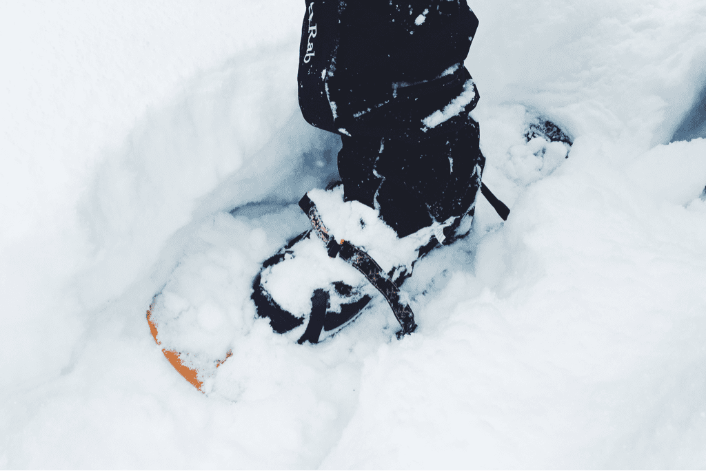
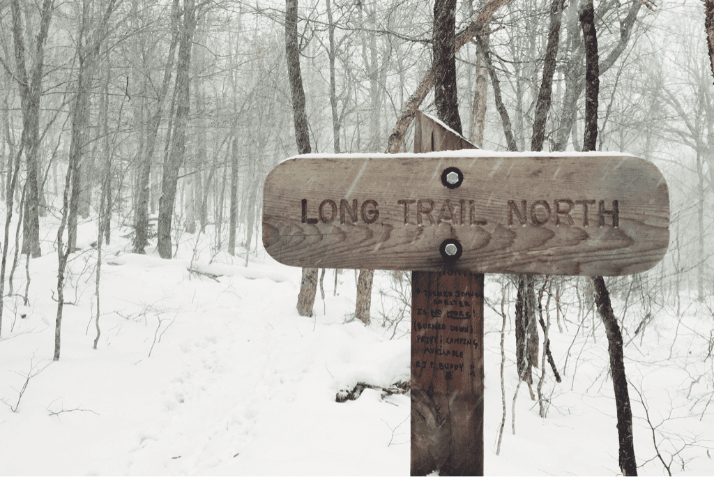
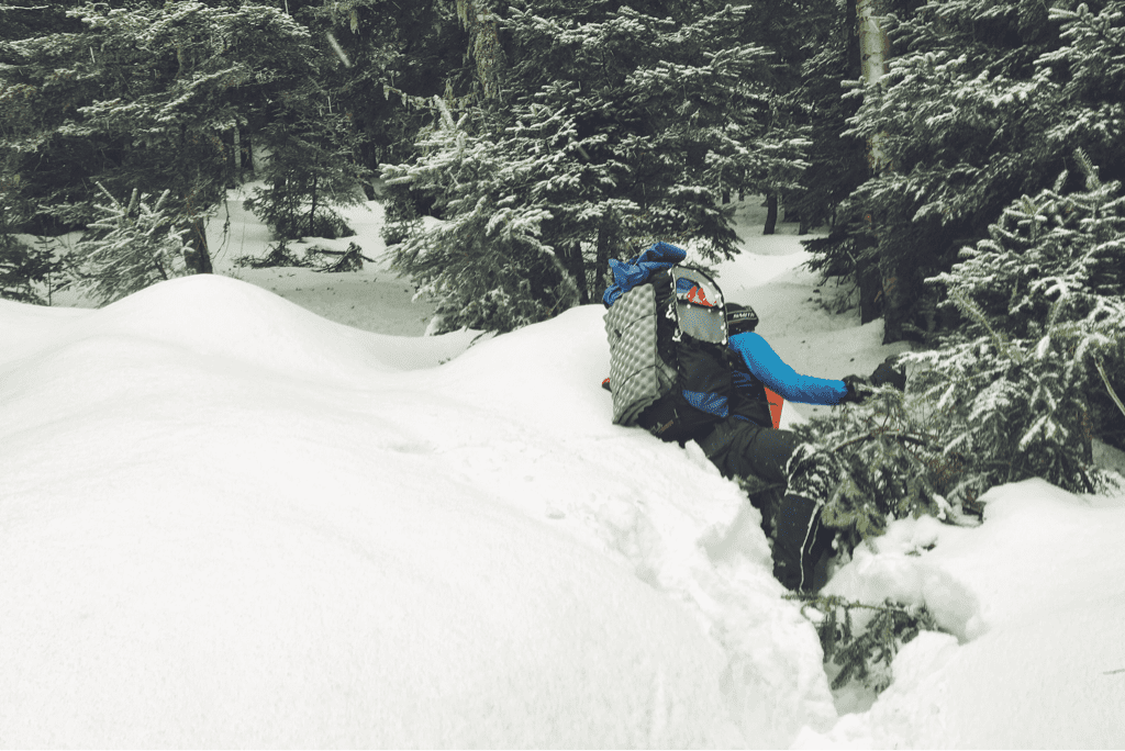
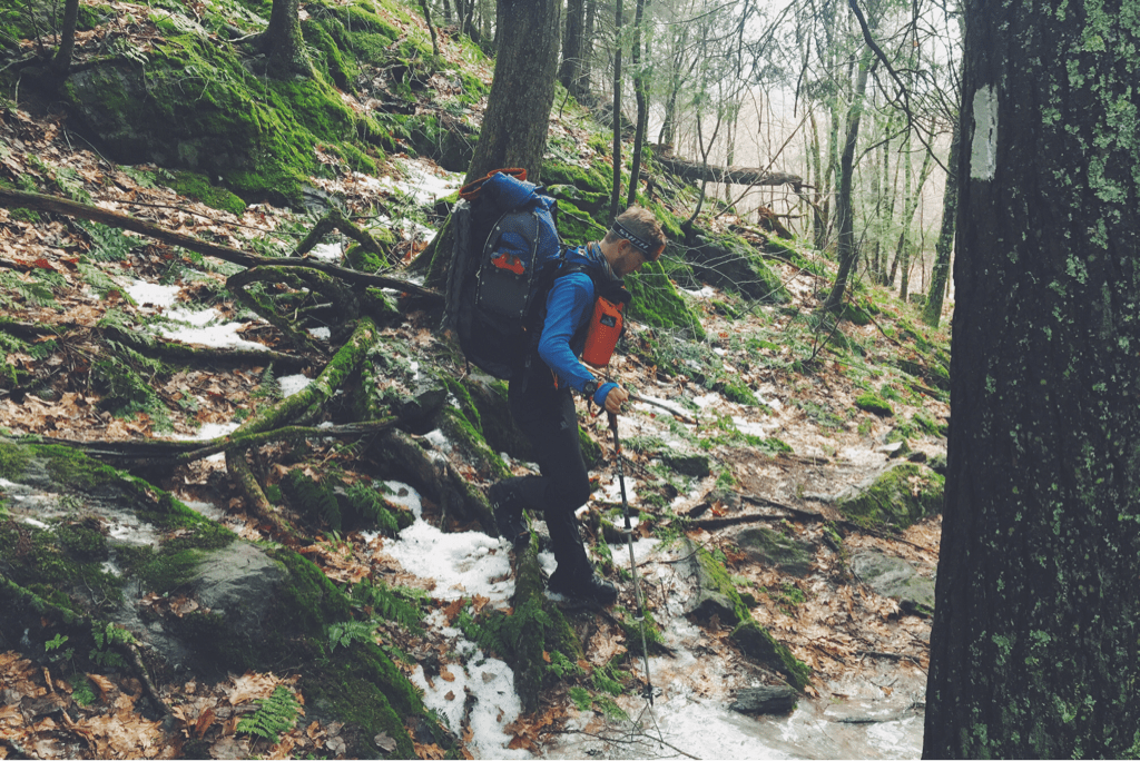
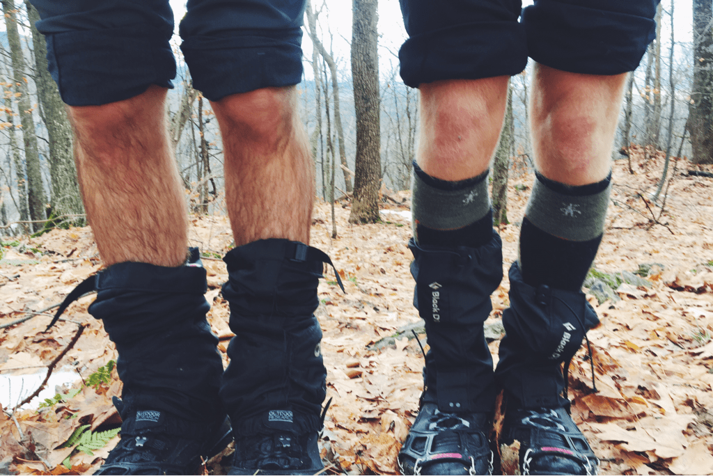
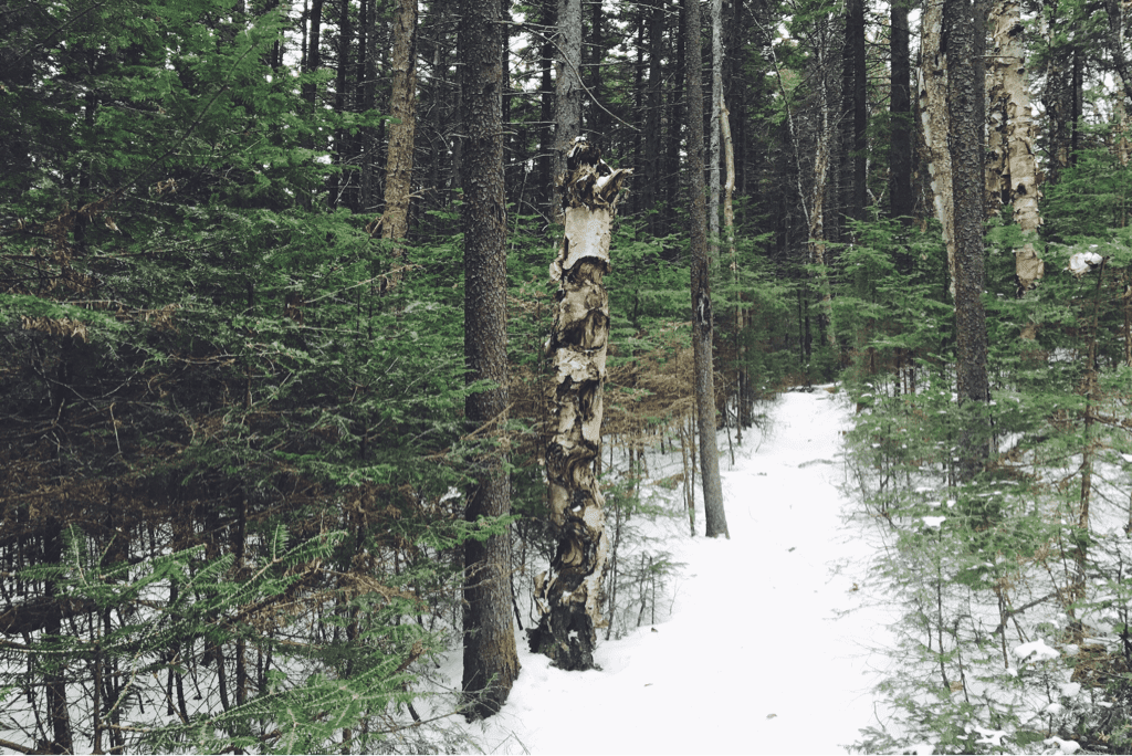
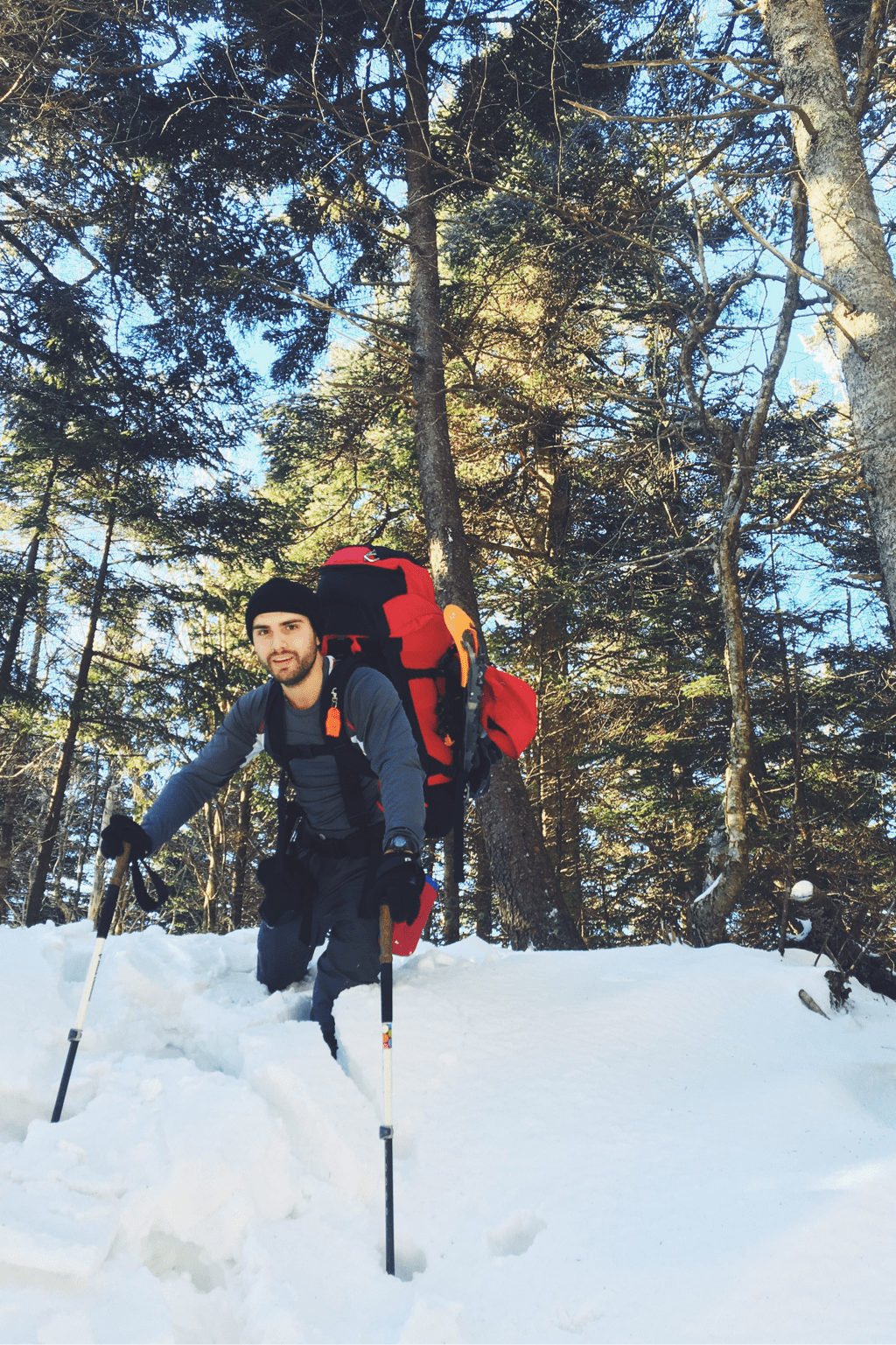
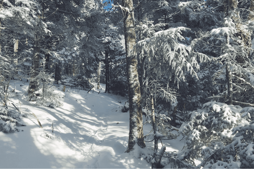
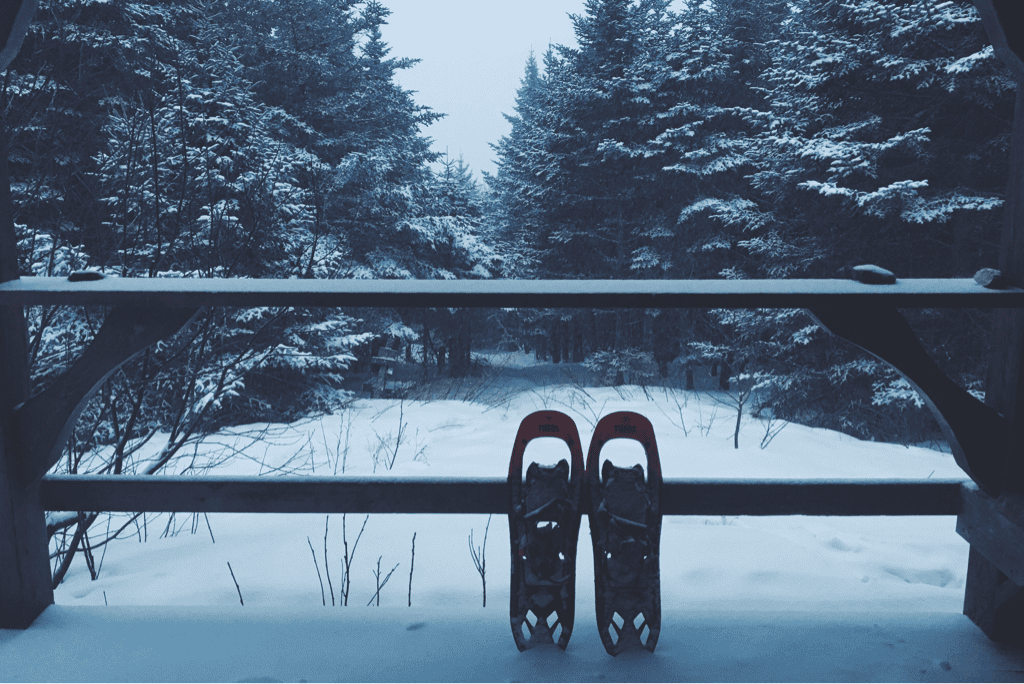
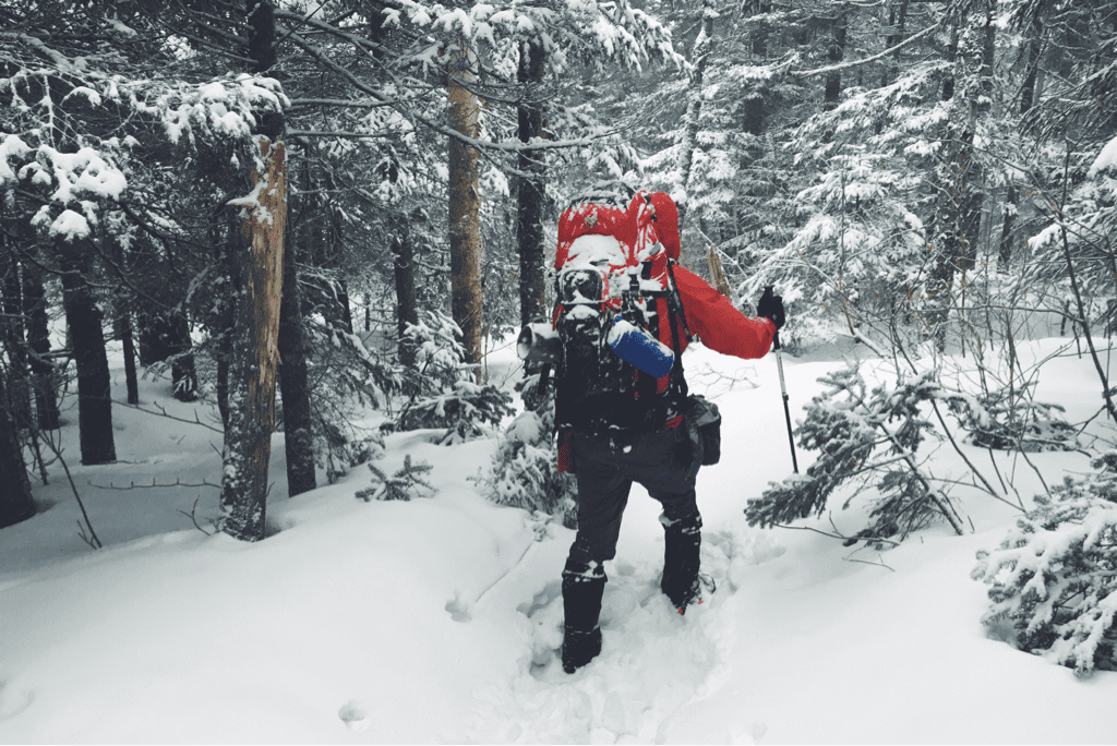
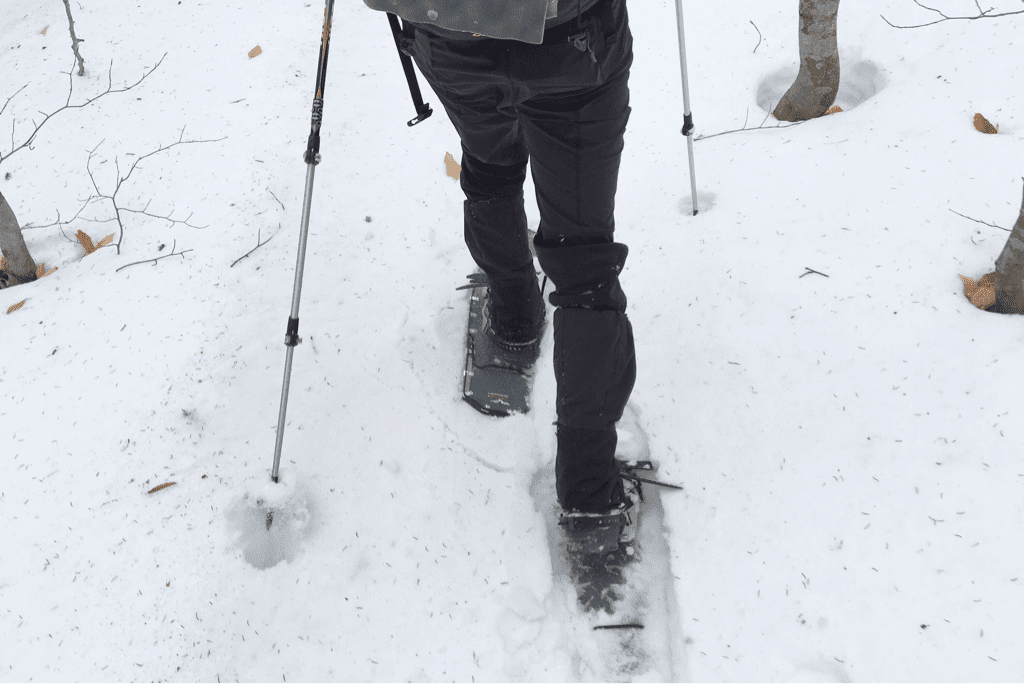
It took us an hour to refill our water supplies and eat, something I wasn't thrilled about given the 8.8 remaining miles to the road gap where we intended to end our day. We packed up and moved back out, following the shelter's steep side trail 0.2 miles uphill to where it had departed from the LT. Immediately we continued climbing, gaining a few hundred feet of elevation through densely packed snow. This began an entire day of difficult, at times miserable, hiking as we progressed north on the trail. Some sections of the Long Trail are incredibly steep, some are cut into the side of a mountain with very little room for a misstep before you risk tumbling down into the oblivion that lies below. We traversed both these kinds of trail, every so often balancing them together as we carefully made our way up the trail. The snowfall depth varied depending on where we were on each mountain, from 8-10 inches deep along the ridges to upwards of 30 inches deep on the steep pitched inclines. Sometimes I would reach my trekking pole out into the snow to catch the weight of my body if I tripped, only to find almost the entire pole disappear into the snow beside me. Each step in my snowshoes was part of an exhausting battle to move forward, and we slowed to an incredible 1 mile per hour as we moved along.

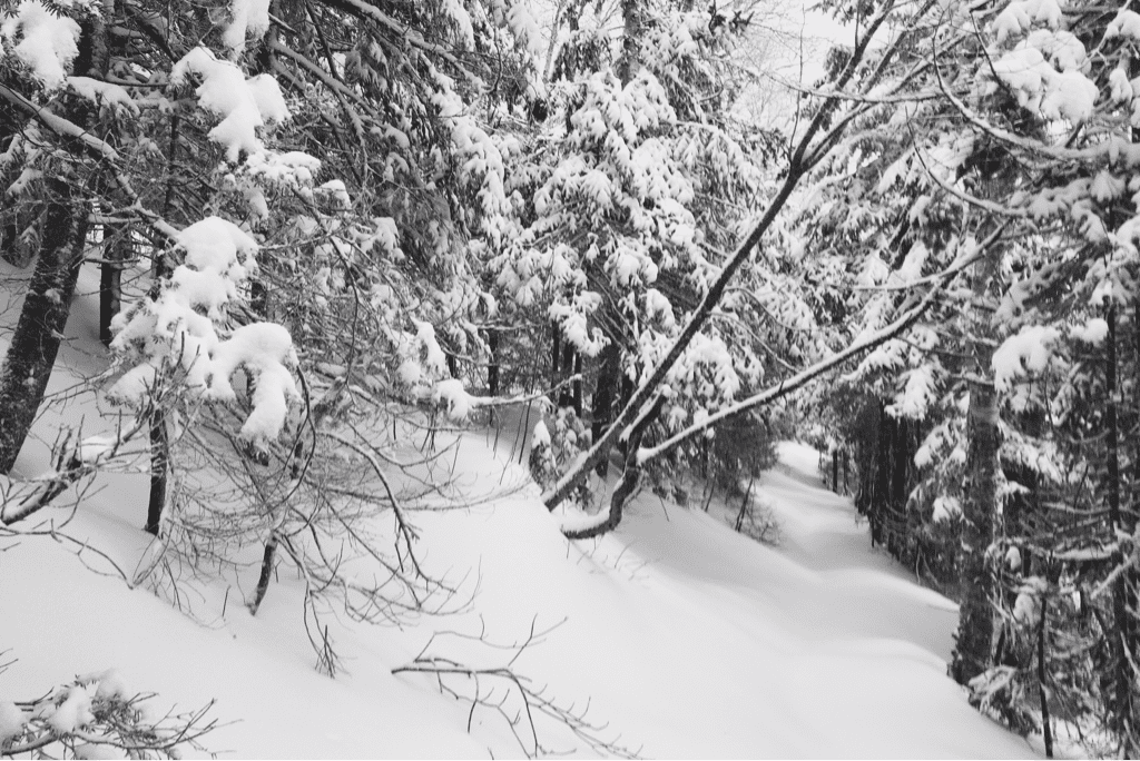
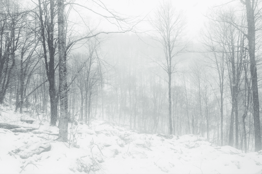
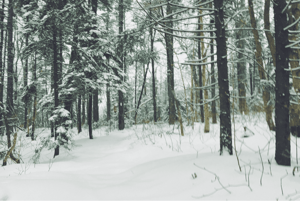
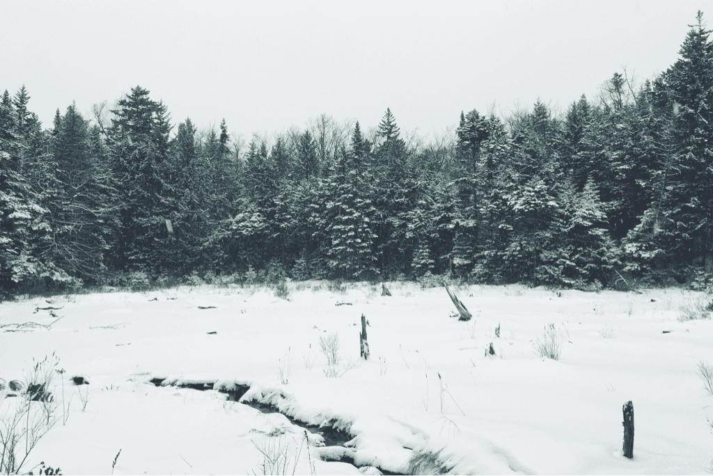
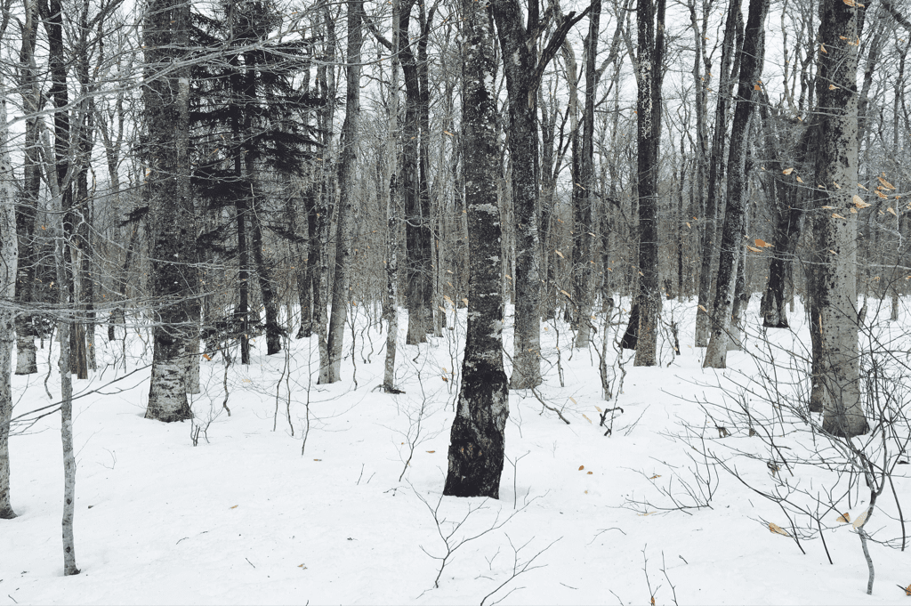
The afternoon passed at a confusing rate, the time seemed to fly as our mileage moved like molasses. We were frustrated with ourselves for the speed, wondering aloud how the LT would be to traverse in the fall when the trail itself was easier to follow. Despite the frequency on other days to talk almost incessantly, we moved along in near silence today, respecting each other's seeming need without any prior arrangement. We crossed through the woods as the trail slowly became more easy to navigate, flowing through pine and maple trees with a wide berth that made it quickly distinguishable versus the rest of the forest we were in. Santa and I alternated breaking trail throughout the day as the trail continued to climb in elevation, crossing over a half dozen well groomed snowmobile trails as they wound through the same mountains we went over.

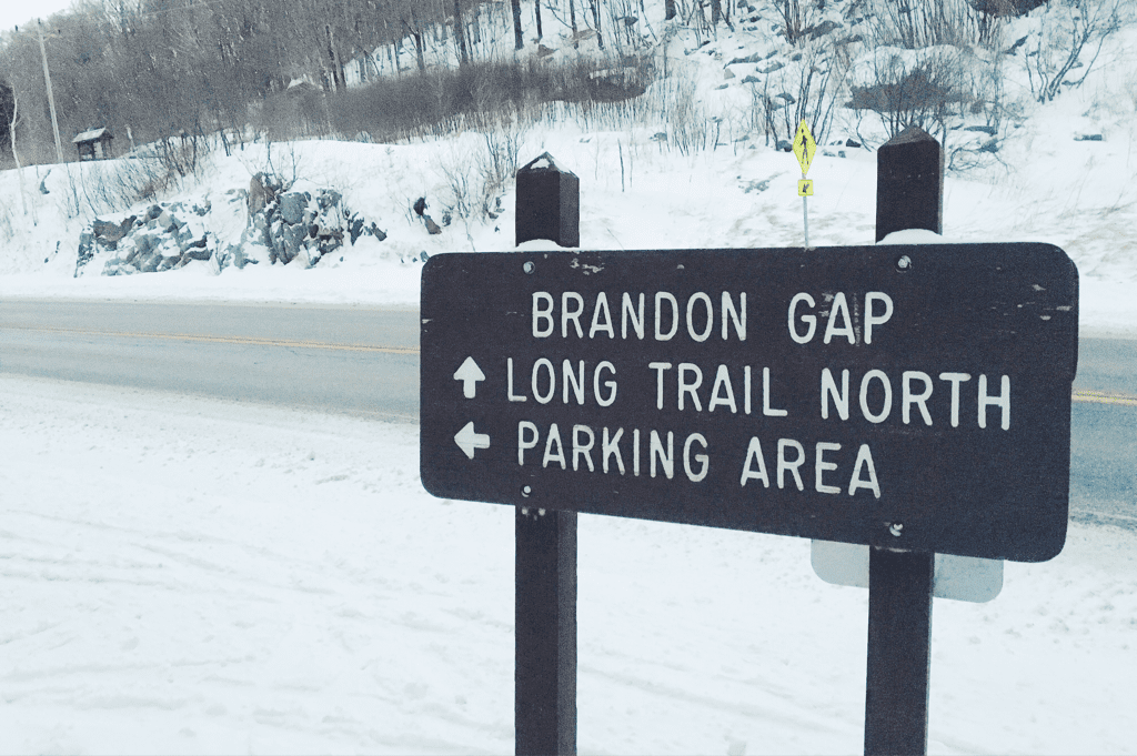
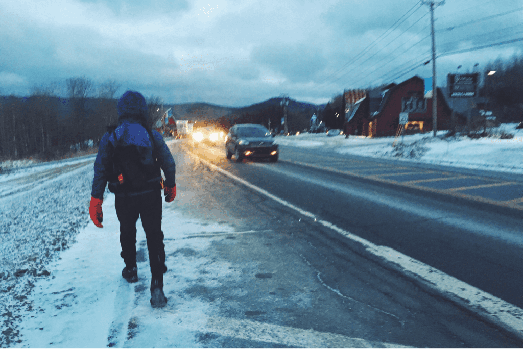
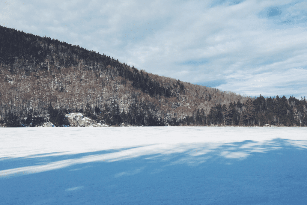
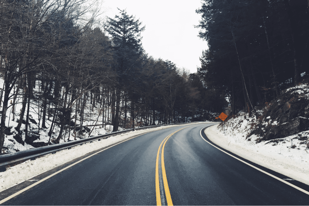
Around 1530hrs we crossed by Bloodroot Gap, marking our initial descent down from the 3,300' ridge to the gap below where Route 73 cuts through the mountains. We had only 2.4 miles left in our day, though the miserably slow mile an hour pace we had been pushing hard to move at made me hesitant for how long the remaining distance would take to cover. Thankfully we soon learned that the area was also popular to cross country skiers, and the LT's route down the mountain had already been well packed from skis despite the heavy snowfall in the last 24 hours. We flew down the gradually descending terrain, making it to the Brandon Gap parking lot where we planned to spend the night around 1645hrs, the tail end of daylight.

Today was difficult, blanketed with snow and constantly subject to more falling, but ultimately was not impossible (or impassable for that matter). Compared to previous days we covered a small amount of mileage and that fact is slightly frustrating, but I take a step back and realize we've just hiked 23 miles, through tough terrain, over a two day winter storm in New England.

Every day we do our best for one more day.
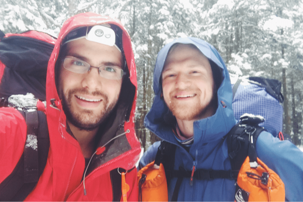
Tex

​
Picture
Picture
Picture
Picture
Picture
Picture
2 Comments

Whiteout

12/30/2016

3 Comments

 
Day #11
Mileage: 11.2 (plus 1.4 off trail)
Long Trail Mileage: 115.3
Time: 8 hours
Day / Night Temp: 28 / 15 F
--
While the Inn wasn't home to the most comfortable bed in the world, the warmth of the wood stove was everything a cold hiker could ever have asked for. I woke around 0700, beginning to pack my new food supplies into my bag as Santa joined me by the fire to do the same. We were expecting snow for 1000hrs, and aimed to be on the trail at that exact time. Breakfast was held in the Inn's dining room, a delightful dish of homemade French toast with watermelon, bacon, hot chocolate, and orange juice. With the meals included in the room cost, the Inn turned out, I believe, to have been an excellent place to stay. We returned to our room to finish packing, checking out at 1000hrs on the dot and shouldering our bags just as the snow began to fall.

The day's plan was a rather simple elevation profile, a few climbs of 4-700 feet each, with what looked like some ridge walking in between. It took a 1.4 mile hike to get back to the Long Trail itself from the Inn, at which point we hiked until we came across the Maine Junction, the point where the Appalachian and Long trails split having had shared blazes, shelters, and exact trajectory for the last 105.5 miles since the Massachusetts border. We triple checked the signage, being sure to choose the right white blazes for our trip north (the Appalachian Trail splits east towards New Hampshire at this junction) and stepped foot into the Long Trail with our sights set towards Canada. Having hiked the AT in 2014, it was a near realization that from this point forward every step was on a trail I had never traveled before. I no longer knew what was around every corner, the tricks to each shelter, etc; it was a freeing feeling of sorts.

As we hiked the heavy snow of the nor'easter continued to fall. We had on our shell jackets, hats, gloves, and goggles to protect ourselves as the snow and wind blew in sideways and seemingly every other direction. We knew the Long Trail would be marked less, so we paid a lot of attention to keeping the right targets in scope, following the right indentations in the quickly falling snow, to stay on track. Had we not been previous thru-hikers, I don't know that we would be as good at following a difficultly marked trail in such heavy winter conditions. Climbing through the hills on the ascent out of Killington, we reached the Rolston Rest shelter around 1245hours, having made great time since leaving the inn, despite the weather conditions. We made the break short, knowing there were still 7.8 miles left in the day and hiked back into the snow having eaten a power bar kind of lunch. The terrain from the shelter climbed a good 500 feet, not the most difficult but not the easiest as we stopped every 100 or so paces to verify our existence on the trail itself. Whereas the Appalachian Trail is packed down from thousands of travelers, the LT has very little depression in the ground making it far less obvious to follow. Best we could tell, the last hikers through this section were our friends Mariposa and Violet who we met towards the end of our AT thrus, who had attempted to finish the Long Trail from Killington to Canada just over a month ago. We were on our own in finding the way.

As we climbed up it became apparent that the original LT is a completely different beast from its AT sharing section. The 'ridge' we anticipated walking on was actually an 18" wide path cut into the side of a 45 degree vertical slope with very low margins for error. As the heavy and wet snow continued to fall, each step was taken cautiously with an ankle rolled to match the pitch of the terrain and keep us upright. Downed trees were everywhere and we found ourselves climbing over or under them as they sprawled across the narrow trail, having no option to go around simple due to the angle of the terrain we were crossing. We gained and lost little bits of elevation here and there, continuing to walk sideways to the mountains, and eventually came out to a snowmobile trail crossing where the trail cut across after a few hundred feet of road walking.

The sign marking the Long Trail's reentrance into the woods was comedically propped up against a tree, pointing in directions that had no actual bearing on the trail itself. We were left to search out the 'trail', covered in 12+ inches of snow, from the forest of white frosted tree trunks that lay before us. We used the GPS to verify the coordinates after wasting a few precious minutes trying to find it on our own, and were eventually back underway, again carving into the steep hillside as Goretex shells began to look wet, a hint at just how much snow was falling (and melting) on them. The drive to make it to the David Logan shelter where we planned to stay the night became even greater. At one point as we hiked this narrow trail on the slope of the mountain, my left foot slipped on a snow covered patch of ice, sending me toppling off the trail and down the incline a few feet before catching my foot on a tree and self arresting. I came down hard on my already pained right knee, and Santa stood on the trail above me asking what he could do to help. We slowly got me back on the trail, cautiously carrying on with less momentum than before. Our speeds slowed dramatically with the weird terrain and increasingly bad weather. As sunset happened somewhere far behind the thick grey clouds that covered our landscape, we donned our headlamps as we do every night we hike. Dusk was upon us quickly, and with it we got more sideways snow in near white out conditions. The glow of the headlamps beam shone back at us in the reflective snow, and we trudged forward slowly with every step.

It was around 1645 hours as the woods became completely dark that we realized we had actually (finally?) lost the trail. Santa began searching for blazes as I referenced the GPS. With the infrequent appearance of our favorite white trail marking paint, we followed the breadcrumb path of the GPS further forward until our position and the 'trail' no longer stayed in sync. We spent nearly half an hour along a ridge trying to find the trail itself, getting colder and more wet in the process as wet snow abundantly continued to fall. We were exactly 1 mile of trail from the shelter, a warm(er) and covered place to spend the night. We debated hiking straight to it, but hesitated due to the topography and slopes of the surrounding area. Santa suggested returning to a blue blazed side trail and trying to approach the shelter from a parking lot at the base of the mountain. Standing there losing body heat and getting more uncomfortable by the minute, I told him we needed to set the tent and hunker down for what would be a long night of continued snowfall. Finding a 'flat' section of ground a hundred or so feet from the top of the ridge, we used our snowshoes to stomp down over a foot of fresh powder, working quickly to get the tent up and keep it dry inside.

We're hunkered down for the night waiting for daylight's arrival with hopes of reacquainting ourselves with the trail when we can see it without struggle. I won't go so far as to say it was dumb to be hiking at night in this weather, as it's something we've absolutely done before. I absolutely think we made the right decision to shelter in place instead of wearing ourselves out by continuing to search for a trail we had little hope of finding in the pitch black on a mountainside. There's little cross-breeze now which makes me nervous for precipitation inside the tent. All our gear is dry from the night at the Inn, and it will be unfortunate when it becomes damp from a night of confined space with little ventilation. I'd leave the door open, but snow continues to fall.

The tone here is pessimistic and moral low. I've never in my life felt unsafe in the woods until tonight, which put me a bit on edge and I think cemented my unwillingness to try and make it the ONE more mile to the shelter. I've carried the tent for 115 miles for this exact reason; to be our port in the storm.

We'll find the trail in the morning and will see how far we make it. Today was almost a 12 mile day and tomorrow is slated to be thirteen. We'll have to see how my knee is after that last fall, and how Santa is feeling about all this. We've seen exactly three hikers on trail since leaving Massachusetts; 157 remaining miles is still a very long way to go, especially if we're breaking 12-18" of newly fallen powder the entire way.

Ever onwards.
Picture
Picture
Picture
Picture
3 Comments

Killing(ton) Me Softly

12/29/2016

3 Comments

 
Day #10
Mileage: 10.6 (plus 3 off trail)
Long Trail Mileage: 104.5
Time: 8 hours
Day / Night Temp: 25 / 18 F
--
​

We've broken the 100 mile mark. Had it not been for the relatively packed trail on our north side descent of Killington, I'd be writing that the mountain whooped our asses around the block and back. For the first time on the trail I woke up the moment my alarm went off, making some kind of noise to wake Santa as well. We had business to tend to, town to get to, supplies to purchase, hot food to eat, and warm beds to sleep in; there was no time whatsoever to mess around.

We left the shelter at 0730 and began walking up the Forest Service road a quarter mile or so before the Appalachian Trail / Long Trail turned off the maintained terrain and up into the woods. The snow flurries continued on from the night before, and would for the rest of our day. The first mile or so was easy with light crunchy snow underfoot and a gradually climbing terrain. We covered that distance in about twenty five minutes, then began slowing from there. Killington's climb for a northbound hiker takes place over approximately 7 miles and gains just about 3,000 feet in elevation. The first three miles of that are moderate, and then the mountain kicks things into gear. The terrain turned more moderate, climbing upward at steeper angles as the snow became gradually deeper. It was strange how yesterday morning we hiked with no snow at all and now we were ankle deep in the stuff, no more than 7 miles as the crow flies from where there was none. We pushed on, our speed dropping as each lift of our legs became more strenuous, carrying on up a mountain with no switchbacks to be seen.

Halfway up we began being slowed down drastically by the snow. Under the evergreens was about 6" of snowfall with a thin but icy top layer crusted on from the warm temperatures and rain the day before. The real problems arose when we crossed areas with no tree cover, finding ourselves knee deep and eventually waist deep in snow drifts. The latter being the deepest snow we've experienced on trail thus far, it was exceptionally difficult to move in. I can only describe it like being waist deep in sand, pushing with every ounce of force in your body to lift/move/wiggle/force your leg forwards to make progress up the mountain. It is emotionally and physically draining, and we combatted this on and off for over a mile towards the summit, climbing vertically all the while. I switched to snowshoes from my light traction, possibly too late in the game, but Santa stayed with Microspikes as we neared in on the Cooper Lodge shelter on the back side of Killington's slopes. I'm not sure there was width in the trail, or honestly anywhere shallow enough, to have put them on earlier either way. We trudged on, me breaking trail with my now massive footprint as he followed behind. We finally arrived at Cooper Lodge at about 1140hrs, the world around us frosted in that beautifully iconic alpine New England frosty ice.

Lunch was quick, and we made conversation with a few skiers who stopped into the shelter to take a recreational smoke break from the slopes. It was at this point that someone asked "what [were our] plans for the blizzard." - the first we had heard of this storm moving in on New England, so I'm sure our responses were slightly worrying and slightly comical. We packed up, both donning snowshoes, and began the descent towards the town of Killington itself, located just over 6 miles down the trail. As it turned out, apparently the trail we would descend is infinitely more popular for hikers than the one we came up, packed down and traveled well enough that we stopped a quick mile later and traded the snowshoes for Microspikes. The 6 miles downhill went by infinitely faster than the 4 miles up, and as we wound our way down the mountain, following previous footprints through a sometimes confusing maze of switchbacks and poorly marked trail. We reached VT Route 4 at 1500hrs, turning east and walking over a mile up the highway to the Inn at the Long Trail where I had made us a reservation for the night.

Oakie, who I assume to be the manager, greeted us kindly and became even warmer to us when he found out we were hikers. He offered us town clothes, left here by others and recycled for hikers in summer months as they do laundry, and told us he upgraded our accommodations to a room with a gas fireplace. We thanked him, ran to our rooms to shed sweaty and soaked layers of clothing, and then began the 2 mile walk further down Route 4 to an outfitter where Santa had a care package mailed. I picked up some new compression shorts and gaiters (both that I began hiking with are falling apart already...) and the rep at Base Camp Outfitters was nice enough to give me a 10% discount and repeatedly encouraged our hike. We quickly visited the small market for yet another expensive New England resupply, then took the local commuter bus back up the hill to the hotel, the driver giving us the ride for free when he found out we were hiking this late in the year.

The rest of the night was comprised of a shower, laundry, cold pints at the Irish pub from Owen the bartender, hot lobster mac & cheese, and phone calls to loved ones now that we actually have service. We used the gas fireplace to dry sleeping bags, and I fell asleep to the glow of the flames dancing around the room. I don't think I've ever been so disinterested in the arrival of a tomorrow, or getting back on the trail. Today took a lot out of me, out of us, and I think the pessimistic thoughts are gaining on the optimistic.

We're aware of the weather. We've seen the reports, estimating 12-18" of heavy snow for this area over a 24 hour span tomorrow. We will be mindful of it, and safety will of course come first, especially over pride. At the end of the day though, a winter thru-hike attempt in New England wasn't going to happen without some kind of weather presenting itself.

Anyway, that's that.

Texaco
Picture
Picture
Picture
Picture
Picture
Picture
Picture
Picture
3 Comments

A Tiring Ten

12/28/2016

2 Comments

 
Day #9

Mileage: 9.7 (plus 2 off trail)
Long Trail Mileage: 93.9
Time: 5.5 hours
Day / Night Temp: 45 / 22 F
--

Last night presented a totally different kind of sleeping challenge from the windy and single digit nights we've had before. With temperatures in the mid 30s, well above the -15 degree rating of my sleeping bag, I awoke to find myself sweating profusely in my long sleeve undershirt and long underwear bottoms. I changed to compression shorts as the wind howled and rain continued to soak the forest floor, eventually falling back asleep for the remainder of the night. We awoke at 0700 and packed our gear, eager to have a less challenging and stressful mileage day ahead of us. Departing from the shelter at 0830 or so we climbed out sharply up another 200' to the top of a ridge that we would meander along for the better part of two miles.

I made phone calls and posted the blog, utilizing the great cell service the ridge provided. We've had bad luck with service at shelters for the past few nights, which we've had to make up for by using our phones as we hike when reception allows for it. Stopping at a vista to photograph the airport and small town of Clarendon, VT in the valley below, we then made a steep and icy descent down through an otherwise barren forest floor. Crossing a narrow pedestrian bridge over the beautiful Clarendon Gorge, we hiked another tenth of a mile before arriving at VT103. Removing our light traction we skipped out on heading directly across the road to continue the LT, instead walking a mile or so on pavement to a small ga station/convenience store/restaurant named Loretta's. There had been a menu left in the shelter the night before and we figured it was worth the road walk for a hot sandwich. We each got chicken parm subs, and as Santa caught up with family on the phone I began calling hotels in Killington to try and book us a room. One lady laughed and asked me if I realized it was a holiday vacation week.... thanks for that. We secured a room at the Long Trail Inn, a half mile off the trail itself, for the steeper price of $240/night, but at this point I don't really care. We've been living in the cold and wet woods for 10 days, I want to take a damn shower.

We walked back to the trail and were hiking again by 1100hrs, making a steep and rocky climb out of the roadway gap up to the Clarendon Lookout vista about 500' above. A few quick rises and falls in the trail brought us to the Clarendon shelter where we refilled our water and quickly carried on. With today only being 10 miles of trail, we weren't in a huge rush but stayed focused on the task at hand. Another very steep climb from the shelter brought us to the top of Beacon Hill with an FAA radio tower a top it, our last steep climb of the day. The next five miles would be relatively simple as far as elevation went, meandering over hills and around farmlands, crossing gravel and paved county roads, all the while beginning the ascent to a shelter at the base of Killington where we would spend the night. Despite the terrain not being too difficult, we both struggled with the light snow on the ground. The warm temperatures (mind you when I say warm I mean 45 degrees) had us sweating profusely, our pants and sleeves rolled up to cool us down, but it also made the snow on the ground wet and very heavy. Our light traction was helping but couldn't prevent us from slipping around a bit with each step, so we grew tired and frustrated as the miles seemed to creep by.

The afternoon presented us with two more dangerous river crossings, water rushing by as a result of the rainfall and the steps between rocks far wider than normal. At one point while crossing a river the piece of ice that I was on, one Santa had just crossed without issue, cracked off and began floating downstream. My immediate reaction was to yell "Iceberg!!" as I jumped to the next sheet of ice in hopes that it would hold me. Our final mile or two crept by as aches in my knees came back for the first time today, likely due to the heft of the snow. We arrived at the Governor Clement shelter around 1545, our earliest arrival yet I believe, and were disappointed to again not have cell service. The old shelter is made of stove and even has a fireplace, and was apparently a popular party hangout for local kids until a few years ago. We set our sleeping gear and cooked dinner under the glow of my LED Christmas lights that I hung from the ceiling.

Falling asleep around 1930hrs, I awoke an hour later to the sound of a truck and opened my eyes to find headlights illuminating the field in front of the shelter. I woke Santa as a second vehicle arrived and we heard car doors slam, he and I preparing for war with our headlamps and heaviest water bottles, but never once moving from the comfort of our sleeping bags. Luckily nobody came into the shelter (I've got no idea where they went or why they stopped actually) and we fell back to sleep.

Tomorrow is another ten mile day up and over Killington Peak, descending as quickly as we climbed down to the road crossing at VT Route 4 where we'll find our hotel. The hope will be to arrive early enough to get our resupply out of the way, eat a large hot meal, wash and dry our stuff (boots are soaked from the warmth today), then sleep well in an environment that isn't subject to sub-freezing temperatures.

Almost 100 miles in. We're exhausted, but we're getting there.

Texaco
Picture
Picture
Picture
Picture
Picture
2 Comments

Towering Evergreens

12/27/2016

1 Comment

 
Day #8

Mileage: 14.9
Long Trail Mileage: 84.2
Time: 7.5 hours
Day / Night Temp: 20 / 36 F (Yes, above freezing!)
--

As we've discussed, waking up in single digit temperatures is one of the hardest aspects of this undertaking. This morning was no exception as my thermometer barely showed 5 degrees and the wind howled. The shelter was built in a gulley between two large hills and despite the later hour of the morning, the sun hadn't reached us yet. I was having problems with my phone charging, so I asked Santa if I could use his to finish writing the blog for the day before, in exchange I offered that we stay in our sleeping bags until well after 0800. In the end we wouldn't be on the trail until just before 0930hrs, our latest start yet, with my dear phone, your lifeline to this blog, teetering on the edge of existence at a measly 1% battery life.

Our plan for the day was ten miles exactly, covering the distance to the Greenwall shelter low on the other side of a mountain ridge a few miles away. We had designed a few days itinerary with the hopes of meeting one of my friends at the trail's VT103 road crossing for assistance with a resupply and perhaps a night in a hotel to shower. A fact I've not yet mentioned and that you may have overlooked is that we've not showered since the morning of December 19th, save for heavy use of baby wipes while in Manchester last weekend. We're both heavily in need of hot water and soap. Anyway, once I was able to get enough service to post the blog, later than the email blast time (sorry that today will include two posts in one email again! I'm trying to avoid that but the mountains and cell towers have final say) I got a text saying that despite valiant efforts my friend couldn't get Tuesday off to pick us up. This meant we didn't need our 10/7 mile days itinerary to meet her, so we jokingly said we'd make today a 15 mile trek to a further shelter despite the later start.

Terrain was amazing for this decision, and I broke trail for us as we flew at a consistent 2.5 mph up the Long Trail. We covered the first 5 miles in what seemed like no time at all, the sunlight having raced across the forest floor and warming us as we retained fleece layers against the brisk wind that reared its ugly head occasionally. Stopping at the Little Rock Pond shelter for a quick snack, we reminisced having spent the afternoon canoeing on the same pond back in June of 2014 as we took a relaxing tour through Vermont on the Appalachian Trail. Today, with cold temps, sunlight, and wind, the frozen lake's ice groaned almost incessantly as we sat and talked about it. Moving on after twenty or so minutes, we turned our sights towards a real lunch at Greenwall shelter, 5 miles and just under 1,000 feet of climbing ahead. I continued to lead us, enjoying the task immensely as my body felt but minimal pain in my right knee, and we cruised through the simple terrain over snow that was no more than an inch deep.

Making the climb out of the winding gullies we had been in, evidently skirting local farmlands, we found ourselves in some of the most beautiful scenery we've seen yet. A forest thick with evergreen trees, skinny but towering overhead, we stopped in awe of the woods around us. Painted with light snowdrifts, it was as if we had been magically transported to the Pacific Northwest and we're now standing in the mountains on the other side of our country. We carried on, stepping carefully on icy trail as we made small climbs and descents along the ridge line of the mountain we were atop of. Passing by the notable rock gardens besides the White Rocks overlook, a small cropping of hundreds of rocks stacked beautifully by hikers who pass by, we stopped to admire the artistry (I had forgotten this was here, but suddenly remembered it quickly from '14) before continuing the descent to the Greenwall shelter, seemingly aptly named for its existence at the edge of the evergreen forest on the side of the mountain. It was 1400hrs exactly when we arrived at the shelter sign, learning it was 0.3 miles off the trail, hypothetically adding half a mile to our already long day. We had already covered ten miles from where we spent the night in just 4.5 hours, so we decided against stopping and headed down to the VT Route 140 road crossing, almost 1,000 vertical feet below, to have lunch.

We cooked our lunch on the side of the road, waving at each car that drove by, though none stopped to ask if we were okay. I guess we just look the part of winter backpackers. Leaving the road crossing at 1500hrs we began a 2-mile climb, 1,100' climb up and over a peak opposite the one we had just come down. The scenery was immensely different as we skirted old stone property boundaries that have marked off farms for generations. The snowfall was almost non-existent, but every step let out a crunching sound as our weight depressed the thick piles of frozen orange leaves beneath our feet. Where two days ago the snow was over my knees, we now hiked through an area that looked like it was stuck back in November after the last leaf fell and the first snow dusted the region. We climbed quickly, eager to cover the 3.6 miles that remained between us and the shelter where we would spend the night. Fleece layers were traded for shell jackets as a light rain began to fall, and we descended the back side of the mountain ridge at a consistent pace, singing songs to the gods of the trail hoping for cell service at the shelter.

We arrived at the Minerva Hinchey shelter at 1700hrs exactly, phenomenal timing given the distance we covered. Dropping our packs and grabbing nearly empty water bottles, we were disappointed to find that the small river that acts as the shelter's water supply was nearly dry. I managed to get 1/2 a liter, complete with some 'floaties', or little bits of dirt and leaves, but it would be enough to cook with. Cell service was also a bust, so our SPOT GPS would have to stand in for alerting family we're done for the night.

It's nearly 2330 as I write this, John Mayer playing in my headphones as the familiar sound of raindrops falling on a tin shelter roof consume the usual silence of the night. With temps in the mid-30s and warming to the 40s tomorrow, we'll cross our fingers carefully for light snow removal and minimal ice buildup in the days to come. We're planning to get up and over Killington's 4,235' summit on Wednesday, and will try for a hotel reservation that same night to wash off the 9 days and 106 miles of wintry grime our bodies have recently acquired.

I'm exceptionally proud of us having covered nearly 30 miles in these last two days. Less than 190 miles to go... Just have to keep plugging away. An immense thanks to you all for commenting and emailing support; I can't stress how much it means to me/us.

Onward & upward with the sun.

Texaco
Picture
Picture
Picture
Picture
Picture
Picture
1 Comment

White Christmas

12/26/2016

2 Comments

 
Day #7

Mileage: 12.9
Long Trail Mileage: 69.2
Time: 8 hours
Day / Night Temp: 30 / 2 F
--

Waking up on Christmas morning in a sleeping bag on the side of a mountain was a new one for me. Despite multiple alarms, I didn't actually get out of my warm cocoon until after 7, slowly packing up as Santa and I made calls to loved ones to wish them a happy holiday. My breakfast was a 'wild berry' PopTart, a far cry from the cheesy quiche, sausage, fruit salad, sugary monkey bread, and fresh OJ I'm used to with family. With the holiday as our excuse for tardiness, we stepped foot on the LT at shortly before 0830, possibly our latest start yet.

The trail was cold and got increasingly windy as we hiked the mile to the summit of Bromley ski mountain, gaining 600' of elevation in the process. Ducking under an orange caution ripe for skiers, we turned left out of the woods and began walking up the ski slope itself, following the trail from our Appalachian Trail memories, not from blazes. Seeing a few early skiers at the top, we waved, then approached the summit's ski patrol hut in hopes of finding fresh water; we realized late last night that our water options today were dangerously limited. The ski patrollers were welcoming and offered us both water and hot coffee as they sat down for a holiday breakfast of bagels and cream cheese. We left the warmth of the hut around 0915, wishing everyone a happy holiday and thanking them profusely for the hospitality and encouragement of our hike.

From the top of Bromley we turned north, beginning a descent of a few hundred feet through thick snow powder, feeling and looking like we were telemarking as we slid down and absorbed movement with our knees. The trail leveled off for a while before climbing up a bit, then making its final 800' descent tons small parking lot at Mad Tom Notch Road where we paused to shed layers in anticipation of the climb ahead. The next mile and a half would carry us up nearly a thousand feet to the very wooded summit ridge of Styles Peak. The climb itself was difficult and steep, but quick, and we welcomed the sunlight that bathed southern Vermont's landscape. Once we leveled off at the top of the mountain we found ourselves in snow up to our inseams, lifting each leg with an immense amount of effort before placing it down again in front of us. The ridge was exceptionally windy and cold, despite the sun above. Santa and I paused at a small rocky vista to gaze out at the world we stood above, then quickly carried on down the mountain where the trail went up and over a few PLUDS (remember this acronym from the Appalachian Trail? Pointless Little Ups and Downs). Our last climb brought us to just over 3,400' feet before we began a 1.2 mile descent to the Peru Peak shelter where we had lunch.

Our pit stop was quick but enjoyable as we each boiled water and ate a hot meal. Temperatures began dropping, my thermometer showing 19 degrees, so we packed up around 1445hrs and moved on the remaining 4.7 miles to the shelter where we would spend the night. The terrain was perfect for late afternoon hiking, rolling hills with some rocks and a surprisingly low amount of snow. We moved quickly up the trail, arriving at the small rocky summit of Baker Peak as the sun glowed orange and hung low on the horizon. Santa waited patiently for me as I set up my camera to snap a few photos, then we moved on at a quick pace with hopes of making it to the destination shelter before it was pitch black.

After a long descent through the dimly lit woods, we arrived at Lost Pond shelter just after 1730hrs, setting up our gear inside as the dusk gave way to darkness. Temperatures are expected to hit single digits tonight, so we cooked quickly and climbed into bed. Christmas Dinner was ramen noodle soup with pepperoni and peanut butter, followed by mac & cheese, and a few frozen gummy bears. Delightful, let me tell you.

It was a great day, and one that I think showed us we're getting our 'trail legs' strength back, even if just a little. Off to bed now, watching the North Star glisten between the trunks of two barren and dormant trees. I have two microfleece hats on and my balaclava covering my face so I can breathe tonight without my skin freezing. Again, delightful.

Tex

Picture
Picture
Picture
Picture
Picture
Picture
2 Comments

Resupply - Manchester, VT

12/25/2016

3 Comments

 
Day #6
Mileage: 9.2
Long Trail Mileage: 56.4
Time: 4.5 hours
Day / Night Temp: 33 / 20 F
--
​

Today was the most excited I've ever been to wake up on this trail. There's something about the knowledge that you're going into town, that you get to feel human if only for a few hours, that drives a hiker to achieve record paces in getting somewhere. We struck camp and meandered through the rolling hillsides of the Green Mountain National Forest with ease, word choice not to discredit what we were doing but just to convey the relaxing nature it brought upon us as we started our day. By 0830 we had made it over a mile and the snow began to fall heavily, another indicator of the unusually warm weather we had. It was only 33 degrees, but compared to 15-20 on most mornings, a it was a welcome change.

Passing by the side trail to the shelter where we had intended to stay the night, the L.T. crossed a small footbridge then strolled down a wide gravel road, still following white blazes, for over a mile, a time during which we were able to travel at an awesome speed, sliding a little on the newly falling snow, and having a blast. We stopped quickly at the Prospect Rock lookout, able to see very little of the valley below but remembering fondly photographs taken there in 2014 with Dorothy, Legs, and Rocket Girl. The drive to get to town pushed us forward back into the mountains for another 4 miles, aimlessly going up and down through rolling mountainous terrain as the snow got thicker and fog rolled in. We conversed extensively as we hiked along through the strangely beautiful scene, discussing what kinds of burritos we would get from the restaurant in Manchester Center. The excitement that comes from the prospect of hot food that doesn't involve my stove or boiling water is indescribable.

We stopped for a quick snack at the Spruce Peak shelter four and a half miles into our morning, sliding open the front door ( it was more of a cabin than shelter - photos below) and watching a few nice scurry away. Packing back up after a granola bar and layer change we rushed on to finish the last 3 miles , climbing a few hundred feet while the sound of cars grew louder as we approached the roadway. We reached VT 11/30 at 1115hrs and after being passed by two dozen out of state license plates were picked up by two locals in a black Expedition. Jim, the driver, helped us throw our gear in the back while Jojo explained to me how she made him turn around to get us in fear that nobody else would. No words could convey the gratitude we have for these two. They drove us to town, gave us a brief tour, suggested a restaurant when the burrito place was closed, and even gave us a $50 gift card to the outdoor outfitter to aid with our resupply; they were truly incredible people!

We are at the Book Store Café in town, each ordering two different hot paninis and a cold drink, basking in the heat until it was almost unbearable to do so. I couldn't take my jacket off, fearing is empty the dining room of patrons with my body odors, so I sat there clammy in my down puffy. A quick fuel resupply at the outfitter using our gift card (Jojo/Jim, thank you so much if you're reading this!!) we then walked to the laundromat to wash clothes and dry sleeping bags of the moisture they've accumulated. You never realize how wet things are when your every activity is done below freezing... Once it thaws it becomes readily apparent how much moisture has been absorbed. We resupplied quickly at the grocery store and as Santa packed his gear up at the laundromat I was able to convince a woman there to give us a ride back to the trail 5 miles out of town in her truck. Thank you again, Adele.

From the trailhead we made the quick and gradual climb of two miles up to the Bromley Shelter, another which I stayed at in 2014 during my thru-hike, arriving around 1815hrs. We set up sleeping bags on the second floor/loft of the shelter, and Santa is reading as I write this. We made it nine miles in half the time of our normal day, something I'm grateful to the terrain and my hiking companion for.

It's not my typical Christmas Eve, and I'm really sad to be missing out on the traditions with both family and friends that I've maintained for years. I wish there was a way to be home tonight and tomorrow, but alas here we are. Hope you're all having a warm and wonderful holiday, and spending it with the people you love.

Talk soon.

Texaco
Picture
Picture
Picture
Picture
Picture
Picture
Picture
3 Comments

Mr. Blue Sky

12/24/2016

2 Comments

 
Day #5
​
Mileage: 14
Long Trail Mileage: 47.3
Time: 10 hours
Day / Night Temp: 31 / 18 F
--
​

The alarms went off like the church bells of Notre Dame, painfully reminding us that the new day was here and we had more miles to hike. Our plan was ambitious, the longest day yet at fourteen miles, and neither of us wanted to wake up and begin the trek. Eventually rising a half hour after the last alarm rang, we packed slowly and made it on the trail by quarter to eight. In stark contrast to the grey and cloudy day before, a climb out of the Story Spring shelter gave us seemingly endless views of the mountain ranges ahead. We moved along watching the snow frosted trees glisten as the sun raced across the mountain, the sky shining a brilliantly saturated blue in the background. Mr. Blue Sky, please tell us why, you had to hide away for so long, sooooo long....

Our day was to be long, but our main focus was the 3,939' peak of Stratton Mountain, our highest peak and longest climb so far on our journey. Having fallen short of our intended destination the night before we were left with nearly four additional miles to hike before we could begin our march to the summit. Thankfully the mileage passed without a hitch, hiking over relatively moderate terrain before arriving at the Kelley Stand Road parking lot where Stratton's ascent began around 1015. We stretched our legs, gathered our thoughts, and hiked on. The first mile of the climb was kind, gradual, and already broken in by other hikers. Crossing a heavily used snowmobile road we then began the steeper ascent, breaking trail on our own. In the next 2.5 miles we would climb 1,400' to the mountain's summit in terrain that alternated between steep/rocky type and a more smooth/gradual kind. As we neared the top we both showed signs of fatigue, encouraged only by the fact that the trees had taken on the classic alpine New England look, barren of color and frosted by wind-blown snow, accented with the same blue sky behind them. Around 1230hrs we reached the summit of Stratton itself, setting up our stove for lunch at the base of the old steel fire tower that is perched atop the mountain.

As we ate our pasta lunches, layered in our different insulating articles of clothing, we were joined by a solo hiker and his gorgeous Labrador retriever named Blaze who were out for a day hike. We conversed for a while before he headed back down and Santa and I climbed up the fire tower itself. The wind was impressively strong as we slowly took each step onto the icy and snow covered stairs, holding the railing for dear life. I can't begin to describe the beauty of the scene we saw from those metal stairs, but hopefully the photo below will paint you a better idea of the snow capped mountains, frosted pine trees, and icy lakes that covered every mile our eyes could see. We could not possibly have asked for a better winter day to be on the summit of that mountain.

Packing up and changing our snowshoes to Microspikes, we flew down the north side of Stratton. Covering the 3 mile descent in just over an hour, it was as if we had returned to our Appalachian Trail pace of life, if even for a while. Arriving at the Stratton Pond shelter at 1500hrs with nearly 10 miles under our belts, we both knew we had signed up to hike another 5.1 miles to the next shelter before calling it a night. In the interest of our safety and willingness to continue, I borrowed a phrase heard on every airline flight "flight attendants: cross check and all call". For those of you who don't travel frequently or geek out on aviation stuff, it's heard over the intercom on commercial flights to ensure that flight attendants have double checked each other's work, emergency exit latches, drink cart locks, etc. before they take off. Once everything is checked, they get on the phone and confirm it once more. In the same sense, I wanted to make sure that Santa and I were both on board with carrying on.

Thankfully the remaining mileage was home to perfect terrain, rolling elevation that wound between mountains on either side. We stopped as the sun set and put on our headlamps and fleece layers in anticipation of the dark and cold to come, carrying on towards our destination. It was at some point that I checked my GPS to verify our location, realizing that the William Douglass shelter we were aiming for was a half mile off trail, way too far for us to go at the end of a day like that. We instead settled for a campsite next to a river, setting up the tent around 1745hrs by the light of our headlamps and two small Christmas decorations we each supplied.

Fourteen miles. I'm laughing at myself as I type this because fourteen miles is both amazing for this season, and pathetic given the fact that the last time I went over Stratton it was a 24 mile day and was hiked in two less hours. Ah, how things change.

Looking forward to town tomorrow, but sleep comes first.

Tex
Picture
Picture
Picture
Picture
Picture
Picture
Picture
2 Comments

Snowfall

12/23/2016

2 Comments

 
Day #4
​
Mileage: 9
Long Trail Mileage: 33.4
Time: 8 hours
Day / Night Temp: 28 / 20 F
--
Waking up to dark skies and abundant snowfall was a new experience for us this morning. The shelter floor, and therefore most of our gear, was covered in frost. The beam from my headlamp easy illuminated snowflakes being scattered through the air around our sleeping pads being strategically located against the wall furthest back from the shelter's opening. The chill caused us to be slow rising from our respective sleeping bags, exactly as it does on a chilly winter morning at home when your bed offers unparalleled comfort from the outside world, just to a much more drastic degree.

The scenery was beautiful, despite the wind and snowfall, and we began trekking around 0800. From the shelter it was a 0.3 mile uphill climb to the summit of Glastenbury Mountain, a 3,750' peak with an old lookout tower that on clear days provides views of Massachusetts and New York. We carried on without pause, beginning a four mile trek to the Kid Gore shelter through some of the most picturesque scenery imaginable. As snow fell abundantly, adding to the inch or two that fell overnight, we descended a few hundred feet before navigating over a few small rises. The blanket of impeccably white snow covered the ground with a flawless ease, accented with the muted green shades of the evergreen trees that were scattered throughout.

We wore snowshoes for the entire trip to Kid Gore, fighting at times through knee deep snow drifts as we moved along. The biggest struggle for me is that there's no way to create rhythm in this situation; two steps could be shallow snow and easy to navigate while the third could be a foot deep with a hidden rock yo twist your ankle sideways. It's frustrating and challenging to move forward with any regular motion, and you can never let your guard down for what your next step might bring you into. We descended steeply into Kid Gore, arriving at 1100hrs and stopping to cook a hot lunch. The view from the shelter looked across a sprawling front lawn and out across three or four small mountain ridges, almost discernible through the snow clouds that still covered our world. We stopped for an hour before moving on, with the hopes of making it 9 more miles to a trailhead parking lot & campsites further north.

We climbed out of the shelter quickly and efficiently with our snowshoes, refueled by the stove cooked meals. From the 3,200' peak we meandered just below the ridge for a mile or two in more shallow snow, crowing frequent streams and exposing our snowshoes to more rocks than either of us cared for. We switched to light traction around 1400 and continued on, hoping the snow would stay at its current 3" depth as we went, which of course it did not. Due to the time it takes to switch traction we simply left our Microspikes on and plunged forwards in 10-12" of snow, continuing a long descent to Beaver Bog below. It was around this point that Santa became fatigued, and I knew our chances of the parking lot campsite were pretty much ruled out.

After crossing by the bogs, gorgeously covered in snow in the most serene and picturesque ways imaginable, we climbed a quarter mile to the Story Spring shelter. Knowing the snow wasn't done falling and winds were to increase, we decided to spend the night instead of trekking on. Dinner was cooked and we counted out what meals we had remaining. We'll need to get into a town on Saturday to resupply as soon as a busy enough road presents itself. Seeing a small mouse scurry around outside we took the time to hang our gear on the shelter hooks, then went to bed. As I write this the wind is gusting cold air, and again the night seems to take forever to pass.

Tomorrow we climb Stratton Mountain and then try and push as far as we can to make resupply Saturday as feasible as possible.

Onwards.

Texaco
Picture
Picture
Picture
Picture
Picture
2 Comments

Shortest Day of the Year

12/22/2016

3 Comments

 
Day #3
Mileage: 10.1
Long Trail Mileage: 24.4
Time: 8.3 hours
Day / Night Temp: 28 / 12 F (plus consistent 10-15 mph winds)
--

I woke up at 0300 last night and wrote yesterday's blog; I forgot how time consuming it can be to do on an iPhone screen with one thumb typing away as my phone is 8" in front of my face in an attempt to stay warm in my bag. The night passed quickly, and the darkness overhead eventually lost it's stars as dawn lit up the sky. My alarm went off at 0600 and was ignored for approximate three snooze cycles before Santa and I finally started moving around. Our 7 o'clock start time was delayed about 45 minutes, but got us on the trail a full hour earlier than the day before so I have no complaints.

From the river and roadside where we camped we crossed a long steel bridge, narrow enough to ensure only hikers could pass over, and began a steep 1,300' climb to an unnamed peak, simultaneously crossing into the southern edge of the Green Mountain National Forest's Glastenbury Wilderness. The Microspikes we had worn for the first three miles were traded for snowshoes after crossing a wide and partially frozen Hell Hollow Brook, the need for greater traction being caused by the work trail becoming untouched on the opposite side of the water. We continued to climb another few hundred feet then descend again, dancing with elevation throughout the day in a typical-of-the-Appalachian Trail-manner. As we continued on the snowpack got deeper and more icy, with the wind beginning to blow at consistent speeds with gusts into around fifteen miles per hour. It wasn't too cold, still mid 20s, but required re-layering to match the environment. One beautiful indication of the cold and wind was a section of trees where the leaves had literally frozen sideways, all facing east as the wind blew harsh from the west.

Stopping six miles into the day at the Little Pond Lookout, we hid below the small cliff itself in order to block ourselves from the wind as we at lunch. Santa cooked a ready-made container of pasta and I attempted a sandwich of frozen Colby-Jack cheese with frozen mango chipotle tuna on an almost but not frozen tortilla shell. Mine was immensely disappointing, and I packed up to move on as quickly as humanly possible. The trail moved upwards over the next mile to just shy of 3,300' before slowly dropping again. At some point I hit a wall and lost all energy, likely a result of the lack of food and water so far in the day. Santa took point in breaking the trail for us, and we slowly moved forwards, at times pausing as we struggled to find the trail in the nondescript forest it wound its way through.

After a steep 700' elevation gain we pulled into the Goddard shelter towards the top of Glastenbury mountain shortly before 1600hrs. Residing at over 3,550' the shelter is open to the wind, but Santa suggested we stop for the night and I quickly agreed. We ate heartily, drank 1-1.5 liters each, and were ready for bed in less than two hours. Inconsistent cell service allowed for texts and phone calls, which was nice after a frustrating and tiring day. The wind maintained until 2230hrs, and as I write this it is very still outside with temps in the low teens. There's solid cloud cover, likely due to us being up on the mountain, and we're expecting snow tomorrow. We didn't make it too far today, barely over 10 miles, and will aim to squeeze in a little more tomorrow.

For those that have written in and commented- thank you! I don't have enough service to reply yet but will when I can. As a reminder there's a full gear list under the Long Trail tab at the top of the page.

Warmest regards on the shortest day of the year...

Texaco
Picture
Picture
Picture
Picture
Picture
3 Comments
<<Previous

    SUBSCRIBE

    Join Over 2,000 Readers On The Search For Adventure!

    Delivered by FeedBurner


    Author

    Hey there! I'm Ryan McKee, a free spirited adventurer, photographer, and digital media creator who calls North Carolina home. I travel incessantly, carry a camera with me everywhere, and am always dreaming of my next big trip.

    Picture

    SOCIAL MEDIA

    Picture
    Picture

    SPECIAL THANKS To

    Picture
    Picture
    Picture
    Picture
    Picture
    Picture
    Picture

    Archives

    October 2019
    September 2019
    August 2019
    August 2018
    July 2018
    June 2018
    February 2018
    December 2017
    November 2017
    October 2017
    September 2017
    August 2017
    July 2017
    June 2017
    May 2017
    March 2017
    February 2017
    January 2017
    December 2016
    November 2016
    October 2016
    August 2016
    July 2016
    April 2015
    September 2014
    August 2014
    July 2014
    June 2014
    May 2014
    April 2014
    March 2014
    February 2014
    January 2013


      Quick Survey

    Submit

    Categories

    All
    Allagash Wilderness
    Appalachian Trail
    Banff National Park
    Bears
    Canada
    Caribbean
    Connecticut
    Georgia
    Greece
    Hiking
    Italy
    Jasper National Park
    Jeeps
    Katahdin
    Long Trail
    Maine
    Maryland
    Massachusetts
    New Hampshire
    New Jersey
    New York
    North Carolina
    Overland
    Pennsylvania
    Photography
    Sailing
    Tennessee
    Travel
    Vermont
    Virginia
    West Virginia

    RSS Feed

ADVENTURES

Trans-Canada Overland Expedition
The Long Trail
Appalachian Trail
Bicycling Across America

Overland Build

Meet The Jeep
Backcountry Gear
​Modifications & Installations

Everything Else

Read The Blog
Photography
Guest Book
Contact

Picture
© COPYRIGHT 2019
​All Rights Reserved