2180miles
  • Home
  • Adventure Blog
  • Overland
    • Meet The Jeep
    • Mods & Installs
    • Overland Gear
    • Trip Reports & Videos >
      • Allagash Winter 2019
      • Greece Adventures 2019
      • Overland Expo East 2018
      • Allagash Wilderness 2018
      • Trans-Canada Overland 2017
      • QB-5 Adventure 2017
  • Long Trail
    • Trip Summary
    • Photojournal
    • Hike Statistics
  • Appalachian Trail
    • Trip Summary
    • Photojournal
    • Gear Talk
    • Hike Statistics
    • Financial Planning
  • Bicycling America
    • Trip Summary
    • Photojournal

Entering North Carolina

4/12/2014

0 Comments


Day: 7

Day mileage: 11.6 mi

AT total mileage: 81.4 mi

Time: 7:15

--

What. A. Day. Gorgeous, sunny, low 70s. 

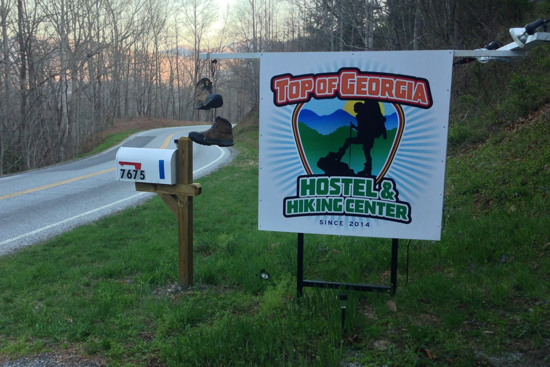
Staying in the hostel was weird. It was packed with people, many of whom I know, but the bunk under where I was sleeping became occupied after I'd fallen asleep.  Had I never seen this individual face to face, I'd have guessed them to be a middle aged obese man with a sinus issue, solely due to the noises emitted from their face throughout the night.  Come morning, I find out the perpetrator is a 5' 4" woman. In no way to I mean to sound sexist, but wow, I was certainly surprised. I took one more very quick shower before we were shepherded out of the hostel and driven back up to the trail at 0800. Before leaving the hostel, I applied some Capsaicin cream to my knee and the top of my foot where pain has been present. The basic ingredient of said arthritis-aimed pain reliever is ground up peppers. This will come into play later. 

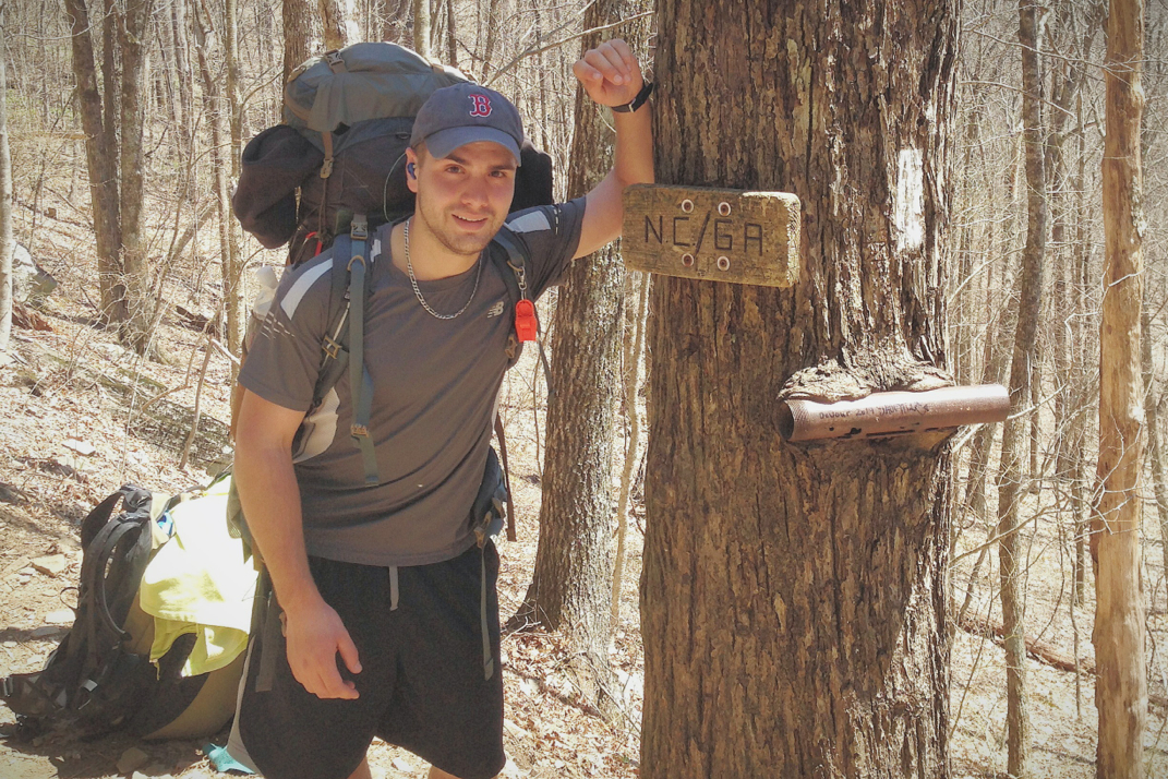
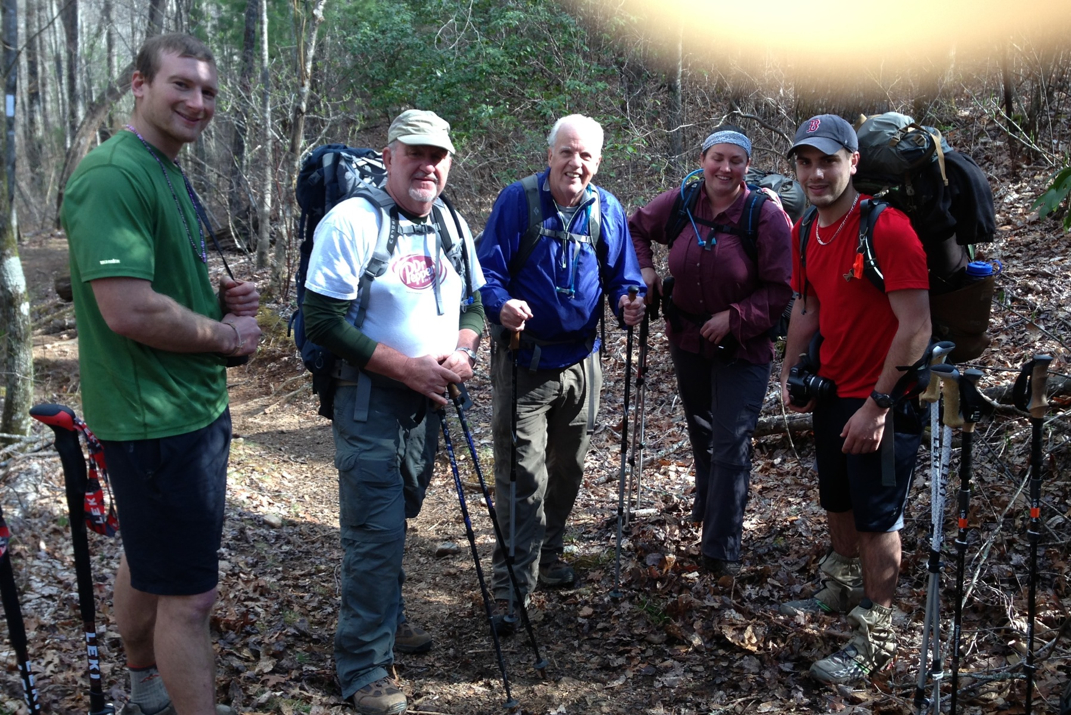
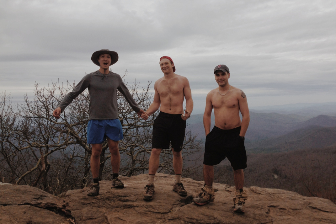
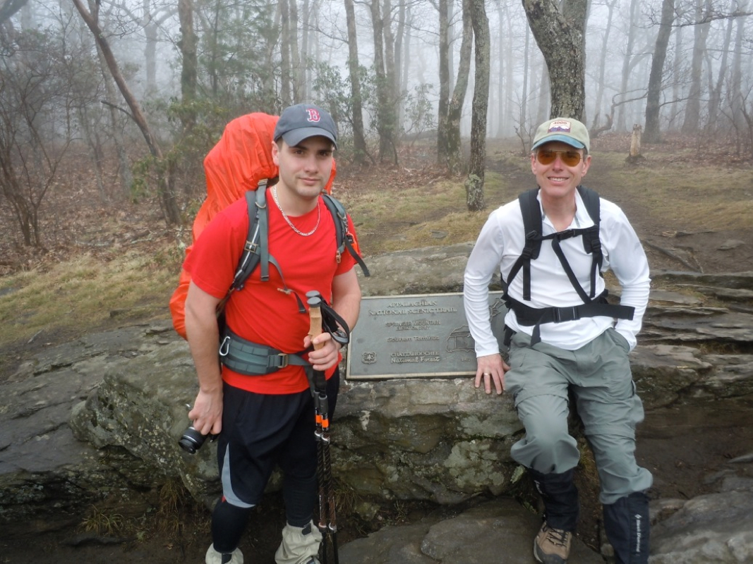
We (Kevin and I) began the hike and slowly climbed out of the gap we were in. Knowing today had a few climbs, but also the exciting prospect of the state line crossing, we pushed forwards with the goal of making it to a shelter at mile 86. This was ambitious, but not out of line with our hiking mileage from the past few days.  Not even half an hour onto the trail, I started noticing something was wrong with my feet. Although I applied the same small dosage of the medication to my knees and feet, my feet were reacting quite differently than my knees. They felt as if they were literally on fire. Words will not do justice to the apparent inferno that was ablaze inside my shoes. It actually became unbearable enough that in a rush to make it even a bit more tolerable, I emptied all 32 immediately available ounces of water out of my water bottle onto my feet. This didn't exactly 'solve' my problem, but it made it a bit more tolerable for the time being. It felt as if my feet had each eaten a dozen jalapeños, followed with a plate of the hottest buffalo tenders you've ever consumed, with no beverage to balance it all out. The looks I got from other hikers while pouring water on my feet were quite comical. Once I felt capable of walking again, we headed along the trail, playing leapfrog with three guys that we've been seeing for the past few days. T-Bird, a recently retired robotics/automation electrician for International Trucks, Murray, who today celebrated his 51st birthday, and Murray's son 'O' which is short for some trail name that I don't remember. O and Murray live in Orlando where O is finishing his masters degree in performance/teaching the trumpet. These three keep a good pace, and are great conversation.  About 4 and a half hours into our hike we came to the small wooden sign on a tree marking, albeit anticlimactically, the state line between Georgia and North Carolina. This was it! One state down, 13 to go.... Haha. Only 13 to go.

So this is all well and good. We snap some photos of each other, refill our water supplies at a great tent site right after the state line (this tent site is where I'd intended on staying last night had we hiked) and head.. Up. There's a great tree at Bly Gap that's famously photographed and is an awesome distraction from the hell that's about to be unleashed on your calf muscles.  It really doesn't seem like much on a map, but in the course of 1.2 miles we'd gain over 1,000 feet in elevation. Unlike most climbs, this one had almost no switchbacks, meaning it was a pure straight walk up the side of this mountain. I'll attach a photo of the elevation map below to explain my point. Anyway, by the time I finished the second one, I thought my heart would fall right out of my chest and I'd die right then and there, barely two miles into the state of North Carolina. For better or worse the world has other plans for me, and I survived without cardiac arrest, although I'm almost positive I left a gallon of sweat on the trail of this climb. 

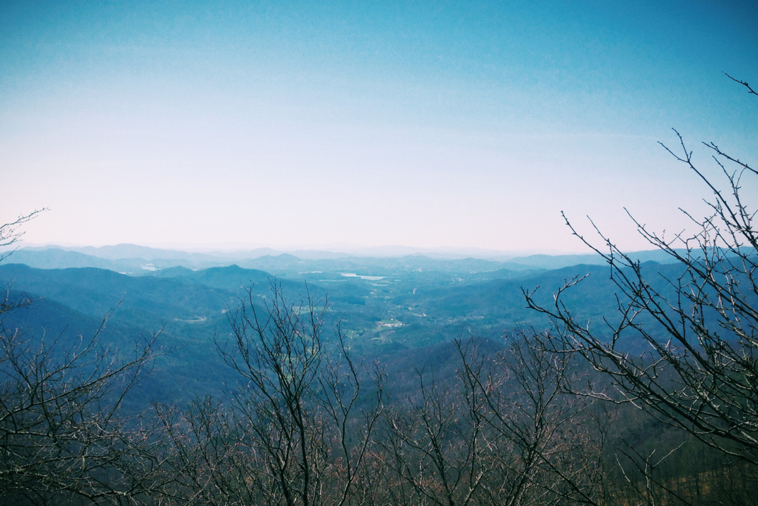
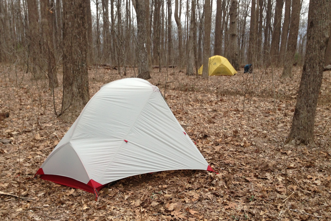
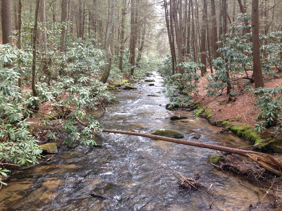
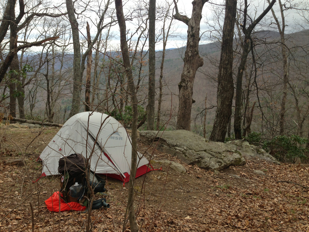
The scenery is starting to change already.  Trees have new buds ready to bloom, small flowers line the trail, and the birds chirp incessantly as I walk along. At one point sitting on the trail, a half dozen mice ran out and around where we were.  One notable thing about North Carolina is the sparkle in the dirt and rocks. From what I remember, this is the state with the largest mineral exports in the United States. It seems there's sediment everywhere, and it's quite captivating to the eye as I walk along.  At one point we were walking through Sassafrass Gap and I was reciting lines from Forrest Gump out loud (those who know me are aware that I can do a pretty spot on Forrest voice) which would be quite comical later at the shelter when a woman arrived and said 'we're you the guys flying by our lunch site reciting Gump??!' ...Guilty as charged, she thought it was quite comical for the middle of the woods.  After the many hours of climbing today, we found a great vista to hang out at, laying down and napping for a few minutes looking out over the mountain chain in front of us. A quick discussion led us to agree to stay at the next shelter we'd come to, Muskrat Creek, at mile 81.4 instead of pushing on for another two or three hours. As such, we were able to set up tents and relax for a while before dinner. We met Viva, Doug, and    here at the shelter, the latter two living only miles from where I did in Orlando a few years ago. Small world. It felt really nice to not stroll into camp so late. 

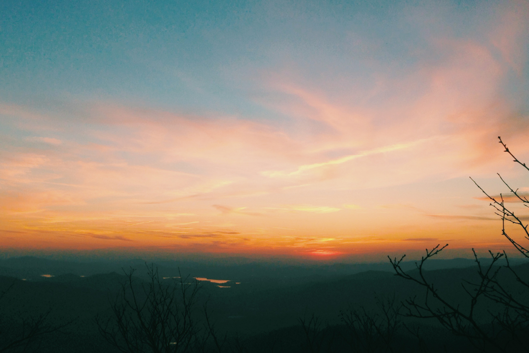
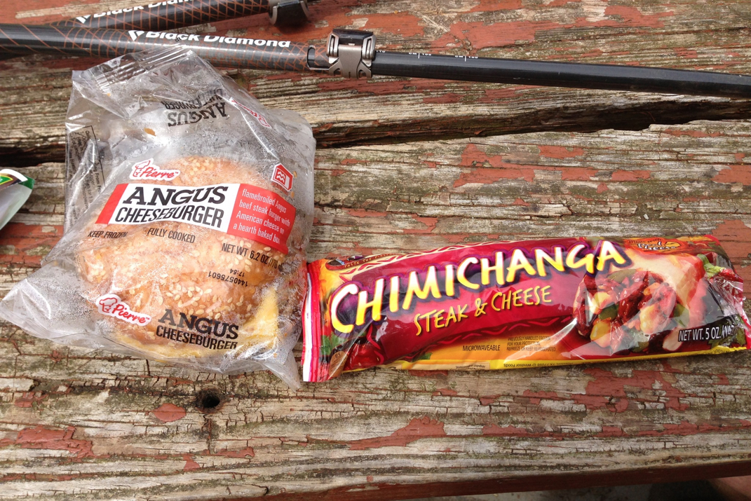
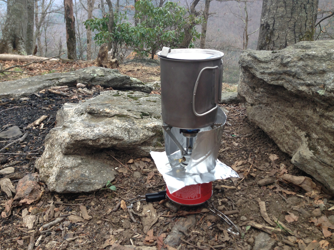
Dinner was ramen noodles, some Mac & cheese, and an oatmeal raisin cookie. We all sat around a somewhat pathetic excuse of a fire for a while before heading up to the vista to watch the sun go down over the valley. No cell service at the tent site means I won't be posting this before bed, but as I type it there are a few owls conversing with hoots in the trees around our tents. The moon is gorgeous and bright tonight, easily illuminating my tent as I lay here. There's a peacefulness in these tent sites after a long day that's hard to describe.  

Tomorrow's a new day. Enjoy the photos. I wish I could post the ones from my dSLR but the iPhone ones will have to do for now. 

Onward & upward. 

Picture
Picture
Picture
Picture
Sunset at Raven Rock
0 Comments

Nero Day

4/9/2014

2 Comments


Day: 6

Day mileage: 3.8 mi

AT total mileage: 69.8 mi

Time: 1.5 hours

--

I will first say that today did not go as planned.  The intentions being to hike through to North Carolina.  Kevin and I had talked last night about hitchhiking down into the local (11 miles away from the trail head) Hiawassee, GA.  From the campsite, it was 3.8 miles to the road, which we covered in an hour and a half. My knee is still giving me pains on downhills, which a lot of this was, but knowing we'd be in a town to resupply was a good feeling. From camp, it was exceptionally foggy and cold, with temperatures in the 30s. Half way through our hike the sun started peeking through, and eventually the fog burned off leaving us with a beautiful morning. Towards the bottom of the trail we ran into a gentleman named Dr. Pepper and his friend, who gifted us with 'trail magic' consisting of a zip lock bag with candy, as well as the offer to open the cooler in the back of their pickup truck to get a cold soda at the roadside parking lot.  We snapped a few photos with them, and headed the remaining 1/4 mile to the road. Their cooler had Root Beer & Coca-Cola, of which my choice is of course the latter. Those who know, however, are familiar with the fact that I gave up Coca-Cola a year ago last May.  So on May 6th of this year I plan on enjoying one again, but until then.... I drank a Root Beer. And for reference, a 'Nero' day stands for 'near-zero' day in hiker talk.


Our attempts to hitch a ride were undoubtedly performed well, but netted us no driver willing to stop. After half an hour we decided to ditch our plan, and returned to the trail head where we inquired with a local hiker hostel driver about the cost of a shower at their place. He drove us the 1/2 mile to the hostel, where we paid $10 for a hot shower. This is somewhat steep compared to most trail places however after a week, and judging by my own emitted body odor, it was worth it. After an extremely nice half-hour shower with a brand new bar of soap, we asked about the likelihood of taking their van into town at its organized time. They wanted another $10 for that ride.... At this point we'd be $20 in the hole, which was the equivalent of the cost to spend the night (a cost which included a bed, free shuttle service to town, and as many showers as you can take). Although I reeeeealllllyyyyy did not want to do this, Kevin and I decided it might be the best way to get food, as well as rest my leg for a day. So, we're staying at the Top of Georgia hiker hostel tonight. They drove us into town with 8 others we've been hiking with, where we ate at a buffet and did some food shopping at a grocery store. As I write this, we're sitting out front in the shade with our groceries, enjoying a cold birthday-beer in the shade (it's Kevin's 25th). Not many places still have Sam Adams Cold Snap, so it was a pleasant surprise. As we were sitting there, looking homeless by the recycled boxes on the side of the grocery store, a little old lady just came by and she said from her car 'I'm looking for boxes to take home, not young men!' - I couldn't make this up.

The van picked us back up at 1700hrs, at which point we went back to the hostel and organized food. Kevin and I split a few purchases to share items. The diet on the trail (ideal calorie intake being 4-5,000 a day) is very sugary. New food adds a good 5-7 pounds of pack weight, which is hard but easily justifiable as it makes our distances between resupplies longer. Hikers staying with us tonight include Steve from MA, Matthew, Jeff (now trail named Yellow Beard- www.itsonlywalking.com), Bob, and a dozen others. I don't know everyone's names. I hope to be on the trail early in the morning, and make up for lost miles today. I realize that there's a pace I shouldn't exceed, but it feels wrong to be sitting idly by and not hiking. Strange that after not even a week, I'm actually missing being on the trail. 

Picture
Trail Magic with Dr. Pepper
Picture
Picture
Southern Style Buffet
Picture
Birthday Toast!
Picture
Homeless looking hikers
Picture
Hiker Hostel Van
Picture
Food in Zip-locks
Picture
Top of Georgia hostel
2 Comments

You're Either Stupid Or Brave

4/7/2014

3 Comments


Day: 3

Day mileage: 11.7 mi

AT total mileage: 36.0 mi

Time: 7 hours

--

This morning began back at Lance Creek with the group from last night. Kevin and I packed up camp while some others were already leaving. I got a photo of the two of us with Ashli (spelling corrected from yesterday) and Just Kyle.  Today actually was a good day for group photos, I think I got a half dozen or so with the dSLR.  Once we were packed up we headed out to the creek to fill up our water supply, and ran into Chong, Jeff, and Sir Stops A Lot who we had hiked with for a while yesterday. Jeff is in his 20s and his thru-hiking, while Chong and Stops A Lot are hiking Springer to North Carolina with him. We all conversed & got a group photo as I filtered my water and enjoyed my morning breakfast, a bagel with peanut butter, and another side of ibuprofen and a multivitamin. 

Straight out of camp came a 6 mile, ~1,800 foot climb to the top of Blood Mountain. On the way up Kevin and I passed hikers Hustle & Flow from the night before, who we ended up playing tag with for the rest of the mountain. At the top was a very windy vista, and an extremely old stone shelter.  After a few photos and meeting a few other hikers (day hike and thru hikers) we began a grueling descent of the mountain. Along the way we listen to music from Hustle's phone, some nice Stevie Ray Vaughn kind of stuff, and ran across many weekend hikers with their dogs.  One dog we ran into was a one year old malamute/husky who was raised in Canada and is a trained sled dog, with quite the playful personality. Many people have mentioned wishing they had a dog with them on the A.T. so far.  We also passed a gentlemen who pointed at our packs and commented "You're either stupid, or unbelievably brave..." Time shall tell, I guess.  We dropped down to Neel's Gap, famed for a hiker hostel/general store that caters to hikers.  I picked up another canister of fuel and some instant mashed potatoes with bacon. Not much else I needed in the food department. Lunch was comprised of microwaveable frozen cheeseburgers and chimichangas, and an ice cream sandwich. I also picked up a rain proof bag to hang my food in at night. 

Most of the hikers we had traveled along Blood Mountain with were staying at the hostel for the showers/ laundry/ dry bed. There's a big storm moving in tonight and tomorrow that's aiming to drop over 3" of water on us. I don't know how many people will hike. After some quick conversation, Kevin and I decided to forge on, and put another 3 miles under our feet before we called it a day. The scenery wasn't gorgeous due to cloud cover, but there was a serenity in the long uphills. Squirrels would run alongside us, off the trail by 10 or so feet, making funny little noises, much alike the way dolphins swim in the waves of passing cruise liners. Nature sure is funny in that way.  The hope of stopping around 1600hrs was to get camp set up before the rain came.  We easily could have done more than the 11.7 miles, but after a hour at Neel's Gap it wasn't worth pushing too far today, so we're at a campsite just below the summit of Cowrock Mountain. As we were cooking, tents already up, we were joined by a guy named Charles (worked as a research analyst for the Forestry Service in Juneau, AK) and he decided to spend the night here. We got a small fire going and had enough time to talk for a while before the wind picked up and the rain moved in. 

I'm not looking forward to hiking in the rain, but I'm going to get wet at some point so who cares. No time like the present, so long as the future affords a moment or two to dry out a bit. 

Picture
Neel Gap
Picture
Microwaveable Lunch
Picture
Awaiting Rain
Picture
Hustle, Kevin, & Myself - Blood Mt. Summit
3 Comments

From The Summit Of Springer

4/4/2014

3 Comments


Day: 1

Day mileage: 10.5 mi

AT total mileage: 9.5 mi

Time: 5 hours


--

The morning resumed at the Stratford Motor Inn.  My 'Last' shower was exceptionally anticlimactic as I don't think the shower head has been replaced in 10 years or so.  I'm spoiled by the Marriott and Starwood shower heads that I so often get when traveling. This morning's left a lot to be desired, but nonetheless hot water that has an (almost) limited supply is something I'll soon be yearning for, so I enjoyed it and hopped out to get ready for the day.  The complimentary buffet at the Motor Inn was a nice combination of muffins, donuts, cereal, and juice from concentrate. Certainly enough to fill me up, as we shared the room with an older gentlemen who smelled like a strange mixture of marijuana and cigarette smoke, and my dad and I talked about adventures of the past.

Thirteen miles on rainy two lane roads brought us through some amazingly diverse landscapes and social situations. One second there'd be a large house with a few nicer American made cars/trucks, the next a barn that had collapsed in on itself a decade or two ago and had been left to rot. The whole 'welcome to Appalachia' really hit when we drove by a woman standing on the deck of her leaning wooden house, leaning in the door frame smoking, surrounded by clothes air drying on the porch with a few busted pick-up trucks on the property. It was truly an eye-opening sight. A few miles later we came across a turnoff for 'Springer Mountain' (please make note of the bullet hole in the sign photo), where the Appalachian Trail begins for northbound hikers. After turning on we were challenged (as was the rental car) with a one-lane dirt road that reminded me of something I'd take a few beginners of my Jeep club on. After a 6.5 mile 'Volkswagen Suspension Check' as I called it, out of the heavy fog came a parking lot with a half dozen cars and a handful of hikers wrapped in neon rain gear.

This just got real.

A 1 mile jaunt up to the summit of Springer allowed me to sign into the hiker registry, take the obligatory photo, and meet a few other hikers. My dad and I hiked back down, and parted ways at the parking lot.  Strange to have him drive away and know it might be a few months till I see him again.  Nevertheless I began walking with Rory from Chicago. Easy conversation and winding trails made for a quick day, and around 1400hrs we met up with Bill from Maine.  Not long after, the three of us stumbled upon 'Trail Magic' which is hiker lingo for a kind individual leaving a beer, candy bar, cold drink, etc. on the side of the trail. As you'll see in photos below, it was a pop up tent with a cooler of ice water. Very appreciated. 


So the three of us kept walking for the remaining 4 miles, continuing on to a campsite I had picked out last night as the one to stop at. There are probably some wondering why I wanted to stop at only 5 hours of walking, given the amount of daylight available (sunset was 20:00hrs).. Although I'm sure I could physically continue for further than 10.5 miles today, my goal here is to make it to Maine. I'm going to aim to stay in a 10-12 mile/day range until I get my legs in trail shape and can push further. Also, it was nice to be at camp, fed, and in bed by 7. I'm tired!  


Rory didn't make it to camp with us tonight. He at one point about a mile from this campsite said he was making a phone call and would meet up with us. He never made it here, so I wonder if he's stopping at an earlier campsite (there was one between where we split and where Bill & I stopped). So Bill and I made camp at the top of this mountain and settled in for the night. It's quite windy up here at 3,067 feet of elevation, and there has been constant rain since we got into our tents. Thunderstorms have been in and out of the area, and the wind has remained.  I'm sure It was quite comical to watch Bill and myself hang out food bag in a tree to keep it from 'da Bears' but it hangs nonetheless, thanks to a couple useful knots I've been taught by riggers on tours/show sites. Hopefully it's still hanging after the wind tonight. 


I went to sleep at 7:30 and tossed and turned before taking some ibuprofen and finally falling asleep. Woke up at 0030 and feel better, figured I'd write this. For those interested, the 'location' page is now updating with my GPS coordinates as I go. 


It's happening, guys. I'm here. In Georgia. With 'the plan' of walking to Maine.... Anyways, lights out. Aiming for 12 or so miles tomorrow with Bill. I don't know if we'll keep pace together, I think I'm in better shape than I thought, but it's fun to watch these like-minded people come and go. What an experience I'm in for. 


Until next time. 

Picture
Picture
Picture
Picture
Picture
Picture
3 Comments

T-Minus  14

3/20/2014

4 Comments

 
PictureBackpack Fully Loaded
Fourteen days from yesterday, my dad & I will fly to Atlanta.   We leave Boston at 3 pm, landing in Atlanta at 6.  We'll rent a car, likely spending the night in the city.  Those who know me are aware that I'm a huge Coca-Cola buff, so my hopes are that we go visit the Coca-Cola bottling plant and museum while we're in Atlanta.  I've never been, and I'm beyond excited for this potential visit.  Thursday afternoon we'll drive up to the Chattahoochee National Forest, the home to Springer Mountain, where the A.T. begins.  An early start Friday morning should allow us to both hike up to the peak of Springer where I'll be able to sign the log book to mark my joining the "Appalachian Trail Class of 2014" as it's known to the hiking masses.   We'll take a few photos together, and he'll head back to the Atlanta airport to fly back to Boston... alone... and I'll be standing at the beginning of an epic journey up the Eastern seaboard.  In the interest of full disclosure, I booked myself a round trip ticket, just in case I get to the base of that mountain and decide that I'm truly batshit crazy, and decide to go home.  If I know myself well enough, however, I'll be spending the night of April 4th 50 yards off the trail somewhere in northern Georgia.  What an incredibly exciting and slightly horrifying thought.

Right below this sentence is a map of where Springer Mountain is.  Not sure how this will embed for all you fancy e-mail subscription people, but on the web it's nicely placed below this line of text.   That little red map dot seems to be quite a ways from Maine.

The big things on my plate have been managing my travel with work and getting everything together.  My massive order of gear showed up while I was in Dallas last week,  and I had a blast last Friday getting it all together.  Lots of new technical equipment, general camp stuff, and some great wicking base layers from the NB Lightning Dry collection (thanks Kim!) The single most important piece of information that came from this joyous gear-Christmas was a rough idea of my total "pack weight".  This is a number that hikers stress over in an unbelievable way.  While it may not seem like a big deal, 1-2 pounds can really change your opinion over the course of a few thousand miles.  My pack weight comes in at 16.2 pounds with everything loaded in (save for clothes I'll be wearing, and my hiking poles).  Food will be another 8-10 pounds for 4-5 days on the trail.  Almost 2 pounds of that is my Canon dSLR, a non-negotiable item.
Gear
"All of my Possessions"
I also took a step towards picking a massively important piece of gear, a step that I've put off for many months now, and that is footwear.  In the decades since hiking took to the mainstream, the 2 pound leather combat boots many wore have been replaced by lighter GoreTex boots, which have been challenged by the new generation of "trail runners".  These light weight sneaker-type shoes come with great grip for off-pavement excursions, and are often times exceptionally breathable (vs the old boots that were known for causing trench-foot type infections due to sealed-in moisture).  The average hiker who completes the A.T. will take around 5-million steps from Georgia to Maine... imagine lifting 2 extra pounds over 5,000,000 times!  Hence my desire to go with a trail runner.  Due to my work with New Balance, I've been able to talk to a guy (thanks Brendan) who specializes in running, and was able to get some very specific questions answered in regards to what was best for my undertaking.  I was pointed towards the NB 910 and NB MT1210  series trail-runners, with the 1210 being the most recommended of the two.  I've read some great reviews of these online, including Appalachian Trail focused forums like WhiteBlaze, but have not heard of anyone thru-hiking (the A.T. phrase for walking Georgia to Maine in one year) with them.  Perhaps I can be the first!  I'm really looking forward to getting these on and testing them out.

So that's it for me.  I'm back in Orlando this week and am enjoying a change to my 18th floor emergency exit stairway training (see blog post #3) due to the stairs being outside the hotel! This place not only encompasses heat, humidity, and staircases, but also views of the outdoors... the most realistic stair training yet, and a pleasant surprise compared to the normal concrete stairwells.

Time is simultaneously flying by and taking forever to pass.  At this point, I'm ready to be in the woods.


*Afterthought- missing from the photo are my medical kit, LED headlamp, and towel.
4 Comments

30  Days  &  Counting

3/4/2014

0 Comments

 
LamborghiniLamborghini Sunset
I decided a while ago that I'd hold off on telling people about my trip until a month before I left to hike the 2,000 someodd miles of the Appalachian Trail.  If for whatever reason in the months of planning I decided not to go, I wanted it to be a conversation to be had with few, not many.  Today is 'announcement' day:  if you're visiting now for the first time, welcome.  Thanks for stopping by :)  On the right hand side is an e-mail sign up if you're interested enough to stay updated automatically, otherwise just visit this site whenever you'd like!  Other than that, it's a website, and pretty self explanatory..  I'll be updating the blog while I'm on the trail, and will post miscellaneous thoughts and findings-of-the-world as I meander my way to Maine.  Back to your originally scheduled programming:

One.  Month.  From.  Today.

Isn't that crazy?  It's been almost a year since I started (seriously) thinking about doing this hike, and it's now only 30 days until I'll step foot on the approach trail, a few mere miles from the base of Mt. Springer, the southern terminus of the Appalachian Trail.  What an insane feeling/realization/situation!

Not only am I 30 days from my start, and 28 days from flying to Atlanta, but I'm also 1/4 of the way through a VERY busy work month that has me home for less than 48 hours over the course of 30 days.  I'll be in and out of Chicago, Dallas, and Orlando twice between now and the 27th of March.  This presents great work opportunities - it's a hard to forget detail that I'll be without income for 5-6 months - but also limits my time available for packing, prepping, gear testing, and outdoor exercise.  Enter my favorite phrase: Urban Mountaineering.  More "rooms with a view" and emergency stairwell "hikes". 

Yesterday I finished up some of my last big purchases for the trip, including a fair chunk of change at REI, and some smaller stuff from Backcountry's website.  I'll have to organize all of this when I'm home, but it's really refreshing and exciting to know that it's all coming together.  It will be very interesting to see what my pack weight comes out to without a week's worth of food.  My fingers are really crossed for 12-18 pounds, but we'll see.  Being under 30lbs with food will be a great feeling, and a decent way to start, as I'm sure weight will drop as I realize that things will be unnecessary once I'm out there, and "winter" type clothes are shed when the temperatures get a bit higher up.  Time shall tell.

As a closing teaser- I'm posting a photo I took last night down here in Orlando.  The show client took their people to the Richard Petty Racing Experience NASCAR track, where I got to tag along in a 160 mph NASCAR ride around the racetrack, raced some coworkers in GoKart races, and got to dragrace in a '14 Dodge Challenger R/T, '14 Camaro SS... NASCAR was fun, GoKarts were awesome, and the Mustang is hands down America's Best (Affordable) Muscle Car.
  Side note: I should start writing for Car & Driver.

30 days... April 4th be here before I know it.


0 Comments

    SUBSCRIBE

    Join Over 2,000 Readers On The Search For Adventure!

    Delivered by FeedBurner


    Author

    Hey there! I'm Ryan McKee, a free spirited adventurer, photographer, and digital media creator who calls North Carolina home. I travel incessantly, carry a camera with me everywhere, and am always dreaming of my next big trip.

    Picture

    SOCIAL MEDIA

    Picture
    Picture

    SPECIAL THANKS To

    Picture
    Picture
    Picture
    Picture
    Picture
    Picture
    Picture

    Archives

    October 2019
    September 2019
    August 2019
    August 2018
    July 2018
    June 2018
    February 2018
    December 2017
    November 2017
    October 2017
    September 2017
    August 2017
    July 2017
    June 2017
    May 2017
    March 2017
    February 2017
    January 2017
    December 2016
    November 2016
    October 2016
    August 2016
    July 2016
    April 2015
    September 2014
    August 2014
    July 2014
    June 2014
    May 2014
    April 2014
    March 2014
    February 2014
    January 2013


      Quick Survey

    Submit

    Categories

    All
    Allagash Wilderness
    Appalachian Trail
    Banff National Park
    Bears
    Canada
    Caribbean
    Connecticut
    Georgia
    Greece
    Hiking
    Italy
    Jasper National Park
    Jeeps
    Katahdin
    Long Trail
    Maine
    Maryland
    Massachusetts
    New Hampshire
    New Jersey
    New York
    North Carolina
    Overland
    Pennsylvania
    Photography
    Sailing
    Tennessee
    Travel
    Vermont
    Virginia
    West Virginia

    RSS Feed

ADVENTURES

Trans-Canada Overland Expedition
The Long Trail
Appalachian Trail
Bicycling Across America

Overland Build

Meet The Jeep
Backcountry Gear
​Modifications & Installations

Everything Else

Read The Blog
Photography
Guest Book
Contact

Picture
© COPYRIGHT 2019
​All Rights Reserved