2180miles
  • Home
  • Adventure Blog
  • Overland
    • Meet The Jeep
    • Mods & Installs
    • Overland Gear
    • Trip Reports & Videos >
      • Allagash Winter 2019
      • Greece Adventures 2019
      • Overland Expo East 2018
      • Allagash Wilderness 2018
      • Trans-Canada Overland 2017
      • QB-5 Adventure 2017
  • Long Trail
    • Trip Summary
    • Photojournal
    • Hike Statistics
  • Appalachian Trail
    • Trip Summary
    • Photojournal
    • Gear Talk
    • Hike Statistics
    • Financial Planning
  • Bicycling America
    • Trip Summary
    • Photojournal

Garden State Finale

6/11/2014

0 Comments


Day: 68

Day mileage: 25.2

AT total mileage: 1,346.4

Time: 8.5 hours

--

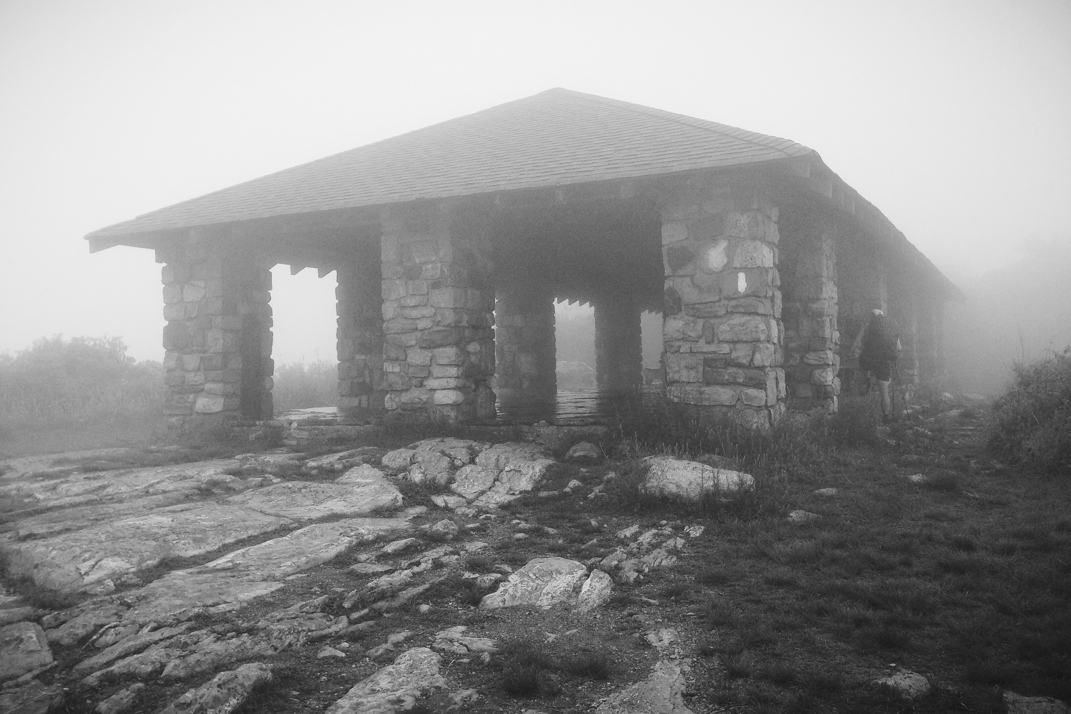
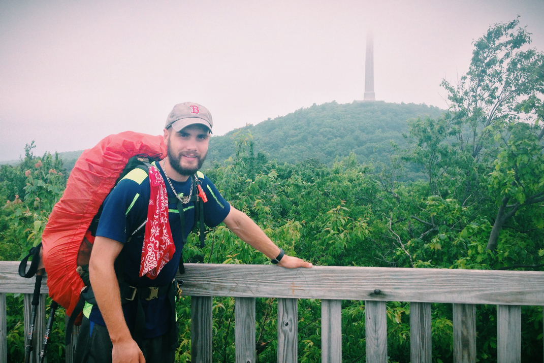
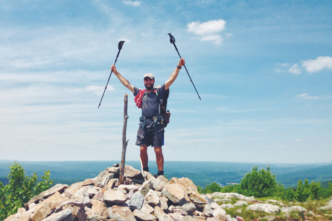
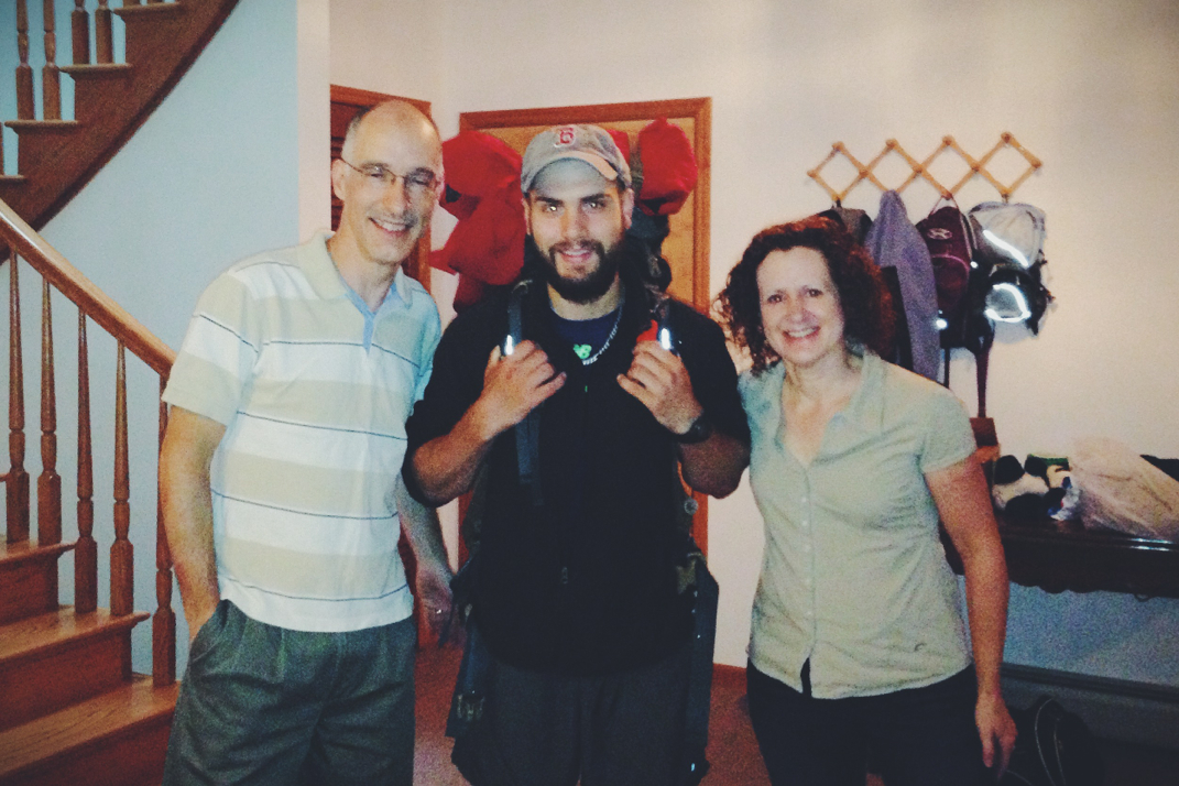
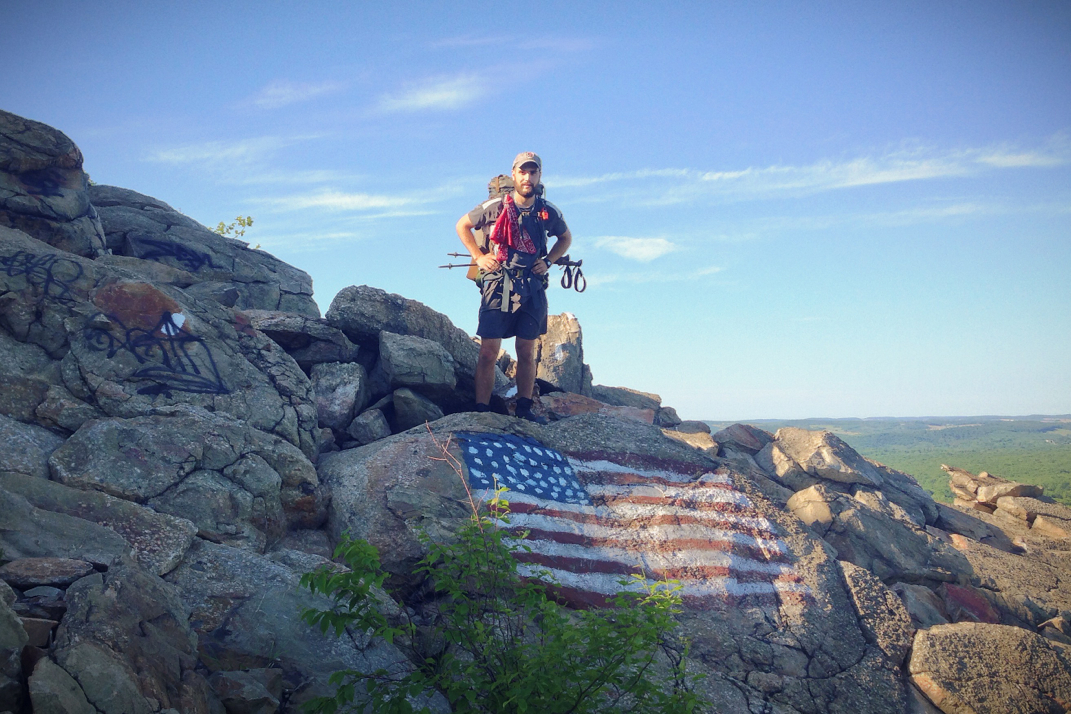
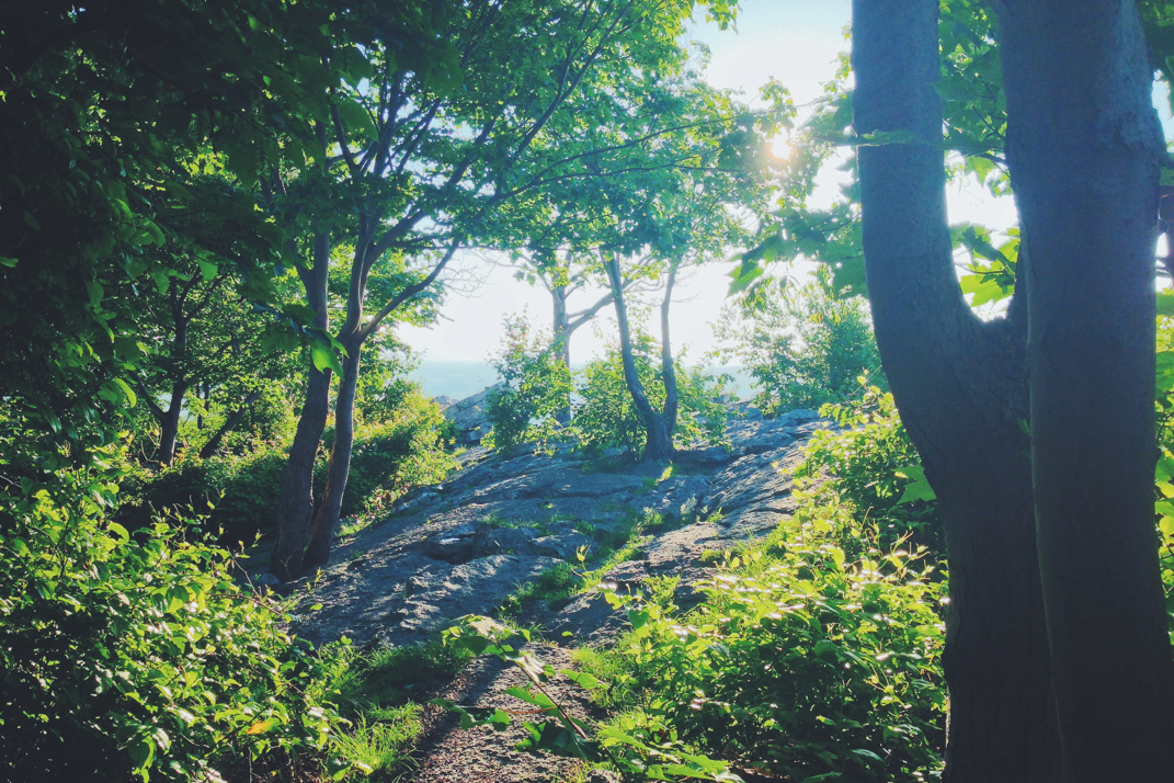
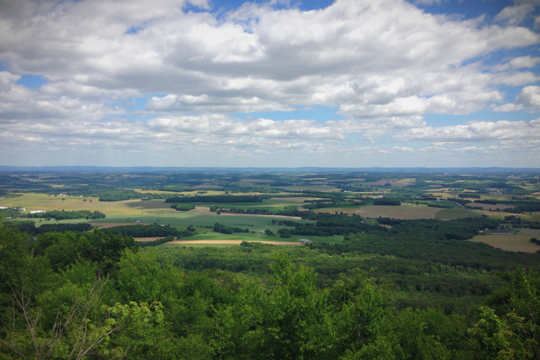
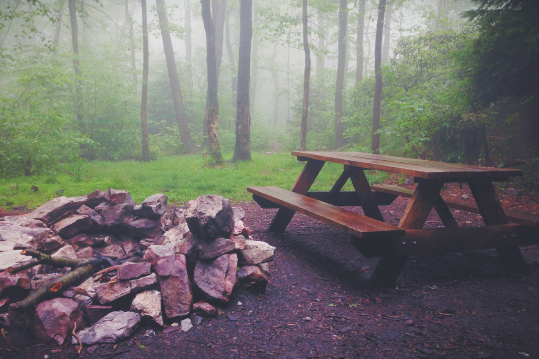
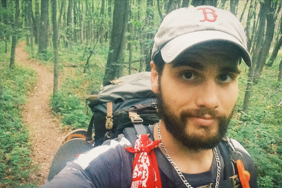
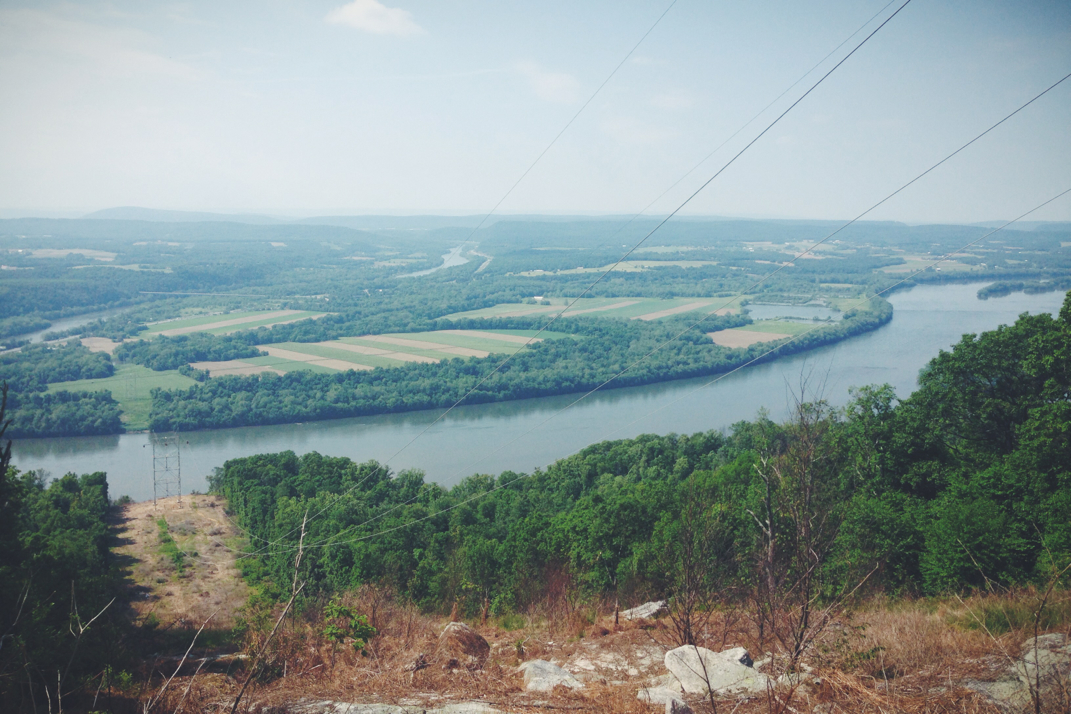
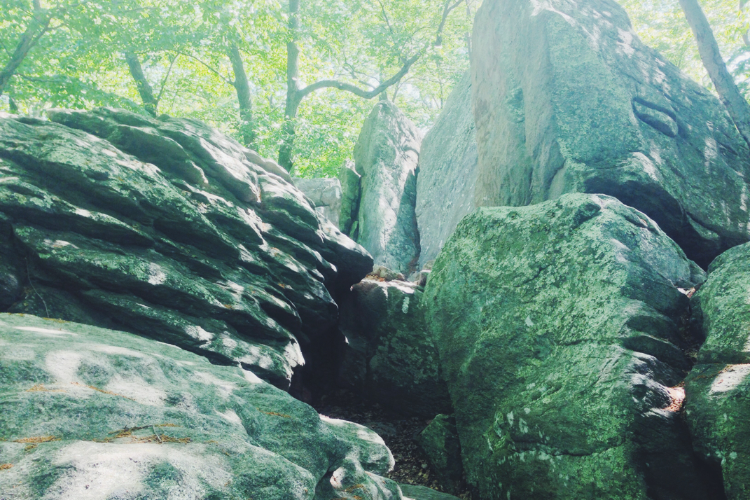
The rain sounded endless last night as the half-full shelter of hikers huddled under sleeping bags to stay dry and warm. Waking up this morning I again had little interest in actually getting out of my warm cocoon, but the time came and I began packing up. I spoke for a while with Flossy & Grey Squirrel, a newly retired couple out hiking the Appalachian Trail. We discussed other adventures, and they too cycled a norther route across the country many years ago. We were even able to comment on exact roads (Idaho's Route 12 over Lola Pass), towns (Missoula, MT, Lewiston & Clarkston, ID), and cycling through Ontario. It's amazing that in such a vast country we shared those exact details of our previous trips. They're considering cycling across again, and I informed them of my research into a third adventure to follow up this one. Eating a few things and packing up my gear, Pneumo and I hit the trail just before 7. With a gentle climb out of the shelter over the course of a few miles, we came upon the top of Sunrise Mountain, capped with a large stone pavilion. Had the sky not been heavily foggy, I'm sure there would have been a stunning view. Alas, we spent another whole day in the rain and fog, and not one scenic vista provided us with a real view. 

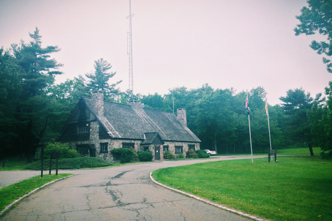
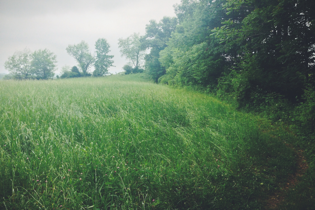
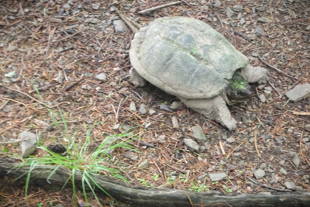
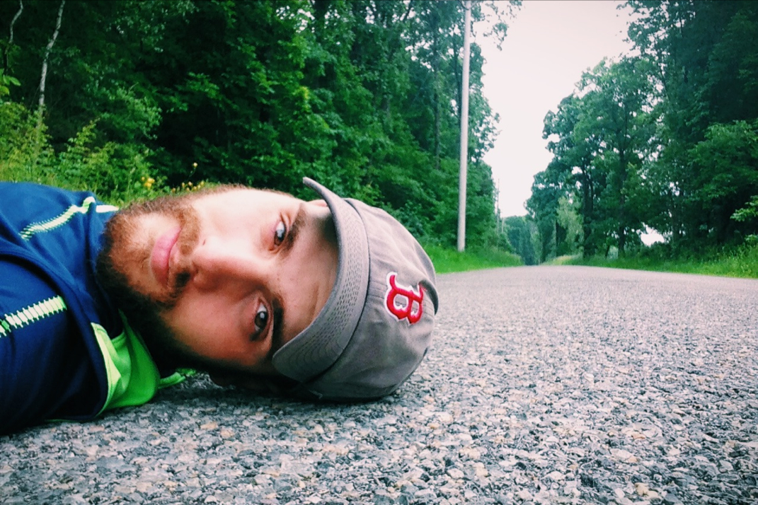
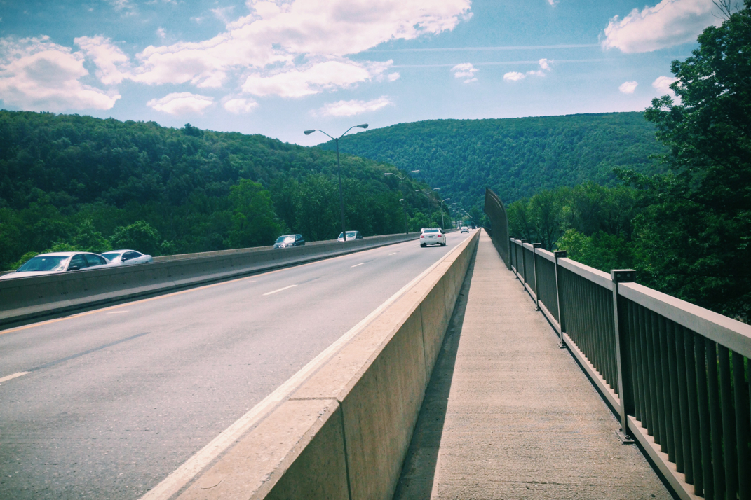
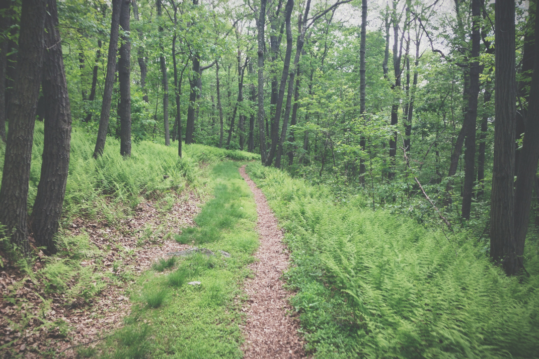
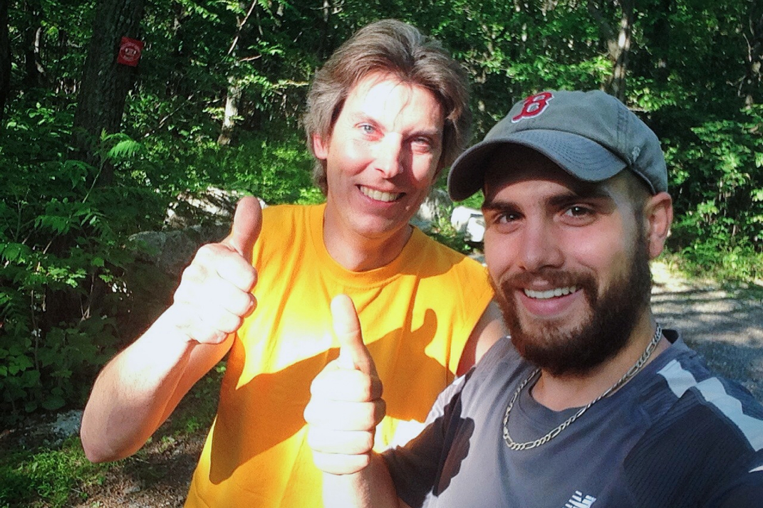
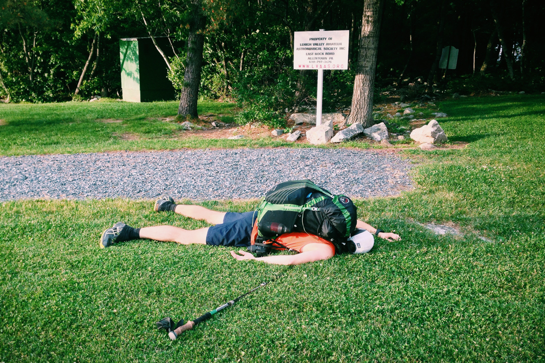
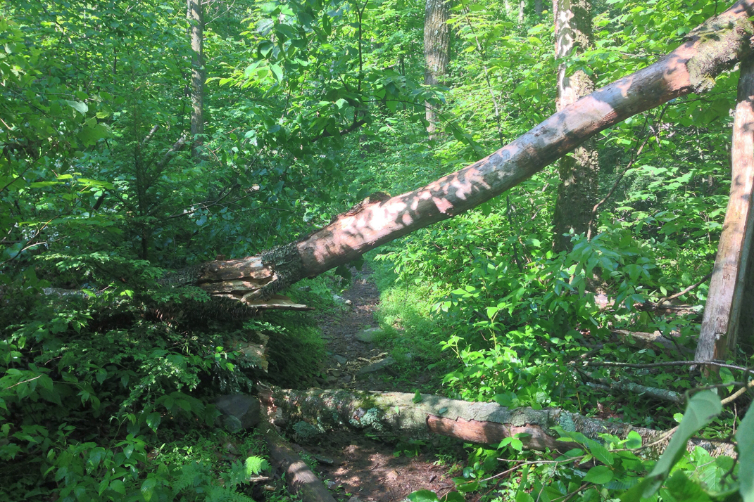
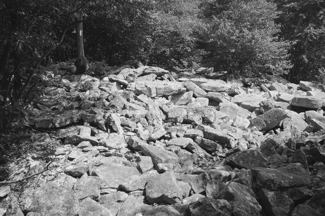
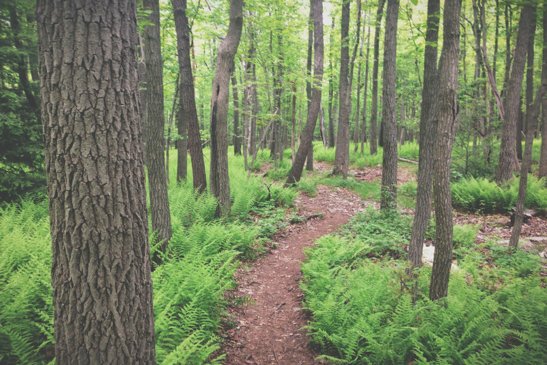
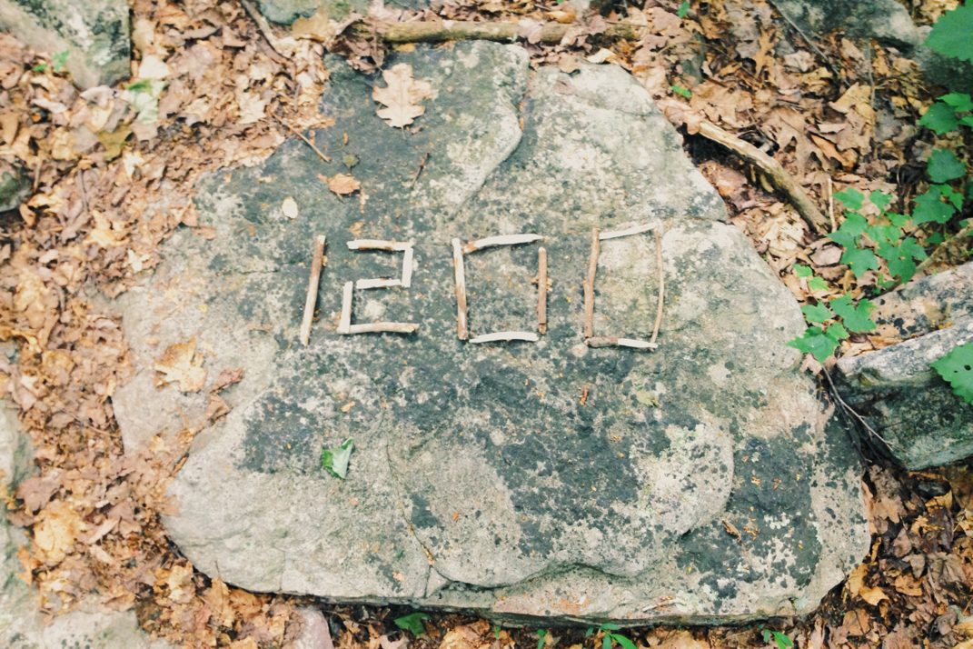
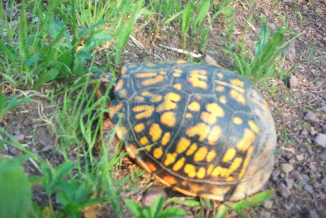
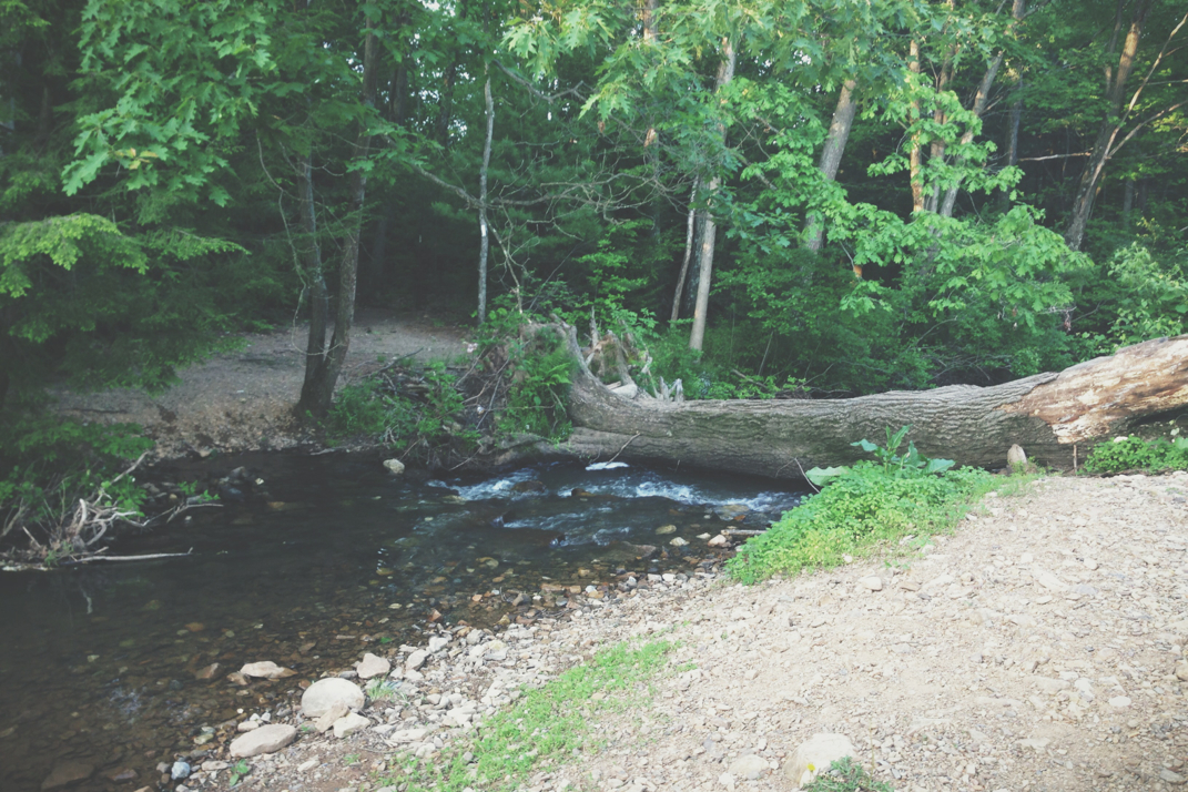
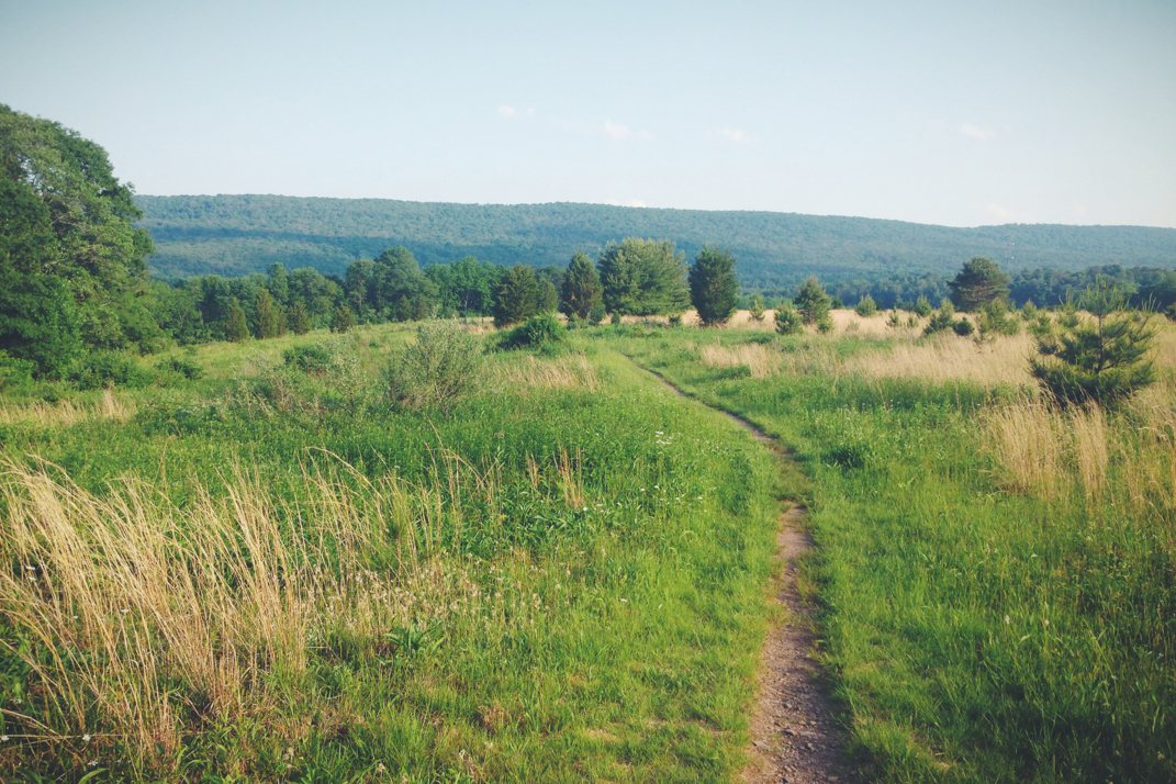
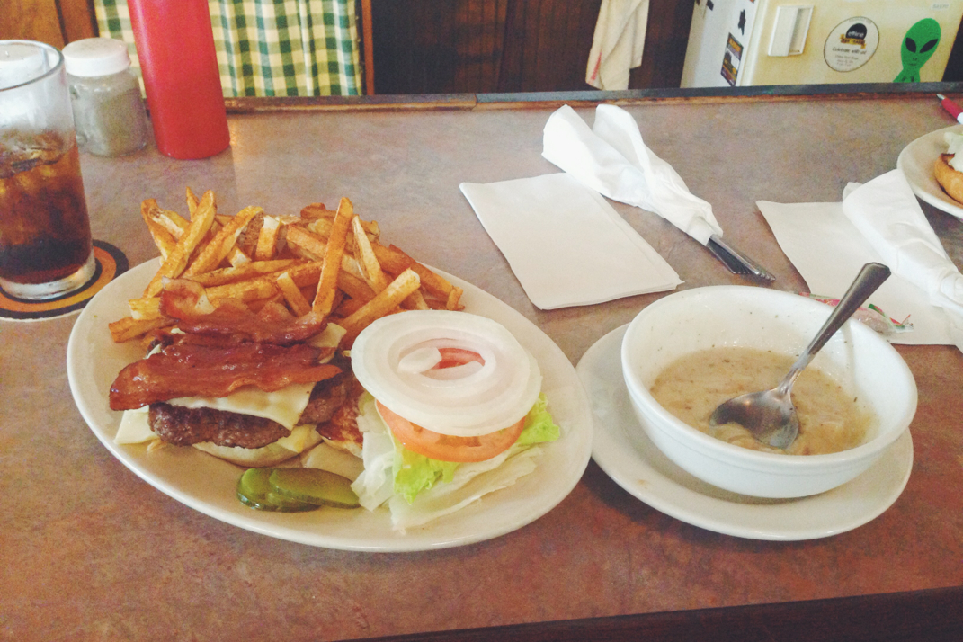
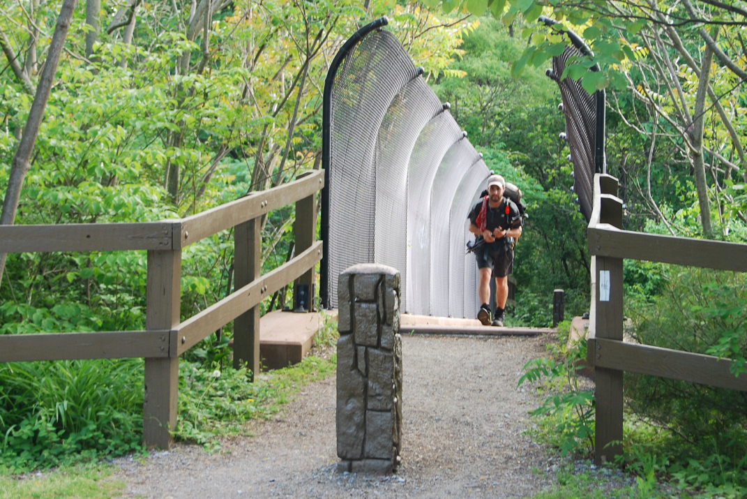
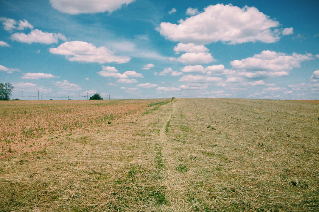
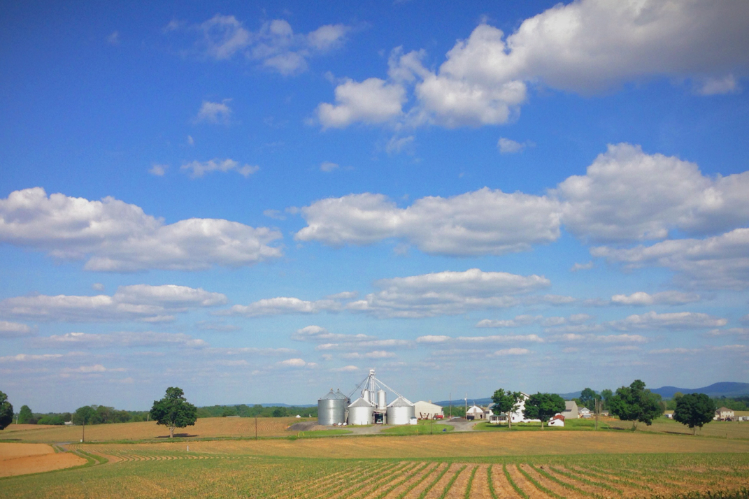
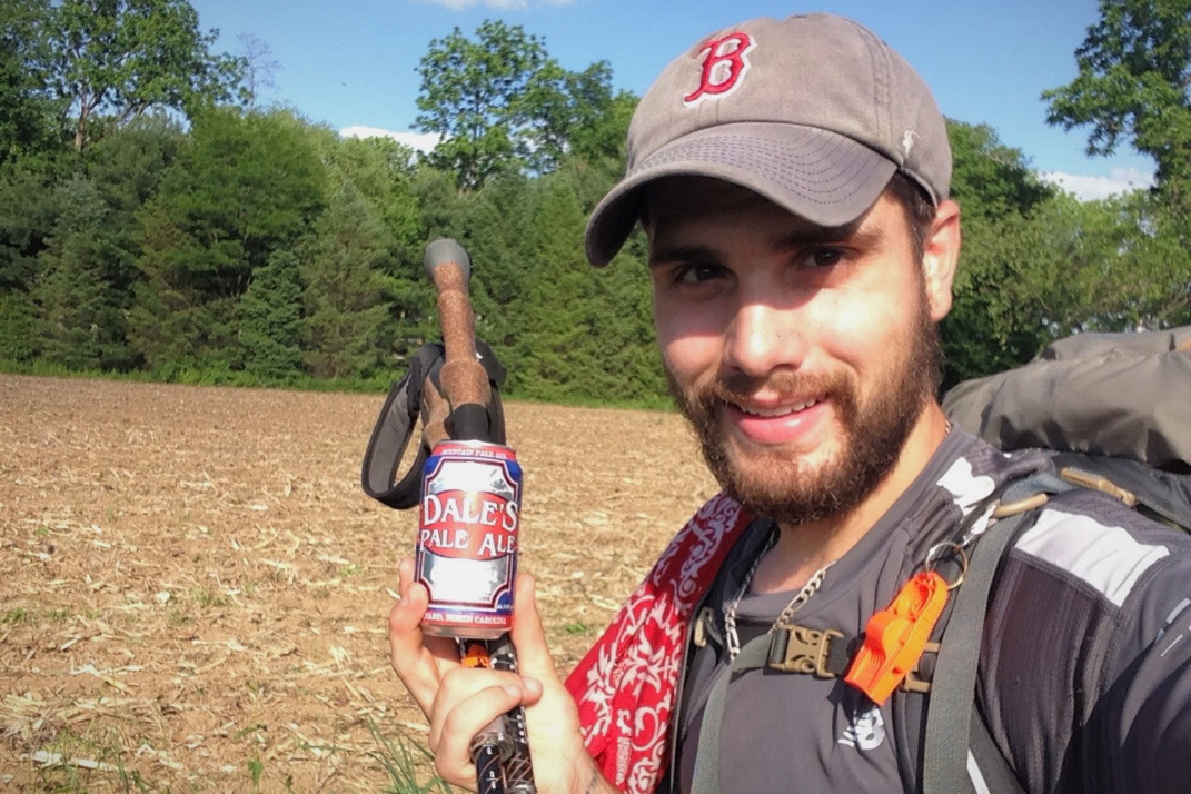
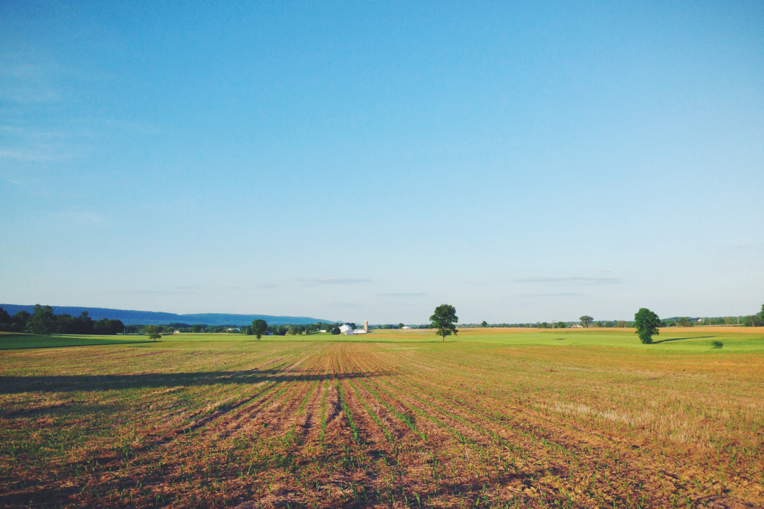
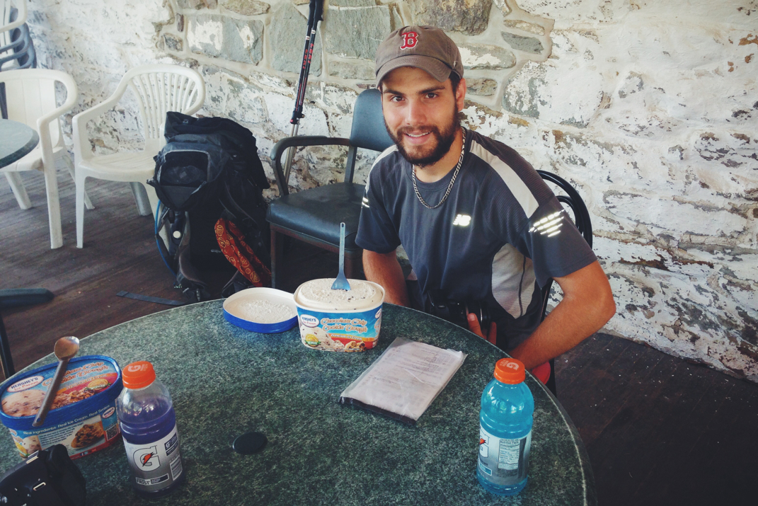
From the top of Sunrise Mountain the trail bounced back and forth between a few hundred feet of elevation, and a handful of miles down the trail we came across the Mashipacong shelter. Settled to the side of a small field, Flossy and Squirrel were already there and conversing with Grasshopper, one of three Appalachian Trail trail runners in New Jersey. He and I spoke for quite a while about the trail before Pneumo and I headed on. Our next stop would be the High Point State Park visitors center, where Grasshopper had informed us we could be the recipients of a trail magic Pepsi. Within an hour we had reached the visitors center, a large stone building with vaulted beam cathedral ceilings. Acquiring my cold Pepsi (only after double checking to make sure they didn't have Coke), Pneumo and I set up shop to eat lunch inside. We spent just shy of an hour there conversing with other hikers and enjoying some food. The next miles included the High Point Monument, after which the park is named. Built atop the highest elevation point in all of New Jersey (a somewhat minuscule-in-comparison 1,803 feet), a 200' stone obelisk stands as a war memorial. From a wooden observation deck we saw parts of the tower in the thick fog, but both agreed it wasn't worth the half mile side trail trip to climb the monument. From the top of High Point we began an 8 mile downhill on the trail, crossing through pastures, dense forests, and many old gravel farm roads. At one point we stopped for a drink on a roadside and ended up staying for a half hour. The extreme lack of vehicles led me to lay on the side of the road and relax for a bit, as you'll see in a photo below. We carried on, and grew somewhat fed up with the climbs that the trail would make, even if only a few hundred feet in elevation, after dropping down the same amount. At one point while powering up a climb, I quickly came to the realization that the rock I was about to step on had a head and legs, and was in fact a snapping turtle present in the middle of the trail. I nearly had a heart attack, and Pneumo laughed hysterically as I jumped sideways to avoid stepping on the turtle's shell. 

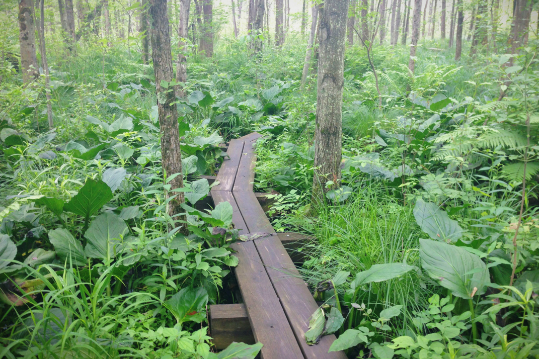
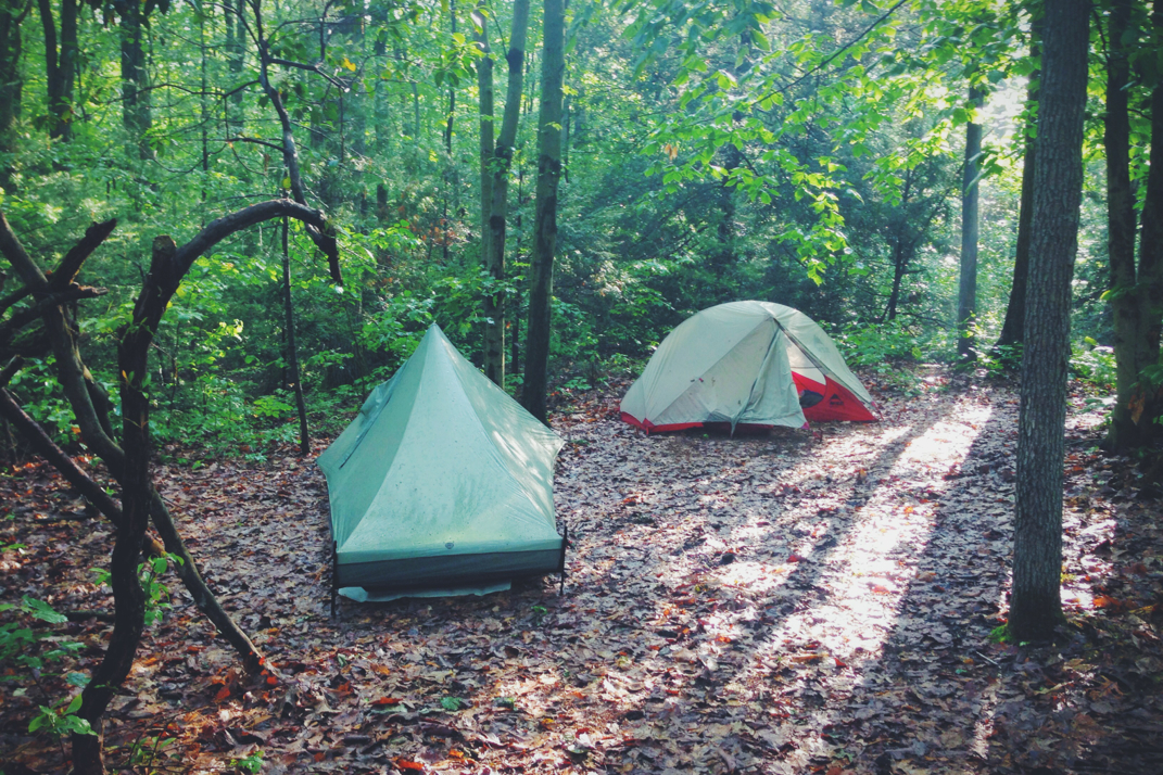
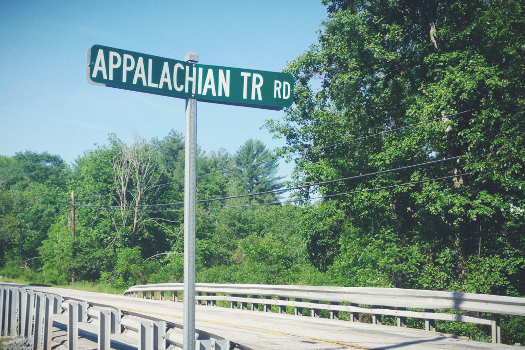
Crossing over a half dozen more cow pastures, we eventually exited the woods and walked a half mile along State Line Road, literally dancing between New York and New Jersey. It won't be until tomorrow that we officially cross the state line. From there we veered right and made an annoying traipse around the Wallkill National Wildlife Refuge, a two mile walk that led us right back to the road we had been on before. After being chased by a thousand mosquitoes during the walk around the Refuge, we got water from the spigot of an abandoned house, and climbed an exceptionally steep half mile up to the Pochuck Mountain shelter where we would spend the night. 

Meeting K2 and Tater at the shelter, two recently retired women who have been section hiking for five years now, Pneumo and I made dinner while conversing with them. I was in my sleeping bag by 2015hrs, fighting off the still-present mosquitoes, annoying enough that Pneumo eventually abandoned the shelter and set up his tent. Tomorrow will be a 23 or so mile day to a shelter, and we'll officially be in New York. The weather still calls for rain and heavy fog, but my fingers are crossed that the precipitation at least stays away. 

Onward and upward with the rise of the sun. 

Texaco

Picture
Pavilion
Picture
Photographing the Newt
Picture
Newt
Picture
Visitor's Center
Picture
High Point monument
Picture
Picture
Picture
Picture
Street Life Portrait
Picture
Wildlife Refuge
0 Comments

Mile 1,300: Delaware Water Gap

6/9/2014

1 Comment


Day: 66

Day mileage: 22.6

AT total mileage: 1,300.3

Time: 7 hours

--

Welcome to New Jersey. 

The silence of the woods last night was incredible. Normally there's a river, road/highway, or airport near enough by to create some kind of ambient noise as we sleep. In rare form, our campsite at mile 1,278 had nothing within 5 miles of it, and as such was completely silent. It was almost eerie to roll over in the middle of the night, patchy areas illuminated by the moon shining through leaves on the trees, and hear nothing at all. Being someone who needs ambient noise to sleep, it was just my luck that my iPod had died and I had no music to put on to break the silence. Regardless, I did manage to fall back asleep and woke up rested around 5:30 AM. Packing up camp shortly thereafter, Pneumo and I began our 'short' hiking day just before 7. 

As if wanting to give us a last hoorah, the final 12 miles of Pennsylvania trail were all kinds of rocky. Small and triangulated rocks that twist ankles, larger boulders that required hopping between them and bracing with trekking poles upon descent... There was quite a bit of swearing going on as we hiked, eagerly looking forward to a new state and hopefully some different terrain. Around 5 miles into the hike we make it to the Kirkridge shelter where we had a quick second breakfast and refilled water before setting our sights on the Delaware Water Gap some 7 miles further north. The trail between the shelter and the gap would be mostly level along a mountain ridge, at some points following dirt access roads for old power line companies, then would steeply drop off close to 1,000 feet into the riverbed below. Towards the end of the ridge we hiked past a sign for the summit of Mt. Minsi, which felt like a joke as we had barely hiked any kind of elevation gain to get there. It was about this time that we began encountering weekend hikers out with their dogs and kids, enjoying the humid and sunny weather. We spoke briefly with everyone as we began descending into the valley below. It was quite comical to watch the variety of weekenders hike Mt. Minsi. There were of course the locals with their dogs who frequent the trail, young women power walking in their yoga pants and oversized florescent cotton shirts, families with dads explaining that 'this isn't even the hard part' to their kids, and then a group of Asian tourists in street clothes with 2-way walkie-talkies in case they got separated while executing this challenging summit. People are entertaining. 

Reaching the valley floor below, the trail turned onto the slow paced back roads of Delaware Water Gap, PA. We followed along, passing by dilapidated homes that were probably once gorgeous in their grandeur, and bank style barns that I can only assume are now home to dusty items from decades past. As you may not know, when the Trail follows through a town there are white blazes painted on phone poles and buildings to alert hikers where to go. It can oftentimes be quite difficult to find these blazes due to the presence of missing puppy posters, yard sale signs, and other miscellaneous things haphazardly covering the rectangular white paint that a hiker relies on for navigation. Luckily we were able to find the blazes easily, and dropped through a small center of town where an old ice cream shop caught my eye. Pneumo and I decided we had a few minutes to spare, and stopped in for two strawberry milkshakes made with Hershey's ice cream. I also ordered a Coke, which I was shocked to see was made by stirring carbonated water with actual Coca Cola syrup. Meanwhile the two high school girls, dressed in matching ice cream shoppe outfits worked away at our milkshakes as period correct music played throughout a room decorated in the style of a time long since passed. My syrup-stirred Coke wasn't as delicious as I had hoped for, but the chunks of real strawberry in my milkshake absolutely made up for it. We got the shakes to-go, and began the mile trek across the Delaware River bridge and over into New Jersey. Goodbye, Pennsylvania - see ya never. 

Hiking the bridge was slightly horrifying. Divided by a concrete barrier with no more than 3 feet of distance between the sidewalk and passing cars, it was nerve wracking to be passed by 18-wheelers going 75 miles an hour down the highway. Despite this scary experience, we trekked across the expansive bridge and eventually were separated from I-80 as we dropped down and into the parking lot of the Kittanytinny Point visitor's center where we were greeted by park rangers who were eager to have us sign their guest book. We were even given Appalachian Trail patches and a childish pin proudly stating 'Junior Park Ranger' in the same way that commercial pilots used to give out plastic Delta and United wings to children who visited the cockpit. With a schedule to keep, we began the long and gradual climb up into the mountains from the riverbed of the Delaware. Again we were presented with many day hikers, not all of whom were friendly or even returned hellos. There were more rocks than I had hoped for, but I think I despised them just a little less due to the fact that they weren't Pennsylvania rocks. New Jersey rocks are apparently excused in my book. Atop the mountain ridge we came across a large, crystal clear lake, the kind that would be absolutely perfect to sit at and enjoy a sunny summer June day. Hiking around it, we trekked on, aiming to meet friends Caren and Mike at an Appalachian Mountain Club outdoors center around 1530hrs. The rocky terrain slowed us a bit, but we arrived a few minutes before them after crossing the Trail's 1,300 mile mark. One more state, and another hundred miles in the books. 

Caren and Mike arrived from a tandem bicycle ride they had been on, and for our stuff in their van. We made the drive back (the longest I've spent in a car since April) at highway speeds for a half hour or so before arriving at their gorgeous New Jersey home. After each taking a wonderfully hot shower, Caren drove us to Wal-mart for a resupply while she picked up her mom to join us for dinner. Our resupply was quick, and we were back at the house within an hour. A homemade dinner of lasagna, fresh bread, and salad was served and enjoyed by all. Their daughter Julia was also home from college for the summer and baked us a desert of delicious chocolate chip cookies. What a feast. It's not very often I walk away with a genuinely full stomach, so this was a treat. 

Pneumo and I planned out our next few days of trail after dinner, and threw in a load of laundry so we hopefully don't smell as horrible for the next few days. Bed came around 2200hrs, and I'm hoping to sleep well on a comfortable mattress. There's lots of rain in the forecast for the next week, which I'm dreading. I suppose we shall see tomorrow how the next few days will play out.

From a warm bed in a dry house... In state #8, with 6 left to go. 

Texaco

Picture
Delaware River
Picture
Ice Cream Shoppe
Picture
Never Ending Bridge
Picture
Picture
Picture
Picture
Practicing my pose for Katahdin
Picture
Picture
Picture
After 3 Servings of Lasagna
Picture
900 miles on my shoes, time to be replaced!
Picture
With Mike and Caren, our gracious hosts!
1 Comment

Mountain Climbing - Literally

6/7/2014

2 Comments


Day: 65

Day mileage: 26.3

AT total mileage: 1,278.0

Time: 10 hours

--

Sleeping without a rain cover is a double edged sword... On the one hand, there's plenty of ventilation for my smelly socks hanging in the headroom of my tent and the stars are visible throughout the night, while on the other hand the sun comes blaring through into my eyes at 5:33 AM. It was at precisely that time that I rolled over and finished writing yesterday's blog, posting the final copy and beginning the daily debate of whether or not to start packing up and starting my hike.  With many miles to make today, and the opportunity to see my cousin later in the day, it was important to get a timely start. Packing my tent up and filling my backpack in a way that's become almost automatic in execution, I ate two packages of Pop-Tarts, and waited for Pneumo to be ready to go. We were on the trail at 7:12, long before the hiker we shared the campsite with had even woken up for the day.

Descending the last half mile down the mountain, walking on a bridge over the Lehigh River a few miles east of Palmerton, PA, we crossed the four lane state road and disappeared back into the woods. I knew that we would have a steep climb back up the other side of the gap, eventually reaching the summit of Blue Mountain. What I was unaware of was how vastly different this climb would be from every single other ascent I've made thus far on the Appalachian Trail. Think about that- at this point I was 1,253 miles into the trail, and was experiencing something for the first time... To me, that's a pretty interesting little piece of information.  Instead of switchbacks or any kind of typical 'steep' trail, the white blazes of the A.T. began being painted on boulders. You may be picturing the photos of boulders I've posted before, but this was a totally different experience. I stopped early on to collapse my trekking poles and store them for the duration of the 1,000' climb. Hand over hand climbing was absolutely required throughout, and there were points where boulders were either completely loose or wobbly, facts only to be discovered after throwing a hand out to them to catch the weight of my body as I attempted to ascend the side of Blue Mountain. The climb itself would take up 1.3 miles of trail distance, nearly all of which was this kind of steep ascents. There's not much else I can say about the climb, other than to urge you to check out the abundance of photos I'm posting below just to let pictures speak their many thousands of words. 

Summiting the mountain, the trail followed along the side of the ridgeline through many miles of tall, wet, and unmaintained grass. Pneumo and I stopped frequently to pull ticks off our legs and shake the abundance of accumulated dew off our shoes. Needless to say, in the humidity and direct sunlight of the early morning, I was not a happy hiker. Our speed was obviously limited due to the hand over hand climbing we had to do, and the combination of these things had frustrated me. Regardless, we hiked on, constantly looking down over the town of Palmerton and the aged industrial complex along the railroad tracks in the valley below us. There was one building that really drew me in, located in the industrial area along the tracks, it was the kind of building that looked as if a swift wind would topple it over. In my time walking along staring at it, I envisioned bringing a chop-top hot rod or older Ford F100 pick-up there to photograph the cars in a kind of aged and period-correct scene. Crossing over a large clearing of power lines we climbed another 200 feet of rocks, not nearly as bad as the early morning ascent, before leveling off atop a ridge. With 16.7 miles between the shelter we tented near and the next northbound shelter, there were many miles to go before we would reach a source of water. The downside to hiking these ridges in the warm summer months is that the springs are drying up more often than not. We would hike all 16.7 miles before coming across another spring, but a local hiker named Soul Flute is aware of this leaves trail magic of gallons of water alongside the trail on a daily basis. By noon we had only hiked 12 miles, a fact that again frustrated me with the slow progress of the day. We stopped at a makeshift campsite for lunch, and I checked my watch to mentally calculate how long it would take me to hike the 11 remaining miles to where I would meet my cousin later in the day. Consuming enough calories to get me through the afternoon without stopping to eat again, Pneumo and I both donned our headphones and hiked on while listening to our respective audiobooks. I'm currently listening to Orson Welles' novel 1984. 

Due to my hiking speed being a bit faster than Pneumo's, I made it to the next shelter a bit before he did. Signing the shelter log I spoke with a few hikers there about the water situation, and they informed me that the 2nd spring downhill from the shelter had 'just enough' flow to get water from. Trekking another half mile downhill on this side trail, I was able to fill my water bottles. This was the last marked water source for over 15 miles of trail headed north, so I chugged a liter of water and filled up my bottles with 2 more liters. Pneumo met up with me to do the same refill, and I headed on towards the crossing of PA 33 where I'd meet my cousin and her kids. By this point it was 1435 as I left the shelter, having said I'd meet them at 1600hrs, and I had 4.6 miles left to hike. Crossing my fingers for relatively tame terrain, I put my audiobook back on and hiked past a few other thru-hikers on the trail. A quick pace and moderately kind terrain allowed me to keep true to my word on when I'd be at our rendezvous point. 

Arriving at the road crossing a few minutes later than scheduled, I was greeted by Tracy and the youngest two of her four kids, Kelly and Karly. Hugging them all, while simultaneously apologizing for any terrible odors I may have been emitting, we crossed the busy road over to a parking lot where their car was. Quick side note- to all the drivers in the Wind Gap, PA area that obviously read this blog, if you see a hiker and young kid crossing the road... slow down. Man, I seriously thought I was going to get hit by this crazy woman who probably accelerated once she saw me in the street. Regardless. The four of us were able to sit in the shade of a trail sign board, and I was presented with a large pepperoni pizza and cold drinks that they brought for me. What a delight to see these guys, talk about the trail, what they're up to in life, and enjoy some hot food. It wasn't long after that Pneumo arrived and was given a pizza of his own- talk about a happy hiker. We hung out as a group for an hour and a half before Pneumo and I had to begin pushing on towards our final destination for the evening. As most gaps go, we'd begin our trek with full stomachs of delicious food and drinks by climbing a steep 700' section of trail back up to another ridge. Hugging the girls and thanking them endlessly for taking the time out of their busy lives to come visit me, we parted ways and I turned back towards the Appalachian Trail. 

I felt morbidly obese hiking up this next section. My stomach had quite the food-baby, and I was slow to make it to the top of the ridge. From there it was pretty level, and we cruised along as I started to feel more normal with my stride. At one point as we were undoubtedly alone in the woods, I began belting out lyrics to Bob Marley, "cause every little thing, is gonna be alright" at the top of my lungs.... can't tell you why, but I think I was missing Fenway Park. (This is Red Sox player Shane Victorino's walk-up song during home games) Well, as fate should happen, a few hundred feet later we came across a family of four out for a weekend hike who had heard my amazing singing. I apologized profusely for the pain their ears must have endured, but was cut off by their leashed pitbull lunging at me with a bark and teeth exposed. Needless to say I stopped apologizing and got out of the dogs way while the owners called out to four-legged 'Sugar' for her bad behavior. 'Sugar' my ass. 

Pneumo and I were both having some soreness on our feet, and ended our day at just over 25 trail miles instead of our planned 27. No need to stress ourselves when we're well within range of where we'll be ending our day tomorrow night. We picked a nice little campsite immediately off the trail, and set up our tents around 1930hrs, getting in them immediately and talking between them as we prepared for bed. He managed to have the desire to cool dinner even after consuming his entire large pizza, while I'll ride the feeling of a full stomach out until tomorrow morning. Sending some photos off to family, I cruised the Internet for a while and began the fun new task of shopping for a new laptop for when I return to the 'real world'. Banking on a good night of sleep, tomorrow should have an easy ridge walk of 13 miles or so before dropping us down into the Delaware Water Gap and across the Delaware river into New Jersey. We sure are making progress.  

Bedtime for me. Hope you all are having a great weekend!

Texaco

Picture
Picture
Looking back at The Climb
Picture
My ascent of Blue Mountain
Picture
Who comes up here to paint this stuff?!
Picture
Family.
Picture
Picture
910.1 to Katahdin!
2 Comments

Boulder Fields

6/7/2014

0 Comments


Day: 64

Day mileage: 30

AT total mileage: 1,252.6

Time: 9.5 hours

--

I missed dawn and the crest of the sun over the mountain ridge by just a few minutes, which was a bit disappointing. It's been a while since I checked to see what time the actual sunrise occurred, so finding out at 5:35 AM that the sun rose at 5:33 was disheartening. Camp got packed up quickly after I posted yesterday's blog, and after eating a strawberry Pop-Tart and a honey bun, Pneumo and I were on the trail around 6:30. Knowing there were five extra miles to make up for shortening yesterday's hike was a big reason behind being on the trail early. After a few minutes of rocky sections of terrain, the Trail took a sharp left onto what seemed to be an old dirt fire road. The number of rocks dropped significantly, and the relatively flat terrain made me wish we had kept hiking a bit further the night before. After four miles or so the trail steeply descended past the Eckville shelter, a four walked cabin of sorts, complete with another prized 'solar shower', and a flush toilet. This is where we had intended on spending the night, a fine place with such first world accommodations. 

The steep climb out of Hawk Mountain Road where the shelter was located was a good 1,000' up onto the next ridgeline. Luckily it would be the only real steep climb of the day, and the rest of the 24 miles would be spent on more of these far too common rocky sections of trail. The top of the steep ascent landed us at Dan's Pulpit, a beautiful vista overlooking the valley below. We stopped to eat, having already hiked nearly 8 miles, and then set our sights on the Allentown Hiking Club shelter a few miles away as somewhere to stop for lunch. From the Pulpit, the trail got significantly more rocky, with boulders again becoming the size of SUVs. I described it as 'hiking through a junkyard over the top of crushed and stacked Cash for Clunkers'. Even with these larger rocks it is still common for them to teeter underneath as you step from one to the other, an exceptionally disheartening characteristic as you put all your faith in each step you take. The miles to the Allentown shelter were a bit  slow, but we made it there around 11:30 and spent a fair bit of time relaxing. There was nobody else around, and after eating I laid out on the picnic table in the sunlight and napped for a half hour before heading on down the trail. With 17 miles left in the day at this point, it was going to be a full afternoon of hiking. I put my iPod on and headphones in, and hiked along listening to music just for a change of pace. I listen to music every night when I fall asleep, but very infrequently as I hike. Pneumo and I were again separated by our differences in pace, and I didn't end up seeing him again until our arrival at the shelter we agreed to meet at just before 2000hrs. 

The afternoon included more tricky boulder fields, including one called Knife's Edge which was a steep climb and then traverse over large pointed rocks along a ridge. At that point in my long day my feet were exhausted, and the incessant beating from the rocks was wearing me down. Crossing over a dirt road I found myself in a parking lot full of cars, which was a bit confusing. Hiking on I discovered that the trail would pass by a popular day-hike view where a dozen high school kids had come to hang out. As much as I wanted to enjoy the view, I felt exceptionally out of place amongst this younger group of people in their freshly laundered clothes, soaked in cologne and perfume, staring at the smelly hiker who walked here from Georgia. I moved on pretty quickly, and was again thrown back into boulder fields. It becomes exceptionally difficult to follow the trail in these scenarios, as most of my time is spent staring at the ground to not misstep or break a leg, so keeping track of infrequent white blazes is challenging. I eventually made it out to a cliff area where I saw many hawks flying overhead, then the trail ducked back into the woods to a bit easier to follow terrain. A mile or so later I came across the Bake Oven Shelter, a horribly run down place that's probably up there with the oldest of structures on the trail. I refilled my water via a 1/3 mile downhill side trail, and headed on. A blog reader and GarageJournal member named Colin had been in touch about meeting up to say hi and congratulate me on making it this far, and we planned to meet about 2.5 miles from where I was at a road crossing. Luckily the trail between the shelter and the road wasn't overly challenging, and I made an on-time arrival even after stopping to snag some trail magic from a large and recently restocked Tupperware bin. Pop-Tarts, coffee cakes, bananas, bread, jelly, and a thousand other useful foods. 

Emerging off the trail and turning towards some parked cars, I met Colin. A tall guy in a brightly colored cut-off shirt, it really made me excited to meet another reader who has been actively following along and commenting on the forums about my activity.  Colin had been gracious enough to not only bring me my signature blue Gatorade (I think I need to reach out to the company and explain that I'm the reason behind their surge in East Coast sales), but also water, a few cold beers, and some burgers from McDonald's. I sat on the tailgate of his truck and we talked about life, the trail, his work, and a multitude of other things as I ate and drank these wonderful bits of trail magic he provided. After an hour of hanging out, we snapped a photo of us together, and I headed back onto the trail. With just under 5 miles to go and the time already around 1830hrs, I wanted to make sure I had some leeway before dark in case the trail got nasty. Colin, thanks again for everything. It was great to meet you and the snacks and drinks were unbelievably appreciated. 

Luckily for me the rest of the miles weren't through horrible terrain, just the typical dirt path with a mix of Pennsylvania's signature smaller rocks.  The most annoying part was the overgrown thorn bushes that were catching clothing and tearing at skin as I walked by. Frankly I've been under impressed with the trail maintenence by whichever hiking club manages this section of the Appalachian Trail. The final mile to the George Outerbridge was a steep descent, and I was certainly feeling the pain in my knees with every step, especially after 29 miles of hiking through vigorous rocks. I met Pneumo at the dilapidated shelter, equally as old as Bake Oven, and we agreed that tenting would be a better option. There were only two other hikers, as apparently most had headed into town to stay at a hostel called The Boroughs. Originally built as overflow jail cells, the city now lets hikers stay in the jail section for free. Had I known about this, I think it would have been a cool place to stay, however finding out an hour before dark didn't scream 'let's keep hiking' so we stayed put. 

It's a clear night, so I'm tenting with no rain fly. Tomorrow we'll hike 27 miles or so, and I'll hopefully be meeting up with some cousins along the way. Sunday morning we'll cross the Delaware Water Gap and be out of Pennsylvania and into New Jersey. I'll never be more thankful to be out of a state... I hope my legs can last another 24 hours here. 

Onward & upward in the morning. 

Texaco 

Picture
Morning at the Pinnacle
Picture
Large Rocks.
Picture
Weight Training
Picture
Picture
Magic Mileage - 1,234.5
Picture
Picture
Picture
Colin & Myself
0 Comments

Pinnacle Rock

6/6/2014

1 Comment


Day: 63

Day mileage: 19.2

AT total mileage: 1,223.1

Time: 7 hours

--

It rained unbelievable amounts over the course of last night. I woke up repeatedly throughout the night in order to reposition my headphones back in my ears and get music playing again in an effort to block out the noise of the rain on the tin roof of the shelter. Liters of water before bed and the serenading of endless rainstorms don't help the mind game of holding back the need to pee overnight.  It took me a while to pack up my stuff once the sky lightened up, as I had absolutely zero interest in hiking in the rain. Weather reports showed that the precipitation would taper off throughout the morning and leave us with a partly cloudy day. Pneumo and I eventually hit the trail at 8:30 or so, with 10 miles to go until we reached the road crossing for Port Clinton, PA. The goal was to hit town, perhaps get a hair cut, and make our way via a hitchhike to the Walmart located in Hamburg a few miles down the road. Per our previously laid out schedule for the week we'd hike 24 miles in total today, allowing for a few hours in town without much worry about hiking after dark.

From the shelter, the trail was muddy and wet everywhere we turned. Brief winds would shake rain from trees, and loose water drops on bushes got our clothes damp, but all in all there wasn't much rain left to fall once we began hiking. At one point Pneumo stopped for a few minutes and I passed him, the last time I'd see him for nearly 9 miles and 3 hours. I only hiked a mile or two before deeming my Marmot rain jacket unnecessary for the lack of precipitation and abundance of humidity. I folded it back up in my bag and pressed on, determined to get to town with enough time for a hair cut. While previous photos may clue you in as to the length of my hair, and you may be thinking I'm crazy for wanting a hair cut so badly, I assure you that I normally cut my hair every two weeks. Not having done so since Hot Springs nearly 1,000 miles back has nearly killed me with the heat and mop of hair on my head. A trim was necessary. The miles went by quickly, and around 10:30 the sunlight started peeking through leftover grey skies.  The descent into Port Clinton was exceptionally steep, and called for precise steps and extreme use of my trekking poles to brace my movement downhill. The trail crossed over a railroad yard at the bottom of the hill, then across two separate hundred year old bridges before meandering down a side street of Port Clinton. I asked a local resident where I might find the barbershop I had been made aware of, and she pointed me up the block to the lower level of an old building with a small sign stating the residence of a barbershop inside. 

A minute later and I had found exactly what I'd been looking for throughout the last few hundred miles. A barbershop seemingly stuck a wonderful forty years in the past, littered with hundreds of out-of-date National Geographic magazines across tables, pin-up dolls and vintage military plane posters on the walls, and a half-dozen salt and pepper haired men slowly leaning back in a row of misfit rocking chairs. Like something out of a feel-good movie, the sounds of Buddy Guy and Miles Davis flowed out of a cheap old CD player as the buzz of hair clippers at work serenaded along with the music. Frank, the proprietor of the Port Clinton Barber Shop alternates conversations between his row of undoubtedly trustworthy gentlemen and the customer in the chair, while attentively dancing around the clientele making precise moves with his electric trimmers. Hearing there was a line of 4 customers in front of me, I hesitated to stick around. Frank offered the cookies he kept out for hikers, and soon enough I sank into an empty space in the line of rocking chairs and settled in for what would be almost two hours of lighthearted and comedic conversations between the older local guys and the long traveled thru-hiker, the latter role played by yours truly. We spoke vintage cars (how moderns 'aren't reliable worth a damn'), politics, and music. The Mayor stopped by to check in on us. Frank is a guitarist, and the barbershop has four or five guitars in the corners, along with a keyboard and a few amps with stacks of classic rock and blues CDs in every spare inch of space. There's a weekly rehearsal that Frank hosts here, with a local physician and a few other members of their band jamming out to arranged blues hits.  When the Buddy Guy CD had played its final tune, I wandered over and replaced it with a CD of my choice as if I'd been going to Frank's shop for years. He complimented my choice of the Muddy Waters, and I continued to await my turn. It would end up taking nearly two hours for me to have my hair cut, but it was truly one of those experiences I refused to walk away from. You've been reading long enough to know that I have a soft spot for antiquated and nostalgic places and moments, and this was right up my alley. Now if only I could find a vintage gas station to hang out in front of on Saturday mornings to check customer's oil levels... It'll be a long while before I forget my time at Frank's Port Clinton Barber Shop. 

Getting into Hamburg was easier than I planned on it being. A very quick call to the Cabela's outfitter and a van was sent to pick us up from the barbershop. Upon reaching the store I purchased a small fuel canister for the next couple weeks, and a bug net for my head to keep these nasty bugs out of my face as I hike along. From there Pneumo and I walked over to the Dollar Store to do a light resupply before getting lunch at Subway. There were plenty of fast food options for lunch, but I was craving a meatball marinara. After wolfing the 12" sub down, I packed up my newly purchased food into my backpack, and began working on a ride back to the trail. Despite my amicable personality, I had to be a bit short with one gentlemen. I had asked him if he was headed by Port Clinton as he exited the store, and after saying no he wanted to strike up conversation about the trail. It seemed difficult for him to understand that in order for me to find a ride, I had to converse with people who might actually want to give me one. I turned him over to Pneumo for conversation, and lined us up a ride with Ruth, a local fire warden for the Forest Service. We piled into her van and she quickly shuttled us back to the trail. With a planned 15 miles left to go, a quick glance to my watch made me hesitant of those plans. The climb out of Port Clinton was a very steep 1,000' gain that mirrored the descent we made earlier on the other side of the road. Sweating by the time we reached the top, I followed along the trail eventually putting some distance between Pneumo and myself. I'd end up waiting for him at the next shelter and we would hike together for the rest of the day. 

Due to the late start this afternoon, we cut our day short. As I've mentioned, my interest in night hiking has severely dropped now that we're in these rocks. There have been reports up the trail of a few thru-hikers with sprained and broken ankles due to the jagged boulders, and I'd prefer to not be part of that statistic. We called it a day at a beautiful vista called the Pinnacle, a mile or so after we came across a local astronomy club's telescopes built at the summit of the mountain. Our view tonight is of the endless valley below, and upon our arrival here we met a husband and wife day-hiker duo named Matt & Kim who graciously supplied us each with Cliff bars and a cold beer. We talked for a while before they headed back down the mountain, as the sun had set and the sky was creeping towards dusk. Cooking dinner in the dark, I retired to my tent at 2130hrs. I'll be waking up a bit early in order to make up the miles we stopped short tonight. The next few days include a few blog readers who are interested in meeting up, so staying on schedule mileage wise is important. 

From the comforts of my warm sleeping bag atop Pinnacle Rock in Pennsylvania...

Texaco

Picture
Rainy Morning
Picture
Frank's Port Clinton Barber Shop
Picture
Texaco Pump Replica at Cabela's
Picture
Astronomy Club Telescope
Picture
Pneumo Takes A Nap
Picture
Beers with Matt & Kim
Picture
New haircut
1 Comment

Mile 1,200: 2 Months In

6/5/2014

1 Comment


Day: 62

Day mileage: 28.3

AT total mileage: 1,204.6

Time: 9 hours

--

The rain continued off and on throughout the night, eventually tapering off around 5 AM. Neither Pneumo nor myself wanted to get up and enter into the damp world the woods had become, so we got another late start around 8:30 after doing our best to shake the water off our tents. This was one of those mornings where I'd have loved to infinitely sleep in, but my plan included a high mileage day so waking up was unfortunately necessary. We began hiking, and all of 2 minutes down the trail, irony struck. If you remember me writing yesterday that it would take death or severe disability to keep me from Katahdin, apparently the Appalachian Trail and Mother Nature read that post as well. I was hiking along silently, cursing the muddy trail in my head, when a large sounding explosion went off. Having hiked by firing ranges with large caliber and automatic weapons the day before, I somewhat frantically looked around to see if a bomb had gone off. Not a half second after the sound a 50 someodd foot tall oak tree came crashing down across the trail about five feet in front of me. Had I not stopped to look around when the base of the tree cracked and made the loud noise, I may in fact have been standing where the oak landed. What a way to start the day... it certainly got my heart rate up. 

The Trail crossed over a 120 year old bridge, then under I-81 (you may have noticed I've been hiking alongside, over, and under I-81 since early Virginia). Veering up into the woods, today's terrain would call for only one steep climb of 1,000' to be completed in the first few miles. After that it would be hiking along a ridge for pretty much the rest of the day. The biggest frustration with the morning hiking was not the rocks on the trail, but actually the damp grass that was soaking my socks and shoes. Despite the storm the night before, the clouds had moved on and the blue skies were allowing sunlight to bake down onto the already humid mountaintops. I can't imagine having started later at Springer Mountain and being in the regions of steeper climbs with this kind of miserable humidity. I can only hope it doesn't get too much worse as I move north. 8 miles into our day we stopped at the William Penn shelter to get water from a stream. I called a friend to wish her a happy birthday, and noticed a celebratory sign on a rock leaned against a tree. There's a photo of it below, but it was exceptionally hard to photograph. The rock, with writing in Sharpie, says "1,000 Miles to the Kat!" - meaning only 1,000 miles to Mount Katahdin in Maine. From here on out it's a countdown of mileage. Pushing on an additional four miles to the 501 Shelter, Pneumo and I crossed our fingers that the guidebook's labeling of a 'solar shower' there would mean the ability to take a quick hot shower before continuing on. Along the way we ran into two hikers named Simba and Peppa who were sunbathing on a rocky vista. From Baltimore and Lyme, NH respectively, they've been hiking together for quite a while at a relaxed pace. Next week they'll be taking a 'trailcation' and visiting the Jersey Shore to stay at a fellow hiker's summer house. Seems to me like a reallllllly relaxed hike. We moved on, coming across the 501 around 1300hrs, and running into Chuck Norris, the owner of a hostel back in Hot Springs, NC. He and his wife met thru-hiking a few years ago, and both offered us a ride into town for cold sodas, pizza, and a resupply. We thanked them profusely but knowing the mileage left in the day decided against taking them up on the offer. 

Unfortunately the 'solar shower' at the 501 Shelter was built in the shade, therefore defeating the 'solar' heat part of the contraption. We conversed with a section hiker who introduced himself as 'I am the Walrus' (I appropriately chorused 'koo koo cachu') and snacked on left over pieces of the pizza he had ordered. We didn't linger long, and after saying our goodbyes headed off into the rocky woods to finish the 15 miles left in our day. These rocks are driving me insane. I can honestly say its the most frustrated I've ever been with a state, and I've never been more eager to hike out of one. Ankles, knees, and general foot pain are incessant as the rocks twist and turn your legs however they please. The mileage went by slowly, and it was relatively boring until about 1500hrs when we came across another new animal on the trail. Honestly I would have walked right past it, but Pneumo slowed and pointed out a snake curled on the trail. We tried to see what kind it was (and if the head was triangulated, often meaning a poisonous one) when it started rattling its tail and extending its body out, at which point we practically broke into a run getting away from it. I for one would rather not be bit by a rattle snake. Hiking on, I set my goal to be at the shelter we were aiming for by 1930hrs. Pneumo was having some pain in his heels which slowed him down a bit, so I hiked on. Some of the pain experienced later in the day was unbearable. Every once in a while there's a pyramid shaped rock that happens to find its way directly into a blister on my feet, sending what feels like an electric shock through my body. I hiked quickly and with purpose, eventually finding myself at the sign for the Eagle's Nest Shelter at 1930hrs exactly. This is where I made a mistake... Without thoroughly reading the carved sign, I turned down the side trail towards the shelter. Half a mile later I realized that I had continued hiking north on the Appalachian Trail, and had to double back that same half mile before finding the appropriate 1/3 mile side trail to the shelter. How frustrating. 

I arrived to a 'full' shelter (in comparison to lately) with 5 hikers. Cooking dinner quickly as the cloudy skies looked threatening, the rain began around 2030. Pneumo had arrived shortly beforehand. The rain increased steadily, and by the time I got in my sleeping bag around 2100, it was pouring. My hope is that it will taper off overnight, but the weather reports aren't sure of that. Hiking in the rain sucks. Tomorrow we'll hit Port Clinton, PA where I'm hoping to get a hair cut and a small resupply at the Walmart. We're only aiming for a 24 mile day so it should be a little less stressed. 

Today marks my 2nd calendar month on the Appalachian Trail. On April 4th my dad and I parted ways at Springer Mountain, and I've now walked 1,204 miles north. In my first month i covered 468 miles of the Trail, and in my second month I covered 736- a sizable difference. With 981 miles left to go, I'm hoping to continue enjoying this daily adventure as much as I have already. 

Onward and upward. Katahdin's on my mind. 

Texaco

Picture
Picture
The fallen tree
Picture
Picture
1,000 to the Kat
Picture
Chocolate Trail Magic
Picture
Rock Fields
Picture
Picture
Picture
Mileage Marker
Picture
Displeased with PA
1 Comment

Marathon Man

6/4/2014

3 Comments


Day: 61

Day mileage: 26.2

AT total mileage: 1,177.8

Time: 8.2 hours

--

Beds are exceptionally under appreciated.  How wonderful it was to not inflate a mattress pad, unroll a sleeping bag, or have to 'zip' in and out while trying to not catch the fabric in the zipper. I finally fell asleep around 2300hrs to the gentle whir of a fan in the corner, and clean sheets under my body. It will be hard to go back to sleeping on the forest floor tomorrow night. I took another hot shower before making my way downstairs where Rich and Ruth greeted me and the smell of French toast was wafting from a griddle on the countertop. We ate breakfast together, and I then begrudgingly packed up my gear, not wanting to head back into the woods. Around 9 AM I hugged Rich goodbye and Ruth and I got into their car to begin the short drive from Halifax up to the Peter's Mountain parking lot where they had picked me up from the day before. I can't thank them enough for their hospitality. We hugged goodbye, and as she drove away I disappeared down the narrow dirt trail that I've followed for over a thousand miles now. Back to my daily life as I've come to know it. 

I again felt some stiffness in my knees for the first half mile or so. I'm not sure if this is due to the strain of the rocky descents or what, but they eventually warms up and becomes a non-issue, so I take it easy just to let them do their thing. Three miles from the parking lot I'd come across Peter's Mountain shelter where Pneumo spent the night last night. I arrived there shortly before 10:30, at which point he had been gone for three or so hours. Signing the log book and getting back on the trail, I traversed the ridgeline looking over the valley, relatively easy terrain with small climbs and descents here and there, otherwise level with some rocky areas. It was in this section that I came across the new worst thing on the trail that I can only assume will become more prominent- noseeums, flies, and the worst- cankerworms, small green worms hanging by a silky string from trees. There's no good way of combating this trio of misery. The buzz of flies, the black floating presence of noseeums in front of your eyes, and the disgusting feeling of silky cankerworm string against your skin as you unavoidably walk through it. It got exceptionally frustrating, and I think I'll have to buy a bug net for my head before I get anywhere near the flies of Vermont. The first ridgeline traverse would last me nearly 10 miles before dropping down to PA 325, where I arrived around 1300hrs. Shortly before reaching the road there was a large green case of trail magic nearly 4 feet wide containing anything and everything you could imagine... Q-tips. Pop tarts, cooking fuel, gummy candies, Dr. Pepper sodas, crackers, moist towelettes, and even dog food for the canine-partner hikers. This was supplied by a 2012 thru-hiker named Diesel who lives locally and resupplies it. He wasn't there, but left a log book asking for trail names and blog links for anyone interested in providing it. From shortly past there the trail would cross the road and begin a long climb up the 1,200' or so to the next ridge. Oddly enough this climb had no switchbacks, and was instead a multi-mile moderately sloped climb up the length of the mountain, allowing for a good speed to be maintained throughout. 

I stopped halfway up the climb at a stream in order to fill my water bottles, knowing it would be another 12 miles until I had the opportunity to do so again. At this point the humid morning had turned exceptionally overcast, and I had stopped earlier to put my rain cover on my backpack, anticipating some precipitation. Despite the lack of direct heat, I didn't feel like making a 12 mile hike with minimal water, so the filtering began. As I was sitting there by the stream I met a Montreal based hiker named Inflammable who is a year or two younger than me. Having never heard my trail name before he asked when I started and was blown away by the date. He asked if I ran marathons or did any kind of ultra-hike training back home in order to prepare for the Appalachian Trail, and seemed almost disappointed that I hadn't done either. Inflammable said my name should be Marathon Man due to my daily distances and endurance, to which I laughed. He hiked with me for a short while before calling out that he couldn't keep up with my pace. I said goodbye, almost wishing I didn't have 15 more miles to go, else I would have hiked at a slower rate with him. Regardless, I trekked on, still battling with jaggedly protruding rocks and cursing Pennsylvania as I went. One at the peak of the climb, only 1,600' or so, the trail leveled off in a polite manner and maintained a relatively flat hike through for the next 8 miles. Determined to make it to the campsite Pneumo and I had selected earlier before dark and despite a later start than normal, I kept a steady pace at my comfortable 3 mph and hiked on. Around 1600hrs I passed by Yellow Springs, the remains of a coal mining village from the late 1850s that's nestled deep into the woods. Stopping to sign the log book that the local A.T. club keeps there in a mailbox, I saw Pneumo had been by not to long before. I kept on, meandering through the woods trying to keep my ankles in tact over the rocks. 

One problem I've been facing (surprise surprise, equipment failure) is that my trekking poles cork handles are falling apart. One side more than the other has a large section that was coming loose, and I was doing my best to keep it held on there until I found superglue or was able to call Black Diamond and ask them for a replacement set. So here I am walking through the woods focusing on keeping the handle together when I step down and realize that I've stepped on the tail of a 5' long black snake. I cannot write the words I spoke. I can however tell you that I jumped 15 feet off the ground and in the freak-out-process ripped the precariously held on chunk of cork off my trekking pole grip. I walked a few feet before turning to apologize to the snake, who at this point had moved a foot or so into the brush but was still very visible and had its head turned towards the trail, and I decided to write off my pole cork as a loss. Snakes, man. They sure catch you off guard. Carrying on I arrived at the side trail of Rausch Gap shelter around 1730hrs, with only 5 miles left to go before my day was out. The side trail to the shelter was 0.3 miles, and despite my desire to go and sit there, perhaps converse with the limited number of thru-hikers remaining, I knew I'd rather have my tent set up and dinner cooked by dark. One foot in front of the other I hiked on, crossing the bridge over Rausch Creek. For readers from JeepForum, North Shore Jeeps, and perhaps even GarageJournal- this is in fact the Rausch Creek that the off road park gets its name from, it's located very closely nearby. 

The last 5 miles included a short but steep climb then a descent back into the valley below where farmlands opened up and highways come through. Walking through a field I came across two Box turtles a few hundred feet apart. The iPhone photos don't do their color justice but my dSLR photos are quite good, although don't hold your breath to see those just yet. I was able to call my folks for a while and catch up with them. My next package will be arriving this weekend with new shoes and my next section of maps, along with some other small stuff I've needed. We're also starting to look at their availability for finish dates to meet me at Katahdin. As strange as it is to say, I'm now at the point where shy of death or severe physical disability, I can make an accurate guess as to when I'll be done. 

I found our campsite at just after 1930, having stopped again just before crossing I-81 to get the water I'd need for the night. There are no other sources for the next 9 miles. No sooner was my tent put up than the skies turned black and deep rolls of thunder started emitting from the sky. Ironically, despite my having to hike further, I made it here before Pneumo who had stopped at the Rausch shelter. When he arrived he rushed to get his tent up, at which point the skies opened and rained unbelievable amounts of water down on us as lightning illuminated my tent and thunder cracked incessantly. It was loud enough that in order to converse, he and I texted on our phones from between our tents. Falling asleep will be easy with the noise of the rain, and hopefully the storm will have moved on tomorrow. 

Nothing really exciting for tomorrow's plans, a simple 27 mile day along a ridgeline with one steep climb. At this point my sights are set on making it to the Delaware Water Gap on Sunday morning. From there the goal will turn to making it to Massachusetts. Tomorrow's hike will include the mile mark that will leave me with less than 1,000 miles to go. We've joked about only referring to miles remaining from now on, instead of miles already walked. The world's biggest and most drawn out countdown. 

Now, to sleep off this storm. 

Texaco

Picture
Picture
Trail Magic
Picture
Rocks
Picture
Picture
Picture
Picture
From Doyle's- Pneumo, Myself, Jellybean
3 Comments

Family Welcoming Committee

6/3/2014

1 Comment


Day: 60

Day mileage: 20

AT total mileage: 1,151.6

Time: 6.5 hours

--

Like a kid on Christmas morning, I was enthusiastically awake pretty early, ready to get my day started. There's an excitement about knowing I'd be seeing family that made me want to fly through my 20 miles in no time at all. Unfortunately despite this desire, it still takes putting one foot in front of the other for a few hours for me to get anywhere, so I packed up my stuff at the shelter and began my hike. Starting downhill from the shelter I noticed some stiffness in my knees that eventually loosened up, and Pneumo and I descended down into another valley on the other side of the ridge we had climbed late last night. We'd hike 11 or so miles into Duncannon from where we camped, have lunch with Jellybean (who has consistently been a day or so ahead of me since mile 700, so it'll be good to see him) and then I'd push on to meet up great uncle and aunt at the crossing of the Appalachian Trail and PA 225 later in the afternoon. 

As we descended into the valley there was a mile or so spent hiking across poorly mowed fields, socks getting soaked from the morning dew still present on the vegetation.  We climbed back up a ridge on the other side of the valley and entered into what the paper guide book called a 'very rocky section' for the next 5 miles. These rocks are obnoxious. It's nearly impossible to step in between, on, or around them without an ankle bending one way or another. Maintaining a good speed isn't likely to happen, and their protruding nature is guaranteed to put pressure on all the sore spots of your feet. I hate rocks like this. Regardless, the miles kept passing by as the heat of the day crept up on us. We came to the end of the ridgeline to a rocky vista overlooking town and the Susquehanna river, and began the rocky descent into Duncannon. Meeting with Jellybean at the laundromat, we caught up on his crazy back-to-back-to-back 30 mile days, some 10 in a row, and got updated on his potential Lyme disease after he discovered a tick and concentric circles around the bite area. He's felt rather weak and took a few zero days in town to seek medical attention. We made our way over to the Doyle Hotel, a hugely hiker friendly institution that's a famous stop for hikers. Built in the late 1800s by the Anheuser Busch company, it was sold off and became a hotel in the mid 1900s. It's now owned by a couple named Pat & Vicki who operate the hotel/hostel as well as the bar/restaurant downstairs. Great food at a great price, served and cooked by two conversationalists who are professionals at talking about the Appalachian Trail. Vicki and I became fast friends, and I was able to get a photo with her before leaving. She even made a jab at me that I 'must not be a real thru-hiker' because I didn't finish every square inch of food on my plate. I'm sure this would be a fun place to hang out a little longer at.

I had 9 miles to hike in order to meet up with my family, which included a 1,000' steep climb out of the riverbed. The Appalachian Trail follows along Main Street of Duncannon for a while, and I was able to see what I can only believe used to be a gorgeous town where many beautiful houses now rest in a serious state of disrepair. It was a three mile pavement trek to the reentry point of the Trail into the woods, which included a half mile hike over the river alongside US 22/322. While crossing, trekking poles in hand and bag on my back, I got interrupted from my day dreaming by a trucker headed in the opposite direction who repeatedly honked the horn of his 18-wheeler and gave me a huge grin and thumbs up as he went by. Putting the biggest smile on my face, I trekked on. The most interesting part about this whole section was that it included a notable 'first' for my hike - I was now officially walking by areas that I've driven to. I've crossed this river before while driving to see the family. I distinctly remember this feeling from cycling across the country in 2007, reaching the point where home was close enough nearby that I knew the roads. It's a very cool feeling.  The climb off the river bed wasn't horrible despite the afternoon heat, but I wasn't expecting the intense rocks that followed afterwords. It amazes me that the guide warned about rocks this morning, but there was no mention of the section at the top of the ridge I was on that afternoon. This in my opinion was by far the largest, longest, and worst section of rocks the trail has crossed yet. I called my family to let them know I'd be a bit later than I anticipated due to the terrain being more difficult than I was hoping for. I continued on, and when it was safe to do so I opened my throttle a bit to make it to the designated rendezvous point by 1630, the time I had told them I'd be there. This meant covering 4 miles in an hour, but I didn't want to be late so I made it work. As I hiked out of the woods and across the pedestrian foot bridge at the top of Peter's Mountain, I was greeted by signs, cameras, and cheering from my great aunt, uncle, cousin, and her twin two year old daughters who had come to see me. The smile on my face was indelible. 

Despite the homeless odor I undoubtedly emitted, hugs were given to all. It's strange to think that I have actually hugged anyone in 60 days. We took many photos, and my uncle Rich handed me a cold Yuengling which absolutely hit the spot in the heat of the day. We piled into their two cars and headed off the 5 or so miles to their house where I'm spending the night. Despite the normal desire to shower and feel human again, I happily sat by the pool drinking my signature blue Gatorade, and watching the twins swim with their grandmother and mom while we all talked and I answered questions about the trail. I eventually got over my laziness and went upstairs to shower before coming back down to assist with dinner by shucking corn. Who ever thought there would be a thrill with shucking corn?! Doing 'normal' summer activities really filled a void. We had hotdogs, hamburgers, baked beans, corn, and salad for dinner, and sat outside enjoying the warmth of the evening catching up on family and the like. Before Kim and her girls left we were able to take a few family photos in the front yard together, some of which are absolutely adorable. Her clan of three parted ways after many hugs, and Rich and Ruth and I settled down, cleaning up the dinner dishes before sitting around the kitchen table and talking for a few more hours. It's amazing to be with family, people that know you and that can pick up where you left off, fill you in on the family, and just feel more... in tune... than hikers on the trail. I'll be spending the night on a real bed, and I seriously debated using my sleeping bag. In the morning we'll have breakfast together and they'll drop me off at the parking lot they picked me up from. I'll hike a few extra miles to meet Pneumo and Jellybean at the shelter we decided on, and from there my life will return to the woods for a while. 

Seeing family is moreso a blessing than a curse, It feels so good to be in the presence of people you love and care about, and it makes it so much harder to get back into the trail knowing there's 1,000+ miles left to go. Regardless, tomorrow I'll hike on, with many photos to keep me smiling and the knowledge that I'll see even more family as I make my way up the northeast section of the States. I can't thank Rich, Ruth, Kim, and her girls enough for their excitement and hospitality, it means the world to me. 

Onward and upward.  Enjoy the photos :)

Texaco

Picture
Pennsylvania Valley
Picture
Lunch at Doyle Hotel
Picture
Jellybean & myself
Picture
Familiar Territory
Picture
Here I come!
Picture
Picture
Kim & Ava
Picture
With Ruth
Picture
Cold drinks thanks to Rich
Picture
Picture
1 Comment

Valley of Farmland

6/2/2014

0 Comments


Day: 59

Day mileage: 26.5

AT total mileage: 1,131.6

Time: 9.5 hours

--

It was rather chilly this morning, so waking up wasn't high on anyone's list of things to do.  Eventually the shelter, a newer one with space for 8 or so, came to life and the four of us occupying the bunks got ready for the day. The two other hikers were sectioning southbound, and we were joined by a northbound section hiker named Kentucky who had camped by the shelter that night as well. She had already hiked from Georgia to Harper's Ferry, and was now continuing on with the hopes of reaching Katahdin. It was another slow morning, and we didn't hit the trail until 8:30 or so. The plan for today was to hike a quick pace over 12 or so miles into Bouling Springs, PA where we would get lunch and head back on the trail.  In that morning section we would have a few climbs and an area listed as the 'rock scramble' on the paper Appalachian Trail maps, something I wasn't really looking forward to. 

The morning warmed up nicely, and despite a somewhat slower pace than I would have liked, the miles moved along. The rock scramble was a half-mile of 20+ foot tall boulders that required putting my trekking poles away in order to use my hands to climb up. At one point there was a 6' vertical ledge that offered no real assistance on ascending, making it quite fun with a backpack on. The half mile was a tough one, but once we were through, following arrows painted on the rocks hinting at the A.T.'s direction, we were left back on a dirt trail with manageable rocks. Being a Sunday, we passed by a few families of day hikers out enjoying the woods. The trail descended down out of the mountains into the valley below.  This next section of trail would be exceptionally easy, as it was comprised of 17 miles of flat terrain crossing over many farmlands. We wound our way through pastures and newly planted crop fields before finding ourselves in the heart of the small Pennsylvania town of Boiling Springs. A community pool was alive with many residents and children occupying the baby blue water, and many others were strolling around the Children's Pond, a crystal-clear water pond fed by an actual spring from the nearby mountains. Kids rode bicycles while men fished, it was rather idyllic. Located in town was the mid-Atlantic office for the Appalachian Trail Conservancy, where Pneumo and I dropped off our packs in order to wander around without lugging the extra weight. I made my way next door to an 'outfitter' to see if they had Platypus water bladders, as mine has broken a seal and is now leaking water. They apparently were more aimed at fly fishing, and the owner suggested asking the Conservancy for a list of locals who shuttle hikers for a fee. It was at this point that a guy about my age spoke up and offered a ride to the sporting goods store. Taking him up on his gracious offer, Pneumo and I squeezed into his tiny Scion and headed the few miles into Carslile, PA to find a new water reservoir. The gracious driver's name was Ben, a lifelong local, who used to intern for the Conservancy and now works with land trusts to maintain the regional lands and keep farms from being sold off and becoming warehouses and factories. The sporting goods store unfortunately didn't have what I needed (and were really no help at all) and as we left Ben took us on a quick detour through Carlslile, showing us town and eventually parallel parking in front of an old brick apartment building. He ran inside quickly and came back with a 1-liter Platypus bladder, handing it to me and insisting I use it until I can get mine repaired. I repeatedly thanked him, turning down his generous offer, but he insisted. We made our way back to Boiling Springs and I invited him to have lunch with us at a pizza place I'd read about before he went on his way. He agreed, and the three of us headed to lunch. Ordering with the intention of splitting the food we god a salad, chicken tenders, cheesy bacon fries, bread & olive oil, and a large meat lovers pizza. It was amazing. We sat for an hour talking and eating, then I realized what time it was. My original intention was to spend an hour in town, as we had 14.1 miles left to go in our hike before the day would be over. It wasn't until 1630hrs that we parted ways with Ben, who had volunteered to take two other hikers to Wal-Mart as we sat at lunch. Really a great guy, and I hope he follows through with his interest in hiking the Trail someday. 

With 14 miles to go, I was interested in getting to the Darlington shelter as quickly as possible. There was no camping allowed in the valley, so it was basically required to get to the shelter.  Luckily with the flat terrain I was able to carry my 'fast' pace of 3-3.5 mph in an effort to not spend much time night hiking. I decided after the fall on the 60 mile day that I'd like to spend as little time hiking at night as possible, especially with the rocks that Pennsylvania has presented us with. The quick paced hike brought me on a tour of newly planted fields, cow and horse pastures, power lines, and trucking distribution centers... quite the variety of scenery compared to mountain ridges and rolling hay fields of other states. At one point I came across a cooler of trail magic containing lemonade, Sprite, and a variety of beer. On a hot almost-summer day, I went for the North Carolina brewed pale ale. I crossed over a half dozen major roads, two highways, and many country back roads, all a reminder of how quickly life moves. It's strange to walk at a few miles an hour then be passed by someone going 20 times faster in their car. I kept hiking as the sun sank over the valley, and began my 700' climb out of the lowlands just after it had set. Donning my headlamp in order to clearly define the rocks in front of me, I pressed on the steep mile uphill and reached the shelter just after 2100hrs. Everyone was asleep, but I quietly set up my sleeping bag and ground pad and got into bed without disturbing anyone. 

Tomorrow is a relatively easy day, I'll only be hiking 19 miles before being picked up by my great uncle along one of the state roads that crosses the trail. I'll get to spend some time with some family, which will be really enjoyable. I've realized that it has been 60 days since I've seen someone I actually have known since before the hike... when my dad and I parted ways at Springer Mountain. Pneumo and I will hike through Duncannon, PA between here and my rendezvous point, where we'll meet up with Jellybean and his dog Lucy for the first time in a few weeks. The weather's supposed to turn sour in a day or so, but I'm hoping to have a decent day in tomorrow's rocks. 

Happy Monday :)

Picture
Picture
Rocky Terrain
Picture
Not in Kansas Anymore!
Picture
Children's Pond
Picture
Picture
Picture
Trail Magic Beer!
Picture
Picture
0 Comments

Mile 1,100: Livin' On A Prayer

6/1/2014

8 Comments


Day: 58

Day mileage: 26.7

AT total mileage: 1,105.5

Time: 9.5 hours

--

♪♫ Woah, we're half way there.......! ♪♫

I woke up around 5:30 in order to shower a second time. Walking wasn't easy per-say, as I still felt some pain with each step, but a hot shower worked miracles on my moral and got me ready for the day. Pneumo's dad Brian would be visiting again, driving up two hours from Virginia to go to breakfast with us and then do some hiking. We packed up our gear while watching The Brady Bunch on TV Land, and then headed over to the Flamingo Diner (same as lunch yesterday) for breakfast once Brian arrived. The restaurant was quite busy, understandable for a Saturday morning, and there was a beautiful teal colored '57 Chevy out front. A gorgeous Saturday morning, I wasn't surprised to see someone's pride and joy out on the road like that. We ordered breakfast, and I went with a bacon and cheese omelette and a Belgian waffle. Breakfast is the meal I miss most, and I look forward to getting eggs Benedict at a local restaurant called Christopher's when I get home. We conversed about the 'long hike' as well as Brian's upcoming job in Afghanistan. After finishing breakfast we headed back to the motel to grab our gear and squeeze it into the back of their Mini Cooper, headed towards the Trail. A very big thanks to Brian not only for breakfast but also for saving us from having to hitchhike back the few miles to where the trail crossed the state road, both are greatly appreciated.

Leaving the car in the lot at the state park made things simple, and we hopped back on the Trail right where I had camped the night before. A local gentlemen setting up for a wedding asked to get photos of 'real thru-hikers' to show wedding guests later in the day. The first mile or two of the hike damn near killed me.  Pneumo and his dad hiked ahead which was fine with me, as I cautiously stepped to avoid hitting sore spots on my feet. At points I felt like I was hiking drunk, asking my feet to go in a certain direction and having them not cooperate. The muscles in my legs certainly showed a fatigue from the exercise two days prior. About an after starting we came across the Quarry Gap shelters, a gorgeous pair of shelters next to each other with a cooking pavilion in between. The space around was gorgeously decorated with hanging planted flowers, benches, stone fire rings, and a sign naming the 'innkeeper' of the shelter. Certainly a cut above some of the run down ones we've stayed in.  We hiked on, a gradual climb of 1,000' spread over 2 more miles. The rocks at this point weren't as bad as they had been, so it was relatively easy to keep a good pace. Around 10:00 Brian was needing to turn back for the car, so we said goodbye and parted ways. Pneumo and I moved on enjoying the relatively easy day of hiking through Pennsylvania. We came across 4 or 5 separate Boy Scout troops preparing for Philmont scout camp, a week long backpacking adventure many scouts go on. Stopping at one shelter we answered many questions the scout leaders had about gear, weight, food consumption, and other hiking information we're now well versed in after 1,000 miles of walking in the woods. At about noon we passed by the official half way point of the 2014 Appalachian Trail: 1,092.7 miles hiked, with the same amount remaining. For a guy who constantly complains about the lack of ceremony with these mileages, this 'sign' seemed more like the trail mocking me. An 8 1/2 x 11" piece of laminated paper stapled to a 1x1" wooden stick announced the halfway point. It was pathetic! I had to kneel down next to it in order to take a photo. Three miles further up the trail we took photos with the 10' tall sign that's much more halfway worthy. I signed the log book there with more Bon Jovi lyrics. 

One of the highlights of the halfway point is a silly hiker tradition known as the 'half gallon challenge'. Akin to the 'hiker burger' in Atkins, VA, the half gallon challenge is a ritual at the Pine Grove Furnace State Park general store where hikers are challenged to eat a half gallon of ice cream in one sitting. We've been talking about this for weeks, and arrived at the store just after 1630hrs. Despite the luring smell of the short order grill, I bought a half gallon of Cookie Dough ice cream and a Gatorade, and made my way outside to consume it. Conversing with visitors about thru-hiking, it took me almost 40 minutes to methodically eat down my ice cream carton layer by layer. I ate it in a fashion that reminded me of the children's book 'Mike Mulligan & His Steam Shovel', which warranted mockery from other hikers. We were also given trail magic by the mother and father of a hiker who's doing a flip-flop hike, walking Harper's Ferry to Katahdin, then Harper's Ferry to Springer. They brought us an assortment of fruit which I carried on due to a full stomach of 2,500 calories of ice cream. As I've said before, this is the only time in life I can eat like this. 

Leaving the general store we passed by the official Appalachian Trail museum which was unfortunately closed for the afternoon. I would have enjoyed seeing what was there. With 7 miles left to hike, we passed by many weekend campers and hikers in the state park before the Appalachian Trail split from the pedestrian path and headed back into the woods. The miles flew by with the rush of sugar we'd taken in, and Pneumo and I found ourselves at the James Fry shelter just before 2030hrs. I brushed my teeth and got into my sleeping bag, looking at my phone and discovering a rather cool thing. I had a comment on an Instagram photo I posted yesterday (Instagram is a social media app based around photos). A woman had commented on my photo saying 'Random question but were you hiking through Pine Grove state park tonight? I could swear I passed you!' I wrote back saying that yes I had been there, and sure enough had walked right by her as she and her boyfriend walked their dog. How truly amazing it is in this day and age that we're so connected. This woman goes on a walk with her dog, passed me, and within two hours has managed to come across a photo of me on my Appalachian Trail Instagram account (@2180miles if you're interested in following on IG). It blows my mind.

I was happy that as the day went on my pain in my legs subsided. I feel strong and believe that there won't be any long term consequences of the long day's hike. Tomorrow the plan is for another 26 miles or so, and I'll hope for some moderately easy terrain. I can't believe it'll be June 1st already. I've now been on the trail for 8 weeks... time sure does fly by.

Picture
Breakfast!
Picture
Pneumo & his dad
Picture
Totally different terrain
Picture
The Good Sign
Picture
Ready, set, eat!
Picture
State Park Regulations... Light Reading
8 Comments
<<Previous

    SUBSCRIBE

    Join Over 2,000 Readers On The Search For Adventure!

    Delivered by FeedBurner


    Author

    Hey there! I'm Ryan McKee, a free spirited adventurer, photographer, and digital media creator who calls North Carolina home. I travel incessantly, carry a camera with me everywhere, and am always dreaming of my next big trip.

    Picture

    SOCIAL MEDIA

    Picture
    Picture

    SPECIAL THANKS To

    Picture
    Picture
    Picture
    Picture
    Picture
    Picture
    Picture

    Archives

    October 2019
    September 2019
    August 2019
    August 2018
    July 2018
    June 2018
    February 2018
    December 2017
    November 2017
    October 2017
    September 2017
    August 2017
    July 2017
    June 2017
    May 2017
    March 2017
    February 2017
    January 2017
    December 2016
    November 2016
    October 2016
    August 2016
    July 2016
    April 2015
    September 2014
    August 2014
    July 2014
    June 2014
    May 2014
    April 2014
    March 2014
    February 2014
    January 2013


      Quick Survey

    Submit

    Categories

    All
    Allagash Wilderness
    Appalachian Trail
    Banff National Park
    Bears
    Canada
    Caribbean
    Connecticut
    Georgia
    Greece
    Hiking
    Italy
    Jasper National Park
    Jeeps
    Katahdin
    Long Trail
    Maine
    Maryland
    Massachusetts
    New Hampshire
    New Jersey
    New York
    North Carolina
    Overland
    Pennsylvania
    Photography
    Sailing
    Tennessee
    Travel
    Vermont
    Virginia
    West Virginia

    RSS Feed

ADVENTURES

Trans-Canada Overland Expedition
The Long Trail
Appalachian Trail
Bicycling Across America

Overland Build

Meet The Jeep
Backcountry Gear
​Modifications & Installations

Everything Else

Read The Blog
Photography
Guest Book
Contact

Picture
© COPYRIGHT 2019
​All Rights Reserved