2180miles
  • Home
  • Adventure Blog
  • Overland
    • Meet The Jeep
    • Mods & Installs
    • Overland Gear
    • Trip Reports & Videos >
      • Allagash Winter 2019
      • Greece Adventures 2019
      • Overland Expo East 2018
      • Allagash Wilderness 2018
      • Trans-Canada Overland 2017
      • QB-5 Adventure 2017
  • Long Trail
    • Trip Summary
    • Photojournal
    • Hike Statistics
  • Appalachian Trail
    • Trip Summary
    • Photojournal
    • Gear Talk
    • Hike Statistics
    • Financial Planning
  • Bicycling America
    • Trip Summary
    • Photojournal

Empire State Of Mind

6/12/2014

2 Comments

 
Day: 69

Day mileage: 23.7

AT total mileage: 1,368

Time: 8 hours

--


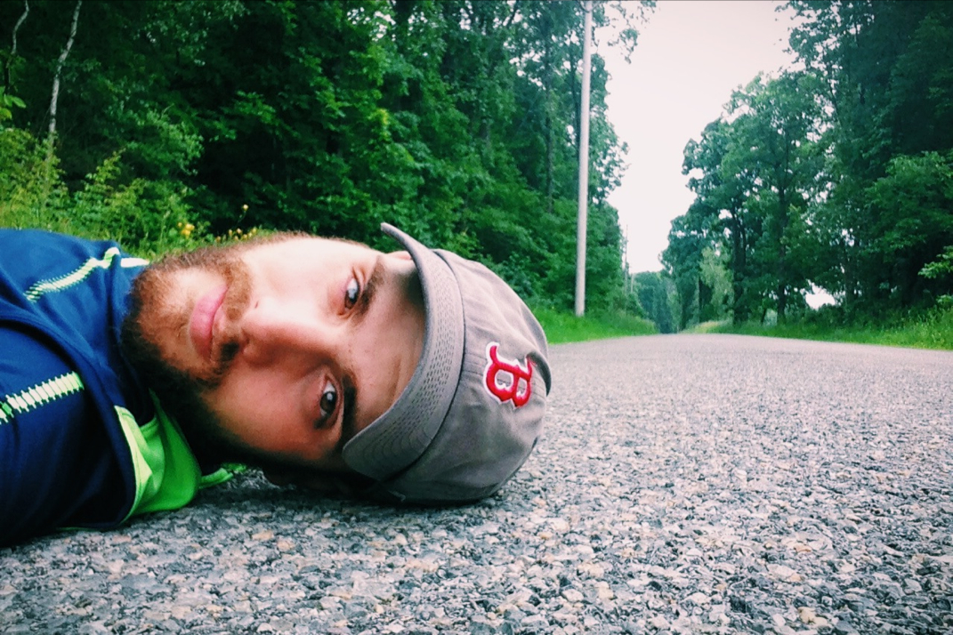
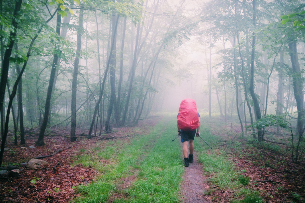
The mosquitoes last night at the Pochuck Mountain shelter were bad enough to drive Pneumo to set his tent in the middle of the night. Despite the lingering humidity, I forced myself to cocoon inside my sleeping bag liner in order to avoid being eaten alive by these little flying bloodsuckers, and as such got a horrible night of sleep. All in all, considering I'm spending most nights sleeping in 3-sided wood floored lean-tos with complete strangers, I suppose a bad night of sleep here and there isn't totally out of line. I awoke per usual around 5 AM and debated going back to sleep. The mileage today was low, and the terrain wasn't to be exceptionally difficult. It was around this time that Tater, one of the retired section-hiking women, woke up and we began chatting. A true adventurer, Tater is out hiking with her friend K2 quite recently after a knee replacement, after climbing in Machu Picchu, and racing sailboats. I told her about cycling cross country, and my interest in continued adventures. Exchanging email addresses, we parted ways as rain began falling from the still cloudy skies. 


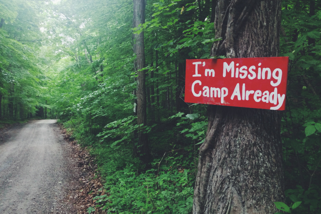
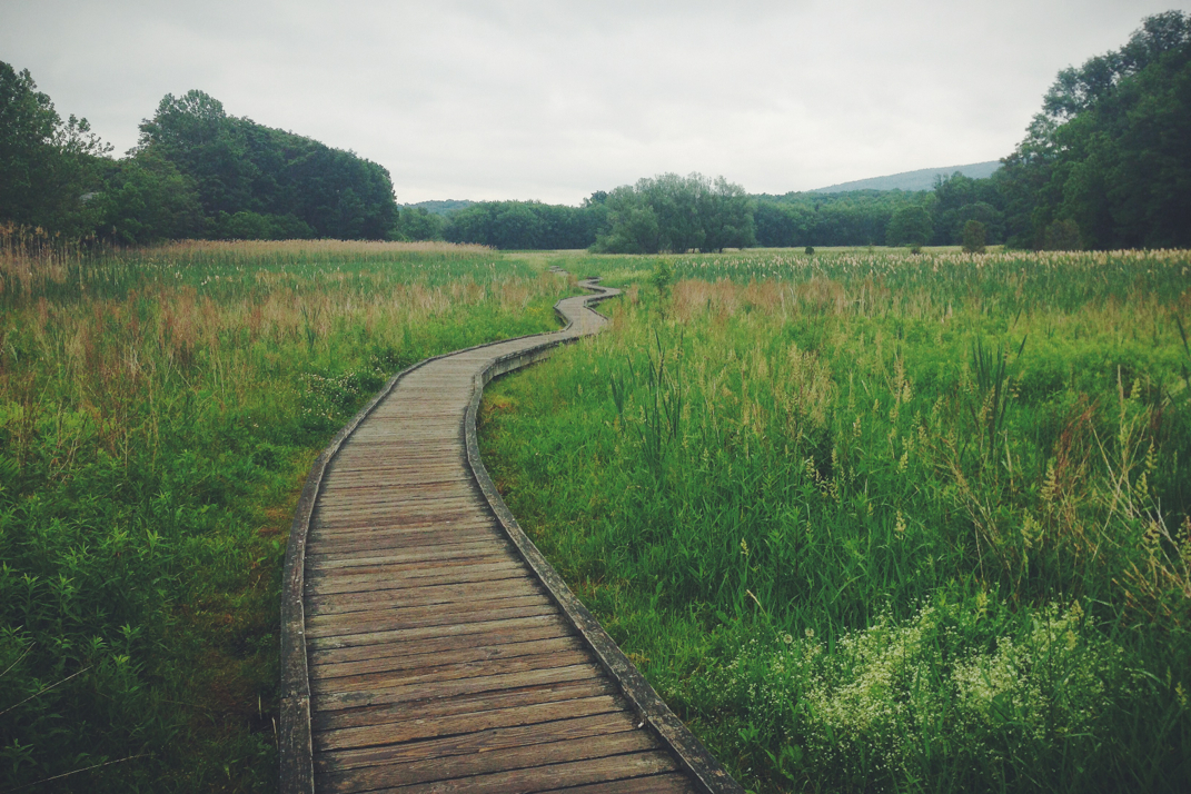
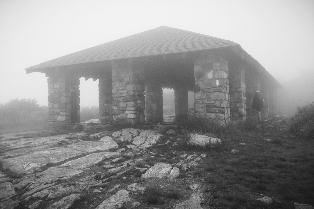
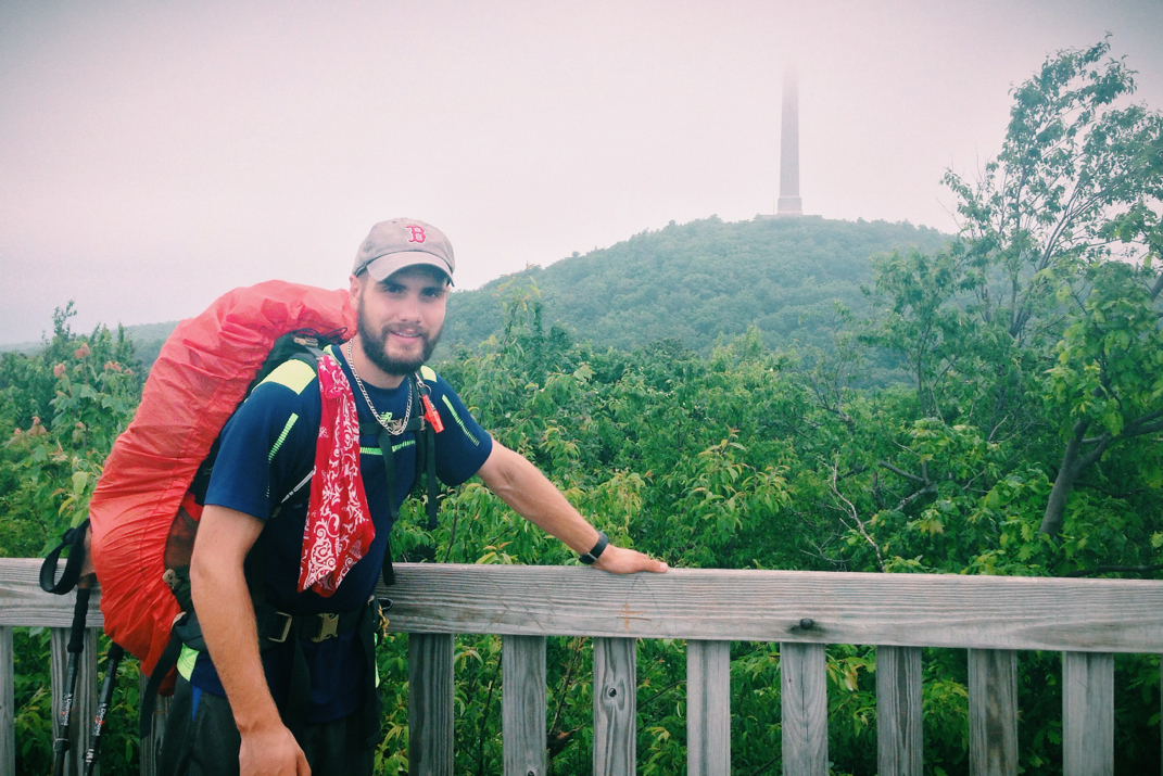
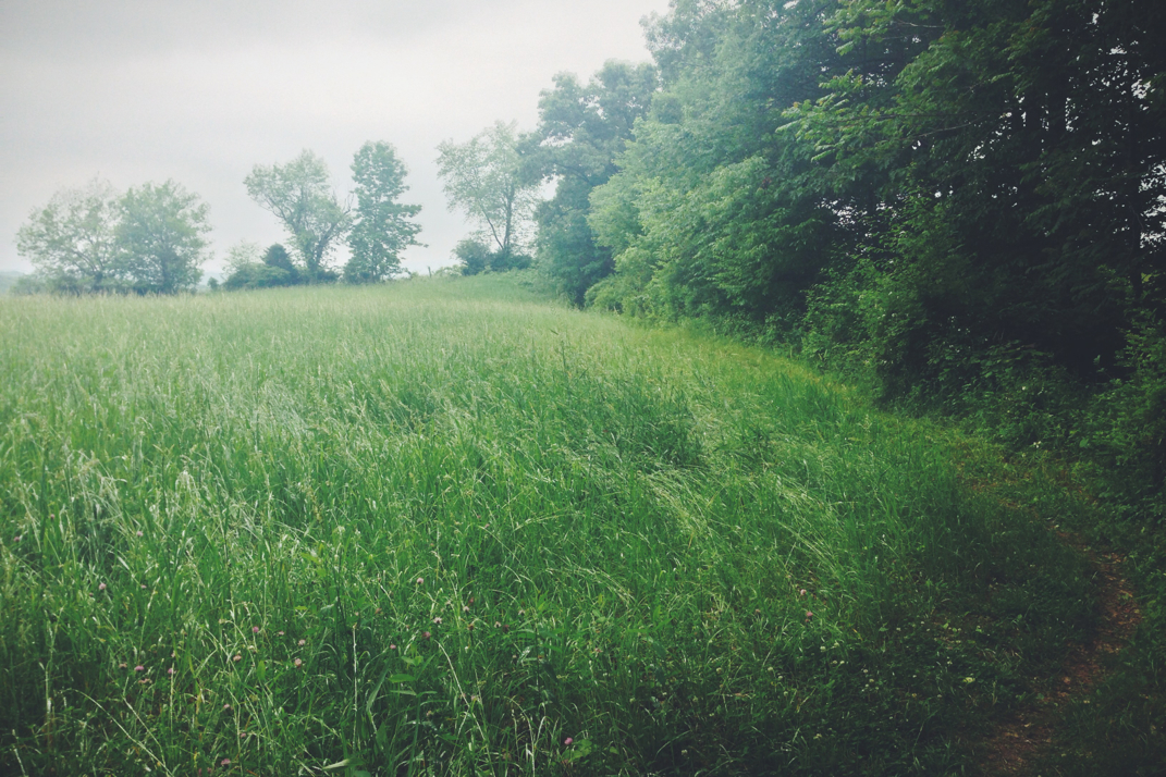
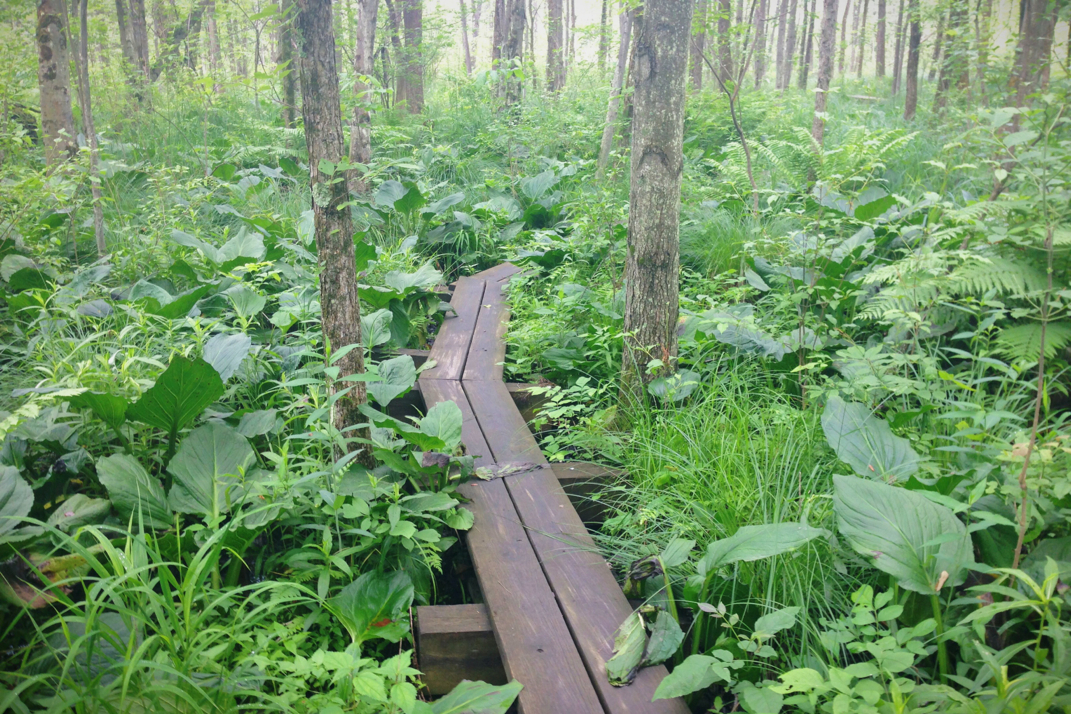
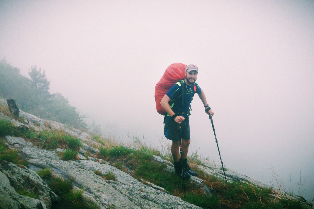
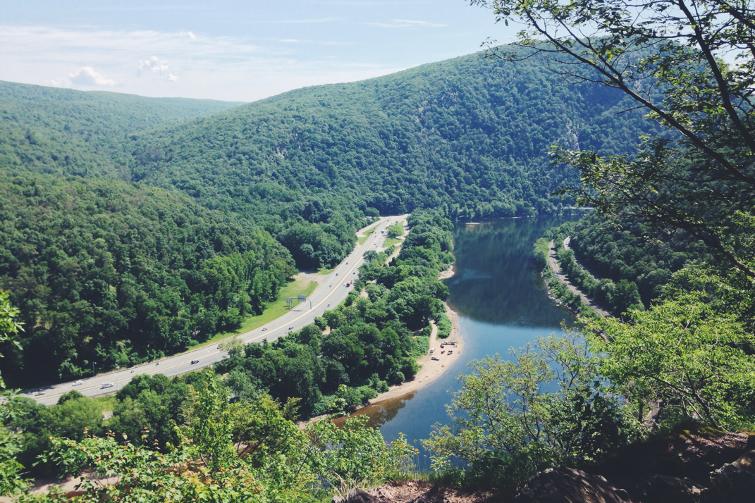
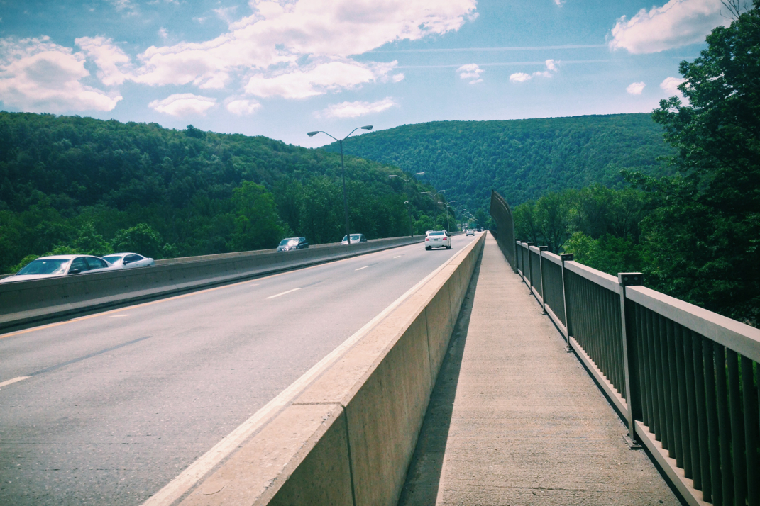
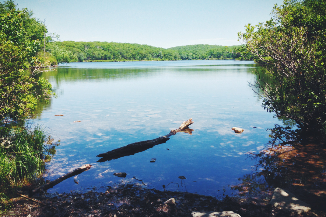
The first three miles of trail would allow us to summit Pochuck Mountain, but only after throwing some steep and rocky climbs at us first thing in the morning. As I know I've discussed, rocks aren't that bad to hike with. It's only when the rain mixes in that things get tricky, as they were this morning. Cautiously climbing up and over the summit, we began a descent down into the valley on the other side of the ridge. Passing over a few dirt roads, including one to a kids summer camp, we got down to county road 517, where Pneumo and I would part ways. He needed to get to the post office of a local town in order to work on getting his passport renewed and also to pick up a mail drop of food. With no need to go the two miles out of the way, I carried on with my hike. The two miles after 517's road crossing were comprised of gorgeous boardwalks spanning over conservation land. Despite the rain continuing to lightly fall,  I enjoyed the views and walked somewhat slowly across the two miles, crossing a suspension bridge built for the pedestrian walkway, and watching Orioles fly about between trees. Eventually coming to the end of the boardwalk, I crossed through a farm pasture, over a railroad track, and across another state road before beginning a mile and a half climb of a thousand feet up into the next ridgeline. The light rain continued, mixed with heavier bits at times, which made the very rocky ascent a bit more difficult. I met a few southbound section hikers as I climbed up to the peak of Waywayanda Vista. I summited and hiked in a few more miles to the Waywayanda shelter where I ate lunch alone before continuing on. 


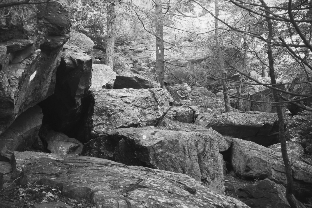
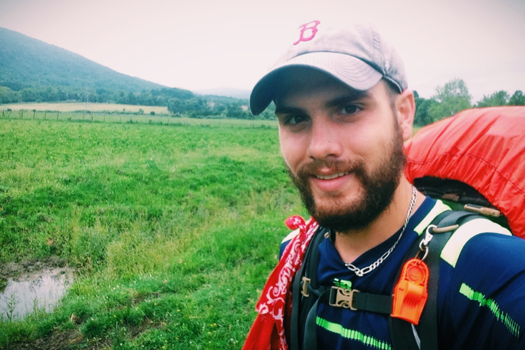
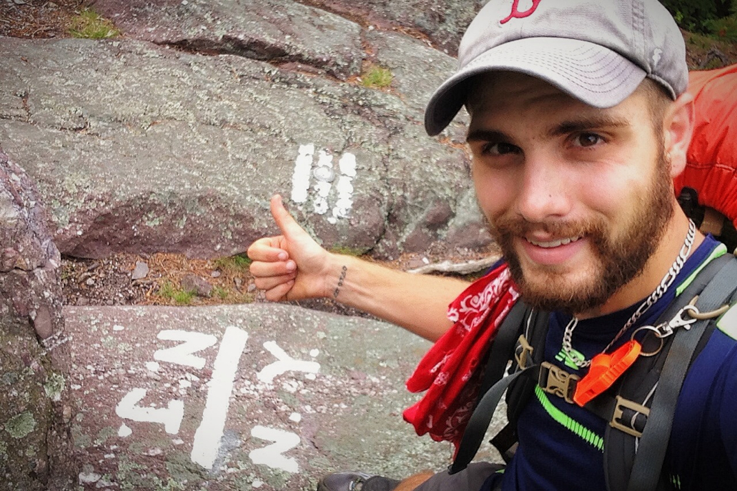
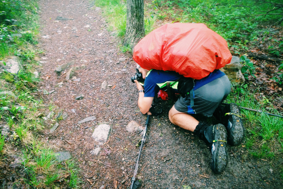
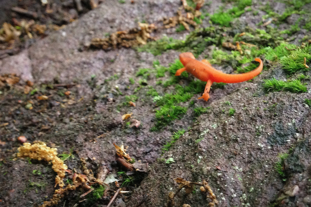
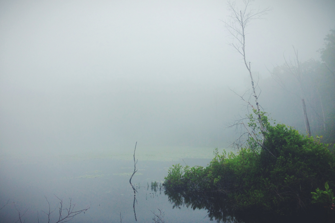
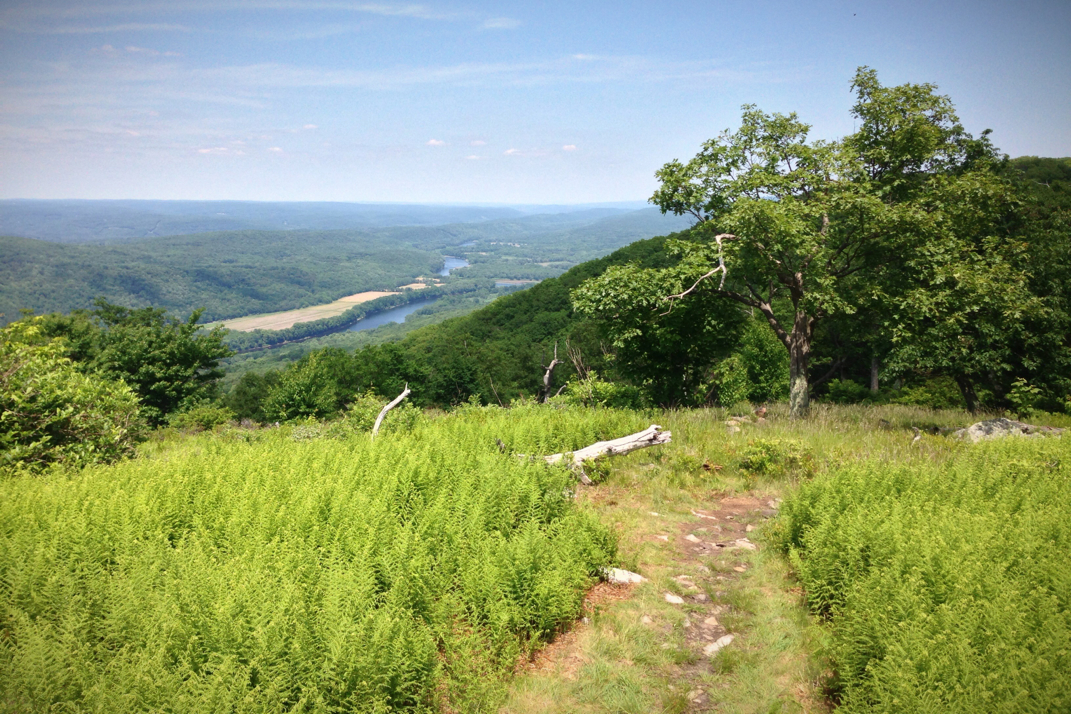
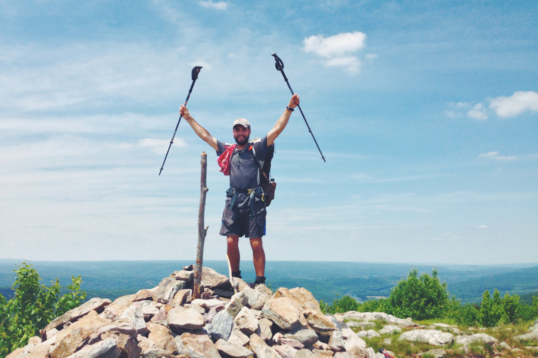
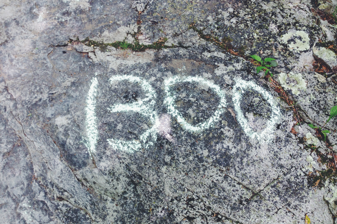
The afternoon was comprised of some hilly sections of trail, mostly deep in the woods until it climbed out and began being higher up along rocky ridges. At 1430hrs or so, Appalachian Trail mile 1,362 crossed me from New Jersey into New York. Taking a difficult photo at the spray painted rock depicting the state line, I hiked on, one state closer to Katahdin. The A.T. Guide sums up the miles after the state line well, stating "Despite the unimposing profile of terrain, rocks, and abrupt ups & downs make this section extremely challenging". For once, the book didn't lie. Miles of trail were comprised of hand over hand scrambling over boulders atop the ridge line. It was actually quite fun, as the rain had stopped and the sun was trying to peek through the grey skies. Half a mile past the state line, the Appalachian Trail reached its highest point on the trail in NY atop Prospect Rock, elevation 1,385', marked with an American flag atop a pole. On a clear day, it's possible to see the New York City skyline from this vantage point, but the clouds weren'T going to allow that to happen. After the miles of rocky terrain the trail turned downwards back into the woods. I was exceptionally thirsty at this point, but hesitated to drink the water (even after filtering) from the streams running off the mountain. The water color was literally a rusty looking reddish orange, which despite thirst was in no way appetizing. I had heard there was trail magic water at one of the next road crossings, so I waited until then to get water. Crossing NY 17A, I got a liter of water to hold me over. It was only two miles further to the Wildcat shelter, where my plan was to spend the night. 


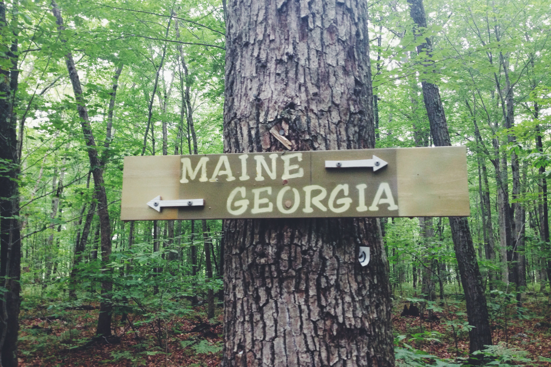
1,368 miles into the Appalachian Trail has hiked me through 8 full states, leaving me now in my 9th with only 5 left. Katahdin is still just over 800 miles away, but the thrill of the chase is certainly still present. The weather is supposed to stay overcast and rainy for the next few days, but I'm hoping to make the most of it. The New York section is rather short, and Connecticut will be within reach by next Monday. Until then, cross your fingers that sunshine returns to the trail in the near future, if you don't mind. 


Onward & upward,


Texaco

Picture
Picture
Picture
Picture
Picture
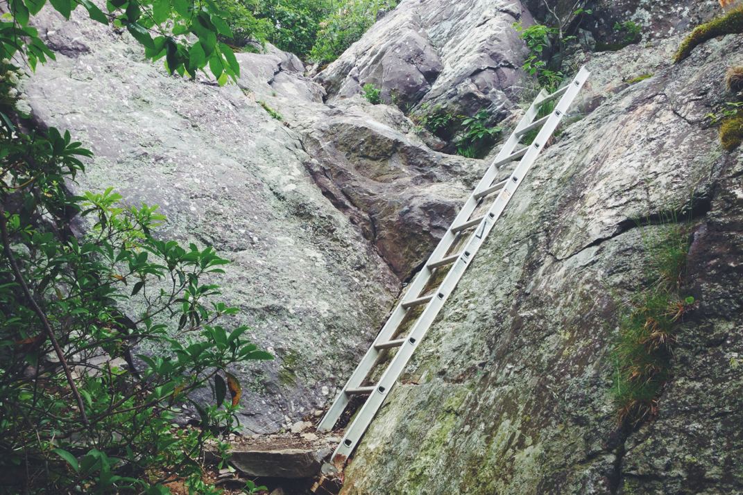
Ladder... Up the trail!
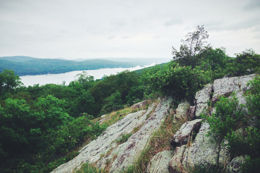
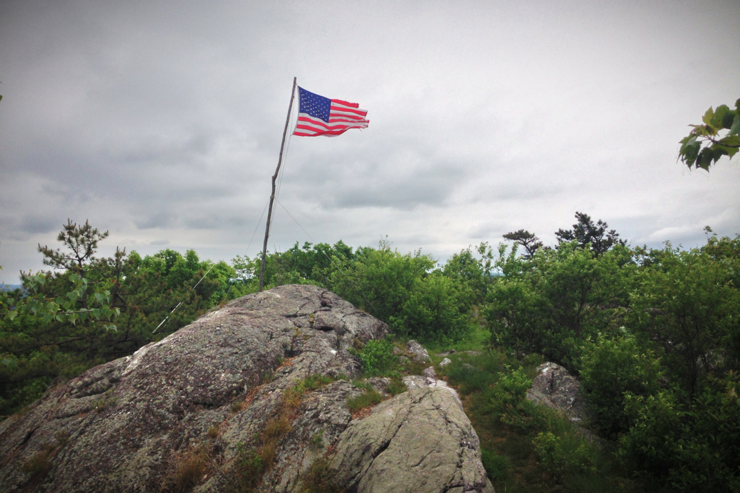
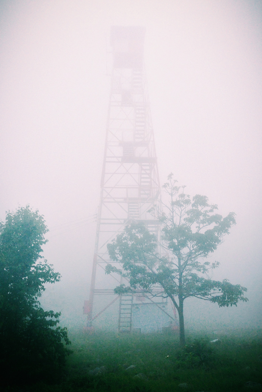
Picture
Picture
Prospect Rock
Picture
2 Comments

Garden State Finale

6/11/2014

0 Comments


Day: 68

Day mileage: 25.2

AT total mileage: 1,346.4

Time: 8.5 hours

--

The rain sounded endless last night as the half-full shelter of hikers huddled under sleeping bags to stay dry and warm. Waking up this morning I again had little interest in actually getting out of my warm cocoon, but the time came and I began packing up. I spoke for a while with Flossy & Grey Squirrel, a newly retired couple out hiking the Appalachian Trail. We discussed other adventures, and they too cycled a norther route across the country many years ago. We were even able to comment on exact roads (Idaho's Route 12 over Lola Pass), towns (Missoula, MT, Lewiston & Clarkston, ID), and cycling through Ontario. It's amazing that in such a vast country we shared those exact details of our previous trips. They're considering cycling across again, and I informed them of my research into a third adventure to follow up this one. Eating a few things and packing up my gear, Pneumo and I hit the trail just before 7. With a gentle climb out of the shelter over the course of a few miles, we came upon the top of Sunrise Mountain, capped with a large stone pavilion. Had the sky not been heavily foggy, I'm sure there would have been a stunning view. Alas, we spent another whole day in the rain and fog, and not one scenic vista provided us with a real view. 

From the top of Sunrise Mountain the trail bounced back and forth between a few hundred feet of elevation, and a handful of miles down the trail we came across the Mashipacong shelter. Settled to the side of a small field, Flossy and Squirrel were already there and conversing with Grasshopper, one of three Appalachian Trail trail runners in New Jersey. He and I spoke for quite a while about the trail before Pneumo and I headed on. Our next stop would be the High Point State Park visitors center, where Grasshopper had informed us we could be the recipients of a trail magic Pepsi. Within an hour we had reached the visitors center, a large stone building with vaulted beam cathedral ceilings. Acquiring my cold Pepsi (only after double checking to make sure they didn't have Coke), Pneumo and I set up shop to eat lunch inside. We spent just shy of an hour there conversing with other hikers and enjoying some food. The next miles included the High Point Monument, after which the park is named. Built atop the highest elevation point in all of New Jersey (a somewhat minuscule-in-comparison 1,803 feet), a 200' stone obelisk stands as a war memorial. From a wooden observation deck we saw parts of the tower in the thick fog, but both agreed it wasn't worth the half mile side trail trip to climb the monument. From the top of High Point we began an 8 mile downhill on the trail, crossing through pastures, dense forests, and many old gravel farm roads. At one point we stopped for a drink on a roadside and ended up staying for a half hour. The extreme lack of vehicles led me to lay on the side of the road and relax for a bit, as you'll see in a photo below. We carried on, and grew somewhat fed up with the climbs that the trail would make, even if only a few hundred feet in elevation, after dropping down the same amount. At one point while powering up a climb, I quickly came to the realization that the rock I was about to step on had a head and legs, and was in fact a snapping turtle present in the middle of the trail. I nearly had a heart attack, and Pneumo laughed hysterically as I jumped sideways to avoid stepping on the turtle's shell. 

Crossing over a half dozen more cow pastures, we eventually exited the woods and walked a half mile along State Line Road, literally dancing between New York and New Jersey. It won't be until tomorrow that we officially cross the state line. From there we veered right and made an annoying traipse around the Wallkill National Wildlife Refuge, a two mile walk that led us right back to the road we had been on before. After being chased by a thousand mosquitoes during the walk around the Refuge, we got water from the spigot of an abandoned house, and climbed an exceptionally steep half mile up to the Pochuck Mountain shelter where we would spend the night. 

Meeting K2 and Tater at the shelter, two recently retired women who have been section hiking for five years now, Pneumo and I made dinner while conversing with them. I was in my sleeping bag by 2015hrs, fighting off the still-present mosquitoes, annoying enough that Pneumo eventually abandoned the shelter and set up his tent. Tomorrow will be a 23 or so mile day to a shelter, and we'll officially be in New York. The weather still calls for rain and heavy fog, but my fingers are crossed that the precipitation at least stays away. 

Onward and upward with the rise of the sun. 

Texaco

Picture
Pavilion
Picture
Photographing the Newt
Picture
Newt
Picture
Visitor's Center
Picture
High Point monument
Picture
Picture
Picture
Picture
Street Life Portrait
Picture
Wildlife Refuge
0 Comments

Jersey Rain

6/10/2014

0 Comments


Day: 67

Day mileage: 21.8

AT total mileage: 1,321.2

Time: 7 hours

--

I've written before that it's extremely hard to leave a 'dry' shelter to hike in the rain. I had no idea how amplified this emotion becomes when you've been graciously put up in a warm and completely weather sealed home, as torrential rain falls from the skies outside. I woke up at 5 naturally, a habit that will be good to have when I get back out on the road with work, and ate my way through half a box of Fruit Loops cereal that I had purchased at Wal-Mart the night before. A few days ago I had an absolute craving for the sugary cereal from my childhood, so when the opportunity presented itself to buy some I absolutely had to. Finishing breakfast and packing up my resupply of food, I made my way to the garage where Pneumo and I said goodbye to Mike, and loaded up the minivan to drive back to the trail with Caren. The humidity, rain, and grey weren't hugely inspiring to go hike in, but alas that's just the way things work. The drive to the trailhead passed quickly with conversation, and Caren had dropped us off by 8:15 right where they had picked us up the afternoon before. 

We didn't begin hiking immediately. Instead we stood around rather mopey after the minivan drove away, having repeatedly thanked our gracious host for her hospitality and generosity. We finally began hiking shortly before 9, and climbed a few hundred feet out of the gap that the roadbed ran through. At the top of the ridge we were presented with the first of many 'scenic vistas' that would be nothing more than heavy fog and no spectacular view. It didn't take long for tall grass and overgrown bushes to soak shoes and clothing with raindrops from the passing storms, and moral between us was pretty low. We hiked on traversing the ridge for a few hours, passing by construction zones and rerouted trail sections, cautiously stepping over grounds with dozens of little orange salamanders as I'd call out 'watch the little guy!' to alert Pneumo of their presence. We passed a hiker named Twizzler, the first thru-hiker we had seen in a while, who we would run into repeatedly throughout the day. He began mid-March, and had taken two zeros in Delaware Water Gap, and was moving quickly from being well rested. Around noon, having only hiked a pathetic 7 miles, we stopped for a snack by a roadside picnic area. Continuing on shorty after, the trail followed old fire service roads for quite a while, interspersed with rocky climbs to keep things interesting. The wet rocks made for challenging climbs up the vertical inclines, and I'd end up slipping more than once throughout the day, often catching myself with an extended arm or trekking pole. 

I had received a care package from my folks at Caren and Mike's containing some small items and a new set of my New Balance MT1210 trail runner sneakers. After having put nearly 900 miles on the last pair, they were certainly showing their age. Despite having the ability to easily switch into a new set of 1210s, I had wanted to wait until after Pennsylvania, hoping to not destroy a new pair on the incessant rock fields that section of trail presented me with. I'll admit that I felt a bit guilty taking a brand new pair out into the rain this morning, but with my Orange Superfeet insoles installed, I definitely noticed a better grip on the trail. As I've said before these trail runners aren't phenomenal on wet rock, but then again what shoes or boots are? This pair should get me at least into New Hampshire, which in itself is an exciting thought. 

We hiked on, going through a roller coaster type section of a few hundred foot summits and descents in a row before we arrived at the Brink Road shelter, the first shelter in 38 miles since the Kirkridge back in Pennsylvania. Stopping for lunch at the brand new building, a low fog lingered in the air around the tent sites and water source. At this point we only had 7 miles left to hike, which would mean a short day at about 22 total miles, landing us in our destination shelter by 1800hrs. We hiked on, with a few miles of relatively level terrain before making a 700' descent down into the valley where the Kittatinny Lake resides. Despite what I imagine are beautiful views, all of the vistas were still fogged in so we got no good looks at the lake from the ridge above. Reaching the very busy two lane highway at the bottom of the mountain, we went in search of a cold drink at a convenience store. None to be found, we ended up at Gyp's Tavern where I ordered a cold beer and a burger, simply because I could. The hiker Twizzler was also there, and we spoke more as we ate. Settling up my bill, Pneumo and I headed back to the trail where 3.2 miles and one more 700' climb would land us at the shelter where we would spend the night. It was funny to hear Pneumo's comments about the cost of beer in bars. Having just turned 21 a few days before hitting the trail, he was taken aback at the $5.25 he paid for a Guinness. We talked for a little about the cost differences between liquor stores and restaurants/bars pricing. 

Summiting the 1,500' mountain at the Culver Fire Tower, we descended quickly down to the Gren Anderson shelter, where we were greeted with more thru-hikers than I've seen in a while. Talking for a bit with them, I was in bed by 1900hrs and ready for sleep under an hour later. The sky still threatens with rain, and the forecast is pretty ugly for the rest of the week. I'll be interested to see what we wake up to. 

One more day in New Jersey, then we'll be on into New York. 

Texaco

Picture
Scenic Vistas
Picture
Fire Tower
Picture
Little Guy Adventuring
Picture
Picture
Pneumo's photo of me walking
Picture
Most obviously helpful sign ever.
0 Comments

Mile 1,300: Delaware Water Gap

6/9/2014

1 Comment


Day: 66

Day mileage: 22.6

AT total mileage: 1,300.3

Time: 7 hours

--

Welcome to New Jersey. 

The silence of the woods last night was incredible. Normally there's a river, road/highway, or airport near enough by to create some kind of ambient noise as we sleep. In rare form, our campsite at mile 1,278 had nothing within 5 miles of it, and as such was completely silent. It was almost eerie to roll over in the middle of the night, patchy areas illuminated by the moon shining through leaves on the trees, and hear nothing at all. Being someone who needs ambient noise to sleep, it was just my luck that my iPod had died and I had no music to put on to break the silence. Regardless, I did manage to fall back asleep and woke up rested around 5:30 AM. Packing up camp shortly thereafter, Pneumo and I began our 'short' hiking day just before 7. 

As if wanting to give us a last hoorah, the final 12 miles of Pennsylvania trail were all kinds of rocky. Small and triangulated rocks that twist ankles, larger boulders that required hopping between them and bracing with trekking poles upon descent... There was quite a bit of swearing going on as we hiked, eagerly looking forward to a new state and hopefully some different terrain. Around 5 miles into the hike we make it to the Kirkridge shelter where we had a quick second breakfast and refilled water before setting our sights on the Delaware Water Gap some 7 miles further north. The trail between the shelter and the gap would be mostly level along a mountain ridge, at some points following dirt access roads for old power line companies, then would steeply drop off close to 1,000 feet into the riverbed below. Towards the end of the ridge we hiked past a sign for the summit of Mt. Minsi, which felt like a joke as we had barely hiked any kind of elevation gain to get there. It was about this time that we began encountering weekend hikers out with their dogs and kids, enjoying the humid and sunny weather. We spoke briefly with everyone as we began descending into the valley below. It was quite comical to watch the variety of weekenders hike Mt. Minsi. There were of course the locals with their dogs who frequent the trail, young women power walking in their yoga pants and oversized florescent cotton shirts, families with dads explaining that 'this isn't even the hard part' to their kids, and then a group of Asian tourists in street clothes with 2-way walkie-talkies in case they got separated while executing this challenging summit. People are entertaining. 

Reaching the valley floor below, the trail turned onto the slow paced back roads of Delaware Water Gap, PA. We followed along, passing by dilapidated homes that were probably once gorgeous in their grandeur, and bank style barns that I can only assume are now home to dusty items from decades past. As you may not know, when the Trail follows through a town there are white blazes painted on phone poles and buildings to alert hikers where to go. It can oftentimes be quite difficult to find these blazes due to the presence of missing puppy posters, yard sale signs, and other miscellaneous things haphazardly covering the rectangular white paint that a hiker relies on for navigation. Luckily we were able to find the blazes easily, and dropped through a small center of town where an old ice cream shop caught my eye. Pneumo and I decided we had a few minutes to spare, and stopped in for two strawberry milkshakes made with Hershey's ice cream. I also ordered a Coke, which I was shocked to see was made by stirring carbonated water with actual Coca Cola syrup. Meanwhile the two high school girls, dressed in matching ice cream shoppe outfits worked away at our milkshakes as period correct music played throughout a room decorated in the style of a time long since passed. My syrup-stirred Coke wasn't as delicious as I had hoped for, but the chunks of real strawberry in my milkshake absolutely made up for it. We got the shakes to-go, and began the mile trek across the Delaware River bridge and over into New Jersey. Goodbye, Pennsylvania - see ya never. 

Hiking the bridge was slightly horrifying. Divided by a concrete barrier with no more than 3 feet of distance between the sidewalk and passing cars, it was nerve wracking to be passed by 18-wheelers going 75 miles an hour down the highway. Despite this scary experience, we trekked across the expansive bridge and eventually were separated from I-80 as we dropped down and into the parking lot of the Kittanytinny Point visitor's center where we were greeted by park rangers who were eager to have us sign their guest book. We were even given Appalachian Trail patches and a childish pin proudly stating 'Junior Park Ranger' in the same way that commercial pilots used to give out plastic Delta and United wings to children who visited the cockpit. With a schedule to keep, we began the long and gradual climb up into the mountains from the riverbed of the Delaware. Again we were presented with many day hikers, not all of whom were friendly or even returned hellos. There were more rocks than I had hoped for, but I think I despised them just a little less due to the fact that they weren't Pennsylvania rocks. New Jersey rocks are apparently excused in my book. Atop the mountain ridge we came across a large, crystal clear lake, the kind that would be absolutely perfect to sit at and enjoy a sunny summer June day. Hiking around it, we trekked on, aiming to meet friends Caren and Mike at an Appalachian Mountain Club outdoors center around 1530hrs. The rocky terrain slowed us a bit, but we arrived a few minutes before them after crossing the Trail's 1,300 mile mark. One more state, and another hundred miles in the books. 

Caren and Mike arrived from a tandem bicycle ride they had been on, and for our stuff in their van. We made the drive back (the longest I've spent in a car since April) at highway speeds for a half hour or so before arriving at their gorgeous New Jersey home. After each taking a wonderfully hot shower, Caren drove us to Wal-mart for a resupply while she picked up her mom to join us for dinner. Our resupply was quick, and we were back at the house within an hour. A homemade dinner of lasagna, fresh bread, and salad was served and enjoyed by all. Their daughter Julia was also home from college for the summer and baked us a desert of delicious chocolate chip cookies. What a feast. It's not very often I walk away with a genuinely full stomach, so this was a treat. 

Pneumo and I planned out our next few days of trail after dinner, and threw in a load of laundry so we hopefully don't smell as horrible for the next few days. Bed came around 2200hrs, and I'm hoping to sleep well on a comfortable mattress. There's lots of rain in the forecast for the next week, which I'm dreading. I suppose we shall see tomorrow how the next few days will play out.

From a warm bed in a dry house... In state #8, with 6 left to go. 

Texaco

Picture
Delaware River
Picture
Ice Cream Shoppe
Picture
Never Ending Bridge
Picture
Picture
Picture
Picture
Practicing my pose for Katahdin
Picture
Picture
Picture
After 3 Servings of Lasagna
Picture
900 miles on my shoes, time to be replaced!
Picture
With Mike and Caren, our gracious hosts!
1 Comment

    SUBSCRIBE

    Join Over 2,000 Readers On The Search For Adventure!

    Delivered by FeedBurner


    Author

    Hey there! I'm Ryan McKee, a free spirited adventurer, photographer, and digital media creator who calls North Carolina home. I travel incessantly, carry a camera with me everywhere, and am always dreaming of my next big trip.

    Picture

    SOCIAL MEDIA

    Picture
    Picture

    SPECIAL THANKS To

    Picture
    Picture
    Picture
    Picture
    Picture
    Picture
    Picture

    Archives

    October 2019
    September 2019
    August 2019
    August 2018
    July 2018
    June 2018
    February 2018
    December 2017
    November 2017
    October 2017
    September 2017
    August 2017
    July 2017
    June 2017
    May 2017
    March 2017
    February 2017
    January 2017
    December 2016
    November 2016
    October 2016
    August 2016
    July 2016
    April 2015
    September 2014
    August 2014
    July 2014
    June 2014
    May 2014
    April 2014
    March 2014
    February 2014
    January 2013


      Quick Survey

    Submit

    Categories

    All
    Allagash Wilderness
    Appalachian Trail
    Banff National Park
    Bears
    Canada
    Caribbean
    Connecticut
    Georgia
    Greece
    Hiking
    Italy
    Jasper National Park
    Jeeps
    Katahdin
    Long Trail
    Maine
    Maryland
    Massachusetts
    New Hampshire
    New Jersey
    New York
    North Carolina
    Overland
    Pennsylvania
    Photography
    Sailing
    Tennessee
    Travel
    Vermont
    Virginia
    West Virginia

    RSS Feed

ADVENTURES

Trans-Canada Overland Expedition
The Long Trail
Appalachian Trail
Bicycling Across America

Overland Build

Meet The Jeep
Backcountry Gear
​Modifications & Installations

Everything Else

Read The Blog
Photography
Guest Book
Contact

Picture
© COPYRIGHT 2019
​All Rights Reserved