2180miles
  • Home
  • Adventure Blog
  • Overland
    • Meet The Jeep
    • Mods & Installs
    • Overland Gear
    • Trip Reports & Videos >
      • Allagash Winter 2019
      • Greece Adventures 2019
      • Overland Expo East 2018
      • Allagash Wilderness 2018
      • Trans-Canada Overland 2017
      • QB-5 Adventure 2017
  • Long Trail
    • Trip Summary
    • Photojournal
    • Hike Statistics
  • Appalachian Trail
    • Trip Summary
    • Photojournal
    • Gear Talk
    • Hike Statistics
    • Financial Planning
  • Bicycling America
    • Trip Summary
    • Photojournal

One Long Day

5/5/2014

6 Comments


Day: 31

Day mileage: 34.5

AT total mileage: 468

Time: 10.75 hours 

--

When I woke up this morning the only light was that of the stars, a crescent moon, and the street lamps glowing in the valley below. The birds, bears, and other wildlife were still asleep, and hikers were fast asleep buried in their sleeping bags, all chilled by the cold of the early morning hours. It was 4 am. I fastened my LED headlamp to my head and began quietly removing my gear from the shelter. I'd carry my sleeping bag 30 feet away before packing it into the stuff sack. I'd carry piece by piece from the shelter to my bag, away from everyone so as to not wake them. I signed the shelter log book as 'out 2 hours before the sun', and hit the trail at just before 5 am. I actually went so far as to carry my air-inflated sleeping pad 1/8 of a mile or so before deflating it on the forest floor, knowing that the rush of escaping air upon deflation would likely wake a sleeping body. Today's early rise was very specifically goal oriented. 

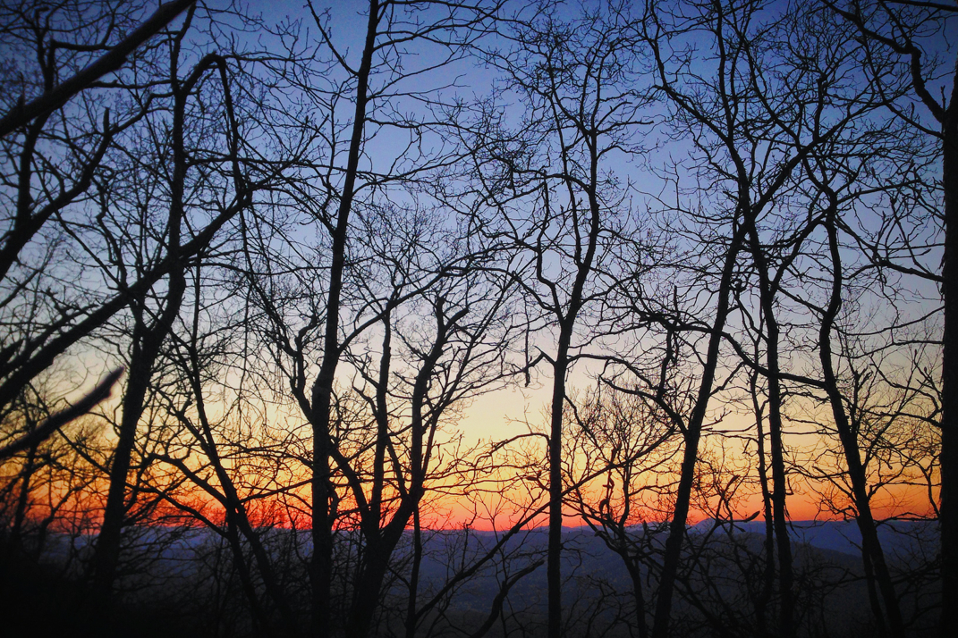
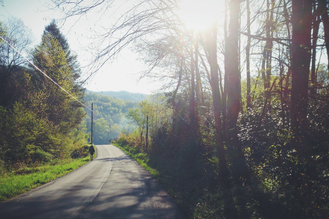
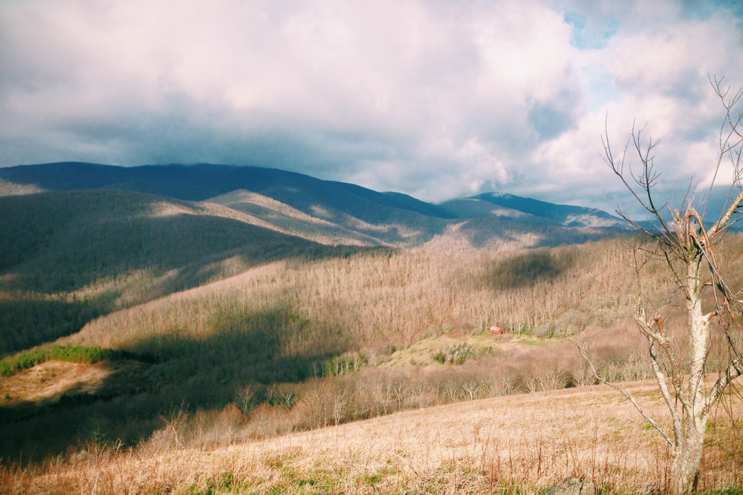
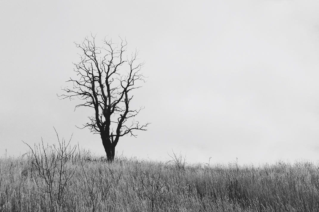
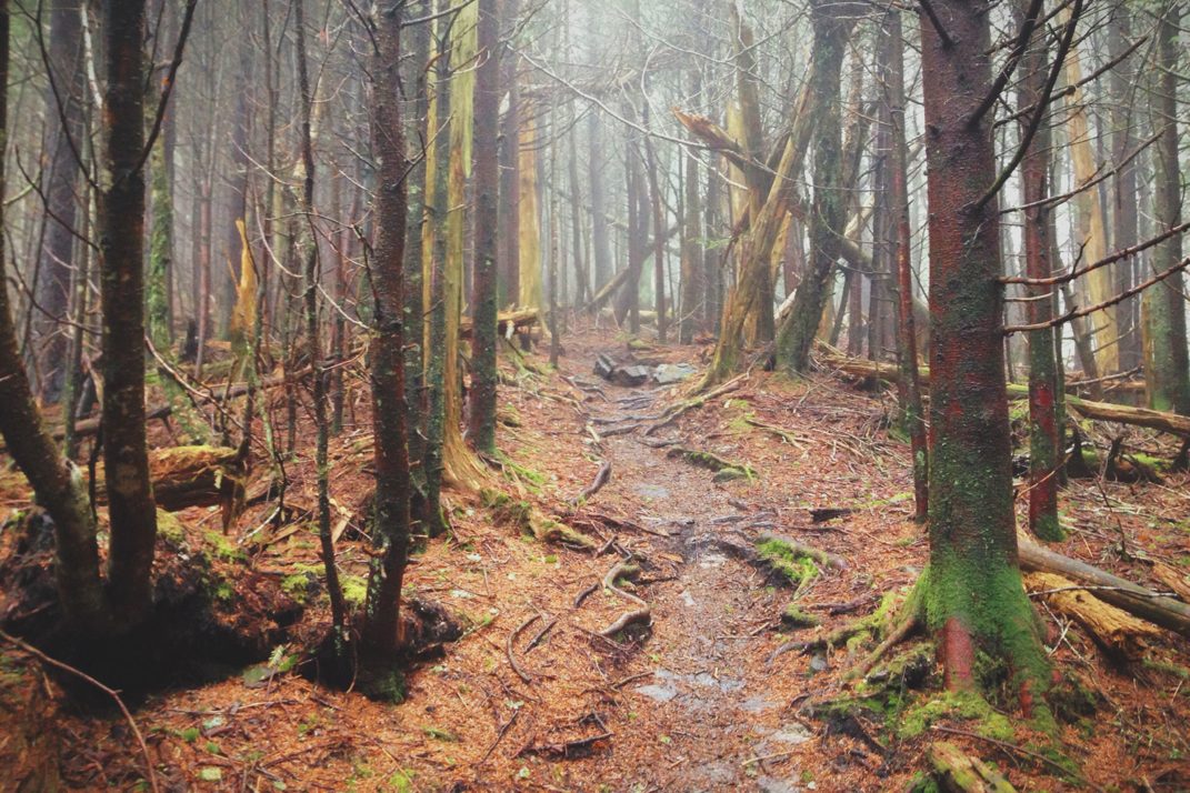
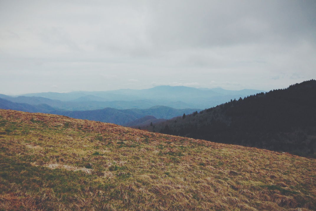
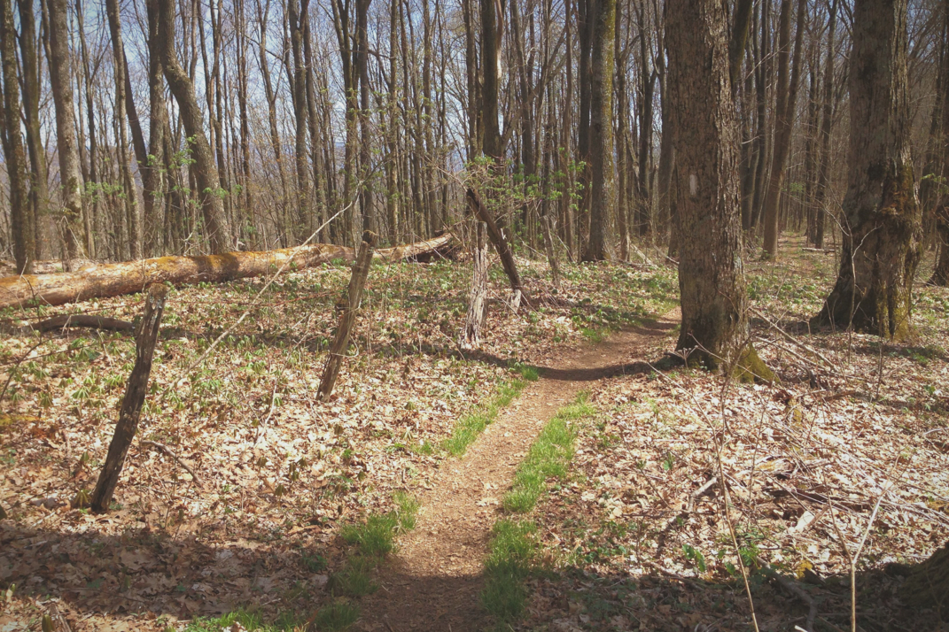
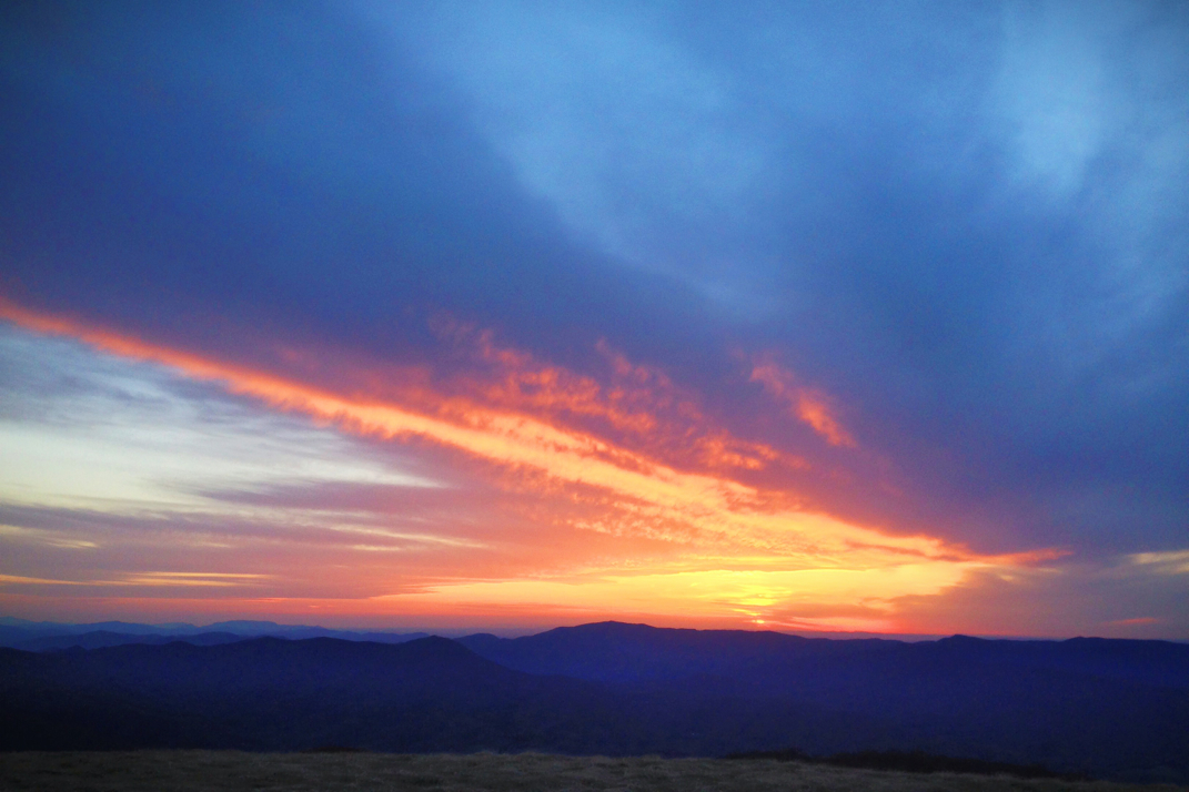
The trail was pitch black. My 140 lumens of headlamp was enough to illuminate the world in front of me, leaving everything else in complete darkness. I found my pace for the morning as I ate a Pop-Tart, knowing I needed something in the variety of food to get me through until my normal breakfast time. As I walked I unknowingly engaged in a game of 'chicken' with moths and other bugs on the trail, as I walked forward they'd fly as close to my headlamp as possible before darting left or right to avoid a collision. Cobwebs spanned across the trail but in the end I was in complete silence, alone in the woods.  About an hour before sunrise the sky began its transformation as a watercolor painting, dark reds and oranges appearing low on the horizon. For a few miles of uphill the trail would skirt around the ridgeline, sometimes dipping down into the ravine below before climbing back up top. At one point it stayed low long enough that I was nervous I'd miss the exact moment of sunrise. In the cold darkness of the morning, my breath visible with every exhale, my body barely noticed the steep inclines I was hiking. Eventually the sun crested the mountain ridges on the horizon, and light raced across the valley at its remarkable 186,000 feet per second. Slowly the world came to life, birds chirping, street lamps turning off for the day, and hikers waking in their tents. 

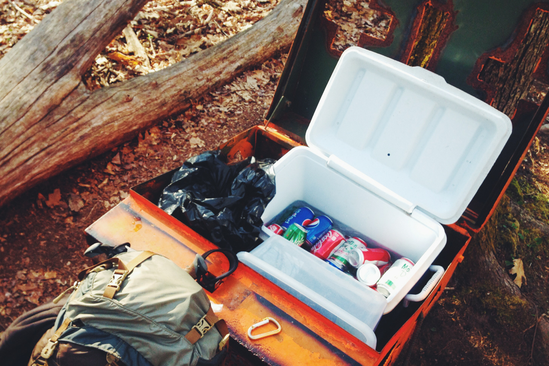
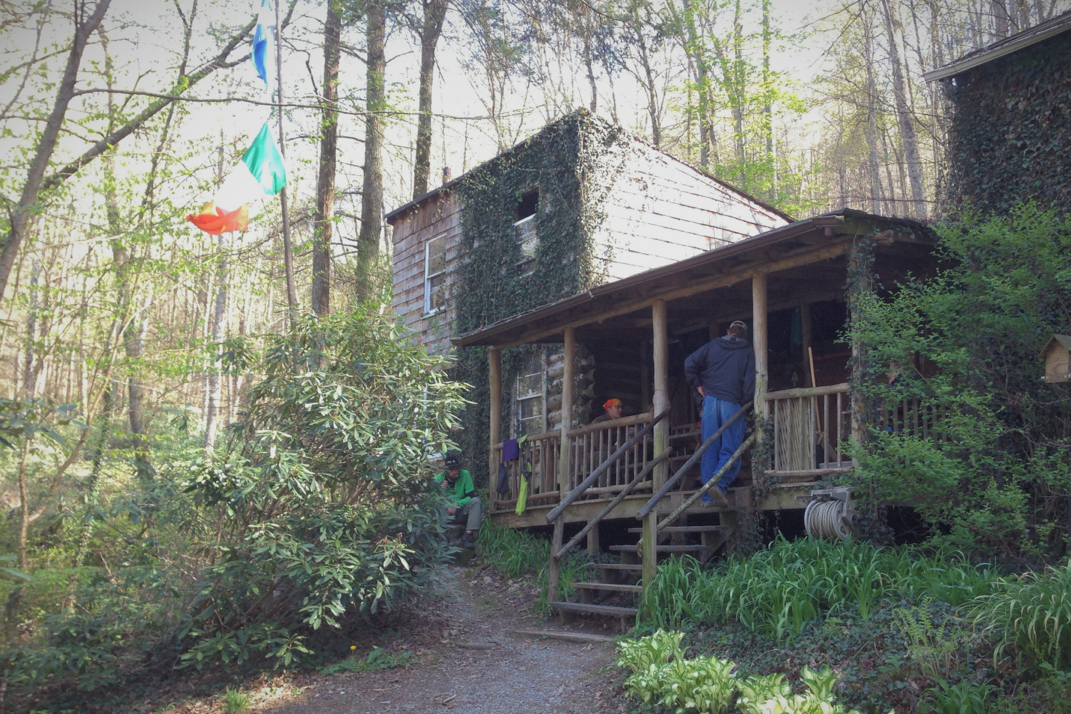
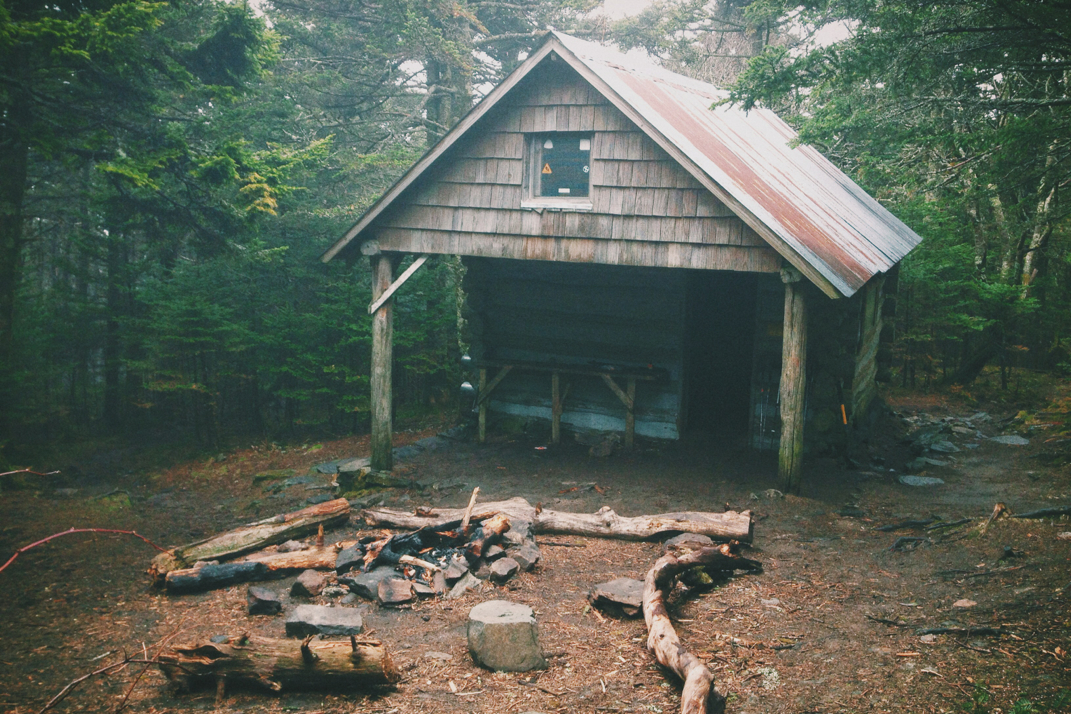
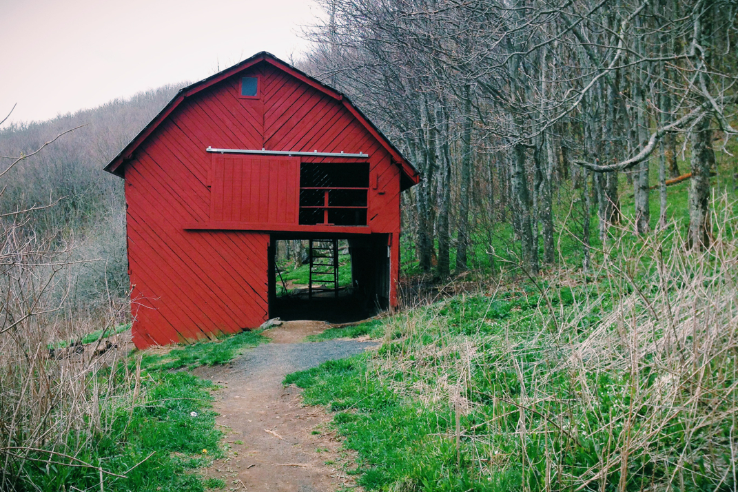
I arrived at Iron Mountain Shelter at 7:15 AM, more than 7 miles down the trail from where I started, meaning I was hiking at just over 3 miles an hour. My goal was not to stay and rest, simply to eat something and quickly move on.  I signed the guest book, listening to tired hikers talk over their breakfasts, poured on hand sanitizer (lots of Norovirus going around) and was back on the trail in less than 5 minutes. One important thing to mention is a piece of graffiti that was written boldly across the front of this shelter. No profanity, no art, just the words 'Practice Momentum'... This became something I thought about & strived for throughout the day.  I continued on, quickly hiking through some easier terrain, stopping to get water before coming across a bright orange steel box sitting on the side of the trail. Messages taped to trees around it informed hikers that it was trail magic from a local church, wishing health, happiness, and the 'discovery of a closer relationship with God' during your hike. The homemade box had crosses cut out with a plasma torch, and was stocked with an ice filled cooler containing Coca-Cola, Pepsi, and Mountain Dew. There was also a Tupperware container with Little Debbie  pastry snacks, and a spiral notebook detailing the elementary school girls responsible for the trail magic. They simply asked that after taking a drink and some food that you write in your trail name and where you're from so they can keep track. Last year their trail magic reached hikers from 43 states and 11 countries. 

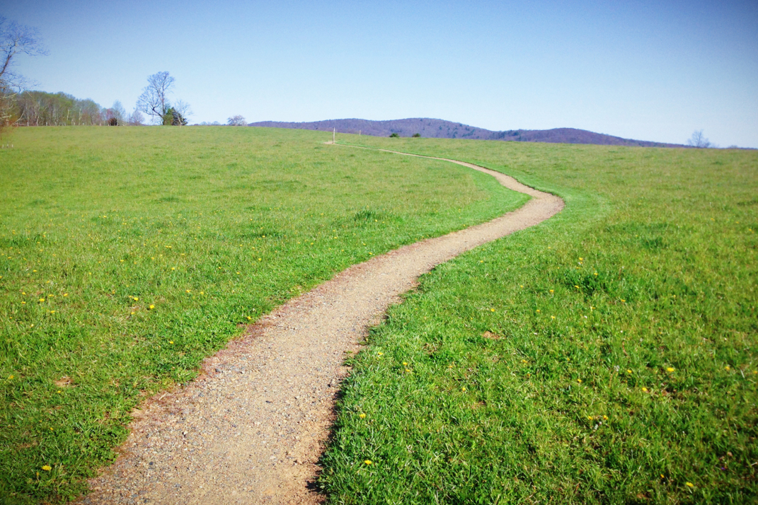
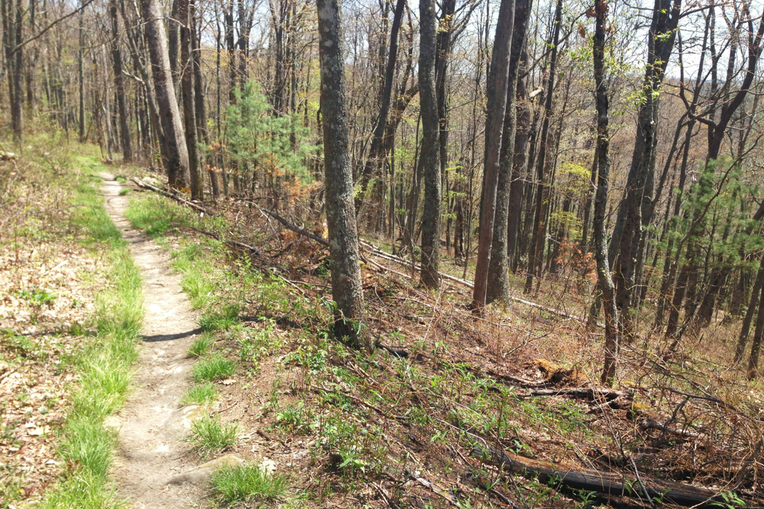
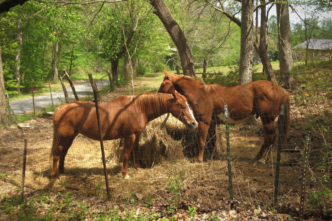
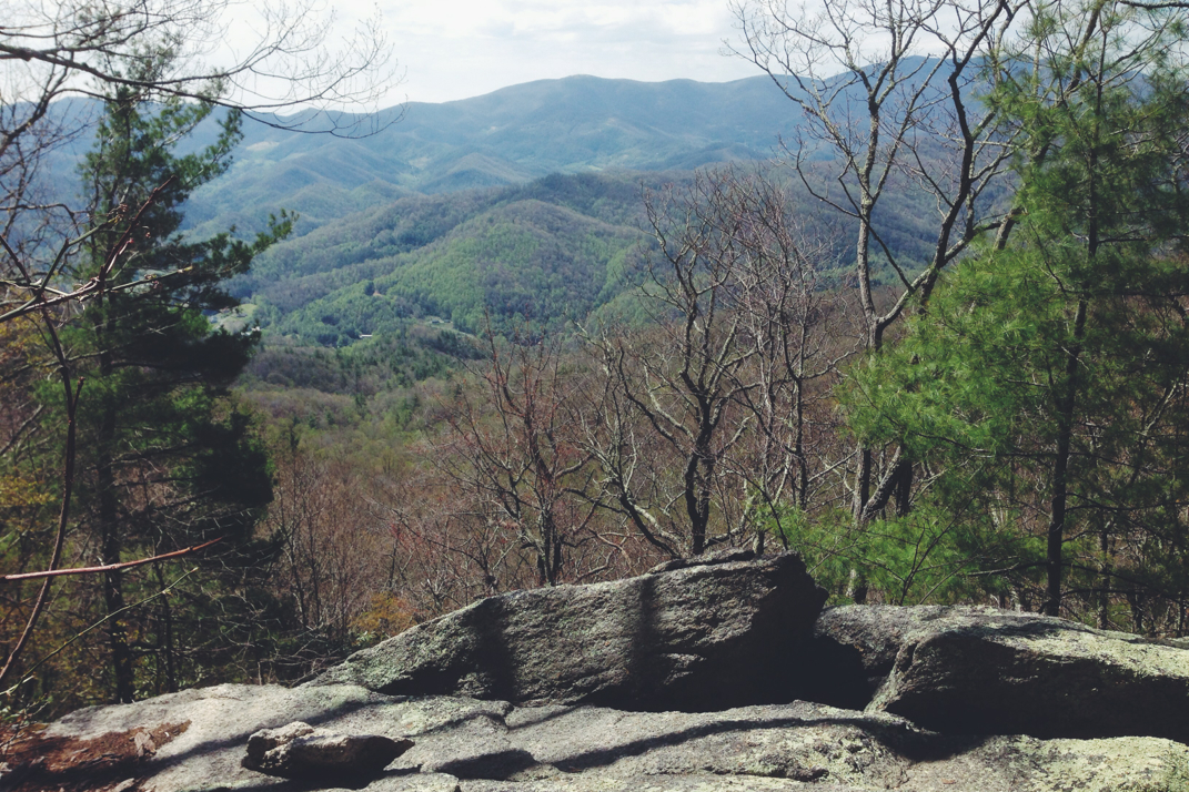
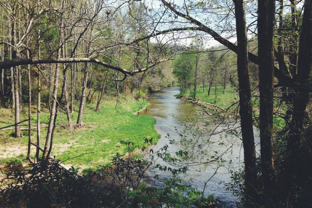
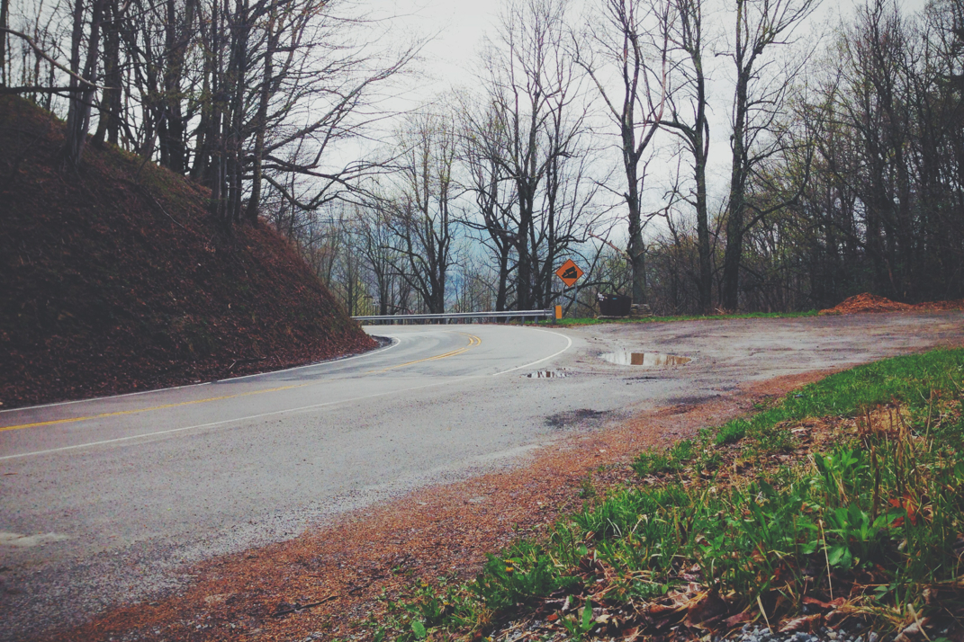
A mile or so after the magic, the trail came out of the woods to Tennessee Rt. 91, where after crossing the road hikers entered through a 'Cow & Horse Proof Gate' (this took me more than a minute to figure out how to get into, so I'm sure it is in fact farm animal proof) a large farming field. The trail continued on through private property, acres and acres of lusciously green grass, perfectly manicured for the rolling hills. After a mile of farmlands and countless views back over the valleys of Tennessee nestled between mountain ridges, the trail inevitably meandered back into the woods, climbing up a thousand feet in elevation before stopping at Double Springs Shelter. I arrived there at 10:02, 5 hours after beginning my hike, now with 15 miles under my feet for the day. I was thrilled with this information, knowing it meant I was maintaining a very quick pace and on track for my long day. I ate a McDonald's double cheeseburger, now around 36 hours old and still delicious, and spoke to a hiker named Hog Driver (from Lynn, MA) and he was flabbergasted with my attained mileage. I also found there to be some beautiful irony with eating a double cheeseburger at Double Springs shelter... It fits.  The trail continued to climb up from the shelter, and I flew by Hog Driver as I continued on. The trail took to higher ridges, elevations changing by 200-500' before dipping back down and repeating the climbs. I call these parts of the trails PLUDS or Pointless Little Ups & Downs. It's tiring to ascend and descend so repeatedly with nothing really gained. Regardless, I walked on. At one point, around 19 miles into the day, I stopped and removed my left shoe and sock, noting some discomfort with one of my toes. Wanting to fix any problem areas before they became blisters, I created a duct-tape condom of sorts for my toe... Problem solved. I'll be getting my new New Balance 1210s via mail drop tomorrow so this isn't a huge issue. I continued along and rolled up to the Abingdon Gap Shelter, 23 miles into my day, at 1 pm exactly. (Slightly disappointed I was down from my 3 mph due to blister treatment). The shelter was empty except for a section hiker named Cellphone who I spoke with while I ate another cheeseburger. Today was about consuming frequently and stopping infrequently to keep the calories and energy coming in. I sat for less than 10 minutes before filtering some new water and getting on my way. 

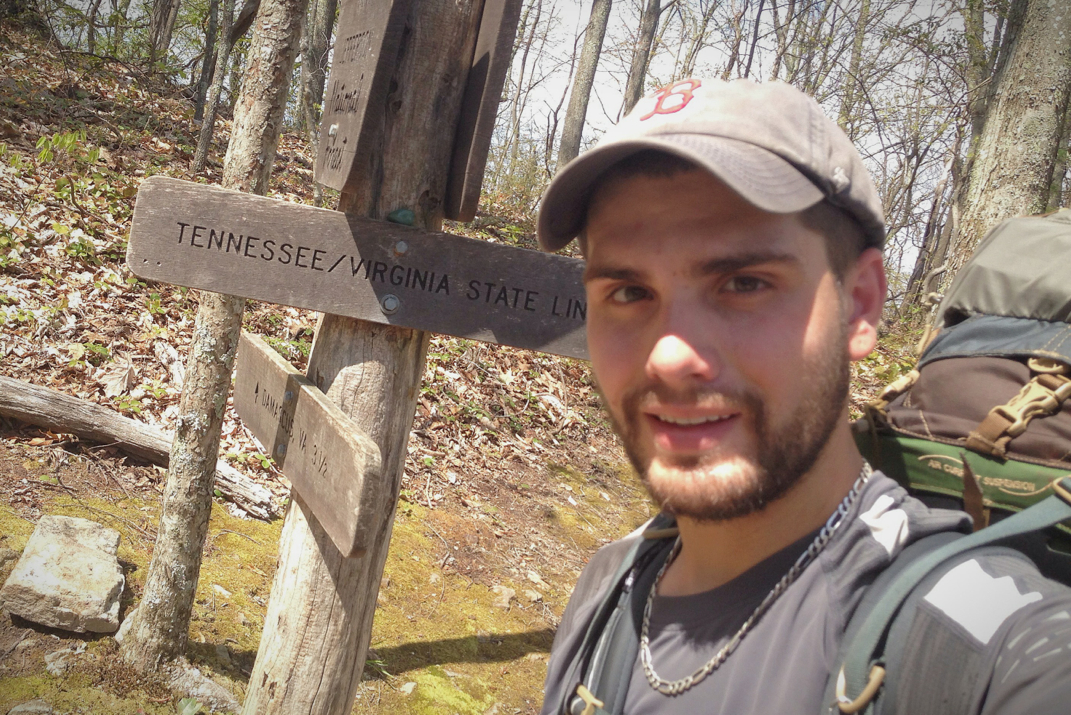
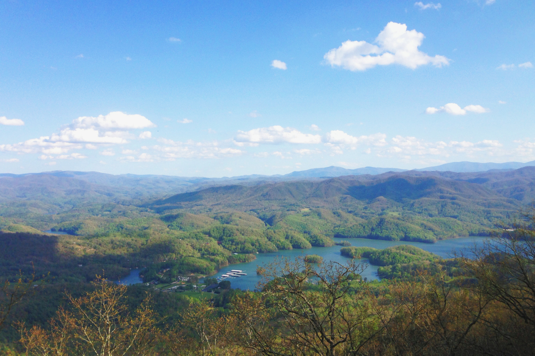
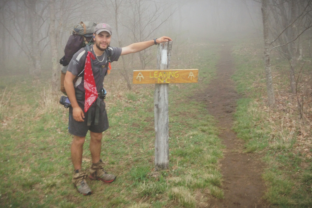
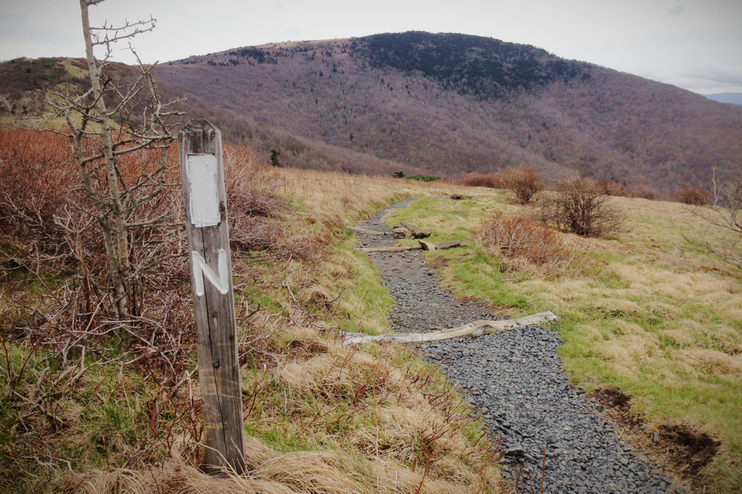
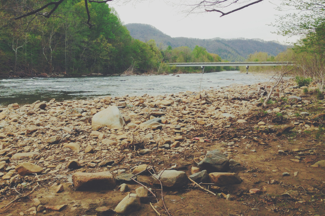
The last 10 miles of my day had some climbs and then a sloped descent into the next town. I was slowing at this point, but after hiking for 9 hours and having 26 miles under my feet, I was understanding of why and allowed myself to slow a bit. At mile 463, I officially crossed out of Tennessee for the last time, and entered into Virginia: State Line #4. Less than 4 miles from there I walked onto the paved streets of Damascus, Virginia, a hugely notable town on the Appalachian Trail, at 4:15 PM. I made it. My goal, decided a few days ago, was to hike an insane 34 miles today in order to make it to Damascus on my 31st day of hiking the Trail. I have officially made it from Springer Mountain, the southern terminus of the Appalachian Trail, to here in one month. This isn't the fastest time (nor am I going for the fastest time) but it's something I'm exceptionally proud of.  I later learned that hiking from the shelter I spent the night in at all the way to Damascus is also known as the 'Damascus Challenge' on the trail, so I guess I completed that too. Good for me. 

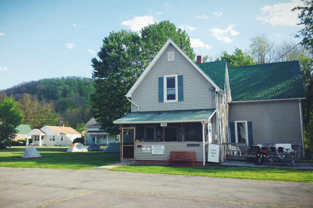
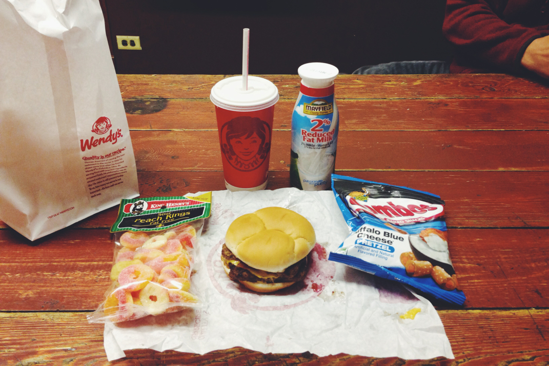
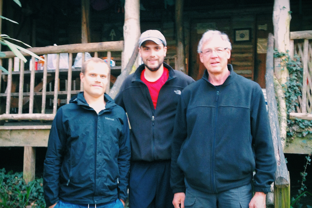
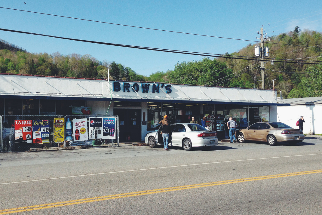
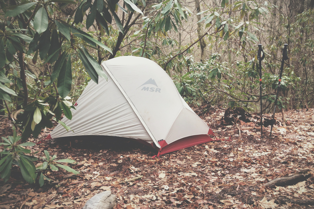
I immediately stopped at the Dollar General on Main Street and bought (4) 32oz Gatorades which were consumed on site. I ran into Soleil who was talking with a thru-hiker from 2011 named Gumby. He's section hiking bits and pieces currently, and bought us a pizza as we sat and talked. A University of Central Florida from the same year I graduated from college in Orlando, we talked for a while and he offered us his car to run any errands. I thanked him profusely for the pizza and offer, and made my way to where I'd be spending the night. The Place (actual name of the establishment) is a large house run by the Methodist Church where hikers and Transcontinental bicyclists can spend the night in a bunk or tenting in the yard for a donation of $6. I set up my tent and was apprised by the caretaker, trail name Bayou, of the 2,000 someodd rules The Place has, then wandered up and down Main Street for a while. I again ran into Gumby and Soleil who invited me to go see a movie, an opportunity to feel human again, which of course I agreed to. I put on some deodorant as I'd yet to shower the 34 miles worth of grime off myself, and we headed out to see the new Captain America film. Afterwords we stopped by Wendy's for some fast food (it's so nice to eat something hot that doesn't require boiling water) and then returned to The Place around 10:30, way past 'hiker midnight' and subsequently my bedtime. 

It was a crazy day. I doubt I'll ever walk that far again on this trip but who knows. I'm not in much pain, which is great to know. I think this is the ultimate proof that my 'trail legs' have been established. Today I walked just under 4x the distance I walked a month ago on my first day of hiking. I'll shower and get a good nights sleep, and celebrate my mileage by taking a Zero day tomorrow here in Damascus. It will be nice to just sit around with no purpose. Tuesday morning I'll pack up and head back into the mountains, with 1,700 miles or so still out in front of me, only attainable a mile at a time.

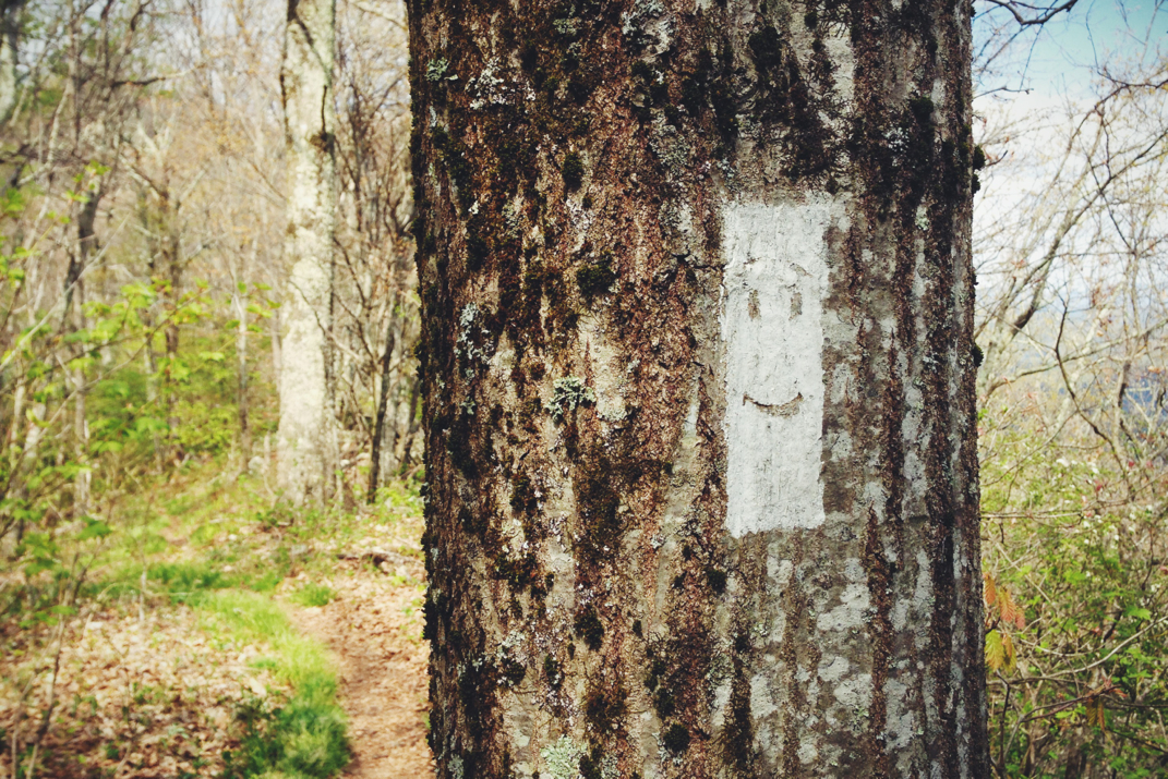
Whew. What a day. I'm still smiling. 

Picture
Sunrise
Picture
Trail Magic
Picture
Acres of Farmland
Picture
Picture
Entering Virginia
Picture
The Place
Picture
When Calories Don't Matter
6 Comments

Shores Of Lake Watauga

5/3/2014

1 Comment

 
Day: 30
Day mileage: 17.5
AT total mileage: 434.4
Time: 7 hours 
--


It's amazing how a shower makes me feel human again. I didn't really get a great night's sleep, waking up a few times, and eventually decided just before sunrise that I'd get up and shower a second time. It's the little things like standing under hot water that make me miss the 'real world'. Showers, and driving. There really are days where I get lost in thought, daydreaming about driving the Audi and punching her through the gears on an open highway. I can't wait to drive again. 


I was on the trail by 8 am, walking down the road back to the Trail with Moe and Whitey. For the first half mile, the Appalachian Trail was as flat as its ever been. It was unbelievable to walk on a soft forest floor and not have to lift my knees any or put any real thought into walking. From there it ducked down into some exceptionally rocky descents,  causing me to cautiously step from boulder to boulder, constantly aware of my knees and ankles being at risk. The reward for this descent: a gorgeous vista overlooking Laurel Falls. Whitey stayed for breakfast after we took a group picture, and Moe and I continued on. The trail followed a river in a fashion I can only describe as romantic, dancing back and forth between the water's edge and deep into the woods. It was quite serene and beautiful to be around as the sun crept its way over the ridges a thousand feet above and the light spilled into the crevices between the mountains. 


After a while meandering along the river, the trail took a sharp right and began an absolutely pointless 2,000 foot climb over Pond Mountain. No sooner was the 2 mile ascent over that the trail then began an identical descent to a small pasture of horses that were quite inquisitive of my backpack. I took their photos, making my best horse noises in an effort to succeed with interspecies conversation,  and headed across a busy two lane state road to a picnic area at the edge of Lake Watauga. I ate lunch there with a handful of hikers, spending almost an hour soaking up the sun and making 'real-life' phone calls to tidy up business that's been tough to keep up with while on the trail. After getting back onto the trail I had a wonderful phone call with my mom, then began an afternoon's climb out of the valley. There were multiple gorgeous vistas overlooking the 16 mile long lake in Johnson County, Tennessee.  The heat and humidity were certainly present today, temperatures in the 70s and an uphill climb over the last 7 miles that completely negated my efforts of showering this morning.  After crossing over one of the lakes two dams, the trail turned up towards a ridge of mountains alongside the lake and remained along that ridge for the rest of the day. 
I arrived at Vandeventer Shelter around 1700hrs, and enjoyed taking some photos of the lake before enjoying a quick and warm dinner of soup and crackers and getting into my sleeping bag. I'll be going to sleep earlier than normal, and planning to hike a good distance tomorrow. I can hardly believe tomorrow is my 1 month anniversary of being on the Appalachian Trail. The sights, friends, memories, and experiences thus far have me extremely excited for what the rest of the mammoth walk will bring. 
On a final and somewhat unrelated note... I wanted to thank everyone who reached out concerned during the three days of storms sweeping the southeast corner of the country. Friends, family, the guys on GarageJournal... It was great and at points somewhat comical to see how concerned you all were.  But in all sincerity thank you all for worrying.


Until tomorrow, my friends. Enjoy a few photos. 
Picture
Early Morning Starts
Picture
Whitey, Moe, Myself - Laurel Falls
Picture
Picture
Wild (not really) horses
Picture
Lunch on the lake
Picture
Smiling White Blaze
Picture
View from the Shelter
1 Comment

Kincora Hostel

5/3/2014

0 Comments


Day: 29

Day mileage: 15.1

AT total mileage: 417.3

Time: 5.5 hours 

--

Rest assured, I have the McDonald's I wanted. but we'll get to that. 

Last night was the coldest night on the trail in quite a while. I woke up a few times to reposition myself within my sleeping bag, often creeping my legs up as tight as possible to keep body heat centralized. I was sleeping in my North Face fleece jacket, a shirt, shorts, and long wool sox. I woke up around 6:30, tossed and turned for half an hour, and got up to have breakfast, ultimately stepping foot on the trail just after 8.  A gradual and somewhat chilly climb out of camp kept me with my jacket on, taking half an hour or so to work up enough heat to take it off. The first shelter I'd come across would be 11 miles into my day after many ups and downs each ranging in a few hundred feet of elevation change. I decided to go without any music from my iPod today, and found myself singing along in my head to a variety of songs. It never ceases to amaze me what the brain comes up with when there's nothing else for it to do but wander aimlessly.  Sometimes I find myself thinking about the most random of things, only to have those thoughts disappear and be replaced with something more practical, only to forget what I'd been thinking in the first place. In the grand scheme of things, a relatively inconsequential problem to have, I suppose. 

The woods today varied from rocky terrain to pine tree forests, more waterfalls and newly green vegetation, dry leaves and thick mud, and miles of rhododendron tunnels. I walked relatively quickly, arriving at the Moreland Gap Shelter just before noon.  It's by no means the nicest shelter I've been to, but I had cell service to post yesterday's blog and it was nice enough to stop and eat lunch. Today was interesting in that I actually dug my stove out to cook a portion of lunch. Knowing that I'd be visiting a grocery store tonight, I'd done quite the number on my food reserves over the past few days, to both enjoy a little more snacking and also to cut down on weight. After finishing two granola bars and a Pop-Tart, I also boiled up some water and had Ramen noodles. This took more time than I'd normally allot to eating, but life is short and I was surprisingly hungry. I drank a liter of water and hit the trail about 45 minutes after arriving, climbing out of the gap the shelter was nestled into, and looking forward to the 7 remaining miles to the place I'd spend the night. Terrain wise, there were a few good climbs and then a long 3.5 mile downhill to a gap where the hostel I'm staying at is located. Despite wanting to get the mileage done quickly, I held myself back to avoid rushing the descent and potentially hurting my ankles or knees. Upon reaching Dennis Cove Road, the lowest point of today's descent, I was greeted with trail magic! A red SUV was parked alongside the trail with coolers offering cold water, apples, Twizzlers, Easter Peeps candy, and oranges. Come to find out, the provider of said magic was the dad of Tigger, a girl I've seen over the past few nights at different shelters. He encouraged me to dig into the food, and then told me he'd be happy to drive me the 1/2 mile to the hostel along with some other hikers. I thanked him profusely, and hopped into the car after devouring a delicious red apple, a bottle of water, and a handful of Twizzlers (the latter of which took a lot of restraint... I absolutely love Twizzlers). 

I'm spending the night at Kincora  Hostel, a big, two story log cabin style building attached to the home of one Mr. Bob Peoples. This guy is one of a kind... In his early 70s, born and raised in Medford, MA (10 miles from where I live), we immediately connected. He's an exceptionally well educated man, with a bachelors from UMass Amherst (from before any other UMass schools existed), a Masters, and almost his Doctorate, during which he discontinued his dissertation on the Mayan Empire. He was a short order cook in Boston's North Station as a teen, and got drafted into Vietnam straight out of college. He graduated from Medford High with 'Mikey Bloomberg'. He spends most of his year doing necessary repairs and maintenance to the Appalachian Trail locally. He has many photos of decades of repair work being done and knows the trail by heart.  A storied man, we had many common ties to Williamstown, MA, where his sister currently resides (my grandmother & great aunt have both lived there)... The connections go on and on, we spoke for almost an hour like old friends. 

After picking a bunk on the second floor of the building, I took a hot shower and put my laundry into the washing machine. We piled an incredible 18 people into the cab & covered bed of his Chevy 3500 truck, and headed down a twisty mountain road to the only grocery store for miles. A quick $20 resupply got me enough food to get to Damascus, as well as some Gatorade and pizza to eat tonight. Since there were a lot of hikers in the caravan to town, we weren't able to go the mile out of the way to McDonald's. Bob told me the Bostonian in me would be frustrated as hell with how slow the service was there, and it'd take an hour to get 18 hikers served.  We'll come back to this. Anyways, Bob provides an open kitchen, stovetop, oven, fridge, sink, dishes, etc. for hikers to prepare their own dinners. The oven must have seen a dozen frozen pizzas tonight. I sat around and ate dinner with Whitey, Moe, Soleil, JPEG, Left Foot, Cannon, and a dozen more hikers. The vibe here is phenomenal... I can see why people stay longer than a night. The hostel has a 'suggested donation' of $5 per night, but I'll be leaving much more. The service he offers is worth tenfold what he asks for... It's blatantly apparent when you walk in how much hikers adore this hostel.  Covering every wall and ceiling are photos of hikers at the summit of Katahdin, with written notes about how much their stays here meant to them. I hope to be on the wall at some point, and got Whitey to take a photo of me & Bob together that I'll send back here either way. It's not the Marriott and I didn't hike any notable mileage today, but this is one of those places that will be one of many priceless trail memories. 

Now, to wrap things up... I mentioned that McDonald's was a mile out of the way, and slow. When we got to the grocery store I overheard a German hiker, Mystic Pony, saying he was walking to McDonald's then hitchhiking back to the hostel. I offered him a $10 bill to get me food, and about two hours after our packed pick-up truck returned to the hostel, he returned smiling and handed me a bag with 3 double cheeseburgers and 3 McChicken sandwiches. See, friends, life is about seeing opportunity- when a guy going out of his way to attain something you'd also like, cash talks. Having already eaten my pizza dinner, these 6 delicious sandwiches will become trail snacks over the next few days. Gross? Maybe. But there's enough preservatives & fake ingredients to keep them edible for at least a week, though they'll never have to worry about going that long without being consumed. 

True hiker stories, great company, new friends, full bellies.. backpacking fast food, and loving it. 

Picture
Picture
New favorite barn
Picture
Kincora Hostel
Picture
Whitey, myself, Moe
Picture
Walls of Kincora - Finished hikers
Picture
Grocery Store
Picture
Piled into the back of the truck
Picture
Me with Bob Peoples!
0 Comments

Mile 400

5/2/2014

2 Comments


Day: 28

Day mileage: 19.5

AT total mileage: 402.2

Time: 7.5 hours 

--

I wandered outside in the middle of the night to look at the stars, and was blown away by the spectacular show of light from millions of miles away glistening in the sky. The interior of the barn was absolutely pitch black, so the change in light was even more shocking. I'm not sure where the moon has been hanging out, as I'm pretty sure the new moon has come and gone, but it was a perfectly clear sky with immeasurable stars looking back at me. Watching the stars is one of my favorite parts of being on the trail. 

The overnight occupants of the barn started waking up around 6:30, and I got up about a half hour later. Whitey and I used the opportunity of being in the barn to each eat 'breakfast in bed', or without leaving our respective sleeping bags. I started my hike at 8 on the dot, and was greeted with some good climbing to get my leg muscles warmed up. Instead of listening to my pre-selected music or audiobooks on my iPod, I switched it over to FM radio and spent the majority of my morning listening to NPR. It's quite strange to have not read a newspaper headline or seen a news program on television in almost a month now... It almost makes me nervous of what I may have missed, although I'm sure that anything huge would be circulated amongst connected hikers. 

A 1,000' climb to the top of Hump Mountain Bald would have netted some gorgeous views, had there not been a massive fog that moved in. I summited the mile-high bald and began descending as a beautiful thing happened, two masses of fog on each side of the mountain rushed around it, crashing into each other and closing me in like two dark curtains. It's tough to explain without a visual, but it was quite amazing to watch. I got down off the bald and began a very long descent through foggy, rocky, New England type terrain. A few miles down the trail after coming across Doll Flats, I passed a sign marking the final (of very many) departures from North Carolina. From this point on we'll be solely in Tennessee, with another 70 miles to the Virginia border. Continuing down from Doll Flats, I came across a road crossing at US 19 which gave hikers the opportunity to hitchhike into Roan Mtn, TN or Elk Park, NC. Having all the supplies I need, I crossed the four-lane highway and continued onto the Appalachian Trail where it picked up across the road. Some easy uphills crossing over more than a few streams, brought the trail into some great open fields where agricultural redevelopment is underway to help protect the Golden Winged Warbler bird. Interesting stuff, gorgeous scenery. The trail turned onto what appears to be old Jeep roads for a mile or so before ducking back into the woods. The miles flew by, as the weather is finally beautiful again after the fog burned off, with temperatures in the mid-60s and scattered clouds against brilliant blue skies. 

I walked alongside a large river for a while, passing by locals who were escaping from life with loved ones and family members to sit by the rushing water. The trail then turned away and began a long and gradual uphill climb to the 400th mile of trail, and ultimately the Mountaineer Shelter. I passed by a few more waterfalls, including one that was 20 feet or so tall, before coming to the relatively newly constructed shelter. This is the first 'triple decker' I've come across, with three individual levels of space for hikers to sleep on. Despite the large number of hikers from Overmountain Shelter that were aiming to stay here (18 miles between the two shelters) there was nobody spending the night yet!  I hesitated to leave, but continued another mile down the trail to camp at a site alongside a river with Whitey and Chili as we had discussed earlier in the day. As they set up camp (I'm going 'cowboy' again now that the weather is nicer) many hikers continued past us, saying they were going to get a few more miles in while the sun was up and weather was nice. I don't blame them- it'd be a great and easy day to push a 20+ mile hike. Tiptoe and Kenny from So. NH also hiked by, and doubled back to camp with us after I informed them there was plenty of room. 

A good dinner around a blazing campfire led to conversations of hiking, work, and life in general. Plans for tomorrow were made, which for me will include a 15 mile hike to a small hostel just outside Hampton, TN. A small $5 donation is recommended in exchange for a bunk to sleep in, warm shower, and shuttle ride into town for food. I don't need any groceries, but am secretly yearning a cheeseburger from the McDonald's in town. All in all it should be an easy day. 

As dusk passed us by and our world became dark, the fire burned down and everyone has retired to their tents. I will again spend tonight in just my sleeping bag under a perfectly clear sky painted with millions of stars.

And yes, those satellites are still circling by.

Picture
Picture
Picture
My new favorite tree
Picture
Picture
Mileage markers of sticks
Picture
2 Comments

Castle In The Sky

5/1/2014

2 Comments


Day: 27

Day mileage: 15

AT total mileage: 383.7

Time: 6.5 hours 

--

Last night's most challenging moment was when I had to pee around 2 am. In a tent or normal shelter this isn't a huge issue, but I was in a bunk-style section of the small shelter. Sharing a 4x6' bunk with Soleil, each of us with an inflatable air mattress and our sleeping bags, making it very difficult for me to get out of my bag and down the ladder without waking her up.  Regardless, with my LED headlamp turned to the red light setting, designed to not wake others up, I pulled it off and got back into bed to finish my night's sleep.  The people-crammed shelter woke up around 7 and everyone hopped up to get a start on the day while the weather wasn't horrible. I'm not sure if any severe storms came through last night, but there was certainly heavy precipitation and wind throughout the night. 

I hit the trail around 8 am, and climbed out of the plot of land the shelter was built on. The plan for today was to summit Roan Mountain, elevation 6,200 feet, despite the threat of continued bad weather. Interestingly enough, Roan will be the highest mountain the Appalachian Trail will climb until it traverses Mount Washington in New Hampshire. The first three miles of trail today included a rather steep climb at one point, then dropping down to Hughes Gap Road before beginning the four mile, two thousand foot climb up to the summit of Roan. The first half of the ascent was comprised of great switchbacks in a wooded mountain forest with some incredibly strong occasional gusts of wind. There was a point about half way up the mountain when I crossed above cloud cover, with winds picking up, precipitation coming and going, and temperatures dropping. The surroundings also changed at this point with the trail becoming steeper and more interestingly, the trees returned to the Pacific Northwest feel with everything cold, damp, and mossy. The fog was blowing through, and it took another hour of climbing to reach the top of the mountain.  As the trail crested the summit, it opened up to a massive plateau. Many hikers continued on to the Roan High Knob Shelter, but I turned into the 50+ mph winds to explore the open field. Having read about it beforehand, I knew that this large opening once was home to a top of the line hotel in the late 19th century. Literally bracing myself against the wind with a historical sign post, I was able to read about the 'Luxurious Cloudland Hotel' which crowned Roan Mountain for about 60 years before it was disassembled and the interior pieces sold off.  Despite the wind that tore my hat off my head, it was amazing to stand there and imagine a building once standing proud atop this mountain. 

Only able to withstand the cold for 10 minutes or so, taking photographs and even a video of the area, I headed a mile down to the mountain's shelter. The Roan High Knob Shelter is the highest shelter on the entire trail, and is a fully enclosed building with a complete second floor to keep hikers out of the oftentimes harsh elements. I ate lunch there with many of the hikers from last night's shelter including Aquaman, Tiptoes, Soleil, JPEG, Achilles, and Whitey.  We were also joined by Einstein and his dog 'Babygirl'. Einstein is likely a homeless hiker along the same lines as the infamous Carver, classified under a title I've created called 'Perma-Hiker' short for 'permanent-hiker' (this word has actually caught on, and I've heard other hikers using it). We ate lunch with the door to the shelter closed, protected from the winds and rain. I hit the trail about half an hour later and enjoyed a rather wet but easy downhill to a road crossing 1,000 feet below. During the descent I passed under the cloud cover, and was protected from the wind via the back side of the mountain. Right before the lowest point in the gap there was a cooler of trail magic for hikers including pretzels, clementines, and white chocolate raisin cookies... All of which were delicious. Tigger & I left a thank you note in the cooler before continuing on. 

The next few miles of the Trail could be some of the most challenging I've hiked this far, not due to elevation gain, but due to weather. Four miles of the A.T. cross over the completely exposed ridges of several bald mountains, putting me up against the correctly forecasted 'gale force winds'. I spent these miles walking with both trekking poles pressed downwind of me in an attempt to keep my body vertical. I kid you not, the wind was blowing me sideways and almost entirely off the trail. The sheer volume of my backpack was large enough to catch the wind and toss me around without much effort. It took a lot of work on my part to stay both vertical and on track... It was exhausting. After these miles the trail climbed up to higher balds still exposed to wind, although to a lesser degree. Eventually the trail turned into the protection of the woods, and meandered downhill for a few miles. I hiked for quite a while with Moe, talking about cars and his annual trip with his wife to destinations around the country in their C5 Corvette. An great guy in his mid 60s, he's working to be in Harper's Ferry (the Appalachian Trail's halfway point) before June 12th in order to get home and organize things for his big family 4th of July party. We walked for a short time before coming across an open field with a sign pointing to the shelter I planned to spend the night at.  The day went by quickly as we arrived at the Overmountain Shelter at 1530hrs. 

Overmountain, as I'd mentioned yesterday, is a rather famous shelter on the Appalachian Trail. Instead of being a normal lean-to structure it's an old rickety red Gambrel barn measuring in at 20x50', with an open first floor for cooking and an enclosed second floor to accommodate 30 or more hikers if necessary. While the walls aren't completely closed in, most planks with 2-3" between them to allow light in, the structure will still protect hikers from the elements. Almost all of the group from last night at here, and were sprawled out across the wooden floor of this great building. Come morning, the valley the barn overlooks will be a perfect backdrop for a gorgeous sunset. The site the barn is built on is famous from during the Revolutionary War where local militia fought the British in a bloody battle and won in September of 1780. 

Hopefully by this point the weather has passed, and hiking for the next few days will be uneventful. Looking at the A.T. Guide (written & updated annually by thru-hiker David 'AWOL' Miller) that almost every hiker uses, the next few days should put me in Virginia by Monday... A very exciting prospect. It's dark pretty early in the barn, and I'm more than ready for sleep. It's strange to think I'm coming up on nearly a month on the trail. Leaves me with lots to think about. Hopefully some time soon I'll have cell service to post the past few days of blogs...

With an abundance of wind in my sails,

Texaco 

Picture
Upper Roan Mountain Trail
Picture
Site of Cloudland Hotel
Picture
Roan Mtn. Shelter
Picture
Picture
Overmountain Barn Shelter
2 Comments

Short Day

5/1/2014

0 Comments


Day: 26

Day mileage: 9.7

AT total mileage: 368.7

Time: 4 hours 

--

If you've been watching the news, you've probably heard about the tornado force winds, massive storms, and subsequent deaths across the lower regions of the country.  Those same weather systems have swept across our region of the Appalachian Trail these past two days, and are supposedly going to continue wreaking havoc tonight and tomorrow as well. 

Rain began at midnight, with a huge thunder and lightening storm beginning at two in the morning. Continuing well into the morning I actually debated hitting the trail at all, with most of the hikers in the shelter wondering if moving out of the rain cover was even worth it. Ultimately, I decided I wouldn't be good at taking a zero day, shy of 'earning' it with impressive mileage the day before, severe illness, or physical disability. I packed up, ate breakfast, and walked out into rain and gusty winds around 9 AM. It took me about a mile of hiking to realize that I had left my Red Sox hat at the shelter, and I turned back at a double-pace to try and not lose out on time or my hat. Luckily, about 1/2 way back to the shelter, a hiker named Moe informed me that Whitey had it and was bringing it with him to the next shelter. Whew! Seems silly, but I assure you my hat is as vital to me as my water and my backpack. It's an essential piece of gear, and I suppose even my identity on the trail (and probably in real life, too). 

Being a weird day with weather, and still hiking alone for the most part, I tried something new today: listening to audiobooks as I walked. Not knowing how I'd like it, I started with Malcom Gladwell's book 'Outliers' which I've already read a print version of. I figured that way if I got distracted or became disinterested, it wouldn't be a huge deal. Jury's still out on the experience as a whole, but it wasn't that bad for mindless walking. I think during more steep ascents and challenging hiking I'll stick with music over a voice reading to me.

About two hours into my hike I came across Iron Mountain Gap, where the trail crosses over a busy state road. I somewhat instinctively looked around for any trail magic, and found none. I decided to stop and eat a granola bar, and about the time I finished throwing the wrapper into my trash bag a small SUV with New Hampshire plates (I did a double take, initially not believing my eyes) pulled into the parking lot. The window rolled down and a girl yelled 'Trail Magic!' which got me on my feet quickly. The girl, trail name Flea, was being dropped off by her mother and aunt after spending some days getting over Norovirus.  Her mom opened the back of the Toyota and offered up a delicious snack of hot dogs, baked beans, BBQ potato chips, and home made cornbread. I've never been so happy to have taken my time eating a granola bar, otherwise I would have missed this!  I spent about half an hour talking with them, and was joined by Whitey and Moe who also got some snacks. After thanking them profusely, I got back on the trail. The weather cleared for a while, save for some exceptionally strong gusts of wind, and climbing out of the gap I was down to hiking in a t-shirt and shorts. 

The trail markings are rather sparse in this stretch of Tennessee, which I believe was part of what led me to the weird feelings today. I can honestly say that I spent a while not wanting to be hiking. Despite the weather and looming threat of more severe systems moving in, I sat for a while on a log examining life.  I kept referencing the map, not understanding why it was taking me so long to reach the shelter I was aiming to eat lunch at. I was simply fed up with walking, for whatever reason. After a while of sitting on the fallen tree (there is a certain freedom about being able to just sit on a downed tree with no consequence to time that's rather amazing) I decided to keep walking. I kid you not, less than 200 yards up the trail I came across the sign for the entrance to the shelter I was aiming for. I guess I was a lot further along than I thought (I blame the poorly marked trail), but I suppose the world is just funny like that. 

Having a small lunch at the shelter, and hearing an updated report of severe weather moving in, I went back and forth for quite a while about moving on to the next shelter or not. The miles wouldn't be an issue, the next place is only 8 miles away. What was a big concern, however, is the 6,200' elevation of Roan Mountain that lies between here and the next protected building to camp in. Summiting a bald mountain at over 6,000 feet during a storm that has already claimed lives and was creating 'gale force winds' and lightening storms at the peak didn't seem like a smart idea. What really bothered me for quite a while was the notion of stopping my hike after 4 hours and only 9.7 miles. It didn't feel right to be done so early in the afternoon.  I debated for quite a while and ended up setting up my sleeping bag in the lofted section of the shelter I was at. Better to be smart and walk less miles for one day than be found dead at the summit of a mountain that isn't Everest. 

I took a few short naps throughout the afternoon, talking with Whitey and Moe who also are staying here. Throughout the remainder of the day another dozen or so hikers showed up, including Soleil and JPEG, and we have crammed 9 people into a shelter built to hold 6. Nobody wants to tent in this weather, although some of the later arrivals will have to. Fingers are crossed that tomorrow's weather will be a bit kinder, and that the last of the major lightening and thunder storms pass by tonight. The wind is already severely worse now (2100 hrs) than it was throughout the afternoon. Either way I'll be pushing another 17 miles or so over Roan Mountain to the Overland Shelter which is sort of famous on the Appalachian Trail. If all goes well I'll be able to post some info and photos of it tomorrow night. 

From a dry sleeping bag in an otherwise soggy world, that's all the news that's fit for print.

Texaco

Picture
Trail magic parking lot
Picture
0 Comments

Storms Roll In

5/1/2014

0 Comments


Day: 25

Day mileage: 17

AT total mileage: 359.0

Time: 6.5 hours

--

I was woken up at 0500 this morning to the blaring horn of a freight train, followed by minutes of screeching brakes as it slowed before heading into town.  I had slept without headphones in last night as I'm a sucker for sleeping with ambient noise, and the river did its job almost as well as my trusty desktop fan that I rely on for a good nights sleep in the real world. This meant that my exposure to the train noise was completely unprotected and made me regret picking a camp site by the train tracks, although I don't think there's anywhere in a 10 mile radius where I could have escaped the noise of the horn. 

Camp was struck and backpacks packed by 8 am, with the looming threat of severe storms and rain present. While Whitey went to a local hostel, Uncle Johnny's, for fuel, I instead hit the trail. My goal for today was to get as many miles in as possible before the rain started. We parted ways and I headed back into the woods, again falling subject to the guidance of the inanimate 2x6" white blaze on trees marking the pathway to Maine. About 1,000 feet into the woods I heard another train coming, and rushed to make it across the tracks before the it cut me off. Unfortunately the 70-something car train won our undeclared race, and I stood alongside the tracks watching the mammoth vehicle in motion.  As I stood there I wondered what it'd be like to hop on a car and 'ride the rails' as B.B. King might sing about.  A few minutes later my thoughts passed as quickly as the last train car around the bend in the track, and I got back to my task at hand. I was quick to realize that I was the first hiker on the trail this morning, as I was walking through many cobwebs that had been spun the night before.  While this shouldn't be an overly exciting occurrence it felt rather exciting to know I was the first to the trail for the day, like opening a new birthday present nobody had seen before.  The climb back out of Erwin started off wonderfully with slow uphills that wandered past a dozen waterfalls and rivers, most large enough to require walking bridges to safely cross from one side to the other as we carved our way out of the valley. About 4 miles out of town I stopped at the Curly Maple Gap Shelter and quickly ate a granola bar before heading on. 

The majority of my hiking today consisted of uphills, in 10 miles the trail would ascend over 3,600 feet of elevation change.  Despite this fact, and the incessant presence of heat and humidity, by the time I stopped for lunch at noon I had already hiked 12 miles. Three miles per hour uphill is fast for me, and I was pleasantly surprised with my accomplishment. I laid in a grassy open field, chatting with a hiker I'd just met named Pockets, as she and I enjoyed the vista looking back over Erwin. I only allowed myself to stay for half an hour or so before I pushed on to make it over the final 5,300' summit and down to the shelter I'd planned on staying at. Despite all Armageddon type storm warnings, it was sunny, blue skies, and humid for the duration of my hike. During the climb out of lunch I began hiking with Chili, a younger guy from Tallahassee, and Cannon, a 32 year old pharmacist who grew up in L.A. and is now living in Manchester, NH. Halfway up the mountain we came across a white van on the dirt road that the trail skirts alongside, where I officially met Miss Janet for the first time. She's something of a trail magic legend, and drives from Georgia to Maine between March and October every year, sprinkling hikers with trail magic and being supportive however she can. Again, I don't know the story behind her ability to do this, but she's an incredibly kind woman who handed out bananas and chatted with us before sending us on our way. 

Up and over a gorgeously unique summit, thick with tall pine trees and a dark mossy forest floor, the trail took a sharp turn before heading back down to a lower elevation. I continued talking with Cannon as we hiked for the rest of the day. About a mile out from the shelter we heard the first crack of thunder, and rushed our way over the next hill to attempt to stay dry. Three or so minutes after getting under the cover of the shelter all hell broke lose- dark clouds appearing out of nowhere, the temperature dropping, walls of water pouring down from the sky, all while lightning bolts illuminated the sky and thunder shook everything around. A dozen or so hikers huddled under the roof of the shelter for over half an hour until the storm moved on leaving blue skies and a damp ground. Apparently there were tornado warnings associated with this storm system that's passing over between now and Wednesday, as it's the same system that's been wreaking havoc across the southeastern part of the United States. 

I managed to snag a spot in the shelter, eager to not have my tent get wet if I could at all avoid it. Dinner was cooked and this group of hikers, many new to me, talked for hours. Two women here have already thru-hiked, and one was quick to say that from point forward on the trail, it's 'all mental'. We'll see how that works out.  We crammed 7 people into the shelter built for 6, and conversations faded as the sun disappeared behind the mountain ridge. I'm not sure what the weather will do tomorrow, but it's expected for another storm to move in overnight. My headphones are in to cut down on both storm and hiker noises, and I'll tackle tomorrow as it comes. Perhaps even with a detour to a famed hostel, as a port in the storm kind of thing. 

Onward and upward,

Texaco

Picture
Picture
Picture
Picture
0 Comments

Erwin, Tennessee

4/27/2014

3 Comments


Day: 24

Day mileage: 18.1

AT total mileage: 342.0

Time: 7 hours

--

I woke up at 0200 this morning and after listening to the wind fiercely blow for 10 minutes, convinced myself to get out of my tent and photograph the stars. I can't honestly say whether or not this was a good idea, as the photos are on my dSLR (for anyone that wasn't aware, all photos posted on the blog are taken with my iPhone). Regardless, close your eyes and imagine a photo of an incredibly starry sky in the middle of the night, a low band of yellow light pollution from small sleepy towns in the distance, and a tent illuminated by the soft glow of my LED hiking headlamp. Can you see it?  Truthfully what you're envisioning is probably better than the photos I took, seeing I'm not hiking with my best camera, but I'll be interested to see how it turned out... 4 months from now when I go through the pictures. 

Rising again with the sun just before 7, Whitey and I hiked an easy mile down off the still windy bald and arrived at the next shelter where we had breakfast with Cheesepuff.  Apparently only 3 people had stayed at the shelter the night before, so it was extremely quiet as we sat there and ate. I left about 20 minutes after Cheesepuff, leaving Whitey to finish his food and pack up for the day. For whatever reason, this morning was hiked to the soundtrack of Pink Floyd. All of nature came out to join me walking, as butterflies fluttered alongside, hawks circled in the breeze above the trees, and I even saw a large owl sweep across in front of me between trees. The temperature slowly creeped up from the evening's chill, and before long I was sweating with the inclines the trail was passing over.  Knowing today's end goal was Erwin, TN, I had a good idea of what was in store. The first 13 or so miles included some good climbs, and the last 5 miles were a steady descent into the valley that comprises town. 

I stopped for a break at a cute little river, and debated soaking my feet. Although it was only noon, I was well aware that I'd been hiking downhill for a few miles now, and my toes were sore. I'll likely be replacing these New Balance 1210 trail runners with another set soon, and the next ones are a half size larger to hopefully accommodate expected growth in my feet. Most hikers will go up a half or even whole shoe size in the first few hundred miles of hiking. After finding my first blister (not bad for 341 miles) today, I'm hoping my new size 12 1/2 shoe will buy me some room in the toe box to avoid this problem going forward. Anyways, after snacking on a Pop-Tart and filtering some water at the river alongside Spivey Gap, I continued up into the mountainside. This was around noon, and temperatures had risen well into the high 80s, leaving me constantly sweating as I hiked deeper into the woods. After summiting the first crest, the trail began a meandering path through the woods and on towards the next shelter. There was a reminiscent feeling about the afternoon's hike, a hodgepodge of sensory stimulus occurring throughout a few hours time. 

The smell of the forest reminded me of summers past, walking my since deceased dog Bailey through the local state park. There's a certain aroma that goes along with pine needles on the forest floor, warmed from the heat of the sun. It smells like summer, adventure, and Boy Scout camp all at once. This of course caused my mind to wander, and I delightfully followed the Appalachian Trail's white blazes at a quick pace of 3 mph to the next shelter.  The trail shelter at mile 335.7 is a work of art. The 3-sided, brown, cinderblock structure is affectionately known as the 'No Business' shelter.  You might think this is quite the strange name for a place hikers might stay at, until I inform you of the slogan written both under the shelter's sign as well as on the shelter log book: 'No Privy. No Water. No Business (being here)'... Sounds inviting, no?  Sure enough there is a large distance in front of us where shelters will not have privies. Also this particular shelter was more than half a mile from the nearest water supply, which happened to be southbound. No northbound hiker in their right mind would walk back in the direction they came for a mile round trip on a day just shy of 90 degrees. Luckily, I had stopped and filled up 2 liters, and was ready to finish the last 7 miles into town. I rested at the shelter for a half hour or so, snacking again and signing the log book 'I'd rather stay at a La Quinta than spend a night here.' Surprisingly, one of the nicer comments in comparison to others in the book, and hiker graffiti on the walls of the building. 

Out of No Business came a few more steady climbs before the descent into the valley. About a mile from the base of the trail I ran into two guys out with their sons, probably 12 years old or so, for a Sunday afternoon hike. From where they were standing there was a gorgeous vista over the town of Erwin and the train tracks that come through the valley. I ended up stopping to talk to the four of them for quite a while. They were extremely interested in my hike, my gear, mileage, and the like. It's really fun for me to talk to inquisitive people about the trail, especially when they live so close by and have such easy access to it.  After chatting for a while I said goodbye, and headed down the rest of the mountain to meet Whitey and figure out where we were spending the night. Our initial plan had been to head into town (the trail is 3.5 miles from 'downtown') in the morning, then hit the trail. We ended up hitchhiking to the grocery store before even getting camp set up, which will leave us in a position to get back into the woods first thing in the morning. 

You may be astonished about hitchhiking, you may not. I think this is reliant on your upbringing, geographic location, and generational belonging.  Let me tell you, this was a very... special... hitchhike. First by saying I am incredibly appreciative towards anyone willing to save me from walking into a town. We hopped into the back of a 20 year old white Suburban and made small talk with the sometimes incomprehensible, cigarette smoking, grey haired, kindhearted driver and his wife. Their son was also piled in next to us. Seeing as I could only understand one out of every three words this man spoke, regional dialect and all, I focused on observing my surroundings. All was well and good until I began noticing that he was living the High Life as he was driving, with two cold ones sitting open in the front seat cup holders. The combination of his talking, drinking, smoking, and friendly waving at every passing car was a quick reminder that I'm not in Kansas anymore. I clenched the seat belt a little tighter, just in case, and continued tuning in as best I could to his running commentary on the town as we drove to the grocery store. 

Shopping was quick and easy, and I changed up my purchases a little to try and save some weight. The goal here is to make it through the next 130 miles with this $22 food purchase, arriving in Damascus, VA next Monday. Along with necessary food, I also bought two red apples and a half gallon of skim milk, sitting outside the grocery store consuming the aforementioned items as I repacked my bag. Whitey and I quickly re-hitched back out of town with a younger guy and his girlfriend who couldn't believe that we'd walked from Georgia and were headed to Maine. It makes me wonder whether or not people are aware of the footpath that walks through the backyard of this town. We got dropped off on a road alongside the river, where the guy driving mentioned we could find plenty of places to camp hassle-free for the night. We set up camp and swam in the river as an attempt at bathing, then cooked dinner and got into the tents just as the water spiders began coming out across the sand for the night. I hate spiders. 

Weather report says thunder, lightning, and rain for the next three days. I'm not a meteorologist so I have no idea if this will be true or not, but I'm hoping we get a bit of a break. One rainy day here and there is fine, but back to back begins dampening the soul and spirit of a hiker. Regardless, tonight we sleep next to a rushing river, and face tomorrow as it comes, seeing as that's about all we can do. 

From the shores of the river and a symphony of aquatic white noise, I'm off to sleep.

Texaco 

Picture
Bad photo- Myself, Cheesepuff, Whitey
Picture
A.T. Rock
Picture
Erwin, TN
Picture
Dairy love
Picture
Chilled Milk
Picture
Down by the river
3 Comments

Somewhere Sunny & 75

4/26/2014

1 Comment


Day: 23

Day mileage: 18

AT total mileage: 323.9

Time: 8 hours

--

A joke: How do you confuse the hell out of a northbound Appalachian Trail hiker? 

..You have them hike south!

It took me only about 10 minutes of walking this morning to notice that something in my simple little world was horribly amiss.  Turns out I've become keenly aware of the fact that in the morning the sun is on my right, and in the afternoon it's on my left. This was apparently not applicable this morning. Upon leaving Flint Mountain Shelter, where I resided last night, the trail turns abruptly south, and stays in that orientation for a half-dozen miles or so. Seems rather counterproductive for an individual attempting to walk to Maine, no?  Alas, it eventually returned to the proper orientation and all was right with the world again. 

After a late (0900) start, the first few miles flew by. Since I'm now walking alone for the majority of my day (for those who have asked, Crusoe and I are hiking separately after he took a second day off in Hot Springs), I'm apparently exceptionally quiet. There was one point where I felt I was being watched, and looked up to see a small group of deer standing in the woods around me. They were exceptionally attentive to my movement but remained still, eyes glued to me, as I snapped a few photos with my dSLR. For a minute or two we just watched each other, some sort of silent interspecies communication taking place, before I moved on down the trail and they simply watched me go. It's the closest I've been to a wild animal thus far on my hike, and was a peaceful & memorable experience. I exited the woods a mile later, crossing a small state road and conversing with hikers Osprey and Landslide. Both hikers were awaiting a shuttle to a local hostel and as we made small talk, Osprey gave me some dehydrated raspberries. Words cannot describe how delightful these little things were. I thanked him profusely, said goodbye to Landslide, and climbed over a small ladder into a fenced in field where the Appalachian Trail continued on. 

The next two hours were spent climbing an unnamed mountain, fair and relatively basic switchbacks winding past some beautiful waterfalls and lush green fields. I decided to spend the morning without my iPod so I was singing to myself, often only getting two or three lines of a song out before I'd forget the rest and just repeat what I'd already sang. As I've said before, pressing issues in a hiker's life. There was also a while on this climb where I stopped and watched a bug. I realize this sounds completely abnormal, but there was something about the blue color of it's shell that caught my attention enough to stop my walking, and I simply watched it make its busy way down the dirt trail. I wondered what he was up to, and if it had a to-do list for the day, as he certainly seemed to be on a mission.  After another half hour or so, I summited the mountain and was joined by Cheesepuff and Whitey as we made our way to the next shelter to stop for lunch.  We were at the Hogback Ridge Shelter for close to an hour just conversing with other hikers and soaking up the sun. Today's temperatures creeped up to the mid-70s with a flawlessly clear sky... A perfect day for hiking. 

I filled up my water bottle before leaving the shelter, and continued down a few miles of trail before the next road crossing. One of my favorite parts of hiking this Tennessee/North Carolina state line since exiting the Smokies has been the barbed wire fences. It seems we're constantly between old farmland property lines, with rickety and rusty fence lines running over hills and through fields. I often wonder how long ago they were actually used for keeping livestock in, or neighbors out. Some fence posts are in decent condition, while others have been claimed back by Mother Nature. The trail meandered down into Sam's Gap crossing under the highway at yet another NC/TN state line. From there an afternoon of climbing began, the end of which kicked my butt around the block and back. After 5 or so miles of gaining elevation, Cheesepuff, Whitey, and myself came across a great campsite between two rivers. We sat for a while debating staying there, but ultimately I put my pack back on and decided to keep hiking. It just feels wrong to stop even at 1700hrs, even with 15 miles hiked, all the while knowing there's 3 hours of sunlight left. My task here is to hike, and while there's light left to do it, I'd rather be hiking. 

Ultimately, the last 3 miles kicked my butt around the block and back. It was a constantly steep climb, which after 7 hours of hiking can take a toll. Regardless, as a group we summited the mountain called Big Bald, and decided it'd be an interesting place to set up camp. Not everyday do you get to camp out at the bald summit of a 5,616' mountain. There are 3 other hikers here with me, Whitey, JPEG, and Soleil, and with the wind howling we watched an absolutely gorgeous sunset. Everyone retired to their tents and my dinner was cooked inside my vestibule of the tent. The wind is still gusting, but I'm hoping that the sunrise in the morning will make it all worth while. Sometimes shelters just don't make things exciting enough, and things need to be shaken up a bit. 

Tomorrow I'll walk another 16-17 miles, aiming to be nearby to Erwin, TN for Monday morning to get some supplies before continuing on. For now, I'll listen to a combination of my Billie Holiday playlist, and the howling wind.  Quite the Saturday night, am I right?!

Onward and upward, per usual. 

Texaco

Picture
Oh Deer!
Picture
Rolling Fields
Picture
Picture
Barbed wire property lines
Picture
Selfie!
Picture
Camp on the Bald
Picture
Sunset
1 Comment

Mile 300

4/26/2014

0 Comments


Day: 22

Day mileage: 17.5

AT total mileage: 306.1

Time: 8 hours

--

Highlights of today: 300th trail mile, trail magic, summiting Big Butt Mountain, and the sun appearing just before my arrival at the shelter. 

Rewind to 0800 this morning, munching on my breakfast bagel with peanut butter, breaking down camp. No sooner did I pull the straps on my backpack then the sky began to trickle down raindrops. Truthfully, phenomenal timing, so I wasn't all that frustrated. Cheesepuff, Whitey, and I headed out onto the road to a small store called 'Mom's' and advertised to hikers for snacks and drinks. They had been closed upon our arrival the night before, but we saw a car pull in before leaving our campsite and decided (excitedly) to stop by for some ice cream before hitting the trail. Only on the Appalachian Trail (and cycling cross country) is ice cream acceptable for a second-round breakfast. 

The building that's home to 'Mom's' honestly appears as if it should be demolished. Windows are covered with plexiglass to hide holes in glass from baseballs, it's dirty, and half of the store is a pile of junk literally just tossed aside. I was in love.  I'd made speculations yesterday upon seeing it for the first time that in its previous life the building was a gas station on the state line. I made some easy conversation with Dwayne, the 62 year old store owner, about his vintage cigarette advertisements just to get my foot in the door before steering the conversation where I really wanted it: the history of the building. Those of you who know me personally know I'm a huge fan of vintage petroleum history & advertising/signage, hence my trail name being Texaco.  Dwayne's face lit up when I asked him about the building's past. Apparently in the 60s it was his dad's gas and service station, originally branded as an Esso station. 

Quick history lesson for the sake of informing you, Esso and Mobil were both owned by Standard Oil Company. The government had intervened and expressed concern with Standard's size, so they split themselves. Esso was run out of New Jersey, named this way due to it's sounding like 'S.O.', aka an abbreviated Standard Oil. Mobil was run from New York, and was often advertised as a 'SOCONY' company, or Standard Oil Company Of New York.

End gasoline history lesson. Anyways, Dwayne and I spoke for a while about the signage, the time his dad was being bribed to turn over to a Sinclair station, and all of the old station stuff he still owns. I gave him a business card and told him to call me if he ever wants to part with his signs, one of which apparently is an original 1950s 48" Coca-Cola button. This was pretty much the single most exciting conversation I've had in a while and I can truthfully say I believe he was equally thrilled to have someone, especially from a younger generation, who was so appreciative of his family's business and his memorabilia 'hoarding'. 

At 0900 I was on the trail, beginning what was a long elevation climb over the course of 8 miles or so. The rain really kicked in with downpours as I was hiking up, and when I stopped to put my Goretex rain jacket on, my backpack's right shoulder strap broke at the point where it mounts to the bag. Upon hurried closer inspection (due to the monsoon of water falling from the sky and all) I saw that the mounting hole had cracked allowing the strap to fall out. I rushed to get the strap situated, although now it's in a different position than the other side. It's not perfect, but it will work. I'm not sure if I'll pursue this issue further just yet. I stopped at the next shelter to have a bite to eat and sign the journal (every shelter has a log book for hikers to write in) and I caught up with Cheesepuff and Whitey, as well as a few others who were hiding from the rain. I drank my filtered water, and refilled my Platypus with another 2 liters from a spring. After a nice break, and with the sun back out, I continued up the same climb I had started two hours earlier. 

Upon summiting the unnamed mountain, the trail a began a wonderful ridgeline walk for a handful of miles. The rain came and went more than a few times, making the trail a muddy and slippery mess. This was probably the worst condition the trail has been in since I left Georgia 3 weeks ago, and I almost fell more than a few times throughout the day thanks to the mud and wet rocks. I credit my trekking poles with saving my butt, and will again say aloud that I don't get how people hike without them. An hour or so into the less strenuous ridge walk, I came across a campsite with a creek where someone had littered cases of aluminum soda cans on the side of the trail. Upon closer inspection, this was actually a great moment of trail magic, where a local left two dozen soda cans (unopened! worry not!) in a pool of the river to keep them cold. I gleefully took a Sprite and headed on my way. The trail magic lately has been abundant, and has gotten me thinking about how I'll give back in the same regard when I finish the trail. 

With the rain subdued for a while, the trail came across a rather interesting sign. The carved wood presented separate trails: one a more sheltered option for 'bad weather', and a second trail that was a very exposed ridge line over the summits of a few mountains. Even though we'd had rough weather all day, there was no doubt in my mind about continuing onto the exposed trail. This proved to be a fascinating decision, with the rain quickly picking up and winds gusting fast enough to move me around as I hand-over-hand climbed up some exceptionally slippery rocks, visibility no more than 20 feet, and heavier fog moving in. What's life without adventure? I didn't come here to take the sheltered trail, after all. I stopped in the pouring rain to take a photo or two of the complete lack of views from the summit, and hurriedly navigated my way back down under the cover of trees.

Passing Jerry's Cabin Shelter, and ultimately the 300th mile mark of the Appalachian Trail, the path climbed back up to more of these incredibly eerie fields filled with fog. I tried to photograph a hiker and his dog, but no sooner would I stop to get the camera out then he'd disappear into fog even 30 or so feet away from me.  These scenes are beautiful, and although the photographs may seem redundant, each occurrence truly is its own experience. After climbing up to the anticlimactic summit of Big Butt Mountain (there was no sign to photograph for you, but this mountains name will live in hiker infamy along with Georgia's Chunky Gal Trail) the trail turned sharp right and followed an old dirt fire trail for almost two miles. I was alone, and loudly singing along to Skynard's 'Sweet Home Alabama' as I walked along... I can only imagine how harshly the squirrels judged me.  Wide enough to allow cars to travel, the road was very muddy and at times frustrating to navigate. Not knowing where the trail turned back into the woods and a lack of markings left me second guessing how far I'd walked for nearly 45 minutes. Eventually I came across the grave site I'd known to expect, and the trail turned back to the 18" wide dirt path I'm used to.  

There are 3 tomb stones in a field at the end of this dirt road. Two are exceptionally old (not by the standards of 'old' headstones in New England) but date back to the Civil War. These identical headstones belong to the Shelton brothers, Union soldiers visiting their families in the Confederacy, who were killed here. The third is for a 13 year old boy who was killed at the same spot in 1863. His headstone is newer, and is marked as installed by his descended family members. Flags and flowers are present, and this is a fascinating piece of history to be brought by. 

Around the time I left the graves, the sun started toying with the idea of coming out. It wasn't until I crested a small hill, suddenly exposed to a sweeping view of the valley, that the warmth of the sun was out in full force. It was another 3 miles to the shelter, but the time went by quickly and I arrived around 1700hrs. 

I set up camp and ate dinner with Cheesepuff and Whitey, getting into bed before sunset as the wind picked up and temperatures dropped. A little music, rereading letters from home, and a warm sleeping bag will allow me to nod off easily. Tomorrow's supposed to be nearly 80 degrees, and the elevation maps show about 2,500' of climbing between two summits which should get my heart rate up a bit. My plan is to do 19 miles and spend another night at a shelter in my tent. 

From the dark and starry skies in the middle of nowhere, goodnight. 

Picture
Mom's old Esso Station
Picture
Picture
Picture
Civil War Headstones
Picture
My corner of the world
0 Comments
<<Previous

    SUBSCRIBE

    Join Over 2,000 Readers On The Search For Adventure!

    Delivered by FeedBurner


    Author

    Hey there! I'm Ryan McKee, a free spirited adventurer, photographer, and digital media creator who calls North Carolina home. I travel incessantly, carry a camera with me everywhere, and am always dreaming of my next big trip.

    Picture

    SOCIAL MEDIA

    Picture
    Picture

    SPECIAL THANKS To

    Picture
    Picture
    Picture
    Picture
    Picture
    Picture
    Picture

    Archives

    October 2019
    September 2019
    August 2019
    August 2018
    July 2018
    June 2018
    February 2018
    December 2017
    November 2017
    October 2017
    September 2017
    August 2017
    July 2017
    June 2017
    May 2017
    March 2017
    February 2017
    January 2017
    December 2016
    November 2016
    October 2016
    August 2016
    July 2016
    April 2015
    September 2014
    August 2014
    July 2014
    June 2014
    May 2014
    April 2014
    March 2014
    February 2014
    January 2013


      Quick Survey

    Submit

    Categories

    All
    Allagash Wilderness
    Appalachian Trail
    Banff National Park
    Bears
    Canada
    Caribbean
    Connecticut
    Georgia
    Greece
    Hiking
    Italy
    Jasper National Park
    Jeeps
    Katahdin
    Long Trail
    Maine
    Maryland
    Massachusetts
    New Hampshire
    New Jersey
    New York
    North Carolina
    Overland
    Pennsylvania
    Photography
    Sailing
    Tennessee
    Travel
    Vermont
    Virginia
    West Virginia

    RSS Feed

ADVENTURES

Trans-Canada Overland Expedition
The Long Trail
Appalachian Trail
Bicycling Across America

Overland Build

Meet The Jeep
Backcountry Gear
​Modifications & Installations

Everything Else

Read The Blog
Photography
Guest Book
Contact

Picture
© COPYRIGHT 2019
​All Rights Reserved