
Day: 22
Day mileage: 17.5
AT total mileage: 306.1
Time: 8 hours
--
Highlights of today: 300th trail mile, trail magic, summiting Big Butt Mountain, and the sun appearing just before my arrival at the shelter.
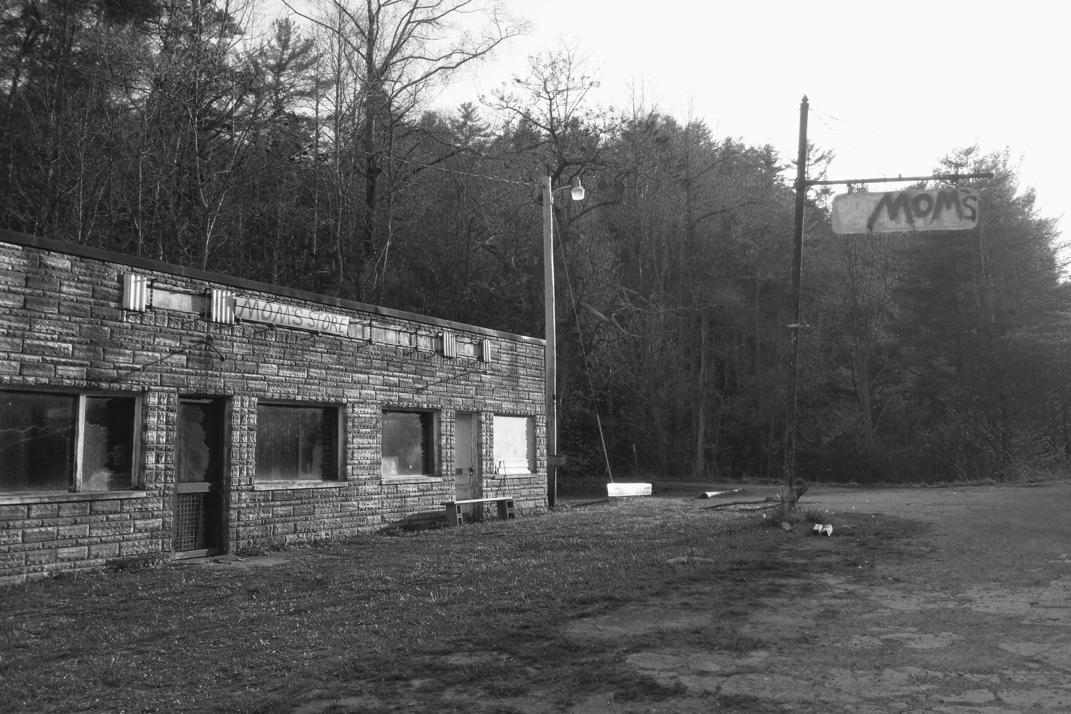
Rewind to 0800 this morning, munching on my breakfast bagel with peanut butter, breaking down camp. No sooner did I pull the straps on my backpack then the sky began to trickle down raindrops. Truthfully, phenomenal timing, so I wasn't all that frustrated. Cheesepuff, Whitey, and I headed out onto the road to a small store called 'Mom's' and advertised to hikers for snacks and drinks. They had been closed upon our arrival the night before, but we saw a car pull in before leaving our campsite and decided (excitedly) to stop by for some ice cream before hitting the trail. Only on the Appalachian Trail (and cycling cross country) is ice cream acceptable for a second-round breakfast.
The building that's home to 'Mom's' honestly appears as if it should be demolished. Windows are covered with plexiglass to hide holes in glass from baseballs, it's dirty, and half of the store is a pile of junk literally just tossed aside. I was in love. I'd made speculations yesterday upon seeing it for the first time that in its previous life the building was a gas station on the state line. I made some easy conversation with Dwayne, the 62 year old store owner, about his vintage cigarette advertisements just to get my foot in the door before steering the conversation where I really wanted it: the history of the building. Those of you who know me personally know I'm a huge fan of vintage petroleum history & advertising/signage, hence my trail name being Texaco. Dwayne's face lit up when I asked him about the building's past. Apparently in the 60s it was his dad's gas and service station, originally branded as an Esso station.
Quick history lesson for the sake of informing you, Esso and Mobil were both owned by Standard Oil Company. The government had intervened and expressed concern with Standard's size, so they split themselves. Esso was run out of New Jersey, named this way due to it's sounding like 'S.O.', aka an abbreviated Standard Oil. Mobil was run from New York, and was often advertised as a 'SOCONY' company, or Standard Oil Company Of New York.
End gasoline history lesson. Anyways, Dwayne and I spoke for a while about the signage, the time his dad was being bribed to turn over to a Sinclair station, and all of the old station stuff he still owns. I gave him a business card and told him to call me if he ever wants to part with his signs, one of which apparently is an original 1950s 48" Coca-Cola button. This was pretty much the single most exciting conversation I've had in a while and I can truthfully say I believe he was equally thrilled to have someone, especially from a younger generation, who was so appreciative of his family's business and his memorabilia 'hoarding'.
At 0900 I was on the trail, beginning what was a long elevation climb over the course of 8 miles or so. The rain really kicked in with downpours as I was hiking up, and when I stopped to put my Goretex rain jacket on, my backpack's right shoulder strap broke at the point where it mounts to the bag. Upon hurried closer inspection (due to the monsoon of water falling from the sky and all) I saw that the mounting hole had cracked allowing the strap to fall out. I rushed to get the strap situated, although now it's in a different position than the other side. It's not perfect, but it will work. I'm not sure if I'll pursue this issue further just yet. I stopped at the next shelter to have a bite to eat and sign the journal (every shelter has a log book for hikers to write in) and I caught up with Cheesepuff and Whitey, as well as a few others who were hiding from the rain. I drank my filtered water, and refilled my Platypus with another 2 liters from a spring. After a nice break, and with the sun back out, I continued up the same climb I had started two hours earlier.
Upon summiting the unnamed mountain, the trail a began a wonderful ridgeline walk for a handful of miles. The rain came and went more than a few times, making the trail a muddy and slippery mess. This was probably the worst condition the trail has been in since I left Georgia 3 weeks ago, and I almost fell more than a few times throughout the day thanks to the mud and wet rocks. I credit my trekking poles with saving my butt, and will again say aloud that I don't get how people hike without them. An hour or so into the less strenuous ridge walk, I came across a campsite with a creek where someone had littered cases of aluminum soda cans on the side of the trail. Upon closer inspection, this was actually a great moment of trail magic, where a local left two dozen soda cans (unopened! worry not!) in a pool of the river to keep them cold. I gleefully took a Sprite and headed on my way. The trail magic lately has been abundant, and has gotten me thinking about how I'll give back in the same regard when I finish the trail.
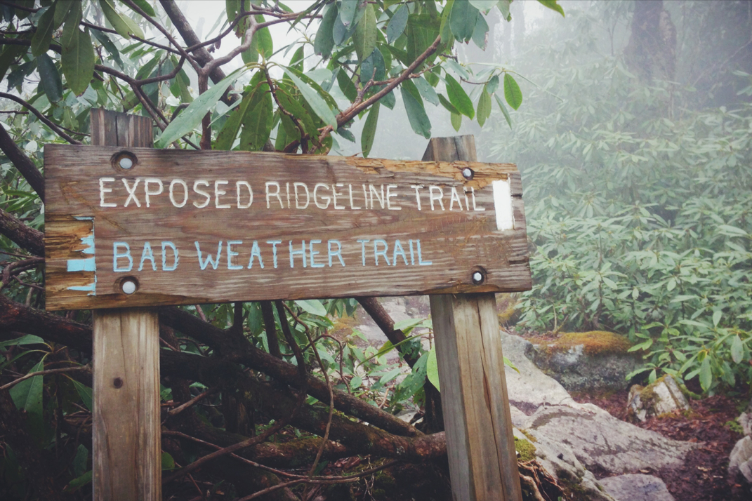
With the rain subdued for a while, the trail came across a rather interesting sign. The carved wood presented separate trails: one a more sheltered option for 'bad weather', and a second trail that was a very exposed ridge line over the summits of a few mountains. Even though we'd had rough weather all day, there was no doubt in my mind about continuing onto the exposed trail. This proved to be a fascinating decision, with the rain quickly picking up and winds gusting fast enough to move me around as I hand-over-hand climbed up some exceptionally slippery rocks, visibility no more than 20 feet, and heavier fog moving in. What's life without adventure? I didn't come here to take the sheltered trail, after all. I stopped in the pouring rain to take a photo or two of the complete lack of views from the summit, and hurriedly navigated my way back down under the cover of trees.
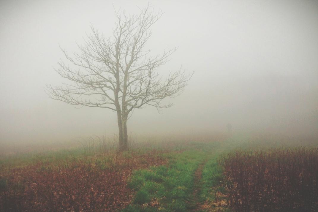
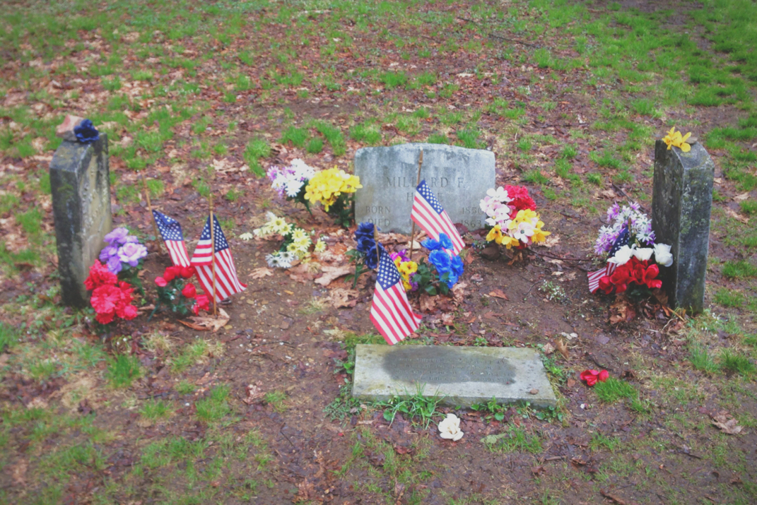
Passing Jerry's Cabin Shelter, and ultimately the 300th mile mark of the Appalachian Trail, the path climbed back up to more of these incredibly eerie fields filled with fog. I tried to photograph a hiker and his dog, but no sooner would I stop to get the camera out then he'd disappear into fog even 30 or so feet away from me. These scenes are beautiful, and although the photographs may seem redundant, each occurrence truly is its own experience. After climbing up to the anticlimactic summit of Big Butt Mountain (there was no sign to photograph for you, but this mountains name will live in hiker infamy along with Georgia's Chunky Gal Trail) the trail turned sharp right and followed an old dirt fire trail for almost two miles. I was alone, and loudly singing along to Skynard's 'Sweet Home Alabama' as I walked along... I can only imagine how harshly the squirrels judged me. Wide enough to allow cars to travel, the road was very muddy and at times frustrating to navigate. Not knowing where the trail turned back into the woods and a lack of markings left me second guessing how far I'd walked for nearly 45 minutes. Eventually I came across the grave site I'd known to expect, and the trail turned back to the 18" wide dirt path I'm used to.
There are 3 tomb stones in a field at the end of this dirt road. Two are exceptionally old (not by the standards of 'old' headstones in New England) but date back to the Civil War. These identical headstones belong to the Shelton brothers, Union soldiers visiting their families in the Confederacy, who were killed here. The third is for a 13 year old boy who was killed at the same spot in 1863. His headstone is newer, and is marked as installed by his descended family members. Flags and flowers are present, and this is a fascinating piece of history to be brought by.
Around the time I left the graves, the sun started toying with the idea of coming out. It wasn't until I crested a small hill, suddenly exposed to a sweeping view of the valley, that the warmth of the sun was out in full force. It was another 3 miles to the shelter, but the time went by quickly and I arrived around 1700hrs.
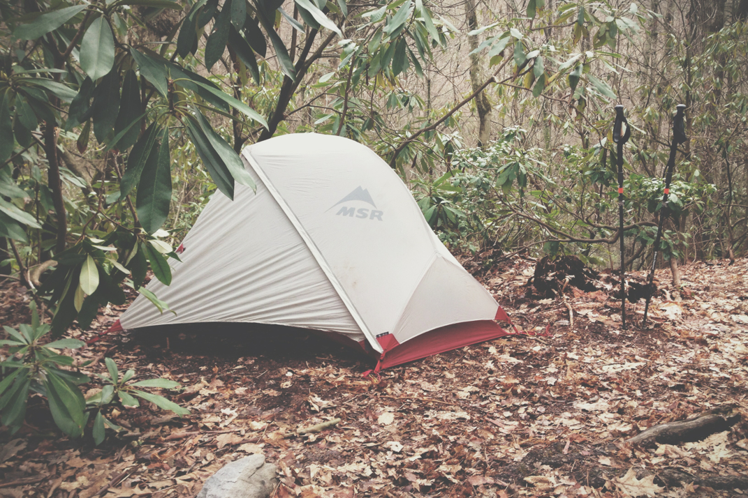
I set up camp and ate dinner with Cheesepuff and Whitey, getting into bed before sunset as the wind picked up and temperatures dropped. A little music, rereading letters from home, and a warm sleeping bag will allow me to nod off easily. Tomorrow's supposed to be nearly 80 degrees, and the elevation maps show about 2,500' of climbing between two summits which should get my heart rate up a bit. My plan is to do 19 miles and spend another night at a shelter in my tent.
From the dark and starry skies in the middle of nowhere, goodnight.


 RSS Feed
