2180miles
  • Home
  • Adventure Blog
  • Overland
    • Meet The Jeep
    • Mods & Installs
    • Overland Gear
    • Trip Reports & Videos >
      • Allagash Winter 2019
      • Greece Adventures 2019
      • Overland Expo East 2018
      • Allagash Wilderness 2018
      • Trans-Canada Overland 2017
      • QB-5 Adventure 2017
  • Long Trail
    • Trip Summary
    • Photojournal
    • Hike Statistics
  • Appalachian Trail
    • Trip Summary
    • Photojournal
    • Gear Talk
    • Hike Statistics
    • Financial Planning
  • Bicycling America
    • Trip Summary
    • Photojournal

Exploring Maligne Lake

8/30/2017

0 Comments

 
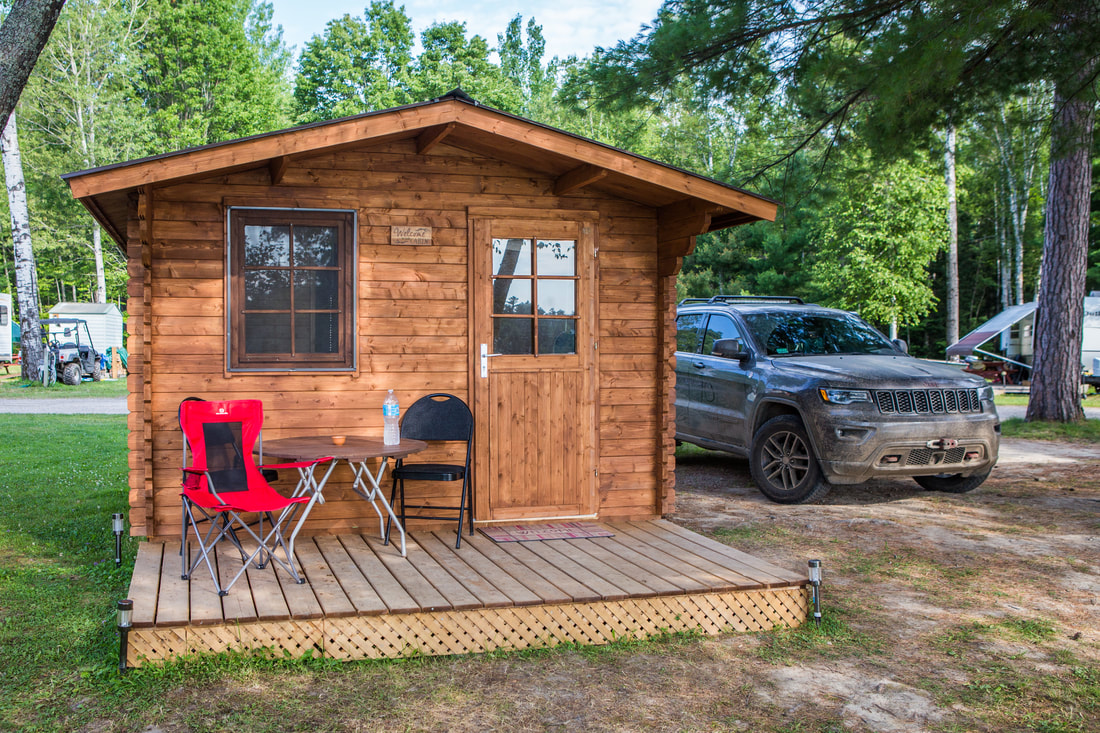
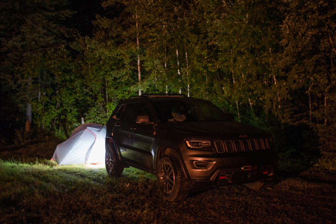
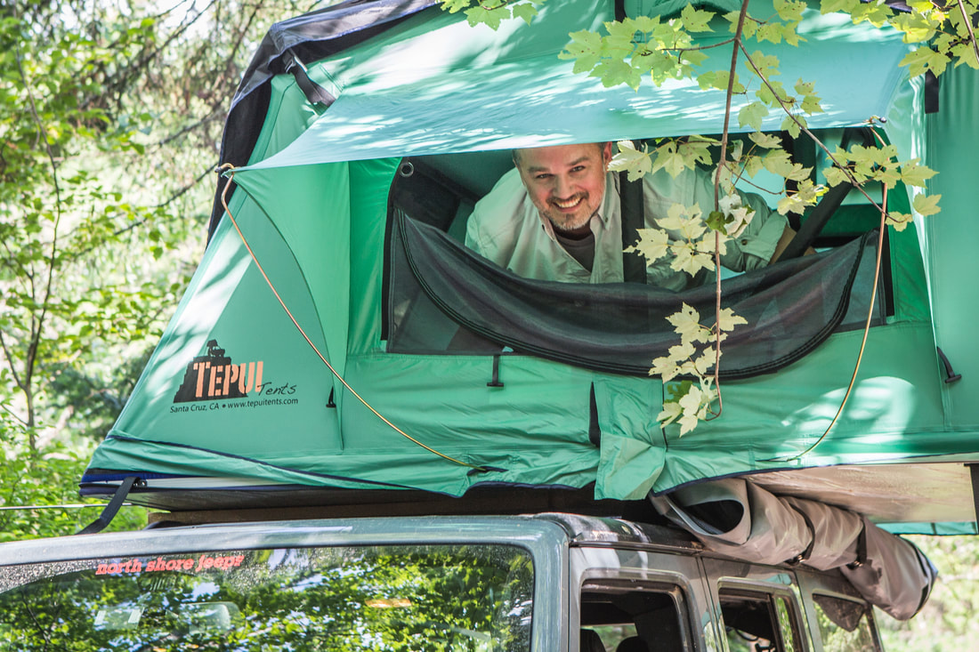
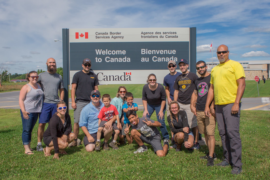
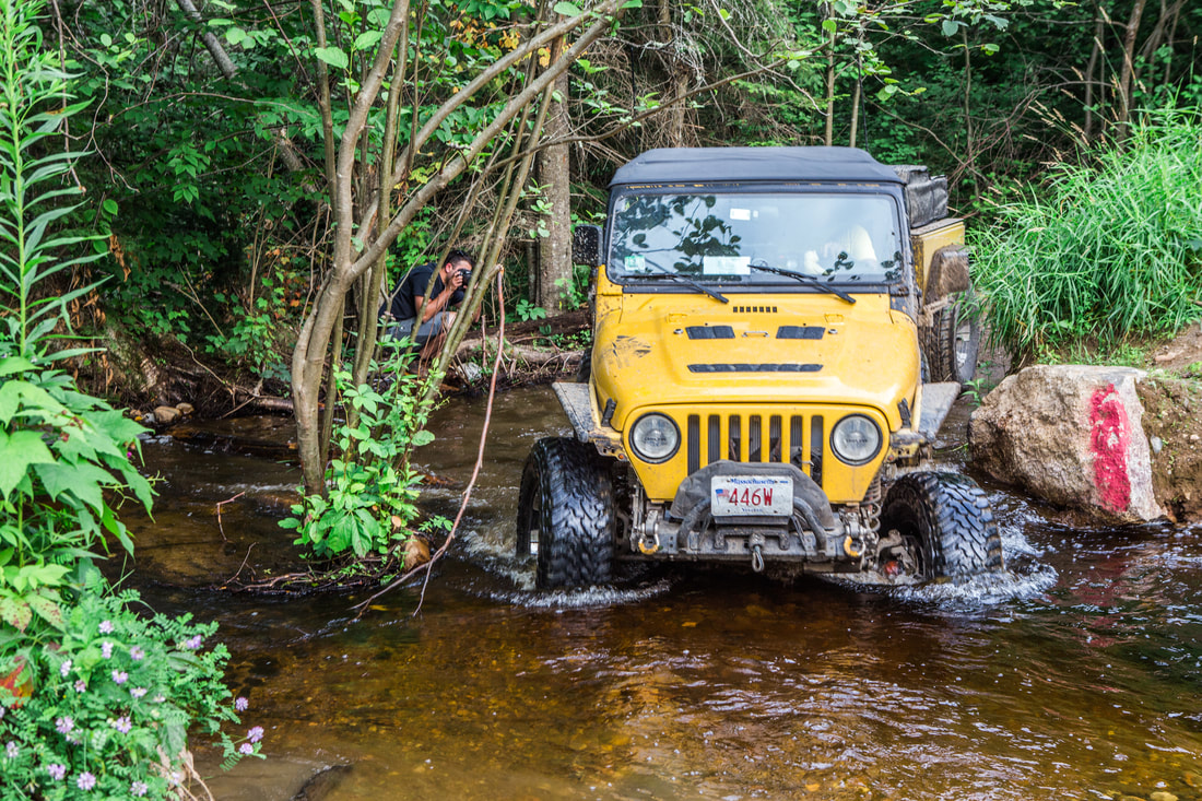
​Thunderstorms had started late and carried on throughout the night, with heavy rain falling intermittently through the late morning hours. We woke up around 07h30, later than the last few days, and discussed what we each had in mind for the day. We settled on starting at the campground showers to rinse off the long day before spend on the road, and then figured we would drive into downtown Jasper to find a coffee shop and get some work done while the rain clouds (hopefully) blew away with the wind. It was a brisk 48 degrees when I got out of the tent, and once I was showered I re-dressed in a few layers with a poly ¼-zip fleece and a wind/rain shell over top. Dani had even more layers than I, and topped them off with a SmartWool puffy polyester jacket. Given that she’s a Floridian, I was quite proud to see her variety of newly acquired outdoor hiking apparel to choose from given the fluctuation of weather.
 
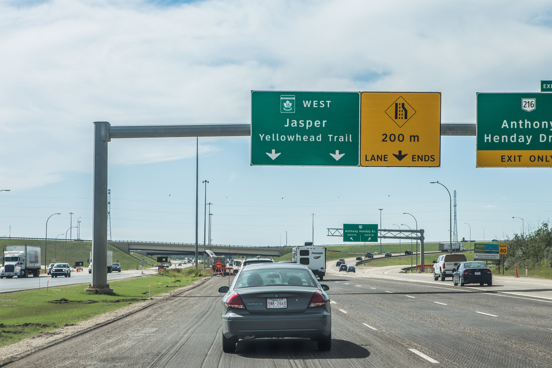
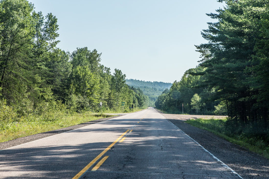
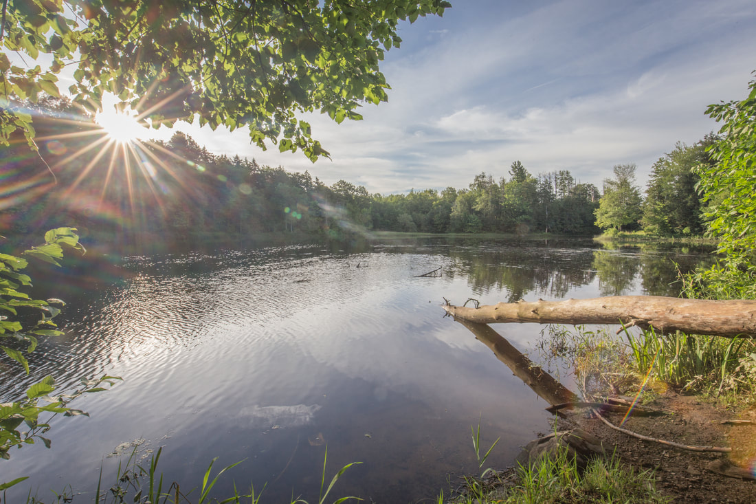
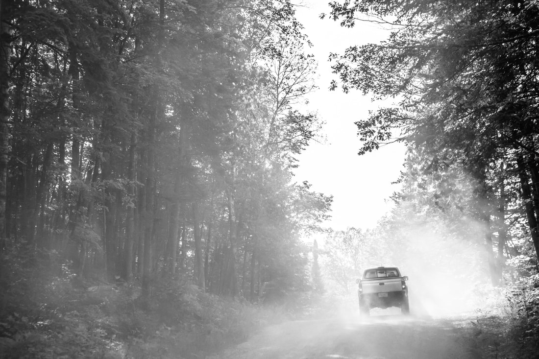
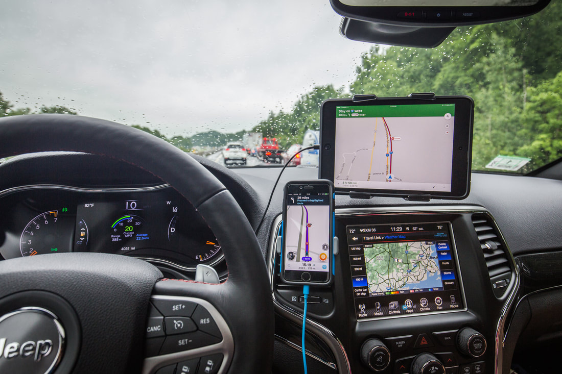
Because of the duration of time we’re actually spending in Jasper, only three full days, it was important to both of us to do and see as much as we can. Dani had mentioned the long drive up to Maligne Lake, and we used the limited Internet I was able to squeeze out of the iPad and coffee shop Wi-Fi to figure out the route. Piling into the Jeep around 11h00 we turned east, back the way we came the night before, and made a quick turn-off for the Maligne Lake road. A brief stop a few miles up gave us a stunning view of Jasper from a rocky overlook, but the crowded parking lots and lack of phenomenal weather pushed us back towards the car and further up the road. After a half hour of winding switchbacks through tall pine tree forests we arrived at the famous “disappearing” Medicine Lake. A shallow 3.5 mile long body of water, it’s known for disappearing in the autumn and winter seasons due to its inability to retain water as it flows at a weaker rate from the glacial lakes upstream. When we arrived the small parking lot was half-full, and a light rain was falling outside. We took a few photos of the large body of water, but the true color it’s known for was lacking due to the clouds overhead. As the rain got heavier I packed up my camera gear and we continued further up the mountain towards Maligne Lake. It was at one point along the next section of road that Dani commented on the fact that her ears were popping, and after querying the iPad’s GPS we noted it was the first time she had ever been over 5,000’ elevation outside of an airplane. I thought to myself that the new and unique experiences of our trip seemed to be endless.
 
Picture
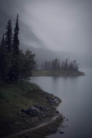
A dreary day at Medicine Lake

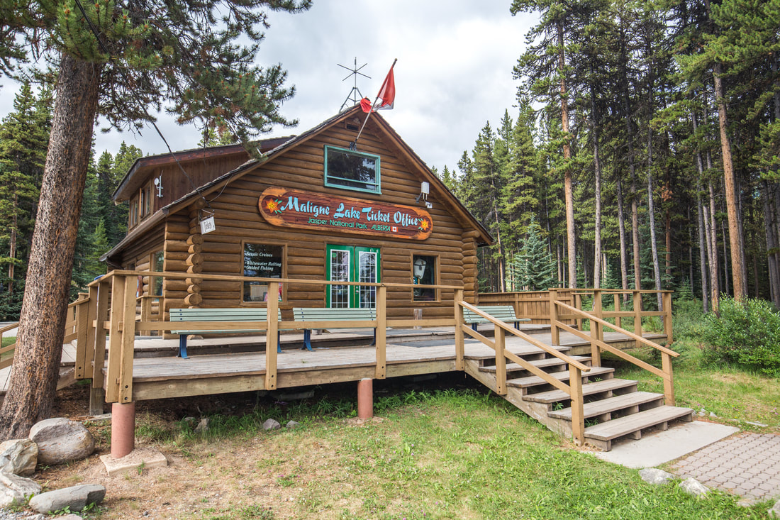
Arriving at Maligne shortly after 13h00 I was shocked to see that, accurate to the GPS prediction, it had actually taken us nearly two hours to make the 50km drive. Located at the top of a dead-end road was the Maligne Lake visitor center, historic canoe boathouse, and the Maligne Lake cruise to the world famous Spirit Island. We explored the visitor center and got an idea of the cost for the boat ride, but were initially turned away by the $100/per person rate. Instead of dishing the money out we followed a trail for a few miles that meandered around the lake, soaking in the beauty and serenity of the mountains. As we walked the clouds began lifting, causing us to debate our decision to skip the boat ride, and ultimately turning us back to try and get tickets for the last cruise of the day. We were able to secure “cheaper” tickets for $76 each for the 15h00 boat, giving us about half an hour to eat a quick lunch before our trip.
 
The cruise across Maligne Lake would take us nearly twenty miles southeast across the second largest glacially fed lake in the world. We climbed onto the motor-powered boat with about 30 other visitors and took our seats while the tour guide introduced herself and got us acquainted with the itinerary of the tour. We’d cross the lake as she narrated our surroundings, then dock near the notable Spirit Island where we’d have fifteen or so minutes to explore and take pictures. I spent most of the ride across the lake on the back deck of the boat taking photos, listening in to the stories of the mountain ranges and glaciers towering over both sides of Maligne’s shores. As we neared the opposite side of the lake the sun began shining through dispersing clouds, and by the time we arrived at the quiet dock near Spirit Island it was almost a beautiful day outside. I must have taken five hundred photos in the short time we were there, doing my best to capture the island from any angle I could, but still standing in silence with Dani truly appreciating the beauty of this tiny peninsula-like island in the middle of the turquoise water backed up against gigantic mountain ranges. We took the half-hour boat ride back to the visitor center, both of us on the back deck of the boat this time, watching the world go by and endlessly appreciating where we were.
 
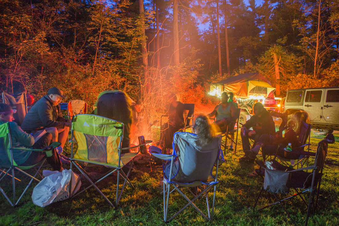
The drive back to Jasper passed quickly, and we spent the late afternoon walking around town popping in and out of stores and picking up a few groceries from two stores that were gluten-free friendly. At the latter of the grocery stores I asked the checkout clerk where his favorite spot to watch sunset from was and he pointed us towards Old Fort Point, an elevated vista on the other side of the Athabasca River. We drove to the Old Fort Point parking lot and cooked a small salad and pasta dinner, then hiked for twenty or so minutes up to the top of a barren and windy hill to watch the sun set over Jasper. While the sunset itself was nothing spectacular, the elevated view really gave me a greater appreciation for the town and just how nestled into the mountains it really is. We returned to the campground and climbed into bed around 22h00 under skies that were still as bright as day, but after a long day of exploring the Park it was easier than I ever would have guessed to fall soundly asleep for the night. ​
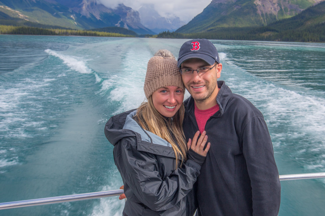
​
Picture
Picture
Crossing the Lake
Picture
Picture
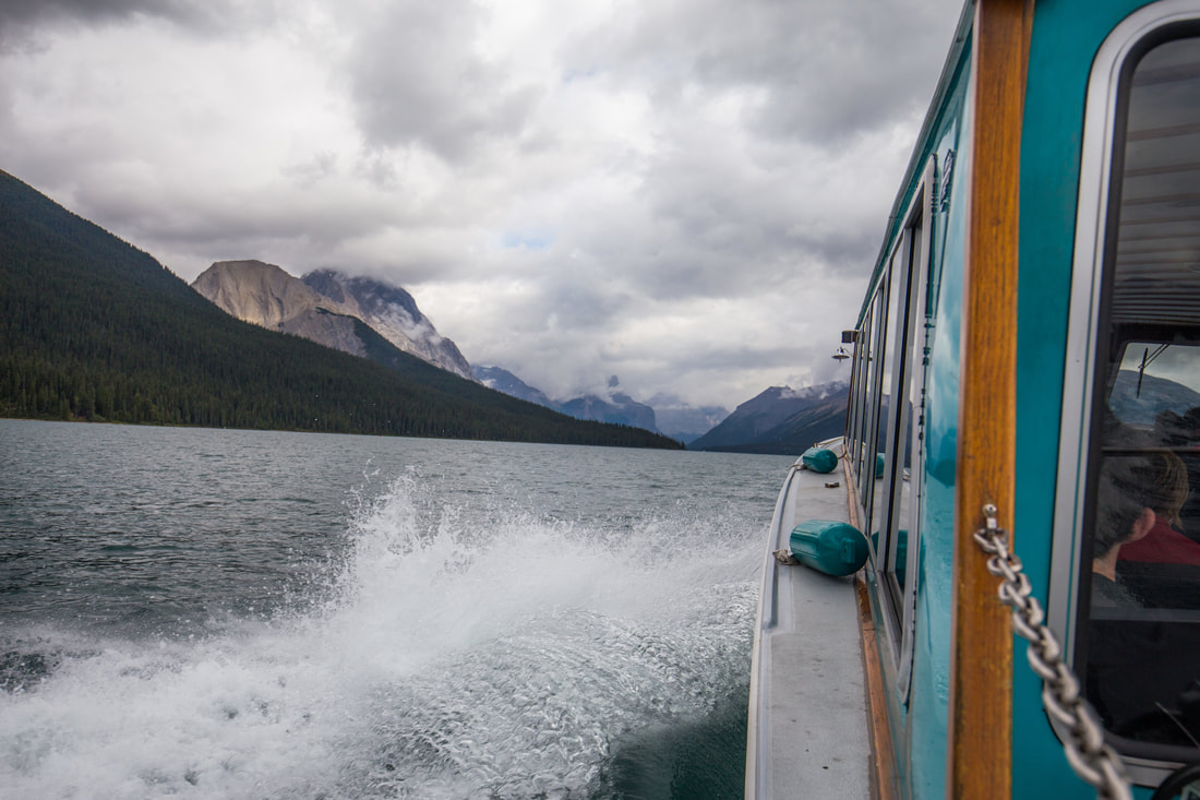
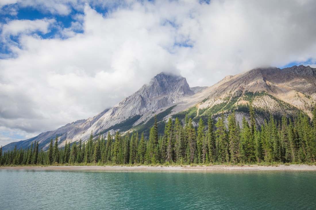
The Queen Elizabeth Mountain Range
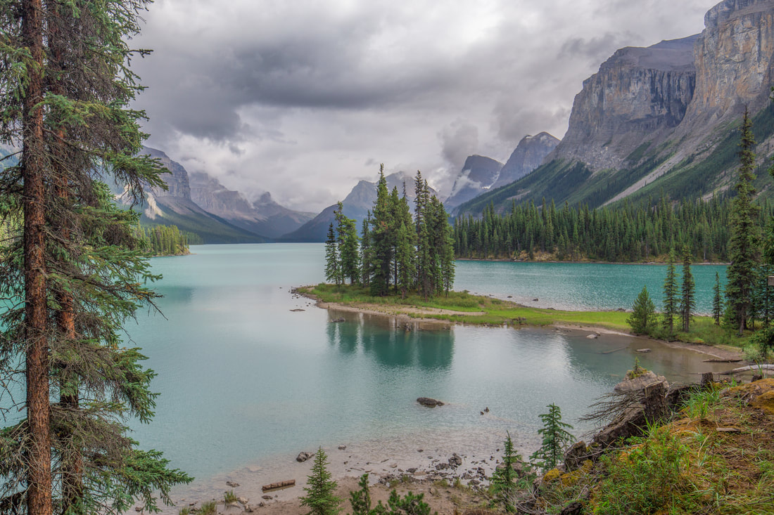
Picture
Spirit Island
0 Comments

Trans-Canada: Saskatoon to Jasper, AB

8/28/2017

0 Comments

 
​Despite the quiet house when we fell asleep, I was woken up throughout the night from heavy footsteps upstairs. The Airbnb’s owner had warned us that they had a newborn baby and that crying might be heard, but the creaking floorboards were the breaking point. I barely slept that night, and finally got out of bed around 06h00 as baby's older sibling was running around and the ceiling felt like it was going to collapse on top of us. We packed up what gear remained, making a half dozen trips to and from the car carrying our backpacks, cookware, washed camping gear, and bags of food. I arranged everything inside the Jeep as Dani did a last once-over throughout the apartment to verify we had everything, then we got into the Jeep and began the days drive to Jasper National Park. She noticed a few minutes later that we weren’t heading to the highway, and upon inquiry was delighted when I informed her I had found her a Starbucks in downtown Saskatoon to get coffee at before we hit the road. Ten minutes later with some fun named and delicious smelling beverage in her hand, we turned onto the Trans-Canada Highway to begin the 535 mile haul to Jasper, Alberta.
 
The majority of the morning was comprised of long, straight highway through farming fields. We paralleled seemingly endless train tracks, passing small towns with large silos and dozens of pick-up trucks haphazardly parked in gigantic dirt lots. The “towns” could be seen from miles away as we approached, then seemed to pass in the blink of an eye before the road opened up widely again and we repeated the long approach to another arrangement of silos in the distance; it was like driving on Groundhog’s Day, though Bill Murray didn’t join us. Shortly after noon we drove into Lloydminster, a city with the unique geographical honor of straddling the Saskatchewan/Alberta provincial border. We took a quick photo at the wood-carved “Welcome to Alberta” sign on the side of the road and carried on towards our next major city, Edmunton. It’d take us another two and a half hours to get there, during which Dani drove and I took a much-needed nap. She woke me up as we got to the outskirts of Edmunton, knowing that I had wanted to find a carwash before we hit Jasper. I took some time with the dash-mounted iPad to find a touchless one along our route, and changed the navigation to bring us there. After 1,925 miles since the last carwash, I felt the Jeep needed to look “pretty” as we rolled into the Canadian Rockies. With a half-dozen sponsors with products on the Grand Cherokee and living in the social-media age, it was important to me that photographs taken of it in the majestic mountains have that rugged look, but also appear like something of a promotion for Jeep and the companies that have so graciously worked with me throughout the months of owning it. We filled the gas tank and ran it through the deluxe carwash then turned our attention completely to the road ahead, passing under a highway sign denoting Jasper, our distance from our ultimate destination diminishing by the mile.
 
In the early evening we pulled off the Trans-Canada Highway onto a small dirt road alongside a field, parking on a grassy section and setting up our cooking table and stove. We cooked dinner in the sunlight and sat in our camping chairs, watching the highway traffic fly by a hundred or so feet away. We cleaned the dishes and packed up camp, Dani picking a flower from the roadside as she hopped in the Jeep. A mere half hour later we began seeing the silhouettes of the Canadian Rockies standing tall over the road we traversed. Soon enough we were seeing young Elk standing on the side of the road, a dozen cars parked haphazardly in the brake-down lanes as people flooded the road taking photographs. I slowed down to be cautious, paused briefly to snap a photo out the window, and moved on towards the park’s east entrance. Greeted by a friendly Park Ranger, I showed him our Canadian Parks pass, something I got for free from the National Parks Service in celebration of their 150th anniversary. He pointed out how to get to our campground, wished us a good stay, and moved us along. We drove through the small but bustling town of Jasper, turning south on Canada Highway 93 and pulling off to Whistler’s Campground in search of site 25-J.
 
It took about twenty minutes to get to the back side of the campground and find our exact spot. We hopped out to figured out where the tent would best go, then backed the Jeep into place and emptied the Pelican storage cases to start building camp. By the time we had our teeth brushed and were ready for bed it was after 23h00, though the sky left me assuming otherwise. It was 45 minutes before midnight and the glow from the sky above was bright enough to have read a book inside the tent. It was interesting for me to realize that this was the furthest north I had ever been on our continent. We had no defined plans for the next day, instead wanting to figure it out as we went; it was easy to fall asleep quickly, grateful for having completed without incident our 2,400 mile drive to the world-famous Jasper National Park. I was excited for what adventure the following days would bring.

Picture
Seemingly Never-ending Canola Crop Fields
Picture
Entering Province #4
Picture
Jasper - Straight Ahead
Picture
Highway Flowers
Picture
Young Elk
Picture
Entering Jasper National Park, Alberta
0 Comments

Trans-Canada: Winnipeg to Saskatoon, SK

8/24/2017

0 Comments

 
​We woke up late the next morning, likely due to the lack of sunlight in the room versus the tents ability to glow in the early morning hours. I took another quick shower, savoring the opportunity to stand under hot water, and nearly died (okay, not really) when I attempted to adjust the temperature. Turning the dial towards what I thought was a colder setting, the water suddenly was boiling hot; I tried to hop out of the way of the stream and ended up slipping, reaching for the nearest thing to break my fall and tearing the entire shower curtain off the rod. It was a life-threatening morning. By the time we were packed up it was 09h00, and Dani was excited that we had found a Starbucks nearby to the Airbnb. We stopped in for an hour or so, using the Wi-Fi so we could both work while she drank her coffee and I ate a breakfast sandwich. We had about ¼ tank of gas left, but I decided upon our departure that I would rather wait until we weren’t in the heart of Winnipeg to refuel.
 
Before long the city disappeared in our rear view mirror and we were back in the 110km/hr, vastly open region of the Trans-Canada Highway. With a mere 482 miles northwest to Saskatoon, it honestly felt like today would be a “short” day in comparison to our recent long hauls. An hour or so outside of the city I pulled into a Petro-Canada gas station on the side of the highway as a light rain began to fall. It continued for the next few hours, making the monotonous plains of western Manitoba a little more interesting, the typically vibrant yellow hay fields seeming muted against the grey skies overhead. Our scarce road signs began noting that Saskatchewan was quickly approaching, and after taking a few minutes break to fly the drone on an empty dirt farm road we crossed into our third Canadian province shortly before 13h00. Within the hour the clouds broke up and revealed the blue skies we had become used to. There was a minor scare in the late afternoon that my wallet may have fallen out at a gas station rest-stop two hours behind us, but we eventually learned that there was a “secret” part of the Jeep’s dashboard storage compartment that is relatively hidden unless you’re desperately crawling around in the back seat. I maintained a relative calm during the 45-minute search, emptying out the entire contents of the Jeep and slowly pacing in the restaurant parking lot. Eventually Dani noticed my wallet in this little storage area, and all became right with the world again after a few deep breaths and a little swig of whiskey.
 
She drove the remainder of the day to Saskatoon, delivering us to a grocery store in the city to pick up final items before reaching Jasper the next evening. We were again staying in a cheap Airbnb, owned by a young couple with a new baby. Their entire basement had been newly redone as an in-law apartment and was ours for the mere price of $34 a night. Dani cooked us a delicious dinner with grilled seasoned chicken, rice, and broccoli, while I got to work doing laundry and drying our camping gear, still damp from the torrential rain in Longlac two nights prior. We drank some local hard ciders while folding laundry and reviewing photos from the QB-5 portion of our trip as I did my best to get some writing done. Sharing this adventure with someone, while an exceptionally nice change to my usual solo-ness, made it much harder to get my usual blogging done at the end of each day. On average it takes me about an hour to write one of these posts, edit the photos, and prep it for publication. She’s been incredibly helpful in driving for a while each day to let me write and edit photos, but I was still way behind. Alas, not being out on this adventure alone was worth any tradeoff I can think of.
 
The next morning we would begin our final haul to Jasper, Alberta, continuing a manageable 535 miles on our northwest trajectory and reaching the first of the two national parks on our itinerary before the sun set on the Canadian Rockies.
​
Picture
Refueling in the Rain
Picture
Entering Province #3
Picture
On The Road Again
Picture
Back to Blue Skies
0 Comments

Trans-Canada: Longlac to Winnipeg, MB

8/22/2017

0 Comments

 
​Waking early to a dreary sky, I was disappointed to see the tent had not handled the excessive amount of precipitation as well as I had hoped. As Dani rolled up the sleeping pad and bag, I prepped our gear inside the Jeep for us to quickly pack it up. We looked around at the empty “campground” and drove away slowly, headed a short ways to the only building on site that I had read housed free showers. Sure enough the doors were unlocked and we were each able to rinse off before beginning another long day on the road. We hit the road at 08h00, turning back onto the Trans-Canada Highway and quickly searching Google on the iPad to find the nearest gas station. The Jeep’s digital display showed 15 miles to empty, eventually dropping to “Low Range” on the gas gauge hit the bottom of its scale; we were still 5 miles from the nearest fuel supply. In what was probably the most nerve-wracking moment for me during our trip, the GPS announced our arrival at the gas station as we arrived at an empty field… no fuel to be found. Saying a quick prayer in my head we continued on, eventually finding the gas station a mile down the road. We paid a shocking 119 cents per liter, the most we would on our entire journey, and the Jeep took an impressive and scary 23.5 gallons in the 24 gallon tank.
 
After fueling up and carrying on, our scenery changed a bit to include a lot more lakes and higher-rising rock mountains. The road carved through the country as we moved further through the western side of Ontario, and the clouds from the storms the night before lingered overhead. After almost two hours we started seeing signs for a visitor center at a nearby mine, thinking it’d be a good rest stop as Dani had never seen one before. We hopped off the highway and took a gravel road another 15km before arriving at the main building for the Amethyst Mine Panorama. They offered a tour of the 1,100 foot long mine, having been in continuous production since 1965, but where we had neither the time or interest in spending the money to walk through a field of rock, we politely asked to go peer over the railing into the mine itself and made a quick return to the Jeep to carry on with our journey. Before pulling out of the parking lot we looked at the maps and choose the large city of Thunder Bay, Ontario, as the appropriate destination for our upcoming lunch.
​
Picture
Abandoned Church - Longlac, ON
Picture
Exceptionally Low on Fuel
Picture
Gorgeous Scenery
Picture
Cooking Lunch in Thunder Bay
As the highway descended from higher elevations we began seeing the vast waters of Lake Superior to the south of us. Signs for Thunder Bay began popping up, and we chose a random exit to find a restroom and a place to cook lunch. We found a McDonalds with a nearby city park, and in short order were set up with our grill and cooking pasta with chicken sausage to strange glances from onlookers. We were exceptionally efficient, in and out of Thunder Bay in under an hour with our sights set on making it to Winnipeg before the sun was too low on the horizon. It took a while to get out of the more pedestrian roads of Thunder Bay before the Trans-Canada Highway again opened up to the two-lane road we had become familiar with. In the early afternoon we passed by a sign marking the Arctic Watershed, the geographic point where all streams flow north to the Arctic Ocean. I snapped a quick photo of the Jeep with the sign, and we carried on as Dani drifted to sleep in the passenger seat and I quietly listened to a 40s swing channel on the satellite radio, tapping my fingers to the beat as the Jeep’s tires endlessly rotated on the well paved road beneath them.
 
We crossed out of Ontario and into Manitoba around 18h30 with only 150km left until we arrived in Winnipeg. I drove alongside a slowing trail for the last few miles before entering the city proper, and Dani turned her attention towards finding us somewhere to eat. Not having an interest in cooking another meal at the end of the long day we stopped at an Applebees for a quick dinner only a few miles away from where we would spend the night. I had found an Airbnb for us nearby to the Trans-Canada Highway for a mere $30, which bought us a large in-law apartment in the basement of the young family’s house. We arrived and unloaded the minimal but necessary gear, took quick showers, washed our pots and pans from lunch, and climbed into bed. We had covered 988km, or 614 miles, and were celebrating that the next day’s distance would only be 80% of that, a “relaxing” day, if you will. We were over a thousand miles from Ottawa with a thousand left to go; our eyes, hearts, and imaginations were set on Jasper, and we couldn’t get there fast enough. 
​
Picture
Open Roads
Picture
Arctic Watershed
Picture
Racing Against Trains
0 Comments

Trans-Canada: Ottawa to Longlac, ON

8/20/2017

0 Comments

 
After leaving Ottawa on Sunday the 30th we hopped onto the Trans-Canada Highway and began our 2,400 mile drive to Jasper National Park in Alberta. I had spent the last few months simultaneously planning our National Parks trip alongside the QB-5 adventure, and though I didn’t want to rush things, we absolutely had a tight itinerary for driving. Taking things one step at a time, we had a 2.5 hour drive to Mackey, Ontario, where I had reserved us an Airbnb. Our first hour on the road painted a vivid picture of what the rest of our journey would be like: an exceptionally well paved road only two lanes wide, pine trees that stretched forever in either direction, and oncoming cars just feet away traveling at an equal 100 kilometers per hour. I was initially uncomfortable with this, thinking of a tired driver in the other lane veering just a few feet and crashing into us with an immense amount of force, but eventually got used to it and kept razor sharp focus on the road ahead as we traveled along.
 
As darkness set on Ontario at the same late hour as we had been experiencing with the Jeep club, the dashboard mounted iPad spoke up and announced we were nearing the campground the Airbnb would be located at. For those unfamiliar with the company/trend, Airbnb is an online-based “hotel” network where people list spare bedrooms or even entire houses for others to rent for a night, week, or even month. Prices range depending on where you are in the world and how nice the space is, but I have had great success using the platform in the past to book places to stay, and Dani and I agreed it would work well for the trip. For a mere $37 we had a small cabin to ourselves, nestled at the back of a popular campground along a wide river just off the highway in Mackey. I met our host, April, at the campground office and she gave us the key for the one-room cottage we’d be staying in. After well deserved showers we quickly fell asleep, a small desk fan providing white noise and a bit of air movement throughout the night.
Picture
Headed West
Picture
McKee Road - Deep River, Ontario
Picture
Airbnb Cabin
We woke up the next morning after sleeping in a bit, packing up our stuff and eating a small breakfast before meeting April at the main office. In messaging her prior to our trip she had volunteered to do a load of laundry for us for an agreeable $10, which we discovered she had even folded up for us before handing it back in a large trash bag. Thanking her endlessly we hopped back in the Jeep and began our 580 mile drive (I used miles in my pre-production planning, and maintained it as we travelled) to Longlac, Ontario where we would spend Monday night. The Trans-Canada Highway continued to be the same layout as the day before, though we faced more hilly terrain as we moved westward throughout the day. We stopped for gas around 11h30, getting more accustomed to recognizing “good” prices while converting liters to gallons and CAD to USD all at the same time. Ontario seemed to have decent prices, usually around 88 cents per liter. As our small breakfasts wore off I put my trusty navigator in charge of finding us a lunch restaurant, looking at the maps and picking the city of North Bay as our ideal lunch location. She called around to a few places that Google listed as gluten friendly, and we eventually settled on Urban Cafe as our restaurant of choice. Pulling into North Bay we refueled for the first time since early the day before, and got the Jeep a well deserved car wash to rid it of the mud that was caked onto all of its surfaces.
 
After an incredibly delicious soup and sandwiches lunch we hopped back in the car and stopped by Wal-Mart to resupply some of our more perishable foods, picking up veggies and fruits to store in the fridge as future snack items. At that point it was nearly 13h00 and we had another 497 miles on the Trans-Canada Highway until we reached our destination for the night. We carried on for hours, watching the sun slowly sink in the vast Canadian sky, making a few stops for bathroom breaks as we went along. Darkness set on us at 21h00 as we travelled along Highway 11, and with the abundant lack of other vehicles I turned on the 30” Black Oak LED bar mounted on the Grand Cherokee’s roof. Lighting up the road for almost a mile ahead, it was an immense contributor to my comfort level as we navigated winding roads over countless hills. A heavy rain began as we carried on into the night, and I began to get nervous as the gas needle gradually sank below half a tank. We drove late into the night, getting closer and closer to lightning and storm clouds ahead of us, eventually passing over the last of the small mountains and descending into Longlac, arriving with just 10 miles of fuel left in the gas tank. All in all we had gone over two and a half hours without seeing a town, a street light, or any kind of fuel station; I cannot convey how glad I was that we had made it without running out of gas. We scoped out a remote campsite that had been listed on iOverlander.com, and after deeming it suitable I rushed out into the rain to set up our tent as Dani got the inside of the Jeep organized and ready for bed.
 
We climbed into the tent and laid down to the sound of heavy rain falling on the tent fly and loud cracks of thunder echoing through the area, shaking the ground beneath us. A few times a minute cracks of lighting would illuminate the entire sky, and for a moment the inside of the tent was as bright as daylight. Despite the sensory overload, we fell asleep quickly after a long day of travel, resting up before continuing on to Winnipeg when the sun again crested the horizon. ​


Picture
Car wash in North Bay
Picture
49th Parallel
Picture
Restocked Refrigerator
Picture
Campsite in a Storm
0 Comments

On To Ottawa

8/13/2017

0 Comments

 
Camp was slow to rise Sunday morning, and after a few people had checked on him Shaun made a grand entrance as most everyone else finished up their fresh-made blueberry pancake breakfast. We broke down camp in decent time and arranged to meet at Bonnechere park’s main entrance at 09h00 for departure. I pulled our Grand Cherokee onto the pavement as the lead vehicle and sped up only to hear someone call out that a teal colored Frisbee had flown off my roof… alas this was not a Frisbee, but one of our two plastic camping plates that I had temporarily misplaced while packing up. Andrew was kind enough to pull over and grab it for me, but wasn’t able to rescue it before a small sedan drove over it at 80 km/hr. The great news is that aside a few scuffs, it will live to be used another day.
 
When Rob and I initially planned the QB-5 trip, we feared that the first two days of trail wouldn’t be enough to excite the group. In talking more with Ted from GravelTravel.ca, we joined together the Ottawa Valley route with a section from the Swisha Valley Loop, adding a “day” of off-road travel to our plans. In order to connect the two routes we would have to travel 46 highway miles to Waltham, Quebec, then join up with the Swisha Loop. The highway driving was relaxing and hilly, bringing us through a few towns until someone needed a rest stop and we found our way to a Tim Horton’s for coffee and a bathroom. After a twenty or so minute stop we carried on towards Waltham we hopped back on the two lane state road we’d been traveling down after a half hour or so of Jenny intermittently serenading us with song over the CB, Bob chimed in to announce signs he had been seeing for a scenic waterfall just a few miles ahead. After gauging group interest, we decided to veer off our route and explore the area to see what the waterfall was all about. Shayna did some quick Googling and read off information, and upon arriving Bob, Shaun, and Dani went to get some information from the destination’s main office about what it would cost for us to visit.
Picture
Famous Pancake Breakfast
Picture
Campsite #113
Picture
Highway Travels
Picture
Pit Stop at Timmy Ho-Ho's
Nestled at the end of well graded gravel road was the Chutes Coulonge, a high-altitude adventure center boasting zip lines and and elevated ropes courses, all centered around the       waterfall, and the canyon downstream. The zip line program took 6 hours and costs over $100, something none of us were in a position to parktake in, but for a mere $8 each we could tour the grounds, see the waterfall, and soak in the sunlight. We decided to make this our lunch stop, and everyone agreed to meet back at the cars at 14h00 after exploring the property. Dani and I joined Mandy and Rob for a while, overlooking the falls from the north side, then hiked down a little ways with Brendan and Andrew to stand on an elevated deck overlooking the falls from the south side.  The spray of the falls felt amazing in the heat of the afternoon, and I took a few minutes to run the drone overhead before the battery died; I forgot to charge it the night before after the park. Dani and I wandered the property for a little longer before finding everyone else back at the main pavilion, snacking on a small lunch and then hitting the road.
 
We had another two hours of trail riding before our route was completed, and planned to visit Canada’s capital city of Ottawa once we were done. The trail section seemed slow moving as time flew by, leading me to call up to Bob and ask him what our exit options were to bypass the remaining 25 miles of trail. Truthfully, in the back of my mind I was concerned that Dani and I had a 2.5 hour drive west after Ottawa to begin our drive across Canada, while the rest of the group would be just under an hour from their final campsite. Bob quickly circumvented our route and plopped us onto paved and highly traveled roads, where we spent an hour or so making our way through the countryside before hopping onto the highway for a faster paced drive into the city.
​

Picture
Visiting Coulonge Falls
Picture
The Coulonge River
Picture
Final Miles Off Pavement
Looking back, the city was a bad idea with the group size we had. My hope had been that we would have a final dinner as a big group before parting ways, but the parking situation was tough on the beautiful Sunday afternoon with such a large group and two trailers being towed. We managed to find a lot to accommodate all of us, but by that point frustration level amongst all of us had begun to grow. We tried to find a restaurant that would seat us all, and when we sat down at the only one that could, the waiter informed us that they had a limited menu… not at all helpful to a large group with some dietary restrictions. It was at this point that we all disassembled in a sort of disappointing fashion, everyone heading off in their own way to grab a bite to eat in whatever groups naturally formed. Dani and I ate on the outside deck of an Irish pub, enjoying our meal and paying the tab as the rest of the group drove off to the campsite I had arranged for them further east.  We waved goodbye as they drove off, and chimed in one last time on the radio before they were out of range.
 
Dani turned the CB radio off as we merged onto the Trans-Canada Highway headed west, beginning our 2,375 mile drive to Jasper National Park in Alberta’s Canadian Rockies. It had been a great start to our trip, and I could only hope that the weeks to come would follow suit.
​
Picture
Picture
Picture
Downtown Ottawa

Summary
 
To summarize, the trip as a whole was a success. There were moments that were frustrating for everyone, issues with radio communications, the campsite parking debacle, and probably a few other things I don’t remember. In the end though we all had a great time, enjoying each others company and getting out into the backwoods of a country and province I’ve never been able to explore before.
 
During our e-mail debriefing. input from the group was that we need shorter days and more social activities; while this was something Rob and I had tried to design into the route this year by shaving off a lot of driving versus 2016’s North Maine Woods trip, we’ll have to go back to the drawing board and change how we design the route for next year. Social activities were harder to find in the Ottawa Valley as we were in pretty rural areas, but I think we all agreed that the waterfall adventure course was a highlight of Sunday, and perhaps even the biggest highlight of the trip as a whole.
 
I’m not sure where we’ll go next year, or what kind of trip we will go for. Some are thinking we should stick closer to New England and explore Acadia National Park, using our campsite as more of a home base and doing day-trip adventures, while others are keen on looking further south to Kentucky or Tennessee for some backwoods adventure down there. We’ve got a year to throw around ideas and actually plan it, and a year to talk about change we can make to have the whole thing be even more enjoyable. At the end of the day though, the ability to get out with 15 friends and use the vehicles we’ve built for off-road travel to do such a thing and do it well, was an awesome opportunity and one that I will not take for granted. Until we’re able to hit the road again, I can’t wait to see where the year ahead takes us and find out what’s in store for next summer.​
“Nothing behind me, everything ahead of me, as is ever so on the road.”― Jack Kerouac
​
Picture
The 2017 QB-5 Crew
0 Comments

A Sunny Day in Barry's Bay

8/9/2017

0 Comments

 
I was surprised to hear how early people were up and milling about in camp, but I think the communal message the night before of the necessity of being on the road early and staying focused throughout the day resonated with the group. I struck the tent as Dani put our gear away in the Jeep, and the smell of breakfast wafted through the air from Jenny and Shayna’s cooking. We dined on a kind of “meat-lover’s” scrambled eggs, sitting between two picnic tables in relative silence as everyone stuffed their faces; the deliciousness of the meals those two prepared cannot be understated.
 
We gathered down by the campground’s boat docks at 09h00 exactly, taking a quick group photo after Rob finished up cutting his Tacoma’s tail-pipe off with a Sawzall to prevent it from banging around after a weld had broken. Right off the bat we hopped back on our route, following it for a few miles before making a right turn to circumvent a few miles of trail riding. Easy gravel roads took us up and over a few hills, past farm fields and expansive valleys as CB chatter narrated our morning. Bob and I took turns in the lead position as we were the only two running GPS that wanted to be up front (in fairness, Brendan had the navigation up but usually likes to be the last vehicle in line). We strolled through a small lakeside town an hour and a half into our ride, then turned off the established roads in favor of the tighter, unmaintained roads that make our trips exciting. In single-file fashion our caravan rolled through the woods, suspensions continually articulating over uneven terrain, calling out to Brendan in the back to make sure he hadn’t gotten lost in our cloud of dust.
​
Picture
Morning #3
Picture
Rob: Sawzall Surgeon
Picture
Crusing the Backroads
Shortly before noon we pulled into Killaloe, ON, stopping at a small grocery store to use the restrooms and see what snacks we could pick up. After a quick meeting in the parking lot we rolled out of town, our eyes set on another small community a half-hour up the road to Barry’s Bay where we would search for a park or playground to stop and have lunch at. The state road we took allowed for 80 km/hr driving, which Dani and I did with the sunroof open and rear windows down allowing a gorgeous summer breeze through the Jeep. The group pulled into a Shell gas station to re-fuel while the opportunity was available, and I used the opportunity to search our maps for a nearby place to eat. Down the road not even half a mile was a park on the edge of the lake, complete with a little beach, a playground for the kids, and picnic tables for us to sit at. Our line of 7 trucks backed in and set up shop, deciding to stay for an hour and a half and relax. After meals were consumed a few people played Frisbee, some went swimming, and others napped in the shade. I flew the drone up for a little while over the area, then packed it up and got ready for our scheduled 13h30 departure.
 
From the lake in Barry’s Bay we had roughly 30 miles to cover before reaching our campground in the Bonnechere Provincial Park. The terrain was comprised mainly of rough dirt roads that likely see a lot of 4WD traffic. Some areas were a tighter squeeze through brush and fallen trees than others, but Dani did a phenomenal job negotiating the Grand Cherokee as I took photos and attempted to write notes for the blog. With Rob and Mandy in front and Brendan behind us, we enjoyed a little break being at the back of the group. Exiting the thicker woods onto wider logging roads, we found ourselves back on pavement and quickly reaching the campground just before 16h00… and that’s where the fun really began.
 
Despite Jenny having called almost two months earlier to make our reservation, explaining the size of our group, our vehicle situation, etc, apparently someone who wasn’t “in the know” booked our reservation. We were assigned 3 campsites for 15 people in 7 vehicles; upon our arrival we were told only 5 people and 1 vehicle were allowed per campsite. This obviously wouldn’t work for our parking needs, but they happily informed us that for an additional $13 we could park extra vehicles in a parking lot “nearby” to our sites. Jenny hashed this out with the Park people, and we begrudgingly made our way to sites 111-113, a colorful commentary echoing through the CB radio as we went.
Picture
Killaloe Mural
Picture
Negotiating Tactics at Bonnechere
Picture
Lakeside Nap in Barry's Bay
Picture
Ready to Roll

After setting up camp in our three respective sites, Jenny + Shaun, Brendan, and Andrew in one, Shayna + Topher, Dani + myself in between, and Rob + Mandy, Bob + Jessica in the last, the group dispersed for visits to the lake, quick naps, and a run to the liquor store. Topher and I took the Grand Cherokee down the road to the store for some local cider and beer, where they informed us that the nearest town that sold alcohol was in fact Barry’s Bay, a mere 30 minute drive almost all the way back to where we started our day. By the time we went, bought drinks, got ice, and returned to the campsite, Shayna and Dani were concerned we had either fell through a wormhole or died trying to complete our supply run; thankfully neither was the case. 
 
The group gathered in our campsite as dinner was cooking, drinks opened and laughter frequent as we recounted our day and joked about how frustrating the parking situation was. To our advantage the overflow lots were completely full, so we had temporarily won the ability to keep all 7 vehicles at our campsites. As the night went on and we chowed down on yet another amazing dinner, our laughter got louder as we watched Jenny get in a dance competition with Bob’s sons Claude and Ben where she proceeded to get her butt handed to her. Just before the sun set two Park rangers came by on bicycles and inquired as to whether or not our extra vehicles were moving. Shaun, likely the least serious public relations representative our group has, took the lead in informing them of the full overflow lots and our alcohol consumption. He offered to have Ben and Claude drive the cars over (ages 3 and 5) to which the rangers told us to leave them parked for the night. Overland Group – 1 , Bonnechere Bicycle Cops-0.
 
I disappeared an hour or so later for a quick shower, and meandered back to the campsite as Shaun, Brendan, and Andrew arrived from another stroll to the beach. It was late and nobody was of sober mind, so after we had one last hurrah for winning the parking stand-off, each of us retired to our respective living quarters for the night. As a whole the day had gone much better than the one before; there was far less stress, we arrived at the campsite early, and everyone had a chance to relax. I wish we’d known going into this trip that even shorter days were necessary to allow for more things like time at the park and sitting by the lake, but it’s absolutely something we’ll account for even more of next time around. As I learned quite literally during my visit to Italy this past May, Rome wasn’t built in a year. ​

Picture
Provincial Park Map
Picture
Bob in his Roof Top Tent
Picture
Jenny vs Claude
Picture
Attempting the Worm
Picture
Rob Enjoying His Massage
0 Comments

Arrest For A Photo, Eh?

8/6/2017

0 Comments

 
I can’t begin to describe how much I’ve missed sleeping in a tent. To make things easier on Dani and I sharing the space inside the Quarter-dome 2, I purchased an Exped Synmat Duo, a niche-market sleeping pad that has two separately inflatable sleeping pads in one unit. We can each have our own firmness in the mattress, but carry only one piece of gear to do so, and the “heavy” model boasts a weight of only 3 pounds – aka light enough to take backpacking on trips where she and I are sharing weight. Highly recommend looking into this if you’re a 2-person hiking/backpacking team and are looking for a solution to saving some space in the tent and your backpacks.
 
My eyes first opened around 06h30 to hear the sounds of people stirring about in the campfire/stove area our group had taken. I changed into fresh clothes and meandered up to find our amazing cooks had heated up the homemade egg, cheese, and sausage sandwiches they had prepared for breakfast. Finishing my sandwich, I went back to break down our tent as Dani ate. Packing up the gear into their respective Pelican-brand cases in the back of the Jeep, I tightened the ratchet straps to secure the cases to the rear storage deck that I built for this purpose exactly. As other families packed up as well I put the Mavic Pro drone up in the air, flying it around and recording video of the surrounding farmlands and our campsite to pass time until we departed for the Canadian border.
 
Turning onto NY-37, we cruised past a half-dozen Amish horse and carriages as we made our way towards the town of Ogdenburg where we would take the Ogdensburg-Prescott International Bridge to Canada. We made pit-stops at the local Wal-Mart and a gas station, making sure that everyone had full tanks of gas and all the supplies they needed before we left the country. We crossed over the St. Lawrence River at 10h30 and promptly found ourselves in front of the Canadian customs/immigration gates. There was a long line of cars and tractor-trailers in front of us, and our radio-talk turned to that of taking a group photo in front of the Welcome to Canada sign. We hopped out quickly and arranged ourselves as I set my tripod up, snapping a single photo and getting back into the car right about the time that border patrol officers approached me and threatened us with arrest for exiting our cars. Thankfully all went well, and after 10 minutes and a quick apology, we were at the starting coordinates for our QB-5 route.
 
We rolled off of pavement and onto a narrow dirt road that seemed to stretch forever. I’m unsure if this was once a railroad track, but in the United States it easily would have been converted to a bicycle path. We drove along at a comfortable pace, splashing through large puddles of water some twenty feet long. The sun shone down and everyone was in great moods as the journey began. We followed the GPS route with Dani and I leading, passing by bogs, crossing narrow bridges over gorgeous blue rivers, and through thick forests. I took advantage of a great moment and flew my Mavic drone up over the line of vehicles, capturing some photos and video footage of the scenery from an otherwise unattainable angle. After an hour or so we turned onto a string of lose gravel roads, making better time on our way to Merrickville, Ontario where we would stop for lunch.
 
Realizing we were a bit behind and had a lot of driving left to do to make it to our campsite, we made lunch a short 45-minute endeavor, meeting back at the rigs and debating our next move. After referencing the maps and some discussion with Bob we decided to take Canada’s route 7 and 43, part of the Trans-Canada Highway, and cut out a part of our off-roading for the day. The roads were well paved and hilly, winding through the countryside and passing by many small towns with barns and silos surrounded by acres of fields. After an hour or so of 50 km/h driving we took a right turn that planted us back on our original trail route, arriving just a few minutes later at the Ompah General Store where fuel was available from three above ground tanks. The group took the opportunity to use the bathroom, then headed onward down dirt trails over power-lines and through heavily wooded forests, crossing into Ontario’s Frontenac Wilderness. This 20+ mile stretch would have us driving at varied speeds, sometimes as slow as 3 or 4 miles per hour. There were some more difficult sections which truly required 4-wheel drive to be engaged, but the majority was common and enjoyable worn out dirt roads that required some intricate negotiation of the vehicles through the woods.
 
Around 18h30 we passed Granite Lake campground, the location we initially were going to spend the night before finding out they wouldn’t have room for a group of our size. At this point there was some tension in the group – we had been driving for the better part of 10 hours and people just wanted to be at our destination and set up camp for the night. The time following our departure from Granite Lake was much different from the driving prior; the trip took on a sort of “Rally-X” feeling, with us driving the dirt roads at 25+ km/h, using our off-roading experience to judge the terrain in front of us and navigate the road accordingly. This went phenomenally well until I slammed on my brakes upon seeing a hazard sign placed in the middle of the road. As it turns out, a small bridge had collapsed and hadn’t yet been replaced; to continue on with the trail we had to get each vehicle truck down a steep embankment, across a 2’ deep and actively flowing river, then back up the bank on the other side. I went first, and despite looks on Dani’s face, was thrilled to see that the Grand Cherokee Trailhawk performed exactly as I had hoped and expected.
 
We arrived at the Black Donald Mines campground shortly after 20h00, turning countless heads as our convoy of mud-covered Jeeps and the Toyota pulled into the parking lot to sign in. Jenny and I had done the legwork to get the sleeping arrangements set for the trip, so we knew already that we had campsites #40-41 at Black Donald. The two sites made up one large open field with two fire pits, plenty to park 7 vehicles and set up two trailers with roof-mounted tents. It took a few tries to figure out how we would arrange ourselves, but once we were set tents went up seamlessly and dinner was practically finished being cooked. We had “Taco Tuesday” (despite it being a Friday night) and everyone was thoroughly full by the time we started washing dishes.
 
A campfire was blazing as the sunlight disappeared, the sky above losing its blue hue to the darkness of the night. Ciders, homebrews, craft beers, and whiskey were passed around as everyone talked and told stories. We laughed as Jenny tried to get Shaun to dance with her, Rod Stewart playing on someone’s iPhone as a tribute to them celebrating their 10th wedding anniversary that night. A few of us made use of the campground’s hot showers before bed, with the rest of the group planning to do so the next morning before we departed.
 
The last thing we did that night was decide to have a “driver’s meeting” the next morning where the driver of each vehicle got together and talked about the days itinerary; this was likely something that we should have done each morning, but I think will absolutely be a staple in our adventures going forward. There had been an inadvertent lack of communication during the day that put us behind schedule and late to camp that we were going to try and avoid going forward, so we would test this out and see if improvements were made as a whole.
 
All in all, day two wasn’t a failure by any means; as a group we reached our destination, faced some challenges to overcome throughout the drive from Theresa, NY, and still ended the day with smiles on our faces and warm food in our stomachs. There was a lot of anticipation for the next day to see how things would improve, and everyone slept soundly under a vastly starry sky.

​
Picture
Sunrise View - Theresa, NY
Picture
Updating Last Year's Sticker
Picture
Amish on the way to Wal-Mart
Picture
The Only Organized Photo We Got
Picture
Welcome to Canada (If you look in the back right you can see the Border Patrol Officers approaching)
Picture
Ompah Fuel Supply
Picture
Rob & Mandy in a Dust Cloud
Picture
Granite Lake
Picture
Topher Crossing the River
Picture
Winding Down at Night
0 Comments

Welcome To New York

8/3/2017

0 Comments

 
​Dani and I rolled out of the driveway with 3,924 miles on the Jeep’s odometer. An early but focused morning led us to be packed, Jeep's fridge loaded, and out the door, checklists as complete as humanly possible, and out the door at 08h00. Despite both of us being on vacation, the rest of Boston had work that morning so we sat in the appropriate amount of rush-hour traffic on I-90 before clearing the city and speeding up to more appropriate speeds on our way to the rest stop where we planned to meet the rest of the group. While we’re rather focused when we need to be, the rest of the time we have a pretty terrible habit of getting sidetracked at every available moment.
 
Pulling into the Westborough rest stop on the Mass Pike (Boston’s nickname for Interstate 90) minutes before nine,  Dani and I said hi to Shayna and Topher as the rest of the group arrived. It took us just under an hour to get completely organized, and as we pulled back onto the highway our 6-vehicle convoy was greeted with a light rain. We cruised towards the New York / Massachusetts state line at a speed comfortable for everyone, chatting intermittently on our CB radios (yes, we still use CB in off-road communities). Rob and I are both licensed HAM radio operators, and as such were having separate conversations occasionally as we went along.
 
We crossed into New York at noon exactly, and chatter on the radio turned almost immediately to plans for lunch. Jenny got to work on her phone researching restaurants ahead of us on our route, and we settled on the 518 Pub in Amsterdam, NY for what turned out to be rather slow service, but very good food. It was still raining when we left the Pub, and a few of us ended up working on Topher’s Jeep trying to diagnose a problem with his front passenger wheel bearing. After we settled the issue everyone got back in their cars and we headed on with just over three hours to go until we reached our campsite for the night. Getting off I-90, we merged onto NY-12 north, winding our way through the countryside as sunshine broke through the clouds and cast shadows across the open road. I drove along ever so slightly over the 55-mph speed limit, windows down and sunroof open as Dani napped in the passenger seat.
 
We drove past miles of lusciously green corn stalks, past grain silos and farms, with views for miles to our east and rolling hills off to the west. After 7 hours of driving, we arrived at Santaway Park in Theresa, NY around 18h30. Months earlier while planning this trip I found a free campsite listed on iOverlander.com (a great resource for free and pay campsites around the world for individuals overlanding) and decided we’d attempt to stay there. The website listing for Santaway Park was rather vague, but thankfully we managed to fit all 7 vehicles and 2 trailers in a small cul-de-sac at the end of a well worn dirt road overlooking a meandering river.
 
Camp was set while Jenny and Shayna started cooking the meals they had pre-prepared; we dined on bourbon infused steak, sautéed mushrooms, green beans, and grilled chicken, with Claude’s home-made cookies for dessert. The group gathered around a fire that Shaun built as people ate and a few of us did dishes. Darkness set as the fire grew and craft beers were passed around, but I was exhausted and excused myself for bed around 21h30, falling asleep in our new REI Quarter-dome 2 tent to the sounds of the woods around me.
 
Tomorrow we start our day with an hour drive to the Canadian border, beginning our nearly 500 mile clockwise route of off-pavement adventure through Ontario.
​
Picture
I-90 Rendezvous Point
Picture
The Jeep Loaded Up
Picture
Testing GPS Redundancy
Picture
Castleton Bridge, Albany County NY
Picture
Troubleshooting Topher's Jeep
Picture
Upstate New York
Picture
QB-5 Dinner #1
0 Comments

Final Journey Preparations

8/1/2017

0 Comments

 
If you'll bear with me for a second, I'll  start with a brief backstory. In 2011 I started North Shore Jeeps, a small group of Wrangler owners in Massachusetts that has since grown to a club of over 400 Jeeps of all different kinds from all over New England. One of the greatest things that has come out of the group is a small circle of friends that jokingly refer to each other as the “Cool Kids Club”. It’s this great group of people with a 20-year age span, a couple kids, a few dogs, and a lot of cars. We get together frequently, have a very busy e-mail chain, and have managed to create this awesome bond despite our varied ages and backgrounds. In the summer of 2015 we began talking about an overland trip, a sort of expedition driving, branching out from the usual 3 to 4 hour “trail ride” type club events that North Shore Jeeps sponsors monthly in the Northeast, and instead turning to a more adventure based kind of travel.
 
As the sort-of ring-leader of this little circus, I got to work with my buddy Rob in the winter of 2015, planning what became a nearly 1,000 mile route through New Hampshire and Maine, including a lot of time in the wilderness of the North Maine Woods. I unfortunately wasn’t able to attend the trip itself as I had something come up with work and had to be in Asia over the same dates, but the trip went off without too many issues, and everyone had a phenomenal time. You can read about that trip on Rob and Mandy (Rob’s fiancée) blog, Out of Ipswich .
 
With the immense enthusiasm after what we called the “Overland 2016” trip, it became immediately apparent that we had the interest to make this an annual event. After a few weeks of tossing ideas around with Rob last December, I stumbled upon GravelTravel.ca, a website devoted to overland motorcycling that is home to a dozen or so routes through and across Canada. I reached out to Ted Johnson, the organizer of the website, and explained to him my interest in planning a route for the club to explore Canada. He and I spoke back and forth for a while and after receiving GPS files from him for two different routes that he has created, I got his blessing to combine both of them to make a bit longer of a trip for our group.
 
Rob and I spent a very snowy afternoon in February of this year at his kitchen table working through the GPS files and creating a rough itinerary for what we began calling the QB-5 route, named after being in Quebec for 5 days (the irony is that we'll spend more time in Ontario than Quebec, and though initially I thought the trip would have most of our time spent in the latter province, Rob and I made the executive decision to keep the original name anyways). After using Google Maps and satellite views extensively we had come up with a solid plan for what our summer trip would consist of: roughly 525 miles both on and off pavement throughout the greater Ottawa region of Canada.
 

Picture
Planned QB-5 Route
After weeks of thorough planning and months of e-mail banter, we got together in mid-July for our final “shakedown”, a meeting where I did my best to force 10 minutes of actual critical information about the trip, followed by 5 hours of regional ciders and beers, burgers and hot dogs. I handed out a printed itinerary for everyone detailing the trip, our plans, camp locations, phone numbers, allergies, and emergency contact information. I’m not sure if that’s standard for most that do these kinds of group trips frequently, but we like to be sure that we have as many bases covered as possible. We went over what communal gear was being brought (spare tire jacks, the more thorough tool kits, air compressors, cooking stoves, etc.) to make sure that we had as much as we needed without wasting people’s space inside the vehicles. The get-together went well, and despite the excitement and difficulty focusing, we covered the necessary topics and got to spend some time relaxing together in the summer sun.
 
With a crew as large as ours, and a 350+ mile trip to our first campsite in very Upstate New York on Day 1, we simply decided we would travel in whatever groups organically formed then meet at the campsite in Upstate New York for dinner on Thursday night, July 27th. Until then each of us would return home and make sure that our vehicles and gear were in thorough working order. It’s exciting and slightly nerve wracking to be heading out to a different country (yeah, okay, it’s Canada and not the Ukraine) and to be reliant on both ourselves and the strength of the group as a whole in a variety of vehicles, but I have little doubt in our abilities to pull this off and have a great time in the process.

So with that, let us begin our second annual vehicular adventure by introducing the cast members of the journey.
​

Characters In The QB-5 Story:

Picture
Myself & Dani
Picture
Rob & Mandy
Picture
Andrew
Picture
Jenny, Shaun, & Declan
Picture
Topher & Shayna
Picture
Brendan
Picture
Bob, Jessica, Claude, & Ben
0 Comments

    SUBSCRIBE

    Join Over 2,000 Readers On The Search For Adventure!

    Delivered by FeedBurner


    Author

    Hey there! I'm Ryan McKee, a free spirited adventurer, photographer, and digital media creator who calls North Carolina home. I travel incessantly, carry a camera with me everywhere, and am always dreaming of my next big trip.

    Picture

    SOCIAL MEDIA

    Picture
    Picture

    SPECIAL THANKS To

    Picture
    Picture
    Picture
    Picture
    Picture
    Picture
    Picture

    Archives

    October 2019
    September 2019
    August 2019
    August 2018
    July 2018
    June 2018
    February 2018
    December 2017
    November 2017
    October 2017
    September 2017
    August 2017
    July 2017
    June 2017
    May 2017
    March 2017
    February 2017
    January 2017
    December 2016
    November 2016
    October 2016
    August 2016
    July 2016
    April 2015
    September 2014
    August 2014
    July 2014
    June 2014
    May 2014
    April 2014
    March 2014
    February 2014
    January 2013


      Quick Survey

    Submit

    Categories

    All
    Allagash Wilderness
    Appalachian Trail
    Banff National Park
    Bears
    Canada
    Caribbean
    Connecticut
    Georgia
    Greece
    Hiking
    Italy
    Jasper National Park
    Jeeps
    Katahdin
    Long Trail
    Maine
    Maryland
    Massachusetts
    New Hampshire
    New Jersey
    New York
    North Carolina
    Overland
    Pennsylvania
    Photography
    Sailing
    Tennessee
    Travel
    Vermont
    Virginia
    West Virginia

    RSS Feed

ADVENTURES

Trans-Canada Overland Expedition
The Long Trail
Appalachian Trail
Bicycling Across America

Overland Build

Meet The Jeep
Backcountry Gear
​Modifications & Installations

Everything Else

Read The Blog
Photography
Guest Book
Contact

Picture
© COPYRIGHT 2019
​All Rights Reserved