2180miles
  • Home
  • Adventure Blog
  • Overland
    • Meet The Jeep
    • Mods & Installs
    • Overland Gear
    • Trip Reports & Videos >
      • Allagash Winter 2019
      • Greece Adventures 2019
      • Overland Expo East 2018
      • Allagash Wilderness 2018
      • Trans-Canada Overland 2017
      • QB-5 Adventure 2017
  • Long Trail
    • Trip Summary
    • Photojournal
    • Hike Statistics
  • Appalachian Trail
    • Trip Summary
    • Photojournal
    • Gear Talk
    • Hike Statistics
    • Financial Planning
  • Bicycling America
    • Trip Summary
    • Photojournal

Erwin, Tennessee

4/27/2014

3 Comments


Day: 24

Day mileage: 18.1

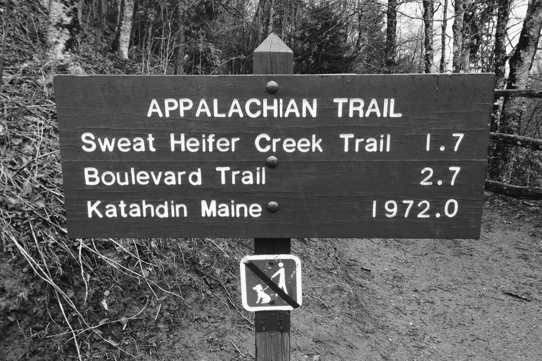
AT total mileage: 342.0

Time: 7 hours

--

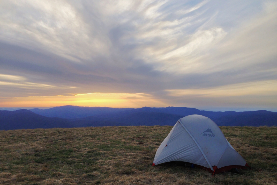
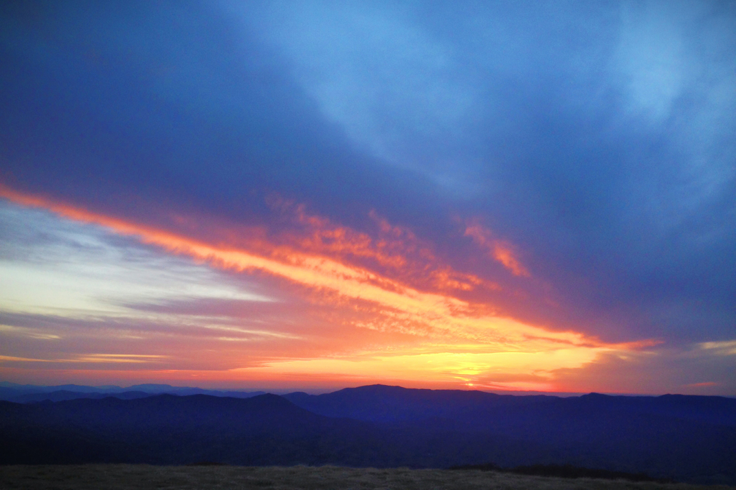
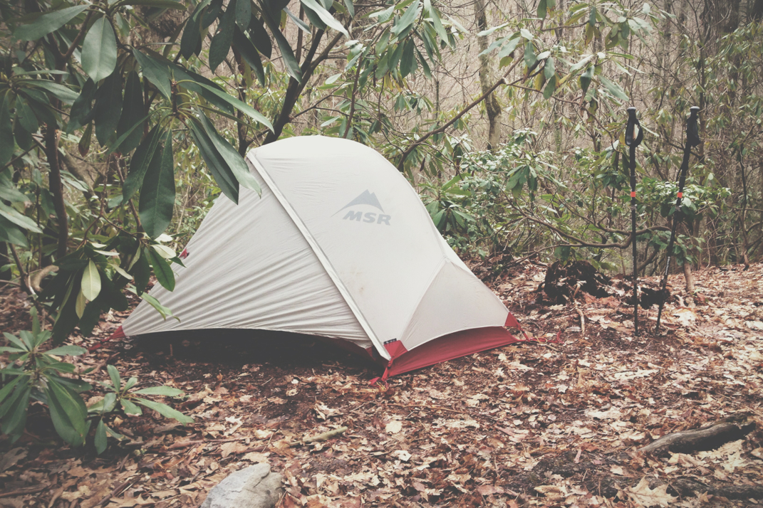
I woke up at 0200 this morning and after listening to the wind fiercely blow for 10 minutes, convinced myself to get out of my tent and photograph the stars. I can't honestly say whether or not this was a good idea, as the photos are on my dSLR (for anyone that wasn't aware, all photos posted on the blog are taken with my iPhone). Regardless, close your eyes and imagine a photo of an incredibly starry sky in the middle of the night, a low band of yellow light pollution from small sleepy towns in the distance, and a tent illuminated by the soft glow of my LED hiking headlamp. Can you see it?  Truthfully what you're envisioning is probably better than the photos I took, seeing I'm not hiking with my best camera, but I'll be interested to see how it turned out... 4 months from now when I go through the pictures. 

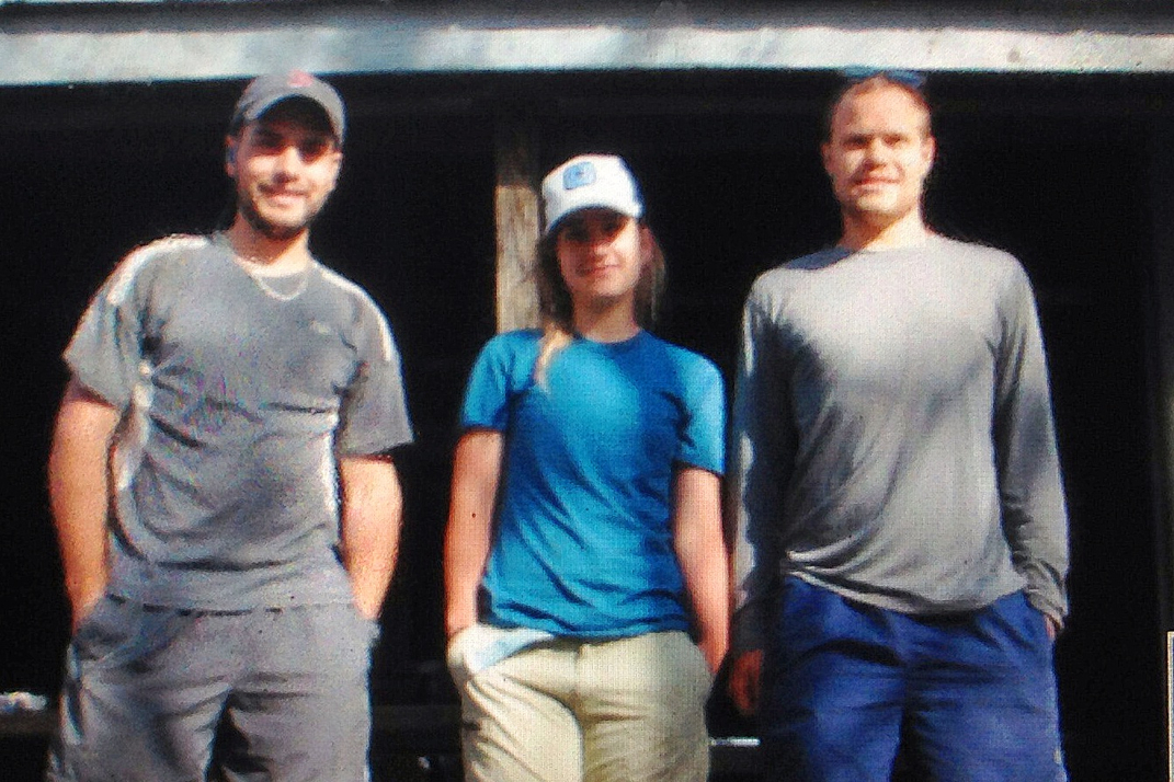
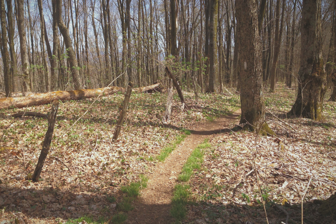
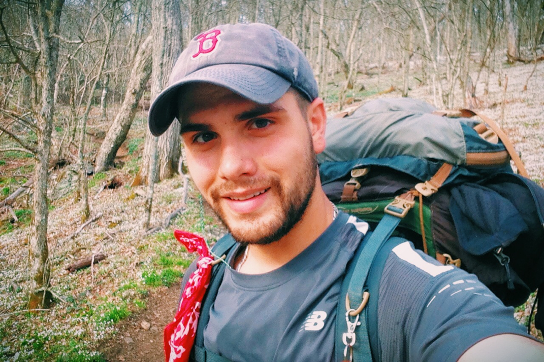
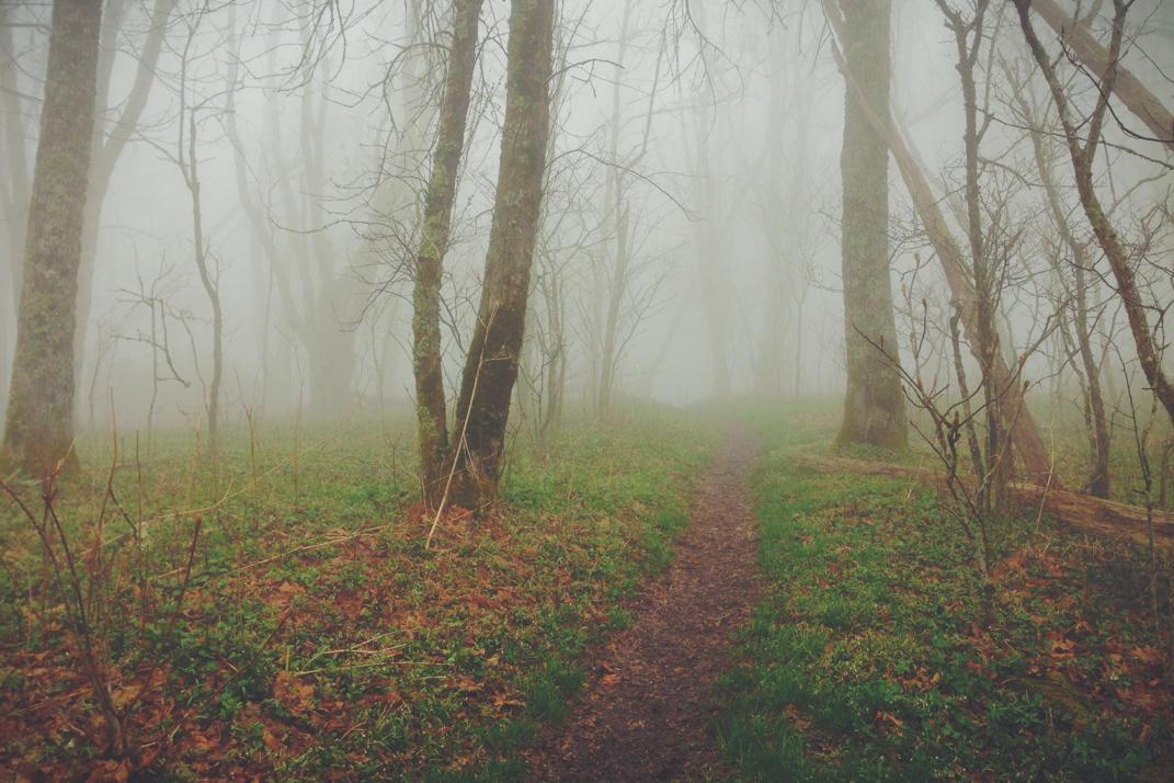
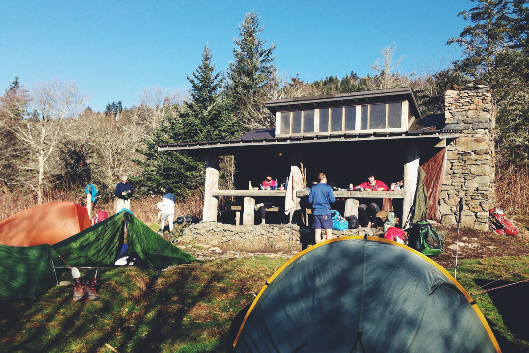
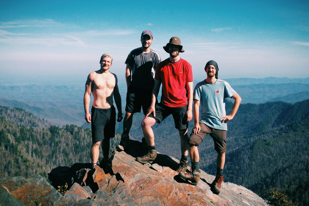
Rising again with the sun just before 7, Whitey and I hiked an easy mile down off the still windy bald and arrived at the next shelter where we had breakfast with Cheesepuff.  Apparently only 3 people had stayed at the shelter the night before, so it was extremely quiet as we sat there and ate. I left about 20 minutes after Cheesepuff, leaving Whitey to finish his food and pack up for the day. For whatever reason, this morning was hiked to the soundtrack of Pink Floyd. All of nature came out to join me walking, as butterflies fluttered alongside, hawks circled in the breeze above the trees, and I even saw a large owl sweep across in front of me between trees. The temperature slowly creeped up from the evening's chill, and before long I was sweating with the inclines the trail was passing over.  Knowing today's end goal was Erwin, TN, I had a good idea of what was in store. The first 13 or so miles included some good climbs, and the last 5 miles were a steady descent into the valley that comprises town. 

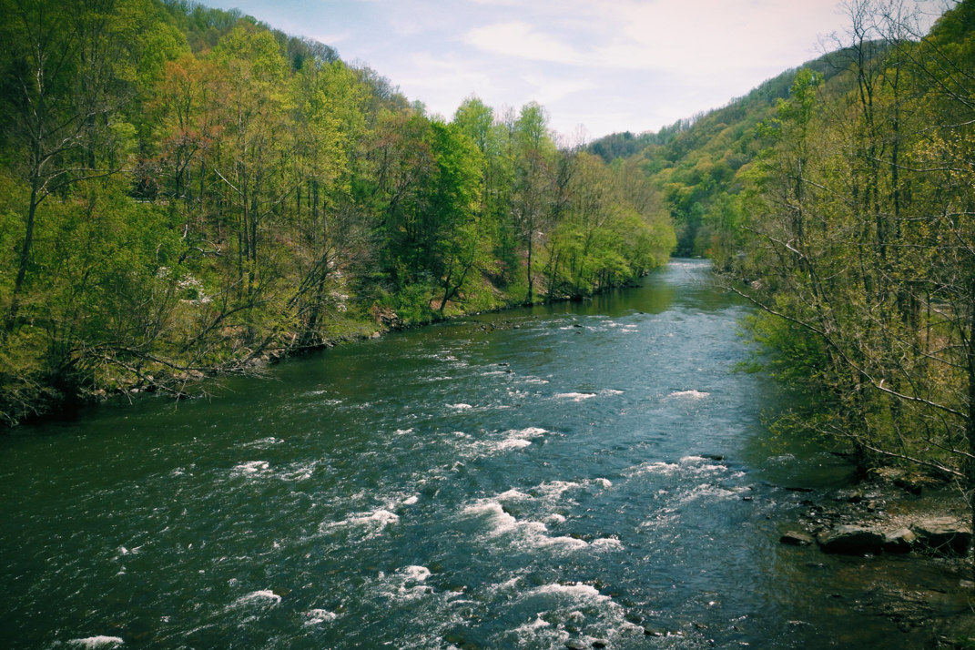
I stopped for a break at a cute little river, and debated soaking my feet. Although it was only noon, I was well aware that I'd been hiking downhill for a few miles now, and my toes were sore. I'll likely be replacing these New Balance 1210 trail runners with another set soon, and the next ones are a half size larger to hopefully accommodate expected growth in my feet. Most hikers will go up a half or even whole shoe size in the first few hundred miles of hiking. After finding my first blister (not bad for 341 miles) today, I'm hoping my new size 12 1/2 shoe will buy me some room in the toe box to avoid this problem going forward. Anyways, after snacking on a Pop-Tart and filtering some water at the river alongside Spivey Gap, I continued up into the mountainside. This was around noon, and temperatures had risen well into the high 80s, leaving me constantly sweating as I hiked deeper into the woods. After summiting the first crest, the trail began a meandering path through the woods and on towards the next shelter. There was a reminiscent feeling about the afternoon's hike, a hodgepodge of sensory stimulus occurring throughout a few hours time. 

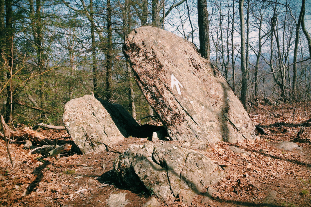
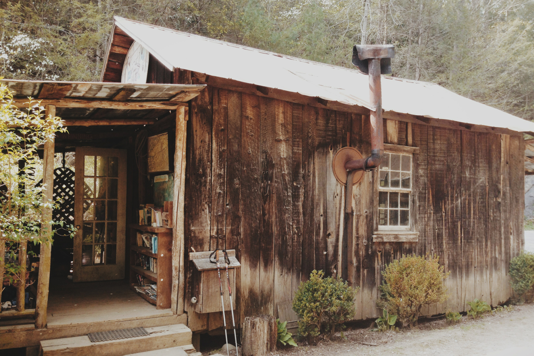
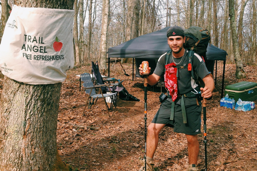
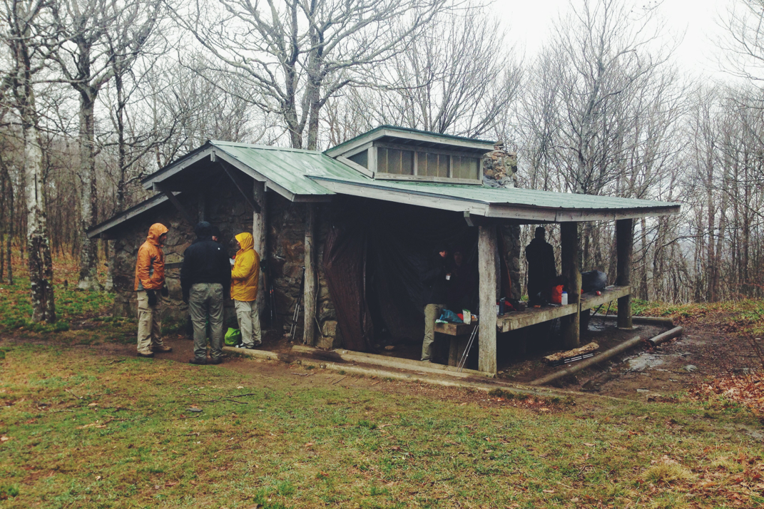
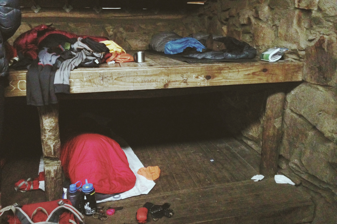
The smell of the forest reminded me of summers past, walking my since deceased dog Bailey through the local state park. There's a certain aroma that goes along with pine needles on the forest floor, warmed from the heat of the sun. It smells like summer, adventure, and Boy Scout camp all at once. This of course caused my mind to wander, and I delightfully followed the Appalachian Trail's white blazes at a quick pace of 3 mph to the next shelter.  The trail shelter at mile 335.7 is a work of art. The 3-sided, brown, cinderblock structure is affectionately known as the 'No Business' shelter.  You might think this is quite the strange name for a place hikers might stay at, until I inform you of the slogan written both under the shelter's sign as well as on the shelter log book: 'No Privy. No Water. No Business (being here)'... Sounds inviting, no?  Sure enough there is a large distance in front of us where shelters will not have privies. Also this particular shelter was more than half a mile from the nearest water supply, which happened to be southbound. No northbound hiker in their right mind would walk back in the direction they came for a mile round trip on a day just shy of 90 degrees. Luckily, I had stopped and filled up 2 liters, and was ready to finish the last 7 miles into town. I rested at the shelter for a half hour or so, snacking again and signing the log book 'I'd rather stay at a La Quinta than spend a night here.' Surprisingly, one of the nicer comments in comparison to others in the book, and hiker graffiti on the walls of the building. 

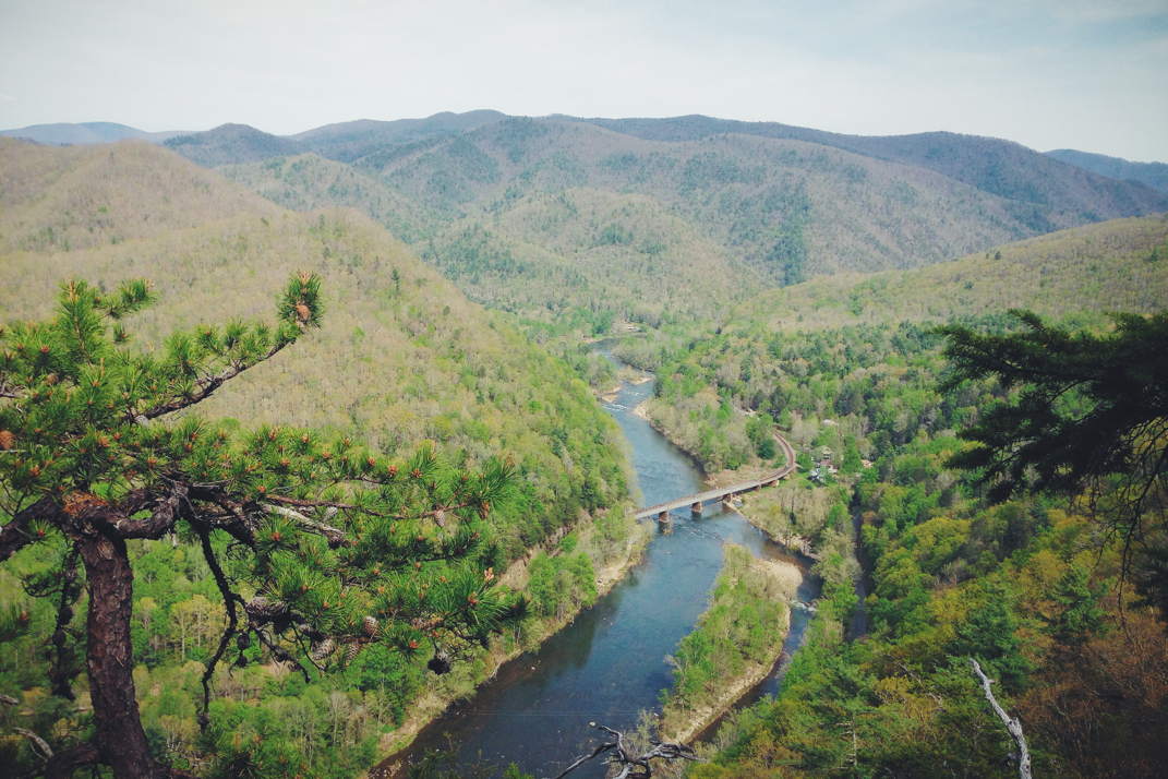
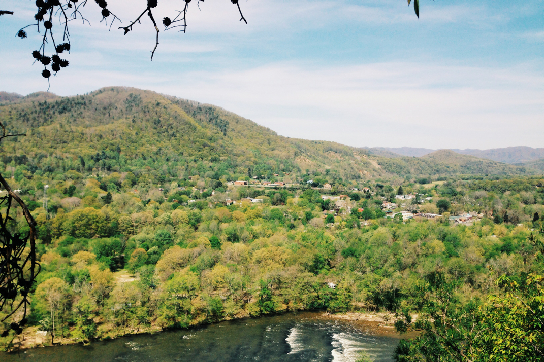
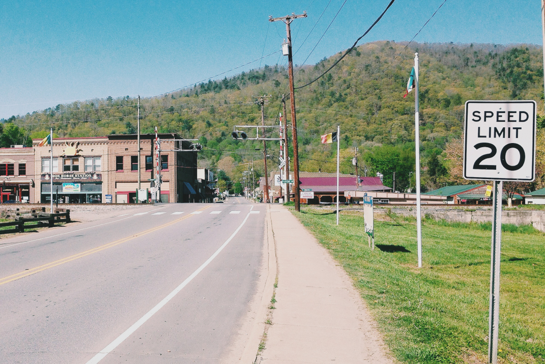
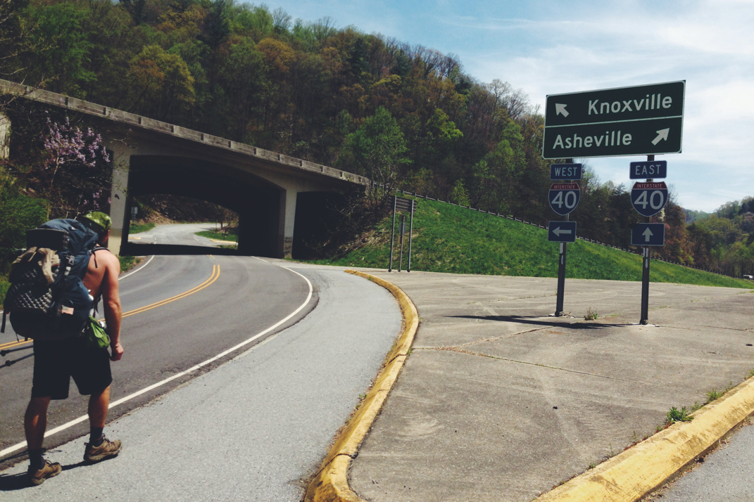
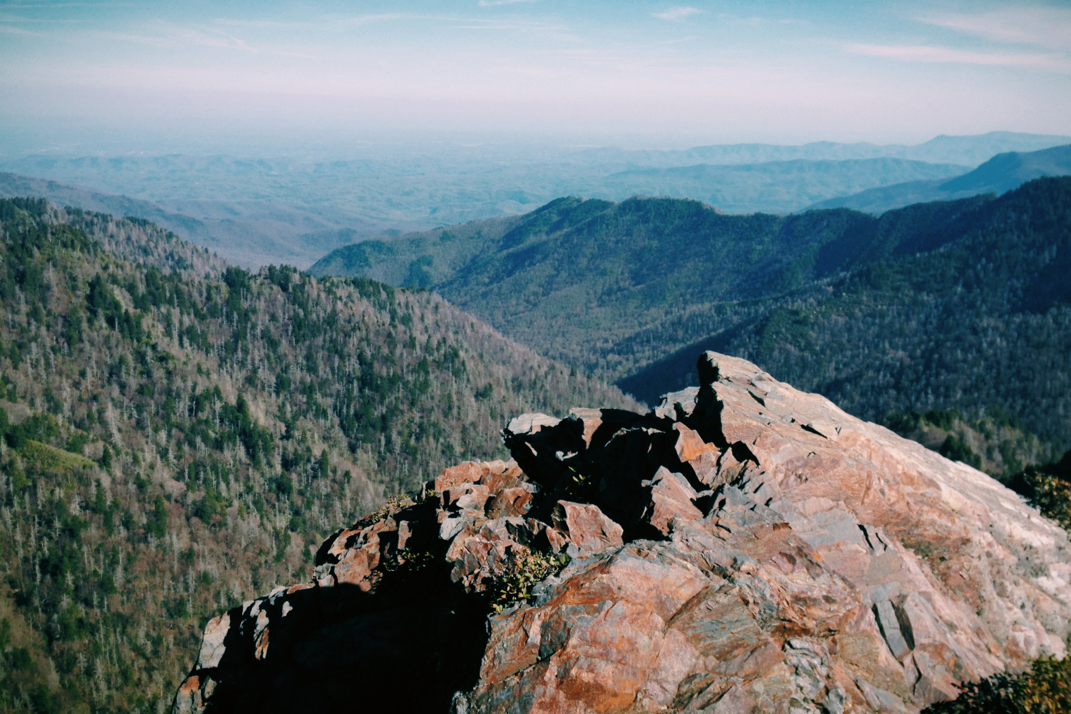
Out of No Business came a few more steady climbs before the descent into the valley. About a mile from the base of the trail I ran into two guys out with their sons, probably 12 years old or so, for a Sunday afternoon hike. From where they were standing there was a gorgeous vista over the town of Erwin and the train tracks that come through the valley. I ended up stopping to talk to the four of them for quite a while. They were extremely interested in my hike, my gear, mileage, and the like. It's really fun for me to talk to inquisitive people about the trail, especially when they live so close by and have such easy access to it.  After chatting for a while I said goodbye, and headed down the rest of the mountain to meet Whitey and figure out where we were spending the night. Our initial plan had been to head into town (the trail is 3.5 miles from 'downtown') in the morning, then hit the trail. We ended up hitchhiking to the grocery store before even getting camp set up, which will leave us in a position to get back into the woods first thing in the morning. 

You may be astonished about hitchhiking, you may not. I think this is reliant on your upbringing, geographic location, and generational belonging.  Let me tell you, this was a very... special... hitchhike. First by saying I am incredibly appreciative towards anyone willing to save me from walking into a town. We hopped into the back of a 20 year old white Suburban and made small talk with the sometimes incomprehensible, cigarette smoking, grey haired, kindhearted driver and his wife. Their son was also piled in next to us. Seeing as I could only understand one out of every three words this man spoke, regional dialect and all, I focused on observing my surroundings. All was well and good until I began noticing that he was living the High Life as he was driving, with two cold ones sitting open in the front seat cup holders. The combination of his talking, drinking, smoking, and friendly waving at every passing car was a quick reminder that I'm not in Kansas anymore. I clenched the seat belt a little tighter, just in case, and continued tuning in as best I could to his running commentary on the town as we drove to the grocery store. 

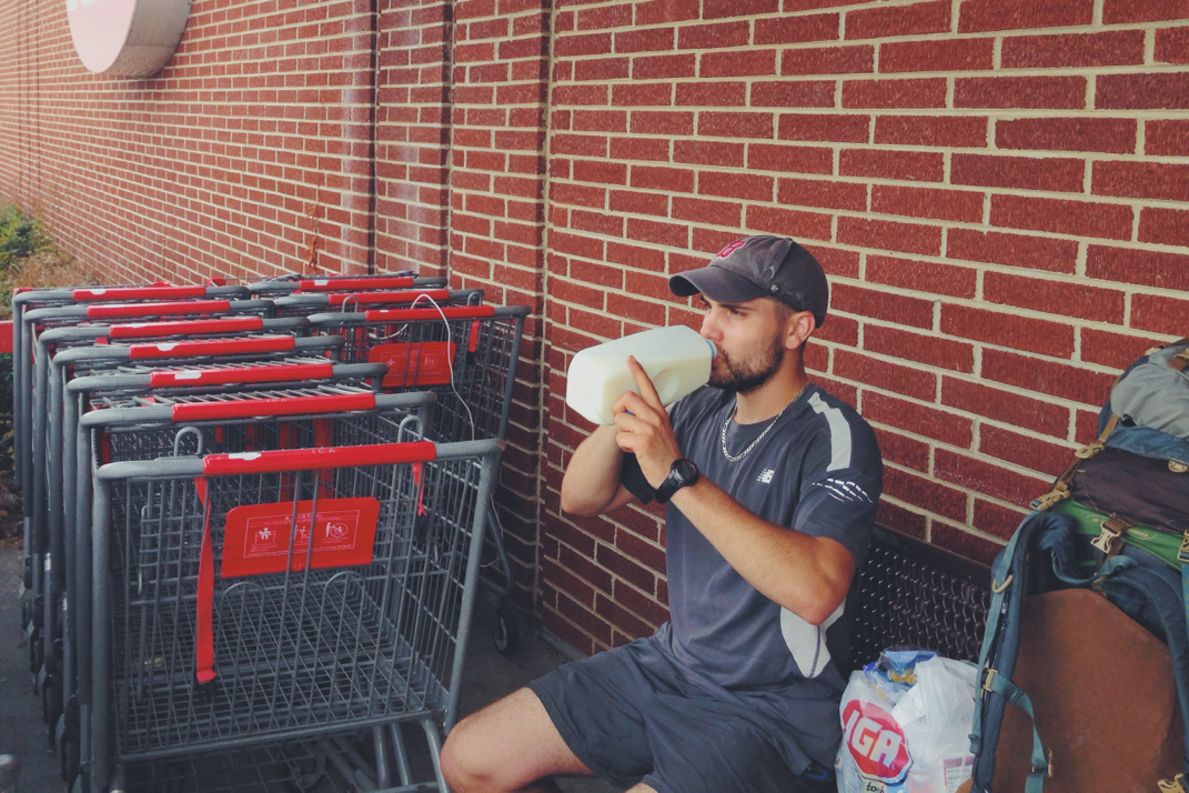
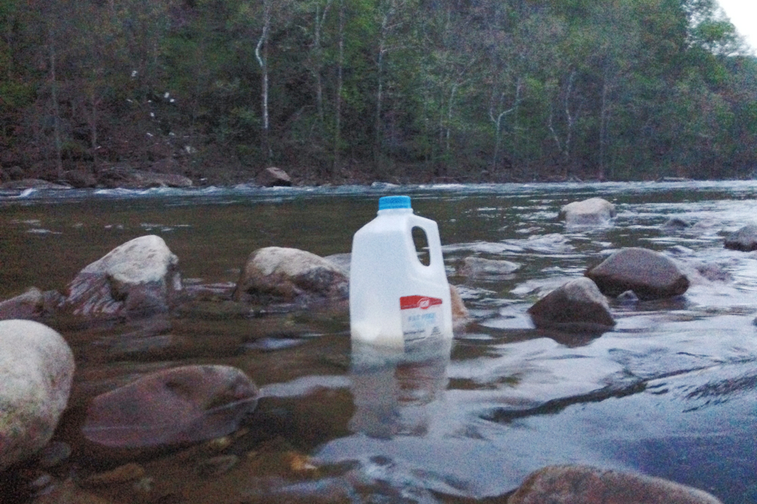
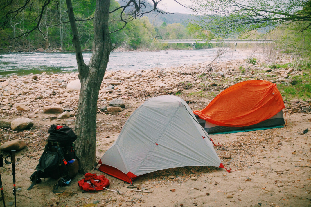
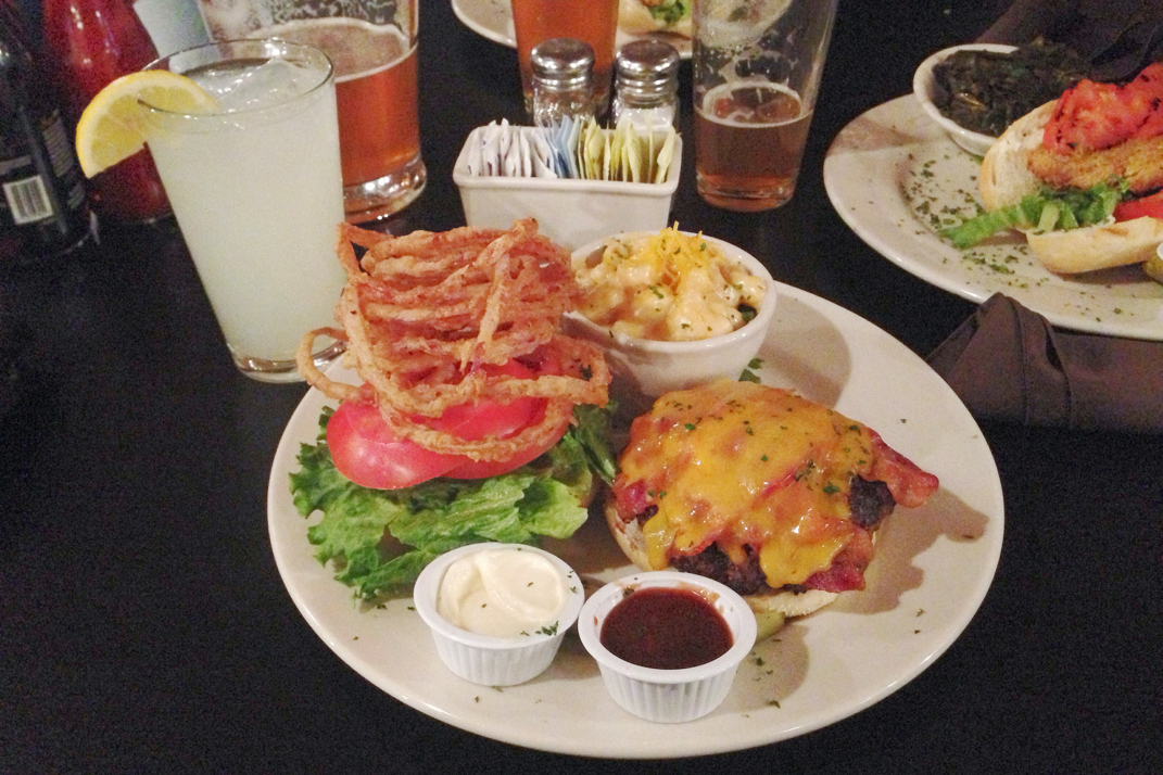
Shopping was quick and easy, and I changed up my purchases a little to try and save some weight. The goal here is to make it through the next 130 miles with this $22 food purchase, arriving in Damascus, VA next Monday. Along with necessary food, I also bought two red apples and a half gallon of skim milk, sitting outside the grocery store consuming the aforementioned items as I repacked my bag. Whitey and I quickly re-hitched back out of town with a younger guy and his girlfriend who couldn't believe that we'd walked from Georgia and were headed to Maine. It makes me wonder whether or not people are aware of the footpath that walks through the backyard of this town. We got dropped off on a road alongside the river, where the guy driving mentioned we could find plenty of places to camp hassle-free for the night. We set up camp and swam in the river as an attempt at bathing, then cooked dinner and got into the tents just as the water spiders began coming out across the sand for the night. I hate spiders. 

Weather report says thunder, lightning, and rain for the next three days. I'm not a meteorologist so I have no idea if this will be true or not, but I'm hoping we get a bit of a break. One rainy day here and there is fine, but back to back begins dampening the soul and spirit of a hiker. Regardless, tonight we sleep next to a rushing river, and face tomorrow as it comes, seeing as that's about all we can do. 

From the shores of the river and a symphony of aquatic white noise, I'm off to sleep.

Texaco 

Picture
Bad photo- Myself, Cheesepuff, Whitey
Picture
A.T. Rock
Picture
Erwin, TN
Picture
Dairy love
Picture
Chilled Milk
Picture
Down by the river
3 Comments

Somewhere Sunny & 75

4/26/2014

1 Comment


Day: 23

Day mileage: 18

AT total mileage: 323.9

Time: 8 hours

--

A joke: How do you confuse the hell out of a northbound Appalachian Trail hiker? 

..You have them hike south!

It took me only about 10 minutes of walking this morning to notice that something in my simple little world was horribly amiss.  Turns out I've become keenly aware of the fact that in the morning the sun is on my right, and in the afternoon it's on my left. This was apparently not applicable this morning. Upon leaving Flint Mountain Shelter, where I resided last night, the trail turns abruptly south, and stays in that orientation for a half-dozen miles or so. Seems rather counterproductive for an individual attempting to walk to Maine, no?  Alas, it eventually returned to the proper orientation and all was right with the world again. 

After a late (0900) start, the first few miles flew by. Since I'm now walking alone for the majority of my day (for those who have asked, Crusoe and I are hiking separately after he took a second day off in Hot Springs), I'm apparently exceptionally quiet. There was one point where I felt I was being watched, and looked up to see a small group of deer standing in the woods around me. They were exceptionally attentive to my movement but remained still, eyes glued to me, as I snapped a few photos with my dSLR. For a minute or two we just watched each other, some sort of silent interspecies communication taking place, before I moved on down the trail and they simply watched me go. It's the closest I've been to a wild animal thus far on my hike, and was a peaceful & memorable experience. I exited the woods a mile later, crossing a small state road and conversing with hikers Osprey and Landslide. Both hikers were awaiting a shuttle to a local hostel and as we made small talk, Osprey gave me some dehydrated raspberries. Words cannot describe how delightful these little things were. I thanked him profusely, said goodbye to Landslide, and climbed over a small ladder into a fenced in field where the Appalachian Trail continued on. 

The next two hours were spent climbing an unnamed mountain, fair and relatively basic switchbacks winding past some beautiful waterfalls and lush green fields. I decided to spend the morning without my iPod so I was singing to myself, often only getting two or three lines of a song out before I'd forget the rest and just repeat what I'd already sang. As I've said before, pressing issues in a hiker's life. There was also a while on this climb where I stopped and watched a bug. I realize this sounds completely abnormal, but there was something about the blue color of it's shell that caught my attention enough to stop my walking, and I simply watched it make its busy way down the dirt trail. I wondered what he was up to, and if it had a to-do list for the day, as he certainly seemed to be on a mission.  After another half hour or so, I summited the mountain and was joined by Cheesepuff and Whitey as we made our way to the next shelter to stop for lunch.  We were at the Hogback Ridge Shelter for close to an hour just conversing with other hikers and soaking up the sun. Today's temperatures creeped up to the mid-70s with a flawlessly clear sky... A perfect day for hiking. 

I filled up my water bottle before leaving the shelter, and continued down a few miles of trail before the next road crossing. One of my favorite parts of hiking this Tennessee/North Carolina state line since exiting the Smokies has been the barbed wire fences. It seems we're constantly between old farmland property lines, with rickety and rusty fence lines running over hills and through fields. I often wonder how long ago they were actually used for keeping livestock in, or neighbors out. Some fence posts are in decent condition, while others have been claimed back by Mother Nature. The trail meandered down into Sam's Gap crossing under the highway at yet another NC/TN state line. From there an afternoon of climbing began, the end of which kicked my butt around the block and back. After 5 or so miles of gaining elevation, Cheesepuff, Whitey, and myself came across a great campsite between two rivers. We sat for a while debating staying there, but ultimately I put my pack back on and decided to keep hiking. It just feels wrong to stop even at 1700hrs, even with 15 miles hiked, all the while knowing there's 3 hours of sunlight left. My task here is to hike, and while there's light left to do it, I'd rather be hiking. 

Ultimately, the last 3 miles kicked my butt around the block and back. It was a constantly steep climb, which after 7 hours of hiking can take a toll. Regardless, as a group we summited the mountain called Big Bald, and decided it'd be an interesting place to set up camp. Not everyday do you get to camp out at the bald summit of a 5,616' mountain. There are 3 other hikers here with me, Whitey, JPEG, and Soleil, and with the wind howling we watched an absolutely gorgeous sunset. Everyone retired to their tents and my dinner was cooked inside my vestibule of the tent. The wind is still gusting, but I'm hoping that the sunrise in the morning will make it all worth while. Sometimes shelters just don't make things exciting enough, and things need to be shaken up a bit. 

Tomorrow I'll walk another 16-17 miles, aiming to be nearby to Erwin, TN for Monday morning to get some supplies before continuing on. For now, I'll listen to a combination of my Billie Holiday playlist, and the howling wind.  Quite the Saturday night, am I right?!

Onward and upward, per usual. 

Texaco

Picture
Oh Deer!
Picture
Rolling Fields
Picture
Picture
Barbed wire property lines
Picture
Selfie!
Picture
Camp on the Bald
Picture
Sunset
1 Comment

Mile 300

4/26/2014

0 Comments


Day: 22

Day mileage: 17.5

AT total mileage: 306.1

Time: 8 hours

--

Highlights of today: 300th trail mile, trail magic, summiting Big Butt Mountain, and the sun appearing just before my arrival at the shelter. 

Rewind to 0800 this morning, munching on my breakfast bagel with peanut butter, breaking down camp. No sooner did I pull the straps on my backpack then the sky began to trickle down raindrops. Truthfully, phenomenal timing, so I wasn't all that frustrated. Cheesepuff, Whitey, and I headed out onto the road to a small store called 'Mom's' and advertised to hikers for snacks and drinks. They had been closed upon our arrival the night before, but we saw a car pull in before leaving our campsite and decided (excitedly) to stop by for some ice cream before hitting the trail. Only on the Appalachian Trail (and cycling cross country) is ice cream acceptable for a second-round breakfast. 

The building that's home to 'Mom's' honestly appears as if it should be demolished. Windows are covered with plexiglass to hide holes in glass from baseballs, it's dirty, and half of the store is a pile of junk literally just tossed aside. I was in love.  I'd made speculations yesterday upon seeing it for the first time that in its previous life the building was a gas station on the state line. I made some easy conversation with Dwayne, the 62 year old store owner, about his vintage cigarette advertisements just to get my foot in the door before steering the conversation where I really wanted it: the history of the building. Those of you who know me personally know I'm a huge fan of vintage petroleum history & advertising/signage, hence my trail name being Texaco.  Dwayne's face lit up when I asked him about the building's past. Apparently in the 60s it was his dad's gas and service station, originally branded as an Esso station. 

Quick history lesson for the sake of informing you, Esso and Mobil were both owned by Standard Oil Company. The government had intervened and expressed concern with Standard's size, so they split themselves. Esso was run out of New Jersey, named this way due to it's sounding like 'S.O.', aka an abbreviated Standard Oil. Mobil was run from New York, and was often advertised as a 'SOCONY' company, or Standard Oil Company Of New York.

End gasoline history lesson. Anyways, Dwayne and I spoke for a while about the signage, the time his dad was being bribed to turn over to a Sinclair station, and all of the old station stuff he still owns. I gave him a business card and told him to call me if he ever wants to part with his signs, one of which apparently is an original 1950s 48" Coca-Cola button. This was pretty much the single most exciting conversation I've had in a while and I can truthfully say I believe he was equally thrilled to have someone, especially from a younger generation, who was so appreciative of his family's business and his memorabilia 'hoarding'. 

At 0900 I was on the trail, beginning what was a long elevation climb over the course of 8 miles or so. The rain really kicked in with downpours as I was hiking up, and when I stopped to put my Goretex rain jacket on, my backpack's right shoulder strap broke at the point where it mounts to the bag. Upon hurried closer inspection (due to the monsoon of water falling from the sky and all) I saw that the mounting hole had cracked allowing the strap to fall out. I rushed to get the strap situated, although now it's in a different position than the other side. It's not perfect, but it will work. I'm not sure if I'll pursue this issue further just yet. I stopped at the next shelter to have a bite to eat and sign the journal (every shelter has a log book for hikers to write in) and I caught up with Cheesepuff and Whitey, as well as a few others who were hiding from the rain. I drank my filtered water, and refilled my Platypus with another 2 liters from a spring. After a nice break, and with the sun back out, I continued up the same climb I had started two hours earlier. 

Upon summiting the unnamed mountain, the trail a began a wonderful ridgeline walk for a handful of miles. The rain came and went more than a few times, making the trail a muddy and slippery mess. This was probably the worst condition the trail has been in since I left Georgia 3 weeks ago, and I almost fell more than a few times throughout the day thanks to the mud and wet rocks. I credit my trekking poles with saving my butt, and will again say aloud that I don't get how people hike without them. An hour or so into the less strenuous ridge walk, I came across a campsite with a creek where someone had littered cases of aluminum soda cans on the side of the trail. Upon closer inspection, this was actually a great moment of trail magic, where a local left two dozen soda cans (unopened! worry not!) in a pool of the river to keep them cold. I gleefully took a Sprite and headed on my way. The trail magic lately has been abundant, and has gotten me thinking about how I'll give back in the same regard when I finish the trail. 

With the rain subdued for a while, the trail came across a rather interesting sign. The carved wood presented separate trails: one a more sheltered option for 'bad weather', and a second trail that was a very exposed ridge line over the summits of a few mountains. Even though we'd had rough weather all day, there was no doubt in my mind about continuing onto the exposed trail. This proved to be a fascinating decision, with the rain quickly picking up and winds gusting fast enough to move me around as I hand-over-hand climbed up some exceptionally slippery rocks, visibility no more than 20 feet, and heavier fog moving in. What's life without adventure? I didn't come here to take the sheltered trail, after all. I stopped in the pouring rain to take a photo or two of the complete lack of views from the summit, and hurriedly navigated my way back down under the cover of trees.

Passing Jerry's Cabin Shelter, and ultimately the 300th mile mark of the Appalachian Trail, the path climbed back up to more of these incredibly eerie fields filled with fog. I tried to photograph a hiker and his dog, but no sooner would I stop to get the camera out then he'd disappear into fog even 30 or so feet away from me.  These scenes are beautiful, and although the photographs may seem redundant, each occurrence truly is its own experience. After climbing up to the anticlimactic summit of Big Butt Mountain (there was no sign to photograph for you, but this mountains name will live in hiker infamy along with Georgia's Chunky Gal Trail) the trail turned sharp right and followed an old dirt fire trail for almost two miles. I was alone, and loudly singing along to Skynard's 'Sweet Home Alabama' as I walked along... I can only imagine how harshly the squirrels judged me.  Wide enough to allow cars to travel, the road was very muddy and at times frustrating to navigate. Not knowing where the trail turned back into the woods and a lack of markings left me second guessing how far I'd walked for nearly 45 minutes. Eventually I came across the grave site I'd known to expect, and the trail turned back to the 18" wide dirt path I'm used to.  

There are 3 tomb stones in a field at the end of this dirt road. Two are exceptionally old (not by the standards of 'old' headstones in New England) but date back to the Civil War. These identical headstones belong to the Shelton brothers, Union soldiers visiting their families in the Confederacy, who were killed here. The third is for a 13 year old boy who was killed at the same spot in 1863. His headstone is newer, and is marked as installed by his descended family members. Flags and flowers are present, and this is a fascinating piece of history to be brought by. 

Around the time I left the graves, the sun started toying with the idea of coming out. It wasn't until I crested a small hill, suddenly exposed to a sweeping view of the valley, that the warmth of the sun was out in full force. It was another 3 miles to the shelter, but the time went by quickly and I arrived around 1700hrs. 

I set up camp and ate dinner with Cheesepuff and Whitey, getting into bed before sunset as the wind picked up and temperatures dropped. A little music, rereading letters from home, and a warm sleeping bag will allow me to nod off easily. Tomorrow's supposed to be nearly 80 degrees, and the elevation maps show about 2,500' of climbing between two summits which should get my heart rate up a bit. My plan is to do 19 miles and spend another night at a shelter in my tent. 

From the dark and starry skies in the middle of nowhere, goodnight. 

Picture
Mom's old Esso Station
Picture
Picture
Picture
Civil War Headstones
Picture
My corner of the world
0 Comments

Back Into The Woods

4/26/2014

0 Comments

 
Day: 21
Day mileage: 15
AT total mileage: 288.60
Time: 7 hours
--


Sleeping in Hot Springs was tough. I was on the floor in my sleeping bag which at this point feels normal, but the drone of trucks engine braking through town is something I'm not used to at all. As such, I spent almost all night with headphones in, quietly listening to John Mayer to help me fall/stay asleep. 
I woke up officially at just before 9 AM, and hopped in the shower for one more heavenly hot water session before packing up for the day. Aiming to use as much of the shampoo/conditioner that I purchased as possible, I began an old trick I've heard for non-itchy beard growth of shampooing my beard. We'll see how that works out, haha. Crusoe, who intended to spend the day in town, was awake when I got out of the shower. We ate a normal trail breakfast instead of going to the diner again, as Nero days can really add up in cost. At 10:55 we left the motel & headed down Main Street where I stopped at the post office & ATM before crossing the railroad tracks and bridge out of town. Immediately after the bridge the A.T. hops the guard rail and turns down into the woods. We walked along the river for half a mile or so before the pathway took a sharp left turn and headed up into the mountains. It was a steep climb out of the valley that had many muscles in my legs burning before long. The extra weight of new food is immediately noticeable and somewhat uncomfortable. 
I stopped a few times on the way up that first mountain, at one point meeting Landslide, a 22 year old hiker from North Dakota. She and I were talking when she pointed out a rather large black snake sunning himself on a fallen tree. This is only the second snake I've seen, but was much larger than the first. I continued on ahead of her, and at the peak of the first mountain I came across Whitey in a small campsite, who had stopped to eat some of his newly purchased food to cut down on weight. I followed suite, eating a few things and leaving some Pop-Tart trail magic for others. Every time after a resupply there's a day or two where the pack needs to be adjusted for new weight. This is very frustrating, and I stopped a handful of times throughout the day to move things around inside. I split off the trail at one point to visit another fire tower, speaking with a group of French hikers who said in broken English that the view was '50/50'. I went up anyways, and enjoyed panoramic scenery of the mountains, Hot Springs, and a rather large cell tower. 
Around 4 I came across the Spring Mountain Shelter where most people were spending the night. It was 11 miles out of town and at the top of a climb that many apparently got winded on after their time off the day before. I wasn't comfortable with only putting in 11 miles on the trail, and I convinced Whitey and Cheesepuff to join me for another 4 miles to make it to a campsite I'd seen on another map. Landslide came along as well, and we pulled into the campsite around 5:30. After getting almost completely set up, Whitey came back from getting water and announced there was a larger campsite nearby down the trail that would fit us more comfortably. Due to the proximity and ultimately laziness, I decided it'd be a good idea just to carry my assembled tent down the trail. This was quite the sight to see apparently, and Landslide captured a few photos which she'll send me to post. 
Camp is a level place with room for a half dozen tents but no water. We wandered out to the state road that's 1,000' away or so, and asked a couple nearby if we could use their spigot; their response was simply 'round back'. We built a small campfire and ate dinner. I changed things up a bit by adding broccoli and cheddar instant rice to a large tortilla and enjoying that. Hopped into bed around 2120hrs and caught up on the last 4 days of my shortly written journal entries, then followed up by writing this. 


Scattered thunderstorms are slated for tomorrow, but we'll see. Mileage wise I'm looking at 18 for tomorrow, as I'm interested in keeping with higher mileage going forward and also rather enjoy the time in the rain. 
Literally posting from another point on the North Carolina/Tennessee state line, where every pick-up truck needs a muffler and subsequently sounds like an 18-wheeler... I hope you're all doing well!
Picture
Looking back at Hot Springs
Picture
Picture
Dirt Road Trail
Picture
Picture
No Hunting, Dogs, or Guns - Except during man hunts
Picture
Beautiful trail day
0 Comments

Nero Day - Hot Springs, NC

4/24/2014

2 Comments

 
Day: 20

Day mileage: 3.9

AT total mileage: 273.9

Time: 1.3 hours

--


Greetings from Hot Springs, North Carolina!


A quick early morning walk through the remainder of yesterday's lower mountain ridge dropped the Appalachian Trail right down Main Street of the most easily imaginable southern town I've ever seen. A place once famous for its naturally hot mineral springs, popularity with tourists rose and fell a few times over the last century and a half. Main Street itself is only about 1/2 a mile long, and consists of two dozen brick buildings lining the wide road with businesses like a 60 year old hardware store, a library, diner, two taverns, a 'hiker ministry', hiking supplies outfitter, laundromat, and ice cream parlor. On the other side of the train tracks headed out of town is the grand entrance to the historic World Famous Hot Springs Resort. I'd imagine that the town was once thriving with tourism, and has gone the way of the Historic Route 66, with new highways and more modern amenities stealing the spotlight away. If you've seen Pixar's film 'Cars', imagine Radiator Springs. Stuck in the 21st century, this not-even-one-traffic-light-town seems to enjoy the constant flow of hikers coming through and keeping businesses alive. 


Regardless, it's a cute place, nestled into the Appalachians of western North Carolina.  Crusoe, Whitey, Cheesepuff, and I ate a delicious breakfast at the Smoky Mountain Diner along with a dozen other hikers and some locals. Pricing was absolutely fair & my pancakes were delicious. We strolled Main St. looking for a cheap place to stay, and ended up at the Alpine Court motel for $60/night. The two-queen bed rooms are still cleaned with then same shag-carpet destined champagne colored Electro-Lux vacuum cleaner that probably rolled off the production line the same decade the motel was built.  Split four ways it's absolutely reasonable.  My objectives for time in town were to resupply food, charge electronics, get a hair cut, and do laundry. Unfortunately there's no cell service here so I am left at the mercy of Wi-Fi hotspots which are few & far between. First order of business after dropping bags off at the motel was a haircut. I stopped by the 'hiker ministry', a lovely log-cabin style building with a sign boasting free snacks, backpack babysitting, Wi-Fi, and coffee. It's owned by a wonderful woman in her late 40s who happily caters to hikers needs, hunger, and questions, baking muffins & cookies while hearing stories from the trail told by hikers comfortably plopped on the many couches. My question for her was simple- where to get my hair cut- but I wasn't answered until I had a chocolate chip cookie in hand, and a photograph taken with my trail name and start date, to add to her Facebook page so hikers can see where their friends are. Come to find out she moves her operation to the New Jersey segment of the trail during June, and Maine during August & September. I don't know what she did or does for a living to afford this, but she's a wonderfully caring woman who was lovely to talk to. She directed me down the street to a small salon run out of a double wide trailer. 


Normally, walking into a place of business that can be hooked up to a tractor trailer cab and rolled away would cause me to hesitate, but seeing as I was in Hot Springs, I didn't miss a beat. I entered and met Jewel, the sister of the owner of the salon. She admitted that she didn't regularly do men's hair cuts, but that she would 'give it a go'. When I told her I usually cut my hair myself, she handed me the clippers and sat me down in the barber chair, keeping conversation as I trimmed. We spoke for a good 20 minutes or so, with me laughing as I've never had anyone watch me cut my hair before. She got quite a kick out of how I do it, double checking my own work before calling it a wrap. Thanks to the great conversation and laugh she charged me nothing for the use of the trimmers and sent me on my way, wishing me good luck and safe travels.  The next stop was Dollar General to pick up some cheap shampoo before showering. There are few words to describe how good a hot shower feels after a week of high-intensity activity in often humid, hot, and dusty mountains. Standing there letting water pour over me was heavenly, and I did my best to not take note of how much dirt and grime was flowing down the drain. 3 shampooings and individual detailing of all 10 soapy toes later, I hopped out and put on my 'town' clothes. This fashion statement is comprised of a light long sleeve New Balance shirt, NB underwear, and a new-to-me pair of gym shorts I got for $1 at the 'thrift shop' in the gas station next to the motel. How often in life do you get to buy clothes from a Salvation Army type pile in a gas station?!


Whitey, Crusoe, Cheese, and I shared a $2 bottle of detergent and each did our load of laundry at the laundromat. While mine was running I walked to the hiking outfitter, as my water filter broke a few days ago. Where the filter joins the reservoir of 'dirty' water, the o-ring had come loose and was spilling unfiltered water into my bottle. Explaining this to the guy at the shop, he returned with a zip-loc baggie of new o-rings and explained that it's a common thing. New o-ring at zero cost to me, and now my filter's working again. The rest of the afternoon went by quickly, and food shopping at the Dollar General netted me two weeks of food for $40. We retreated to the motel where we watched The Big Lebowski followed by the Red Sox playing the Yankees, snacking on trail foods and enjoying some cold beers. Around 2030hrs we left for the Iron Horse Station, a local restaurant establishment founded in 1865. The history of this place must be incredible, with photos showing it operating in the same building under the same name almost 150 years ago. When we walked in we were greeted by loud 'hoorays!' and were delighted to see a long table filled with our friends from the Connected Warriors program. They had finished their section hike and were heading back for Annapolis in the morning. Each and every one of them gave us high-fives and shook our hands as we were seated. Dinner was a delicious burger, and I stuck with free refills of lemonade instead of a beer. 


We returned to the motel just before 10, and I routinely inflated my sleeping bag air mattress with the same 21 deep breaths that I do every night. Whitey and Crusoe will get the beds, and I'll crash on the floor. Cheesepuff left for the night to see her dad who is in NC with business, and will be back on the trail tomorrow. Due to some ankle pains and swelling, I think Crusoe will stay in town another day or two, so tomorrow I'll head out on the trail without him for the first time since A.T. mile 10. Crazy to think that in two weeks we've walked 263 miles together, and just today exchanged phone numbers for the first time. I'm sure we'll meet up again down the trail. It's been fun to inform people we only met at Springer, as it seems most hikers think we've known each other since elementary years. 


Days in town are strange, and tug at different emotions. It's hard to go from modern amenities back to the woods, and sometimes makes me miss home. At the same time, however, there's something so much more freeing about being alone with a dozen or so hikers in your shelter-to-shelter group, and thousands of acres of trees. Tomorrow morning I'll follow the A.T. logo that's literally stamped into the sidewalk down Main Street, and will leave Hot Springs to head back into the woods. The next big thing in my sights is Damascus, the first town over the Virginia state line. It'll take just under two weeks to get there, but as far as milestones go, Damascus is a big one. Until then I'll just keep walking, because that's what I do. 


Onward and upward, ascend and descend, rinse and repeat. 


Texaco

Picture
Picture
Picture
2 Comments

Free As I'll Ever Be

4/23/2014

4 Comments

 
Day: 19
Day mileage: 23
AT total mileage: 270.5
Time: 10.5 hours
--
Today has been my favorite day on the trail thus far, for a multitude of reasons, which I'll cover at the end of my soliloquy. 


I woke up a few times throughout the night, lying under the open sky, watching stars flicker from millions of miles away. This is an experience that isn't easily achieved from the Greater Boston area, so I'm making every use of the lack of light pollution. By going 'cowboy', breaking down camp is easier. Unavoidable contact from the morning sun makes sure of an early rising, and after a blueberry bagel with the last of my peach preserves, Crusoe and I hit the trail. It took less than a mile of hiking to start toying with the idea of hiking the 26 miles to Hot Springs, NC today. We settled on attempting the 23 mile trek to a shelter that's then only 3 miles from town, making Main Street easily accessible Wednesday morning. In theory, this was an exciting, challenging, probably attainable goal. 
After some serious uphill climbing, we emerged into a totally new Appalachian Trail from anything I've experienced yet. The trail abruptly exists the woods and begins traipsing through rolling grass fields. I can only assume this is private land, but for a few miles we followed fence posts with the guiding White Blaze of the A.T. painted on them. As we hiked, thick cold fog moved in and began flying by us, hugging the curves of the hills and creating some incredible views as we moved along. As we exited the foggy field, we entered another Enchanted Forest of tall barren trees surrounded with perfectly still and thick fog. I kid you not, these sights are chill-inducing. They look quite eerie. What makes eerie hiking better? Finding a zip lock bag, fashioned with a blue gift bow, with freshly baked sugar cookies sitting at the base of a tree. Crusoe and I each enjoyed a cookie before heading on. We stopped for lunch at 11:30 with 9 miles already under our belt. Rain was steady at this point, and we ate with hikers Hungry and Bartender, both of whom are finishing hikes they began in June of 2014 at Katahdin in Maine before being kicked off the trail due to the harsh winter. They'll be finishing their hikes in a few short weeks. Whitey also arrived, and we spoke for a while before Crusoe and I headed back onto the trail, recognizing the 14 miles we still had to walk before getting to our desired shelter. By our quick pace we covered 3.5 miles in just under an hour, coming into a place called Lemon Gap, where we met a few guys setting up a tarp by their pick-up truck. I'm a pretty big conversationalist, so it didn't take long before we were invited to hang out and enjoy some soda and fruit as they fired up their charcoal grill for burgers and hot dogs. Being the calorie burning hikers that we are, we graciously accepted and got a fire pit fire going while they cooked.


It's important to me that I take a minute to talk about these guys. The pick-up truck they drove was vinyl labeled with the words 'Connected Warriors Foundation'. Further conversation would inform us that it's a non-profit organization based in Annapolis that works to get wounded veterans involved in social groups to help with social anxiety and self-seclusion often experienced with PTSD. The three guys offering us food were all veterans working with Connected Warriors, and were acting as "Sherpas" (their word) for a group of 7 wounded veterans who were doing a multi-day section hike of the Appalachian Trail. The organization is sponsored by groups like Google and Amazon as well as many others, who allow these soldiers to be transported around the country to participate in exciting group adventures like this one at no out-of-pocket cost to them.  Not only were they cooking for their own group, adding some edible excitement to their rainy hiking day, but they also went out of their way to make us comfortable and plentifully fed.  Words cannot describe how amazing this group of people are. Trail magic is one thing, and an incredible aspect of the Appalachian Trail... But an outside group to take us in during a rain storm, feed us, give us cold drinks, chips, veggies, and warm our spirits... This is something I will not soon forget. If you're the type who donates to great causes, I'd encourage you to look at their website if it interests you: www.ConnectedWarrior.org - also, they got some photos of me so I may be on their Facebook page... That in itself is interesting, haha. 
We hung out with these soldiers for close to an hour before deciding we needed to push on if we had any intention of making it the remaining 12 miles before dark. We departed Lemon Gap at 1500hrs, and climbed. The afternoon would be comprised of two huge ascents, two huge descents, and some typically inconsistent up-downs through a low mountain range. Crusoe and I climbed these mountains, disappearing into more incredibly thick fog, and emerged at summits that were unlike anything I've ever seen. Again following blazed fence posts, we walked by low bushes covered with thousands of spiderwebs glistening with beads of moisture from the thick moving fog. Closer inspection would show small black and red spiders with small bugs captive in their webs. We re-entered the forest on the other side of the peak, and descended to a small gap hidden in tall pine trees before climbing back out to ascend the 1,000' to the peak of Bluff Mountain. Again the fog and rain got thicker the higher we climbed, until we summited and visibility of any sort was almost impossible. It was truly a sight to see. Trunks of trees disappeared 15 or so feet off the ground, trails seemed to vanish in front of us, and the wind still whipped the fog through at incredible speeds. We didn't linger before beginning our 4-mile, 2,600 foot descent. Crusoe and I didn't spend much time talking today, instead migrating off to our own little worlds with music playing through our own sets of headphones.  Despite this minor disconnect, we still seemed to appreciate each other's awe at the scenery we passed. 


Upon reaching the bottom of the mountain, we climbed from a gap back to a smaller, meandering mountain ridge that would take us the remaining 4 miles to our shelter. At this point, 19 miles and many solid climbs into the day, it was depressing to see we still had so many miles left. Regardless, we hiked on, arriving at Deer Park Mountain shelter at 1930hrs. As my good friend Keegan would quotably say, referring to his feet after a long day, "my dogs [were] barking". Laziness won with me tonight, and dinner was a combination of Ramens and Mac & Cheese, cooked in the same pot at the same time, with both the 'chicken flavor' sodium packet and both cheesy sauce packets stirred in. Honestly- it was divine. Due to tomorrow's time in town including a resupply, I also ate an extra honey bun, as well as miscellaneous foods occupying space in my bag. Dessert was 'precooked' bacon strips that hiker Cheesepuff had bought at a grocery store in the last town. How easy it is to please a tired and hungry hiker. 
Today didn't have any sunshine. Birds barely chirped, squirrels hid from the rain, and soggy hikers hunkered down under layers of waterproof Goretex clothing.  On this same day, however, rivers flowed wildly, flowers blossomed, green hillsides glistened with countless water droplets, and eerie fog hugged every inch of visible terrain. I made a dozen new friends, experienced two different 'trail magic' phenomenons, shared an interesting dinner with great fellow hikers, and pushed my own limits by achieving another 'longest day yet' record. As I've said, these are the days I'll remember. Bedtime now, again under the clear sky as clouds have moved on, leaving us with a flawlessly beautiful day tomorrow. 


As free as I'll ever be. 
Picture
Foggy Fields
Picture
Connected Warriors Trail Magic
Picture
Bluff Mountain Summit
4 Comments

Out Of The Smokies

4/23/2014

1 Comment


Day: 18

Day mileage: 17.8

AT total mileage: 247.8

Time: 8.5 hours

--

I first woke up at around 6:15, pointed East and able to watch the most magnificent sunrise over the Smoky Mountain ridge line. I fell back asleep for a while and woke up again at 8 am, having breakfast and packing up for the day. The first of many people throughout the day commented on how funny it was to see three guys laying in sleeping bags in the camp sites. We were the last to leave the shelter at 9 am or so, with Snailman staying back, true to his name of being slow in the morning. (We later found out that he tumbled on the descent that morning and was transported to the hospital... No updates known as of now simply due to the main source of communication on the trail being written notes left at shelters- either way, best wishes Snail). Crusoe and I headed out and were greeted with a somewhat surprising climb from the shelter site. Although I have a good guide with topographical measurements, sometimes it isn't as accurate as hikers would like. After about an hour of climbing we began a long descent that lasted almost 7 miles. As we hiked the temperatures started really rising, eventually getting up to the mid-80s for the rest of the day. 

At the bottom most part of the descent, we crossed over the northern boundary of the Smoky Mountains, with having completed the entire Appalachian Trail portion of GSMNP in 4 days of hiking. This is something I'm very proud of. As we continued hiking we passed by many waterfalls and running streams, and the noises of 'real' civilization became present. Sure enough, a mile from the exit of the park the Appalachian Trail actually crossed under an I-40 highway overpass. We climbed a great stone staircase back into the woods and followed the trail to a river crossing where a sign pointed towards the Standing Bear hostel. I'd heard about this place but after being let down by the visitor center at Clingman's dome, I was hesitant to walk even the 600 yards out of the way to Standing Bear. A fellow hiker, Whitey, passed on the information that it was worth the trip so we headed off the trail for a visit. Standing Bear should win a Thru-hiker Institution Award (no such thing exists...yet). Picture a half dozen of the most rickety old southern shacks, along the lines of where Steve Martin's character grows up in the film The Jerk, and add 40 smelly hikers sitting around with smiles on their tired faces. For $10, I purchased from the 'store' 2 microwaveable cheeseburgers, 2 Gatorades, and a Ginger Ale. It's thru-hiker heaven here with a thousand items available for purchase, and bunks available for the night. A guy named Rocket is the general manager of sorts, wearing an Appalachian Trail edition Pabst Blue Ribbon shirt, sharing stories with hikers in the yard. All payments are honor system, and you simply hand him an envelope with money, as well as your trail name & a list of what you purchased written on the front. I wish we could have stayed longer, but we had places to be. As we were leaving we ran into our favorite four-legged trail friend, Cormack, who's hanging out here for the week while Wild Turkey finishes hiking the Smokies where dogs aren't allowed. I think I was more excited to see him than he was to see me. On an interesting final note about Standing Bear, there was a scale on the porch of the bunk house. In the 20 days since I've left Boston and walked 250 miles through the mountains of Georgia, North Carolina, and Tennessee, I have already lost over 13 pounds of body weight. This explains why my elastic waist-band shorts now need to be tied to keep them from falling off. It does make me wonder how much I'll lose in total. 

The ascent out of this area is hellish enough to be summed up by one sign posted about 300' up the trail reading: "GO BACK TO STANDING BEAR". With a stomach full of cheeseburgers and Gatorade, it took me a while to climb the few thousand feet of elevation gain over 5 miles to the top of Snowbird Peak. Once arriving at the peak however, I was surprised by a 10' pop up tent with coolers full of cold Orange Crush and Coca Cola sodas. I'll be able to drink Coke in just over 2 weeks (gave it up for no reason almost a year ago, so May 6th I'll be allowing myself to drink it again) so I enjoyed two Orange Crush drinks as Crusoe and smiled like little kids at the excitement of the 'trail magic'. We pressed on, and came across a very strangely shaped building at the top of the mountain. Upon inspection, the 'US Government: No Trespassing' signs are guarding an FAA radar/communications building. The sign on the doors have to be the most intimidating message ever, and read as follows:

"Warning: This facility is used in FAA air traffic control. Loss of human life may result from service interruption. Any person who interferes with air traffic control or damages or trespasses on this property will be prosecuted under federal law."

We took a photo of the building and continued the 4 miles downhill into Groundhog Gap where the shelter for the night was built. Surprisingly, there were only 4 other thru-hikers there, and 3 friends on a short hiking trip. After examining the area and comparing weather reports, Crusoe and I decided to 'cowboy' it again, sleeping in our sleeping bags under the open sky. Dinner was the last of Papa Doc's dehydrated meals, and bed came just after sunset. Falling asleep by a well built fire was extremely relaxing, and I love being able to watch the stars uninterruptedly from where I sleep. 

There's supposed to be scattered thunderstorms tomorrow, and we're planning a relaxed 15 mile hike that will leave us 10 miles out of Hot Springs, NC for an easy walk into town Wednesday morning. 

Onward and upwards, but only after some shut-eye. Hope you're all doing well :)

Picture
Out of the Smokies
Picture
Hiking under the highway
Picture
Standing Bear
Picture
Trail magic Smiles!
Picture
Alien Invasion Fortress (FAA radar)
1 Comment

Hiking After Dark

4/21/2014

3 Comments


Day: 17

Day mileage: 20.2

AT total mileage: 230.0

Time: 9.5 hours

--

I have officially hiked a 20 mile day on the Appalachian Trail. 

When I went to sleep last night my world was a cold, rainy, and windy place. This might help you understand why I was so confused to wake to the heat of the morning sun warming my tent, and a bright sky surrounding me. At some point overnight the skies cleared and left us hikers with an absolutely beautiful Easter Sunday. As we cooked breakfast a thru-hiker named Rabbit handed out Jelly Beans. It even smelled like an Easter morning as one hiker was frying Spam, giving off the aroma of bacon cooking on the stove. Nobody seemed to be in a rush to hit the trail, and we all left stuff hanging on tree branches drying in the sun until departing at 9 am or so. Again due to the limitations of only staying in shelters in the Smokies, our basic hiking options for the day were 6 or 12 miles. We agreed to do the 12 mile hike to Tri-Corner Knob Shelter, where we'd arrive early and relax for the day.

Our first stop this morning was at a gorgeous rocky vista called Charlie's Bunion. Due to our still being within a few hiking miles of a popular visitors center and parking lot, there were two early-morning hikers already there. These girls were in their mid 20s, having road tripped down from Detroit for a few days, and were extremely inquisitive as to how, why, etc, anyone would hike the Appalachian Trail. We sat there and talked for a while, having them take our photo with Simba and Alpine Monkey (German and Austrian thru-hikers), and then actually joined in on one of the girl's projects. She's apparently the organizer of a fitness/dietary weight loss program called Break the Weight, and has been filming 'a dance a day' for 70 someodd days now to promote physical activity. She wanted our involvement for today's video, so sure enough Crusoe, Simba, Alpine, and myself joined in dancing on top of Charlie's Bunion (cautiously, so as not to plummet to our dancing demise) while being video taped for YouTube. It probably looked as funny as it sounds. Anyways, the girls gave us some Easter trail magic of Starbursts candy and some granola bars, and we were on our way. We stopped for lunch at a beautiful vista around 1230 and after some gorgeous, challenging, elongated climbs back into the 6,000' altitude regions, pulled into camp around 1530. Interesting fact: since entering the Great Smoky National Park, we've spent less than 10 miles of trail under 5,000'. 

At some point during the day I'd broached the idea with Crusoe about taking an afternoon break and pushing on to the next shelter an hour or so before sunset. Many people lately have spoken about night-hiking, and the idea was exciting. He agreed, and we planned out a 1900hrs departure, hypothetically landing us at the next shelter 8 miles down the trail at an hour or so before midnight. I spent my afternoon lying in the sun on my sleeping pad, again pretending I was at the beach, and then we prepared our dinners before continuing our hike. We did get a few crazy looks for our plans, but also gained interest from a 22 year old Danish hiker named Snailman (he's actually quite the fast hiker, just very slow to get up in the morning) who decided to join along. Crusoe and I hit the trail and climbed to a great elevation to watch the sunset from the trail. I finally had some cell service to get email and the sort, but we literally had miles to go before we slept so we didn't linger past the sun's beautifully colorful disappearance. Temperatures initially dropped enough to warrant fleece layers, but we shed them not long after due to being quite comfortable moving in the chill of the early night. About an hour after dark Snailman came up behind (mind you the trail is pitch black aside light from our LED headlamps, so initially all we really saw was a small light gaining on us from behind) and joined us for the rest of the way. It was a bit tricky navigating rocky, muddy, tree-rooted trails at night, but we carefully kept a good pace and made it the 8 miles in three and a half hours. Conversations with Snailman ranged from American healthcare to gun control, cars to college, and eventually how he came across hiking the Appalachian Trail. He apparently read about it on Google just 5 months ago. We quietly arrived at the shelter and looked around for somewhere to sleep. The shelter itself was full, so we decided to 'cowboy it', hiker term for a ground pad and sleeping bag only, lying under the stars. Luckily for us it's a new moon, so the stars are brilliantly shining without the moon interrupting. There wasn't a lot of even ground that wasn't already taken by tents, so I'll spend tonight sliding downhill a bit. C'est la vie. 

As I fall asleep writing this, I'm able to be in my sleeping bag, and uninterruptedly stare into the vast sky at what seems to be a million different glistening stars. The lack of ambient light pollution is perfect for this, and the sky is clear enough that I'm actually able to watch a satellite orbit in space. 

These are incredible moments, after wonderful and noteworthy days of hiking, that I hope to remember for a long time. Tomorrow by lunch we'll be beyond the northern boundary, completing our 71 mile traverse of the National Park in just 4 days. Onto more mountains, more interesting people, and more amazing experiences. 

Off to bed, I think that satellite is going by again. 

Picture
Sunny Morning
Picture
Charlie's Bunion Rock
Picture
Crusoe, Myself, Simba, & Alpine Monkey
Picture
Myself, Mid-day nap
Picture
Sunset over the Smokies
3 Comments

Clingman's Dome

4/21/2014

1 Comment


Day: 16

Day mileage: 17.0

AT total mileage: 209.8

Time: 8 hours

--

I'm embarrassed to admit that some of today's mileage was due to an idiotic mistake on my part. About 1/2 mile before the summit of Clingman's Dome there's a sign designating the Dome trail & the bypass trail. After thoroughly examining this sign, I proceeded to walk a half mile down the *wrong* path, which upon realizing my mistake, forced me to double back the same half mile (uphill this time) and turn back onto the A.T. to get to Clingman's summit. I only admitted this to three people on the trail, one of whom was Crusoe who had been waiting an extra 20 minutes for me to arrive at the peak. Although I have a feeling it won't be, I do hope this is the only time this happens... It's not only rather counterproductive, but also extremely embarrassing. 

Last night in the shelter was great. People went to sleep rather early due to the temperature, and there wasn't a lot of ambient noise throughout the night. I opened my eyes the first time around 0400 to hear rain drops on the tin roof. Three hours later the rain was still present, accompanied by some serious gusts of wind. It seemed everyone in the shelter was on the same wavelength, as although people were awake nobody actually moved out of their sleeping bags until almost quarter till 8. Crusoe and I were packed up and were the first from our shelter on the trail at 8:30. We had a gentle climb out of camp and cruised along quickly to the next shelter 2 miles down the trail. We stopped there for a quick breakfast and learned from campers that there was a group of wild hogs that had been present the night before outside the shelter. The Smokies have some interesting animals!  We hit the trail again and began a very smooth 3 mile climb the remaining 1,000' to the summit of Clingman's. During this time, however, it seemed we were magically transported to hiking the Pacific Northwest. Barren & dead trees were replaced with lusciously green pine trees, mossy forest floors, and a wet atmosphere amplified by the drizzle of rain still falling. It was a totally different atmosphere than anything we've hiked in thus far, and would last throughout the day. 

Just before 11 we summited Clingman's, suddenly thrown back into the mainstream of America as tourists walked the paved path to the lookout tower atop the mountain. It's funny how quickly we felt out of place. Winds at the top of the tower were gusting over 50 mph, blowing us around with our large packs. A few quick photos were taken, and we headed down to decide whether or not to visit the 'gift shop' with HHH (abbreviation of my new phrase: hungry-hiker-hopes) of a microwaveable cheeseburger and some cold Gatorade. The predicament was whether or not to walk the 1 mile round trip, returning up a very steep paved path, to the shop. We decided for it, and were severely disappointed to find that they only sold water. Probably passive aggressively, I also felt the need to buy a 1lb mason jar of locally made peach preserves for $5... Either way, I ate about 1/4 of the jar and drank my $1.35 bottle (a liter! Imagine that. Great pricing of water..) and we headed back up the windy mountain. It was funny again to walk alongside pedestrian tourists who were winded and quick to bail on their plans of visiting the summit due to the steep, still paved, path to the top. We got some strange looks, and returned to the trail by 12:30. Even after such a short time mingling with people it felt good to be back on 'our trail'.  

Take home message for hikers south of Clingman's: do *not* waste your time & energy walking down to the gift shop. 

Take home message for the US Parks Department: if you put in a $200 fridge with frozen foods, some cold drinks, and candy bars, you'd make a *killing* from thru-hikers and tourists alike. 

We quickly hiked the afternoon miles, talking about photography, sing partially correct choruses to pop country songs, and sometimes just walking in silence. At some point just after the summit of Clingman's we unceremoniously crossed into the 200th mile of The Trail. The surroundings (still looking like the PNW) were captivating, again revisiting my term of Mother Nature's Battlefield with gigantic fallen pine trees covered in moss lying everywhere. Some fallen trees ripped up root systems 15-20' in diameter, towering over us as we hiked alongside. Some root systems pulled up boulders weighing in at several hundred pounds. I wish I knew how so many managed to fall, shallow roots perhaps? These are monstrous trees, sometimes taking 2-3 others down with them when they tumble. It's quite the sight to see. Regardless, we re-entered civilization where the trail crosses a popular access road to the Smoky Mountains. There was a parking lot full of tourists who were quick to ask questions of where we had come from and where we were going. I suppose we looked out of place in our t-shirts and shorts, as the rain was once again picking up, with temperatures still in the 40s. We snapped a few photos, and headed up the trail the remaining 3 miles to the shelter we intended to stay at. We passed an interesting sign at the parking lot, showing 1,972 miles to Katahdin in Maine, our ultimate destination. It's the first sign I've seen with that kind of marking on it. We shared the Trail with pedestrians again for the rest of the afternoon due to there being a scenic vista at the top of the mountain that they hike to see. It's quite strange to share the path with people who have no regard for trail etiquette. Obviously I shouldn't be surprised, but it felt out of place. 


We pulled into the Icewater Spring Shelter at 1700hrs with the cold rain steadily falling. The first thing to check for was whether or not there was shelter space, which there was not. The fabled Ridgerunner (GSMNP hiking enforcement) clued us in to 4 'reservations' who ultimately would push 4 thru-hikers out of the shelter. This meant we were setting up tents in the rain... Not my favorite activity. In order to avoid getting it wet inside as I set it up, I pre-built it under the cover of the Shelter and transported it into the rain fully assembled. A few people got a kick out of this, but it makes perfect sense to me. Dinner was quickly consumed, a tortilla cheese wrap with pepperoni, and a bowl of Ramens soup just to warm me up. I climbed into my tent over an hour before sunset and fell asleep listening to the radio on my iPod. There are almost a dozen FM country music stations available, some of which are broadcast from Ashville. I guess we're relatively close in proximity. I couldn't find an FM news station, but I suppose nothing catastrophic has happened since someone today would have said something

Due to placing of shelters and the requirement to stay at them, we'll only do 13 miles tomorrow. This will get us out of the Smoky Mountains late Monday or first thing Tuesday morning- not bad for 4 1/2 days of hiking through what the Park Service calls 'one of the most challenging parts of the entire Appalachian Trail'. 

Back to sleep now, it's almost midnight as I write this & the rain has stopped, leaving a quick wind and low temperatures. Tomorrow should be an easy day with higher temps to dry everything out.  I for one am hoping to find some Easter eggs hidden on the trail. 

Picture
Mother Nature's Battlefield
Picture
Clingman's Tower
Picture
Clingman's Tower
Picture
Picture
Picture
1 Comment

18 Mile Day

4/19/2014

4 Comments


Day: 15

Day mileage: 17.8

AT total mileage: 194.3

Time: 8.5 hours

--

Sleeping in a shelter is challenging, but I've yet to decide if the benefits outweigh the drawbacks. People made a lot of noise throughout the night, snoring, rolling around, conversing (yeah.. one guy stayed up talking till around 2 am) and making general sleeping noises. However, I was able to pack up in 5 minutes due to not having to put a tent away. Luckily I've got my headphones from work, custom molded that cut 30 dB out of ambient noise, so I leave music on at night and it makes dealing with people easier. 

It was quite cold when I woke up this morning, with temps in the high 20s per a hiker's thermometer. I packed up camp, ate a honey bun, and Crusoe and I hit the trail. I waited a mile or two for him to fully wake up before broaching the subject of my intentions to hike 18 miles, which would make for our longest single day on the trail thus far. We agreed to see how we were doing mid-afternoon, but that it didn't seem unreasonable. Today rivaled yesterday with the frustration and difficulty of uphill climbs. There are some gorgeous views from these peaks, but where normal trails and mountains have switchbacks for elevation gain, these climbs are usually straight up. It's discouraging and taxing on my body, but Crusoe is kind enough to wait at the top of hills for me to arrive after he powers up them. Luckily, thanks to the Superfeet insoles I was recommended by my friend Kim, my downhills are now painless, and limited in speed only by my desire to watch every step to try and avoid a sprain or break of some sort. Regardless, the 2 mph average is maintained.  At one grassy peak we crossed a very interesting piece of signage, a chalk written marker noting the '2,000' mile (southbound) mark of the A.T., leaving one to contemplate just how long this walking trail really is. 

We stopped for lunch at a water spring where we refilled. Occasionally at springs there are PVC pipes brought up  by trail maintainers to create a more accessible water filling station than using the flow of the stream to do it. Since I've never discussed it, my water operation is as follows: I fill a 72oz Platypus bag-style bladder in a river, and then thread on my SawyerSqueeze filter. By applying pressure to the Platypus bag, it forces 'dirty' water from the stream through the filter, cleaning it of bacteria before it flows out into my 32oz hard-shell Nalgene bottle. It's a relatively efficient system, allowing me to carry up to 104 oz of water at any time (this is a lot of weight- and I typically only have 72 oz total with me unless I'm aware of a dry patch between springs).  Once finishing lunch we continued on the trail to the next shelter, where we were informed that a bear had been spotted 50 yards or so from the shelter just an hour beforehand. This is the second report of black bears we've had since entering the Smoky Mountains yesterday. It certainly makes you more alert to your surroundings, ideally to not end up between a mother bear and her cub. 

By 1500hrs Crusoe and I were both audibly complaining about fatigue, which I hereby deem as completely acceptable, given the 15 miles of strenuous elevation changes we'd already done so far today. We passed the final sign we needed to see, alerting us to '2.9 miles to Siler Bald Shelter' where we planned to end our day. We pulled in around 1730hrs and were early enough to secure spots in the shelter. I say lucky enough due to the rain that's expected tonight; there's a lot of frustration that goes along with a wet tent. Dinner tonight was one of Doc's dehydrated meals that he gave us as parting gifts. A delicious 'BBQ Spaghetti' with chunks of ground beef, with a (loosely termed) desert consisting of a few spoonfuls of peanut butter. Meal expectations, and therefore taste bud excitement levels, are drastically different on the trail. 

By completing 18 miles of the trail today, we're lined up to knock out Clingman's Dome first thing in the morning. This shelter is 4.6 miles from the peak of Clingman's which, despite popular belief, is the highest point on the Appalachian Trail, reaching 6,643 feet. For reference, Mt. Washington is 6,288 feet at its peak. In theory we should be able to summit Clingman by 10:30 or so, giving us the rest of the day to complete the 10 remaining miles to the Ice Water Shelter where we'll spend the night. 

Cold temperatures have retired me to my sleeping bag earlier than normal, and my hope is to get 10-11 hours of sleep before tomorrow's climb. Today's accomplishment is worthy of such sleep, I believe. It's amazing that in the two weeks since I stepped foot on Springer Mountain, I've walked just under 200 miles of the Appalachian Trail. It seems petty in comparison to the entire thing in terms of both length & time, but I'm proud nonetheless.

Bed now, then onward & upward with the rise of the sun. 

Picture
Mile Marker
Picture
Dinner
Picture
Siler's Bald Shelter
Picture
Sleeping Bunks
4 Comments
<<Previous

    SUBSCRIBE

    Join Over 2,000 Readers On The Search For Adventure!

    Delivered by FeedBurner


    Author

    Hey there! I'm Ryan McKee, a free spirited adventurer, photographer, and digital media creator who calls North Carolina home. I travel incessantly, carry a camera with me everywhere, and am always dreaming of my next big trip.

    Picture

    SOCIAL MEDIA

    Picture
    Picture

    SPECIAL THANKS To

    Picture
    Picture
    Picture
    Picture
    Picture
    Picture
    Picture

    Archives

    October 2019
    September 2019
    August 2019
    August 2018
    July 2018
    June 2018
    February 2018
    December 2017
    November 2017
    October 2017
    September 2017
    August 2017
    July 2017
    June 2017
    May 2017
    March 2017
    February 2017
    January 2017
    December 2016
    November 2016
    October 2016
    August 2016
    July 2016
    April 2015
    September 2014
    August 2014
    July 2014
    June 2014
    May 2014
    April 2014
    March 2014
    February 2014
    January 2013


      Quick Survey

    Submit

    Categories

    All
    Allagash Wilderness
    Appalachian Trail
    Banff National Park
    Bears
    Canada
    Caribbean
    Connecticut
    Georgia
    Greece
    Hiking
    Italy
    Jasper National Park
    Jeeps
    Katahdin
    Long Trail
    Maine
    Maryland
    Massachusetts
    New Hampshire
    New Jersey
    New York
    North Carolina
    Overland
    Pennsylvania
    Photography
    Sailing
    Tennessee
    Travel
    Vermont
    Virginia
    West Virginia

    RSS Feed

ADVENTURES

Trans-Canada Overland Expedition
The Long Trail
Appalachian Trail
Bicycling Across America

Overland Build

Meet The Jeep
Backcountry Gear
​Modifications & Installations

Everything Else

Read The Blog
Photography
Guest Book
Contact

Picture
© COPYRIGHT 2019
​All Rights Reserved