
Day: 16
Day mileage: 17.0
AT total mileage: 209.8
Time: 8 hours
--
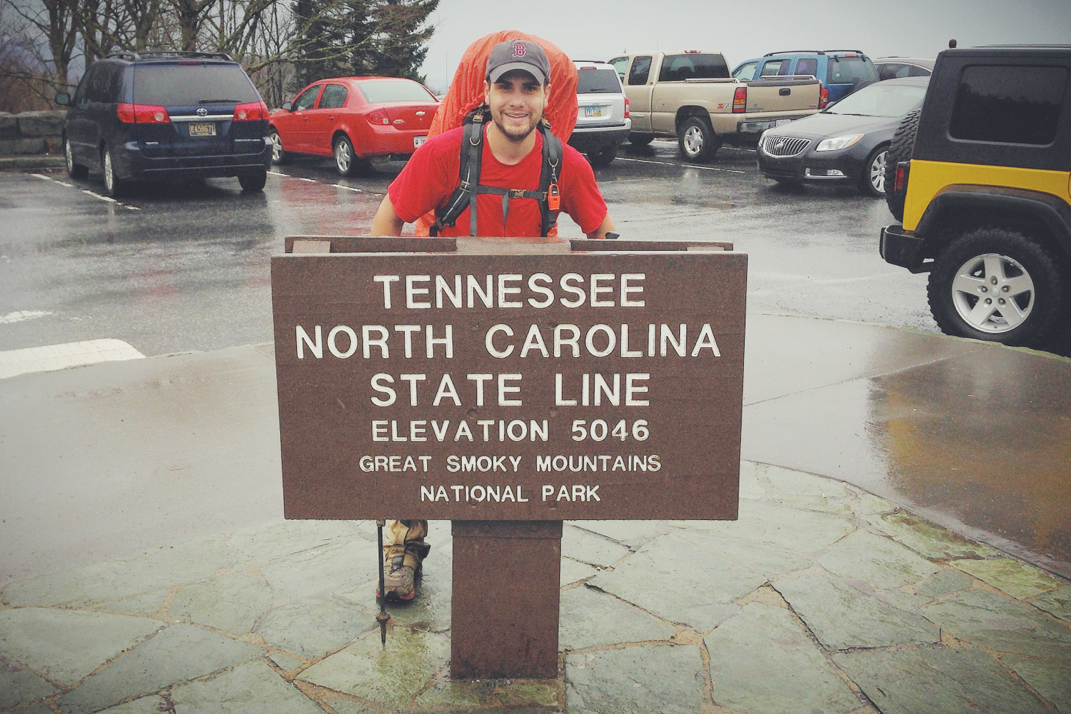
I'm embarrassed to admit that some of today's mileage was due to an idiotic mistake on my part. About 1/2 mile before the summit of Clingman's Dome there's a sign designating the Dome trail & the bypass trail. After thoroughly examining this sign, I proceeded to walk a half mile down the *wrong* path, which upon realizing my mistake, forced me to double back the same half mile (uphill this time) and turn back onto the A.T. to get to Clingman's summit. I only admitted this to three people on the trail, one of whom was Crusoe who had been waiting an extra 20 minutes for me to arrive at the peak. Although I have a feeling it won't be, I do hope this is the only time this happens... It's not only rather counterproductive, but also extremely embarrassing.
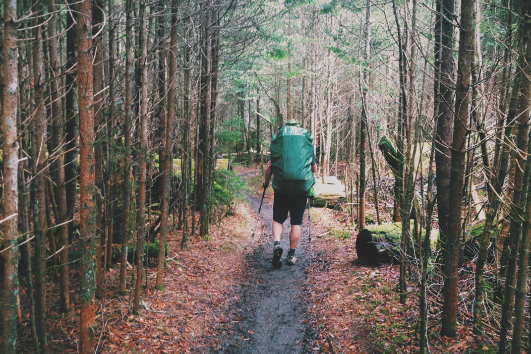
Last night in the shelter was great. People went to sleep rather early due to the temperature, and there wasn't a lot of ambient noise throughout the night. I opened my eyes the first time around 0400 to hear rain drops on the tin roof. Three hours later the rain was still present, accompanied by some serious gusts of wind. It seemed everyone in the shelter was on the same wavelength, as although people were awake nobody actually moved out of their sleeping bags until almost quarter till 8. Crusoe and I were packed up and were the first from our shelter on the trail at 8:30. We had a gentle climb out of camp and cruised along quickly to the next shelter 2 miles down the trail. We stopped there for a quick breakfast and learned from campers that there was a group of wild hogs that had been present the night before outside the shelter. The Smokies have some interesting animals! We hit the trail again and began a very smooth 3 mile climb the remaining 1,000' to the summit of Clingman's. During this time, however, it seemed we were magically transported to hiking the Pacific Northwest. Barren & dead trees were replaced with lusciously green pine trees, mossy forest floors, and a wet atmosphere amplified by the drizzle of rain still falling. It was a totally different atmosphere than anything we've hiked in thus far, and would last throughout the day.
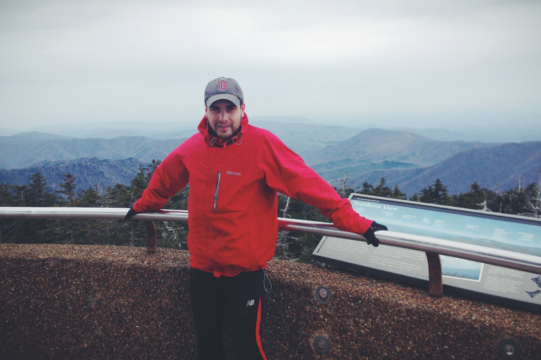
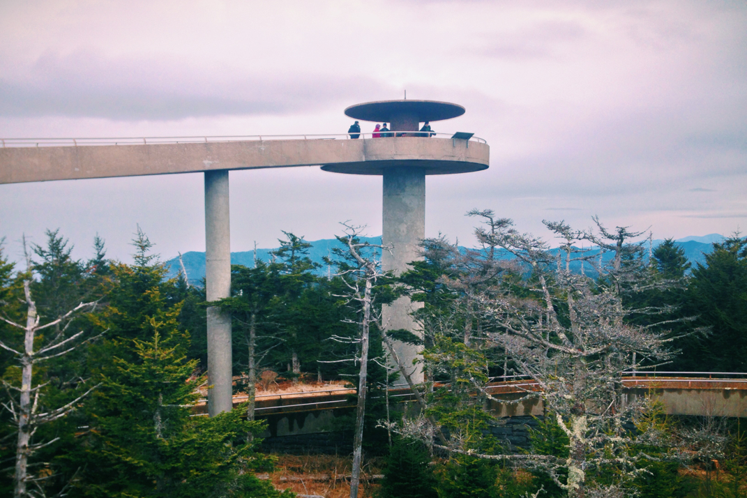
Just before 11 we summited Clingman's, suddenly thrown back into the mainstream of America as tourists walked the paved path to the lookout tower atop the mountain. It's funny how quickly we felt out of place. Winds at the top of the tower were gusting over 50 mph, blowing us around with our large packs. A few quick photos were taken, and we headed down to decide whether or not to visit the 'gift shop' with HHH (abbreviation of my new phrase: hungry-hiker-hopes) of a microwaveable cheeseburger and some cold Gatorade. The predicament was whether or not to walk the 1 mile round trip, returning up a very steep paved path, to the shop. We decided for it, and were severely disappointed to find that they only sold water. Probably passive aggressively, I also felt the need to buy a 1lb mason jar of locally made peach preserves for $5... Either way, I ate about 1/4 of the jar and drank my $1.35 bottle (a liter! Imagine that. Great pricing of water..) and we headed back up the windy mountain. It was funny again to walk alongside pedestrian tourists who were winded and quick to bail on their plans of visiting the summit due to the steep, still paved, path to the top. We got some strange looks, and returned to the trail by 12:30. Even after such a short time mingling with people it felt good to be back on 'our trail'.
Take home message for hikers south of Clingman's: do *not* waste your time & energy walking down to the gift shop.
Take home message for the US Parks Department: if you put in a $200 fridge with frozen foods, some cold drinks, and candy bars, you'd make a *killing* from thru-hikers and tourists alike.
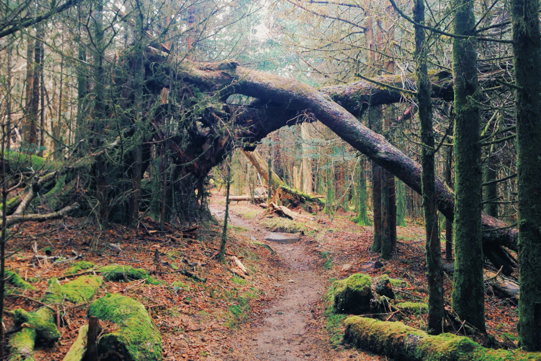
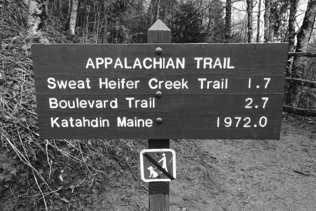
We quickly hiked the afternoon miles, talking about photography, sing partially correct choruses to pop country songs, and sometimes just walking in silence. At some point just after the summit of Clingman's we unceremoniously crossed into the 200th mile of The Trail. The surroundings (still looking like the PNW) were captivating, again revisiting my term of Mother Nature's Battlefield with gigantic fallen pine trees covered in moss lying everywhere. Some fallen trees ripped up root systems 15-20' in diameter, towering over us as we hiked alongside. Some root systems pulled up boulders weighing in at several hundred pounds. I wish I knew how so many managed to fall, shallow roots perhaps? These are monstrous trees, sometimes taking 2-3 others down with them when they tumble. It's quite the sight to see. Regardless, we re-entered civilization where the trail crosses a popular access road to the Smoky Mountains. There was a parking lot full of tourists who were quick to ask questions of where we had come from and where we were going. I suppose we looked out of place in our t-shirts and shorts, as the rain was once again picking up, with temperatures still in the 40s. We snapped a few photos, and headed up the trail the remaining 3 miles to the shelter we intended to stay at. We passed an interesting sign at the parking lot, showing 1,972 miles to Katahdin in Maine, our ultimate destination. It's the first sign I've seen with that kind of marking on it. We shared the Trail with pedestrians again for the rest of the afternoon due to there being a scenic vista at the top of the mountain that they hike to see. It's quite strange to share the path with people who have no regard for trail etiquette. Obviously I shouldn't be surprised, but it felt out of place.
We pulled into the Icewater Spring Shelter at 1700hrs with the cold rain steadily falling. The first thing to check for was whether or not there was shelter space, which there was not. The fabled Ridgerunner (GSMNP hiking enforcement) clued us in to 4 'reservations' who ultimately would push 4 thru-hikers out of the shelter. This meant we were setting up tents in the rain... Not my favorite activity. In order to avoid getting it wet inside as I set it up, I pre-built it under the cover of the Shelter and transported it into the rain fully assembled. A few people got a kick out of this, but it makes perfect sense to me. Dinner was quickly consumed, a tortilla cheese wrap with pepperoni, and a bowl of Ramens soup just to warm me up. I climbed into my tent over an hour before sunset and fell asleep listening to the radio on my iPod. There are almost a dozen FM country music stations available, some of which are broadcast from Ashville. I guess we're relatively close in proximity. I couldn't find an FM news station, but I suppose nothing catastrophic has happened since someone today would have said something
Due to placing of shelters and the requirement to stay at them, we'll only do 13 miles tomorrow. This will get us out of the Smoky Mountains late Monday or first thing Tuesday morning- not bad for 4 1/2 days of hiking through what the Park Service calls 'one of the most challenging parts of the entire Appalachian Trail'.
Back to sleep now, it's almost midnight as I write this & the rain has stopped, leaving a quick wind and low temperatures. Tomorrow should be an easy day with higher temps to dry everything out. I for one am hoping to find some Easter eggs hidden on the trail.


 RSS Feed
