2180miles
  • Home
  • Adventure Blog
  • Overland
    • Meet The Jeep
    • Mods & Installs
    • Overland Gear
    • Trip Reports & Videos >
      • Allagash Winter 2019
      • Greece Adventures 2019
      • Overland Expo East 2018
      • Allagash Wilderness 2018
      • Trans-Canada Overland 2017
      • QB-5 Adventure 2017
  • Long Trail
    • Trip Summary
    • Photojournal
    • Hike Statistics
  • Appalachian Trail
    • Trip Summary
    • Photojournal
    • Gear Talk
    • Hike Statistics
    • Financial Planning
  • Bicycling America
    • Trip Summary
    • Photojournal

Rocks In The Rain

6/25/2017

0 Comments

 
Mileage: 7.6
​Time: 3.5 hours

NH 4,000 footers: Mt. Osceola & Osceola East Peak
--

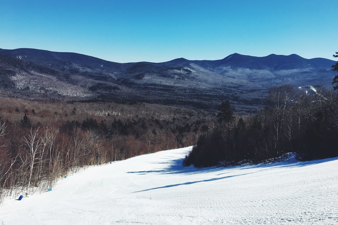
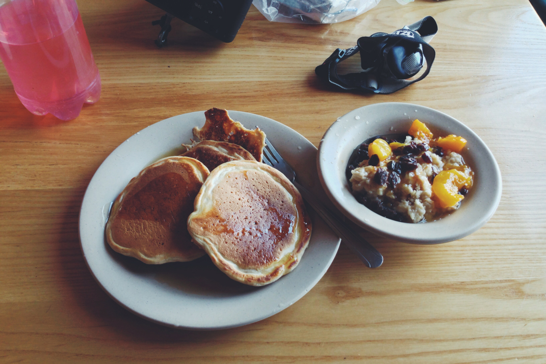
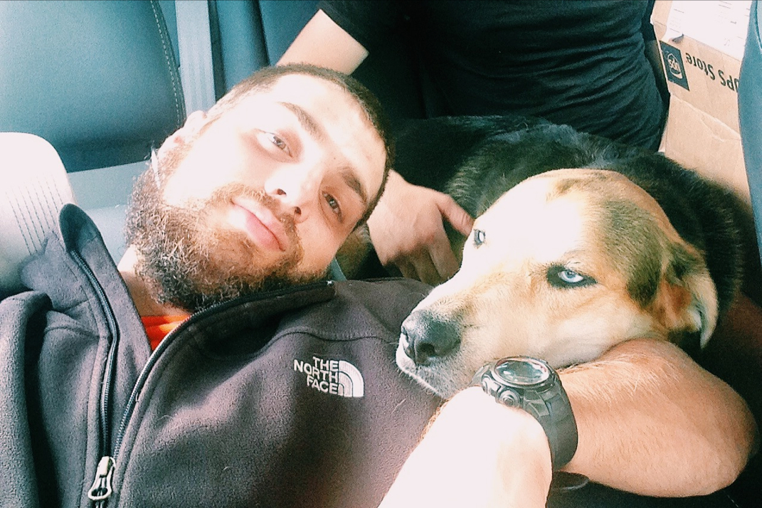
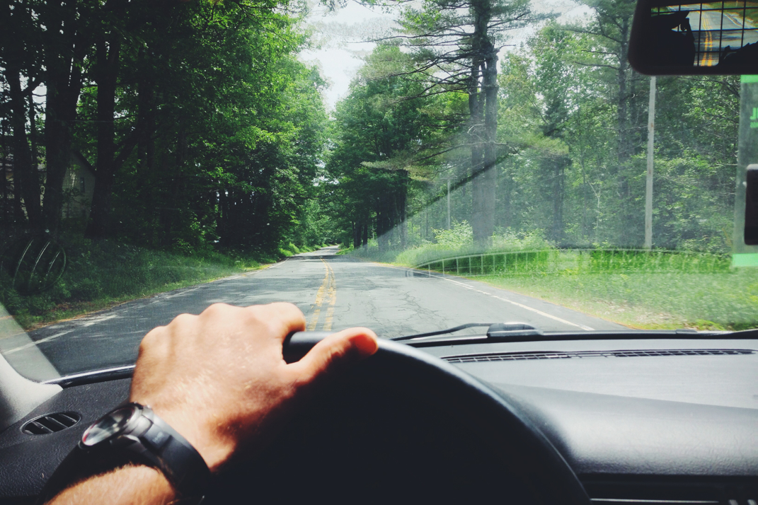
I woke up on a June 16th to a quiet morning, my first day off in a few weeks, with nothing major that needed to be done around the house. As I debated what to do with my day, I got a burst of inspiration to go hike a mountain. Throwing on some New Balance activewear, I grabbed my 40-liter LowePro Rover backpack and threw in miscellaneous hiking gear that I thought would come in handy for a single day trip in the White Mountains. With my camera, a small tripod, a few granola bars, a liter of water, and my REI quarter-zip fleece packed into the bag (with tons of space to spare), I hopped in the car and began the 2.5 hour drive to the Kancamangus, a 34 mile scenic highway that stretches across mid-New Hampshire and winds past a handful of trailhead parking lots that lead to notable 4,000' peaks. To be honest, I didn't check the weather report before leaving the house, something that I'd expect myself to do but for some reason forgot; about an hour from the trailhead my windshield wipers kicked on as a light rain began to fall, at which point I realized I never packed a rain shell... oops! 

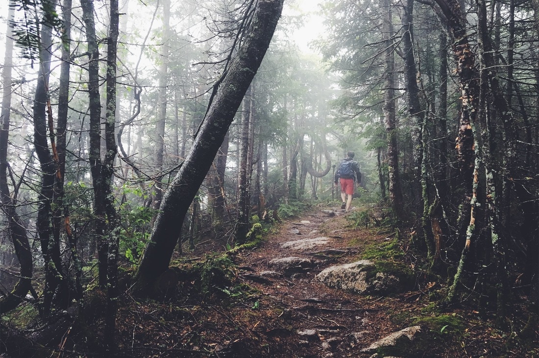
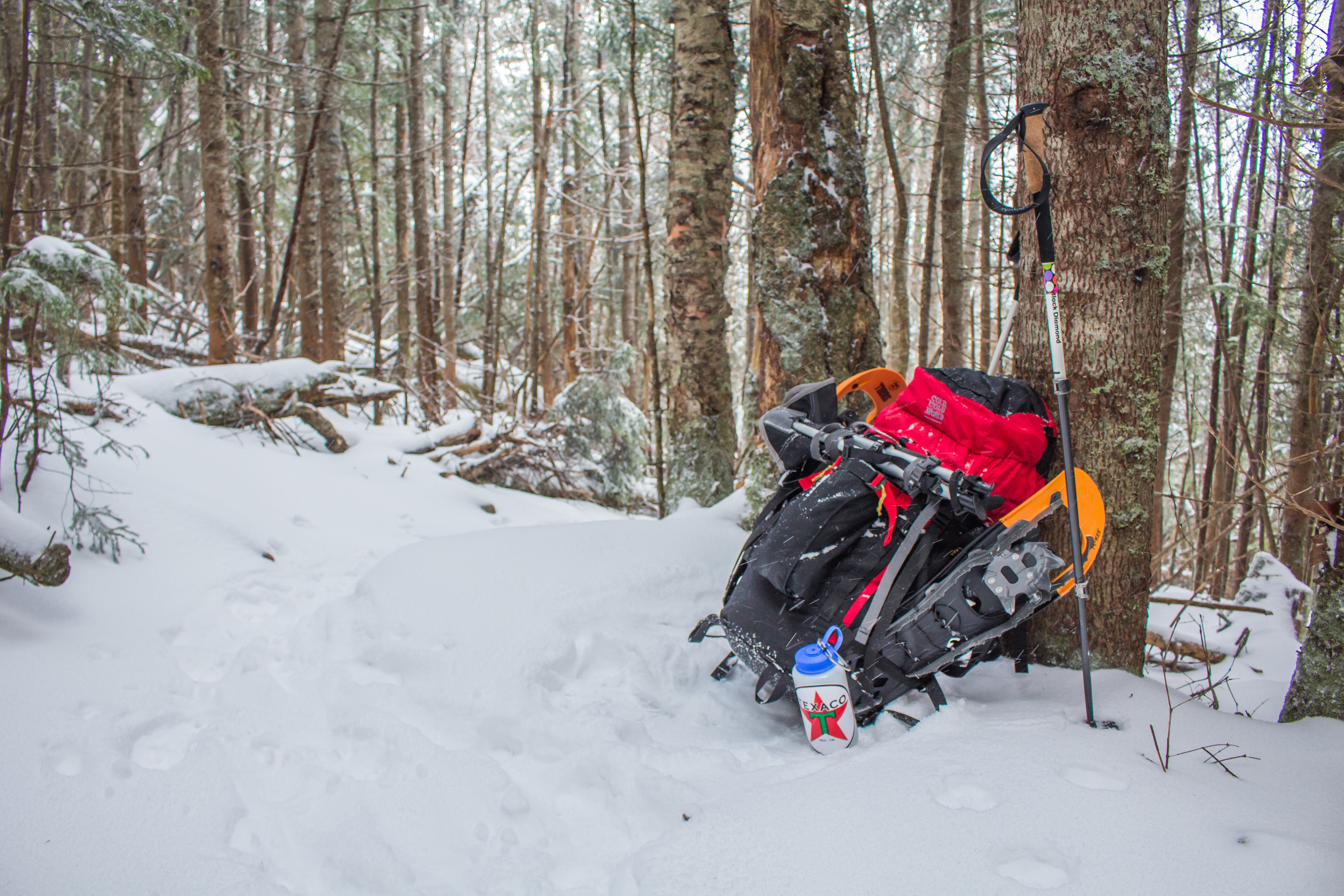
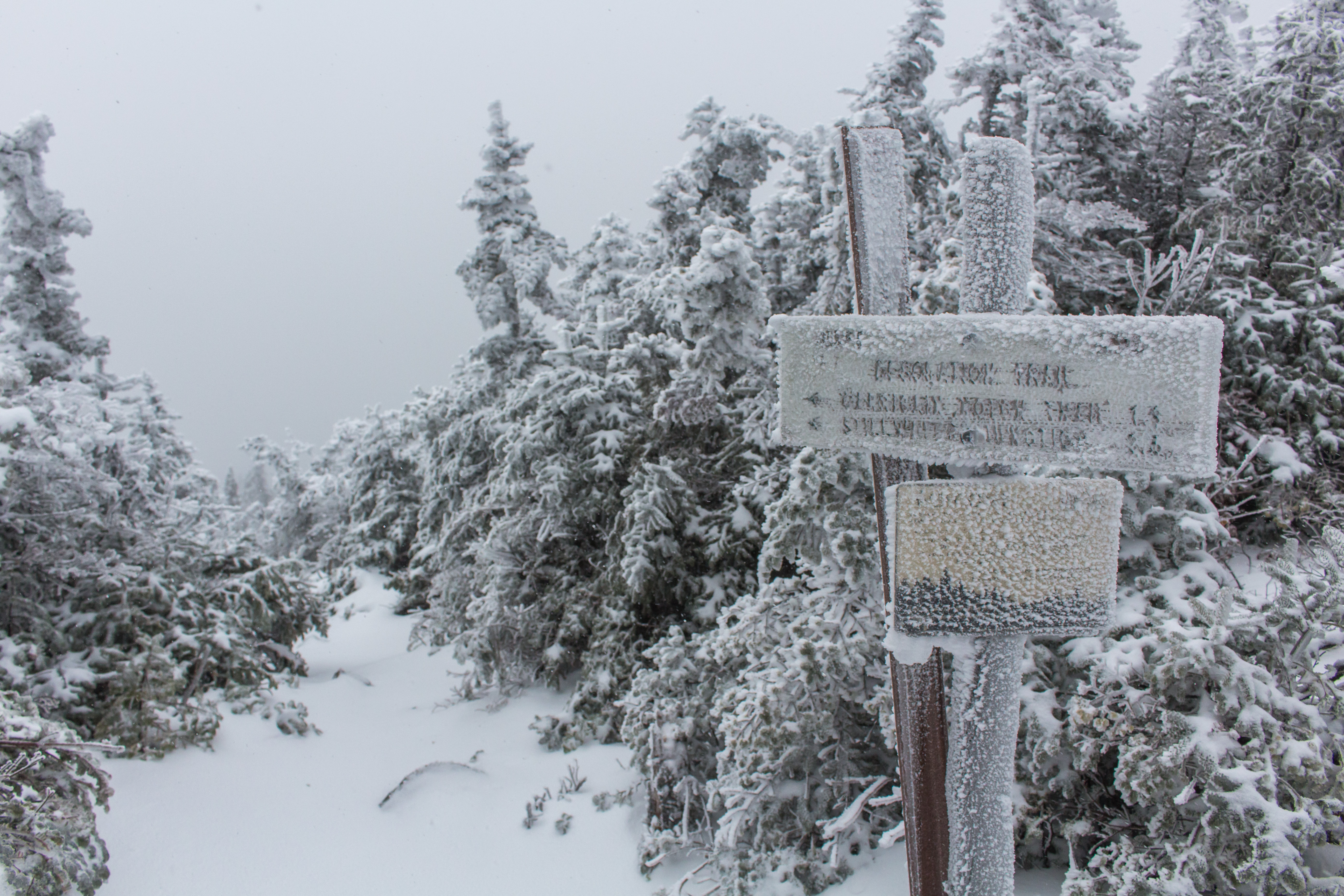
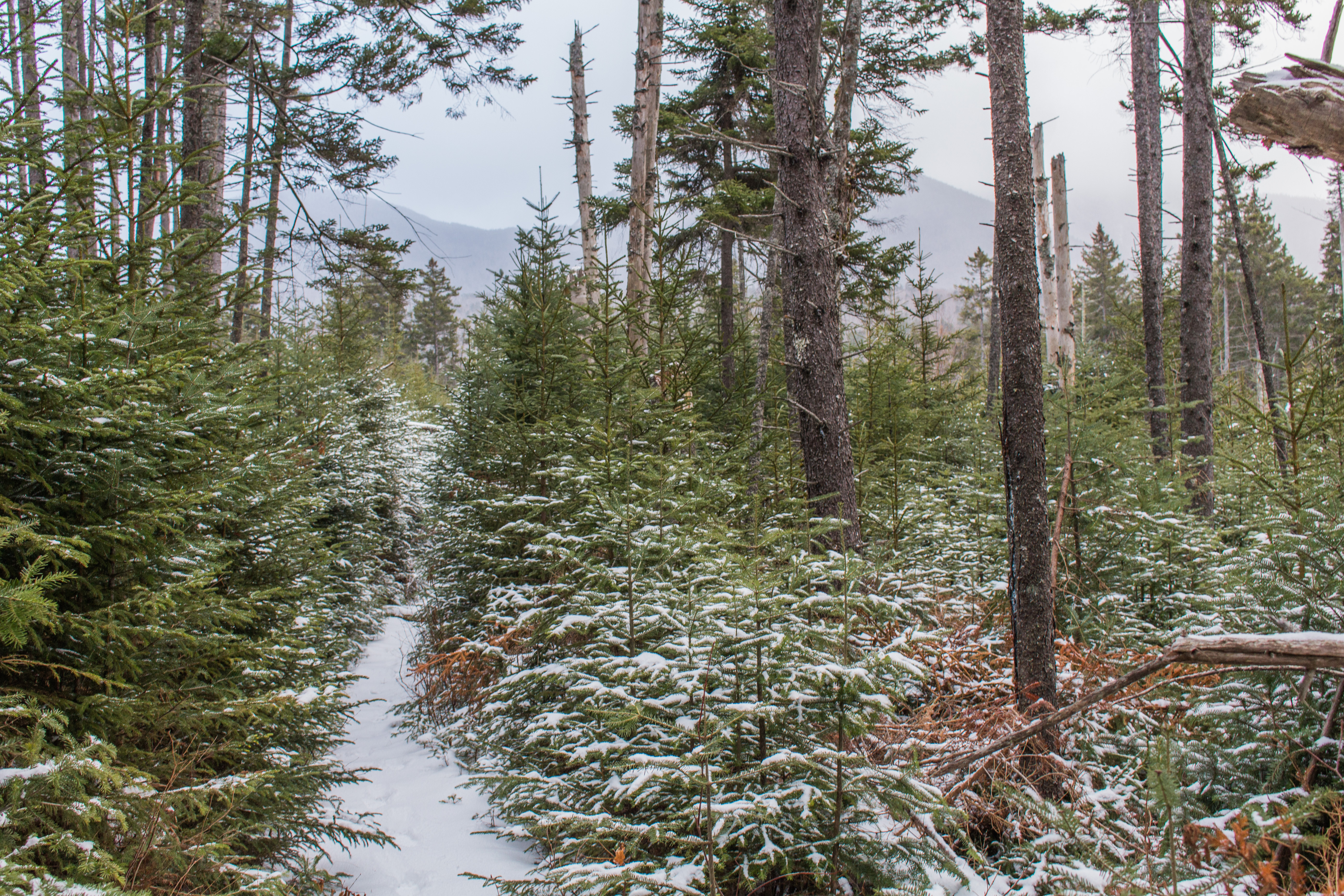
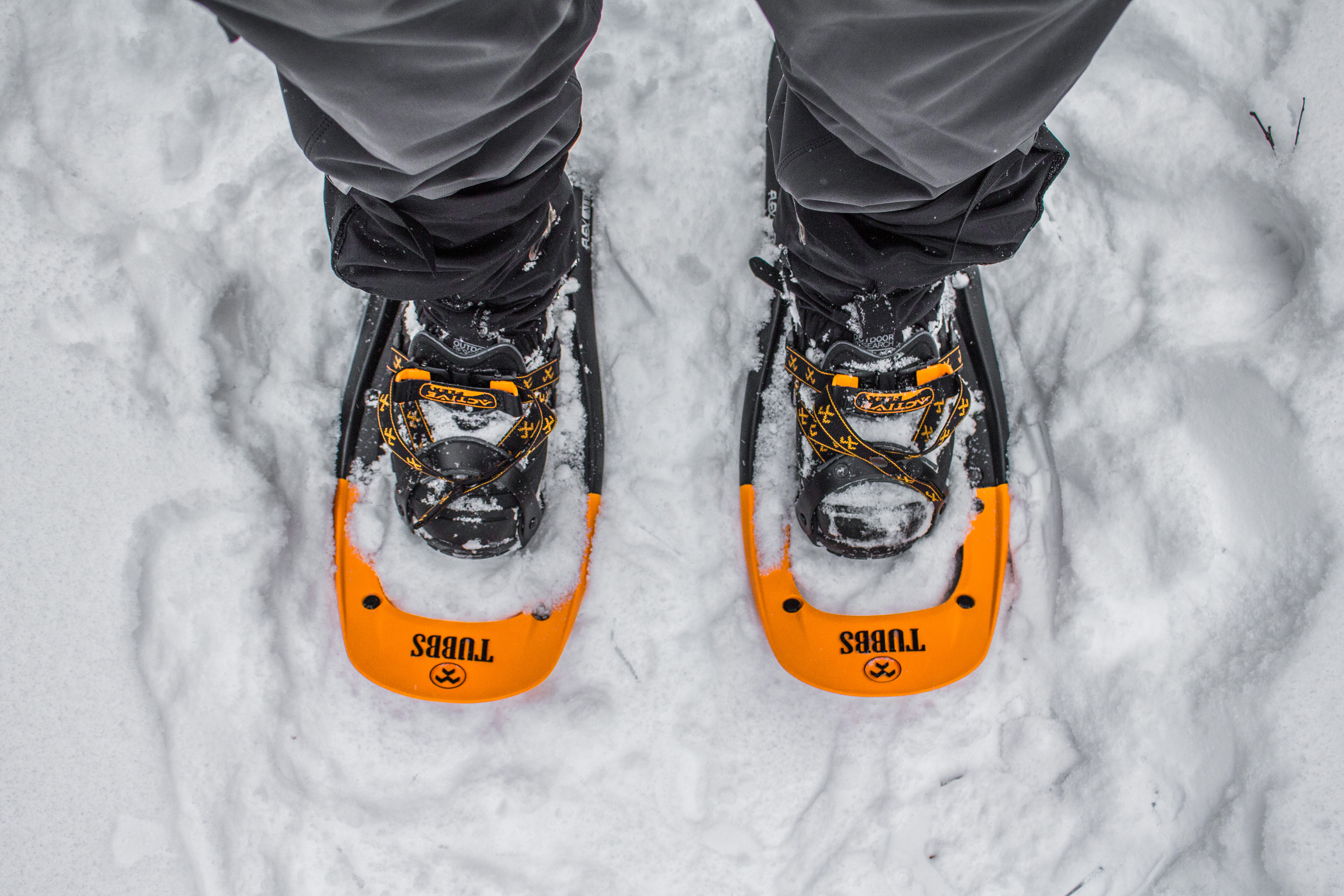
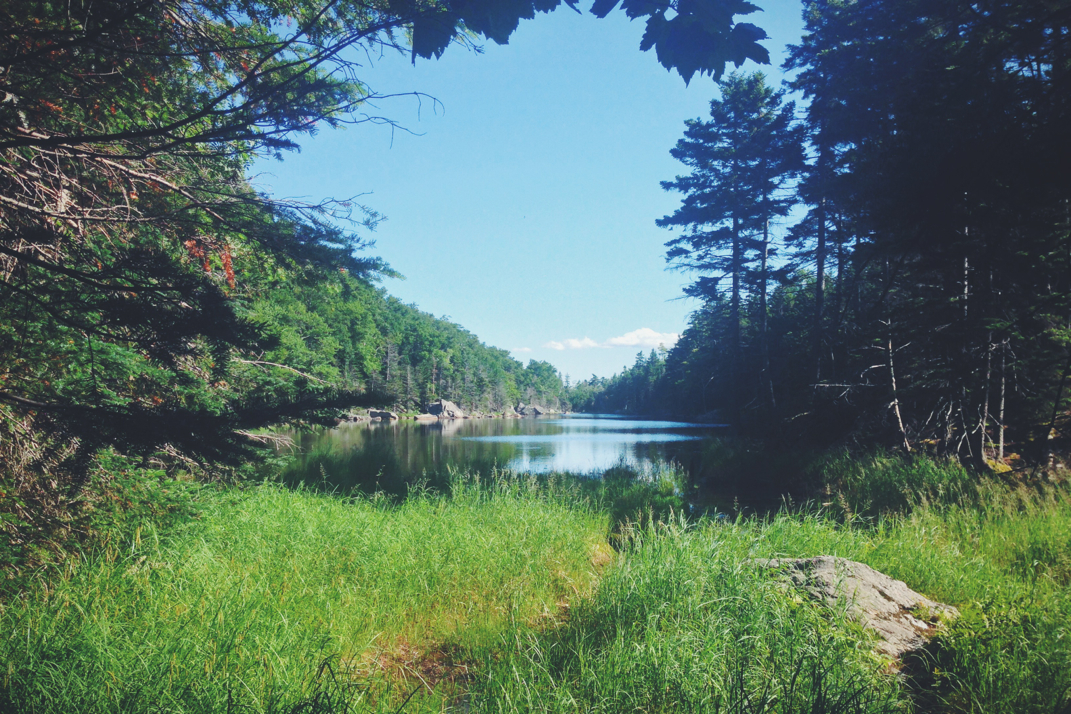
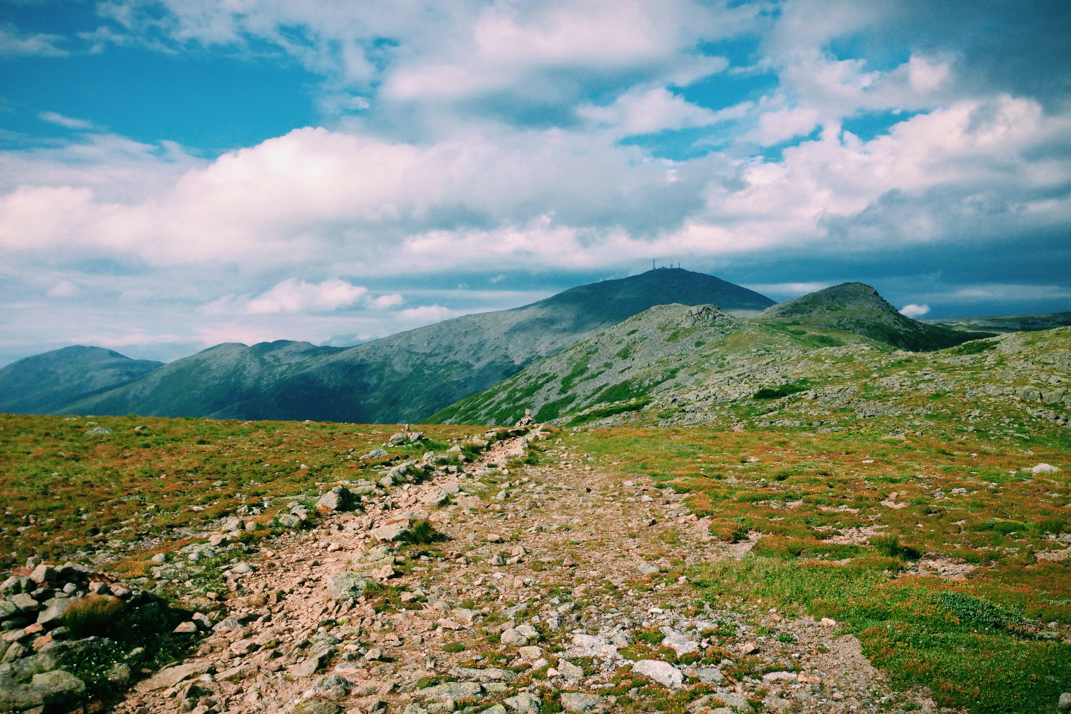
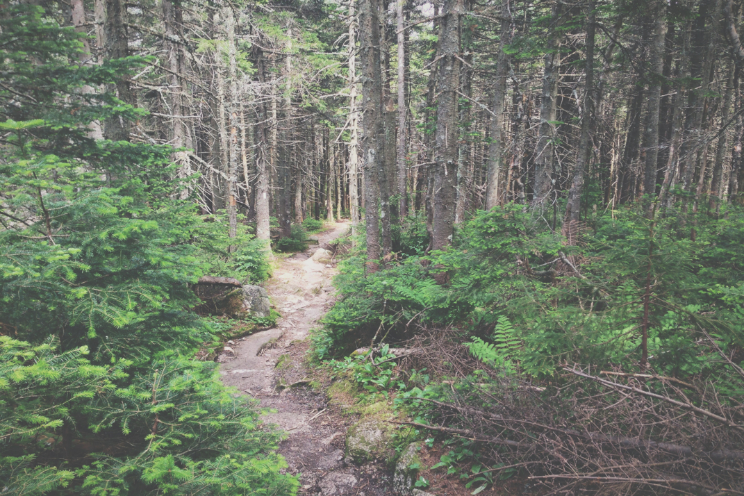
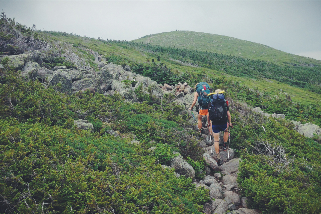
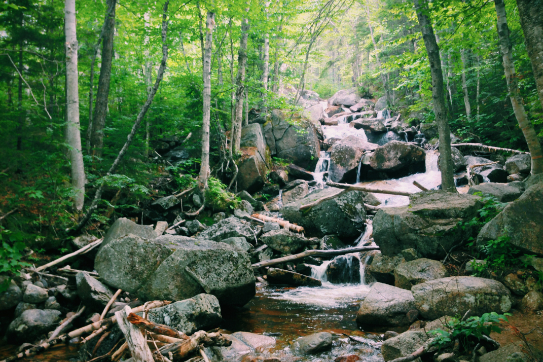
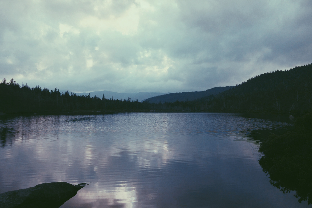
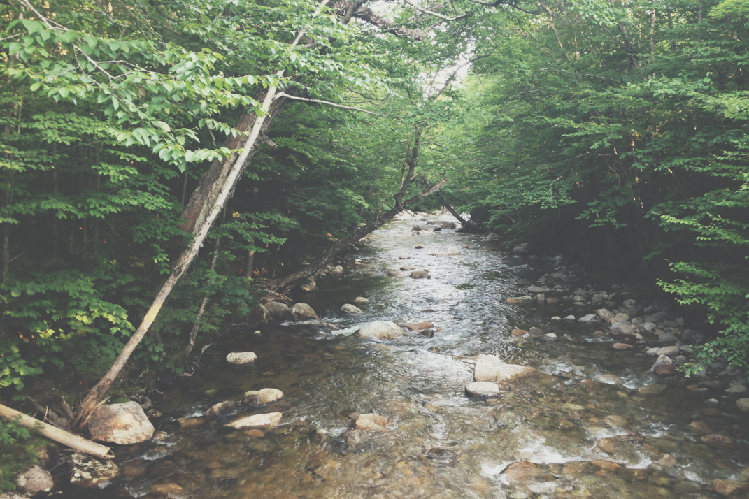
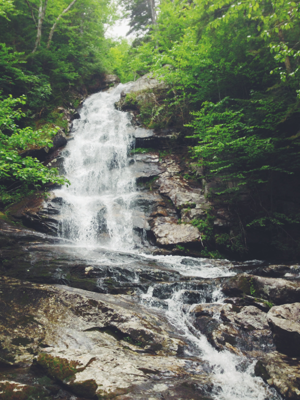
I arrived at the Greeley Pond Trailhead parking lot at 10h45 with light rain still falling, and after a quick stretch and referencing the trailhead map, I began my hike to East Osceola's summit 5 minutes after shutting the ignition off. Per the posted sign it would be 1.3 miles to a trail split where the I would turn southwest and begin the climb to the peaks. The distance from the parking lot to the split was exactly what I needed as a warmup: gradual terrain that crossed over a few streams and one wider river, a few log bridges over swampy marsh, and otherwise typical root and rock stricken ground that is so characteristically New England. It was after crossing the first stream that I heard branches breaking behind me, turning to see a black Columbia rain shell moving through the woods a hundred feet back. As the silent hiker and I made our way further, I laughed as I recognized I had, without consciously doing so, pushed myself to maintain the quick pace I began at. It took no time at all to reach the sign at the trail split, at which point my stopping to take a picture allowed Black Columbia Jacket Guy to catch up to me. We exchanged hellos and he took the lead for the next portion of the hike. The sign had denoted 1.5 miles to the peak of East Osceola and 2.5 miles to Mt. Osceola's summit.

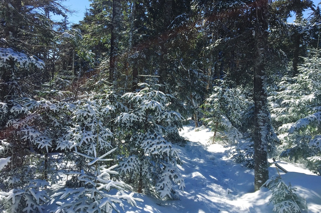
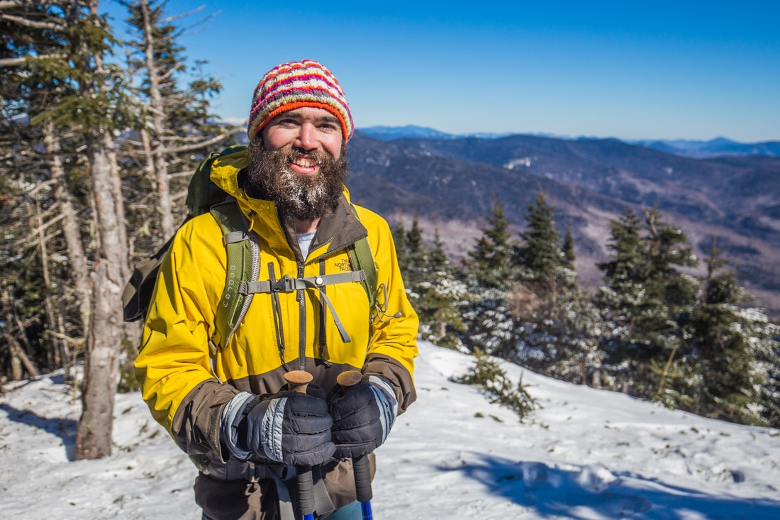
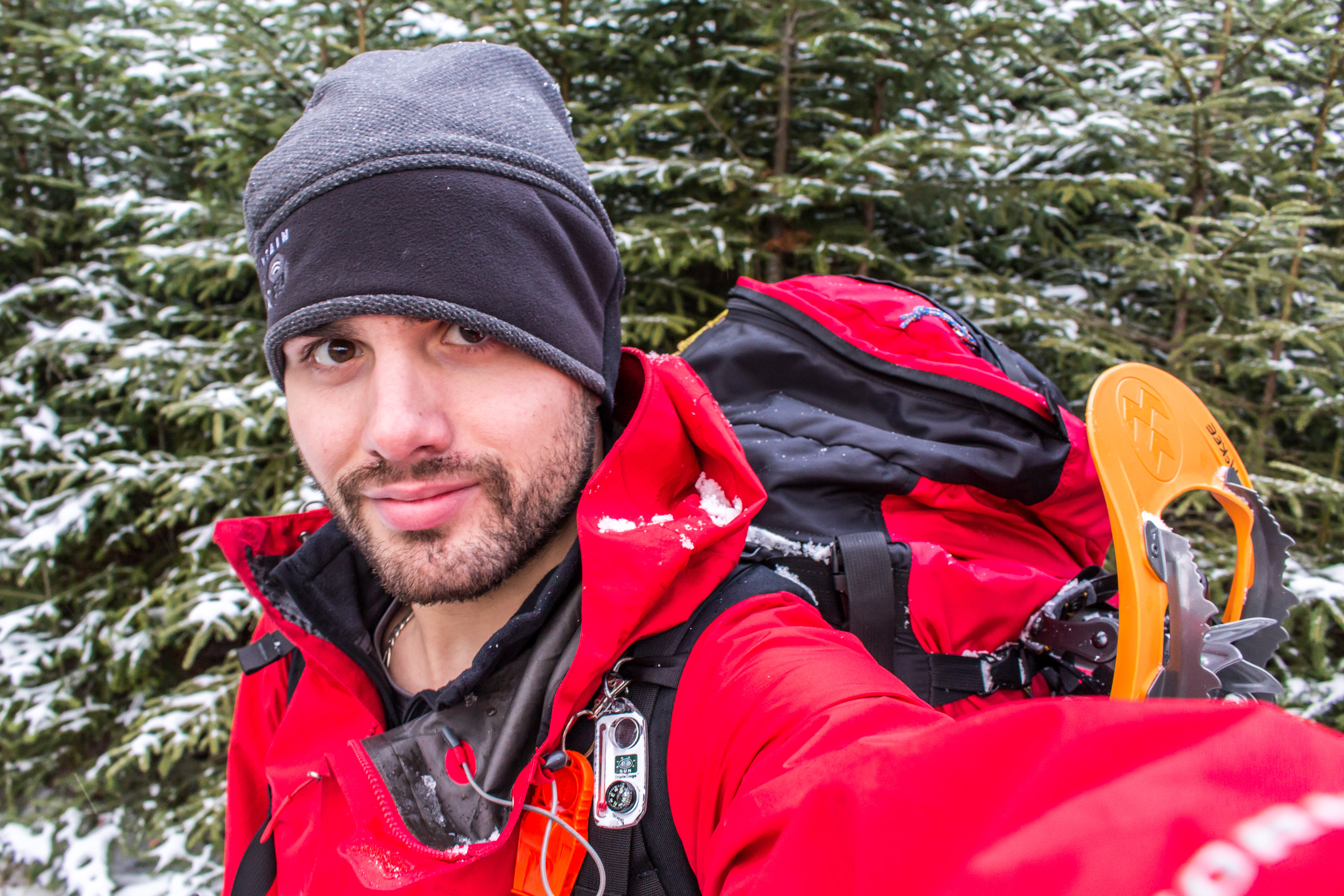
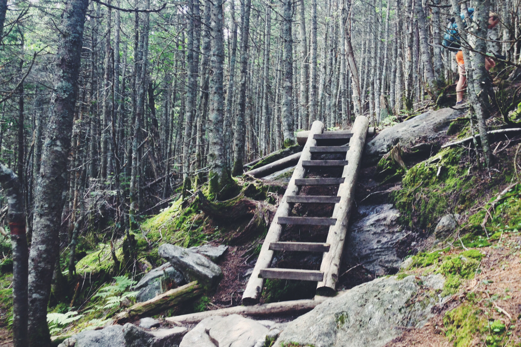
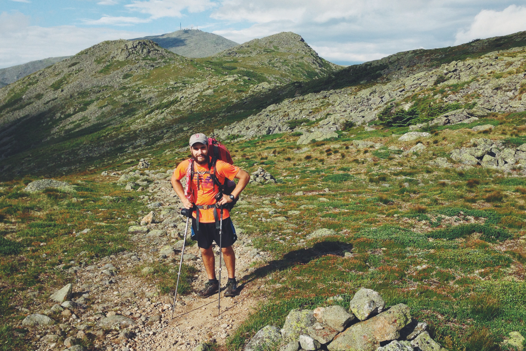
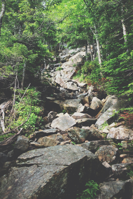
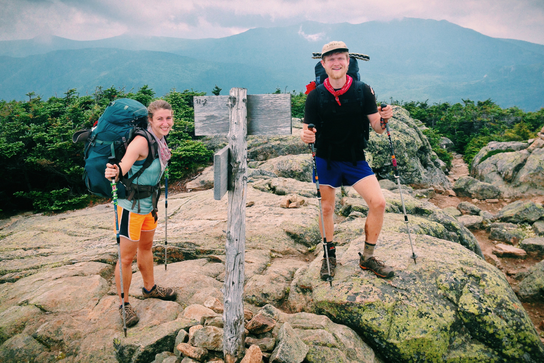
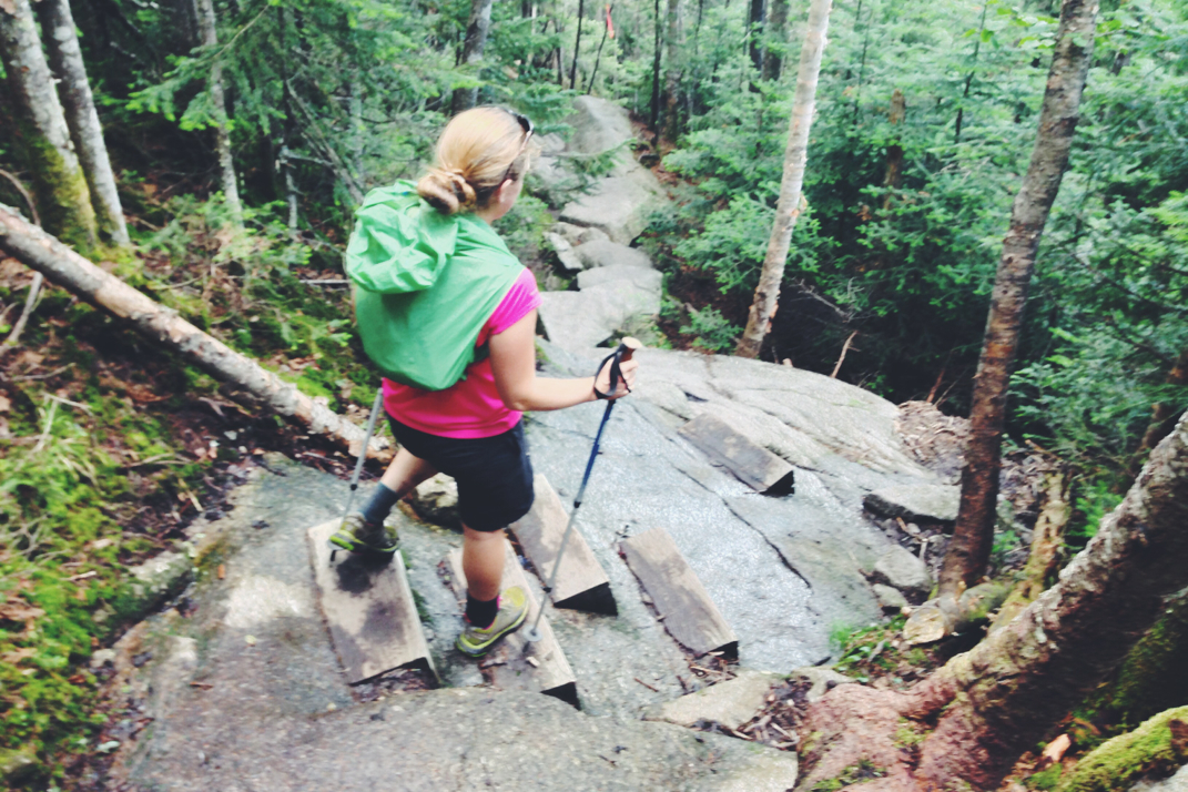
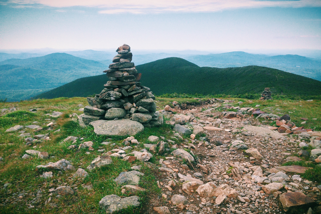
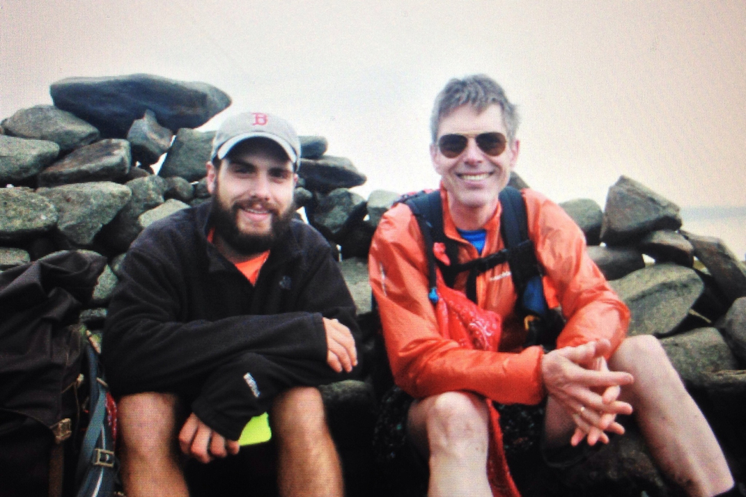
The trail began climbing almost immediately, though the terrain stayed more towards the dirt and roots side of things. I made it a quarter mile or so before realizing with the rain picking up, it would be worth my time to stop and pull the rain cover over my backpack earlier on than waiting until it was soaked. I lost some distance behind Black Columbia Guy, but caught up to him ten or fifteen minutes later as he stopped for a snack break. It was at this point that I asked if he was peak-bagging the 4,000-footers in New Hampshire, which he was, and we continued talking together as we moved up the mountain. The terrain became steeper by the minute, and as our conversation carried on I began utilizing my hands more and more to grip wet rocks and whatever tree trunks were possible to pull myself up the mountain. Having not climbed a mountain like that in quite a while, I definitely felt the strain on my body as I got higher up and covered the more difficult terrain. By 12h55, only an hour into my hike, the Black Columbia Jacket Guy and I reached the top of Mt. Osceola East. The completely wooded peak was adorned with a large pile of rocks against a tree denoting the 4,116-foot summit, and the worn-down trail was starting to resemble a running stream due to the volume of water falling. It was at this point, taking each other's pictures with the rock pile, that I introduced myself to Black Columbia Jacket Guy, who officially became Matt. 

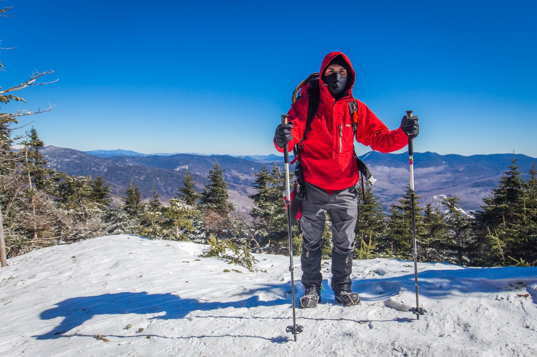
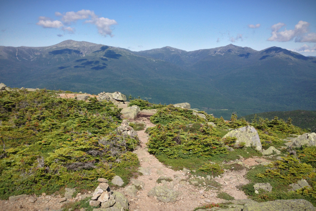
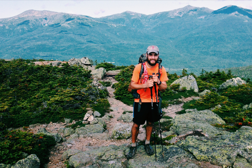
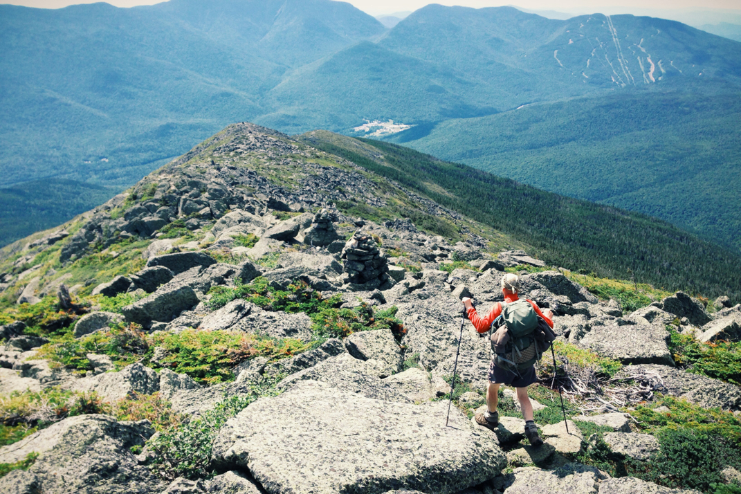
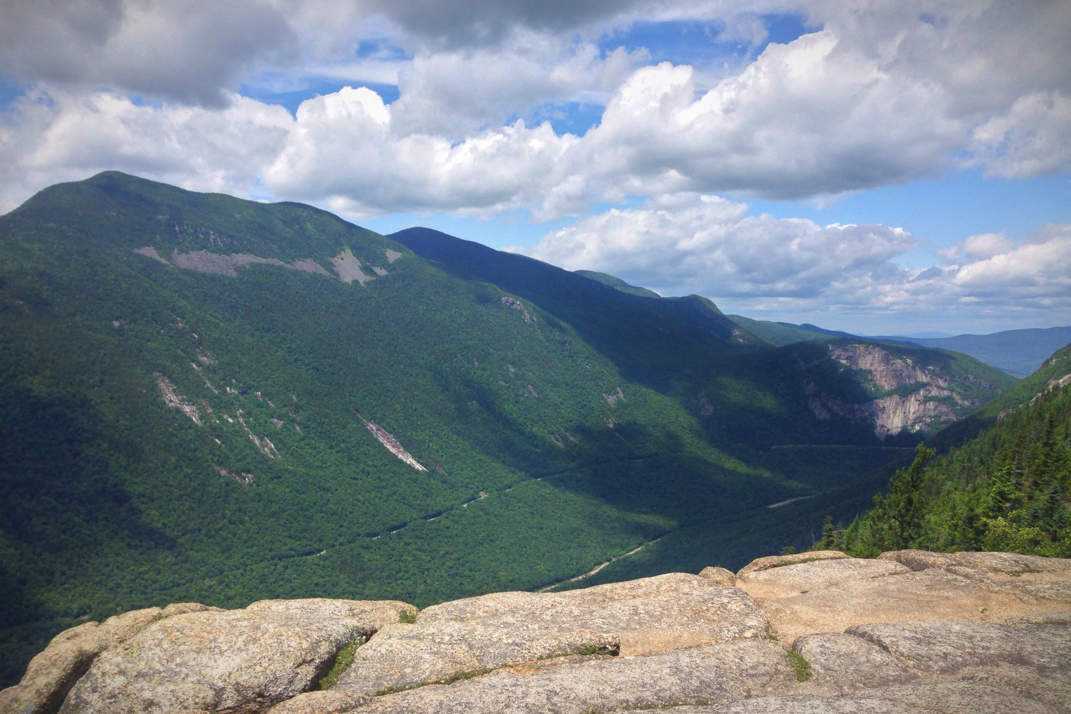
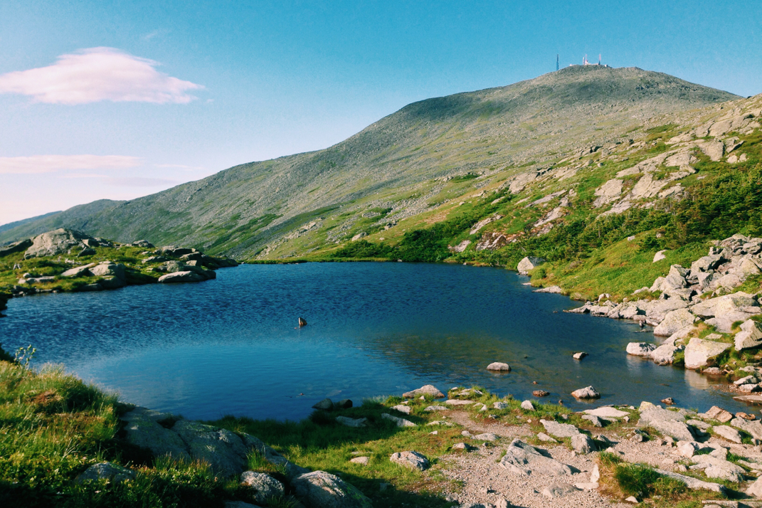
Informing my new friend of the time, he asked me if I was continuing on to Mt. Osceola's main peak, another mile  southwest of where we currently stood. Given the rain and rocky conditions we encountered on the way up, I had been thinking against moving towards the second peak if it was to be alone, though he quickly interrupted my internal thought process by saying that he would add the mileage if I was going... with that, Matt and I moved on together, continuing conversations of work, life, hiking, and other adventures. Dropping steeply off the East Peak to the varied terrain of the ridge between the mountaintops, we came across two other hikers in head to toe rain gear, who we came to learn were the drivers of the only other vehicle in the Kancamangus trailhead parking lot. After another ten minutes or so we came to the bald face of Mt. Osceola where I was greeted with cold wind and stinging rain against my skin. I took a quick photo before ducking into the nearby trees down a short trail, taking a moment to pull out my water bottle for some hydration. We didn't linger long, turning around and heading another mile back to the East Peak and begin our descent out of the mountains.

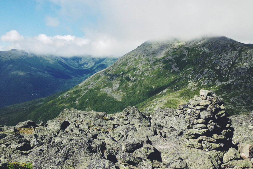
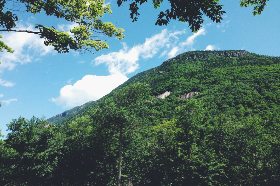
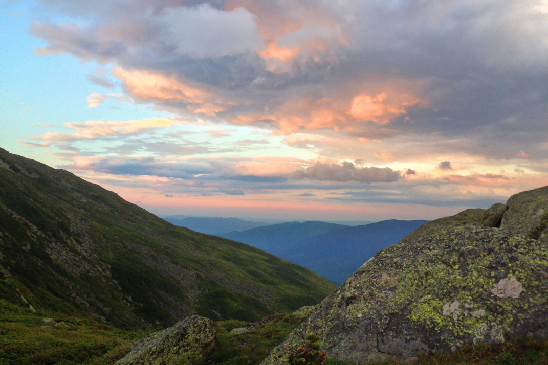
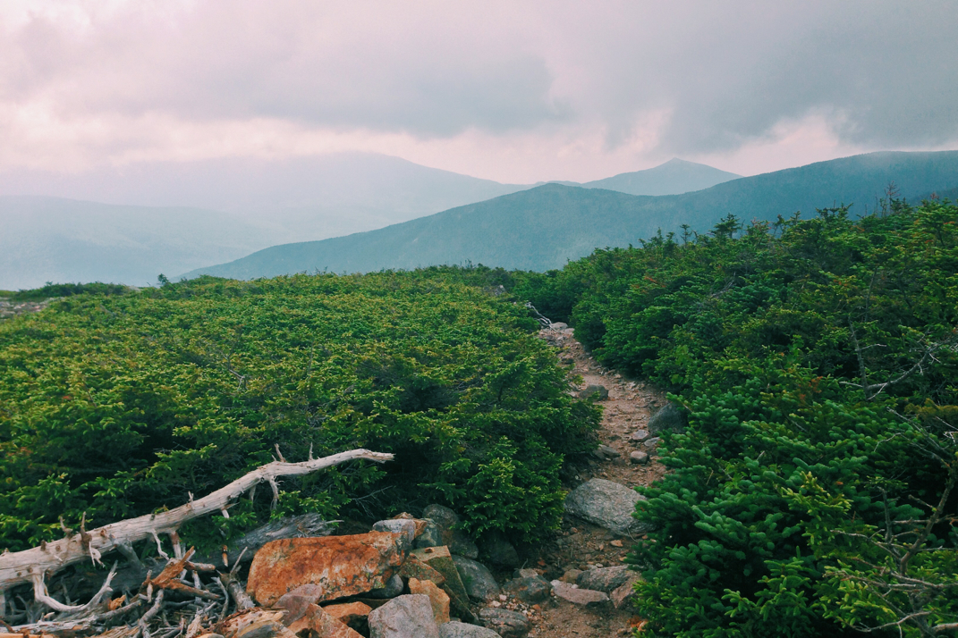
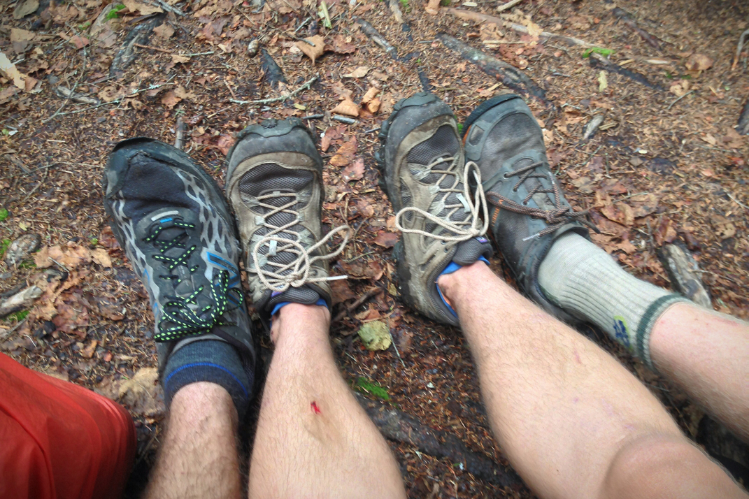
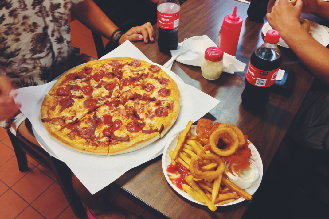
We flew down the trail, using caution and our weight to get down the more difficult sections of terrain. As we crossed over an exposed face to the north of East Osceola, the thick cloud cover broke for a few moments exposing a beautiful view of vibrantly green trees that stood tall across the ridge before us. Carefully stepping across the wet rocks, my body was quick to remind me that my knees don't love descents as they started getting sore after just a little while; I always hike with my Black Diamond trekking poles, but had recently lent them to a friend who was doing a day hike in the Whites and asked to borrow them. Cutting back into the tree-cover the ambient temperature got warmer, and as our elevation dropped my damp shirt became a little bit more bearable as it stuck to my skin. After what seemed like no time at all, Matt and I approached the trail split sign denoting the remaining 1.3 miles to the parking lot. I mentioned my hunger, having not eaten anything while on the trail all day, and he spoke up about a favorite bar in nearby Lincoln, NH, suggesting we stop in for a burger on the way out of the mountains. We stepped foot in the trailhead shortly before 14h30, just 3.5 hours after beginning the hike, a time I was quite pleased with given the mileage and terrain covered. Hopping in our respective cars, I followed him a few miles west on the the Kancamangus to Black Mountain Burger Company where we had a quick lunch before we parted ways and I began the 130 mile drive back to Boston, satisfied with a great, albeit wet, impromptu day in the mountains, checking another 2 peaks off my list of the 48 New Hampshire 4,000-footers.

​As June marches on, work winds down and I'm getting closer and closer to nearly two months of summer vacation. From the looks of it there will be a plethora of adventures throughout North America with lots of hiking and photography opportunities... but I'll fill you in on that in a week or two.


Onwards & upwards,

Texaco

Picture
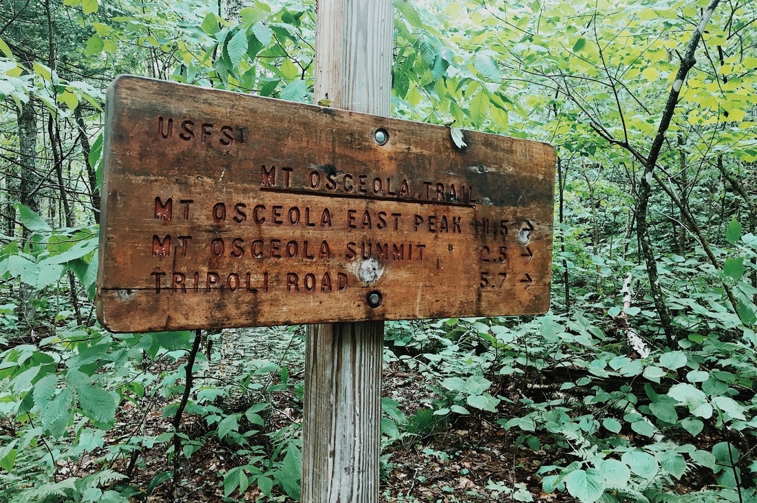
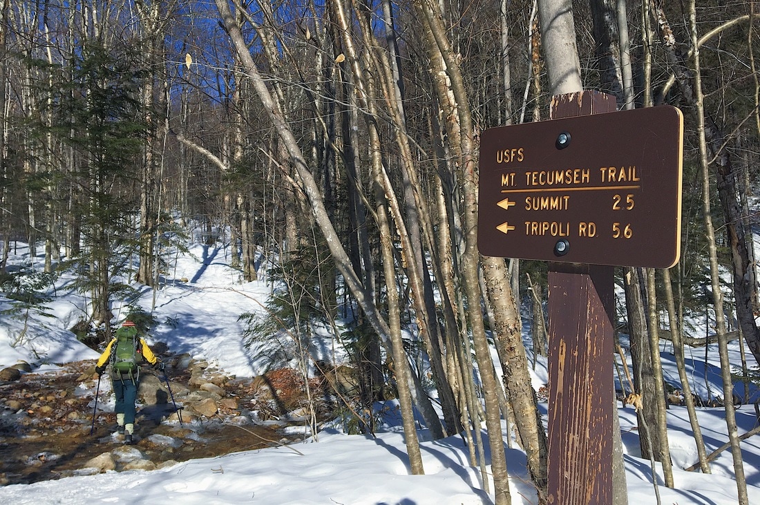
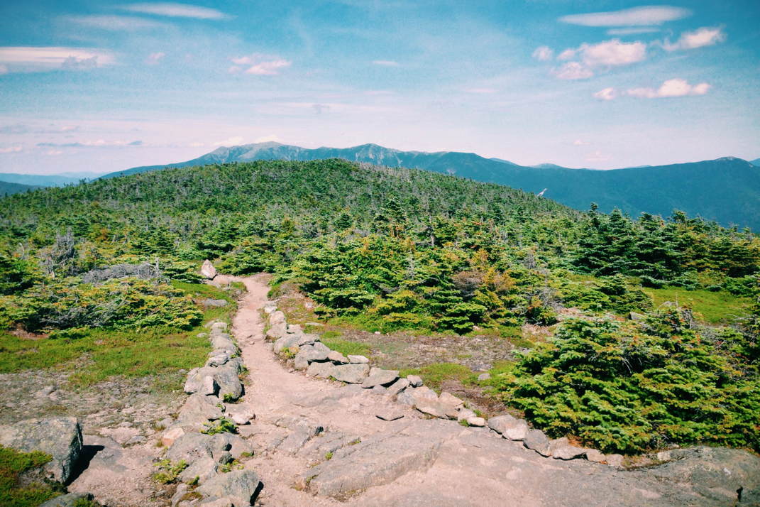
Mt. Osceola Trail Split
Picture
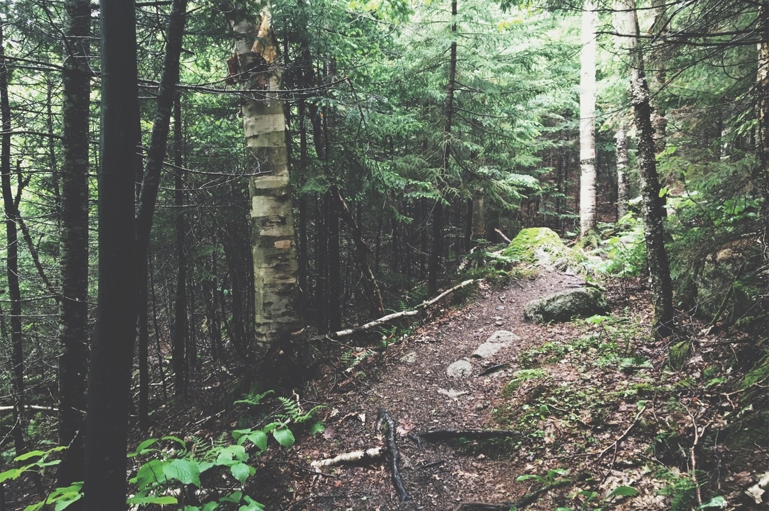
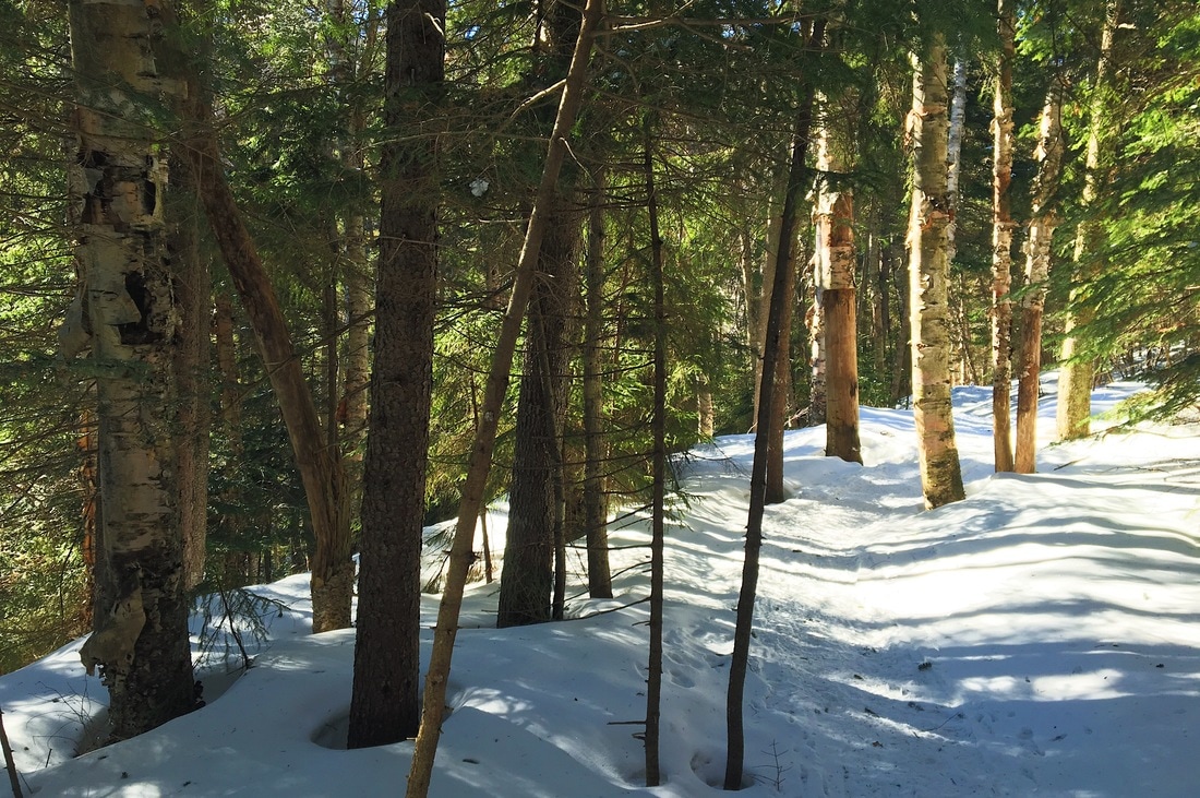
Typical New England Terrain
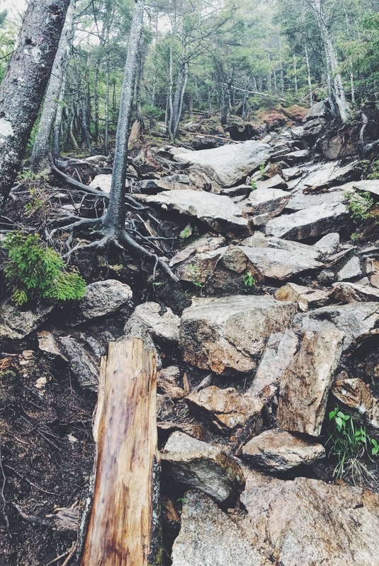
Picture
Rocky Climbing
Picture
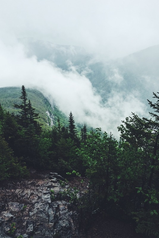
Clouds Break over the Ridge
Picture
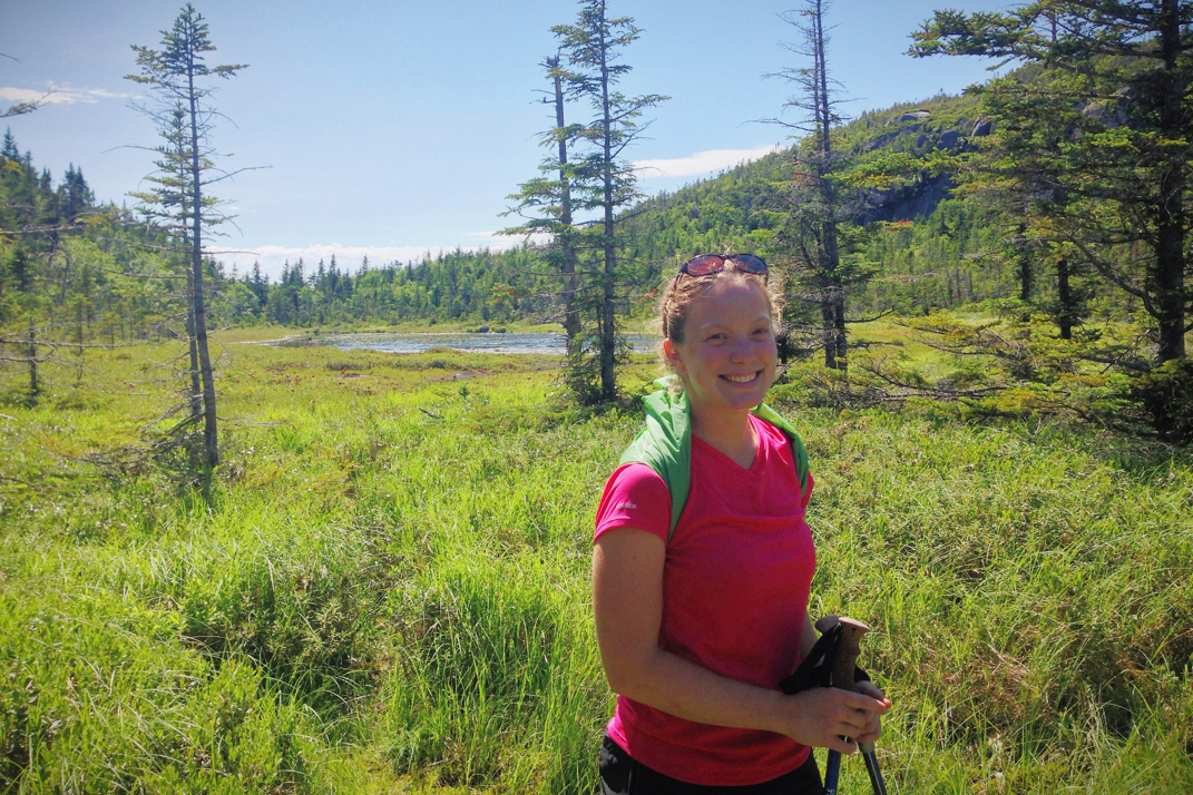
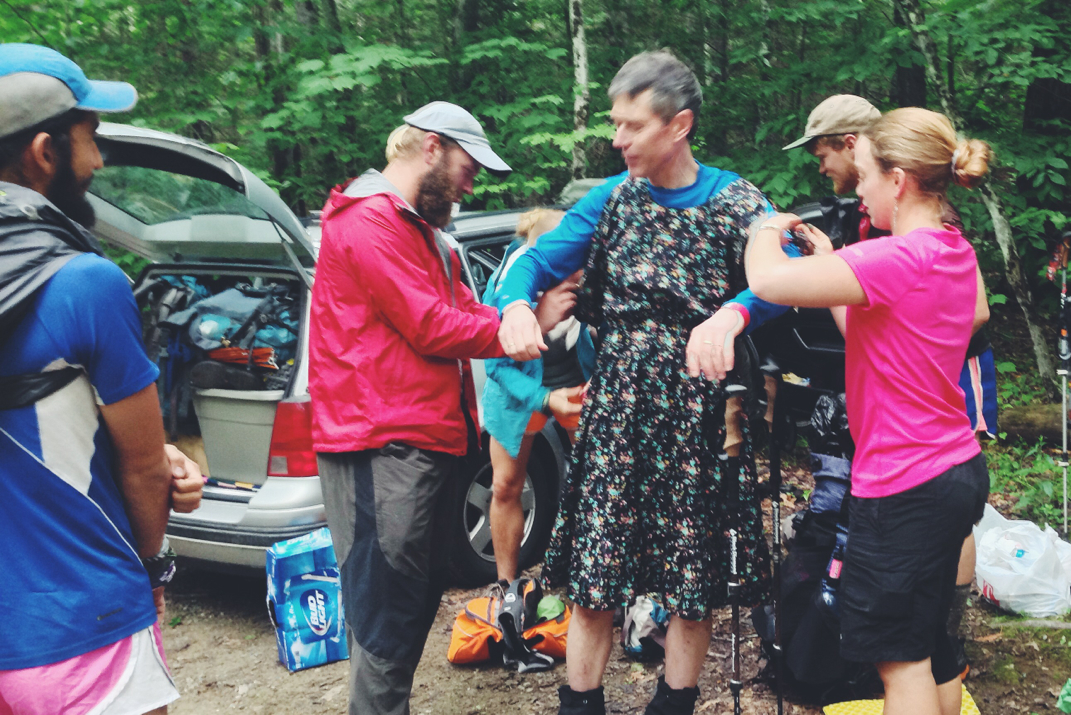
Black Columbia Jacket Guy (later known as Matt)
Picture
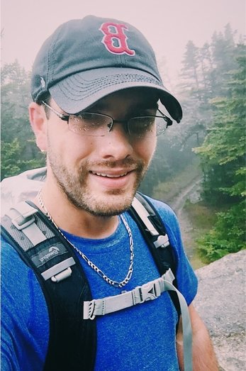
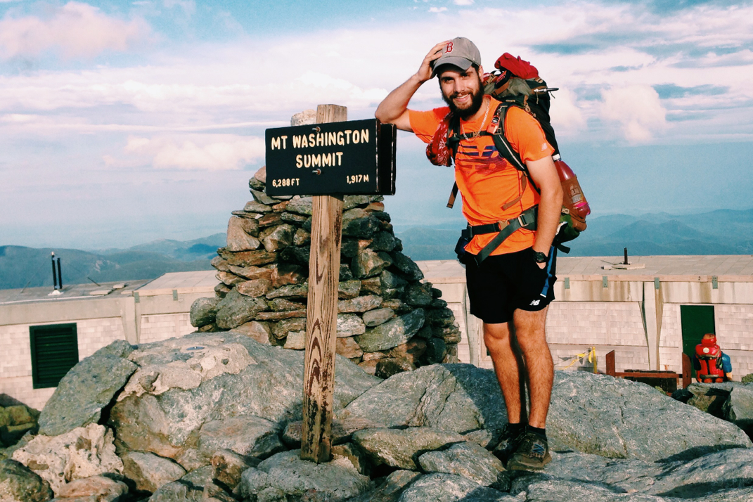
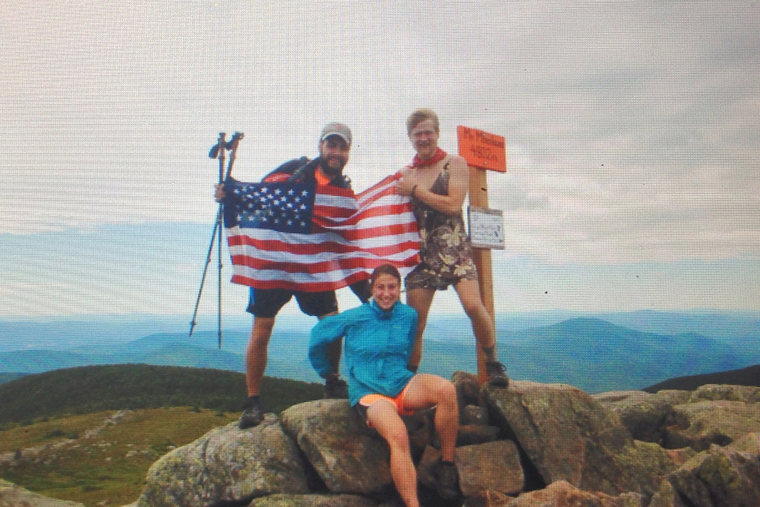
Soaked & Smiling atop Mt. Osceola's 4,315' Summit
0 Comments

Single Digits & Blue Skies

3/5/2017

0 Comments

 
Mileage: 5.2 miles
​Time: 3 hours

NH 4,000 footer: Mt. Tecumseh
--

Returning home to Boston on Friday night I was greeted with temperatures in the twenties and light snowfall, a stark contrast to the 85-degree sunny days I had enjoyed for a the 6 days prior while down in Florida with work. With Saturday's temperatures in the teens and relentless winds to boot, I laughed out loud when my good friend Rob (a long time member of the MA-based Jeep club I founded) sent me a text gauging my interest in hiking in the White Mountains on Sunday. Having not been in the mountains in almost exactly a month, I quickly jumped on the offer and agreed to meeting him the next morning halfway to the Waterville Valley trailhead for Mt. Tecumseh. The lowest of the 48 4,000-ft mountains that New Hampshire is home to, measuring in at 4,003 feet exactly, Tecumseh was an easily accessible trail and one that neither of us had hiked before. I packed up my equipment late Saturday night, triple checking the weather forecasts for the mountain and making gear decisions based on the predictions that temperatures would be falling well below zero once windchill was factored in. 

Meeting just over the Mass/NH border at 08h00, we hopped in his Tacoma and made the rest of the hour journey north to the Waterville Valley ski mountain's parking lot, placed perfectly directly across a resort road from the trailhead we would start from. Donning the appropriate footwear and insulating layers for the single digit temperatures outside, we made our way across the road and began our trek around 09h30. The forest was nearly perfect, covered in a few inches of snow while the trail was clearly packed down by the plethora of hikers who had made their way up the same route in recent days. Weather in New England has been nothing shy of remarkable recently, especially given the season, and the condition of the ground reflected the warm temperatures that had swept the region. We made our way up the meandering terrain at a comfortable pace, conversing as we went about a plethora of miscellaneous things. Carefully analyzing rock placement, we made our way across a river before climbing up the other side and mutually deciding to stop and put on our microspikes light traction. While the snowfall in no way required snowshoes, I had mine strapped to my bag just in case they were going to be needed further up the mountain.

A few hundred feet after the river crossing we came about a short side trail to a Waterville ski slope, finding it completely void of anyone aside the two of us hikers. I'm not sure if the weather had turned people away, but I was a bit taken aback to see it empty on such a beautiful winter weekend. Turning back towards the trail we began the 1.3 mile climb to the summit of the mountain. Unlike many other climbs, the Tecumseh route was comprised of one long incline that was consistent and allowed us to gain the majority of our elevation. I led us up the mountain at Rob's request, and we took a handful of short breaks during the ascent to talk about projects and troubleshoot technical issues with Jeeps and electronics alike. Around 1100hrs I began seeing the saturated blue sky glowing behind distant trees instead of above them, a clear indication that we were nearing the top of whatever section of the mountain we were climbing. We progressed forwards, turning north and hiking across a gorgeously snow-covered ridge as the mid-morning sun cast shadows of barren trees across the forest floor. A few thousand feet further along we came across a fork in the trail, and a crooked sign offering each path as a route to the summit. A hiker we passed on the way up suggested the blue-blazed trail instead of the yellow-blazed, so we followed his suggestion, turning towards the west side of the mountain and carrying on.

The trail climbed further as we walked a tight path towards the summit, taking in the gorgeous views of the mountain ranges to our left. It was along this section that I felt the wind becoming more prevalent, and stopped to put my Marmot shell back on, adding my microfiber face mask to my attire to try and protect myself from wind burn once we got further up. Making a sharp hairpin turn up the next leg of trail, we came to a flat area with a sign that I inferred as denoting the top of the mountain. With no ground higher than where we stood, I logically inferred that we had reached the top of Tecumseh, 4,003-feet above sea level, at just before 11h30. We snapped some photos and talked to another hiker who joined us as he measured the temperature with a far more advanced thermometer than the $4 one that I keep hooked to the side of my backpack. He informed us it was a whopping 4 degrees, and I was immediately glad to have added my extra layers before reaching the top. Rob didn't need to, as he sports a hell of a beard that kept his face warm. In looking at Waterville's temperature reports later last night I read their noon report of -10 degrees with windchill at their 3,400' peak, so I'm sure we were somewhere in the same range, if not a little lower.

We packed up and headed back down the mountain in short order, retracing our steps on the blue-blaze trail instead of bothering with the yellow route. I habitually adjusted my trekking poles to account for the descent, hoping to preemptively fight back against any knee pain I might feel the next day. Without running down the mountain per-say, we maintained a quick pace and covered the distance in half the time we took to ascend. Towards the bottom we came across a woman who had also summited while we were at the top, hiking along with her dog who wore a neon vest proclaiming "IGNORE ME". After introducing ourselves and a bit of conversation with Cynthia I correctly guessed that he was a shelter dog and had a real aversion to adult men. In a twist of irony, she knows my dad very well from hiking with him in the past, and was quick to ask how my parents were doing... I wasn't truly surprised by this as my dad is active in the New England hiking community, but it still made me laugh to be out in the woods and randomly meet someone who knew my parents.

Rob and I returned to the car shortly before 12h30, and stripped down our layers to something more comfortable for the two hour ride home. Three hours hiking and covering 5.2 miles was a great activity for a cold weekend day, and I'm exceptionally grateful he invited me to tag along. Out of curiosity I added up hikes after getting home, realizing I've climbed to 16 of the 48 four-thousand foot peaks in New Hampshire, a solid number for someone who hasn't actively been trying to check them off a list. In further conversation, Rob and I are going to try and make this more of a regular thing when I'm not traveling, which should be a nice way to get back in the woods more frequently than I'm usually able.

Hope you're all doing well. I've got another post to write about a photography trip a few weeks ago up to Mt. Washington, so keep an eye out for that in the coming days. 

Onward & upward..

Tex

Picture
Parking Lot Trailhead
Picture
Sunshine & Shadows
Picture
Waterville Valley's "Lower Periphery" Slope
Picture
Blue Skies towards the Summit
Picture
Rob and the impressive icicle-beard.
Picture
I'm obviously dressed for the occasion.
0 Comments

Nothin' Shaking on Shakedown Street

12/6/2016

0 Comments

 
Dates: December 3rd and 4th, 2016
Day mileages: 9.7 / 7.1
NH 4,000 footer: Mt. Carrigan
--
 
The point of this past weekend's small adventure was to do a shakedown hike, putting my new and old gear to the test. I hoped to figure out which way was best to arrange the inside of my pack, to confirm the comfort of my sleeping bag in colder mountain temperatures, and to figure out if there's anything else I needed to order before this trip gets underway in less than two week's time. I think it was a successful weekend, all things considered.
 
My dad dropped me off Saturday morning at the Sawyer River Road upper parking lot (elevation 1,400') around 8:30, and I began my 5-mile hike up towards Mt. Carrigan's summit. Located in the Crawford Notch region of New Hampshire's White Mountains, temperatures were in the low 30s and as expected, snow began falling about a mile in as I crossed over the trail's first river. It would continue to snow for the duration of both days of my hike. The first 2 miles of trail meandered through a quiet and slowly climbing woods terrain before crossing over the Carrigan Notch Trail, where it then began a steeper ascent. I took my time getting to the mountain's summit itself, letting a few groups of hikers go past me as they hiked up from behind. Each seemed to be sporting microspike traction (the lightest/least aggressive option) on their boots, and typical Osprey/Gregory 25 liter day packs with enough gear to get them to the summit and back. At that point I had no traction on and wasn't feeling it necessary, so I kept going bare booted. Halfway up the climb I shed my fleece layer, leaving me with just my long underwear top and Marmot shell that did me fine the rest of the way to the summit. I stopped at the upper ridge walk about 1/2 mile from the peak to take photos; with temps in the low 20s and wind howling across the ridge I got chilly quickly, but that's the photographer in me going any length for a photo. I'll have to get better at not doing that during the thru-hike.
 
I reached Carrigan's 4,665-foot summit around noon, slightly disappointed in my timing of 3.5 hours to cover 5 miles. This is another trait of winter backpacking I'm also going to have to get used to. Not every thru-hike can be accomplished at 3 mph. I didn't venture up the mountaintop's old fire tower, but instead snuck off to a little clearing in the woods, quickly eating a sandwich after putting my fleece mid-layer back on. The wind wasn't constant, but the temperatures were much chillier than they had been at lower elevations. At this point there were 20+ people in the vicinity of the summit so I packed up my stuff, affixed my microspikes to my boots, and began my venture down the aptly named Desolation Trail. It appeared from the snowfall and lack of previous tracks that I was the first person to head that way in quite a while. I had no issue in my light traction, but some steps on my descent left me in snow deeper than my nearly knee-high gaiters. I flew down that segment of trail and got to the bottom, elevation 2,200', where it crosses Carrigan Notch Trail pretty quickly. By continuing forward a mile or so I would come across Nancy Pond Trail, the one that would ultimately take me back to NH Route 302 the next morning. Deciding to cover the distance and cross both of the trail's wide rivers before stopping, I carefully navigated each being cautious to not get my boots wet or misstep. With lots of previous spring/summer/fall hiking, I'm used to little consequence in getting my feet wet crossing a river. In this instance I was exceptionally cautious with each step to make sure my feet wouldn't get wet as doing so could end my hike very quickly.  I found a nice flat spot alongside the second river around 1530hrs, knowing that sunset was timed for 1610hrs. I'll plan to hike later into the dark once Santa and I are on the trail together, but in this instance I was happy to stop and get camp set up. I was able to set up the new Mountain Hardwear Direkt2 tent within 8 minutes of dropping my bag, a remarkable improvement over my initial set-up in my living room. I do think I figured out the trick to getting it pitched quickly, something I was very thankful for given the isolation in the woods. I got all my gear set up inside in no time at all, set up my stove just outside the tent door, and immediately got dinner ready. It was at this point that I realized I had forgotten a friggin' (I assure you this was not my word of choice in the moment) lighter to ignite the stove with. Dinner Saturday night was a string cheese stick and a cold Pop-Tart instead of cheesy pasta, soup, and hot cocoa. Imagine, if you will, how disappointing that was.
 
With nothing else to do and darkness quickly settling over the woods, I slept from 1630 to 2100, waking up to pee and shed a few layers. One of the things I'll have to get used to is appropriately choosing layers to sleep with. I had initially fallen asleep with my compression shorts, fleece pants, long underwear top, fleece top, and puffy down jacket on. At 2100 I shed everything except my underwear base layers for the rest of the night. Temperatures dropped to twenty overnight, and hovered at about 28 inside the tent. When I awoke at 0630hrs (yeah... 14 hours of sleep!) I was concerned to find just how much moisture had been absorbed into my sleeping bag from my sweat and breath. Despite shedding the layers and hopefully sweating less as the night went on, I made the mistake of being super comfortable and burrowing down inside the bag itself, exhaling a ton of moisture into the bag. In researching this since getting home, I've learned that on a cold night a hiker can exhale up to a liter of moisture in their breath into the fabric of the sleeping bag. This is something I will not do again, and I felt lucky to be out of the woods as I left the sleeping bag unzipped on my forced-hot-water radiators today to dry out. I'm considering vapor barrier layers (VBL) for socks and sleeping bag liners, but I'm also wondering if by adjusting the ventilation and my breathing (both vents in the tent were open, but due to snow falling I left the door closed) I'll be able to not have this issue.
 
Sunday morning I took my time, striking camp in a little over 45 minutes, and was on the trail by 0800. There was an inch or so of new snowfall overnight on top of what appeared to be relatively untraveled trail, so I stopped and strapped on my snowshoes just to check how they worked with the extra weight of my pack. I followed along with what I believe were moose tracks (doubt anyone is riding horses in the Whites) and made my way up the 1,200' gradual incline to Norcross Pond. The trail got pretty narrow from there on, but the snowshoes continued working well and I hiked another mile to Nancy Pond, skirting the frozen water before beginning the descent back to NH302. About a half mile from the pond I met a solo hiker, chatting for a minute before continuing on. I think we both caught each other off guard, hats on covering our ears and otherwise silence in the woods. Neither of us expected to see anyone.
 
I stopped to send my dad a text around ten, estimating my arrival at Route 302 for noon exactly. I descended a bit faster than I thought, and he managed to arrive at the trailhead at the exact moment I was walking into the parking lot. Serendipitous. 
 
Take homes lessons:
 
1) Don't be a moron. Bring a f'n lighter. Seriously can't believe I left that out.
2) Need a vapor barrier for my feet. My boots were wet, my socks smelled like hell after one day... this will be horrid after a month.
3) Need to either practice better moisture management in the tent/sleeping bag, or add a VBL for that too.
4) Revisit lesson number one.
 
Honestly, other than that I think I did a great job getting some good mileage in and utilizing most of the gear I brought, save for my change of clothes and other socks. The SPOT GPS worked well checking me in and tracking my progress, and my apparel did a great job and covering different bases of exterior temps and body temp regulation.
 
At this point I'll pick up a few small extra items, and will turn my sights towards planning our routes/days, food, and other last minute small details before the hike. I don't love the idea of an itinerary for this hike, but I think that given our timetable it's going to be necessary to know at minimum where we need to be in order to finish on time. Trust me, for as much as moments of this undertaking might suck, we're going to have a blast.
 
Some photos for your enjoyment.
 
Texaco

Picture
Taking a break on Signal Ridge Trail
Picture
Mt. Carrigan's icy summit, turning down Desolation Trail
Picture
Picturesque Nancy Pond Trail - Mt. Carrigan in the background
Picture
Home for the night alongside Norcross Brook
Picture
Snowshoes on the Trail
Picture
Dressed for the weather and terrain
0 Comments

Almost A Zero

7/18/2014

0 Comments


Day: 100

Day mileage: 1.0

AT total mileage: 1,888.1

Time: 0.3 hours 

--

It's hard to imagine 100 days on the Appalachian Trail. For 100 days I've lived in the woods, slept on the ground of primitive lean-tos, and filtered water from streams and springs in order to stay hydrated. For 100 days, I've hiked the Trail. I'll proudly admit that I never imagined being this far along on day 100, but that's a whole other story altogether. 

The initial plan (you obviously expected this statement, as a 1 mile day is rather pathetic) was to head out early after another post office visit to get a package Santa was expecting, and a quick breakfast. Like many people, lazy Saturday morning syndrome kicked in and we didn't end up waking until 8:30 or so. I showered for a third time, taking everyone's laundry with me and washing everything in Old Spice body soap. It wasn't the most ideal situation, but saving the hour at the laundromat by skipping their washing machine was worth it. There's a photo below of the color of the bath water between clean and dirty water that sums up the immense amount of grime we collect pretty well. Hopping out of the shower and packing up my bag, we left the motel just before 11. Walking the mile down Main Street with all of our gear, we stopped at the laundromat to put our clothes in the commercial dryer while we went in search of food. Deciding on Pizza Hut for the cost vs. serving size ratio, we stopped in to have pizza and breadsticks, talking about the trail and watching YouTube videos on our phones. It sounds anti-social, but we have many moments on the trail of referencing shows/movies/clips and don't often have the chance to actually watch them. After eating we went back to the laundromat, removing our clothes from the dryer and calling Golden Waldo (the gentlemen who picked us up yesterday from the trail) for a ride back to the trailhead. He came by shortly after we called and dropped us back at the White Mountain Hostel alongside the A.T. where many other hikers were staying. 

A gorgeous white colonial servicing thru-hikers, the White Mountain is owned by a lovely woman named Marnie and assistant managed by a great guy named Eric. Our initial plan was to drop off some excess food in the hostel's hiker-box, an area most facilities offer for hikers to leave gear or food for others to pick through. When I say initial plan, you might find it blatantly obvious that things diverted from this. We ended up sitting in the driveway for a while, I spoke with Eric about photography while Legs and Santa spoke with a hiker named Violet about the trail. Soon enough we had pulled patio chairs up and were deep in conversation, music playing on a portable speaker, and a beer or two being passed around. What was to be quick stop at the hostel became an elongated one, including cooking dinner on our camp stoves in the driveway and watching the animated Dreamworks film Shrek in the living room at the hostel. I was completely taken aback when two hikers hopped out of the hostel van shouting my name... I hadn't the slightest clue as to who they were, but as it turns out it was a hiking couple named Caveman and Litefoot who I literally have not seen since Tri-Corner Knob shelter in the Smoky Mountains nearly 1,600 miles ago. It was amazing to talk with them, know that they're still on the trail, and hear stories about how at different points they have been anywhere from a month to just a few days behind me. Around 2200hrs the three of us packed up and headed out of the hostel, saying goodbye to Violet as well as our new friends Canary and Joules, two girls that have been hiking NOBO together since March 1st.  The nearest shelter north was 11 miles including a thousand or so feet of climbing so instead of attempting that, we hiked a mile or so north to a dirt road skirting a railroad track and set up our sleeping bags under the stars and full moon. 

Tomorrow we'll hike on, wrapping up our 13th state and venturing into the final miles of trail. The next few days are known to be the most difficult section of the entire Appalachian Trail, a stretch that slows many northbound hikers due to the challenging terrain and rock climbing. My hope is that the weather holds out long enough for us to make this traverse without getting stuck in any precarious situations, but I suppose we'll take it as it comes. Also, for those interested in an update on Naila, she'll be leaving my folks house in Mass tomorrow (Sunday) and coming up to New Hampshire. Originally our plan of getting to town was to borrow Bangarang's car and drive to Boston to get the dog, but a lovely woman named Donna who reads my blog offered to transport the puppy up to her home and to aid in the care of her paws for a little longer. I think this will be perfect for both Legs and Naila so that neither have to worry about the care or worsening of her paws over the terrain in front of us. 

Less than two weeks to go.

Texaco

Picture
Dirty Laundry
Picture
Hitchhiking through town
0 Comments

Out Of The Whites

7/12/2014

4 Comments


Day: 99

Day mileage: 16

AT total mileage: 1,887.1

Time: 6.5 hours 

--

I wasn't kidding when I closed yesterday's blog by mentioning the cold weather. Waking up this morning was quite difficult in the mid-40 degree chill of the mountains. Nestled under the pine trees, still shaded by the thousand foot mountain towering above me, I was glad to still have my 20 degree down sleeping bag. I tossed and turned for a bit before biting the bullet and packing up my gear, hoping to start a movement amongst Legs and Santa to do the same. Our destination for the day was the town of Gorham, NH, the last trail town in the 13th state of the Appalachian Trail. In order to get there at any kind of reasonable hour I had hoped to leave early, though we didn't make it onto the the trail until nearly 8 AM, keeping my North Face jacket on for the first 1/4 mile or so just to warm up. 

The climb from Carter Notch was 1.2 miles to the summit of Cater Dome, lingering nearly 2,000 feet over the AMC hut below. A steep climb for first thing in the morning, it took me almost 40 minutes to summit Carter Dome, calling my dad on the hike up to talk about plans for my finish date in Maine. From the top of the Dome there were gorgeous views to the west, and after waiting for Santa and Legs to arrive at the top we headed down to Zeta Pass at the bottom of the next gap. With yet another rocky climb ahead of us, we carried on towards the Imp campsite/shelter where we had originally intended to spend the night before. The climb up after Zeta brought us over the summits of South, Middle, and North Carter mountains. Leaving the peak of North Carter, the trail immediately turned downward in an unbelievably steep manner. Sheer rock faces at harsh angles made the descent challenging, combined with some large and wet areas that made it even more difficult to get down. We ultimately dropped 1,000 feet of elevation in under a mile, eventually coming upon the Imp shelter where we ate a long lunch. It would have been ideal to keep lunch down to a short period of time, however I knew we would be resupplying in town that afternoon so I actually went so far as to cook a dinner meal for lunch. After mashed potatoes and a bowl of soup, we hung out for a while and then pressed on the remaining 8 miles to the trail's crossing of Route 2. There was one more steep climb out of the shelter's location to the summit of Mt. Moriah before a nearly 6 mile descent down to the road. Maintaining a steady pace up as led by Santa we reached the peak and turned downwards towards the road that would lead us to town. After a steep beginning including a few stream crossings and more obnoxious root and rock strewn trail sections, the path leveled out a bit and allowed for quicker pacing. In an effort to make it to the post office in Gorham before it closed I began some extremely quick walking, long strides that caused both Legs and Santa to jog along behind me to keep up. We covered 3.5 miles in 45 minutes at this pace, arriving at the Route 2 road crossing around 1700hrs. 

It took a while to hitchhike the 4 miles into town, but a previous thru-hiker who shuttles hikers every summer picked us up and brought us to the post office. Picking up Legs' packages from the post office we then turned our attention to finding a hotel to stay at. The Four Peaks Motel had a room for the night for $60 which we agreed to split, and a MA resident named Doug picked us up to bring us the mile to the hotel. He's currently working on completing his New Hampshire 4,000 footer mountains, and was eager to hear about our time in the Presidential range. Settling in at the motel we then got picked up by Bangarang to go to WalMart for a resupply. An hour later we were meeting up with Rocket, Dorothy, and Deep Blue who were also zeroing in town after a tough day atop Mt. Washington. They had decided to hike from Lake of the Clouds to Washington's summit at 3 AM to watch the sunrise, and upon reaching the top were approached by two 60-something year old hikers who spent a very unprepared night on Washington's summit lying on the ground under the cog railroad tracks. Shivering and likely hypothermic, Rocket sprung into action getting them into sleeping bags and searching for help. They were brought inside and warmed up, but shortly thereafter Dorothy started feeling ill so the thru-hiker trio hitchhiked into town for the day. We ate dinner as a large and reunited group at an AYCE (all you can eat) Chinese buffet, together for what will likely be the last time. 

Returning to the hotel I took a long and hot shower, eventually crawling into my sleeping bag as Legs and Santa occupied the two beds. Absolutely exhausted, I'll sleep well. Tomorrow will be a warm day, and we should make it across the state line into Maine. The end is absolutely near, and this will likely be my last relaxed day on the trail. It's hard to imagine, but in two weeks this adventure will come to a close. Until then, I hike. 

Onward and upward. 

Texaco

Picture
Washington & the Prezis
Picture
Picture
Lunch at the Imp Shelter
Picture
Yummmmm
Picture
Santa being funny.
4 Comments

Carter Notch

7/12/2014

1 Comment


Day: 98

Day mileage: 13.5

AT total mileage: 1,871.6

Time: 8 hours 

--

I woke up to the sweetest voice in the world whispering 'good morning A.T. thru-hikers' as a lovely young woman, one of 5 AMC caretakers at Madison Springs hut, woke us. Having slept on the floor of the hut's dining hall, we had to be up and moved out of the way before the paying customers wandered out of their bunks for breakfast. Cleaning gear up and putting the dining table benches back on the floor, the group of thru-hikers I was in then occupied an out of the way table and waited for everyone else to eat breakfast. In exchange for some chores when the paying hikers leave for the day, we were able to secure a delicious breakfast of pancakes and oatmeal. Afterwords we cleared our dishes and swept the dining hall, made the beds in the bunk rooms and parted ways with the hut, thanking the caretakers and setting our sights on the summit of Mt. Madison. 

Madison is the last peak in the presidential range, a jagged and rocky summit measuring in at 5,367 feet tall. The climb from the hut was steep and rocky, at some points requiring hand over hand climbing to reach the summit. We passed by many day hikers, surpassing them with a speed and agility that I suppose is only that of someone who hikes 7 days a week for months on end. Once reaching the windy summit we began the long descent, nearly 7 miles, down to the Pinkham Notch visitor's center in the valley below. From the peak the trail continued to be exceptionally rocky, enough so that the word 'trail' is really almost inappropriate to use. There were points where no clear path was visible, and it was merely a 'go with what you feel' type descent. The beauty of this descent was the incessant ability to turn and practically drool over the panoramic views of the presidential range looming behind us. It's quite the amazing feeling to be descending such a challenging peak and to know that you've hiked everything, these massive and rocky mountains, in the past day.  Turning my sights downhill, our group eventually got back under tree cover for the first time in nearly 24 hours. The wind died as we exited the exposed alpine zone, continuing with rocky terrain that was now joined with the massive jutting roots of the vegetation growing around the trail. I slowed down a bit due to some pain in my knees from the harsh descent from the summit, and lost sight of Santa and Legs. As such I decided to stop and put on my headphones, hoping that doing so would keep me motivated to descend at a somewhat reasonable pace instead of becoming lazy and truly slowing down even more. Jamming out to the concert in my head I hiked on, passing a few weekenders and some more southbound hikers. I eventually caught up to my friends, and we spent quite a while hiking down the mountain. The terrain towards the summit truly cut into our average speed for the day, but we made it past a few confusing forks in the trail and down to the Pinkham visitor center. Open with a cafeteria, small gift shop, and lodge for hikers we were able to stop and have delicious hot sandwiches for lunch. As I could have guessed laziness set in and we ended up sitting at the visitor center for a few hours, then a while lying on a picnic bench outside soaking in the sun. The next part of the trail would include the climb and summit of Wildcat D, part of the Wildcat ski resort, an exceptionally difficult ascent of over 2,800 vertical feet. It was quite obvious why nobody wanted to leave the visitor center at Pinkham Notch. 

Sometime around 1600hrs we finally gathered the courage to hike on. Myself, Santa, and Legs headed for the mountain after crossing VT 302 and skirting a gorgeously blue lake nestled in the woods. Much of Wildcat's first few miles of ascent would be rock scramble and difficult stepping, making it a challenge to maintain any kind of speed. Getting higher and higher left us with stunning rock ledge views of the state road below, as well as amazing vistas of the presidential range which we had climbed the day prior. Eventually reaching one of the multiple Wildcat summits, we passed by the ski mountain's gondola lift before continuing upwards. Due to the terrain, our 6 mile trek to the AMC's Carter Notch Hut took nearly 4.5 hours. We descended from Wildcat's final peak into a deep gap where the hut was located just as the sun began to set. Although our plan was to night hike another 7 miles, we cooked dinner at the hut and found a stealth campsite 1/4 mile or so away. Carter is a very neat place for me to be at as it was the destination of one of my very first Boy Scout backpacking trips many years ago. 

As darkness settled over the Carter Notch area, the moon reflected off the lake and cast shadows with the pine trees surrounding our camp. Hopefully tomorrows hike into Gorham, NH will be fair and have decent weather. We'll get a hotel room in town before heading back out Saturday morning. For now, off to bed on a chilly summer night in the Whites. 

Texaco

Picture
Madison Springs Hut breakfast
Picture
Picture
Looking back at the Presidentials
Picture
Descending Madison
Picture
Pinkham Notch Lodge
Picture
1 Comment

The Presidential Range

7/10/2014

3 Comments

 
Day: 97

Day mileage: 22

AT total mileage: 1,858.4

Time: 10.5 hours 

--

Shortly after midnight an incredible amount of rain stormed through the Ethan Pond area, pummeling the tin roof of the shelter like 1,000 children learning to tap dance.  Despite some drips from the ceiling, I fell back asleep quickly and awoke again a few hours later as the abrasive SOBO hiker began packing up. I'm not sure why, but despite the silence that the rest of us shared as some continued to sleep, she loudly began talking about her hike and her adventures through Maine. I got up and quickly packed, doing my best to avoid spending any more time around her than I had to. We ate breakfast at the designated cooking area, an AMC attempt to cut down on beer activity in the shelter areas. For whatever reason we had another late departure morning, leaving the Ethan Pond shelter around 9:30 and headed northbound. 

The initial part of the day would be comprised of a 3 mile drop out of one mountain ridge, crossing VT 302 and heading up the other side towards the summit of Mt. Webster.  The climb was fair but steep, a demanding ascent that netted gorgeous views from the Webster cliffs overlooking the gap below. It was difficult to hike at any decent pace, as I constantly turned around to stare out at the view. The upper portions of Webster were quite challenging, demanding hand-over-hand rock scrambles on multiple occasions.  Crossing over the peak we turned towards Mt. Jackson at an elevation of 4,052 feet, turning downhill and pushing on towards the AMC Mizpah Spring Hut. It was shortly before the hut that I got cell service and fought my phone to post the last two days of blogs. Hurrying on to catch Santa and Legs at the hut, we ate a quick lunch and pressed on for the summit of Mt. Washington.  With 6 miles to go including the summits of Mt. Pierce, Eisenhower, and Monroe, Santa pressed on alone hoping to make it to Washington's summit visitor with enough time to get a hot dog and bowl of chili that many hikers feast on during their Presidential Range traverse. Legs and I hiked at a bit of a slower rate, hiking the 3 peaks before the final ascent of Washington, stopping for a few minutes at the famous Lake of the Clouds hut to refill water. Packed with paying customers staying in the hut, we talked with two thru-hikers for a short while before hiking on. The 0.8 miles from the hut to Washington's peak would be a steep and rocky traverse in a stiff wind, constantly pushing me around and making some steps very difficult. Luckily the expected storm system didn't seem present in the sky, and nobody at the Lake hut encouraged us to not summit, so we hiked on into gorgeous and windy skies.  

We arrived atop New England's highest peak, the second highest summit on the Appalachian Trail, shortly after 1830hrs. At 6,288 feet above sea level, the wind was insane, yanking my Red Sox hat off my head more than once. The summit was deserted as the stores had all closed an hour earlier, and after taking a few photos with the elevation sign, Legs and I headed down  the opposite side of the mountain and set our sights on Madison Springs hut located another 6 miles north on the trail.  With 16 or so miles under our belt for the day already, we wanted to slow a bit but maintained a steady pace as the sky began filling with darker clouds. The sun set in a gorgeous fashion as we crossed between the summits of Mt. Clay and Jefferson, both well over 5,000' in elevation, with the sky becoming exceptionally dark as we descended the back side of Mt. Jefferson. You're all aware that night hiking isn't my favorite activity, but this was a totally different kind of night hike. The long climb up Mt. Adams was exceptionally rocky and jagged, making for a great traverse in the pitch black. With 2 miles left to the hut we continued on, fighting against the steady wind, searching with my headlamp to retain sight of the trail. It is unbelievably hard to follow a trail in the dark when it is comprised solely of boulders with no real markings, so I spent half my time searching the darkness in front of me with my narrow beam of light for some marking on which to base my trajectory. We pulled into the hut after descending Jefferson to find the place pitch black. The time was shortly after 2200hrs, and everyone was asleep. We woke Santa up, currently asleep on the hut's dining room floor, to let him know we were alive and well then proceeded back outside to cook our dinners. Warm soup and pasta was an amazing treat in the chill of the night as occasional rain and clouds whipped quickly by the large moon, causing shadows to dance across the stone porch in front of the hut. 

We'll sleep on the floor of the dining room alongside Santa and Radio Man, as well as two southbound thru-hikers that we haven't met yet. Tomorrow will hold an unknown amount of miles, likely in the same range as today. I won't do a +30 day through the Whites, but a 22 mile hike over the Presidential range is nothing to scoff at, so I'll be proud of that. Being in a warm and wind proof building is amazing, and though we'll have to sleep quickly to be out of the way before the hut caretakers serve the paying customers breakfast in the morning, it'll be a good night of sleep. 

16 days to Katahdin. Onward & upward.

Texaco

Picture
Webster Cliffs
Picture
Picture
Picture
Picture
Headed for Washington
Picture
Picture
Picture
Holding my hat from the wind
Picture
Cog Railroad up Washington
Picture
3 Comments

Gorgeous Day In The Mountains

7/9/2014

1 Comment


Day: 96

Day mileage: 14.4

AT total mileage: 1,836.8

Time: 6 hours 

--

Service has been horrible. I promise I have turned off airplane mode at the top of every peak to try and post the blog, but there isn't much by way of cell reception up here. Also, while we're in the realm of disclaimers, please don't judge my mediocre mileage through the Whites. Aside the terrain being more consistently difficult than any other region on the trail, I'm also choosing less miles to stay with the group I've spent almost a month with now. They have no interest in long mileage days, so Pneumo will always hold the 2014 record in my book for his 33 mile day through the Whites last week. Alas, I'll be leaving the group soon enough to push on for my July 26th finish atop Katahdin, so I'd like to spend as much time as possible with them before parting ways. I'm hoping Dorothy and Rocket will catch up, though I don't see it realistically happening. 

We had a delayed departure from the shelter, not for any particular reason other than laziness and the late arrival the night before. Hitting the trail around 9:30, we briefly passed by Bangarang before continuing on. The first mile of trail was exceptionally challenging, enough so to limit us to a pace of one mile an hour. The rain in days before had turned the steep and exceptionally rocky section of trail into a literal waterfall, and as we navigated northbound it was a tricky game of foot placement to not slip and fall or soak footwear. Cautiously we made the full descent from the shelter's location atop Mt. Garfield, the trail leveling off for a short while before beginning the climb up to South Twin Mountain. A half mile or so into the climb we came across the AMC's Galehead hut where we stopped for a quick bite to eat, sitting in the sun on the front porch alongside a half dozen weekend hikers. The climb from the hut was exactly 0.8 miles to South Twin's peak, with an elevation gain of 1,000'. It would again be a case of hand over hand rock climbing to ascend the mountain, but we were able to do it quickly, passing another half dozen hikers as we went along. The views looking back from South Twin's summit were unbelievable, and the sense of accomplishment in turning around and seeing Lincoln, Lafayette, and Garfield massively standing in the distance is a feeling no other section of trail has provided. We hiked on, beginning a very long descent to the Zeland Falls hut where we would ultimately have lunch. Some 6 and a half miles away, the descent was a combination of steep rocky sections, and smooth level terrain. Again passing many day and weekend hikers, we had short conversations with all of them about the thru-hike before carrying on. 

We pulled into Zeland Falls around 1530hrs, eating lunch on the front porch and filling our water in their kitchen sinks. The huts are a huge source of income for the AMC, charging upwards of $140 a night per person to be fed and sleep on a nice bunk. They're light-years beyond a shelter, and the caretakers will cook each meal for you. We have the opportunity to do work-for-stays, cleaning or aiding with chores around the hut in order to stay for free and be fed. They typically limit it to 2 people, so with the three of us we'll likely stay in shelters or tent for the rest of the trip. Snacking and moving on, we continued the descent to a level area of trail that was a welcome change in my rocky and steep day. We cruised along at 3 miles an hour through this flat section of trail, reaching the Ethan Pond shelter shortly after 1800hrs. Ideally we were aiming for more than the miles we did, but after a horrible night of sleep Santa was practically falling asleep while hiking so we called it a day. Talking with the shelter caretaker, Em-bear, we set up shop and cooked dinner. 

One of the exceptionally cool things about this point in the trip is that we are starting to come across southbound hikers. While 93% of Appalachian Trail thru-hikers begin their hike in Georgia, a brave 7% begin in Maine.  Facing Katahdin and the White Mountains first, it takes a stronger hiker who is more comfortable with isolation to attempt a SOBO hike. They usually begin in early June to mid July, finishing in Georgia between November and January of the next year. Regardless, we've started seeing SOBO hikers, and it's quite interesting to hear their perspective. Most we've run into started in the first week of June, and are now 350 or so miles into the hike. Most of them are wonderful and excited to be hiking, but the woman in the shelter this evening hiking SOBO drove me up a wall. I don't mind input from hikers who have traversed sections I haven't done... But this woman asked when I planned to be done, and upon hearing the fact that I'll summit on July 26th she proceeded to inform me that 'There's no way you can hike Maine in 14 days. No way. Not Maine. Maine's different. You won't be able to do it.' It bothered me to no end. I'm a goal-oriented, come-hell-or-high-water kind of person. I've hiked this far in 96 days. To be told by someone who has completed only one state of the Appalachian Trail, some 11% of the total trail, who only has the ability to say 'I've been through Maine'... Blood pressure built.  It took some serious tongue biting to refrain from getting exceptionally frustrated towards her, but Santa (equally frustrated) distracted me with conversation. 

We'll spend the night here, hopefully staying dry from the pending storms. I'm hoping that we have a decent day tomorrow to complete the Presidential traverse, including Mt. Washington where weather is known to change on a dime. The long term plan is to be in Gorham, NH on Friday to then facilitate getting Naila back from my folks down in Boston. From there my goal turns to Katahdin and a summit of the final mountain of the Appalachian Trail. 17 days to go. 

Texaco

Picture
Picture
Picture
The trail
Picture
Picture
Picture
Picture
Picture
Picture
Comparing Shoes
Picture
Ethan Pond
1 Comment

Mile 1,800

7/7/2014

0 Comments


Day: 94

Day mileage: 16.3

AT total mileage: 1,812.3

Time: 7.5 hours 

--

When my dad and I parted ways yesterday afternoon, I gave him a few pieces of gear I've gone without using for weeks now. My goal was to try and cut down on some of the weight I was carrying, so I sent home excess clothing and other stuff, including stripping my tent down to just the rain cover and pole system, basically giving myself a giant umbrella. This would normally be fine, save for the gigantic gusts of wind and dry duff on the low elevation forest floor that essentially turned my tent-like shelter into a snow globe of leaves. Regardless, I was asleep at an exceptionally reasonable hour, and stayed asleep until shortly before 4 when I woke up for the day. The sun rose and eventually everyone packed up, heading for the trailhead parking lot where we would eat breakfast and prepped for the day. Dorothy, Legs, and Rocket would continue slack packing with Bangarang while Santa and I decided that it was time to load up and start carrying our gear again. 

The day would begin with a 6 mile gradual climb to the summit of Wolf Mountain. The terrain was rocky, rooted, and typical of New England but allowed for a steady pace and good conversation as Santa and I hiked together. Stopping once I had service in order to post the blogs from the last few days, we then carried on to the summit where climbed a short side trail to a vista overlooking the valley below and mountain ranges in the distance.  Lingering for a short while, the four of us began the descent down to the Eliza Brook shelter where we would meet Dorothy and have lunch. As the heat of the day picked up energy levels dropped and after eating a large lunch, I laid flat across the floor of the shelter and took a brief nap while everyone talked and finished their lunches. The afternoon would include a 10 mile hike up and over South and North Kinsman peaks, a solid climb of 2,000 vertical feet. Legs took off from the shelter first, while Rocket, Santa, and I began the climb together. We skirted along a gorgeously flowing river for nearly a mile before the trail steeply turned away and began a challenging climb towards the summit. The closer we got to the south peak, the more difficult the climb became. I actually went so far as to collapse both of my trekking poles, strapping them to my pack in order to facilitate some serious hand over hand rock climbing. Thankfully it was an absolutely gorgeous and clear day, but there were absolutely visible reminders of the monsoon rains that have swept through the region in recent days. At points it was necessary to wedge the edge of a single shoe into a 1" jutting ledge in a rock face in order to extend a hand upwards to pull yourself to the next level of trail. As we had been told by northbound thru-hikers who had done this already, Kinsman is more of an upper body workout than a leg workout. Regardless, summiting the southern peak gave us unbelievable views of the ridgelines in the distance, including that of Moosilauke from yesterday's climb. Continuing on after fitting my iPod & headphones for some afternoon motivation, I hiked alone the mile of trail to the north Kinsman peak. From here there were panoramic views of Mt. Washington and the rest of the Presidential mountain range. Soaking it in for a moment, that unbelievable feeling that I did in fact walk here, I took a deep breath before heading on. Another 6 miles of trail, mainly downhill, would bring us to another trailhead parking lot where Bangarang would pick us up. 

One of the highlights in my day was on the descent from the northern peak of Kinsman. Nestled down in the lower shadows of Kinsman is an Appalachian Mountain Club building called Lonesome Lake Hut. A destination for weekend hikers year-round, they operate in the summer as an outdoorsy hotel of sorts, charging upwards of $125/person for a night of a home cooked meal and a bunk house stay in the mountains. Having hiked and stayed there many times as a Boy Scout many years ago, it was unbelievably nostalgic to be there again. I had even planned ahead and had my dad bring up my 12+ year old Lonesome Lake hiking shirt.  Despite my excitement, the hut staff was completely impartial to the arrival of Rocket & myself, and offered us nothing by way of running water or anything of the sort. We later heard from a shelter caretaker that the hut employees were quite cold to hikers on a regular basis, so I felt a little bit better. Hiking alongside the lake, with Washington's barren summit towering above, Rocket and I descended the remaining 2.7 miles of easier trail down to the parking lot where Bangarang was meeting us. He was taking us to the home of a local hiker who had converted his garage to a hostel of sorts. Chet's Place has bunks and carpeted floors, refrigerators and showers, washing machines and countless food and clothing items that others have left for hikers to use. We arrived there after piling 6 people and backpacks into the Jetta station wagon, and met the gracious and welcoming Chet who invited us into his home. A quick shower and change of clothes allowed me the feeling of normalcy for a moment, and we headed into town as a group for a dinner of pizza and buffalo wings at a local restaurant.  Back to the house and into my sleeping bag atop a comfy mattress, it was time for bed. 

Tomorrow the storms are starting to move in from the Great Lakes, so I'll be interested to see where we end up in the mountains. Hiding from lightning storms will be interesting 4,000 someodd feet up. Regardless, with a limited amount of days left, I'll be hiking again come tomorrow. For what it's worth, I'll mention now that regularity of the blog posts might be compromised as we move further north. The cell service is extremely limited, and will likely get worse as I move up into Maine this upcoming weekend. That being said, I hope you know I'll do my best to get them up and on the web in a reasonable time. So yeah. That's that. 

Some photos for your enjoyment. It truly is gorgeous up here.

Texaco

Picture
Picture
Picture
South Kinsman Summit
Picture
Wooden stairs on rocky descents
Picture
Lonesome Lake Hut
Picture
Lonesome Lake with the Presidential Range
Picture
My dinner.
0 Comments

No Visible Panty Lines

7/6/2014

3 Comments


Day: 93

Day mileage: 8

AT total mileage: 1,796

Time: 4.4 hours 

--

I apparently have made a habit of inviting my father to join me hiking in days with strange trail traditions. If you remember back a few weeks, he tagged along hiking on Naked Hiking Day. Today, he joined us on a day where the guys traditionally wear dresses while climbing Mt. Moosilauki. I can't tell you the origin of this tradition, but it certainly is a weird one.  So there's the backstory on the title of today's blog, a title specifically requested by my father.

We woke up rather late this morning, with few people stirring before 7 AM. I of course was not this lucky, but was able to close my eyes again after waking up at 5. Packing up gear in the damp air of the morning, we somewhat slowly got things going, and I carried a minimal amount amount of unneeded gear up to Bangarang's VW station wagon to load up for another day of slack packing. After being informed of the dress tradition by Santa and Dorothy, my dad decided he would also wear a dress while hiking the mountain. I'm not sure I've ever rolled my eyes so drastically, but sure enough he wiggled into Bangarang's thrift shop floral printed dress. It was absolutely hysterical to watch him be adjusted by Rocket and Radio Man, and I truly loved how easily he was interacting with my friends. Once he was situated, Legs, Santa, my dad and I headed off the 0.3 miles to the parking lot at the base of Mt. Moosilauki. A truly fitting entrance to the White Mountains, Moose (as I'll affectionately shorten it to) is a 3,300' climb over 3 miles to both a southern and northern peak.  The climb was strenuous but absolutely fair, a long but evenly sloped ascent over typical rocky and rooted New England terrain. As we made our way up in elevation it was quite obvious how the vegetation was changing to match the exposure to weather.  Typically sized greeneries and leafed trees traded places with low lying vegetation and bare pine trees, obviously tortured by winters atop the mountain. We stopped every twenty minutes or so for a quick break, only ever long enough for a drink or snack, then carried on at a great pace further up the mountain. Luckily due to the grade of the mountain's trail, there was very little flooding or muddy areas on the path, making for an easier ascent than many of the ones we encountered the day before.  As the wind severely picked up, we hiked on, reaching the southern summit of Moose in just under two hours of hiking. Turning left onto the carriage trail that skirts the summit ridge-line, we hiked another mile on the ridge to the northern summit of the mountain, some 300 vertical feet higher.  The wind was howling, literally blowing my rain cover off my pack, forcing us sideways as we tried to hike. With poles situated on the down-wind side to fight back, we made it to the summit where stone bunkers have been erected by hikers as a hideout from the wind. Huddling into a waist-high bunker, we each drank a celebratory beer left over from our underwhelming July 4th celebration the night before. Snapping a few photos in the frigid wind, literally almost being blown over at the summit while trying to take a photo, we packed up and headed down the bald peak and set our course back towards the wooded area of the trail. 

The descent would take another 2 hours to hike, an exceptionally tough section of trail that was rocky and unbelievably steep at many points. Bangarang, who has done this descent before, affectionately calls it the knee buster. He can't be that far off, my legs were killing me by the time I reached the trailhead parking lot some 2,000' below the peak. Having hiked by a gorgeous waterfall that parallels the Trail for half a mile or so, there were many scenic vistas that made the challenging descent worthwhile. Reaching the parking lot where my dad's car was left overnight, we dropped our gear and met Bangarang with his car. I'd end up driving him the half-hour trip to the southern side of Moose so he could climb it himself, then I would return his car to the northern lot to be there after his descent. During the hour it took me to drive him, Legs worked on Naila. The puppy has had some issues with the pads of her feet recently, and has made them worse by licking them in camp at night. The best thing for her is time off the trail, so we've been brainstorming solutions for where to keep her as we go through the Whites. Ultimately my dad ended up taking her home with him for a week or so, giving her time to rest as we complete the difficult terrain of New Hampshire. Legs will then pick the dog up in a week or so and get her back on the trail. Piling into my dad's car, we ran errands through town including a delicious lunch and a quick stop at Price Chopper to resupply food for the mountains. Once everything was settled and we had done our errands, the four of us and the dog returned to the trailhead parking lot at about the same time that Rocket, Dorothy, Radio Man, and Bangarang emerged from the woods having finished their Moosilauke climb. We sorted our gear, I ended up sending a few pounds of stuff home with my dad, who parted with the dog around 1900hrs. We eventually found a campsite with enough space for our group, and got our gear situated.  This is the first time in 3 weeks that I've actually set up my tent, as we've been staying solely in shelters.  We sat around for a while, but I was in a strange mood, quietly retired to my tent, and went to sleep rather early. 

It was phenomenal to share my first White Mountains climb on my Appalachian Trail trip with my dad. As I've mentioned before he's an exceptionally avid hiker in these woods, so it was great to have him along. He was very patient and invaluable in our quasi town-day assisting with the resupplies, and it was great to be able to hike with him again (despite his doing it in a dress). I don't much mind the short day, it was the right decision to keep the group together instead of pushing to the next shelter, and allowed time for vital organization in town. Tomorrow we'll hike on, summiting Mt. Wolf and South Kinsman, working our way through the White Mountain range, closing in on Maine and ultimately Katahdin. 

On with the sun in the morning. 

Texaco

Picture
Getting outfitted
Picture
Dad, Santa, Radio
Picture
Moose
Picture
Picture
Picture
Picture
Picture
Picture
Picture
3 Comments
<<Previous

    SUBSCRIBE

    Join Over 2,000 Readers On The Search For Adventure!

    Delivered by FeedBurner


    Author

    Hey there! I'm Ryan McKee, a free spirited adventurer, photographer, and digital media creator who calls North Carolina home. I travel incessantly, carry a camera with me everywhere, and am always dreaming of my next big trip.

    Picture

    SOCIAL MEDIA

    Picture
    Picture

    SPECIAL THANKS To

    Picture
    Picture
    Picture
    Picture
    Picture
    Picture
    Picture

    Archives

    October 2019
    September 2019
    August 2019
    August 2018
    July 2018
    June 2018
    February 2018
    December 2017
    November 2017
    October 2017
    September 2017
    August 2017
    July 2017
    June 2017
    May 2017
    March 2017
    February 2017
    January 2017
    December 2016
    November 2016
    October 2016
    August 2016
    July 2016
    April 2015
    September 2014
    August 2014
    July 2014
    June 2014
    May 2014
    April 2014
    March 2014
    February 2014
    January 2013


      Quick Survey

    Submit

    Categories

    All
    Allagash Wilderness
    Appalachian Trail
    Banff National Park
    Bears
    Canada
    Caribbean
    Connecticut
    Georgia
    Greece
    Hiking
    Italy
    Jasper National Park
    Jeeps
    Katahdin
    Long Trail
    Maine
    Maryland
    Massachusetts
    New Hampshire
    New Jersey
    New York
    North Carolina
    Overland
    Pennsylvania
    Photography
    Sailing
    Tennessee
    Travel
    Vermont
    Virginia
    West Virginia

    RSS Feed

ADVENTURES

Trans-Canada Overland Expedition
The Long Trail
Appalachian Trail
Bicycling Across America

Overland Build

Meet The Jeep
Backcountry Gear
​Modifications & Installations

Everything Else

Read The Blog
Photography
Guest Book
Contact

Picture
© COPYRIGHT 2019
​All Rights Reserved