
Dates: December 3rd and 4th, 2016
Day mileages: 9.7 / 7.1
NH 4,000 footer: Mt. Carrigan
--
The point of this past weekend's small adventure was to do a shakedown hike, putting my new and old gear to the test. I hoped to figure out which way was best to arrange the inside of my pack, to confirm the comfort of my sleeping bag in colder mountain temperatures, and to figure out if there's anything else I needed to order before this trip gets underway in less than two week's time. I think it was a successful weekend, all things considered.
My dad dropped me off Saturday morning at the Sawyer River Road upper parking lot (elevation 1,400') around 8:30, and I began my 5-mile hike up towards Mt. Carrigan's summit. Located in the Crawford Notch region of New Hampshire's White Mountains, temperatures were in the low 30s and as expected, snow began falling about a mile in as I crossed over the trail's first river. It would continue to snow for the duration of both days of my hike. The first 2 miles of trail meandered through a quiet and slowly climbing woods terrain before crossing over the Carrigan Notch Trail, where it then began a steeper ascent. I took my time getting to the mountain's summit itself, letting a few groups of hikers go past me as they hiked up from behind. Each seemed to be sporting microspike traction (the lightest/least aggressive option) on their boots, and typical Osprey/Gregory 25 liter day packs with enough gear to get them to the summit and back. At that point I had no traction on and wasn't feeling it necessary, so I kept going bare booted. Halfway up the climb I shed my fleece layer, leaving me with just my long underwear top and Marmot shell that did me fine the rest of the way to the summit. I stopped at the upper ridge walk about 1/2 mile from the peak to take photos; with temps in the low 20s and wind howling across the ridge I got chilly quickly, but that's the photographer in me going any length for a photo. I'll have to get better at not doing that during the thru-hike.
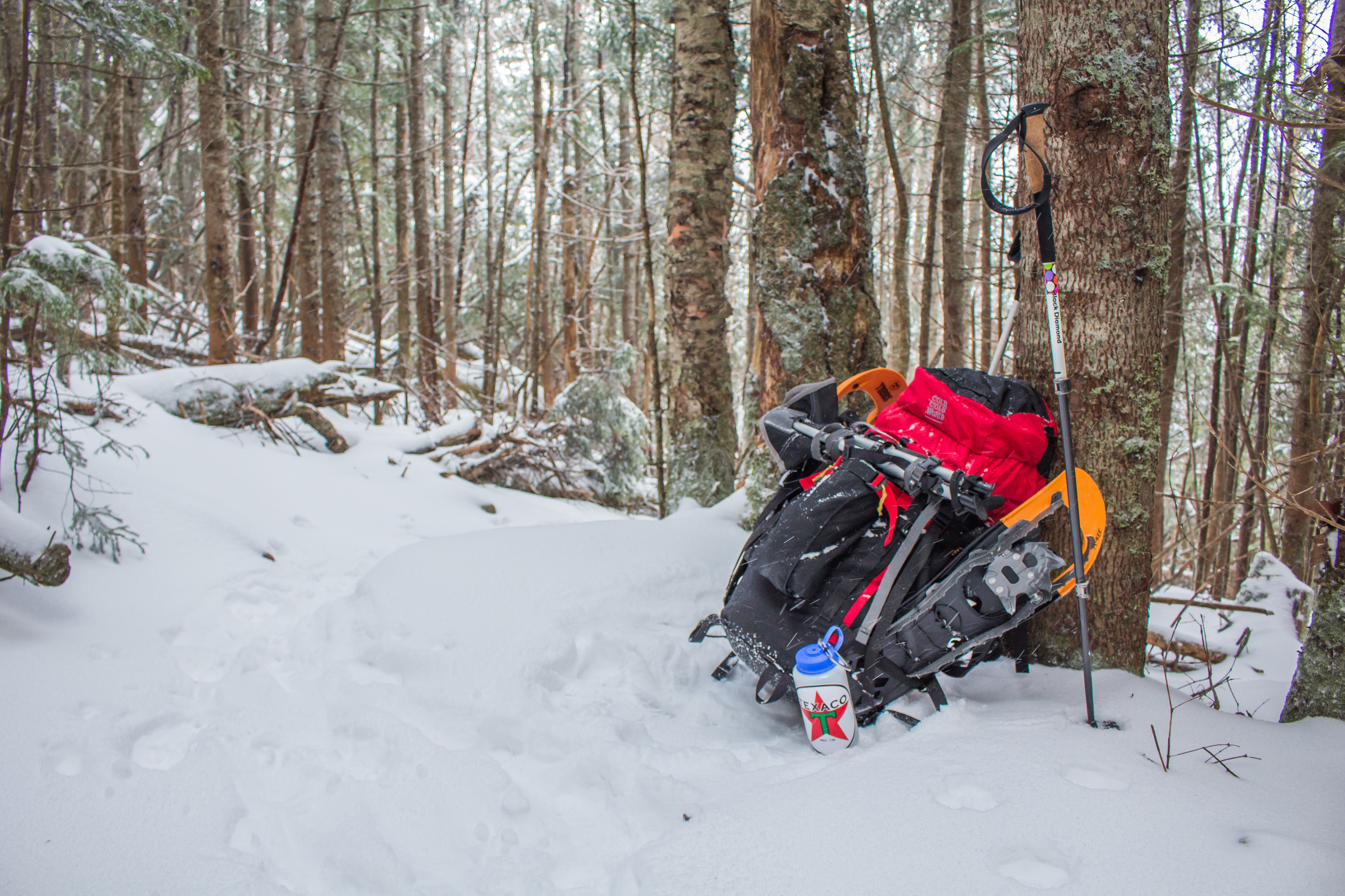
I reached Carrigan's 4,665-foot summit around noon, slightly disappointed in my timing of 3.5 hours to cover 5 miles. This is another trait of winter backpacking I'm also going to have to get used to. Not every thru-hike can be accomplished at 3 mph. I didn't venture up the mountaintop's old fire tower, but instead snuck off to a little clearing in the woods, quickly eating a sandwich after putting my fleece mid-layer back on. The wind wasn't constant, but the temperatures were much chillier than they had been at lower elevations. At this point there were 20+ people in the vicinity of the summit so I packed up my stuff, affixed my microspikes to my boots, and began my venture down the aptly named Desolation Trail. It appeared from the snowfall and lack of previous tracks that I was the first person to head that way in quite a while. I had no issue in my light traction, but some steps on my descent left me in snow deeper than my nearly knee-high gaiters. I flew down that segment of trail and got to the bottom, elevation 2,200', where it crosses Carrigan Notch Trail pretty quickly. By continuing forward a mile or so I would come across Nancy Pond Trail, the one that would ultimately take me back to NH Route 302 the next morning. Deciding to cover the distance and cross both of the trail's wide rivers before stopping, I carefully navigated each being cautious to not get my boots wet or misstep. With lots of previous spring/summer/fall hiking, I'm used to little consequence in getting my feet wet crossing a river. In this instance I was exceptionally cautious with each step to make sure my feet wouldn't get wet as doing so could end my hike very quickly. I found a nice flat spot alongside the second river around 1530hrs, knowing that sunset was timed for 1610hrs. I'll plan to hike later into the dark once Santa and I are on the trail together, but in this instance I was happy to stop and get camp set up. I was able to set up the new Mountain Hardwear Direkt2 tent within 8 minutes of dropping my bag, a remarkable improvement over my initial set-up in my living room. I do think I figured out the trick to getting it pitched quickly, something I was very thankful for given the isolation in the woods. I got all my gear set up inside in no time at all, set up my stove just outside the tent door, and immediately got dinner ready. It was at this point that I realized I had forgotten a friggin' (I assure you this was not my word of choice in the moment) lighter to ignite the stove with. Dinner Saturday night was a string cheese stick and a cold Pop-Tart instead of cheesy pasta, soup, and hot cocoa. Imagine, if you will, how disappointing that was.
With nothing else to do and darkness quickly settling over the woods, I slept from 1630 to 2100, waking up to pee and shed a few layers. One of the things I'll have to get used to is appropriately choosing layers to sleep with. I had initially fallen asleep with my compression shorts, fleece pants, long underwear top, fleece top, and puffy down jacket on. At 2100 I shed everything except my underwear base layers for the rest of the night. Temperatures dropped to twenty overnight, and hovered at about 28 inside the tent. When I awoke at 0630hrs (yeah... 14 hours of sleep!) I was concerned to find just how much moisture had been absorbed into my sleeping bag from my sweat and breath. Despite shedding the layers and hopefully sweating less as the night went on, I made the mistake of being super comfortable and burrowing down inside the bag itself, exhaling a ton of moisture into the bag. In researching this since getting home, I've learned that on a cold night a hiker can exhale up to a liter of moisture in their breath into the fabric of the sleeping bag. This is something I will not do again, and I felt lucky to be out of the woods as I left the sleeping bag unzipped on my forced-hot-water radiators today to dry out. I'm considering vapor barrier layers (VBL) for socks and sleeping bag liners, but I'm also wondering if by adjusting the ventilation and my breathing (both vents in the tent were open, but due to snow falling I left the door closed) I'll be able to not have this issue.
Sunday morning I took my time, striking camp in a little over 45 minutes, and was on the trail by 0800. There was an inch or so of new snowfall overnight on top of what appeared to be relatively untraveled trail, so I stopped and strapped on my snowshoes just to check how they worked with the extra weight of my pack. I followed along with what I believe were moose tracks (doubt anyone is riding horses in the Whites) and made my way up the 1,200' gradual incline to Norcross Pond. The trail got pretty narrow from there on, but the snowshoes continued working well and I hiked another mile to Nancy Pond, skirting the frozen water before beginning the descent back to NH302. About a half mile from the pond I met a solo hiker, chatting for a minute before continuing on. I think we both caught each other off guard, hats on covering our ears and otherwise silence in the woods. Neither of us expected to see anyone.
I stopped to send my dad a text around ten, estimating my arrival at Route 302 for noon exactly. I descended a bit faster than I thought, and he managed to arrive at the trailhead at the exact moment I was walking into the parking lot. Serendipitous.
Take homes lessons:
1) Don't be a moron. Bring a f'n lighter. Seriously can't believe I left that out.
2) Need a vapor barrier for my feet. My boots were wet, my socks smelled like hell after one day... this will be horrid after a month.
3) Need to either practice better moisture management in the tent/sleeping bag, or add a VBL for that too.
4) Revisit lesson number one.
Honestly, other than that I think I did a great job getting some good mileage in and utilizing most of the gear I brought, save for my change of clothes and other socks. The SPOT GPS worked well checking me in and tracking my progress, and my apparel did a great job and covering different bases of exterior temps and body temp regulation.
At this point I'll pick up a few small extra items, and will turn my sights towards planning our routes/days, food, and other last minute small details before the hike. I don't love the idea of an itinerary for this hike, but I think that given our timetable it's going to be necessary to know at minimum where we need to be in order to finish on time. Trust me, for as much as moments of this undertaking might suck, we're going to have a blast.
Some photos for your enjoyment.
Texaco
Day mileages: 9.7 / 7.1
NH 4,000 footer: Mt. Carrigan
--
The point of this past weekend's small adventure was to do a shakedown hike, putting my new and old gear to the test. I hoped to figure out which way was best to arrange the inside of my pack, to confirm the comfort of my sleeping bag in colder mountain temperatures, and to figure out if there's anything else I needed to order before this trip gets underway in less than two week's time. I think it was a successful weekend, all things considered.
My dad dropped me off Saturday morning at the Sawyer River Road upper parking lot (elevation 1,400') around 8:30, and I began my 5-mile hike up towards Mt. Carrigan's summit. Located in the Crawford Notch region of New Hampshire's White Mountains, temperatures were in the low 30s and as expected, snow began falling about a mile in as I crossed over the trail's first river. It would continue to snow for the duration of both days of my hike. The first 2 miles of trail meandered through a quiet and slowly climbing woods terrain before crossing over the Carrigan Notch Trail, where it then began a steeper ascent. I took my time getting to the mountain's summit itself, letting a few groups of hikers go past me as they hiked up from behind. Each seemed to be sporting microspike traction (the lightest/least aggressive option) on their boots, and typical Osprey/Gregory 25 liter day packs with enough gear to get them to the summit and back. At that point I had no traction on and wasn't feeling it necessary, so I kept going bare booted. Halfway up the climb I shed my fleece layer, leaving me with just my long underwear top and Marmot shell that did me fine the rest of the way to the summit. I stopped at the upper ridge walk about 1/2 mile from the peak to take photos; with temps in the low 20s and wind howling across the ridge I got chilly quickly, but that's the photographer in me going any length for a photo. I'll have to get better at not doing that during the thru-hike.
I reached Carrigan's 4,665-foot summit around noon, slightly disappointed in my timing of 3.5 hours to cover 5 miles. This is another trait of winter backpacking I'm also going to have to get used to. Not every thru-hike can be accomplished at 3 mph. I didn't venture up the mountaintop's old fire tower, but instead snuck off to a little clearing in the woods, quickly eating a sandwich after putting my fleece mid-layer back on. The wind wasn't constant, but the temperatures were much chillier than they had been at lower elevations. At this point there were 20+ people in the vicinity of the summit so I packed up my stuff, affixed my microspikes to my boots, and began my venture down the aptly named Desolation Trail. It appeared from the snowfall and lack of previous tracks that I was the first person to head that way in quite a while. I had no issue in my light traction, but some steps on my descent left me in snow deeper than my nearly knee-high gaiters. I flew down that segment of trail and got to the bottom, elevation 2,200', where it crosses Carrigan Notch Trail pretty quickly. By continuing forward a mile or so I would come across Nancy Pond Trail, the one that would ultimately take me back to NH Route 302 the next morning. Deciding to cover the distance and cross both of the trail's wide rivers before stopping, I carefully navigated each being cautious to not get my boots wet or misstep. With lots of previous spring/summer/fall hiking, I'm used to little consequence in getting my feet wet crossing a river. In this instance I was exceptionally cautious with each step to make sure my feet wouldn't get wet as doing so could end my hike very quickly. I found a nice flat spot alongside the second river around 1530hrs, knowing that sunset was timed for 1610hrs. I'll plan to hike later into the dark once Santa and I are on the trail together, but in this instance I was happy to stop and get camp set up. I was able to set up the new Mountain Hardwear Direkt2 tent within 8 minutes of dropping my bag, a remarkable improvement over my initial set-up in my living room. I do think I figured out the trick to getting it pitched quickly, something I was very thankful for given the isolation in the woods. I got all my gear set up inside in no time at all, set up my stove just outside the tent door, and immediately got dinner ready. It was at this point that I realized I had forgotten a friggin' (I assure you this was not my word of choice in the moment) lighter to ignite the stove with. Dinner Saturday night was a string cheese stick and a cold Pop-Tart instead of cheesy pasta, soup, and hot cocoa. Imagine, if you will, how disappointing that was.
With nothing else to do and darkness quickly settling over the woods, I slept from 1630 to 2100, waking up to pee and shed a few layers. One of the things I'll have to get used to is appropriately choosing layers to sleep with. I had initially fallen asleep with my compression shorts, fleece pants, long underwear top, fleece top, and puffy down jacket on. At 2100 I shed everything except my underwear base layers for the rest of the night. Temperatures dropped to twenty overnight, and hovered at about 28 inside the tent. When I awoke at 0630hrs (yeah... 14 hours of sleep!) I was concerned to find just how much moisture had been absorbed into my sleeping bag from my sweat and breath. Despite shedding the layers and hopefully sweating less as the night went on, I made the mistake of being super comfortable and burrowing down inside the bag itself, exhaling a ton of moisture into the bag. In researching this since getting home, I've learned that on a cold night a hiker can exhale up to a liter of moisture in their breath into the fabric of the sleeping bag. This is something I will not do again, and I felt lucky to be out of the woods as I left the sleeping bag unzipped on my forced-hot-water radiators today to dry out. I'm considering vapor barrier layers (VBL) for socks and sleeping bag liners, but I'm also wondering if by adjusting the ventilation and my breathing (both vents in the tent were open, but due to snow falling I left the door closed) I'll be able to not have this issue.
Sunday morning I took my time, striking camp in a little over 45 minutes, and was on the trail by 0800. There was an inch or so of new snowfall overnight on top of what appeared to be relatively untraveled trail, so I stopped and strapped on my snowshoes just to check how they worked with the extra weight of my pack. I followed along with what I believe were moose tracks (doubt anyone is riding horses in the Whites) and made my way up the 1,200' gradual incline to Norcross Pond. The trail got pretty narrow from there on, but the snowshoes continued working well and I hiked another mile to Nancy Pond, skirting the frozen water before beginning the descent back to NH302. About a half mile from the pond I met a solo hiker, chatting for a minute before continuing on. I think we both caught each other off guard, hats on covering our ears and otherwise silence in the woods. Neither of us expected to see anyone.
I stopped to send my dad a text around ten, estimating my arrival at Route 302 for noon exactly. I descended a bit faster than I thought, and he managed to arrive at the trailhead at the exact moment I was walking into the parking lot. Serendipitous.
Take homes lessons:
1) Don't be a moron. Bring a f'n lighter. Seriously can't believe I left that out.
2) Need a vapor barrier for my feet. My boots were wet, my socks smelled like hell after one day... this will be horrid after a month.
3) Need to either practice better moisture management in the tent/sleeping bag, or add a VBL for that too.
4) Revisit lesson number one.
Honestly, other than that I think I did a great job getting some good mileage in and utilizing most of the gear I brought, save for my change of clothes and other socks. The SPOT GPS worked well checking me in and tracking my progress, and my apparel did a great job and covering different bases of exterior temps and body temp regulation.
At this point I'll pick up a few small extra items, and will turn my sights towards planning our routes/days, food, and other last minute small details before the hike. I don't love the idea of an itinerary for this hike, but I think that given our timetable it's going to be necessary to know at minimum where we need to be in order to finish on time. Trust me, for as much as moments of this undertaking might suck, we're going to have a blast.
Some photos for your enjoyment.
Texaco
Taking a break on Signal Ridge Trail
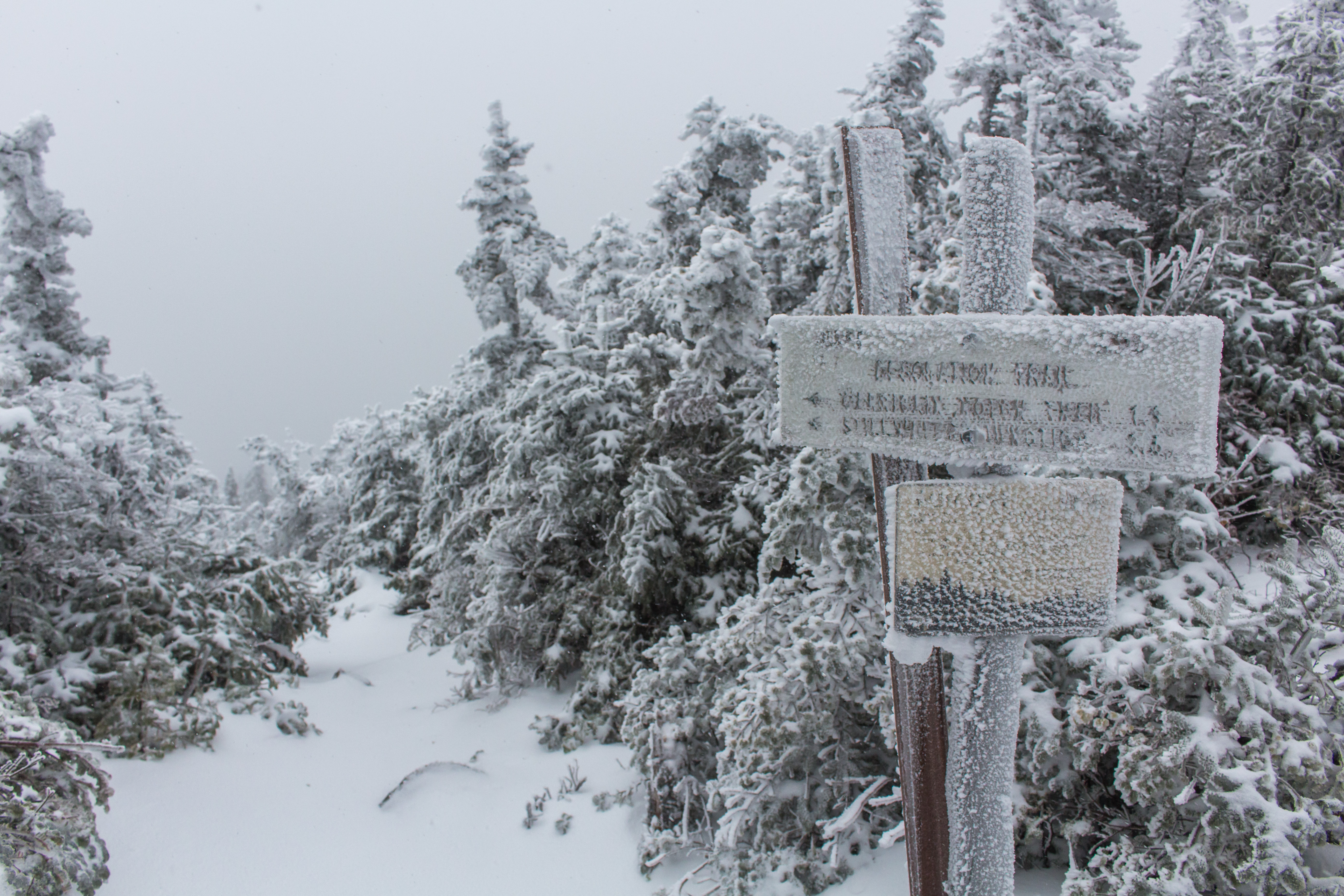
Mt. Carrigan's icy summit, turning down Desolation Trail
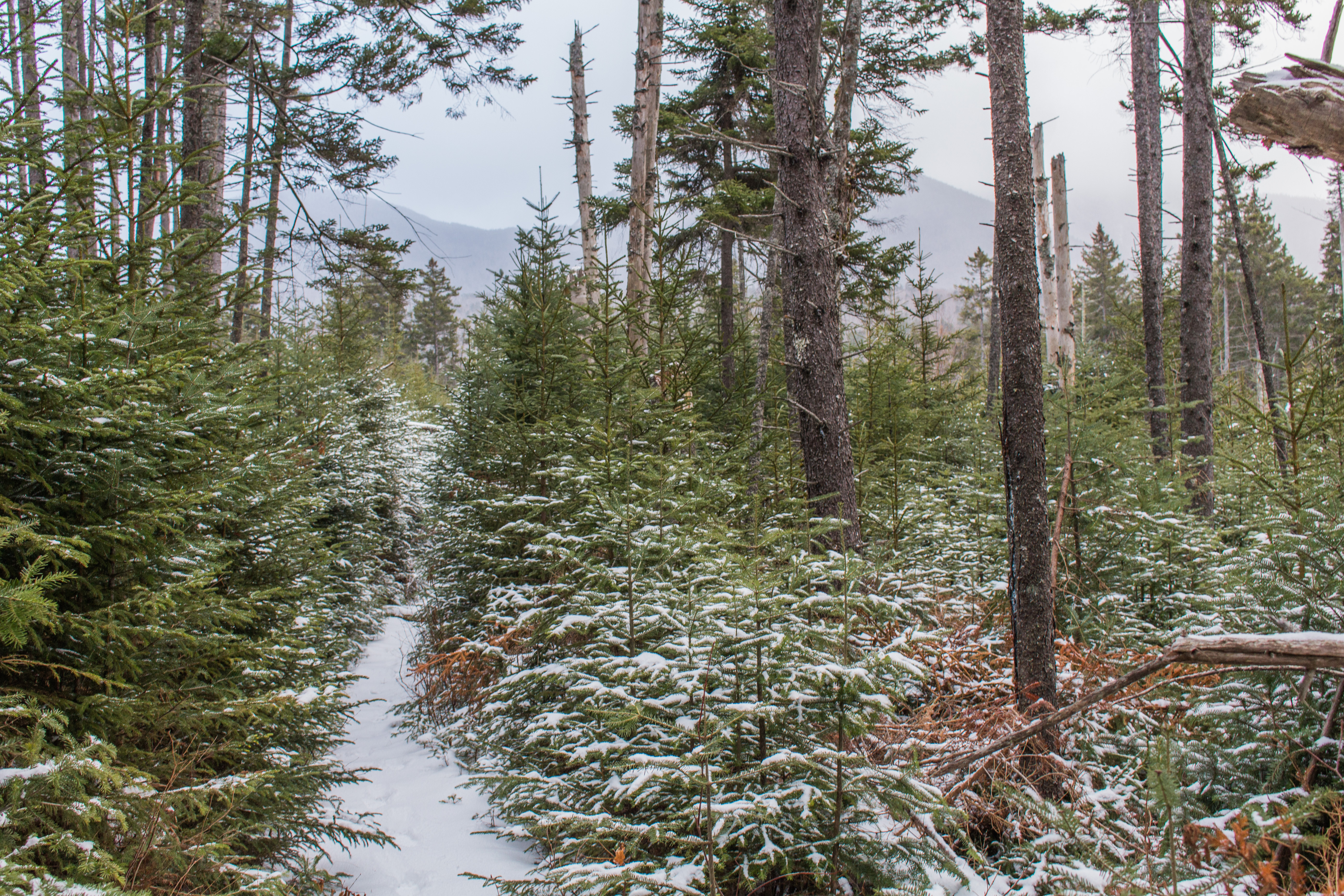
Picturesque Nancy Pond Trail - Mt. Carrigan in the background
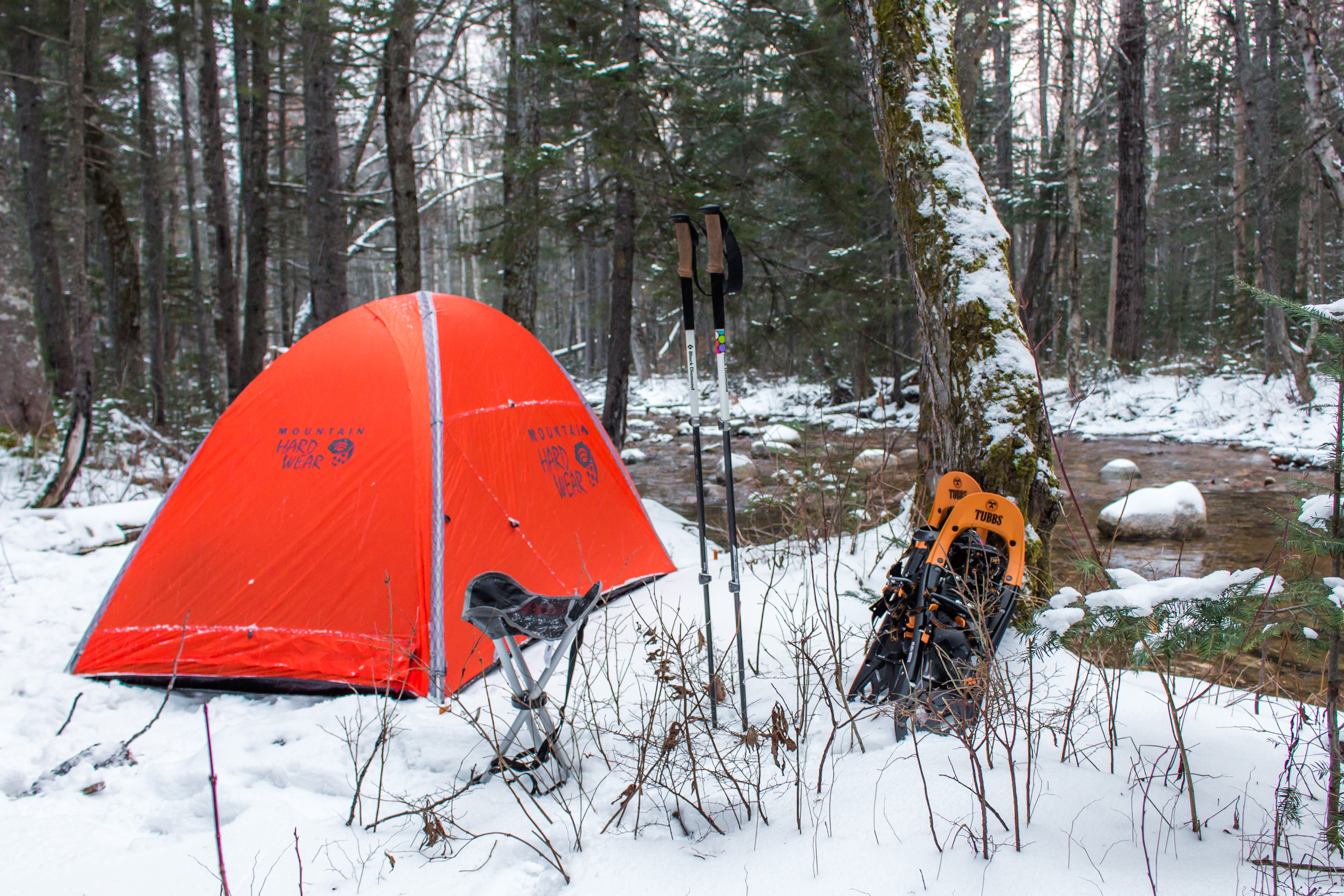
Home for the night alongside Norcross Brook
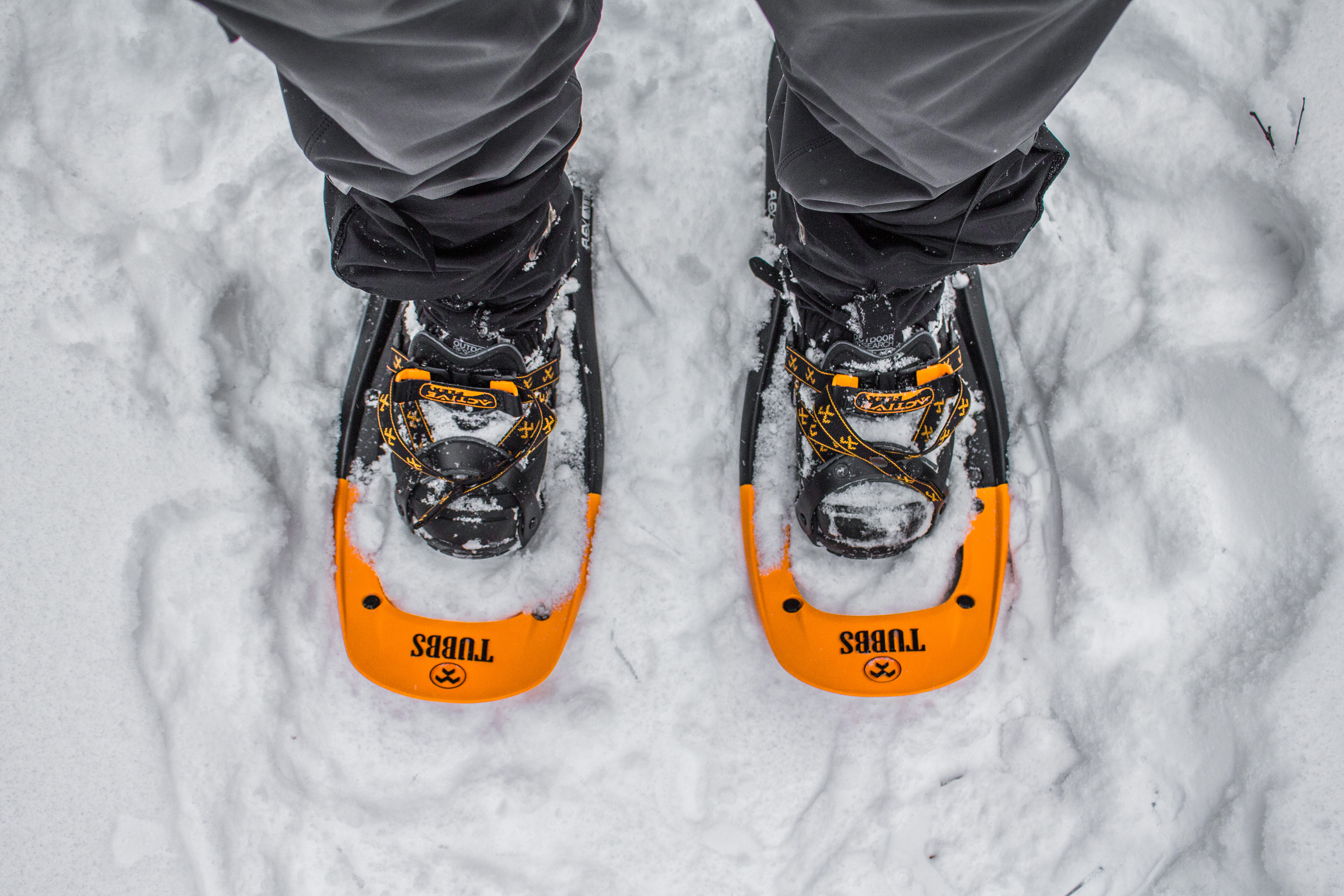
Snowshoes on the Trail
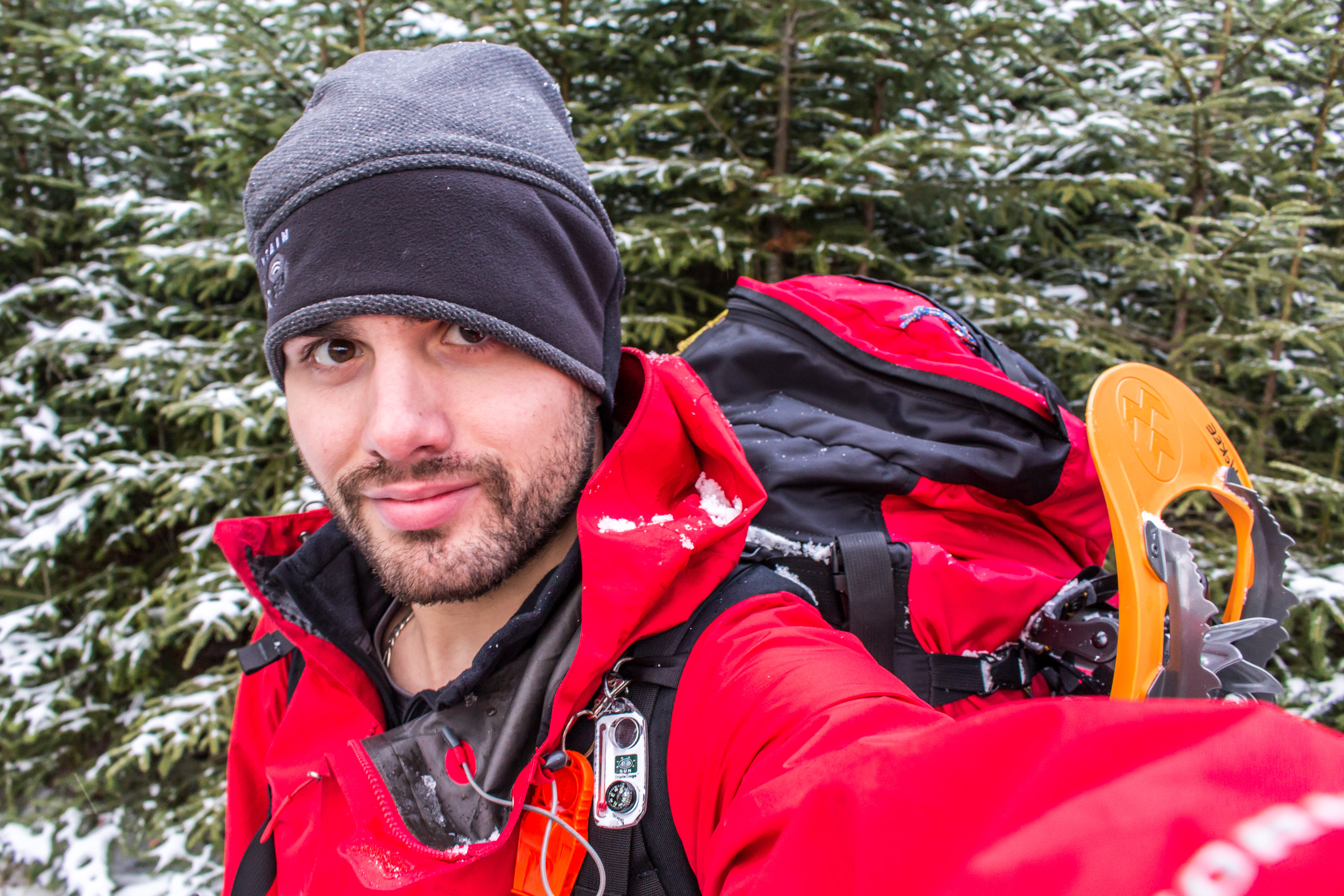
Dressed for the weather and terrain


 RSS Feed
