2180miles
  • Home
  • Adventure Blog
  • Overland
    • Meet The Jeep
    • Mods & Installs
    • Overland Gear
    • Trip Reports & Videos >
      • Allagash Winter 2019
      • Greece Adventures 2019
      • Overland Expo East 2018
      • Allagash Wilderness 2018
      • Trans-Canada Overland 2017
      • QB-5 Adventure 2017
  • Long Trail
    • Trip Summary
    • Photojournal
    • Hike Statistics
  • Appalachian Trail
    • Trip Summary
    • Photojournal
    • Gear Talk
    • Hike Statistics
    • Financial Planning
  • Bicycling America
    • Trip Summary
    • Photojournal
  • Blog

From Killington Peak

6/30/2014

1 Comment


Day: 87

Day mileage: 20

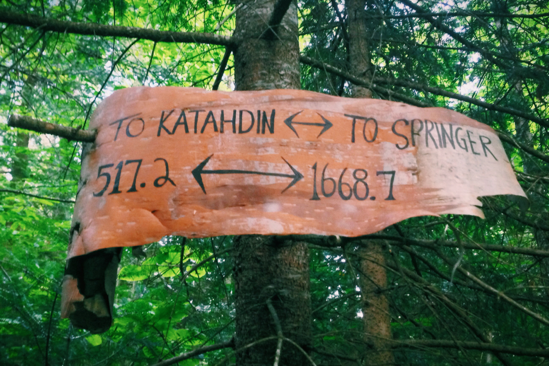
AT total mileage: 1,690.9

Time: 7.5 hours 

--

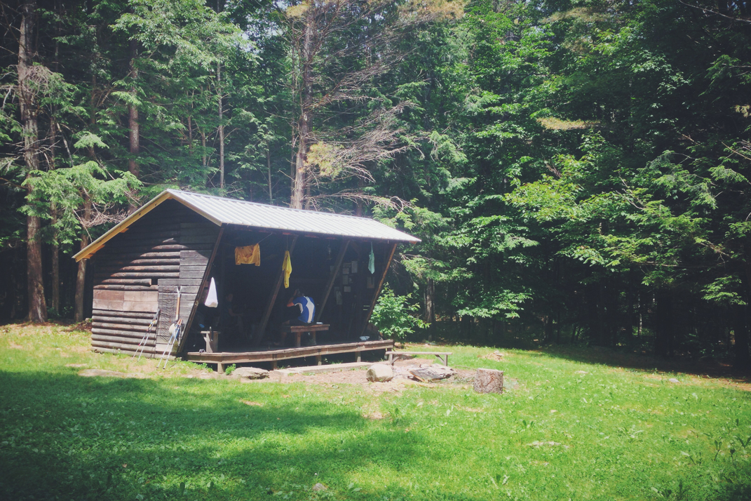
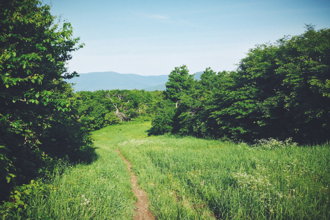
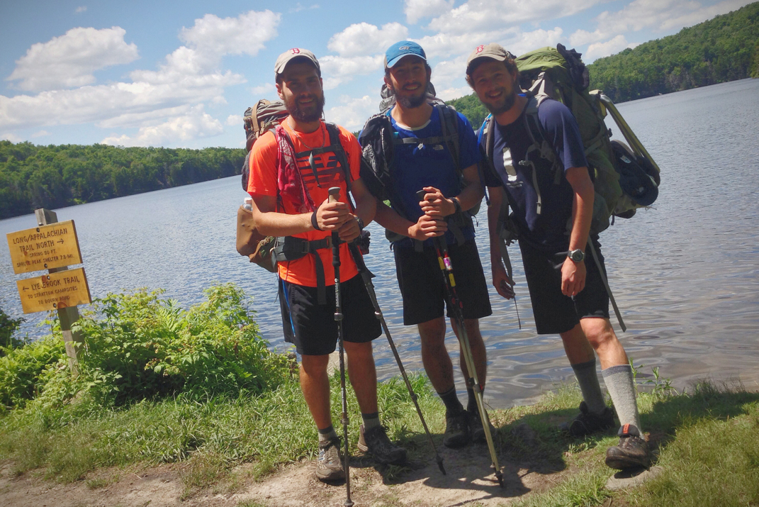
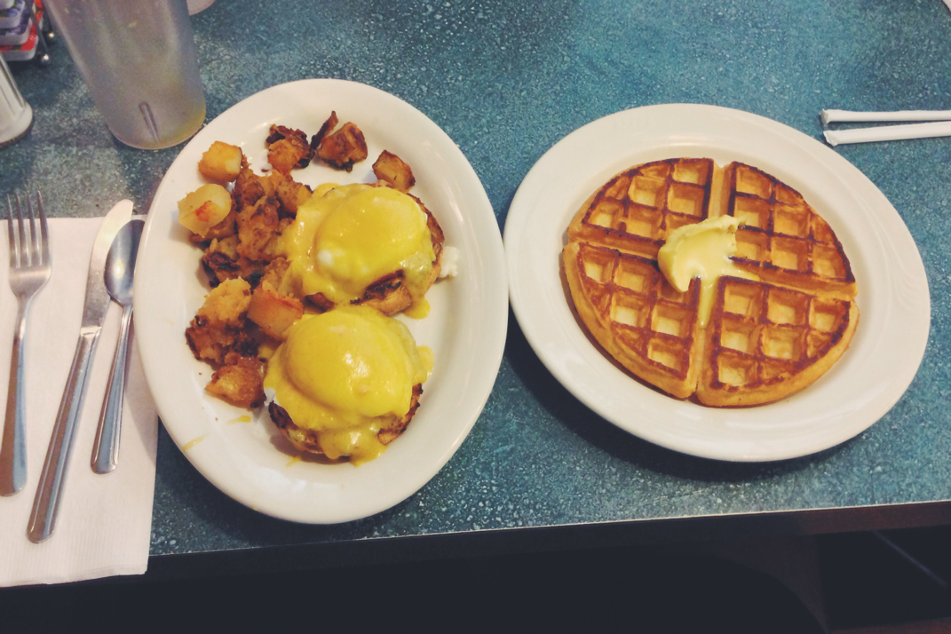
In a unparalleled feat of machine-like hiking, I led Santa, Legs, and Naila through the first five miles of trail in an hour and a half. We had departed the shelter shortly after 7, and after a quick descent from our shelter we began a 1,300' climb to the top of an unnamed peak. The climb included some switchbacks, but was still a strenuous one that had me soaked in sweat shortly after beginning. I'm not entirely sure why I felt the need to hike it so ferociously, but it felt amazing to do so, and neither of the two hiking with me complained, so on we trekked. We had decided before leaving that we would all stop at the first shelter we came to for a quick break, not realizing we would be there so quickly. Upon arrival we relaxed for quite a while, awaiting the appearance of Dorothy and Rocket Girl. Eating a second breakfast and reading my Everest book, we were there for almost an hour before heading on, off the bat climbing a 200' rise before beginning a long descent into a gap to cross VT 103 at Clarendon Gorge. Passing some day hikers, the trail made a remarkably abrupt change to its terrain with a 1/2 mile, 800' climb up an incredibly steep fallen rock field, before descending down to the next shelter. Since we were already 9 miles into the day at this point, having hiked quickly and in a very focused manner, we stopped for lunch. The shelter was also occupied by an older guy who was a bit on the odd side, making random comments about the trail and napping on and off during our time there. At one point he woke up and questioned our presence... he seemed to be completely sure he'd been there alone.

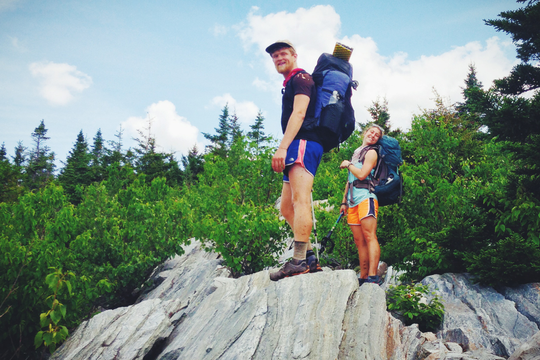
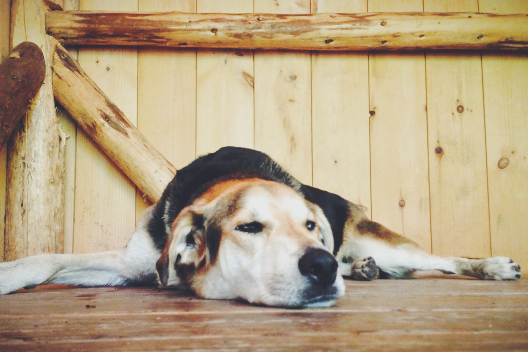
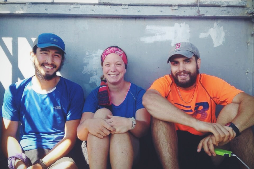
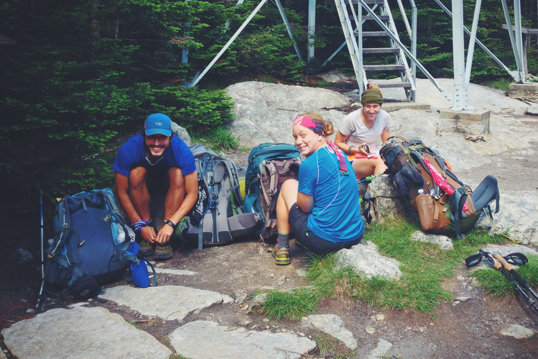
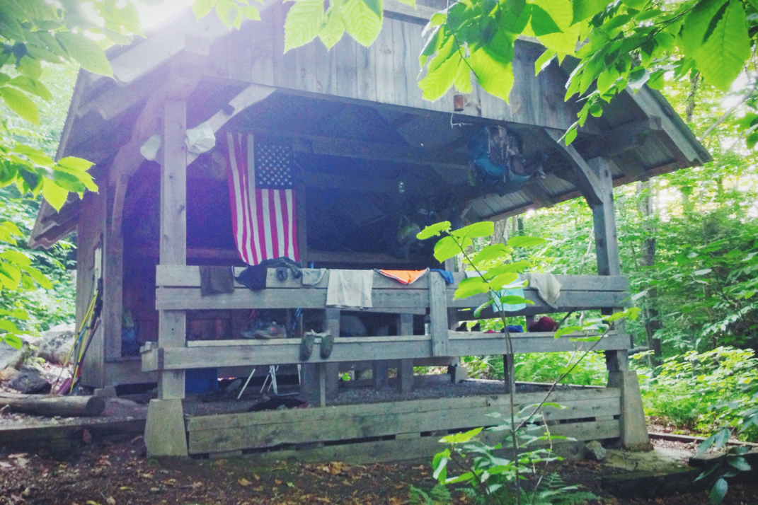
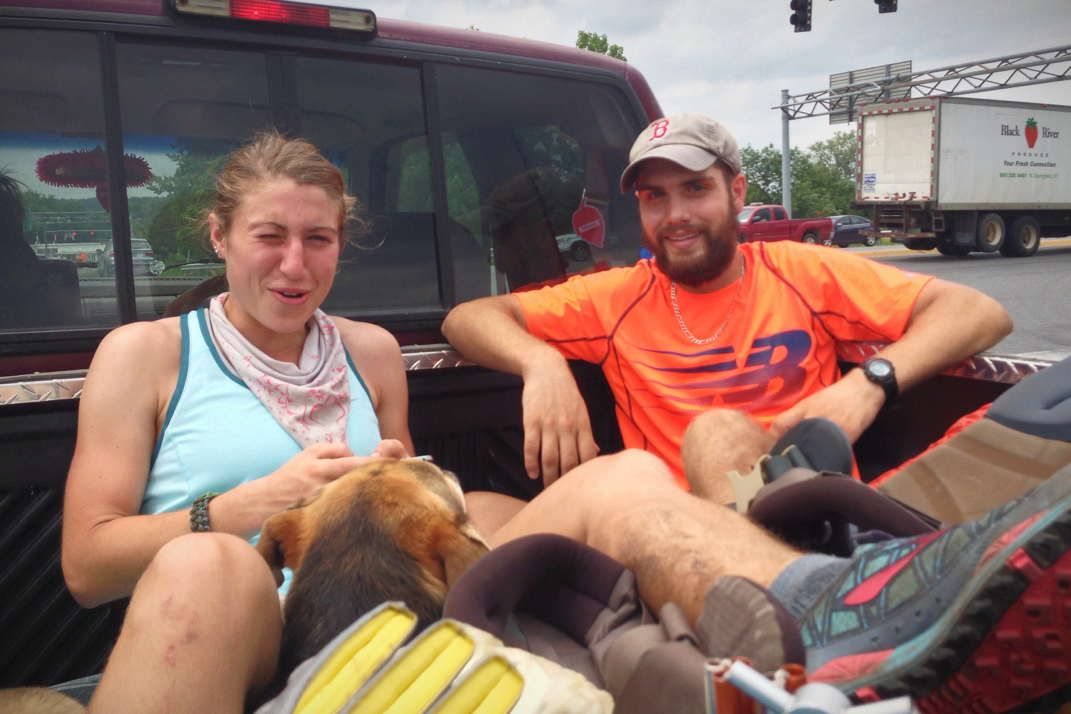
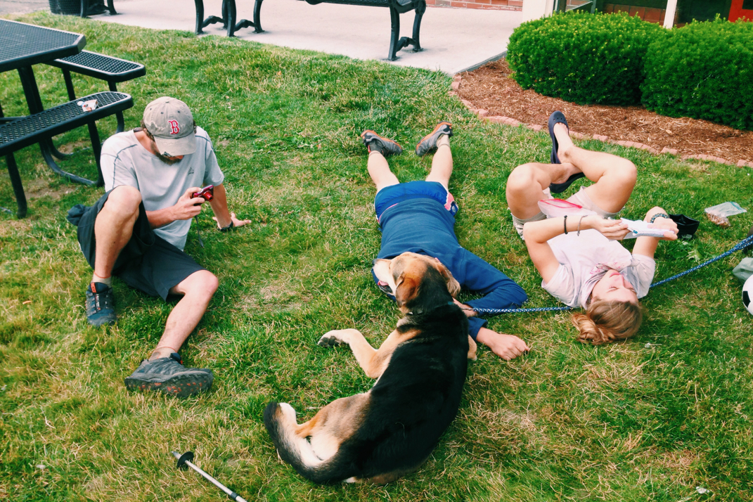
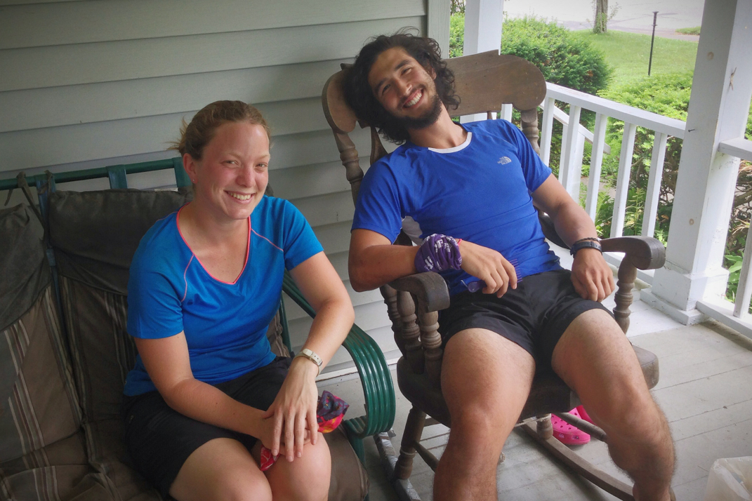
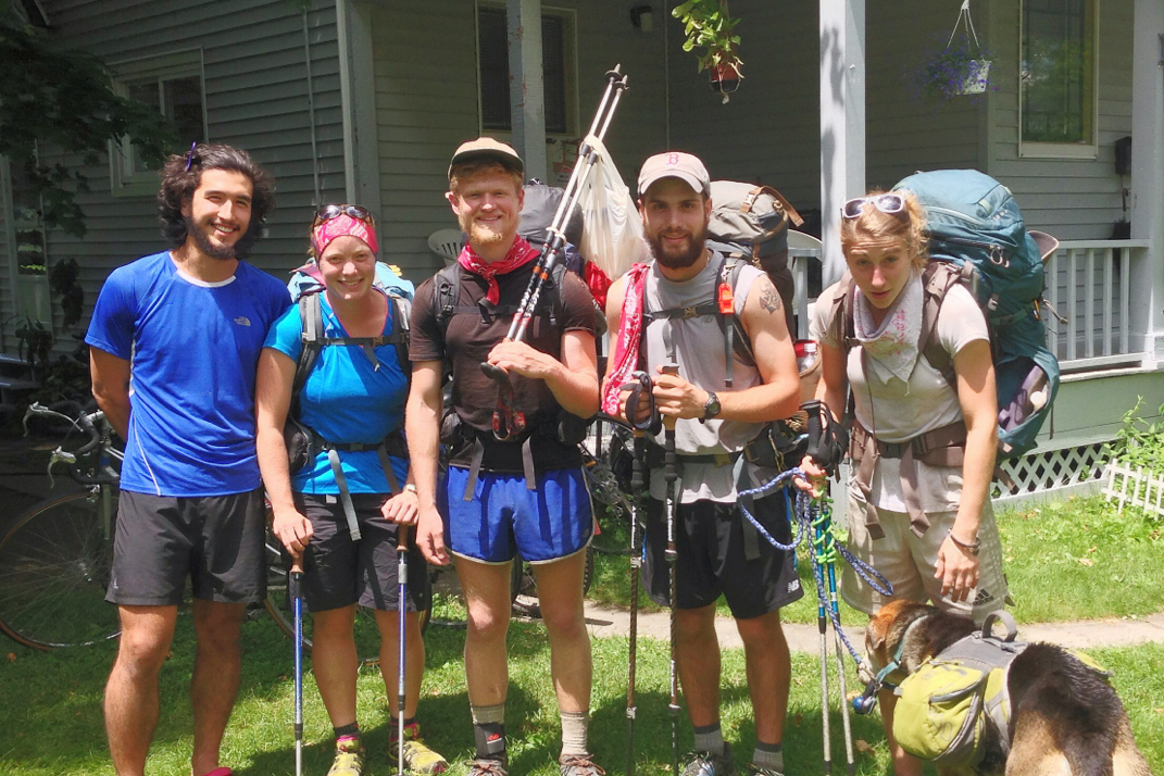
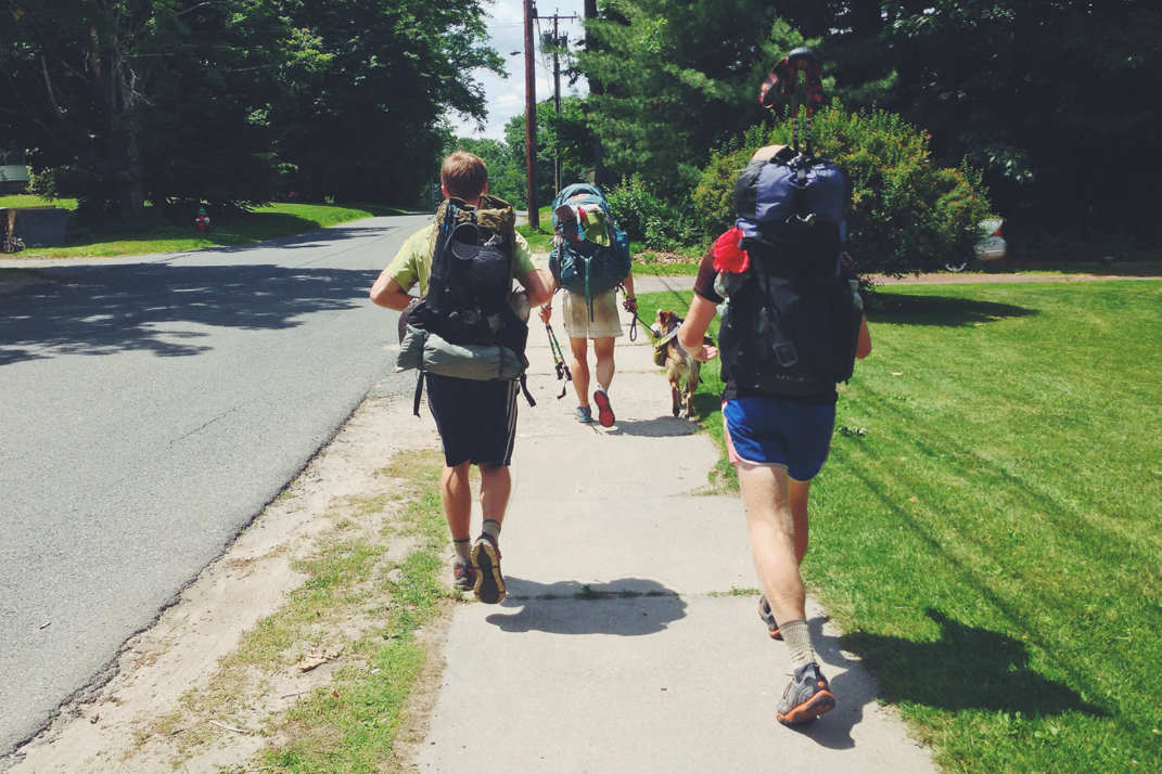
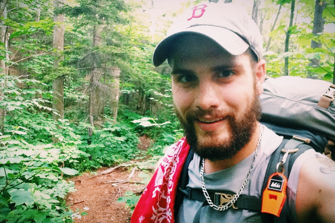
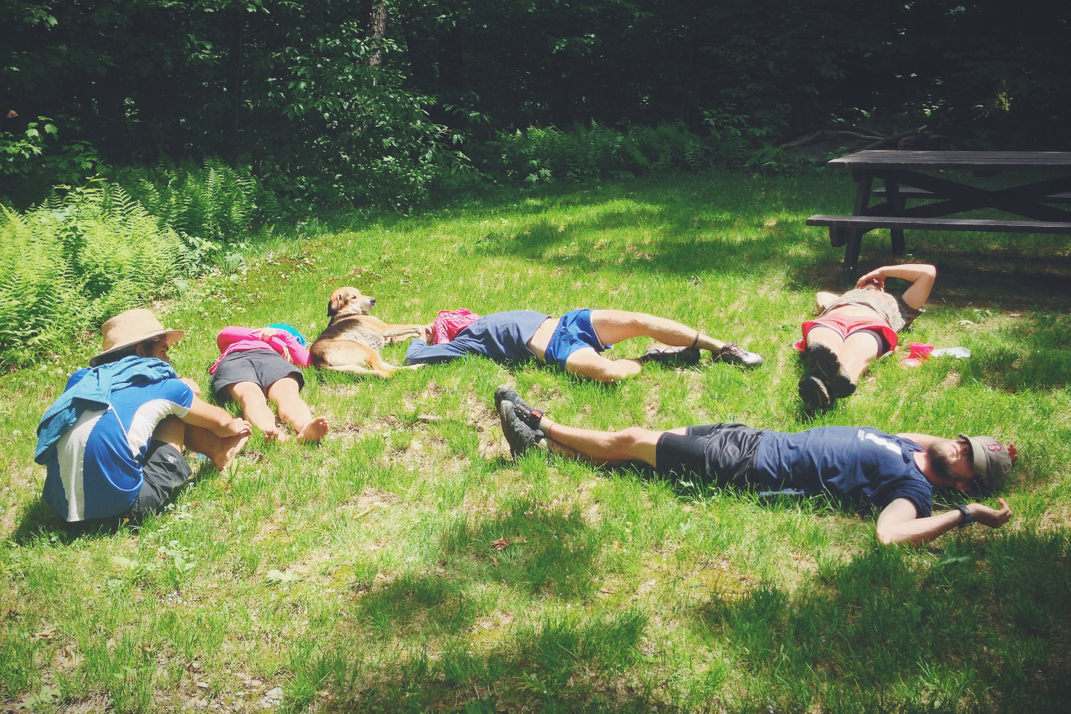
After each of us had arrived and eaten, we slowly became lazy in the heat and humidity of the early afternoon. I laid down on one of the shelter's lower bunks and closed my eyes for a little, resting my head on Naila's furry stomach. After a few minutes both Rocket and Dorothy did the same thing on other bunks, and Legs stretched out next to me and the dog. While Rocket and Dorothy slept, she and I talked for a long while, going through photos on my iPhone of the trip, my travels, and other random bits of my life. It's quite interesting to paint a picture of the backstory of my life for someone who's never even known me without a beard. You put into scale the fact that I've only known this group for 2 weeks, and there really is so much of my life they don't know about, yet it still can sometimes feel like I've known them forever. Again, as we've discussed, the power of the trail's great equalization. We probably relaxed there for two hours before anyone moved; at one point Legs said both Dorothy and Rocket's names out loud, and upon neither responding we decided it would be most responsible to wait until they woke up before packing our gear and hiking on. Around 1330hrs they started stirring, and we began begrudgingly packing up our gear to head out. There were only 10 miles left in the day, but those miles included an exceptionally steep climb up Beacon Hill, and later the 2,700 foot climb up to the summit of Vermont's famous Killington Peak. About half way through our relaxing break at the shelter, Santa grew restless and said goodbye to Legs and myself before hiking on. We'd planned to stay at the rickety cabin atop Killington, and would rendezvous there later in the day. 

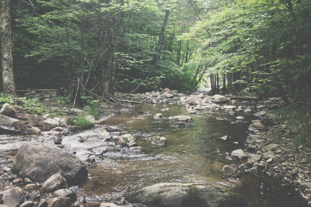
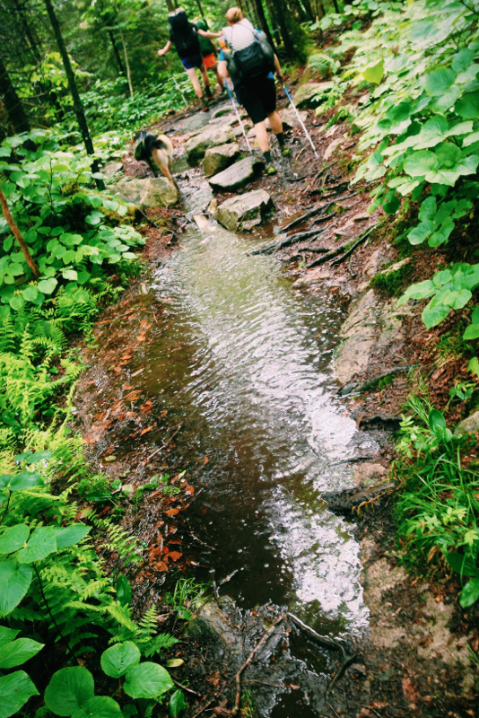
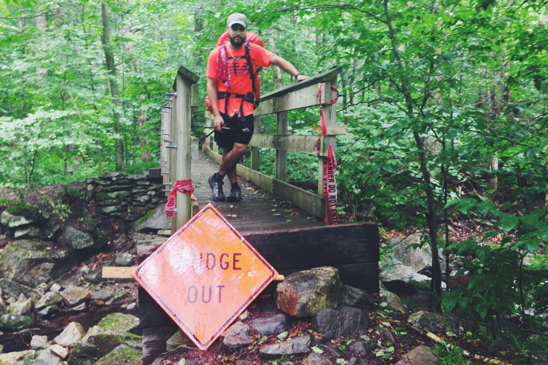
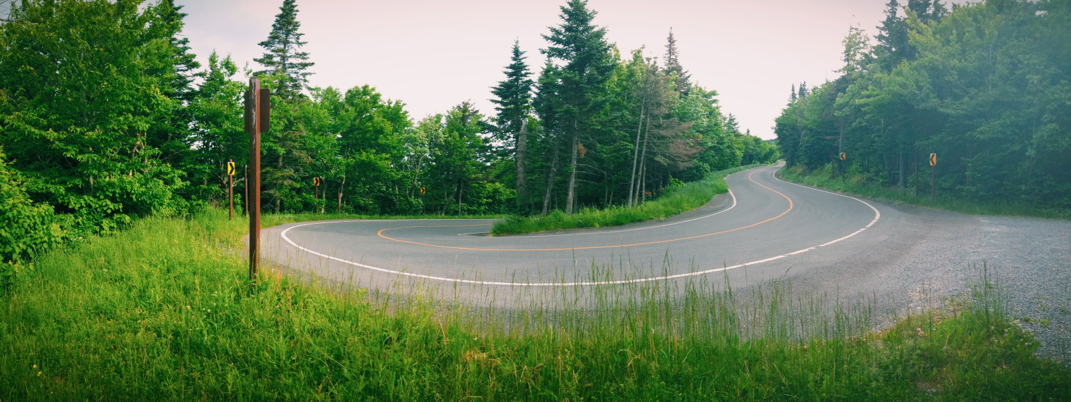
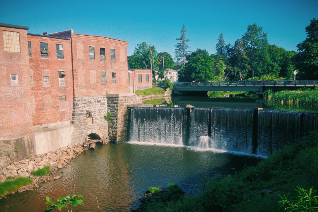
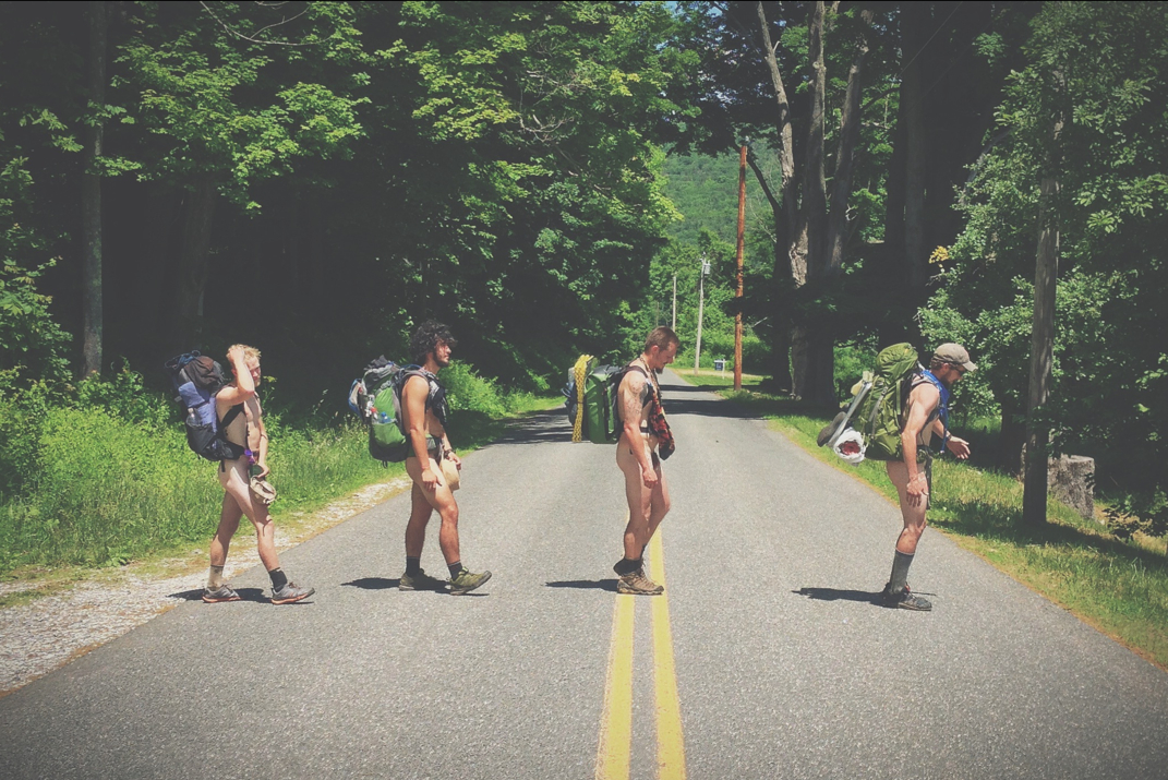
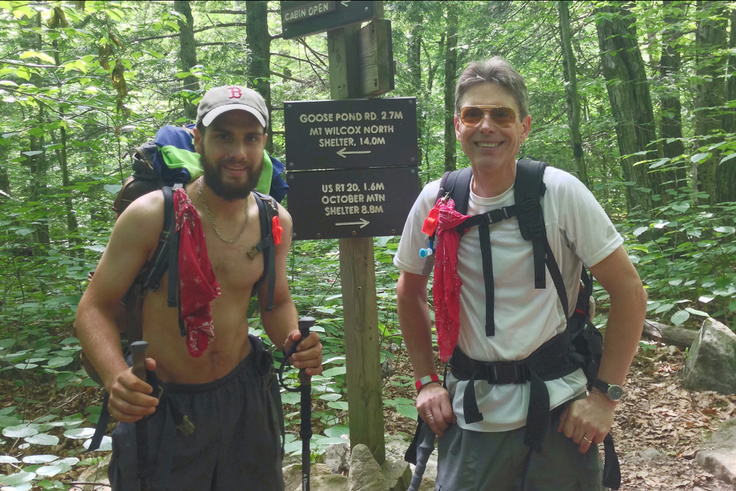
Leaving the lunch shelter and beginning the steep trudge to the top of Beacon Hill, I made it about halfway up before realizing that I'd forgotten my broken dSLR camera at the shelter. I dropped my pack and began running down the hill back to where I'd left it. Because I hike at a faster rate, it took me a minute or two before I crossed paths with the 3 others of my hiking group who stopped me, apparently having seen the camera and grabbed it before leaving. Thanking them profusely I turned around and trekked up the climb for a second time. I ended up passing them again to maintain a good clip across many of the miles the rest of the day would require. Emerging from the woods at a dirt road, I was confronted with an A.T. sign stating there was a detour due to a washed out bridge and lots of remaining trail damage from Hurricane Irene. I read the detour directions, then somewhat confused due to the lack of clarification in the writing, and hiked on in what I believed was the right direction down a dirt road. It took about half a mile for me to start doubting myself, at which point I turned around and went back to the sign. It was there that I met two southbounders who informed me that the trail was in fact passable, but it required forging a river or two and the terrain was in tough shape. By this point I had wasted enough time being confused that Legs, Rocket, and Dorothy showed up. Having settled the issue of the detour, we hiked on the normal A.T. trail despite the warning of potential challenges. It wasn't all that bad, but there's a lot of remaining evidence of the hurricane, as the riverbeds are strewn with fallen trees, trails washed out, and the obvious lack of bridges across rushing bodies of water. Luckily there was a fallen tree across the worst point of the river, which I delicately balanced across for 40' or so, crossing my fingers that I wouldn't be swimming in the river below me any time soon. 

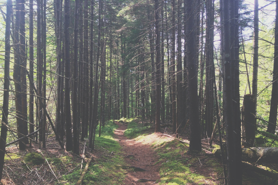
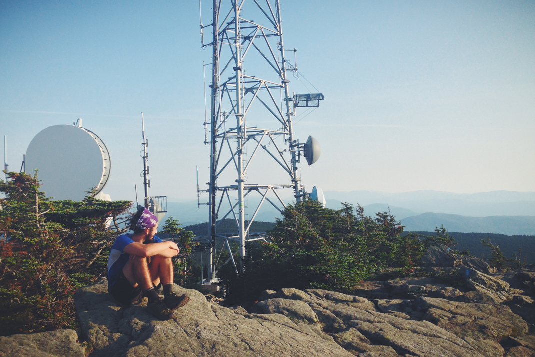
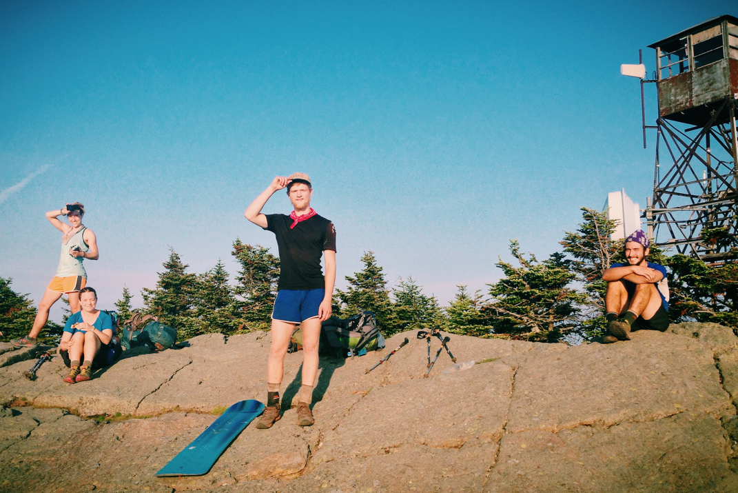
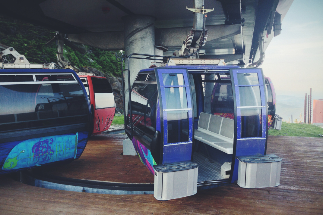
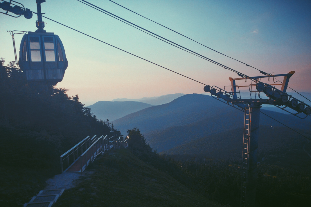
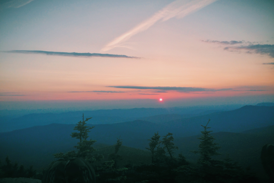
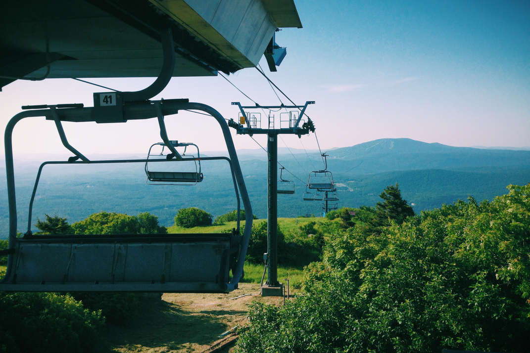
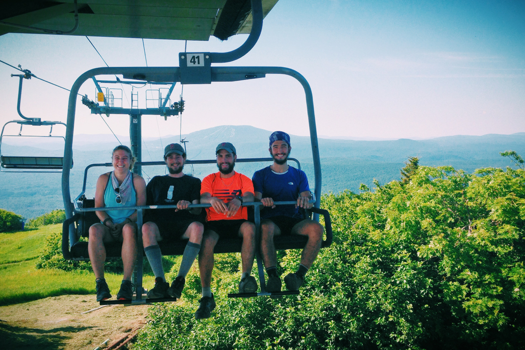
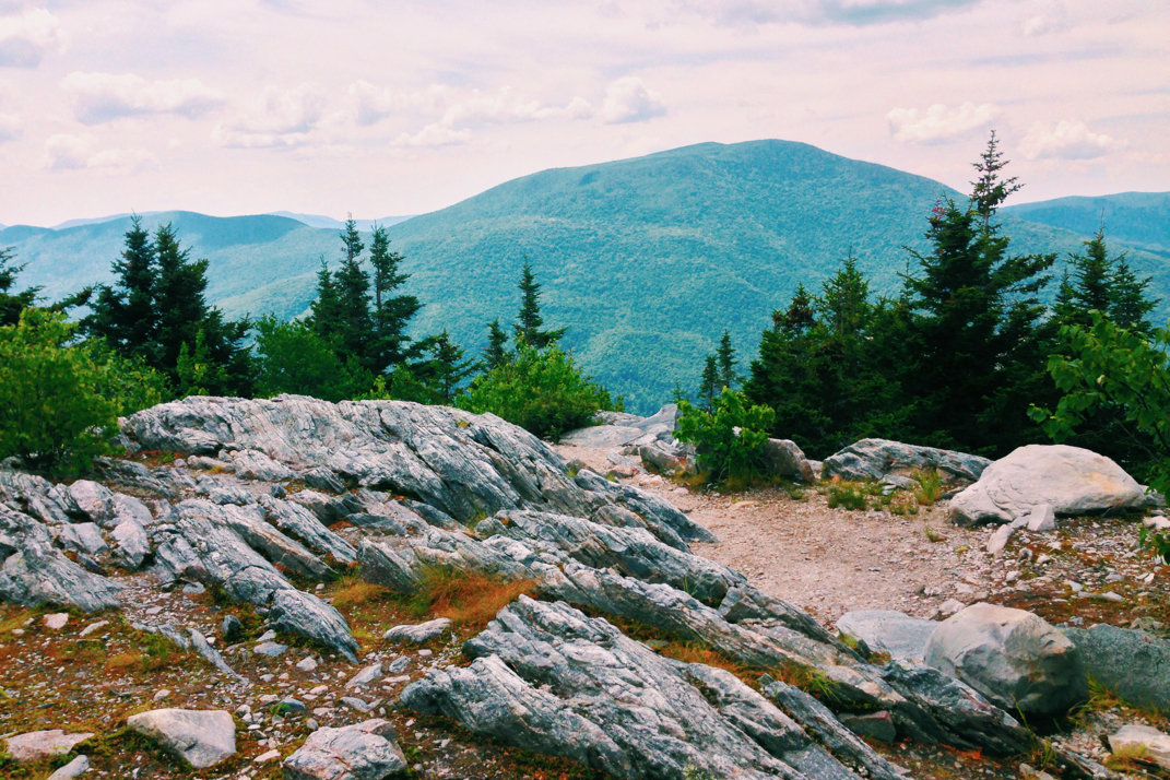
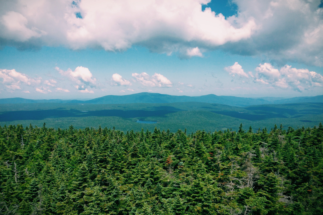
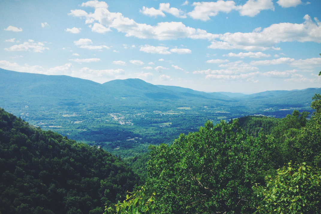
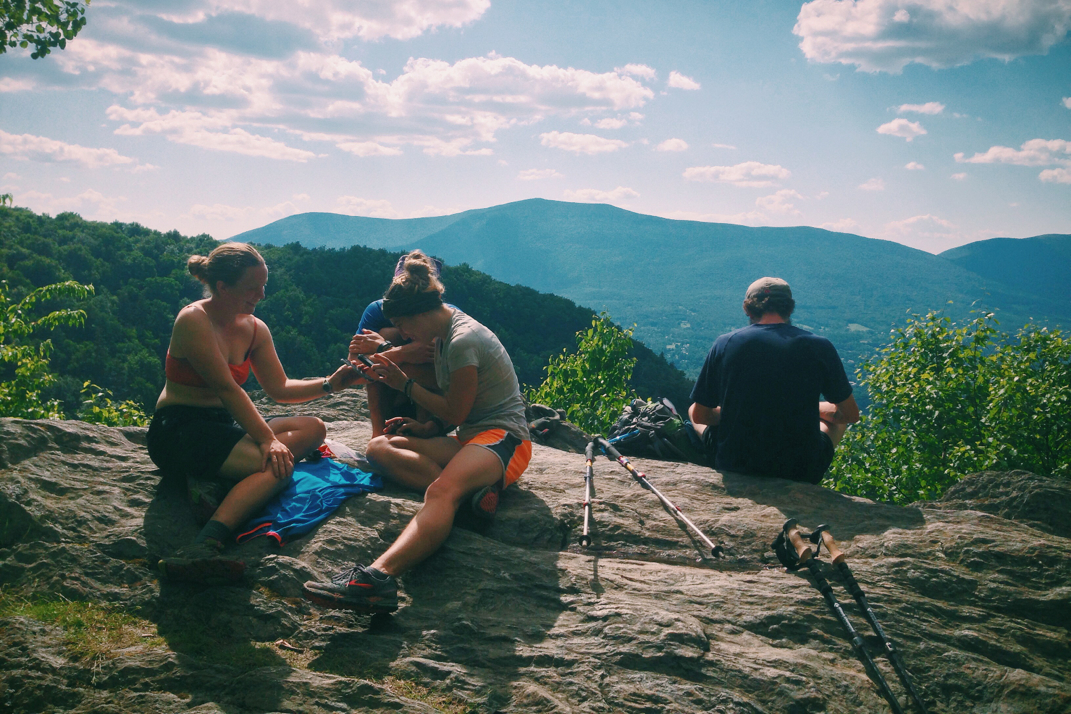
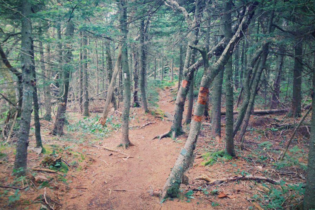
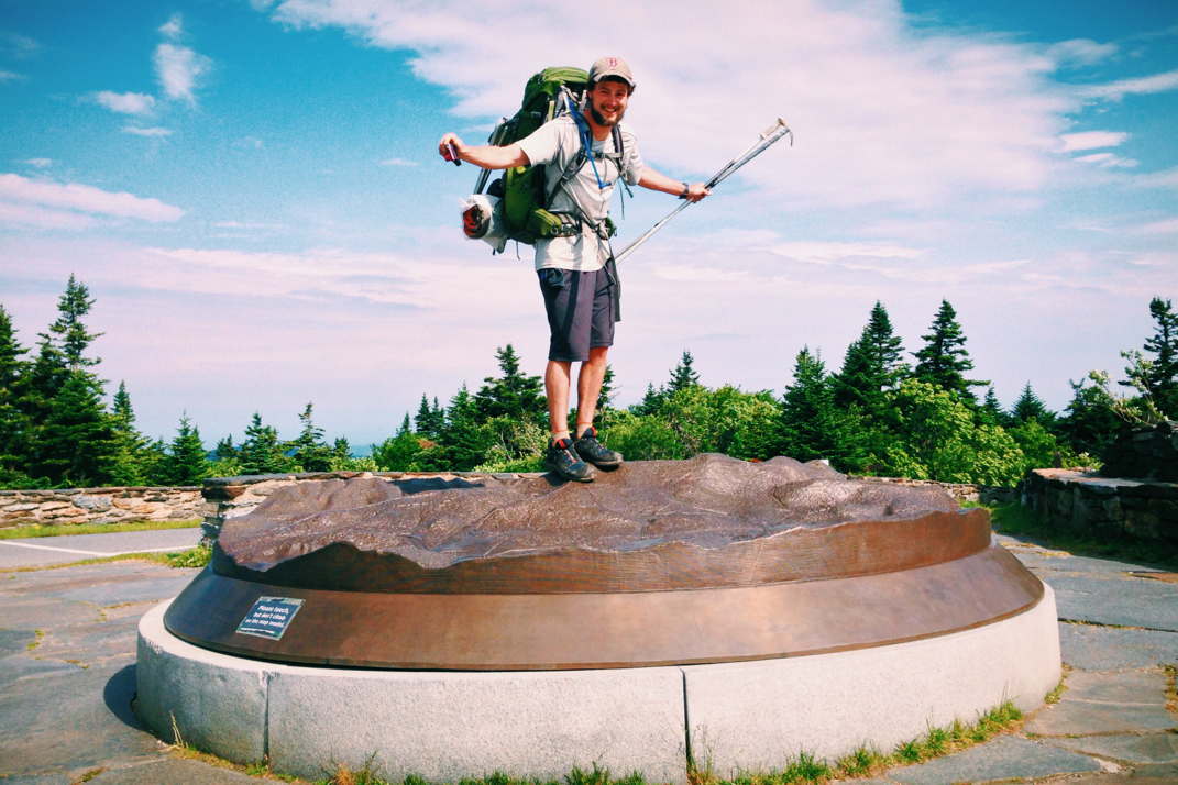
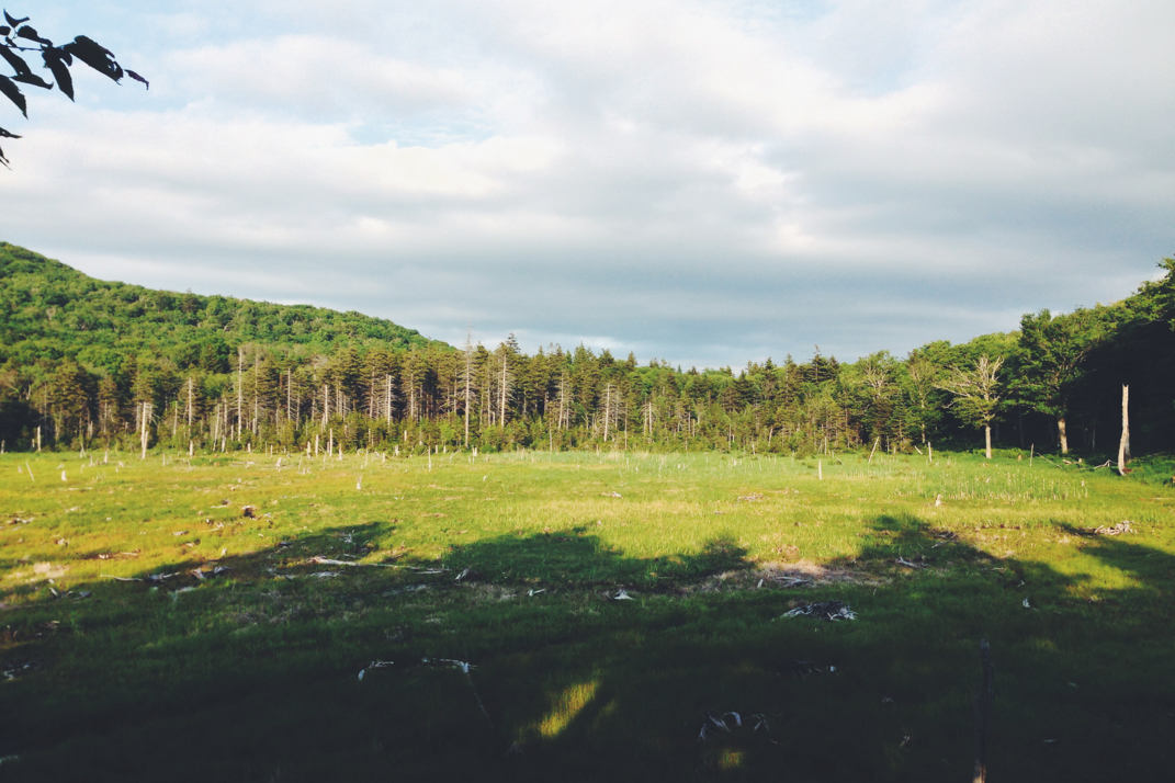
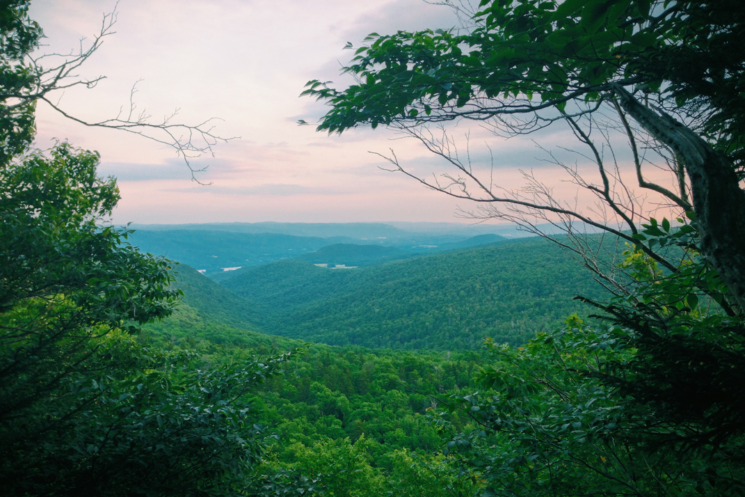
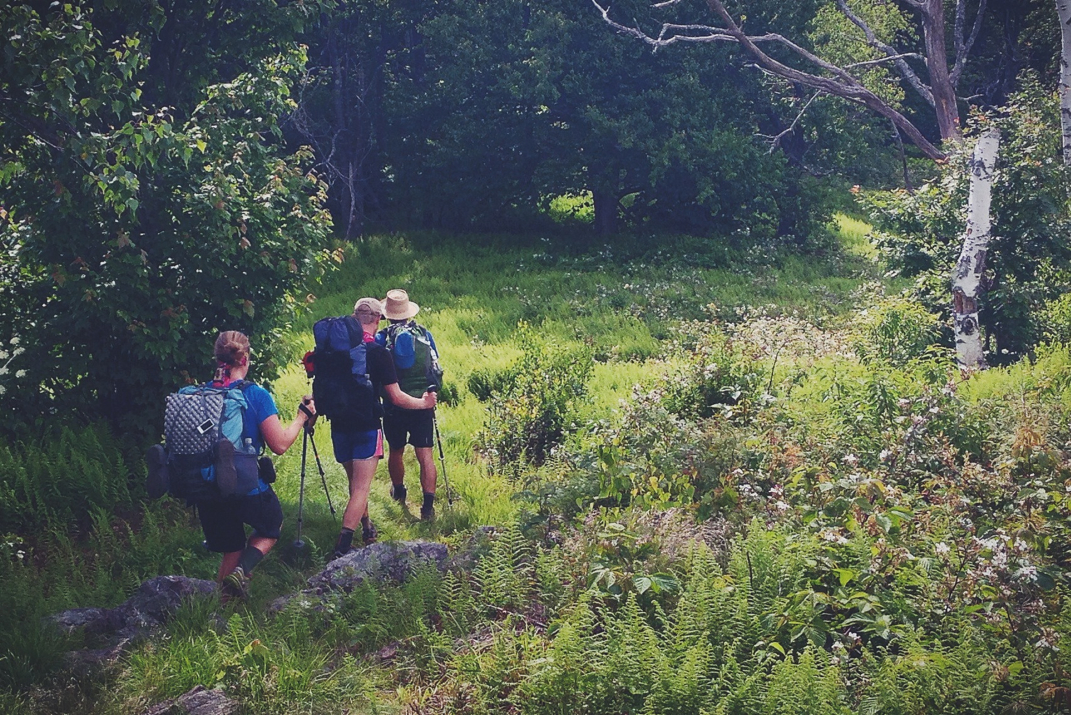
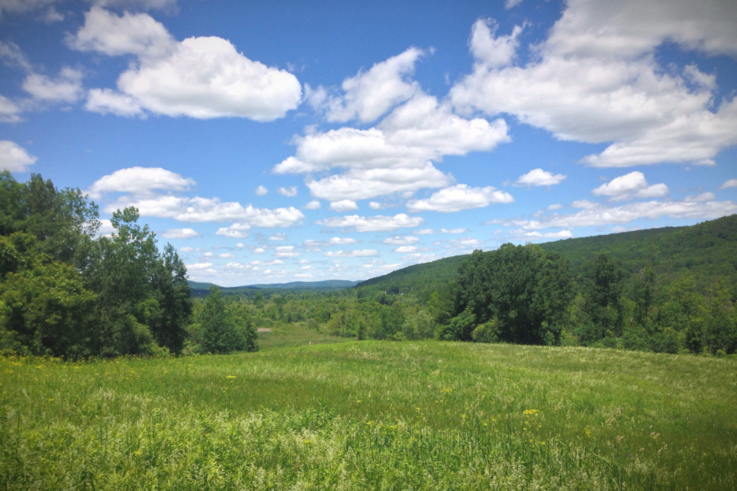
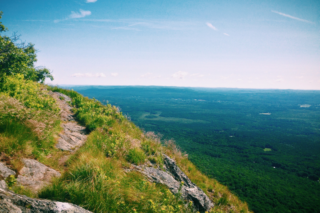
Climbing Killington was challenging and exciting. The mountain is the first in 900 miles, when the Trail climbed The Priest in Virginia, to cross over four thousand feet of elevation. Beginning gradually at the tree-littered riverbed, the trail cut sideways across the ridge leading up the mountain. Becoming obviously steeper and more challenging as the climb went on, the scenery and vegetation changed drastically to match the elevation. Abundant oak trees turned to thin pines, more obviously weathered by decades of severe storms, with roots jutting out of the ground like an obstacle course for my feet. Some sections of the ascent included hand over hand climbing over rocks, while others were more obviously traveled and had much more forgiving terrain. Noticing these changes caused me to really think about how many people have traveled this path. We can go hours, sometimes even days without seeing other hikers, but all the while might be just a few miles behind someone else trekking. It's impossible to know how many feet have traversed these woods. It ended up taking us two hours to reach the shelter on Killington. Arriving at what can only be described as a graffiti-ridden, rock constructed, ramshackle structure, undoubtedly home to many late nights of drinking and smoking by hikers and winter sport enthusiasts alike, the Cooper Lodge was immediately decided to a place we would not spend the night. Filling water at a pristine and frigidly cold natural spring, we began an extraordinarily strenuous 0.3 mile climb up a rocky face to the true summit of Killington. From the highest point, a rock slab carved out an unfathomable sum of years ago by receding glaciers, I turned to see panoramic views of the Green Mountains jaggedly defining the line between the sky and earth. We lingered as a group for a while, soaking in the sunlight and views before hiking another quarter mile down to the unique location where we would spend the night. Perched at the highest point of Killington's machinery-accessible terrain was a lodge, closed for the night, and the gondola loading and unloading deck. Three gondolas were on deck level, doors open, and begging for us to sleep in them. We set up sleeping bags on the benches, cooked dinner in the gusting wind, and returned to the rock face summit to watch the sun disappear for the night behind a wispy clouded horizon.

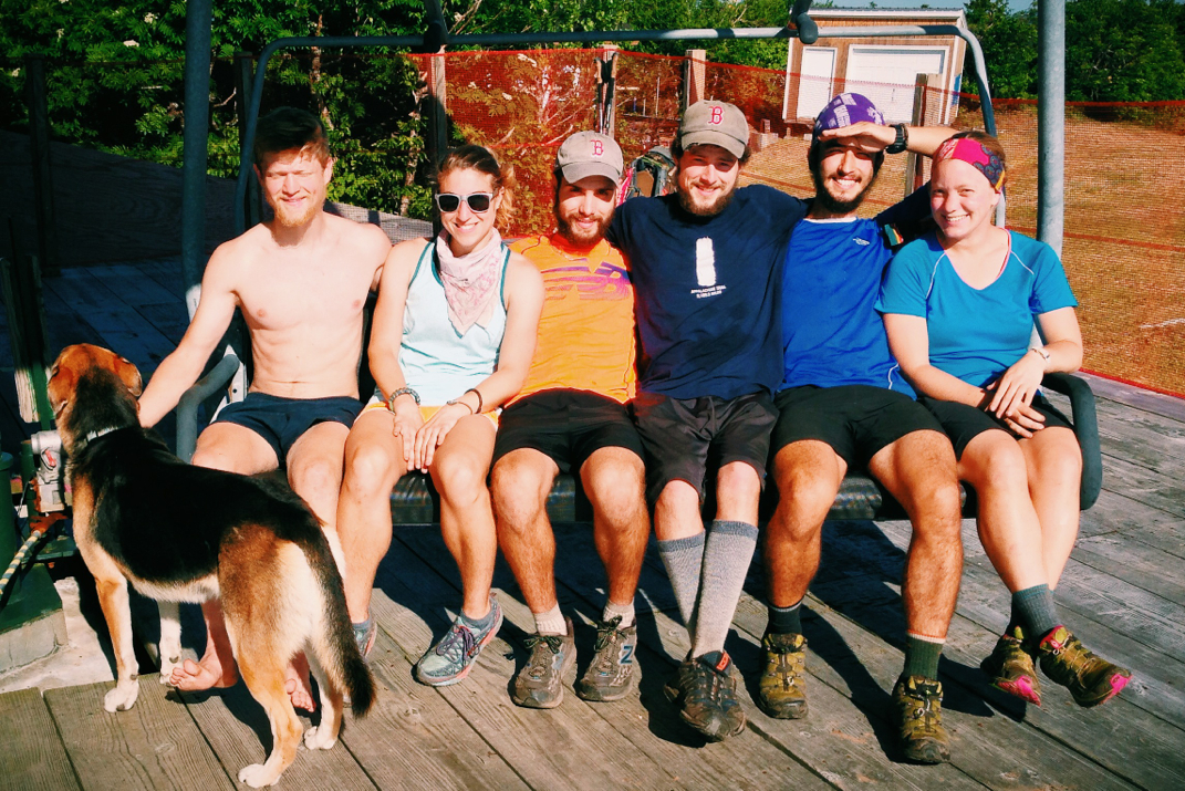
I'm literally sleeping in a Swiss-made gondola. How often do moments like this present themselves?  If my natural sleep schedule holds true, I'll be awake to watch the sun rise again over the valley in front of me. The wind is howling, the gondola swaying on its cable line, and the vacation towns below are glowing against the dark and starry sky. Five friends, one dog, and the unmistakable sense of pride in having literally walked here for this moment and the many left to come. 

Picture
Lunch Break
Picture
Picture
Picture
Killington Radio Towers
Picture
The Gang
Picture
Home for the Night
Picture
Picture
Sunset over the Green Mountains
1 Comment

Adventure Is Out There

6/29/2014

1 Comment


Day: 86

Day mileage: 23

AT total mileage: 1,670.2

Time: 7.5 hours 

--

I woke up early again, and after a quick debate in my head as to whether or not to sleep a bit longer, got out of my sleeping bag and began my day. I did my best to stay quiet, giving the four others a chance to sleep in a bit more. After eating breakfast and beginning to pack up, I woke each of them and encouraged them to start packing up. Two days earlier, our contently pathetic 9 mile day, Santa had decided to hike on to get a few more miles in than we were doing. Since then he has been ahead, but we got a text last night when we arrived at the shelter encouraging us to hike one mile further uphill to a ski patrol lodge at the summit of Bromley Mountain where we could stay for the night. The mountain owners apparently leave the building open for A.T. thru-hikers to stay in during the summer months. Having already unpacked everything and cooked dinner we decided against hiking up to him Friday night, but we had a chance to catch him this morning if we left early enough. After a somewhat leisurely morning packing up at the shelter we began the one mile climb up to Bromley's peak around 7:30. Some 20 minutes later we emerged out onto a wide and somewhat groomed ski trail which we hiked on for a few tenths of a mile before summiting and being confronted with panoramic views of the valley, framed with unused ski lifts in the foreground. Legs later in the afternoon described the ski lifts as 'abandoned' which I jokingly mocked her for, but she wasn't far off. Ski lifts in summer look horribly out of place, like a long since forgotten item left out in the elements to deteriorate and be forever unused. We ended up hanging out on the summit for an hour or so, taking group photos on the ski lift chairs and endlessly commenting on the beauty of the mountains surrounding us.

Turning north from the peak, we followed the trail down a steep incline that would bring us down to a road crossing and parking area for the national forest where many day and weekend hikers had left their cars. Our next climb would be to the summit of Styles Peak, a 3,300' wooded summit with no views to speak of. By this point we had split up into a few small sections of our group, everyone hiking at their own pace. Santa, Legs, and I kept a steady 3 mph pace up and over the mountain, arriving at the Peru Peak shelter around noon for a quick snack before pressing on another 4 miles to reach a separate shelter where we would ultimately eat lunch. After descending Styles Peak the terrain was relatively easy, meandering through the woods and doing our best to fight off the humidity of early afternoon. After making a steep climb to the rocky top of Baker Peak, we began a long descent back into the forest below. We arrived at the lunch shelter around 1345hrs, and would end up staying there for nearly two hours. After eating lunch we each sort of sank into a comfortable spot and closed our eyes for a little, savoring the warmth of the sun and the slight breeze the afternoon provided through the woods. Rocket Girl hiked on around 1500hrs, while the rest of us waited another 40 or so minutes before departing from the shelter. With only 10 miles left to hike, there was no reason to rush anything. The four of us remaining departed, staying in our simple formation as we hiked on, passing a few day hikers and eventually emerging out to another state park forest road where a dozen cars were parked by weekenders. Hiking a gradual incline for three miles, jumping and bush whacking around flooded and muddy sections of trail, we came upon a clearing overlooking Little Rock Pond. 

More of a lake than a pond, Little Rock is nestled between mountains in a gorgeous area of Vermont trails. We decided to stop for a break, as Rocket Girl was there waiting for us, and we talked with a group of recent college grads who were hanging out on a tent platform next to the lake. Out on the water was a couple in a canoe, and we each debated swimming. A few minutes later the couple (part of the college grad group) arrived at the shore and offered us the canoe. Obviously having to take them up on the opportunity, Santa, Legs, Dorothy, Naila puppy, and myself piled into the boat and pushed out for a trip across the lake. I'd love to tell you the canoe was of the utmost construction quality, but it really was just a canoe-like shaped piece of styrofoam with metal bracing keeping it together. We far exceeded its weight capacity, as made evident by the two inches of sidewall visible above water. Regardless, we paddled off into the lake. Halfway out, Legs and I recreated the iconic scene from Titanic on the bow of the boat, standing with our arms out like Leonardo de Caprio and Kate Winslet. This worked well until I nearly fell overboard, so we sat back down. Arriving at the other side of the lake, Dorothy and Santa wanted to explore a rock cliff to see if they could jump off into the water. Legs, Naila, and I stayed in the canoe, and I paddled us out and around in the water as we watched Santa assess the situation on shore. He decided he was ready to jump, but first wanted to toss down some things he had in his pockets. I parked the boat by the rock cliff some 20' under him, and he tossed two items down. Realizing that one of them would completely miss the canoe, I reached out to grab it, missing it, and extended myself far enough out that I ended up falling into the lake in an attempt to rescue this unknown object. Resurfacing after my unintentional swim, I was greeted by hysterical laughter from all dry persons around me, as I then continued the unintentionally comedic act by trying to get back in the styrofoam vessel without dumping Legs out of it. Once situated, I learned that I'd in fact jumped in the water to save a rock that Santa had been carrying. A rock. I dove in the water to rescue a rock. How's that for friendship?? Anyways, Santa and Dorothy decided to jump off the rock face and swim back across the lake, as Legs and I took the canoe back alongside them. I pulled it up on shore and we talked for a while with the grads as Santa and Dorothy finished their cross-lake swim. The weekend group offered us food, which we gladly took them up on, and one guy who lives up by Hanover, NH offered to bring us to resupply later next week when the trail crosses by his town, which we'll absolutely take him up on. As the saying goes, the Trail provides. 

We said our goodbyes and headed on the remaining 5 miles, having quickly debated spending the night next to the lake. We'd climb up a bit more before the shelter, but arrived there as a group in less than 2 hours time. Due to the proximity to road crossings and the popularity of the Green Mountain National Forest, the shelter and campsites are rather full of weekend hikers. They were happy to make room for us with half the shelter, and we easily fit our group of 5 into space for 4. Cooking dinner and passing around a water bottle of cinnamon whiskey that the grads had also given us, we talked for an hour or so before each of us got into our sleeping bags.

Tomorrow will be another 23+ mile day, perhaps even crossing the 4,200' summit of Killington. All planning has been left to Rocket Girl and Legs, I'm simply along for the ride. The temperatures are supposed to hold steady around the low 80s with a decent bit of humidity, but hopefully early starts and afternoon breaks will alleviate some of the stress that comes from humid and hot days. With only 70 more miles to the New Hampshire border, and a mere 513 miles until the summit of Katahdin, this hike is cruising along. And after days like today, on ski lifts, napping in shelters, and falling out of canoes in the middle of gorgeous lakes nestled into the mountains of Vermont, I'm quite glad I decided to be a part of this group. These are most certainly opportunities I'd have hiked right past. 

Take an extra moment to appreciate the present, and have a great weekend. 

Picture
Bromley Ski Trails
Picture
Picture
Santa, Legs, Me, Blue, Dorothy, and Rocket
Picture
Legs, Blue, Me, Dorothy
Picture
Rocky Baker Peak
Picture
Santa & Legs
Picture
Naila Napping
Picture
Our Stroafoam Vessel
Picture
Almost there.
1 Comment

Green Mountains

6/28/2014

0 Comments


Day: 85

Day mileage: 24

AT total mileage: 1,649.2

Time: 8 hours 

--

I was sound asleep by 2130hrs last night, and woke again for the first time at 0400. I'm not sure why my eyes opened that early, but I'm truly hoping it doesn't become a habit. I laid in bed for a while before emerging from my sleeping bag, the first person out of the 8 packed into the shelter to do so, and began packing up. At this point it was only 6 AM, but after the relaxing day before I figured I owed it to the trail to ride early and be hiking by a reasonable hour. With our group down to only four of us (at max, 7 and a dog) it was worth it to wait for the other three to be ready before hiking on. We departed shortly after 7, and began what would ultimately be a great day of foot travel on the Appalachian Trail. 

From the shelter we hiked a few miles downhill before beginning the only real challenge of the day, a 1,800 foot elevation climb to the summit of Stratton Mountain. It was 6.8 miles from the shelter to the fire tower at the mountain's peak, and we arrived there shortly after 9:30. The easy terrain before beginning the climb allowed us to travel quickly in our established line, hopping over mud and flooded areas doing our best to keep socks and shoes dry. It's a battle I'm bound to lose against the Trail, but since we took the time off early yesterday a surprising amount of rainfall has been absorbed by the earth. I couldn't bring myself to wear my soaking wet and muddy socks for a third day in a row, so instead I wore a separate pair that had been used for a day or two before the rain that were still somewhat dry. Upon reaching the lowest point after the shelter, the point where the 3.6 mile climb up Stratton would begin, we changed paces, slowing a bit as a whole but maintaining a strong stride uphill. It was at this point that I provided some group entertainment. A little known fact about me is that I can quote the script of the 1994 film Forrest Gump nearly verbatim. While it's not a talent that will win me awards or critical acclaim, it's still rather entertaining, and kept the group in good spirits as we hiked along to me reciting the famous Tom Hanks lines (voice included) of the movie, filling in less important scenes with detailed narration. It took over half the climb to complete the movie, but Rocket, Legs, and Dorothy each said they were able to see every scene I described in their minds, and that they had a great time listening. Despite our efforts to find another movie everyone had seen that I could recreate the experience for, we couldn't find common ground, and the idea disappeared as quickly as it had come. 

After two days of relatively upsetting weather, cloudy skies and rainfall of all sorts, there was an amazing feeling in summiting Stratton to a warm sun shining down and wispy clouds speckling a baby blue sky. We spoke briefly with a Park Service cabin caretaker, employed to maintain the shelters and cabins in the area, then headed up a 60' fire tower to see what views the wooded summit had to offer. Despite the wind, the views were incredible. Not since the Smoky Mountains have there been such incredible vistas, sprawling mountain ranges, and subsequent feelings of invincibility atop a peak. It feels so good to be back in the mountains, able to see for miles from atop a summit, immediately gaining the sense of hiking gratification that is craved after a long or steep ascent. The feeling of being on top of the world that comes with hiking 1,635 miles as if it were just for this moment. So there I stood, in a fire tower on the top of the mountain where Benton McKaye initially conceived the idea for a walking trail that ran from Georgia to Maine some 100 years ago, watching the clouds blow over the valley on a stiff breeze, truly happy with where I was and who I was able to share the moment with. Handsome Dan took a photo of Dorothy, Rocket, and myself before we head back down out of the tower, and upon my feet touching dirt again I turned my efforts to finding a new camera. My fingers are crossed that its solely the body of the dSLR that is broken, meaning the lens survived the water. There's no way to really know just yet, but I found an identical version of my Canon body and was able to have it overnighted to Killington, VT so that it will be there when we hike through on Sunday or Monday. Ideally I'd like to have it sooner, but beggars can't be choosers. In the end, as my dad keenly pointed out in conversation, it's quite amazing that the now dead camera survived 1,600 miles of mud, dust, pollen, rain, hail, snow, river crossings, rock rash, smashing into trees, and every other bit of daily activity it was subjected to while hooked onto the waist belt of my pack. I'm more than happy with the mileage (see what I did there?) that I got out of the camera, and in the end it's my 2nd backup body for when I'm actually photographing in the real world, so it's not a huge deal to lose it. I'll keep the bad camera and mail it home, perhaps being able to repair it upon my return later in the summer. Until then, I'll anxiously await the arrival of a new one a day or two from now, and will continue to marvel at Amazon's ability to get me a product overnight (sometimes even same day delivery) for less than $10 shipping. 

After spending an appropriate amount of time atop Stratton, we began the 4 mile descent to the Stratton Pond shelter where we intended to have lunch. Hiking down the mountain wasn't obnoxious, and again we witnessed areas where the previously rushing water had been absorbed back into the earth leaving us with a slightly muddy trail to hike. Anything is better than the complete lack of care required to trudge through 4-6" of muddy water for hours on end. We got to the shelter around noon-thirty, a large post & beam structure with plenty of bunk and loft space for two dozen people, and probably even more in a pinch. Upon arriving we noticed a hiker had left clothes out to dry, and with further investigation we learned it was Deep Blue. Having parted ways with him back in Bennington two days prior, he had hiked through the night, arriving at 8 am after watching the sunrise from the top of the windy fire tower earlier that morning. He woke up and ate with us, ultimately deciding to hike on now that we'd all met back up. We left the shelter an hour after arriving, and began what would truly be an easy afternoon of relatively level hiking terrain for the next 12 miles. This section was substantially muddier than the morning, but even with careful steps we maintained a solid pace through the forest. The hours passed by steadily with fun conversation amongst the 5 of us, being intermittently disrupted by Legs as she walked into a fallen tree, then later did a 180 spin before plopping down into the mud due to a low & slippery wooden bridge of sorts. Around 1630 we hiked a half mile down a road, still 'on trail' before a wrong turn brought us out to a gorgeous rock face overlooking the valley below. We stopped for a moment, but ultimately found seats on the rock and stayed a while, listening to music and relaxing in the warmth of the late afternoon sun. Trekking on, we were a short 5 miles from our intended destination for the evening. An hour and a half later we emerged at the road crossing of VT 11/30, a fast paced four lane highway delightfully marked by the A.T. Conservancy with an enthusiastic 'Don't become road kill!' sign. Crossing quickly, we gathered in the parking lit at the trail head and split up. Rocket and Dorothy would go into Manchester, a town 5 miles west for a resupply while the remaining three of us hiked on the 2 miles to the shelter. Rocket secured them a ride from a woman leaving the parking lot (a day hiker we later learned had thru-hiked the Pacific Crest Trail just a few years prior). Legs and I headed up the next mountain, the puppy Naila leading the way, while Blue hung out by the road for a little longer. 

We arrived at a gorgeously built and completely empty shelter a shirt time before 1900hrs, cooking dinner and listening to country music as I explained to Legs my sadness about this weekend. Zac Brown Band, one of my absolute favorite artists and a band I would kill to be an audio engineer for, is playing two nights at Fenway Park in Boston. I'd considered many months ago about getting off the trail for either the Friday or Saturday show, but never followed through with finding tickets. Regardless, we cooked and ate, joined by Blue and shortly after by Rocket and Dorothy as well. They had picked up a bottle of Jim Beam while in town, and we had a nice Friday night on the trail in each other's company. At 2100hrs we piled into our sleeping bags, the massive double decker shelter to ourselves, and streamed a comedy on Dorothy's large smartphone from Netflix.  Quite the sight, I'd imagine; five hikers in their 20s, trekking the length of the Appalachian Trail, having an 'exciting' Friday night with a bottle of bourbon and a movie in the middle of Vermont's Green Mountains. Bed came next, but only after moving packs around upon the discovery of a half dozen mice running around. 

Tomorrow we'll do another 24 or so mile day, hopefully in equally gorgeous weather. I'm exceptionally happy with where I am and who I'm with, and now that I've got less than 30 days on the trail remaining, I look forward to experiencing the rest of it with this great group of friends I stumbled into. 

Onwards & steeply upwards in the morning. 

Tex

Picture
From atop Stratton
Picture
Dorothy, Rocket Girl, & Myself
Picture
Picture
Bad Shadows... Myself, Dorothy, Blue
Picture
Picture
Midday Break
Picture
Movie Night Shelter (yep- hung my American Flag)
0 Comments

Short Day Through Vermud

6/27/2014

0 Comments

 
Day: 84
Day mileage: 9.0
AT total mileage: 1,626.0
Time: 3 hours 
--
The plan was for just over 24 miles of hiking today, a feat that we came nowhere near accomplishing. Truthfully, this is probably my fault. After 70 days and 1,400 miles of hiking, I allowed myself to change drastically after meeting what has now become a close group of friends. With the change in pace from long distance days, I've now become seemingly quite lazy. When we arrived at the Story Brook shelter at 1330hrs, a whopping 9 miles into our day, I jokingly suggested we stay the night. After nearly an hour of hanging around and waiting for the sun to present itself from behind the mess of clouds occupying the sky, we agreed to call it a day and remain where we were for the rest of the night. 
Last night in the shelter was one of the more interesting (read: obnoxious, frustrating, impolite) nights I've had in my time on the Appalachian Trail. At 0400hrs the guy sleeping next to me began packing up his stuff, closely followed by three other hikers in the packed shelter. Over the course of the next hour and a half these four hikers would pack their backpacks, an activity that is impossible to do quietly, deflate their air mattresses, and smoke both cigarettes and joints before leaving. It very much frustrated me as I tried to sleep, ultimately giving up around 0430 and remaining awake until they left. We've all had early mornings on the trail, but I at least have the decency to pack my bag away from the shelter to try and keep noise down. Regardless, they left, and around 7 AM I started thinking about waking up. The rain continued intermittently until 9 or so when we got on the trail, only after having sung along with some decade old top-40 music on the portable speaker as we redressed in wet clothes and got ready for the day ahead. Hiking north, we gained a mere 300' in elevation before finding ourselves at a fire tower at the top of Glastenbury Mountain. Climbing in the thick fog, there was no view to be seen from the top of the tower, but we seemed enjoy it nonetheless. Climbing back to the surface of the mountain, the trail began a steep descent of what ultimately had turned into a quick-flowing river over an insanely muddy area. This is pretty much how the trail would continue to be for the rest of the day. Alike hiking in the storm of Wednesday evening, it basically got to the point where I no longer cared about my feet being soaking wet, and just hiked along continually stepping in the mud and rivers as I moved forward. There were points where I actually feared losing my shoes as the mud was so thick and deep that it practically grabbed hold of my footwear and threatened to remove it from my feet. 


We arrived at the Story Spring shelter for a late lunch with the intention of pushing on 15 more miles to another shelter further on. This 15 miles would include a 2,000 foot climb of Stratton Mountain, which I wasn't looking forward to in the wet mud. One way or another the joking conversation of staying turned to a serious one, and we began unpacking. Santa wasn't thrilled with the thought and continued hiking on, leaving Dorothy, Legs, Rocket, and myself at Story Spring. A relaxed afternoon in the intermittent sunshine allowed us to try and dry out soaked gear from the previous day's downpour, and we sat around a fire for a few hours before other hikers came through to spend the night. Mid afternoon a guy named Harley hiked past, and was genuinely excited to find out who I was. He immediately recognized my name from the '60 mile day' out of Harper's Ferry (nearly a month ago now) and said it was such a notable accomplishment he hadn't forgotten my name in all that time. To me, that was kind of cool. He hiked on, and a few hours later we began cooking dinner. I cuddled up with Naila and napped shortly before getting in my sleeping bag to read for a while afterwords.  Closing my book and giving Legs my headlamp so she could utilize the red LED function and read in the dark of the shelter, I rolled over and wrote this, soon to be asleep. 
One exceptionally discouraging piece of information is that I'll need to buy a new camera. The sudden and completely unexpected monsoon-like downpour on Wednesday left me with no time to completely store my camera in my backpack, instead just tucking it away under the rain cover of my pack. Despite this effort, it apparently got wet enough that it no longer likes to power on. I've tried two different batteries and letting it air out for a day, but have had no luck. I'll probably order another dSLR body on Amazon tomorrow and hope to have it shipped quickly to the next available town. I don't like not having a camera, but truthfully this one has taken quite a beating over the last 1,600 miles and I believe deserves to rest in peace. It by no means was my best camera body, but it's still sad to lose a member of the team. Hopefully I can get a replacement quickly. 
The intention is to hike a 23 mile day tomorrow. Rocket and Dorothy need a resupply so they'll head into town... I don't need anything so I might skip it, knowing we'll have access to a resupply on Sunday or Monday. Who knows. We did some mileage calculations today and figured we should be entering the Whites on July 4th or 5th, and as of now I need to hike 18 miles per day to be done on my intended day of July 26th. I'm hoping that after these past few days of 'relaxed' hiking, we buckle down as a group and start doing some more consistent mileage. Either way, it has been good to relax a bit. I haven't had a single digit mileage day since Hot Springs, NC - some 1,400 miles ago. 


Fingers crossed on the camera front. Wish me luck. 
Texaco
Picture
Glastenbury Mountain Tower
Picture
Morning in a Cloud
Picture
Vermud
Picture
Drying shoes
Picture
Santa rinsing his feet off
0 Comments

Glub Glub

6/26/2014

2 Comments


Day: 83

Day mileage: 14.2

AT total mileage: 1,617.0

Time: 9 hours 

--

I woke up in the middle of the night to the unpleasant sensation that something was amiss. Sure enough, my sleeping pad and head were hanging over the edge of the elevated bunk, while my legs dangled off as well, my body restrained by a lone structural 2x4 bracing against my abdomen. Needless to say I spent a bit if time in the dark trying to rearrange myself to avoid falling to my demise in the fully packed shelter.  After falling back asleep, I awoke again at a more appropriate time, beginning to pack my stuff up and get ready for the easy 4 mile trek into Bennington where Santa and Rocket Girl would do a resupply, Blue would find the public library to write his family newsletter e-mail, and Legs and I would tag along for the ride. As I left the shelter a light rain began to fall, foreshadowing of the weather that would be present intermittently throughout the day. 

The hike to VT Route 9 was relatively simple, made challenging only by wet rocks on the steep descent to the road in the gap below the mountain ridges. It took me about an hour and a half to get to the state forest parking lot, having made a few phone calls on my hike and taking my time as I went along. Legs and Blue had arrived before me and were working on a hitchhike, one that would prove challenging due to being more than 5 miles from town. Eventually after quite a bit of trying, a woman in a small sedan pulled over to pick us up. With a small dog and a BMX style bike already occupying space in the car, there was barely enough room for Deep Blue & myself, let alone Legs and the puppy Naila. At this time Santa and Rocket emerged from the woods, rejoining the group, and Blue and I headed on into town. The woman driving was a young grandmother who was going to babysit her grand kids in town. She spoke (after my questioning) about the state of disrepair the towns locally were in, the poor job market, and the lack of presence of social workers for those who need government funding. We eventually arrived at Wal-Mart where Blue and I hung around after purchasing some small items. I charged my phone for a bit, then hiked the mile across town to Kmart where the rest of the group was able to hitch to. Meeting up with them again, I sat outside the store reading my book as everyone shopped. My only purchase would be an American flag, which I got as a second choice to a Red Sox flag in order to assist with hitchhiking. We left Kmart around 1230 in the back of a pickup truck driven by two high school girls on summer vacation. They were only able to take us a few miles back towards town, meaning a second hitch would be needed to get back to the trailhead. We walked through town to make it back to Rt 9 to at least be on the road we needed a ride on, but had very little luck getting anyone to pull over. This may continue to be the case with northern states. Waiting in a gas station parking lot, I was able to get a guy in a truck to offer us a ride, up until the point that he realized the bed of the truck was too full and he could only take two people. Santa and I had the girls & Naila go, and began trying to get our own ride. Walking down the main streets of a large Vermont town, trying to hitchhike, a large American flag held out between us... We were quite the sight to see. Although the flag didn't secure any rides for us, it got many honks and waves from drivers of all kinds, which I figure is at least a small start. Time shall tell how the flag helps. Anyway, we got a ride from a gas station when, ironically, Finn and Dorothy honked from the car of a local trail angel named Steve giving them a ride back to the A.T. so all worked out. 

Back at the road crossing shortly before 1500hrs we began a 2,500 foot climb over 10 miles towards the summit of Glastenbury Mountain. The plan was to hike to the fire tower at the summit, then another 4 someodd miles relatively downhill to a shelter that would end us with a 18.5 mile day on the trail. The climb passed by quickly as we conversed as a group, again back down to the comfortable foursome of myself, Santa, Rocket, and Legs. Around 1715 we stopped for a 'pack break' to relieve our backs, and made note of the storm clouds moving in. It was literally not two minutes later that all hell broke loose, with torrential downpours flooding the trail and soaking us through. We had 2.7 miles left to a shelter before Glastenbury's summit, and we were undoubtedly stopping there instead of pressing on the extra 4 miles to the next shelter. Santa and I practically ran the distance, arriving in 40 minutes, soaked to our cores. As we had quickly hiked along, we yelled at the rain and the thunder, cursed at the mud and the Trail itself, and generally had a great time being soaking wet and having nothing we could do about it. There's a phenomenal motivational phrase on the Appalachian Trail that states: "Embrace the Suck" - basically, there are going to be points where it is plain old awful to be out here, but it's all part of the experience so do your best to make the most of it. About ten minutes into the downpours, we were embracing the suck. All care was gone, and instead of trying to hike around newly forming rivers and massive puddles, we splashed through them, mud flying everywhere as we flew along the trail. We sang songs at the top of our lungs, and I screamed lines from Forrest Gump for no particular reason whatsoever.  If you can envision the Jim Carrey movie 'The Truman Show' you might remember a scene towards the end as he's on a small sailboat in a horrible storm, yelling at the sky 'is this the best you can do?!' - it was very much like that. We certainly made the most out of a situation there was absolutely no way of avoiding. 

At just before 1800hrs we arrived at the Goddard shelter, a newer one built for 8 hikers, packed to the brim with people escaping the downpours. With ourselves and the girls we had at least four more people to try and fit in, so it would end up becoming a Tetris game to see how many we could fit. We ended up with 12 people and the dog on the platform of the shelter, and Dorothy strung his hammock across the beams of the structure allowing himself a space to sleep without occupying floor space. I cooked dinner quickly, and with a quasi damp set of clothes was tucked into my sleeping bag by 1930hrs. Reading for a bit, I'll try and make it to bed relatively early tonight. I'm absolutely exhausted, despite having done such a short mileage day. I'm hoping that in the next few days we'll avoid stops in town as it really seems to alter the course of the day and the desire to hike. 

I'm not sure how far we'll trek tomorrow, but I'm hoping we make up for the few miles we stopped shy of today. The rain will supposedly carry on a bit longer, and we will unquestionably have some challenges in the thick mud and running rivers on the trail that will be present after the heavy rainfall overnight. 

You likely questioned the blog title for today... I shall explain. The children's poet Shel Silverstein wrote a poem called 'Glub Glub' that went like this:

He thought it was

The biggest puddle

He’d go splashing through.

Turns out it was the smallest lake –

And the deepest, too.

Rather applicable.

Texaco

Picture
Picture
Hitching Challenges
Picture
Back of a truck
Picture
Not quite ready for the photo...
Picture
This sums everything up.
Picture
Questionably Safe Bridge?
Picture
2 Comments

Mile 1,600: Vermont

6/25/2014

0 Comments


Day: 82

Day mileage: 24.5

AT total mileage: 1,602.8

Time: 9 hours 

--

Leaving the shelter at 7:30, I began the remaining 3 mile climb towards the summit of Massachusetts' Mt. Greylock.  Over the course of those 3 miles there would be another thousand feet in elevation gain, which was both challenging and fun for first thing in the morning. I had left before everyone else, and would end up being on the summit for 45 minutes or so before the rest of the group arrived. The initial part of the ascent, shortly after leaving the shelter, was much alike every other bit of trail for the past 1,300 miles. It was when the elevation crossed over 3,000' that things took an amazing turn.  It was as if the red carpet was being rolled out to welcome me to New England. Climbing Greylock was picturesque, the vegetation changing rapidly to more robust plants and much shorter pine trees, all capable of surviving harsh winds and snowy, frigid winters. With a strong breeze blowing and the scent of pine needles filling the air, this was exactly what I wanted and expected from my first +3,000 foot summit in the northeast. 

The last mile of climbing was typical of New England, with rocky surfaces jutting out from the ground and pine tree roots protruding and grabbing at anything they can hold on to. As I got closer to the summit the wind picked up exponentially, leaving me even more motivated to push on to the top. To give some background story on the importance of Greylock in my life, my maternal grandmother lived nearby in the town of Williamstown for my entire life. She was a huge proponent of wind power as an energy source, and as such I always think of her when I see them. In 2007 during my cross country cycling ride, she got very ill and passed away mid-July. A mountain that has always been visible from her home, it was a tad bit emotional for me to have the wind pick up near the end of my climb, exit the woods and see panoramic views of the Berkshires, with ridgelines in every direction speckled with windmills. Luckily at this point I was there alone, so I took a few minutes to myself and had a quick conversation with said grandmother. She'd have been thrilled to know I was hiking the Trail that ran right through her figurative backyard. I sat in the wind, having put my North Face jacket on, for quite a while before the rest of the group arrived. We hung out listening to music, talking, and kicking around a soccer ball, taking refuge from the wind and soaking up the brilliant sunlight before continuing on and beginning the descent down into Adams, MA. 

Climbing down Greylock was a 6 mile hike, at some points very steep and slippery. Legs ended up on her butt more than once trying to navigate pine needle covered rocks down severe inclines. Around noon we reached the bottom of the mountain, having sung our way down with a chorus of songs from Grease, Beauty & the Beast, and Frozen. We crossed out of the woods and after a mile of back roads ended up at the intersection of Massachusetts Rt. 2 that runs horizontally across the state. This was also a road I cycled on during my cross country trip 7 years ago. Stormy clouds looming over the valley, the plan was to hike a quick mile off the trail to find a Friendly's restaurant for lunch. Much alike a Perkins or Denny's mixed with an ice cream shoppe, it's a small New England chain that I grew up enjoying and still have fun occasionally eating at. Myself, Blue, Rocket, Legs, and Santa, of course followed by the four-legged Naila, made our way to the restaurant and got a booth. We ordered quite a bit of food, and would spend nearly two hours sitting around the table laughing and joking, being stared at by other customers as we went along. I think our wardrobe, general appearances, and arriving with large backpacks that were nearly lined up on a bench outside were the catalysts behind the staring, but we had fun regardless and didn't think twice of it. I personally ordered a croc of clam chowder, boneless buffalo wings, a bacon cheeseburger, and an ice cream... I've got to get protein in somewhere! Lunch was delicious, and after splitting the bill up for everyone in the group, we went outside and laid down on their grassy front lawn. Afraid of falling asleep, and knowing full well that we had nearly 2,500 more feet of elevation gain before reaching the shelter we were aiming for, I got up and put my pack on, ready to begin the walk back to the trail. Luckily Legs was able to get a hitch for us, and we were quickly delivered back to the trail by a local guy. 

The terrain from town literally just went up. Crossing over a set of railroad tracks and walking through a home's back yard where the Appalachian Trail has an easement of sorts up the driveway, we disappeared again into the forest. The first climb was 1,400 feet in elevation gain, done at a relatively slow speed. Rocket, despite being an exceptionally strong hiker, believes she's slower than the rest, so we put her in front to set the pace for the group to be one she was comfortable with. Eventually reaching the top of the first climb and crossing over a rock garden, the trail leveled off for a few miles before beginning to climb again. During the stretch of more level ground we officially crossed over the MA/VT state line, having completed the 11th state of the Appalachian Trail and entering into the 12th. What a feeling that is, and what a long way I've walked. We snapped some photos before carrying on, debating out loud between hiking 3 miles further to the next shelter or 10 miles further (with another 1,800 someodd feet in elevation gain) before deciding to stick to the original plan and go the longer distance. Our caravan moved on at a good pace, conversing about everything under the sun. We came up with a rotational game where one of us picked a conversation subject and each person had to tell a story that fell under the genre. We talked about previous relationships, work, and medical issues/broken bones as we went along. The beauty of hiking in a group like this with conversation is that you find yourself distracted from the large climbs. Before you know it you're at the summit of whatever peak was necessary to trudge over, and you're descending again.  It was at some point in here that we hiked over the 1,600 mile mark on the northbound hike of the Appalachian Trail. Time passed quickly by, and around 2000hrs we stopped for a break with a mere 2 miles left to go. Legs and I kept our break short and hiked on, as Naila had hiked faster than the group and was likely at the shelter already, having followed the scent of another hiker that has been in the same large group of people we've been with for the past week. Conversing about life, family, and 'the real world', the remaining mileage flew by. Despite the sun setting and the darkness in the woods due to tree cover, I followed her steps and didn't bother stopping to put my headlamp on.  We pulled into the Congdon shelter at shortly before 2100hrs, finding the shelter half full with section hikers who had been fast asleep for nearly 2 hours. Bear Bait, a guy who has hiked in and out of our group for a while, was also here with a fire blazing and Naila napping next to him. We quietly figured out sleeping arrangements, everyone wanting to be in the shelter due to the threat of rain. I skipped on dinner due to a full stomach left over from lunch, but sat around and talked with everyone as we each unpacked for the night. 

In what's becoming a bit of a comedic habit, everyone retired to their sleeping bags, each then pulling out headlamps and reading their respective books. I didn't get more than 10 pages further into mine before deciding I was tired and ready to sleep. Tomorrow we'll hike into Bennington, VT so that a few can get some resupply food, then hike on out of town, likely ending up with a 19 or so mile day. 

The 1,600th mile and the 12th state up the eastern seaboard on my 82nd day. Not bad for a long walk in the forest. 

Onward, upward, etc. 

Texaco

Picture
New England Mountains
Picture
Winding Greylock Roads
Picture
Deep Blue on top of the world
Picture
Greylock Summit
Picture
Picture
Picture
Storm Clouds
Picture
Lunch
Picture
Nap time
Picture
Vermont State Line
Picture
Picture
Naila
Picture
Picture
Guys at work stepping up their competitive game
0 Comments

Climbing Returns

6/24/2014

2 Comments


Day: 81

Day mileage: 17

AT total mileage: 1,579.1

Time: 6 hours 

--

There's something disorienting about being woken up in the middle of the night by a dog wildly barking somewhere nearby at an unknown potential threat. That's pretty much how I woke up this morning, with Naila protecting us from what was undoubtedly a pack of mammoth black bears coming to eat my jar of cake frosting. I fell back asleep for a while, ultimately waking up at 4:30 to write the blog posts for both Saturday and Sunday. I felt bad leaving you all without something to read over the weekend, but time wasn't on my side to write everything and still get a good amount of sleep. I hope you'll forgive me. Once both blog entries were written and posted, I got up and started breaking down my gear. Rocket's alarm went off at 6:00 per usual, and the rest of the shelter slowly came to life. I played some Billie Holiday on the portable speaker as everyone woke up, and ate two packages of Pop-Tarts for breakfast. Rocket left the shelter first, followed by Legs, while Santa and I lingered a bit before taking off. There would be a 3 mile downhill hike with a short and steep climb in the middle of it, dropping us on Main Street of Dalton, MA. We planned to meet up at a local Trail Angel's house, a guy named Tom who hosts hikers tenting in his back yard free of charge. A retired man, he will offer to drive hikers to the local grocery store, Wal-mart, or anywhere else they might need to resupply. 

Santa and I cruised down the mountain, easily catching up to Legs and Rocket, and we all made our way to Tom's house together where we found Finn and Dorothy sitting on the front porch. They told us about the places in town worth visiting, and the free showers available at the community center. We dropped our backpacks, handed Naila off to Dorothy for puppy babysitting, and meandered down the slow streets of Dalton to a few local businesses. Stop #1 was a breakfast cafe where we got fruit smoothies before heading on to the community center. Free of charge for hikers we were handed towels and given directions to the locker rooms where hot showers and saunas were waiting for us. Santa and I sat in the sauna for a few minutes each before heading into the shower room. Despite having showered the day before, the heavenly feeling of hot water was a perfect addition to my morning. After redressing he and I made our way upstairs where we browsed the take-a-book library. Although I've never really had time to read a book, I did pick one up a thousand or so miles ago with the intention of reading it.  With the length of my days and mileage I was doing, I never had time to read so I mailed it home.  Pneumo would kill me if he knew I was carrying the weight of a book, but I thought it was appropriate to grab a donated copy of the Everest disaster written in Into Thin Air. I actually have already begun reading it, so perhaps with my newfound time I'll actually finish it. 

After meeting back up with the girls, the four of us headed across the street to the Dalton Restaurant where we stopped for a splendid breakfast. As I've written before, I've craved eggs Benedict for a long while now, which is exactly what I ordered for breakfast. For the sake of full disclosure the eggs were also accompanied by a Belgian waffle and large orange juice. We sat and talked, with our food eventually being served, enjoying the scenery of the small town restaurant. Upon finishing we walked back towards Tom's house, stopping by the post office so Legs could pick up a mail-drop she had been sent. We met up there with Deep Blue who had spent the day before with his uncle on their boat, and then hiked as a group back to Tom's were we ended up spending a few more hours relaxing on the porch. We knew going into today that it would be relatively low mileage, so after the three miles we put in downhill to begin, there wasn't a huge issue with taking our time in town. It wasn't until 1330 or so that we actually departed, heading up for a long climb of 1,200 feet or so up into a ridgeline that would then drop us down in the next town of Cheshire. We of course had music playing, and despite the sweat negating my morning shower, we crested the peak of the climb easily after an hour or so, and began a steep descent into the next town. Our walk through Cheshire would bring us by both a small ice cream shop and a gas station, of which we would stop at both. Procrastinating what was to come - a 1,800' climb halfway up Mt. Greylock, we sat in the parking lot of the gas station for a good bit of time before heading up the trail. 

With 5 miles and 1,800 feet of climbing to be done, notably the steepest and longest climb since Virginia, our group of four separated a bit with different paces. I buckled down and pressed forward with my 'zero desire to hike in the dark' motivation, ascending at a steady 3.5 mph despite the grade of the mountain. It took him a bit of running to do so, but Santa caught up and we kept pace together for the last two miles to the shelter. Upon our arrival we met a good number of people already there, with Legs and Deep Blue arriving shortly after. The shelter would end up being home to 9 people for the night, with a few more camping close by. Arriving at 2010hrs, the sun was descending on the horizon, and dinner was soon being cooked. I put some Allman Brothers through the speaker, and we sat around enjoying each other's company for an hour and a half before people began retiring to sleeping bags. 

Tomorrow morning we'll climb another 3 miles to the summit of Greylock, the tallest peak in the state of Massachusetts at 3,491 feet. This also marks the first time since Virginia, some 700 miles ago, that the trail's elevation crossed the 3,000' mark. For now, I'll read some more of my book and then close my eyes for the night. We'll hike into state #12 tomorrow- an incredible thought to realize. 

Onward, and most certainly upward. 

Tex

Picture
Dalton, MA
Picture
Community Center Lobby
Picture
Breakfast
Picture
Rocket & Dorothy
Picture
The Gang at Tom's
Picture
Hiking out of Dalton
Picture
Ice Cream in Cheshire
Picture
The Berkshire Mountains
Picture
2 Comments

Easy Like Sunday Morning

6/23/2014

0 Comments


Day: 80

Day mileage: 16.4

AT total mileage: 1,562.5

Time: 6.2 hours 

--

Regardless of being off the trail, my eyes still opened at 5 AM. Habitually checking my phone, I read a text from Dorothy saying they may be hanging around the cabin for a while to meet up with one of Deep Blue's family members who has a boat on the lake nearby. This was reassuring, meaning I could have a more leisurely morning without racing to catch up to them on the trail all day. I fell back asleep, waking up an hour later to shower again and spend some time on my laptop putting new music on my iPod. I had never intended to be the DJ for a group of hikers, so my music variety was solely what I'd want to listen to. I figured it wouldn't hurt any to add in some new music since it's constantly being played through the speaker Rocket carries. I did a load of laundry the night before, washing a bunch of new clothes that my friend Kim at New Balance had sent. Lightweight shirts and a tank top for the hot summer days, as well as some new shorts and socks. I'm excited to have new clothes, and change up the monotony in my wardrobe and thru-hike photographs. Packing up my gear, my great aunt awoke and insisted we stay for breakfast instead of beginning our drive back to the trail in search of food. We ate in the dining room of her retirement facility, and I loaded up on a bacon omelette, fresh fruit, pancakes, an English muffin, a cup of ruby grapefruit, and a pitcher of orange juice, provided when I asked the waitress for a 'bottomless glass of OJ'. After eating we took a photo of my dad, Joy, and myself nearly identical to a photo that was taken 7 years ago when dad and I cycled across the country and stopped by Williamstown. Loaded into the car, we drove through town, stopping shortly at my grandmother's old house and for a moment at the church where my parents got married, then turned south and headed back for the trail. 

An hour later and back in the same parking lot Jesse had picked us up from the day before, I unboxed my newly purchased food and repacked my backpack. After putting some thought into his schedule and to-do list, my dad ended up not hiking with me today, instead heading back for home just north of Boston. Either way, it was great to have him hike with me this weekend and to spend the time together. I only wish he could have met Rocket Girl and Legs before heading home. After I hugged him goodbye I hiked up to the trailhead where it crossed Rt. 20, ironically arriving at the same time that Rocket and Finn emerged from the woods, having left the cabin an hour earlier and on their way north. This was perfect timing, and we hiked on together as a group. The pace was set by Rocket, and we made good time up the 1,000' climb into the mountain ridge. Today's terrain would be pretty simple, comprised of one large climb and a fair bit of relatively level traversing. Over the next few hours we hiked along, running into Kamikaze and Driveway before Finn took off at a faster pace and Rocket and I hiked alone together. We talked about home life, relationships, marriages, and the demise of modern culture due to the influence of social media. I really do enjoy talking to her as she's incredibly intelligent and the conversation is never dry. Around 1400hrs we arrived at the October Mountain shelter where the rest of the group was eating lunch. Deep Blue stayed back at the cabin to spend the day with his family, but everyone else had hiked on and was present for lunch. We must have hung out at the shelter for an hour before heading on. Today was to be a very short day, and with just under 9 miles left to hike there was no reason to rush on. When we eventually got around to heading north again we did so as a large group, music playing, hiking along at a great pace. This lasted for an hour or so before we broke into smaller groups for one reason or another until eventually it was Rocket, Dorothy, Santa, and myself hiking until we reached the Kay Wood shelter where we intended to spend the night. 

There had been some conversation about heading the 3 miles further into the town of Dalton, MA (the trail hikes down Main Street) or staying at the shelter. I had pretty much decided I'd be staying at the shelter regardless, as it was better than getting into town and potentially needing to stealth camp (camp where you're not seen in hopes of not getting in trouble). The shelter would be a dry place to stay that wouldn't cost any money, and wouldn't put me in range of a town tavern with a group of friends. No need to spend money if I can avoid it. We arrived at the shelter around 1830hrs to find only Legs and the puppy Naila here. Sitting down began a comical debate amongst Santa, Rocket, and Dorothy as to whether or not they were staying or hiking on to town. I did my best to convince them to stay, and won over everyone except Dorothy who ended up eventually heading on to meet with Finn and a few others in town. The remaining four cooked our dinner, having this gigantic loft/bunk shelter to ourselves. We talked for a few hours while continuing to listen to some music, which I eventually turned over to the CD of the 9/11 Concert for New York, vividly describing the opening sequence of David Bowie on an empty stage in a single spotlight playing his Playschool children's piano and singing 'America'. Santa, the soon-to-be audiologist and I talked at length about sound, in enough detail that I was drawing diagrams in the shelter log, and we all eventually settled into our bunks for the night right around dark. 

In the morning we'll head down into town, these three will get some supplies, and we'll try and find somewhere for a nice breakfast. Tomorrow night will put us just shy of the summit of Mount Greylock, the tallest peak in Massachusetts, just miles shy of the Vermont border, which we'll cross on Tuesday morning. It's hard to believe how quickly these states are flying by, but Vermont should last a bit longer than these recent ones.  With only 620 something miles left to hike, there's still so far to go, yet it seems like it could be over tomorrow. I'm glad I'm taking my time.

Onwards and upwards with the chill of the New England morning. 

Texaco

Picture
Picture
Picture
0 Comments

Naked Hiking Day

6/23/2014

2 Comments


Day: 79

Day mileage: 22.4

AT total mileage: 1,546.1

Time: 7.5 hours 

--

Deep Blue shattered the silence of the morning with an extraordinarily poignant question: 'So... are we hiking staggered or as a group?' At this point, I was sitting on the picnic bench eating breakfast while the other guys were still in their sleeping bags. The girls had attempted to wake up at 4 to begin hiking early enough to not been seen by any of us, although they didn't end up leaving until quarter till 6. I laughed so hard at Blue's question that I nearly had tears running down my face. Somewhat of a hiker tradition, Naked Hiking Day is celebrated on the summer solstice. It is by no means required, and I have absolutely no idea how many people actually participate. To be honest, I wasn't entirely sure if I'd be participating or not, but my adventurous side took over and after leaving the shelter at 8 AM, I stopped and undressed. There would be two miles of hiking downhill to meet my dad at the parking lot where he would leave the car for the day, and I ended up doing those two miles fully undressed.  Cautiously waiting for the right moment to walk across two busy state roads, I redressed and met up with my dad just shy of the parking lot. 

The plan for the day would be to hike 20 miles together, at which point my friend Jesse would save the day by picking us up and driving us back to where my dad's car was parked. From there we would drive up to Williamstown, MA where my great aunt lives, and we would spend the night there. Our hike together began with a few somewhat steep climbs gaining us 1,000 or so feet in elevation and putting us atop a ridge that we would spend a bit of time on. The great part about hiking with my dad is that he's what I'd call a 'professional hiker' (this is actually how I describe him to other thru-hikers) so I had no worries whatsoever about doing a 20+ mile day at a good pace with him. In fact, I was somewhat nervous that I'd be slower than the pace he is used to hiking at. It was a great relief that we kept a solid 2.5-3 mph throughout the day with each other without issue. Passing by a gorgeous lake, we hiked alone for the first four hours of our day. Truthfully I was happier with this, as I wasn't sure how the whole naked hiking brigade comprised of my friends marching past us would go over. Needless to say it was an inevitable occurrence, and sure enough as we stopped to have a quick lunch around noon, a shameless line of four hikers with Santa in the lead hiked on by. Each saying hello to my dad, they kept their pace and hiked off. We ended up running into them again at the next road crossing, at which they had redressed in order to hitchhike into a town for some supplies. Upon my arrival, Blue asked if I'd take an Abbey Road style photo of the four of them hiking naked across the county road. Not one to pass up an artistic opportunity, I agreed to photographing this comical moment. The guys stripped down to bare skin and suited up with their backpacks, ready to be orchestrated across the width of the street. There's a photo you'll see, keeping in mind it's an iPhone photo, that I edited to give it an Abbey Road style feel. 

As they began their (clothed) walk into town, my dad and I hiked on through a cow pasture and back into the woods. With two more big climbs ahead of us we continued talking and moving along.  It's really fun to be able to talk to him about the trail without it being through the phone or what he reads on the blog. Upon reaching the summit of our second climb we ran into a hiker named Driveway. A few years younger than me, Driveway is a bio-tech engineer student at Virginia Tech. We spoke for a while as the three of us hiked along, and split ways when he stopped at the next shelter. The Upper Goose Pond Cabin is where everyone in my group would be spending the night, and the road crossing where Jesse would pick us up was 2 more miles down the mountain. At the lowest point of our descent we crossed over I-90, a commonly used highway for travel in MA, which subsequently runs all the way out to Seattle. It was quite fun to hike the access bridge over a highway that I frequently travel on, all while in my home state. As we crossed over, I was shocked to see Finn, Santa, Blue, and Dorothy all hiking southbound towards me, ultimately headed for the Cabin, bare assed naked. As it turns out the town they went into initially had nowhere to resupply so they got a hitchhike forward to the next town and A.T. road crossing. We said hello, and as my dad and I doubled around to cross under the bridge, I watched these four guys place their naked butts against the fence on the bridge, putting their show on display for the dozens of cars traveling eastbound down the highway. I smiled at this, and had a reassuring and immature thought that 'these are my friends'. 

Two tenths of a mile later my dad and I exited the woods at a road crossing. Walking a thousand feet west we ran across my friend Jesse who had just arrived to pick us up. Jesse is a freelance video editor I've worked with who lives out in western MA and had told me a while back that he'd be happy to help in whatever way possible as I passed through. He's a miracle worker for venturing out here and driving us back to my dad's car, as otherwise I'm not sure we would have been able to hike together. Jesse dropped us off half an hour later where the car was parked, and after many thanks from me was back on his way home. My dad and I piled our gear into his Prius and began the 1-hour drive north to my great aunt's where we would spend the night.  Arriving at 1830 or so, we met with Joy (great aunt) and took quick showers with the intention of heading out to dinner quickly afterwords. I dressed in cotton (ahhh... That feeling of cotton) and wore my normal-life New Balance 940s instead of my trail runners. Half a size smaller than my hike shoes, my feet actually felt cramped inside which I was surprised about. We drove into Williamstown and ate at the Williams Inn, having a lovely dinner while discussing my trip and how Joy was doing. Afterwords we headed back to her house and I crashed on the couch in my sleeping bag as I texted a few people in the group to find out what their plans for hiking the next day would be. 

I'll likely meet up with them towards the end of the day, as my dad will hike a bit more in the morning with me. I'm really glad he was able to make it out to hike with me. Being done a lot sooner than originally intended means he won't be able to hike the 100 Mile Wilderness in Maine as we had originally planned, but he should still be able to summit Katahdin at the end with me. After a good night's sleep and likely one more shower, I'll resupply on our way back to the trailhead, and should be back hiking by 10 AM or so tomorrow. 

That's that. 

Texaco

Picture
Picture
Naked Abbey Road
Picture
Picture
With Jesse
Picture
Yummy Dinner
Picture
My Dad, Joy, & Myself
Picture
Friendly Work Competition #1
Picture
#2
2 Comments

Massachusetts: Home State

6/21/2014

2 Comments


Day: 78

Day mileage: 23.4

AT total mileage: 1,523.7

Time: 9 hours 

--

I got an exceptionally short night of sleep. By the time the shelter was quiet and conversation had ceased it was after 12:30 AM, leaving me with only four and a half hours until my eyes would undoubtedly open. Sleeping quickly, I woke to a rather chilly morning in the Northeast. It actually was cold enough that I put my North Face jacket on and sent a text home asking my folks to send out the pair of tights I had returned to them after getting through the Smokies back in April. The further north I get the colder the mornings will be, so I figure now is a good time to get that gear back with me. People in our group were slow to get moving, a result of the amount of beer consumed the night before, but the majority of us were on the trail by 07:30. The climb from the shelter would take us up Bear Mountain (the second Bear Mtn - not to be confused with New York's) before sending us on a bit of a roller coaster through the ridgeline. A few miles into the day, we would also cross from Connecticut into Massachusetts - not only my home state, but also the 11th state of the 14 that the Appalachian Trail passes through. 

The climb up and over Bear was relatively easy, and a few of us reconvened atop the stone 'tower' at the summit. The so called tower was actually just a very tall pile of rocks which, according to a plaque placed at the base, had been assembled in the late 1800s by a guy with too much time on his hands...  at least that was how I read it. Descending Bear Mountain I hiked with Deep Blue, talking about our planned summits of Katahdin and what that will be like. We dropped down into a gap between peaks that was home to a dark forest floor and a massive river running through boulders carved out by the rushing water. Crossing over a footbridge made of fallen tree, we came across the 'Welcome to Massachusetts' sign I'd been waiting to see. It's exceptionally cool to think that I've practically walked home. From the state line gap we had a few steep, rocky, and challenging climbs, made worth it only by the views attained at the end of each, which we would stop at to admire the view.  The last severe climb was a rock face mountain that required 700' of elevation gain over half a mile. For this part I hiked with Finn, a guy who keeps an exceptionally good pace, and we simply focused ob the terrain, doing very little talking. From the summit we descended down to a grassy park area with picnic tables alongside a lake. Despite having only done 8 miles at this point, mainly due to the terrain it covered, we stopped for lunch. Setting up shop next to the tables which were home to gallons of ice cold water labeled clearly for thru-hikers, we ended up staying here for an hour or so. After eating everyone laid out under the sun, talking about movies and all other sorts of things. I'm pretty sure that with my Sox hat over my eyes and the warm sun shining down on me, I nodded off once or twice during the time there. Just before 1300hrs we packed up and moved on, still with 15 or so miles to hike before we would be done for the day. In this moment I felt an twinge of dissatisfaction, likely due to the fact that 8 miles before noon is not my style. If it's lunch and I have 15 miles to go, I'd usually have already hiked 12-16 miles. Regardless, new adventure, new things to become accustomed to. 

From the lake picnic area we would hike for 5 or 6 miles across relatively calm terrain, then drop down into the valley where MA Route 7 drives through. I kept pace with Deep Blue, Finn, and Santa for a while before stopping to make some phone calls. My timing and location is about 60 miles off where I expected to be in light of recent events, so my dad's visit this weekend needed to be shuffled a little bit. Originally I was going to be on the VT border tomorrow, so my aunt Joy in Williamstown, MA was going to be able to assist with shuttling me and my dad around. Due to being so much further south, I've asked for help from a friend to transport us after we hike together tomorrow. Orchestrating this from the trail meant stopping for a bit, and after things got settled and I was packing up my maps, Legs came upon me with Dorothy and Rocket Girl. We ended up hiking together for a while before Legs and I got ahead, talking about family and home for a long while before stumbling upon the rest of the group who had stopped for trail magic. Enjoying a soda, orange, and a Dum-Dum lollipop, we hiked on, the entire group shuffled up again. It's quite fun to always end up hiking with the same people but in completely different configurations. We hiked into the valley, where a half dozen miles would be spent traipsing across more level terrain, through pine forests and across farm fields. We crossed more roads than I can remember crossing in recent times, eventually coming to a footbridge that marked the beginning of a long ascent up to the next mountains where the shelter would be. There would be a 1,200 foot climb up before a few roller coaster elevation changes spread over the remaining 5 miles. The climb seemed to take forever, and finding the shelter took even longer. My bag was weighted down more than usual, as Naila the pup had a cut on her foot that was making her walk uncomfortably. To alleviate any additional pain, I offered to carry her dog-backpack, which added a good twelve pounds to my bag. Not uncomfortable, just a lot more weight than I'm used to, likely jumping my bag up over the 40 pound mark. Regardless I hiked on, and with Santa catching up we chatted for a while about his schooling and my work. He's going to be an audiologist so you can see we'd have a lot to talk about. We eventually found the shelter, marked only by two blue blazes painted on a tree, with no sign to be seen. Had he not caught the tin roof in the distance, we'd have likely walked right past it. 

Eating dinner at this gorgeous shelter, I set my sleeping back up in the loft over the picnic table. You could easily fit 30 people in this shelter if you needed to in a pinch. Post and beam style construction, it's a beautiful building with a large stone fire pit where a Ridgerunner who is spending the night here had a blazing fire going. We hung out as a group, and as the sky became dark I put on Pink Floyd's Dark Side of the Moon album through the wireless speaker. Many fell asleep with the music playing before I shut it off for the night. 

My dad will meet me in the morning, and we'll get to spend the day together hiking. With the date tomorrow being the 21st of June, summer solstice, it's also a famed day on the Appalachian Trail known as Naked Hiking Day. Hikers of all ages, sizes, etc. will undress for a mile, or their entire day's hike. I warned my dad of this beforehand, and personally intend on wearing clothing throughout the day. I also explained to the group that they might just need to meet my dad tomorrow when they've got some fabric on their bodies. Another adventure on the Appalachian Trail. 

Off to bed. Hopefully to get more sleep than the night prior. Hope you all had a good week, and also a huge welcome to the international readers of the blog. There's been a big surge in overseas readers from around the globe, which I think is pretty cool. Oh, and one cool thing for fans of Red Sox Nation... Deep Blue and I had this great idea of buying a 'Fear The Beard' Red Sox flag, and writing 'Don't' in spray paint atop it to hold up while trying to hitchhike throughout New England. I think it'd increase our likelihood of getting picked up. 

Onward & upward, four states left to go. 

Tex

Picture
Welcome to MA!
Picture
Worth the Climb
Picture
Post-lunch naps
Picture
Santa
Picture
The best friends ever. Although I can't explain Dave's face.
2 Comments
<<Previous

    SUBSCRIBE

    Join Over 2,000 Readers On The Search For Adventure!

    Delivered by FeedBurner


    Author

    Hey there! I'm Ryan McKee, a free spirited adventurer, photographer, and audio engineer who calls Boston home. I travel incessantly, carry a camera with me everywhere, and am always dreaming of my next big trip.

    Picture

    SOCIAL MEDIA

    Picture
    Picture

    SPECIAL THANKS To

    Picture
    Picture
    Picture
    Picture
    Picture
    Picture
    Picture

    Archives

    October 2019
    September 2019
    August 2019
    August 2018
    July 2018
    June 2018
    February 2018
    December 2017
    November 2017
    October 2017
    September 2017
    August 2017
    July 2017
    June 2017
    May 2017
    March 2017
    February 2017
    January 2017
    December 2016
    November 2016
    October 2016
    August 2016
    July 2016
    April 2015
    September 2014
    August 2014
    July 2014
    June 2014
    May 2014
    April 2014
    March 2014
    February 2014
    January 2013


      Quick Survey

    Submit

    Categories

    All
    Allagash Wilderness
    Appalachian Trail
    Banff National Park
    Bears
    Canada
    Caribbean
    Connecticut
    Georgia
    Greece
    Hiking
    Italy
    Jasper National Park
    Jeeps
    Katahdin
    Long Trail
    Maine
    Maryland
    Massachusetts
    New Hampshire
    New Jersey
    New York
    North Carolina
    Overland
    Pennsylvania
    Photography
    Sailing
    Tennessee
    Travel
    Vermont
    Virginia
    West Virginia

    RSS Feed

ADVENTURES

Trans-Canada Overland Expedition
The Long Trail
Appalachian Trail
Bicycling Across America

Overland Build

Meet The Jeep
Backcountry Gear
​Modifications & Installations

Everything Else

Read The Blog
Photography
Guest Book
Contact

Picture
© COPYRIGHT 2019
​All Rights Reserved