2180miles
  • Home
  • Adventure Blog
  • Overland
    • Meet The Jeep
    • Mods & Installs
    • Overland Gear
    • Trip Reports & Videos >
      • Allagash Winter 2019
      • Greece Adventures 2019
      • Overland Expo East 2018
      • Allagash Wilderness 2018
      • Trans-Canada Overland 2017
      • QB-5 Adventure 2017
  • Long Trail
    • Trip Summary
    • Photojournal
    • Hike Statistics
  • Appalachian Trail
    • Trip Summary
    • Photojournal
    • Gear Talk
    • Hike Statistics
    • Financial Planning
  • Bicycling America
    • Trip Summary
    • Photojournal

Entrance To The Whites

7/6/2014

0 Comments


Day: 92

Day mileage: 29

AT total mileage: 1,788

Time: 10.5 hours 

--

Believe it or not, I have officially been on the Appalachian Trail for 3 months. This thought is mind boggling to me.  To put it in perspective: on my one month anniversary of starting I was in Damascus, VA, mile 468. On my two month anniversary of starting I was in Rausch Creek, PA, mile 1,177. Here, on month three, I'm standing in New Hampshire at mile 1,789 with less than 400 miles remaining in my Appalachian Trail journey. 

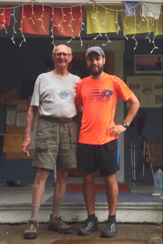
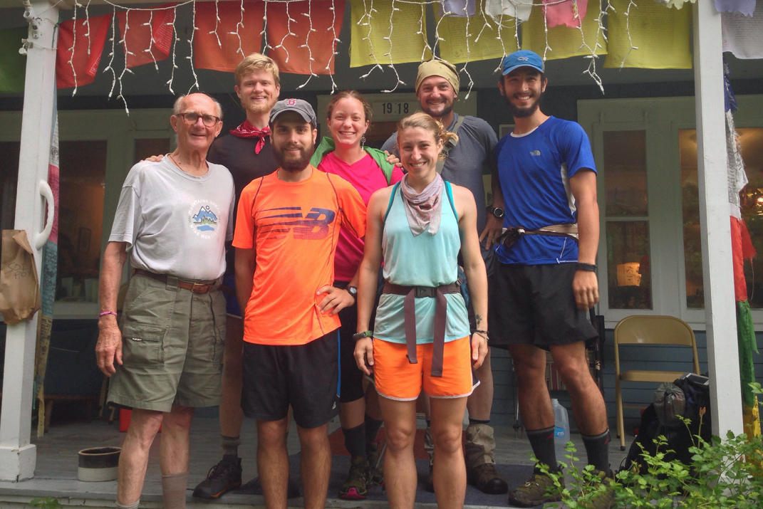
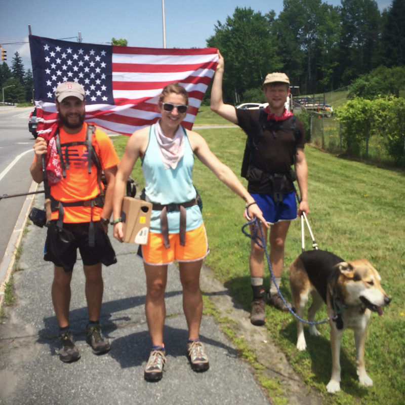
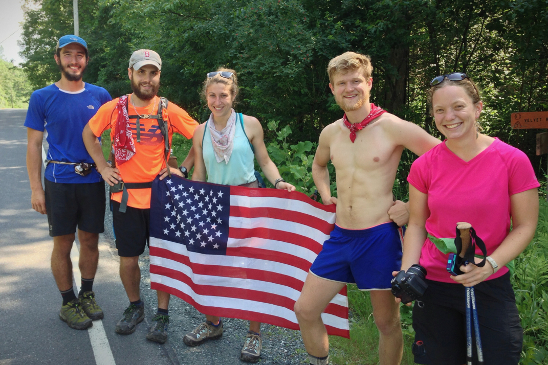
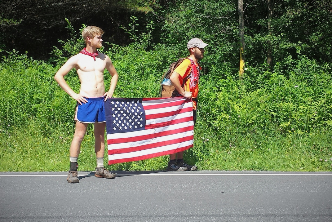
I woke up this morning somewhat disoriented to where I was. You would too if you were sleeping on the carpeted floor of a guy you met in a grocery store parking lot some 15 hours earlier.  What I hadn't fully grasped the night before, likely due to my tiredness and general lack of regard given my state of soaked clothing & soul, was that The Ice Cream Man was simultaneously hosting a 4th of July weekend for his family. Not only did this man gave 8 hikers and a dog sleeping in his home, but also nearly a dozen family members staying there as well. There are very few people in this world who would do such a thing, and for that reason Bill Atkinson will forever be a memorable part of my thru-hike. He and I unsurprisingly got along flawlessly, a retired psychiatrist from Harvard Square in Cambridge, MA, we shared a good sense of sarcasm and enjoyed a few quick witted talks throughout the morning. He even went so far as to invite me to sit down with his family for some pancake breakfast as other hikers packed up. We snapped a few photos with Bill, ultimately hugging goodbye, and hiked on into an overcast day that didn't appear to have much promise in its future. 

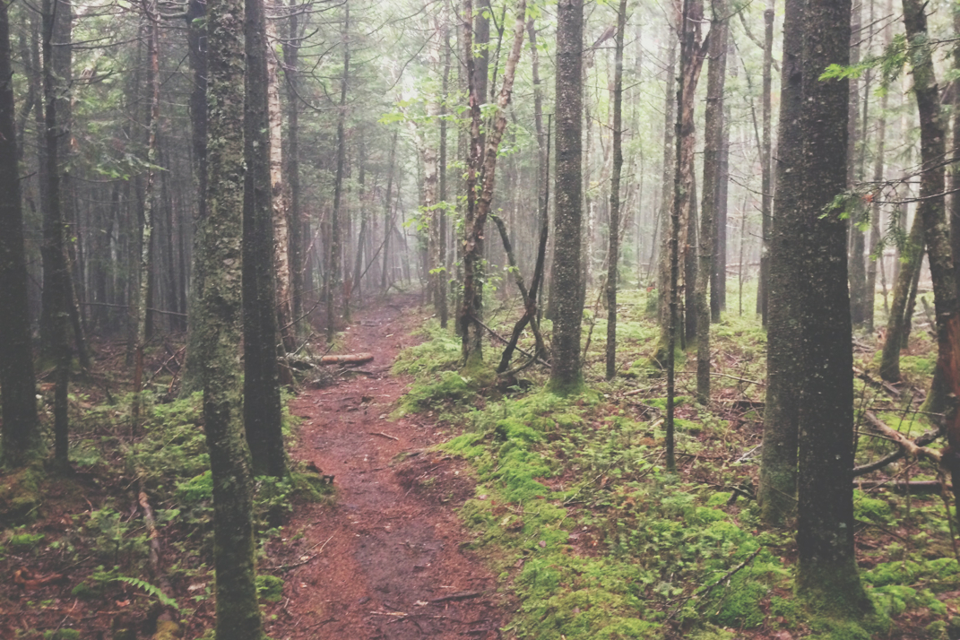
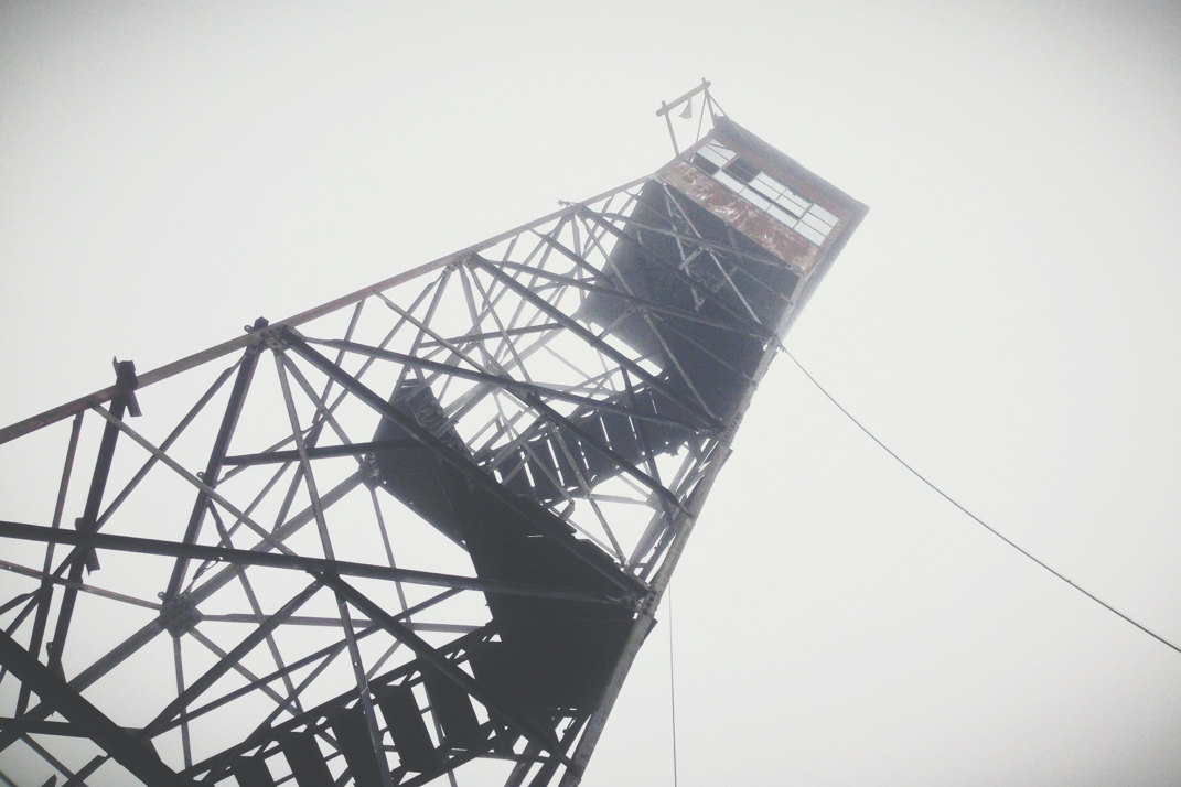
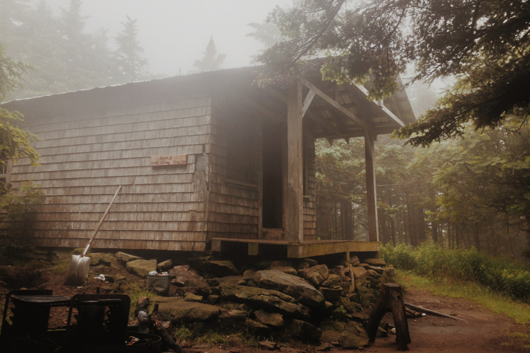
The first few miles of trail passed quickly, an easy meandering bit of trail through the woods. Santa and I hiked together, again with less pack weight due to the generosity of Bangarang to slackpack us for the day. As Santa and I have hiked a lot together lately, the conversations have ranged from school to family, work, career paths, and most notably today, plans of action during a potential zombie apocalypse. With Legs setting an insanely quick pace up front, carrying only a fanny pack with minimal gear, we flew up the mountain together for a while before she took off into the distance. Climbing Smarts Mountain would include nearly 6 miles of trail, putting us at just under 3,500 feet of elevation.  We reconvened as a group at an old fire warden cabin atop the mountain. With a cold breeze blowing and heavy fog blanketing the summit, it was chilly enough to warrant a fleece jacket as we ate lunch.  Each leaving the cabin at different times, I put in my headphones and turned up the music, flying down the mountain at over 4 miles an hour. I'm not sure why this was my approach to the descent, but I was practically jogging down, sliding in mud and having a grand old time. I passed everyone that started before me, and arrived at the base of the mountain, 4.2 miles from the summit, an hour later. 

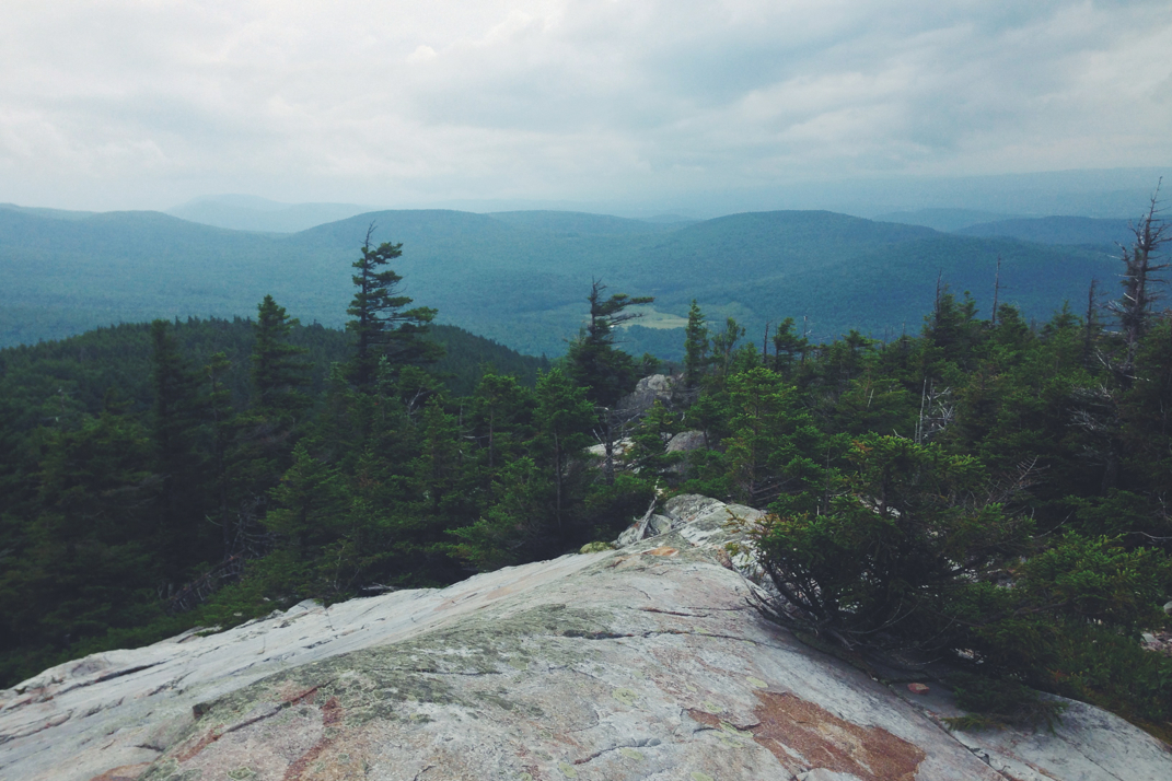
Upon reaching the bottom, Legs caught up to me and we began the next ascent, another 5 mile climb of just under 2,000 feet. We climbed at a quick and steady rate, summiting a rocky face peak overlooking stunning views of the mountain ranges below. Lingering only long enough to soak in the vista, we carried on the 3.3 miles to the base of the mountain where we were to meet Bangarang and get our gear back. As we descended, the skies began getting darker and the wind picked up a bit. Stopping only to get water once, we made it to the road crossing at NH 25C where we waited under some trees alongside the road for Bangarang to return from delivering a hiker to town. Twenty or so minutes later Santa arrived, soon after followed by the Volkswagen loaded up with our gear. After quick conversation with Bangarang, we realized we were both headed for the same shelter tonight, meaning he would be able to drive our slackpacked gear all the way to our final destination.  At this point in the trail Rocket and Dorothy ended their day, getting in the car with Bangarang and heading for the shelter while Santa, Legs, and myself hiked on. With 11 miles to go and ominous clouds appearing in the sky above us, it was a real concern that a storm system would move in and wash us out for the second night in a row. Luckily we hiked quickly, fighting a losing battle against insane amounts of muddy water that occupied the space that once resembled the trail. There was one point where I stepped in omud so deep that my legs disappeared to halfway up my calf muscle. While this scenario sucked as it was, it got slightly worse when I attempted to pull my left foot out of the murky brown-watered sinkhole, and my heel began lifting out of a shoe that was still most certainly stuck in the depths of the mud. I caught myself by grabbing at the only available branch of an exceptionally weak pine tree, a decision which netted me an aroma reminiscent of Christmas on my hands for the rest of the evening. Hiking over one final summit for the day, we descended to the road crossing of Route 25, beginning one more mile of climbing up to the Jeffers Brook shelter where we would spend the night. After crossing the road the three of us encountered an issue we haven't yet come across... a rushing river with no bridge. Debating for quite a while in the foggy darkness of dusk, Santa and I eventually followed Legs' lead of forging her way across the high volume river. With water well past my knees, it was a frigid body of water undoubtedly in a condition amplified by the volumes of water that have fallen from the sky in recent days.  It was somewhere around this point in my day that we crossed officially into the White Mountain National Park.

Arriving at the shelter I met up with my dad who came up to the Whites for the weekend to do some hiking with us. Despite the varied hours of arrival, we all (Rocket, Dorothy, Legs, Santa, my dad, Bangarang, Radio Man, and two other hikers) fit into the large single level shelter. Eating some boiled hot dogs and cracking open a can of beer in honor of the 4th of July, we talked for a while in the shelter before each turning off our headlamps and moving towards bedtime. Tomorrow will be the first climb of the Whites, Mt. Moosilauke, a grand 4,800 foot mountain that officially marks the southern entrance to the famed White Mountain range. 

Off to bed now after a wonderfully long day of hiking, an enjoyable reminder of the hiking days from earlier in my adventure. I can't believe that in 3 months on the Appalachian Trail I've officially entered the White Mountains, with less than 400 miles to go before my terminus at the peak of Mt. Katahdin. 

Onward, without a doubt. 

Picture
Bill's Croquet
Picture
Picture
The gang with Bill
Picture
Picture
Picture
Picture
0 Comments

State Thirteen: New Hampshire

7/5/2014

2 Comments


Day: 91

Day mileage: 19

AT total mileage: 1,759.0

Time: 7.5 hours 

--

The night in the garage passed quickly, and I woke up early per usual feeling exceptionally tired. Packing up and thanking Betsy as she headed off to work, Legs, Santa, and I headed back up the hill to the Thayer house to meet up again with Rocket and Dorothy. There were a few hikers awake when we got there just before 7, and Dorothy informed us that Rocket Girl hadn't slept well at all. She was going to try and sleep in for a while longer, a decision that was fine with me as I was exhausted as well. Eating breakfast on the porch with everyone, a list was made of things that needed to be purchase at Eastern Mountain Sports in town, as one of the Thayers had offered to drive a load of hikers in to make some purchases. As I didn't have anything I needed to buy, I proceeded to flatten myself on the wood decking of the porch next to Naila as she napped, and caught up on a few hours of sleep as Dorothy, Santa, and Legs went into town.  Waking up nearly two hours later, still comfortably entwined with the puppy, I took another shower in the Thayer's guest bathroom and got ready for some actual hiking. It wasn't until 11:30 or so that the gang arrived back from EMS and began packing up to hike out. Saying goodbye to the wonderfully hospitable Mr. Thayer, I caught up to my friends and headed towards New Hampshire. 

We would end up with 4 miles of road walking before the Appalachian Trail would turn back into the woods. Descending from a higher vantage point on the side of the mountain where the Thayer household was, we crossed under Vermont's I-89 and over the Connecticut river on a bridge that had the letters 'VT-NH' stamped in the side of the concrete. With nearly a dozen of us hikers gathered there we took a group photo - officially having completed the 12th and entered the 13th state of the Trail. Cars honked and we cheered, and I added to the festivities by mounting my amazingly awesome American flag on my trekking pole and flying it as we walked into Hanover center. The trail walks down Main Street in town only after traipsing through a bit of the Dartmouth University campus. We took a quick detour and followed Santa to the university's library where in the 'Tower' room, there was some kind of filming of Harry Potter. I'm not sure the exact details as it's very much second hand information, but the tower room in the air conditioned library was a wonderful place for us to stand for a while on the hot summer day. Exiting the library and finding ourselves back in the insane heat and humidity of the otherwise beautiful summer day, we were approached by a grad student named Shelby who was interested in interviewing us for a project she's working on. She said she was willing to hike along with us so as to not slow us down, and would meet us on the edge of town before the trail ventured back into the mountains. We hiked down Main Street, passing by hundreds of people out enjoying the gorgeous day, and found our way out to where the trail left the paved road. Situated around this area is a Co-Op grocery store, which was perfectly placed for me to buy a liter of Gatorade before continuing on with the day. Standing in the parking lot as a group we were approached by an older gentlemen who asked if we were thru-hikers. Introducing himself as The Ice Cream Man, a famous individual on the Trail, Mr. Bill Atkinson invited us to stop by his house for ice cream and a game of croquet some 16 miles north on the trail when we arrived later in the day. Noting Naila's discomfort in the heat, he also offered to take her for the afternoon so she wouldn't have to climb mountains. We thanked him profusely, finished our shopping, and met Shelby to continue hiking while she interviewed us.  The terrain for the day would include two serious climbs of over 1,200 feet each, a challenge in the heat of the late afternoon. Shelby did a great job keeping up with us, and I was actually rather quiet in responding to her questions. She spent about 3 miles hiking moderate terrain in our well-polished group before hopping off the trail at a road crossing that would allow her a quick hitchhike back into town. We hiked on, beginning the first of the two serious climbs. I hiked most of this alone, for reasons I'll now explain.

There are many approaches to the Appalachian Trail. Some people hike 2,000 miles or so, some complete all 2,185.3 miles. Some hikers skip sections via 'blue blazing' meaning to take side trails that might skirt summits or cut out more challenging terrain. There's 'yellow blazing' which means to utilize a car or hitchhike to skip mileage and jump ahead by a fair distance. 'Aqua blazing' refers to a fun and common practice of canoeing through the Shenandoah National Park, bypassing some 100 miles of trail.  There's also a common practice called 'slackpacking' a play on slacking and backpacking, where hikers will leave their full backpacks with a trail angel or hostel owner and carry bare essentials for a day instead of every piece of gear, getting their packs back at the end of the day so they can camp normally.  It's important to follow up this information by informing you of a very important phrase that's synonymous with long distance hiking- HYOH- or, hike your own hike. There is no right or wrong way to go about this adventure, and in the end it is only each individual hiker that can judge whether or not they have successfully thru-hiked the Appalachian Trail. I happen to be in the somewhat strict camp with regards to what constitutes a thru-hike. I have worn my backpack for every mile I've hiked, I've not missed 0.1 mile of trail, and I don't much feel good at the thought of having it any other way. In the end, though, it is the opinion of each individual.  Does physically hiking any distance of the trail over 2,000 miles constitute a full hike? Is it the same accomplishment even if you've utilized different avenues to make things a bit easier on yourself? I'm not sure that it is, but that's just me. 

If you'd like to comment below on your thoughts, I'd be very interested to hear. Reason for bringing this up is that the option of a slackpack was presented by a thru-hiker with a car named Bangarang. He offered to drive our packs to the road crossing just shy of the shelter where we would stay, then give us our gear back. I was exceptionally back and forth on this despite the eager nature at which my friends all accepted his offer. It felt wrong. In the end I compromised- still carrying my backpack with important gear and the like, taking out things like my sleeping back and tent which I wouldn't be needing for the afternoon. I still carried a weighted pack. I found this to be a somewhat reasonable alternative, that didn't leave me feeling horribly guilty. 

The first climb went smoothly. I did most of it alone as the others were literally running the trail with the newfound freedom of no backpack whatsoever. I eventually caught up to Rocket and Santa, noting from a vista that some serious storm clouds were moving in. An hour or so later after descending into a gap below, the sky got insanely dark in a very short period of time. Distant thunder became much closer, and the sky literally turned a sickly looking green color. At this point it was 1900hrs or so, but the darkness of the environment around us gave the impression it was much, much later at night. I stopped to put my headlamp on, a decision based on my poor vision in the dark woods and the desire to not stop during torrential rain to search for it in my backpack. It wasn't 2 minutes afterwords that the heavens opened and all hell broke lose on the Appalachian Trail. Torrential downpours were accompanied by incessant lightning and thunder in the distance, some 4 or 5 miles away. Pushing at an insane pace towards the summit, wanting to get the climb over with and find somewhere dry to stop, we hiked the steeply sloped mountain at nearly 3.5 miles an hour, a rate that's rather beyond my usual uphill speed, and way beyond Rocket's comfort zone.  We stuck together as a group, three LED headlamps marching through walls of water in the pitch black of the woods, a sharp contrast to the ghastly green hue of the sky above. At one point the cracks of thunder and lightning measured out to be less than 1/4 mile away as we neared the wooded summit of the 2,600' peak. One crack of thunder was loud enough to leave my ears a bit sore, likely having been well over 110 decibels, and the closest/loudest episode we encountered. The three of us trekked on, beginning the uncomfortable descent of what was quite literally a river gushing with rainwater and drowning what should have been the Appalachian Trail. I did my best to entertain my two friends, singing and doing anything I could to keep spirits up despite the absolute misery of the situation. At around 2100hrs we neared the bottom of the mountain, approaching a state road crossing. In this moment, Rocket cheered loudly. Following her lead a loud and low pitched scream came from the darkness ahead of me as Bangarang quickly emerged from behind a tree, causing me to jump some 4 feet in the air, subsequently scream, and involuntary throw my trekking poles at him. Laugh all you want, but if you were the first person in a group hiking in the pitch black and someone jumped out from behind a tree and screamed, you'd jump like an NBA star too. 

Bangarang led us the 0.1 miles off the trail at the road crossing to Bill Atkinson's house. In light of the ferocious storm, we were offered to spend the night. His porch was already full of hikers, but Legs, Rocket, Santa, and myself were given space on the living room floor. Cooking a dinner quickly, we still didn't make it to bed until 2330hrs or so. It wasn't an exceptionally long day, but having started well after noon o'clock and hiking through an insane storm, I think we did just fine. It's insane to think that I'm almost there. Some 425 miles from now I'll be standing atop Katahdin. If nothing else, that'll give me something to dream about tonight.

Somewhat dry on the living room floor of a trail angel and living legend of the Appalachian Trail, it's time for bed. Life is mysterious that way- from a grocery store parking lot on a hot summer afternoon to a full house of friendly people some 8 hours later while the world outside gets soaked in precipitation... I've literally found a port in the storm.

Texaco

Picture
VT/NH State Line
Picture
Picture
Picture
Hitchhiking
Picture
Ice Cream Man's House
2 Comments
Forward>>

    SUBSCRIBE

    Join Over 2,000 Readers On The Search For Adventure!

    Delivered by FeedBurner


    Author

    Hey there! I'm Ryan McKee, a free spirited adventurer, photographer, and digital media creator who calls North Carolina home. I travel incessantly, carry a camera with me everywhere, and am always dreaming of my next big trip.

    Picture

    SOCIAL MEDIA

    Picture
    Picture

    SPECIAL THANKS To

    Picture
    Picture
    Picture
    Picture
    Picture
    Picture
    Picture

    Archives

    October 2019
    September 2019
    August 2019
    August 2018
    July 2018
    June 2018
    February 2018
    December 2017
    November 2017
    October 2017
    September 2017
    August 2017
    July 2017
    June 2017
    May 2017
    March 2017
    February 2017
    January 2017
    December 2016
    November 2016
    October 2016
    August 2016
    July 2016
    April 2015
    September 2014
    August 2014
    July 2014
    June 2014
    May 2014
    April 2014
    March 2014
    February 2014
    January 2013


      Quick Survey

    Submit

    Categories

    All
    Allagash Wilderness
    Appalachian Trail
    Banff National Park
    Bears
    Canada
    Caribbean
    Connecticut
    Georgia
    Greece
    Hiking
    Italy
    Jasper National Park
    Jeeps
    Katahdin
    Long Trail
    Maine
    Maryland
    Massachusetts
    New Hampshire
    New Jersey
    New York
    North Carolina
    Overland
    Pennsylvania
    Photography
    Sailing
    Tennessee
    Travel
    Vermont
    Virginia
    West Virginia

    RSS Feed

ADVENTURES

Trans-Canada Overland Expedition
The Long Trail
Appalachian Trail
Bicycling Across America

Overland Build

Meet The Jeep
Backcountry Gear
​Modifications & Installations

Everything Else

Read The Blog
Photography
Guest Book
Contact

Picture
© COPYRIGHT 2019
​All Rights Reserved