2180miles
  • Home
  • Adventure Blog
  • Overland
    • Meet The Jeep
    • Mods & Installs
    • Overland Gear
    • Trip Reports & Videos >
      • Allagash Winter 2019
      • Greece Adventures 2019
      • Overland Expo East 2018
      • Allagash Wilderness 2018
      • Trans-Canada Overland 2017
      • QB-5 Adventure 2017
  • Long Trail
    • Trip Summary
    • Photojournal
    • Hike Statistics
  • Appalachian Trail
    • Trip Summary
    • Photojournal
    • Gear Talk
    • Hike Statistics
    • Financial Planning
  • Bicycling America
    • Trip Summary
    • Photojournal

Entering Tennessee

4/18/2014

1 Comment


*please forgive any delays in updates- data service has been severely lacking*

ay: 14

Day mileage: 11

AT total mileage: 176.5

Time: 5.5 hours

--

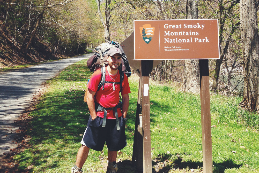
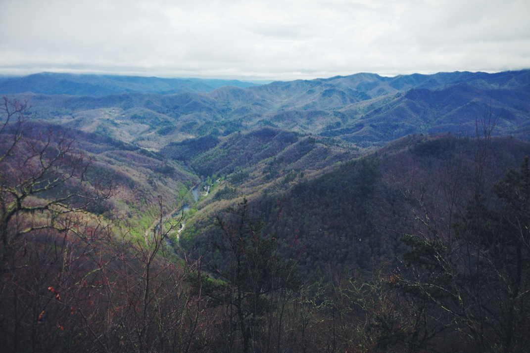
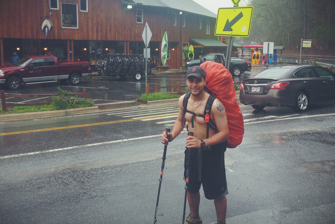
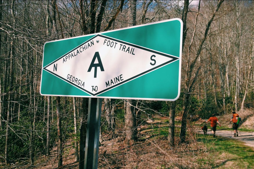
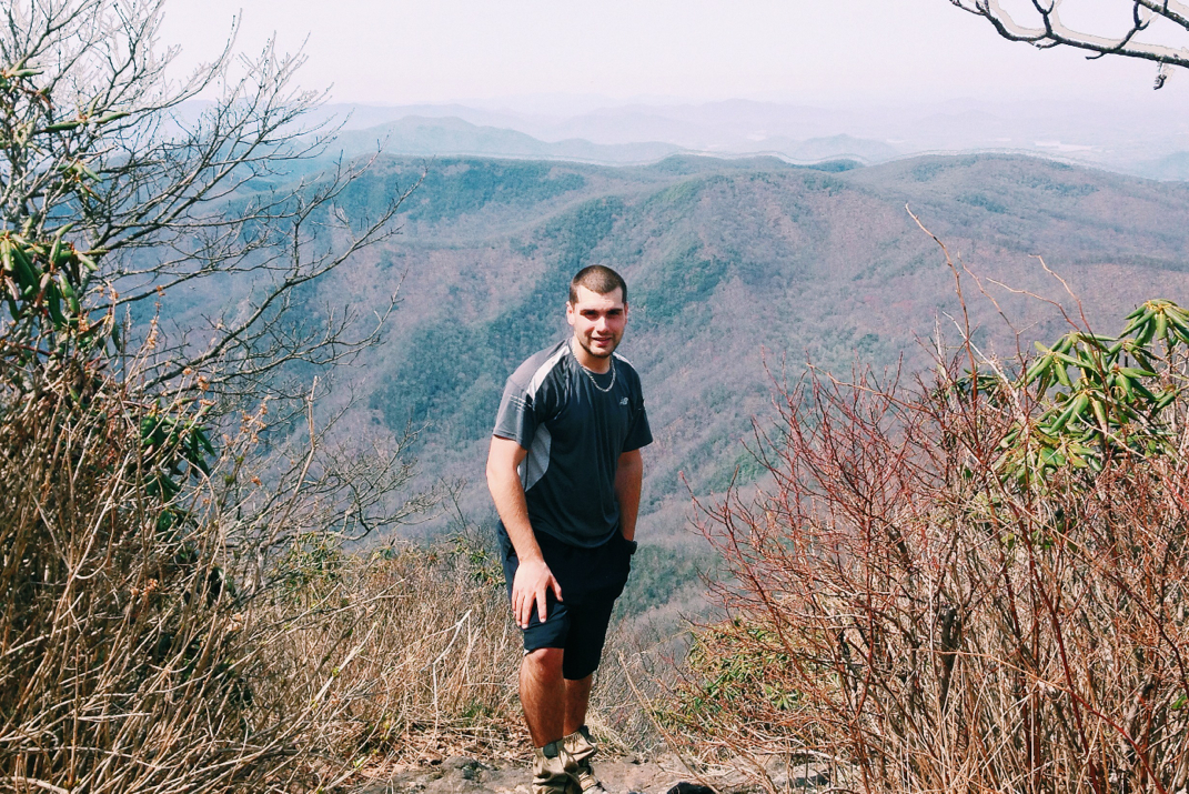
Today seemed to last forever, and at some point we officially entered into Tennessee. 

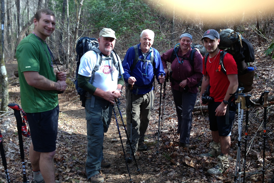
For some reason I was exceptionally exhausted this morning, and finally rolled out of 'bed' at 8:05. Striking my tent and walking to the visitor center by 9 allowed me to wash up and brush my teeth while Crusoe tried to get us on a shuttle into town. This ended up being quite the (comical) ordeal trying to get the older couple working at the visitor center to stop bickering about their fax machine long enough to make the call for us. It was pricelessly hysterical to watch this situation play out. We waited 10 minutes or so for the Chevy SUV to pull into the parking lot and take us to what constitutes 'town' for the sum of $3/direction. 

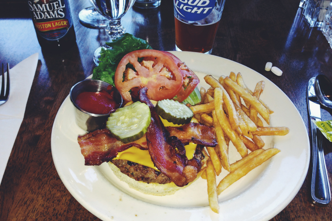
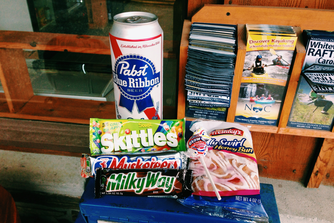
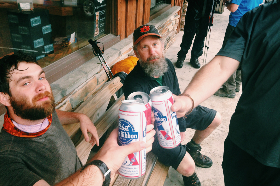
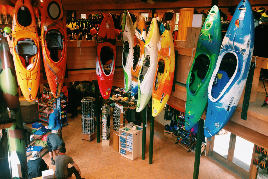
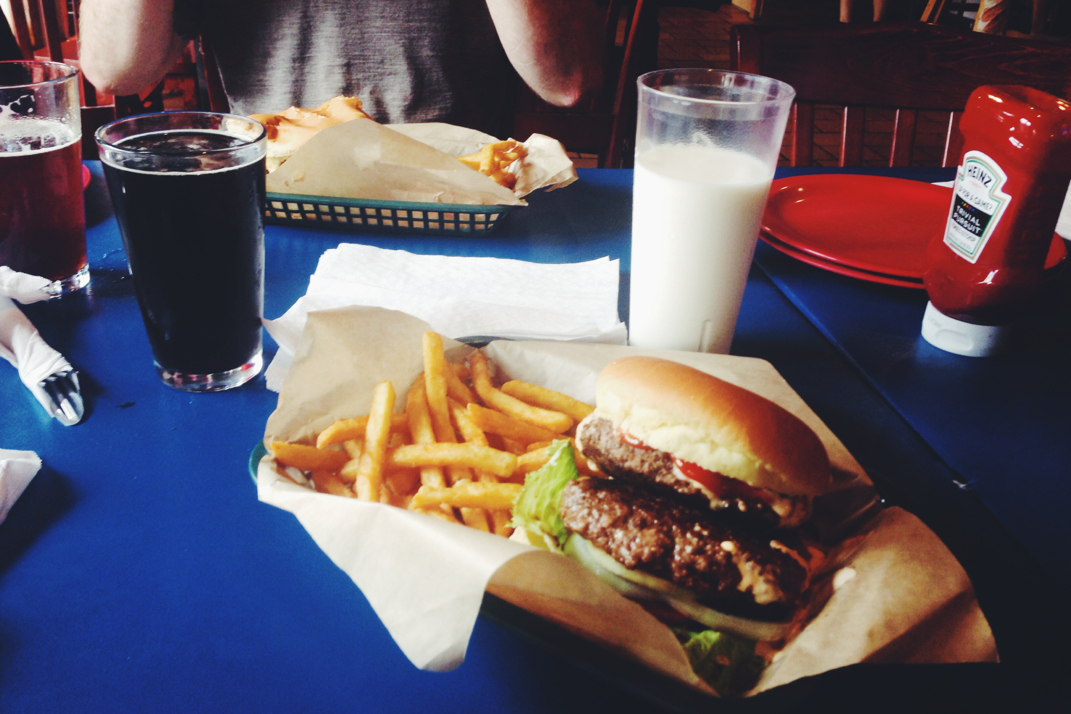
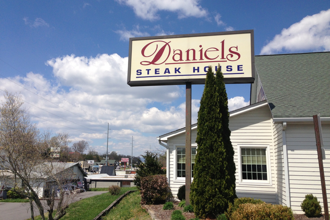
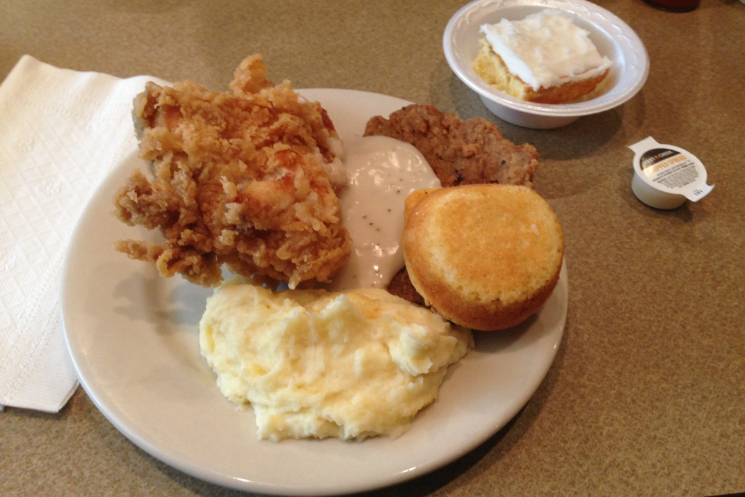
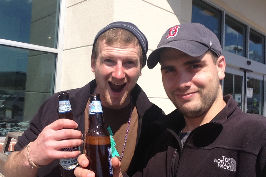
We stopped in at the Fontana General Store, where I giddily drank a Minute Maid orange juice while I shopped for resupply items. I've got a fair amount of meals left, so I filled in my 'mid-day snack' collection with Pop-Tarts, glazed honey buns, Snicker's, and Milky Way bars.  It's quite enjoyable to shop for things by what has the *most* calories, since it's probably the only time in life i'll do this. For $25 I filled up the next week and a half of food items, and Crusoe and I sat in the sun using the store's wifi while it was available. We then headed up to the Fontana Lodge to try and find breakfast. Upon arriving (10:50) we were informed they were closing to change over to lunch... Nothing seemed to be going our way timing wise, as we were still waiting for the single-man-operation post office to open at 11:45. We sat in the lobby of the Lodge conversing with other hikers, and I picked up my new tent poles. We eventually were let into the restaurant where I ate a delicious burger and washed it down with a perfectly chilled Sam Adams Lager. The brewery founder would be ashamed to know it was served to me in a Bud Lite glass. After lunch we went back to the post office to pick up our permits (thank you Mr. & Mrs. Mather) for the Great Smoky National Park, and hitched the shuttle back to Fontana Dam. 

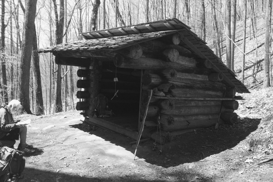
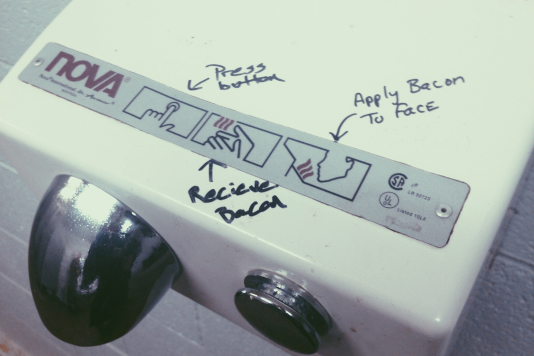
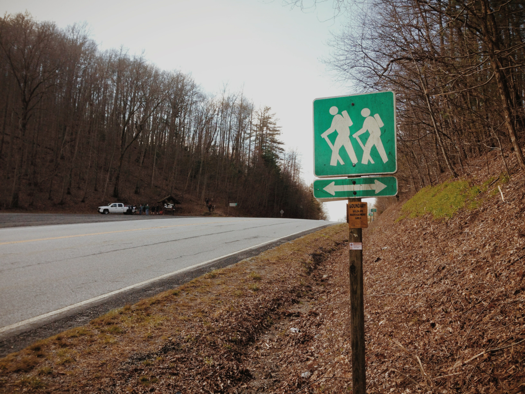
The quick background on the GSMNP permit is as follows: in order to thru-hike the A.T., you pass through GSMNP. To 'legally' do this, each hiker is required to print and carry at all times a permit, costing $20 per hiker, to grant them access to shelters and trails. The 70 some-odd miles of trails include a fair amount of shelters, which come with their own rules. The most detrimental rule in my opinion: shelter space must be fully occupied before a hiker is allowed to set a tent. Basically, no alone space as you have to be in the shelter. The best way to describe these shelters is to compare it to a large morgue. There are two levels of 'shelves' 7 feet deep and with about 3 feet of head room. The shelves are about 15 feet wide, giving room for 5 hikers to fit in next to each other. The sections are divided by small 1x2 pieces of wood to differentiate personal space. Not my idea of a good time. The second ridiculous rule: a thru-hiker has no priority over a weekend hiker for shelter space. Regardless of when a weekend hiker arrives at the shelter, they have precedence for a shelter slot. So I could theoretically show up at 3 pm, exhausted from my 200th mile of hiking in two weeks, and at 7pm when a late weekend hiker arrives, be kicked out of the shelter and forced to set my tent up...... Angry face. Oh and since you asked, the GSMNP trails are patrolled by 'Ridgerunners' who check for permits and enforce these rules at night. I'm really hoping to be down and out of the Smokys in 4 nights. 

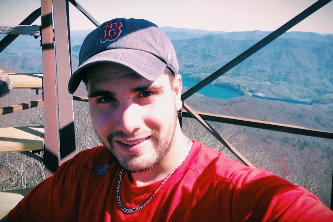
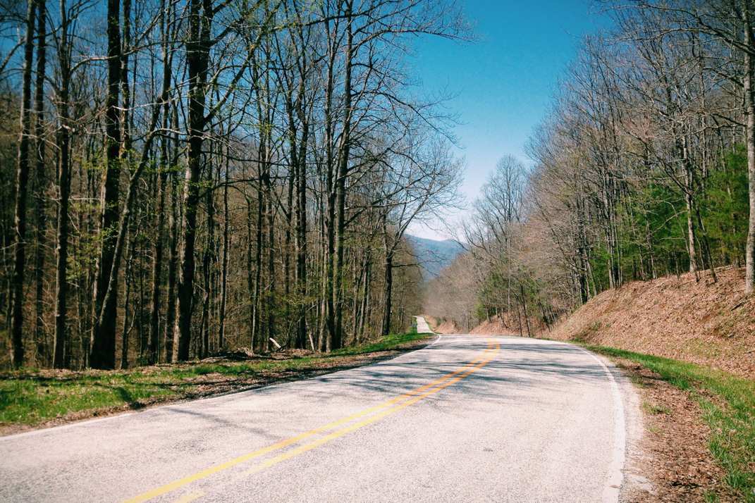
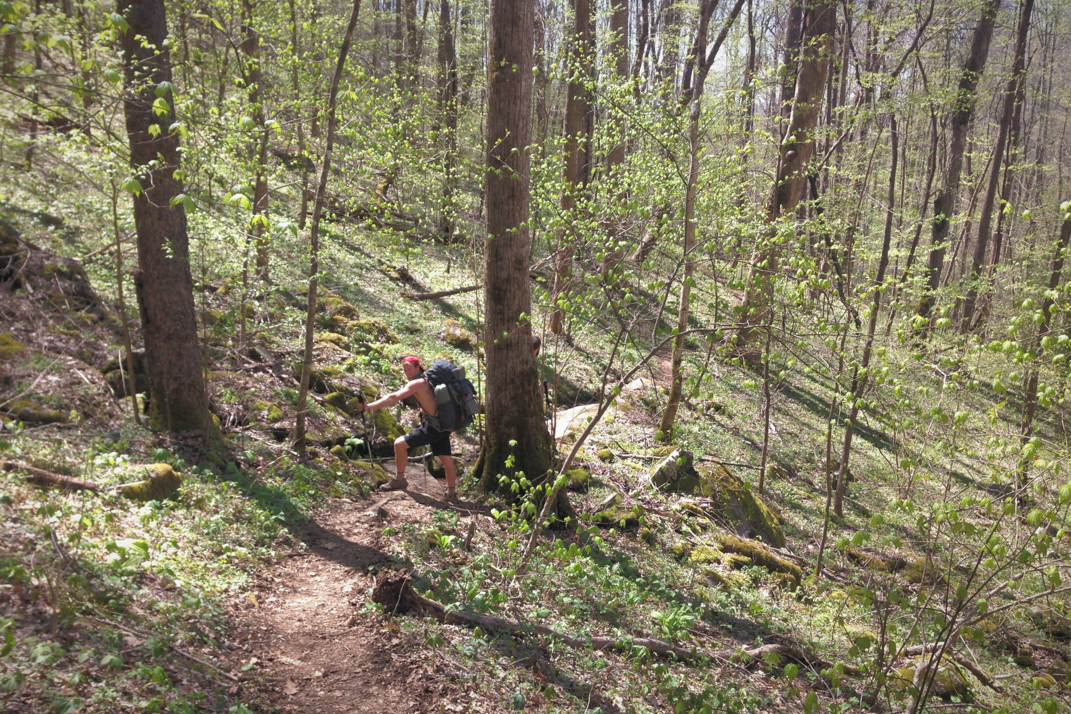
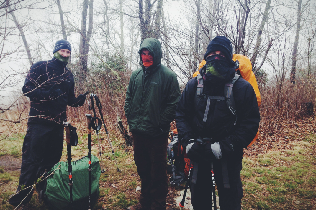
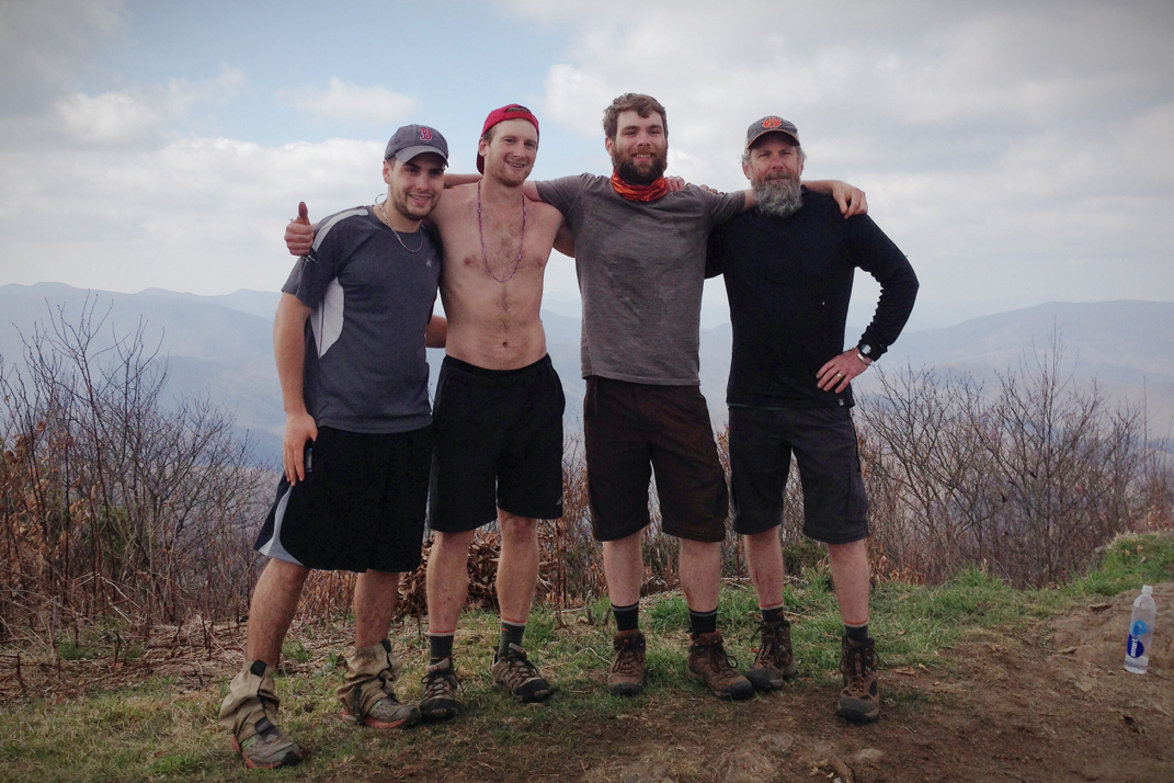
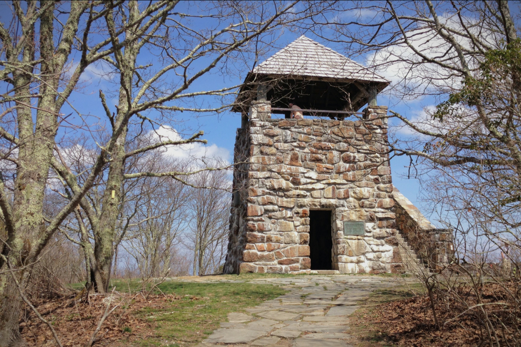
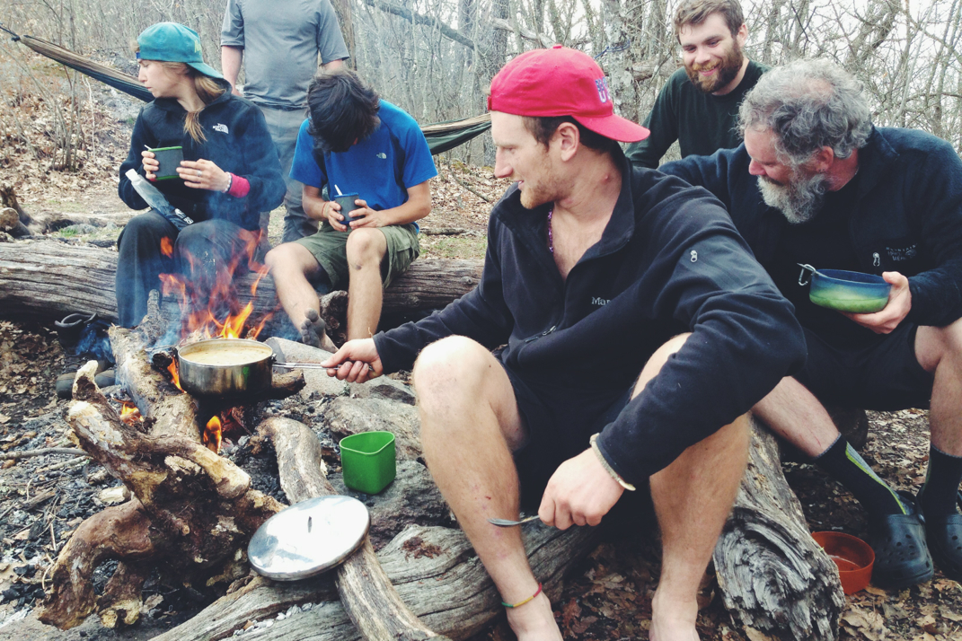
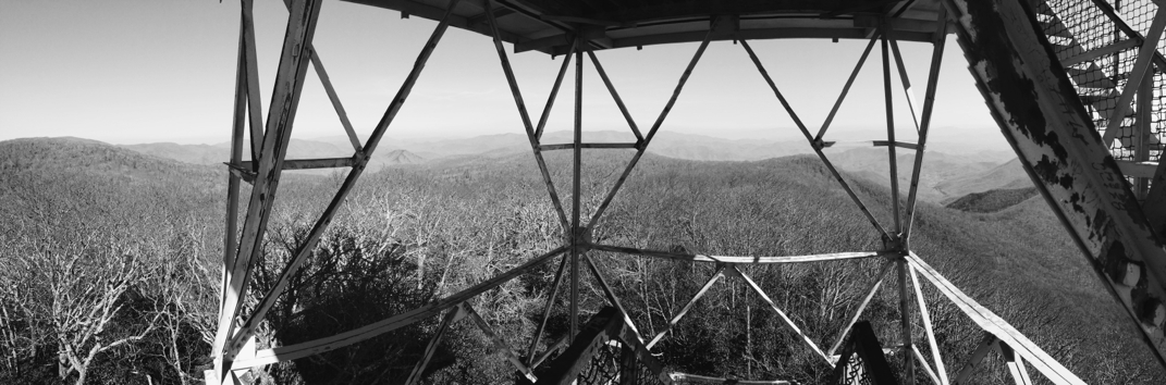
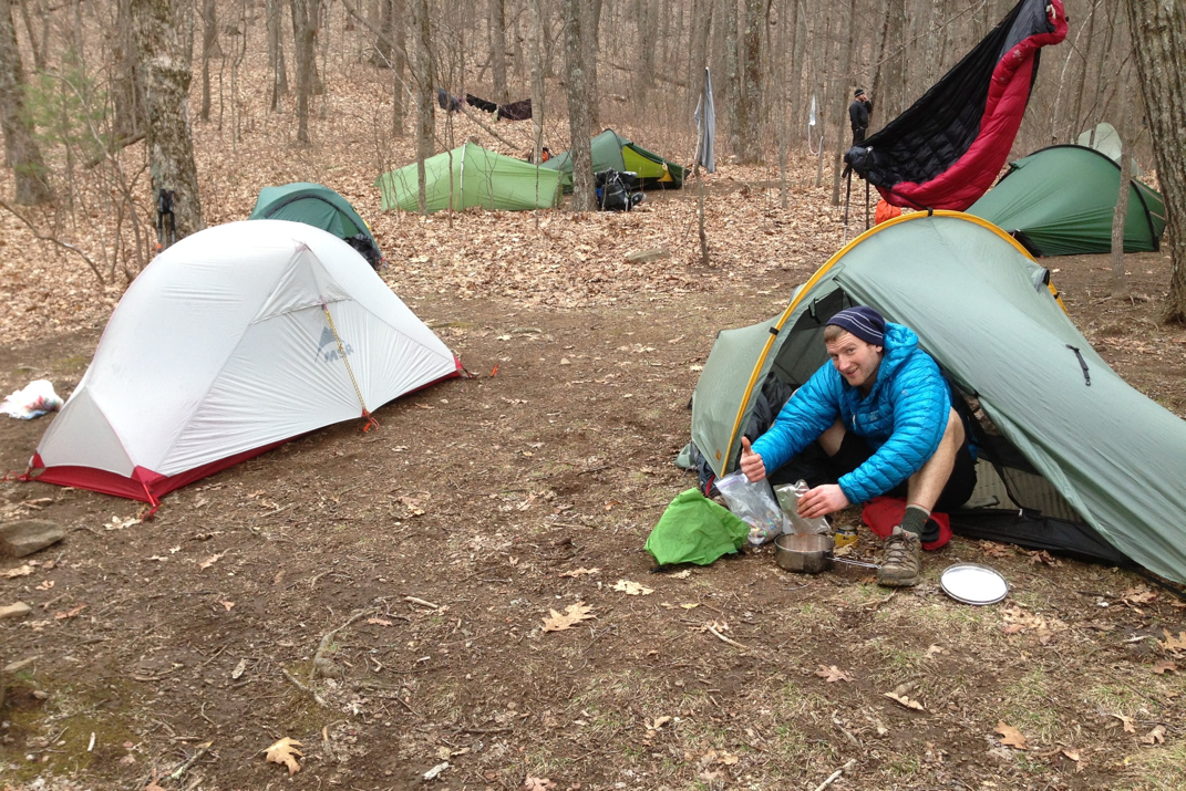
Crusoe and I hit the trail at 1400hrs, very late in the day, due to our required errands in town. This afternoon was exhausting, and included a few thousand feet in elevation gain over not many miles. We were able to climb the sketchiest fire tower I've ever been in, comprised of angle iron, missing railings, rotted floor boards, and amazing views. We snapped some photos and headed back to the trail. Knowing we had to stay at the shelter (11 miles from where we started) our fate was pretty much sealed for a near-sunset arrival time. We did pass through some gorgeous fields and amazingly grown trees, as well as the first bear trap I've ever seen in my life. Tennessee shall be interesting! A long and steep uphill eventually landed us at the shelter at Mollie's Ridge. Unfortunately there weren't enough people to 'force' tenting, so staying in the shelter is what's going to happen. A nice fire with a new group of people, including a mid-20s couple who decided to hike the Trail as their honeymoon (not my idea of a good time), and it's bed time. 

Having to stay in shelters really limits the open-ended freedom of where we camp at night.  Shelter location will limit or force how many miles we complete per day for the next few days, but I think I've got a plan in place to get my butt out of this Government Controlled Woods by Monday. Aren't there better things to be policing than if hikers are sharing bunks appropriately??

Picture
Picture
Picture
Top of the fire tower
Picture
1 Comment

Fontana, Damn!

4/17/2014

1 Comment


Day: 13

Day mileage: 14.2

AT total mileage: 165.5

Time: 7 hours

--

It was 25 degrees when I got out of my tent this morning. I assure you it took an immense amount of willpower to get out of my warm, down-feather sleeping bag and out into the frigid air... just to walk. Who in their right mind would do such a crazy thing? Apparently this guy, right here. After packing up our campsite, and enjoying a 450 calorie 'berry honey bun' from its plastic shrink wrap packaging, the four of us headed into the woods. For the last day, we faced the world as the clan of Texaco (myself), Crusoe (Kevin), Papa Doc (Doug), and Keegan (still no trail name). 

There have been a few moments in the last 165 miles where I've questioned my own ability to make it to Maine. Discouraging moments include pains in my legs, rain soaked mornings rushing to put my wet tent away, smelling horrible after 5 days of intense physical activity while not showering, and moments like the one I had this morning while scaling Jacob's Ladder. Had I been informed before beginning my ascent that this section is the steepest section in all of the AT, I might have felt better about myself. Instead, less than 1/4 mile out of our campsite with morning aches in tired legs, I questioned my physical competence against a beast like The Trail. Holy hell was it steep. Regardless, after an embarrassingly long bit of time and mentally trying to overcome the screaming pain in my cold calf muscles, I made it to the peak of that 'hill' and was promptly informed of its notoriety in the grand scheme of the A.T., instantly making me feel even the tiniest bit better. 

After shedding my fleece top & long underwear layers, again down to just shorts & no shirt, I walked, invigorated by the mix of nippy wind and warm sun. I kept up with the quick pace set by Keegan & Crusoe, and we pushed on. The miles started flying by as we walked over roller coaster hills, the icy & frozen ground seeing sunlight for the first time since the storm, with thick mud becoming present almost everywhere. Neither climbs nor descents were overly extreme.  About half way through our day we passed by Cable Gap Shelter, both very old & very small, known to be one of a few left from their original construction in the 1930s. The climb from Cable Gap was steady & steep, bringing us up to the 3,600' elevation we'd meander along at for another few miles before descending down to Fontana Dam. The descent would include 2,000' elevation loss over a drawn out 5 miles, during most of which the Dam itself was visible. A lurking concrete monstrosity, the Fontana Dam led to many discussions of mechanical engineering, architecture, generic construction, and bridges over (non-troubled) water. It was almost excruciating, the amount of time it took us to get down to road level. During our descent the world once again became less dead, with greenery and even faintly blooming flowers appearing around us. As soon as we made it to the Fontana shelter (aptly named the Fontana Hilton, more on that later) we said goodbye to Doc & Keegan for what likely will be the last time. Their visit with family will probably put a 50-60 mile gap between us, although I do hope to see them again. It's quite strange how quickly people come & go in life, but infrequently do they seem like you've known them forever. These two fine gentlemen will absolutely be missed, but we'll stay in touch & meet up off the trail when circumstance allows. 

Crusoe & I lay claim to tent spots, and headed to the Fontana Dam visitor center to look around. My attempt at an accurate description: the Dam was built in many stages between 1942 & 1945 to cut down on flooding in the local towns after large storms. Regardless, it's quite the sight to see, at over 2,100 feet in diameter. After speaking with the staff at the visitor center and signing the guest book, we each took hot (more importantly: free) showers, and walked back to set up our tents. A quick side note & interesting fact, 30 years or so ago, my mother & her friend Susi dropped my uncle off at Fontana Dam Visitor Center to hike the Appalachian Trail. I've attached a photo of him the day he started, and one of me from roughly the same angle. Rather neat, no?

Back on track... The Fontana shelter is nicknamed the Hilton for the multitude of free showers, working plumbing, and free electricity. It's another world compared to what we're used to.  A good dinner of Ramen noodles & peanut butter (don't knock it till you try it) and Crusoe's tortilla soup, washed down with a 24oz PBR I've now trekked 30 miles (read: 30 miles too far), we sat around a fire with a half dozen other hikers. As the sun set over the Great Smoky Mountains I reflected on the silly fact that we actually walked here... Inadvertently returning to the first thought of my day: who in their right mind would do such a crazy thing? 

Picture
Winding Roads
Picture
Cable Gap Shelter
Picture
Picture
Fontana Dam
Picture
Fontana Dam
Picture
Richard at the Fontana Dam
Picture
Roughly the same shot
1 Comment

Perhaps Every Precipitation Possible

4/15/2014

1 Comment


Day: 12

Day mileage: 14 mi

AT total mileage: 151.3 mi

Time: 6.5 hours

--


Even if I was a meteorologist with the most up to date equipment on earth, I couldn't have predicted the weather we encountered today. 


Waking up 'late' was exceptionally nice. The guys sharing the bunk house with Crusoe and myself got up early and were rather noisy, but some of my favorite Billie Holiday songs on my iPod put me right back to sleep.  Around 9 am I headed out onto the porch to work on the 4 days of unwritten journal entries I've been neglecting. By the time I finish typing blog entries, the last thing I want to do is pick up a pen and re-cap my day again. Doc and I sat outside watching the rain fall from the covered porch for a while before deciding we should start the day. The four of us (Crusoe and Keegan included) packed up our bags, donned our waterproof gear, and headed down for the first cooked breakfast I've had in two weeks. If yesterday's mission was the intake of milk, today's was the intake of orange juice. We enjoyed breakfast at the NOC restaurant, restocked silly items (honey buns, 24oz beers, Skittles) at the convenience store, and headed for the trail around 11:45. 

What. A. Climb. Holy crap. Remember how I said I thought trail legs had been established? Well today kicked my butt. I knew full well the climb that would bring us out of the NOC but this was hours of steady climbing. It only took 20 minutes or so for Crusoe and I to show our thick Yankee blood and ditch everything down to t-shirts despite the drizzling rain and wind.  He and Keegan were hiking at a faster pace than I wanted for today, so Doc and I hiked together while the guys sped off. I turned the ipod over to a record Stevie Ray Vaughn made at Carnagie Hall, and jammed my way up the trail. About an hour into the hike the weather turned for the first time. We were about to ve climbing into the clouds, and the fog was announcing its presence. It was at a look-out called the 'Jump Off' that I first noticed snowflakes falling. Yes friends... Snowflakes. We continued hiking up, and with more elevation came colder temperatures and stronger winds. Temps had dropped into the low 30s, and wind chill brought the apparent temperature much lower. The snow flakes started becoming painful to the skin, and I began noticing that instead of snow, it was chunks of ice falling from the sky. I picked up a few pieces and photographed them to show you what we were getting hit with. The scenery changed from the wet greenery to something out of a dark remake of Snow White... Everything was covered in ice, winds whipping around us and blowing us around on the trail, and the pelting of ice against my jacket (I finally put one on) made a steady rhythm. Doc and I stopped at a shelter to add layers of clothing, and found two dozen hikers bundled up and tucked into their sleeping bags hiding from the wind and harsh elements. They look at us like we were crazy when we headed back out into the weather. 

We regrouped with Keegan and Crusoe  at the summit of Cheoah Bald (5,062') and decided to stick to the original plan of hiking to a campsite 14 miles from the NOC, leaving us with 5 miles to finish. This made me somewhat nervous, as it was 1545 at this point, leaving us hiking close to dark. Temperatures would inevitably fall further, which was another concern. We pushed on, as the hail turned to a gentler sleet, and eventually to just snow. The wind was persistent, though, even as our elevation dropped significantly. The snow continued for the rest of our hike. Around 1730hrs the sun poked through the clouds for a few short minutes, before disappearing for the rest of the day. We crossed a state road before rejoining the trail, and were delighted to find delicious apples sitting on a picnic table. Yes, there's a risk of eating apples left on a table, but man were they good, and I'm still alive to type this. We headed up another 3/4 of a mile to the tent site we're staying at tonight, and set up camp in the freezing wind and snow. 

Dinner was a dehydrated beef stroganoff made months ago by Doc and Keegan that they served to Crusoe and myself. I literally didn't even get out of my tent/sleeping bag, the food was delivered.  After the absolutely delicious dinner we talked for a bit, each tent being bombarded with icy snow flakes and wind that are still very much present outside. Temperatures at the moment are in the very low 20s, and are expected to drop a little more overnight. My water bottles, water filter, and all electronics are buried inside my sleeping bag with me, and I'm wearing almost every layer of clothing I have with me to try and stay warm tonight. I've joked aloud that if all else fails I can put on the arthritis medicine for the 'heat' of the jalapeños. Maybe that would work... Who knows. 

Tomorrow we'll stroll another 13 miles to Fontana Dam where I'll cross into Tennessee for the first time. Tent poles will be available to be picked up (thanks MSR for making it right!) and I'll spend the night at the 'Fontana Hilton' - a pet name for the shelter due to the hot showers and electricity it has. It will be our last day with Papa Doc and Keegan as they're taking a few days off to visit with family. I know Crusoe and I will both miss their presence. It's amazing how close you can become with people in such quick time periods on this trail. 

On another quick tangent, I spent a lot of time today thinking about the year between the Marathon bombings and today. Having met survivors during the World Series Parade and being in love with the City of Boston, it's incredible to know how much closer we've become as a city. The nationwide support was endlessly amazing, and I truly hope that the 2014 Marathon goes off flawlessly to show just how strongly we bounce back after tragedy. 

Anyway. 

Off to bed, hopes of staying warm dancing in my head.... Wish me luck!


Picture
Early morning cabin activities
Picture
Necessary Resupplies
Picture
The Jump Off
Picture
Ice From The Sky
Picture
Snow White Forest
Picture
Summit of Cheoah Bald
Picture
Trail Magic Apples
Picture
Having fun despite the hail!
1 Comment

The NOC

4/14/2014

5 Comments


Day: 11

Day mileage: 11.7 mi

AT total mileage: 137.3 mi

Time: 5 hours

--

The raineth haveth cometh.  

Waking up at 7 am left me to find the camp site practically empty. Of the dozen tents sent up in our one area when we retired for the evening, only 4 were left including my own. We broke our tents down, and ate a quick breakfast. Weather reports indicated the rain would begin at 10 AM and would continue through to tomorrow. As we filtered water and got ready to start hiking, we came across another family who's almost done with their SOBO (SOuthBOund) Appalachian Trail hike. There were both parents, three kids, and a young Husky canine hiking, netting close to 20 miles a day per the father of the clan. That kind of mileage astounds me, although if they've been at this for as long as they say, I'm sure it's not inaccurate. I can't imagine being 12 years old and having hiked the entire A.T. 

We climbed (again, our group of 4) out of the Cold Spring Shelter and headed into what became a quick paced and relatively easy day, all things considered. At our elevation of just under 5,000 feet, we would be dropping down to under 1,700 when all was said and done. The destination for the night was 'The N.O.C.' aka the Nantahala Outdoor Center, a whitewater rafting and hiking outfitter. The hike would take us over 12 miles of terrain, 8 of which was downhill, sometimes at severe angles. We walked together as a group to another bald where we were able to scale yet another fire tower for more cloudy views of the surrounding mountains. We continued our hike from there, and while Crusoe and Keegan headed up the front, Doc and I stayed slow and cautious in the back. He has had issues with his ankle in the past, and we're both aware of the risk of rushing. Over 8 miles it became extremely tedious to watch every downhill step, but proved worth it. At some point we crossed into a low enough elevation that the vegetation completely changed. All of the sudden the forest floors were covered with newly growing plants, the fallen trees covered in a lusciously soft looking moss, and the birds chirping a different tune. It was truly beautiful, and a welcome change from the more barren and still hibernating forest floors of the higher elevations. Papa Doc and I meandered through these lower portions for a while discussing life, work, and traveling. Not too long after we were joined by Simba, one of many German thru-hikers, who has separated for the day from his friends Lucky Moose & Snailman. He spent a while telling us about hiking trails in Europe alike the A.T. that get upwards of 200,000 starting hikers a year... Almost 100x the number of those that attempt the Appalachian Trail. Apparently the A.T. is decently well known in Europe. 

At about noon-thirty, 2 and a half hours after the weather predicted, the heavens opened. We had been in a slight drizzle for fifteen minutes or so, during which we had stopped to wrap our backpacks in waterproof covers. I stowed the camera, expecting some more sever weather moving in, and appreciated that 2 minute detour when the torrential rain began. Simply due to the desire to keep my dry clothes dry, I continued the rest of my day with no shirt on. The looks Crusoe and I have gotten without shirts on some of these days are hysterical, but people seem to forget that we're used to colder weather. We often debate between ourselves whether it'd be more beneficial to be more accustomed to the cold of the North or the heat of the South. Doc, Simba, and I picked up our pace and made it down the remaining mile of switchbacks by 1330. Soaking wet, we were met by Crusoe and Keegan with cold 24oz cans of PBR. Although not my favorite beer, it managed to put a smile on even the most soaking wet of hiker's faces. 

After a quick pow-wow we decided to see if the NOC had any bunks left for the night, hoping to keep our tents dry for one more day if possible. They were able to place us in the 'overflow' house where we'll share the bunk rooms with 4 other guys. For $20 you get a warm bunk room and warm showers.. believe me, it was worth it. I stopped by the outfitter to get tent pole braces, which I'll only need for two more days. Per my parent's help, MSR was contacted and they'll be overnighting new tent poles to Fontana Dam for me to pick up on Wednesday. They're aware of a 'bad batch' of poles manufactured... Further discussions will be had as to whether or not they'll waive the $15 overnight shipping fee. Either way I appreciate the company standing behind the product. The kind fellow at NOC found me some pole repair braces in their storage room, and after hearing my story gave them to me for free. I also picked up a pair of orange Superfeet inserts for my shoes, thanks to a recommendation from my friend Kim. The theory is that they will absorb some downhill impact and relieve my knees. 

Our group of 4 had lunch at the restaurant on property, and I consumed a burger with two 1/2lb patties, jalapeños, cheddar cheese, and the typical mayo/lettuce/tomato mix, along with a few slices of veggie lovers pizza, two beers, and two large glasses of milk. Immediately followed by a pint of strawberry shortcake ice cream. To say that my appetite is decent would be a massive understatement. And to answer your question, when paced correctly, beer and milk work fine together... I walked into town craving milk and orange juice. Tomorrow, the OJ shall flow. 

We're sitting up at our cabin, after each of us took a hot shower, winding down for the night and looking at tomorrow's maps. The rain will undoubtedly continue, and we'll be faced with a 3,300' climb out of this area. Per a previous thru-hiker, we're in 'rarified air' with our 2014 thru-hiking peers. With a full tummy, cleansed body, and dry socks, I look forward to tomorrow.

A little rain never hurt anybody. Lightning maybe, but we'll deal with that as it comes. 

Picture
Foggy Mountain Morning
Picture
Empty Rainy Campsites
Picture
Soaking wet arrival at NOC
Picture
Cold Beer Toasts!
Picture
Inside the NOC
Picture
Lunch/Dinner Part 1
Picture
Funny Captioned Hand Dryer
Picture
Elevation loss/gain for these two days
5 Comments

Cold Spring Shelter

4/14/2014

1 Comment


Day: 10

Day mileage: 14.8 mi

AT total mileage: 125.6 mi

Time: 7 hours

--

Our Everest Base Camp broke down rather quickly this morning. At some point during the night I was awoken by another snapping noise, only to discover that two more tent pole joints broke. I spent about half a second debating doing anything about it, and decided that continuing sleeping was the best course of action. It's Sunday, so no phone calls to the manufacturer can be made. The group we camped with last night offered another brace for me to use to keep the tent up. This kind of generosity is unbelievably appreciated. Turkey, her puppy, Bengus, and Fumbles were heading back to the highway (0.2 miles or so) and spending the day in Franklin, NC. Myself, Crusoe, Doc, and Keegan headed uphill to start our morning, and were quick to get mileage in before coming across a bald mountaintop that we were urged to summit for the view. We were not misled, and a quick game of frisbee (before some bad aim ended the discus in the middle of impassable brush), and phone calls to loved ones accompanied the gorgeous ridge line views. 

We descended from Siler's Bald down to Wayah Gap before beginning an incredibly strenuous climb to the next summit. There are points on the trail, quite frequently, where we walk through what I call 'rhododendron tunnels' - 8' tall tunnels of the not-yet-blossomed covering the trail. It's quite beautiful to walk through, and I hope we get to see them in bloom before too much time goes by. We ate lunch alongside a fresh water spring before continuing up a bit to a paved road and public park. For those in the Boston area, it was a lot like The Fellsway where Wright's tower overlooks the city. We stopped with a dozen other hikers at a stone fire tower that looks over Franklin. With only a few miles left in our day, we pushed on. Crusoe (Kevin) and Keegan stopped at a shelter while Doc and I cruised along for a few miles. It's an amazing phenomenon that every afternoon we slip into an auto-pilot mode and simply breeze through mile after mile of trail. I had my iPod playing and was jamming along to some music. Underneath the heat of the sun today, with temperatures in the high 70s and a lovely breeze, I put some suntan lotion on at lunch and spent my afternoon shirtless. I've noticed tan lines appearing not only where my watch is, but also where my trekking pole straps cross over my hands. I can only imagine how funny this will look after months of exposure. 

A very long climb was how we ended our day, which we somehow overlooked when checking the maps throughout the day. The phrase 'trail legs' is thrown around referring to when you've developed leg muscles capable of climbing these mountains without much issue or pain. While I sweat profusely today, I'd say that my cardio & leg situations have become very much tuned to trail specifications. These climbs are enjoyable and not painful, and I manage to keep my 2+ MPH pace during these long inclines. 

The tent site tonight is packed. Shelter is absolutely full, and it seems many people are planning escape routes from the two days of thunderstorms we're slated to get tomorrow and Tuesday. Our mileage tomorrow should only be 12-13 or so, giving us time to secure a tent site for the four of us (Crusoe, Doc, & Keegan) before much competition arises. We cooked dinner with a large group of people, including a family of 5 who are thru-hiking as the kids are home schooled... certainly an interesting way of bringing up a family, I wonder what implications it will have on the social development of kids that don't have exposure to people their own age? Who knows, but I'll ask Doc tomorrow what he thinks. Crusoe made some chili over the fire which he shared and we all enjoyed. As we were eating dinner a 4th section of my tent poles snapped. Another nice hiker donated his bracing to keep my tent standing tonight. A few phone calls and bedtime as the winds on this ridge are whipping around. My fingers are crossed for an uneventful night of sleep, but I know the guy in the hammock next to me will be colder regardless of my condition. 

We're 3 days out from the Smokies, so that's something worth looking forward to. Hopefully MSR/Cascade Designs will get me new tent poles before then... We've heard rumors of snow storms still happening on the peaks of that mountain chain. It'd help a lot if the tent could stay standing without the assistance of braces & duct tape. Anyway. Bed time for me. Hope you're all doing well & had a good weekend. 

Picture
Myself, Crusoe (Kevin), Keegan, Doc
Picture
Pavement Walking
Picture
Franklin, NC stone tower
Picture
1 of 4 broken tent joints
Picture
Cooking 'completely edible' chili
1 Comment

The 100th Mile

4/13/2014

2 Comments


Day: 9

Day mileage: 13.1 mi

AT total mileage: 110.8 mi

Time: 6:43

--

This morning began earlier than others, and with a very abrupt noise. I was woken by a snapping sound, followed by the consequential bark of Cormack the dog.  My first thought from deep inside my dark sleeping bag? The tree precariously leaning over my tent had broken and I was dead. My fabric abode became a fabric coffin, and I was to be buried at Betty's Creek Gap... Oh, what a way to go.  Okay so in actuality one of my tent poles had snapped at a joint. Due to the tension of the rain fly over it, it didn't collapse on me. After breakfast with the group, I inspected it more closely, and traded Wild Turkey some band aids (for her blisters) for a brace for broken tent poles. I attempted to call the manufacturer later in the day, but they were closed for the weekend. Neither hiking outfitter in the next town had anything better to offer, so I'll need to call MSR/Cascade Designs on Monday to get new parts shipped quickly to Fontana Dam before beginning the trail through Great Smoky Mountain National Park. 

We left camp at 8:30 or so, and began a climb of about 1,000' to the top of a fire tower on Albert Mountain. The last 1/4 mile before the fire tower was a hands-and-knees scramble up rock faces unlike anything we've climbed so far. At some point during this climb we unceremoniously passed the 100th mile mark of the Appalachian Trail.  I high-fived myself, I'm now 1/22nd of the way to Katahdin. Upon arriving the tower was locked, but the four stories of exposed staircases let us get up over the trees to a beautiful view of the mountain ridges to the east. This was also the first time many of us have had cell service in the past few days. The coverage area is drastically different in NC vs what we had in Georgia. A few phone calls, booked hotel rooms for Franklin, NC, and posted blog entries gave us almost an hour of leisurely time at the fire tower. Moments like these, with new friends like these, are the ones I'll remember. I'm really happy that we got a few photos of the group with the mountains in the background. 

We had decided early that the majority of us would be sticking together mileage wise, as we've fallen in a comfortable gap between the main hiking groups on either side of us. Pushing those extra 4 miles yesterday bought us some leeway to less occupied shelters, campsites, etc. With the end goal of 110.8 miles in mind, myself, Kevin (now officially trail named: Crusoe), Doc, Keegan, Turkey, and four-legged Cormack played leapfrog for most of the afternoon. Due to his appearance in a supporting role for the next few days, I'd like to go into a little more detail about Papa Doc... In his early 50s, Doc looks like a twin brother to ZZ Top frontman Billy Gibbs, and he's quite the character himself. We all met up again for lunch at a 1 year old shelter, wooden beams still smelling richly and glowing with a gorgeous red stain.  We continued our walking by several waterfalls (pictures to come) and meandered through the hills for quite a while. This changed, however, and with some good sweat inducing climbs in the sunny 80 degree heat, we put a lot of effort into getting to camp this afternoon. I walked alone for a while, and mentally debated the pronunciation of the word nuclear. Is it nuke-yuh-ler, nuke-lee-r? These are the pressing issues at hand in my world, and I'm not complaining in the slightest. For what it's worth my pronunciation falls towards the latter of the two. I wish I could gift friends, co-workers, and strangers alike with the ability to think so freely and without agenda, about such pointless things. Back with Kevin we spent a while talking about more serious topics like climbing Kilimanjaro, the European zoo that recently killed the lions and giraffe, and the depletion of fish species from the world's oceans. The conversation is never boring. At the final road crossing before where we intended to stop, fellow hikers Bulldog & Deep Woods hitched a shuttle ride into town for a zero day tomorrow. I hope to see them again.  The tent site we aimed for has room for 2 tents next to a stream, which were already placed and occupied. Due to the next campsite being a mile uphill with no water, our half-dozen member group decided to attempt squeezing in. Sure enough, we've fit 9 tents into space for 2, including one that was put up at 7p (in theory after the last hikers would walk by) and placed in the middle of the trail. We'll be up early enough to not disturb anyone. From a distance, we look like a makeshift base-camp on Mt. Everest. Dinner was a yummy fettuccini alfredo with bacon crumbles - not my normal meal, but great nonetheless. I can make meals like that by just boiling water. We talked for a while, staying somewhat separated from the four others who had settled before we did. Kevin and I have passed them before, and we've discussed them at length due to the strange vibe they give off and the sneakers/suitcase looking backpacks they carry.  While I do my best to not judge too quickly, we sure have encountered some strange individuals on this stretch of trail.

As I'm laying in my bed typing this, I'm half-listening to a drunk hiker/self appointed philosopher preach (loudly and disruptively, given the code of bed-at-dark) the ways of successfully hiking through to Maine. Our speaker Carver, a storied hiker reporting 6,000 miles of walking last year, although repeatedly announcing his intoxication, has some good points. If you're not enjoying it, it's not right for you. This is about creating a memory for a lifetime, one that you can look back on as an enjoyable and life changing undertaking. Certainly good insight, Carver. It's been frequent conversation lately that per Appalachian Mountain Club (AMC) statistics, 25% of hikers have already headed home from their A.T. attempts.  Recognizing each one has their own reason, story, gained insight, what have you, I wonder what my fate with this trail is. Tomorrow, I'll continue my walk in the woods with a smile on my face. 

Onward & upward. 

Picture
Top: Crusoe (Kevin), Bengus, Fumbles, Myself Bottom: Keegan, Papa Doc, Deep Woods, Cormack, & Wild Turkey
Picture
Fire Tower Panorama
Picture
Picture
Fumbles climbing a tree
Picture
Trail Waterfalls
2 Comments

Mile High Mountain

4/12/2014

1 Comment


Cell service has been spotty. I'm posting from a fire tower on top of a mountain, soaking up amazing panoramic views of the Smokies. Photos to come :)

--

Day: 8

Day mileage: 16.3 mi

AT total mileage: 97.7 mi

Time: 7:43

--

I awoke to another gorgeous morning on the Trail, with temperatures low in the 40s. As I put away my tent. my morning cinnamon raisin bagel, and took my multi-vitamin, I noticed that the shelter had filled in quite a lot more than I'd seen it last night. In what looked to be sprawled out like tents at the original Woodstock festival, campsites had been set up on every inch of the property, including lower levels and next to the creek. I suppose a lot of people had decided that was the place to stop!  We hit the trail around 8:30, per our usual, and meandered along a great ridge including some peaks well over 4,500 feet for about two hours. During this comparatively casual morning walk, I had a section of the 18" wide trail give out under my left foot, causing me to start sliding down the slope of the mountain. With the frustration I've had with my right knee lately, I'm surprised it didn't cause me severe damage when my right leg twisted perpendicular to my torso. Using trekking poles as support, I was able to climb forwards back on the trail. Quite the exciting moment. 

At mile 86, two hours after beginning, we came to the base of the next big obstacle: Standing Indian Mountain. The next two trail miles would include the climb to the summit, standing over one mile above sea level at 5,498 feet tall.  I'm insanely impressed to inform you that Kevin and I made it up in 1 hour, 24 minutes.  With a steady pace, and lots of switchbacks we found ourselves at the summit of the mountain, a large grass opening with gorgeous panoramic views, an area that used to be home to a Forest Service fire tower. The western view overlooks the valley of the Tullulah River, as well as many mountains the AT has already traversed. We ate lunch at the top with a half dozen other hikers including Papa Doc- psych. professor on sabbatical at Avery University who is hiking with his recent college grad son Keegan (also present), Wild Turkey- a Chicago based ESL teacher- and her 3 year old Irish wolfhound named Cormack. After eating I closed my eyes, basking in the daylight, and drifted off with my Red Sox hat shading my eyes from the sun. After a few minutes of no talking on the summit, I began drifting through my thoughts, and the scene in my mind began to change. Between the warmth of the sunlight, to the smell of my hat over my face, to the sound of the ocean waves crashing on the shore, this moment could have been one of a thousand summer days as a kid on Nantucket Island with my mom. The summer sunlight and warmth of the dunes, part played by the sun and warm grass surrounding me; the sound of the waves, part played by the gentle breezes blowing through the leafs and tree branches of summit vegetation. It's amazing how that kind of sensory stimulation can transmit you miles, even years away from wherever you are.

We stayed at the summit for over an hour just relaxing. These moments of feeling like there's nowhere else to be are moments I'll remember forever. The ease of just being right there at that second, is something that I hope the trail will afford me with a lot of. After parting with a few other trail friends (by this point Doc, Keegan, Wild Turkey, and Cormack had left) we flew through what was nearly 5 miles of amazing downhills from the summit of the mountain. We passed under many green tunnels of trees, and by many rushing streams that we needed to cross by hopping on rocks.  We talked aimlessly about movies, music, friendships, travel, etc. Conversation is limitless. At mile 94, we came across Carter Gap Shelter, and after sharing a Snicker's bar with Doug & Becca from last night's campfire, we decided to push on the 3.7 miles to a campsite further along the trail. As we merged back onto the Trail from the shelter trail, we fell into formation with Doc, Keegan, Turkey, and the pup again. At a phenomenal (and for the first time pain free) pace, we walked another 2 hours along to Betty Creek Gap. Since summiting Standing Indian, we've still not crossed under 4,200' of elevation. We're gearing up for the +6,000'  elevations we'll encounter in the Smokies very soon. 

Upon reaching camp we set up tents with two other hikers, Fumbles and  .  Wandering almost 1/3 mile to a gorgeous creek, we all sat with our feet in the frigid water, taking the heat off after nearly 8 hours of being stuffed into shoes and boots. It was unbelievably cold, but felt incredible.  The sun was beginning to set, the light dancing in the  stream, four hikers relaxing and a puppy chasing sticks through the water.  Dinner was cooked, and we gathered around a campfire until the sun set and the stars started peeking out from the blue-hour sky. The moon's still gearing up to be full, but again illuminates my tent. 

I like these hikers and their pace. Maybe they'll be a good group to latch on to for a few days. Cell service has been spotty, but I believe the GPS is still working flawlessly. That's all I've got to say about that!

Onward & upward...

Picture
Standing Indian Summit
Picture
Lunch Yoga
Picture
The creek
Picture
New favorite tent photo
1 Comment

Entering North Carolina

4/12/2014

0 Comments


Day: 7

Day mileage: 11.6 mi

AT total mileage: 81.4 mi

Time: 7:15

--

What. A. Day. Gorgeous, sunny, low 70s. 

Staying in the hostel was weird. It was packed with people, many of whom I know, but the bunk under where I was sleeping became occupied after I'd fallen asleep.  Had I never seen this individual face to face, I'd have guessed them to be a middle aged obese man with a sinus issue, solely due to the noises emitted from their face throughout the night.  Come morning, I find out the perpetrator is a 5' 4" woman. In no way to I mean to sound sexist, but wow, I was certainly surprised. I took one more very quick shower before we were shepherded out of the hostel and driven back up to the trail at 0800. Before leaving the hostel, I applied some Capsaicin cream to my knee and the top of my foot where pain has been present. The basic ingredient of said arthritis-aimed pain reliever is ground up peppers. This will come into play later. 

We (Kevin and I) began the hike and slowly climbed out of the gap we were in. Knowing today had a few climbs, but also the exciting prospect of the state line crossing, we pushed forwards with the goal of making it to a shelter at mile 86. This was ambitious, but not out of line with our hiking mileage from the past few days.  Not even half an hour onto the trail, I started noticing something was wrong with my feet. Although I applied the same small dosage of the medication to my knees and feet, my feet were reacting quite differently than my knees. They felt as if they were literally on fire. Words will not do justice to the apparent inferno that was ablaze inside my shoes. It actually became unbearable enough that in a rush to make it even a bit more tolerable, I emptied all 32 immediately available ounces of water out of my water bottle onto my feet. This didn't exactly 'solve' my problem, but it made it a bit more tolerable for the time being. It felt as if my feet had each eaten a dozen jalapeños, followed with a plate of the hottest buffalo tenders you've ever consumed, with no beverage to balance it all out. The looks I got from other hikers while pouring water on my feet were quite comical. Once I felt capable of walking again, we headed along the trail, playing leapfrog with three guys that we've been seeing for the past few days. T-Bird, a recently retired robotics/automation electrician for International Trucks, Murray, who today celebrated his 51st birthday, and Murray's son 'O' which is short for some trail name that I don't remember. O and Murray live in Orlando where O is finishing his masters degree in performance/teaching the trumpet. These three keep a good pace, and are great conversation.  About 4 and a half hours into our hike we came to the small wooden sign on a tree marking, albeit anticlimactically, the state line between Georgia and North Carolina. This was it! One state down, 13 to go.... Haha. Only 13 to go.

So this is all well and good. We snap some photos of each other, refill our water supplies at a great tent site right after the state line (this tent site is where I'd intended on staying last night had we hiked) and head.. Up. There's a great tree at Bly Gap that's famously photographed and is an awesome distraction from the hell that's about to be unleashed on your calf muscles.  It really doesn't seem like much on a map, but in the course of 1.2 miles we'd gain over 1,000 feet in elevation. Unlike most climbs, this one had almost no switchbacks, meaning it was a pure straight walk up the side of this mountain. I'll attach a photo of the elevation map below to explain my point. Anyway, by the time I finished the second one, I thought my heart would fall right out of my chest and I'd die right then and there, barely two miles into the state of North Carolina. For better or worse the world has other plans for me, and I survived without cardiac arrest, although I'm almost positive I left a gallon of sweat on the trail of this climb. 

The scenery is starting to change already.  Trees have new buds ready to bloom, small flowers line the trail, and the birds chirp incessantly as I walk along. At one point sitting on the trail, a half dozen mice ran out and around where we were.  One notable thing about North Carolina is the sparkle in the dirt and rocks. From what I remember, this is the state with the largest mineral exports in the United States. It seems there's sediment everywhere, and it's quite captivating to the eye as I walk along.  At one point we were walking through Sassafrass Gap and I was reciting lines from Forrest Gump out loud (those who know me are aware that I can do a pretty spot on Forrest voice) which would be quite comical later at the shelter when a woman arrived and said 'we're you the guys flying by our lunch site reciting Gump??!' ...Guilty as charged, she thought it was quite comical for the middle of the woods.  After the many hours of climbing today, we found a great vista to hang out at, laying down and napping for a few minutes looking out over the mountain chain in front of us. A quick discussion led us to agree to stay at the next shelter we'd come to, Muskrat Creek, at mile 81.4 instead of pushing on for another two or three hours. As such, we were able to set up tents and relax for a while before dinner. We met Viva, Doug, and    here at the shelter, the latter two living only miles from where I did in Orlando a few years ago. Small world. It felt really nice to not stroll into camp so late. 

Dinner was ramen noodles, some Mac & cheese, and an oatmeal raisin cookie. We all sat around a somewhat pathetic excuse of a fire for a while before heading up to the vista to watch the sun go down over the valley. No cell service at the tent site means I won't be posting this before bed, but as I type it there are a few owls conversing with hoots in the trees around our tents. The moon is gorgeous and bright tonight, easily illuminating my tent as I lay here. There's a peacefulness in these tent sites after a long day that's hard to describe.  

Tomorrow's a new day. Enjoy the photos. I wish I could post the ones from my dSLR but the iPhone ones will have to do for now. 

Onward & upward. 

Picture
Picture
Picture
Picture
Sunset at Raven Rock
0 Comments

Nero Day

4/9/2014

2 Comments


Day: 6

Day mileage: 3.8 mi

AT total mileage: 69.8 mi

Time: 1.5 hours

--

I will first say that today did not go as planned.  The intentions being to hike through to North Carolina.  Kevin and I had talked last night about hitchhiking down into the local (11 miles away from the trail head) Hiawassee, GA.  From the campsite, it was 3.8 miles to the road, which we covered in an hour and a half. My knee is still giving me pains on downhills, which a lot of this was, but knowing we'd be in a town to resupply was a good feeling. From camp, it was exceptionally foggy and cold, with temperatures in the 30s. Half way through our hike the sun started peeking through, and eventually the fog burned off leaving us with a beautiful morning. Towards the bottom of the trail we ran into a gentleman named Dr. Pepper and his friend, who gifted us with 'trail magic' consisting of a zip lock bag with candy, as well as the offer to open the cooler in the back of their pickup truck to get a cold soda at the roadside parking lot.  We snapped a few photos with them, and headed the remaining 1/4 mile to the road. Their cooler had Root Beer & Coca-Cola, of which my choice is of course the latter. Those who know, however, are familiar with the fact that I gave up Coca-Cola a year ago last May.  So on May 6th of this year I plan on enjoying one again, but until then.... I drank a Root Beer. And for reference, a 'Nero' day stands for 'near-zero' day in hiker talk.


Our attempts to hitch a ride were undoubtedly performed well, but netted us no driver willing to stop. After half an hour we decided to ditch our plan, and returned to the trail head where we inquired with a local hiker hostel driver about the cost of a shower at their place. He drove us the 1/2 mile to the hostel, where we paid $10 for a hot shower. This is somewhat steep compared to most trail places however after a week, and judging by my own emitted body odor, it was worth it. After an extremely nice half-hour shower with a brand new bar of soap, we asked about the likelihood of taking their van into town at its organized time. They wanted another $10 for that ride.... At this point we'd be $20 in the hole, which was the equivalent of the cost to spend the night (a cost which included a bed, free shuttle service to town, and as many showers as you can take). Although I reeeeealllllyyyyy did not want to do this, Kevin and I decided it might be the best way to get food, as well as rest my leg for a day. So, we're staying at the Top of Georgia hiker hostel tonight. They drove us into town with 8 others we've been hiking with, where we ate at a buffet and did some food shopping at a grocery store. As I write this, we're sitting out front in the shade with our groceries, enjoying a cold birthday-beer in the shade (it's Kevin's 25th). Not many places still have Sam Adams Cold Snap, so it was a pleasant surprise. As we were sitting there, looking homeless by the recycled boxes on the side of the grocery store, a little old lady just came by and she said from her car 'I'm looking for boxes to take home, not young men!' - I couldn't make this up.

The van picked us back up at 1700hrs, at which point we went back to the hostel and organized food. Kevin and I split a few purchases to share items. The diet on the trail (ideal calorie intake being 4-5,000 a day) is very sugary. New food adds a good 5-7 pounds of pack weight, which is hard but easily justifiable as it makes our distances between resupplies longer. Hikers staying with us tonight include Steve from MA, Matthew, Jeff (now trail named Yellow Beard- www.itsonlywalking.com), Bob, and a dozen others. I don't know everyone's names. I hope to be on the trail early in the morning, and make up for lost miles today. I realize that there's a pace I shouldn't exceed, but it feels wrong to be sitting idly by and not hiking. Strange that after not even a week, I'm actually missing being on the trail. 

Picture
Trail Magic with Dr. Pepper
Picture
Picture
Southern Style Buffet
Picture
Birthday Toast!
Picture
Homeless looking hikers
Picture
Hiker Hostel Van
Picture
Food in Zip-locks
Picture
Top of Georgia hostel
2 Comments

Deep Gap Shelter

4/8/2014

1 Comment


Day: 5

Day mileage: 16.0 mi

AT total mileage: 66.0 mi

Time: 8 hours

--

This morning started off as a chilly one, with temps at the shelter measuring in at 33 degrees.  The challenge of today was well known going into it, with the terrain including three separate mountain summits each over 4,000 feet.  Things looked up a bit, when as packing up my stuff that I left to dry by the fire, I came across a 'donated' stick of Old Spice deodorant. Yes, this may seem gross, but after 5 days and more than a few miles/mountains, I'm willing to share deodorant with strangers in order to feel even slightly more human. Let me tell you, it did wonders. I fell in love with the smell of this, and enjoyed catching a whiff of myself throughout the day as I worked away at these mountains. Next time I'm in town, I'll be picking some up... Not sure why I didn't plan to pack that in the first place. 


After making our way (Kevin and I are still hiking together) to Unicoi Gap, we were joined by many hikers who spent last night in warm hotel rooms with freshly laundered clothing and warm showers.... Yes. I was jealous. Our ascent out of the gap was the first strenuous one of the day, and we played leap frog with the other hikers. I'm still stopping every couple hundred feet on the challenging uphills to spend 30 seconds catching my breath. Despite my stopping, we still average just over 2 miles an hour throughout the day.  By the time we began descending from the summit, many layers had been shed and the temps were in the 50s with gorgeous blue skies. After coming off the mountain, we crossed through a gap and meandering trail segment that lead us to the second time for 'things to look up' as there was a man-made drainage pipe leading a stream under a roadway. In what can only be described as 'a sight to see' we splashed water on our faces, arms, and legs, hoping to achieve some sort of socially acceptable bathing on the trail. As if this wouldn't look funny enough to a stranger passing by on the road (the road that was not even 5 feet away) I started singing along with imaginary Johnny Cash (full mimicking voice) "...when I hear that whistle blowing, I hang my head & cry..." It went with the moment rather well. If I'd been a runaway convict in the 50s or 60s the scene would have been perfect. 


We kept on and summited Tray Mountain (elev. ) just after 1230. After enjoying a moment there soaking in the sun, we traveled a quarter mile or so to the next shelter where we ate lunch with other hikers. One gentleman thru-hiker named Dre complimented my camera and showed me his 2 dSLR Canons that he's taking and photographing the trail with. It was nice conversation, but that's more weight than I'd want to mess with. Throughout the day it seemed everyone we talked to was heading for the same shelter we were. This is good and bad news, camaraderie is great, however the risk of losing valuable camp sites is always present. Regardless, we kept on keeping on, and pushed for the 8 more miles it'd take to get to our destination before dark. On our afternoon hike we met Roundabout, a hiker who thru-hiked in 1975, and is currently cross hiking with his wife. In essence, they drive to a location on the trail together, he drops her off and drives to an 'end' point where the trail crossed the road, and then hikes back towards where she started. They cross in the middle, then she picks him up when he's done. They've been hiking the AT together for 3 years so far like this, since their oldest graduated from college. He seemed very content with this approach, and is excited to be a 'two-timer' when he's done hiking for the second time with her. He scurried off the way we'd come, and soon after we ran into Mark and Grunt who are mid-20s missionaries, who decided to hike the trail together. Grunt was an REI employee, alike Ashli and Kyle. At one point we stopped and I followed a labeled trail down to 'water' which ended up being a huge mistake. Total distance off the trail was a 1/2 mile of steep trail by the time all was said and done. I was very frustrated, and considered labeling the waypoint sign 'Just Past Narnia' to warn others. It's always fun to see labels people add to signs, but I refrained. 


At 14 miles for the day I was exhausted, and still 2 miles short of my goal. Knowing our pace, and it being 1550hrs, I could assume we'd be at the shelter by 1700. This did, however, require the summiting of our 3rd 4,000 foot mountain - not an ideal task after 7 hours of solid hiking. Regardless, we pushed on, and made it to the Deep Gap shelter just before my guessed time. This place is *packed* with 30 or so people, two dozen tents, and lots of conversation. Although there was nearly three hours till sunset, I ate a cold (no interested in the added effort of boiling water and cleaning my bowl) dinner, I climbed into my tent and hunkered down.  The temperature is dropping fast with 'below 0 tonight' being repeated in barely distinguishable English by the German hikers staying here. Cold temperatures make early rising a lot less inviting, but tomorrow's another day with more miles to attain. 


Totaling 16 miles is exciting. It was by no means my plan to hike these longer distances so soon, but I feel almost guilty by stopping for the day at lunchtime. There's a lot of ground to cover, and no time like the present to keep chipping away at it. Hitting the North Carolina state line tomorrow is easily attainable. For now, hunkering down in my sleeping bag with a few layers of clothing top and bottom, and hoping for the best with temperatures tonight. 

Picture
Unicoi Gap - Highway to Helen, GA
Picture
Swag!
Picture
Tents! Mine's gray, Kevin is cooking dinner.
1 Comment
<<Previous
Forward>>

    SUBSCRIBE

    Join Over 2,000 Readers On The Search For Adventure!

    Delivered by FeedBurner


    Author

    Hey there! I'm Ryan McKee, a free spirited adventurer, photographer, and digital media creator who calls North Carolina home. I travel incessantly, carry a camera with me everywhere, and am always dreaming of my next big trip.

    Picture

    SOCIAL MEDIA

    Picture
    Picture

    SPECIAL THANKS To

    Picture
    Picture
    Picture
    Picture
    Picture
    Picture
    Picture

    Archives

    October 2019
    September 2019
    August 2019
    August 2018
    July 2018
    June 2018
    February 2018
    December 2017
    November 2017
    October 2017
    September 2017
    August 2017
    July 2017
    June 2017
    May 2017
    March 2017
    February 2017
    January 2017
    December 2016
    November 2016
    October 2016
    August 2016
    July 2016
    April 2015
    September 2014
    August 2014
    July 2014
    June 2014
    May 2014
    April 2014
    March 2014
    February 2014
    January 2013


      Quick Survey

    Submit

    Categories

    All
    Allagash Wilderness
    Appalachian Trail
    Banff National Park
    Bears
    Canada
    Caribbean
    Connecticut
    Georgia
    Greece
    Hiking
    Italy
    Jasper National Park
    Jeeps
    Katahdin
    Long Trail
    Maine
    Maryland
    Massachusetts
    New Hampshire
    New Jersey
    New York
    North Carolina
    Overland
    Pennsylvania
    Photography
    Sailing
    Tennessee
    Travel
    Vermont
    Virginia
    West Virginia

    RSS Feed

ADVENTURES

Trans-Canada Overland Expedition
The Long Trail
Appalachian Trail
Bicycling Across America

Overland Build

Meet The Jeep
Backcountry Gear
​Modifications & Installations

Everything Else

Read The Blog
Photography
Guest Book
Contact

Picture
© COPYRIGHT 2019
​All Rights Reserved