
Day #8
Mileage: 14.9
Long Trail Mileage: 84.2
Time: 7.5 hours
Day / Night Temp: 20 / 36 F (Yes, above freezing!)
--
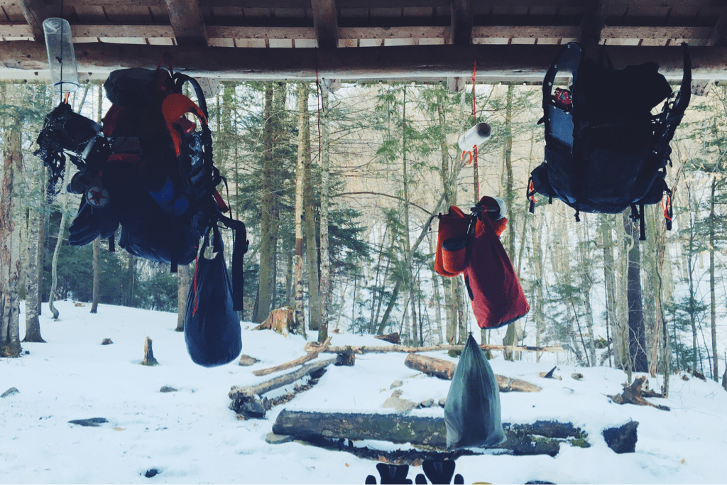
As we've discussed, waking up in single digit temperatures is one of the hardest aspects of this undertaking. This morning was no exception as my thermometer barely showed 5 degrees and the wind howled. The shelter was built in a gulley between two large hills and despite the later hour of the morning, the sun hadn't reached us yet. I was having problems with my phone charging, so I asked Santa if I could use his to finish writing the blog for the day before, in exchange I offered that we stay in our sleeping bags until well after 0800. In the end we wouldn't be on the trail until just before 0930hrs, our latest start yet, with my dear phone, your lifeline to this blog, teetering on the edge of existence at a measly 1% battery life.
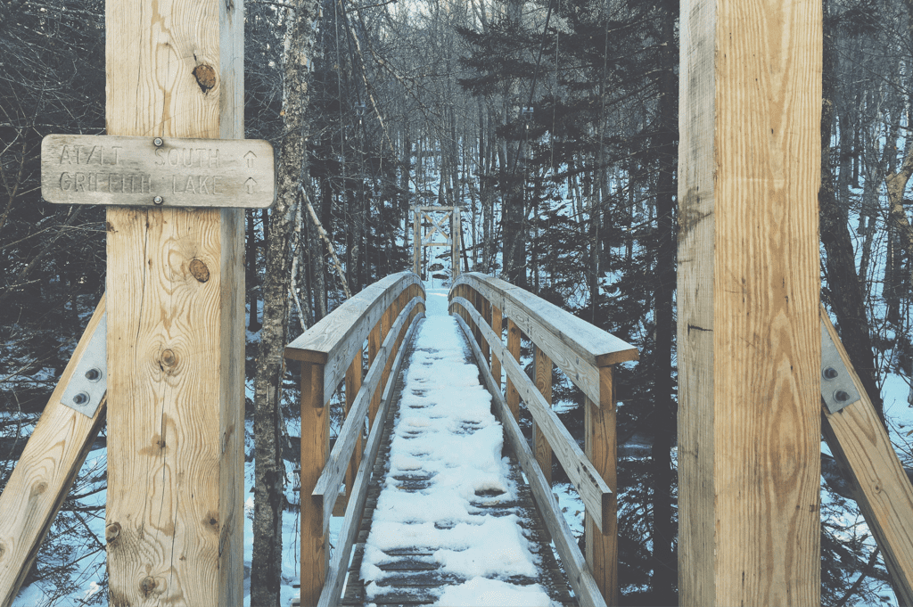
Our plan for the day was ten miles exactly, covering the distance to the Greenwall shelter low on the other side of a mountain ridge a few miles away. We had designed a few days itinerary with the hopes of meeting one of my friends at the trail's VT103 road crossing for assistance with a resupply and perhaps a night in a hotel to shower. A fact I've not yet mentioned and that you may have overlooked is that we've not showered since the morning of December 19th, save for heavy use of baby wipes while in Manchester last weekend. We're both heavily in need of hot water and soap. Anyway, once I was able to get enough service to post the blog, later than the email blast time (sorry that today will include two posts in one email again! I'm trying to avoid that but the mountains and cell towers have final say) I got a text saying that despite valiant efforts my friend couldn't get Tuesday off to pick us up. This meant we didn't need our 10/7 mile days itinerary to meet her, so we jokingly said we'd make today a 15 mile trek to a further shelter despite the later start.
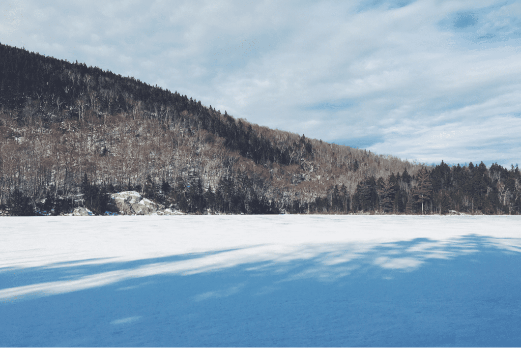
Terrain was amazing for this decision, and I broke trail for us as we flew at a consistent 2.5 mph up the Long Trail. We covered the first 5 miles in what seemed like no time at all, the sunlight having raced across the forest floor and warming us as we retained fleece layers against the brisk wind that reared its ugly head occasionally. Stopping at the Little Rock Pond shelter for a quick snack, we reminisced having spent the afternoon canoeing on the same pond back in June of 2014 as we took a relaxing tour through Vermont on the Appalachian Trail. Today, with cold temps, sunlight, and wind, the frozen lake's ice groaned almost incessantly as we sat and talked about it. Moving on after twenty or so minutes, we turned our sights towards a real lunch at Greenwall shelter, 5 miles and just under 1,000 feet of climbing ahead. I continued to lead us, enjoying the task immensely as my body felt but minimal pain in my right knee, and we cruised through the simple terrain over snow that was no more than an inch deep.
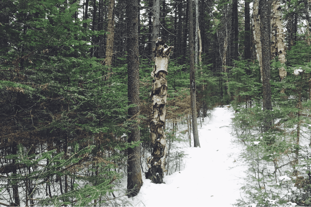
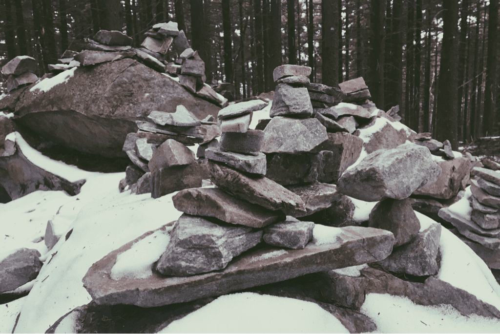
Making the climb out of the winding gullies we had been in, evidently skirting local farmlands, we found ourselves in some of the most beautiful scenery we've seen yet. A forest thick with evergreen trees, skinny but towering overhead, we stopped in awe of the woods around us. Painted with light snowdrifts, it was as if we had been magically transported to the Pacific Northwest and we're now standing in the mountains on the other side of our country. We carried on, stepping carefully on icy trail as we made small climbs and descents along the ridge line of the mountain we were atop of. Passing by the notable rock gardens besides the White Rocks overlook, a small cropping of hundreds of rocks stacked beautifully by hikers who pass by, we stopped to admire the artistry (I had forgotten this was here, but suddenly remembered it quickly from '14) before continuing the descent to the Greenwall shelter, seemingly aptly named for its existence at the edge of the evergreen forest on the side of the mountain. It was 1400hrs exactly when we arrived at the shelter sign, learning it was 0.3 miles off the trail, hypothetically adding half a mile to our already long day. We had already covered ten miles from where we spent the night in just 4.5 hours, so we decided against stopping and headed down to the VT Route 140 road crossing, almost 1,000 vertical feet below, to have lunch.
We cooked our lunch on the side of the road, waving at each car that drove by, though none stopped to ask if we were okay. I guess we just look the part of winter backpackers. Leaving the road crossing at 1500hrs we began a 2-mile climb, 1,100' climb up and over a peak opposite the one we had just come down. The scenery was immensely different as we skirted old stone property boundaries that have marked off farms for generations. The snowfall was almost non-existent, but every step let out a crunching sound as our weight depressed the thick piles of frozen orange leaves beneath our feet. Where two days ago the snow was over my knees, we now hiked through an area that looked like it was stuck back in November after the last leaf fell and the first snow dusted the region. We climbed quickly, eager to cover the 3.6 miles that remained between us and the shelter where we would spend the night. Fleece layers were traded for shell jackets as a light rain began to fall, and we descended the back side of the mountain ridge at a consistent pace, singing songs to the gods of the trail hoping for cell service at the shelter.
We arrived at the Minerva Hinchey shelter at 1700hrs exactly, phenomenal timing given the distance we covered. Dropping our packs and grabbing nearly empty water bottles, we were disappointed to find that the small river that acts as the shelter's water supply was nearly dry. I managed to get 1/2 a liter, complete with some 'floaties', or little bits of dirt and leaves, but it would be enough to cook with. Cell service was also a bust, so our SPOT GPS would have to stand in for alerting family we're done for the night.
It's nearly 2330 as I write this, John Mayer playing in my headphones as the familiar sound of raindrops falling on a tin shelter roof consume the usual silence of the night. With temps in the mid-30s and warming to the 40s tomorrow, we'll cross our fingers carefully for light snow removal and minimal ice buildup in the days to come. We're planning to get up and over Killington's 4,235' summit on Wednesday, and will try for a hotel reservation that same night to wash off the 9 days and 106 miles of wintry grime our bodies have recently acquired.
I'm exceptionally proud of us having covered nearly 30 miles in these last two days. Less than 190 miles to go... Just have to keep plugging away. An immense thanks to you all for commenting and emailing support; I can't stress how much it means to me/us.
Onward & upward with the sun.
Texaco
Mileage: 14.9
Long Trail Mileage: 84.2
Time: 7.5 hours
Day / Night Temp: 20 / 36 F (Yes, above freezing!)
--
As we've discussed, waking up in single digit temperatures is one of the hardest aspects of this undertaking. This morning was no exception as my thermometer barely showed 5 degrees and the wind howled. The shelter was built in a gulley between two large hills and despite the later hour of the morning, the sun hadn't reached us yet. I was having problems with my phone charging, so I asked Santa if I could use his to finish writing the blog for the day before, in exchange I offered that we stay in our sleeping bags until well after 0800. In the end we wouldn't be on the trail until just before 0930hrs, our latest start yet, with my dear phone, your lifeline to this blog, teetering on the edge of existence at a measly 1% battery life.
Our plan for the day was ten miles exactly, covering the distance to the Greenwall shelter low on the other side of a mountain ridge a few miles away. We had designed a few days itinerary with the hopes of meeting one of my friends at the trail's VT103 road crossing for assistance with a resupply and perhaps a night in a hotel to shower. A fact I've not yet mentioned and that you may have overlooked is that we've not showered since the morning of December 19th, save for heavy use of baby wipes while in Manchester last weekend. We're both heavily in need of hot water and soap. Anyway, once I was able to get enough service to post the blog, later than the email blast time (sorry that today will include two posts in one email again! I'm trying to avoid that but the mountains and cell towers have final say) I got a text saying that despite valiant efforts my friend couldn't get Tuesday off to pick us up. This meant we didn't need our 10/7 mile days itinerary to meet her, so we jokingly said we'd make today a 15 mile trek to a further shelter despite the later start.
Terrain was amazing for this decision, and I broke trail for us as we flew at a consistent 2.5 mph up the Long Trail. We covered the first 5 miles in what seemed like no time at all, the sunlight having raced across the forest floor and warming us as we retained fleece layers against the brisk wind that reared its ugly head occasionally. Stopping at the Little Rock Pond shelter for a quick snack, we reminisced having spent the afternoon canoeing on the same pond back in June of 2014 as we took a relaxing tour through Vermont on the Appalachian Trail. Today, with cold temps, sunlight, and wind, the frozen lake's ice groaned almost incessantly as we sat and talked about it. Moving on after twenty or so minutes, we turned our sights towards a real lunch at Greenwall shelter, 5 miles and just under 1,000 feet of climbing ahead. I continued to lead us, enjoying the task immensely as my body felt but minimal pain in my right knee, and we cruised through the simple terrain over snow that was no more than an inch deep.
Making the climb out of the winding gullies we had been in, evidently skirting local farmlands, we found ourselves in some of the most beautiful scenery we've seen yet. A forest thick with evergreen trees, skinny but towering overhead, we stopped in awe of the woods around us. Painted with light snowdrifts, it was as if we had been magically transported to the Pacific Northwest and we're now standing in the mountains on the other side of our country. We carried on, stepping carefully on icy trail as we made small climbs and descents along the ridge line of the mountain we were atop of. Passing by the notable rock gardens besides the White Rocks overlook, a small cropping of hundreds of rocks stacked beautifully by hikers who pass by, we stopped to admire the artistry (I had forgotten this was here, but suddenly remembered it quickly from '14) before continuing the descent to the Greenwall shelter, seemingly aptly named for its existence at the edge of the evergreen forest on the side of the mountain. It was 1400hrs exactly when we arrived at the shelter sign, learning it was 0.3 miles off the trail, hypothetically adding half a mile to our already long day. We had already covered ten miles from where we spent the night in just 4.5 hours, so we decided against stopping and headed down to the VT Route 140 road crossing, almost 1,000 vertical feet below, to have lunch.
We cooked our lunch on the side of the road, waving at each car that drove by, though none stopped to ask if we were okay. I guess we just look the part of winter backpackers. Leaving the road crossing at 1500hrs we began a 2-mile climb, 1,100' climb up and over a peak opposite the one we had just come down. The scenery was immensely different as we skirted old stone property boundaries that have marked off farms for generations. The snowfall was almost non-existent, but every step let out a crunching sound as our weight depressed the thick piles of frozen orange leaves beneath our feet. Where two days ago the snow was over my knees, we now hiked through an area that looked like it was stuck back in November after the last leaf fell and the first snow dusted the region. We climbed quickly, eager to cover the 3.6 miles that remained between us and the shelter where we would spend the night. Fleece layers were traded for shell jackets as a light rain began to fall, and we descended the back side of the mountain ridge at a consistent pace, singing songs to the gods of the trail hoping for cell service at the shelter.
We arrived at the Minerva Hinchey shelter at 1700hrs exactly, phenomenal timing given the distance we covered. Dropping our packs and grabbing nearly empty water bottles, we were disappointed to find that the small river that acts as the shelter's water supply was nearly dry. I managed to get 1/2 a liter, complete with some 'floaties', or little bits of dirt and leaves, but it would be enough to cook with. Cell service was also a bust, so our SPOT GPS would have to stand in for alerting family we're done for the night.
It's nearly 2330 as I write this, John Mayer playing in my headphones as the familiar sound of raindrops falling on a tin shelter roof consume the usual silence of the night. With temps in the mid-30s and warming to the 40s tomorrow, we'll cross our fingers carefully for light snow removal and minimal ice buildup in the days to come. We're planning to get up and over Killington's 4,235' summit on Wednesday, and will try for a hotel reservation that same night to wash off the 9 days and 106 miles of wintry grime our bodies have recently acquired.
I'm exceptionally proud of us having covered nearly 30 miles in these last two days. Less than 190 miles to go... Just have to keep plugging away. An immense thanks to you all for commenting and emailing support; I can't stress how much it means to me/us.
Onward & upward with the sun.
Texaco


 RSS Feed
