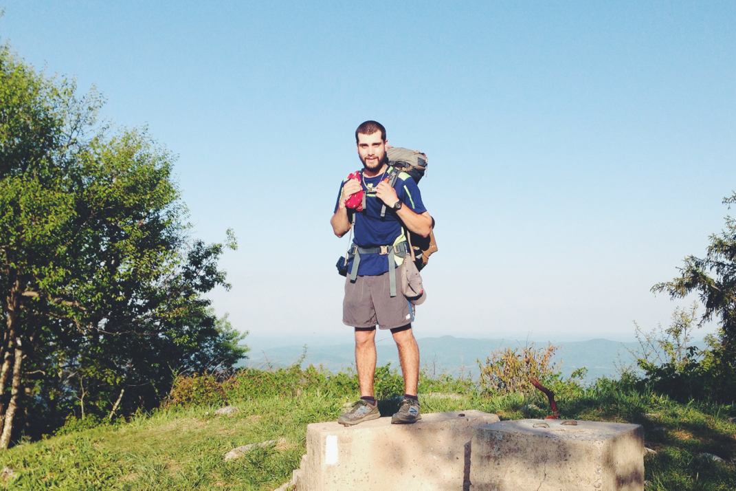
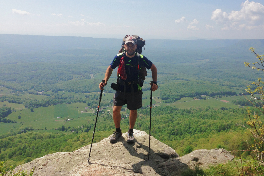
2180miles
  • Home
  • Adventure Blog
  • Overland
    • Meet The Jeep
    • Mods & Installs
    • Overland Gear
    • Trip Reports & Videos >
      • Allagash Winter 2019
      • Greece Adventures 2019
      • Overland Expo East 2018
      • Allagash Wilderness 2018
      • Trans-Canada Overland 2017
      • QB-5 Adventure 2017
  • Long Trail
    • Trip Summary
    • Photojournal
    • Hike Statistics
  • Appalachian Trail
    • Trip Summary
    • Photojournal
    • Gear Talk
    • Hike Statistics
    • Financial Planning
  • Bicycling America
    • Trip Summary
    • Photojournal

Mile 800

5/21/2014

1 Comment


Day: 47

Day mileage: 25

AT total mileage: 816.3

Time: 10 hours 

--

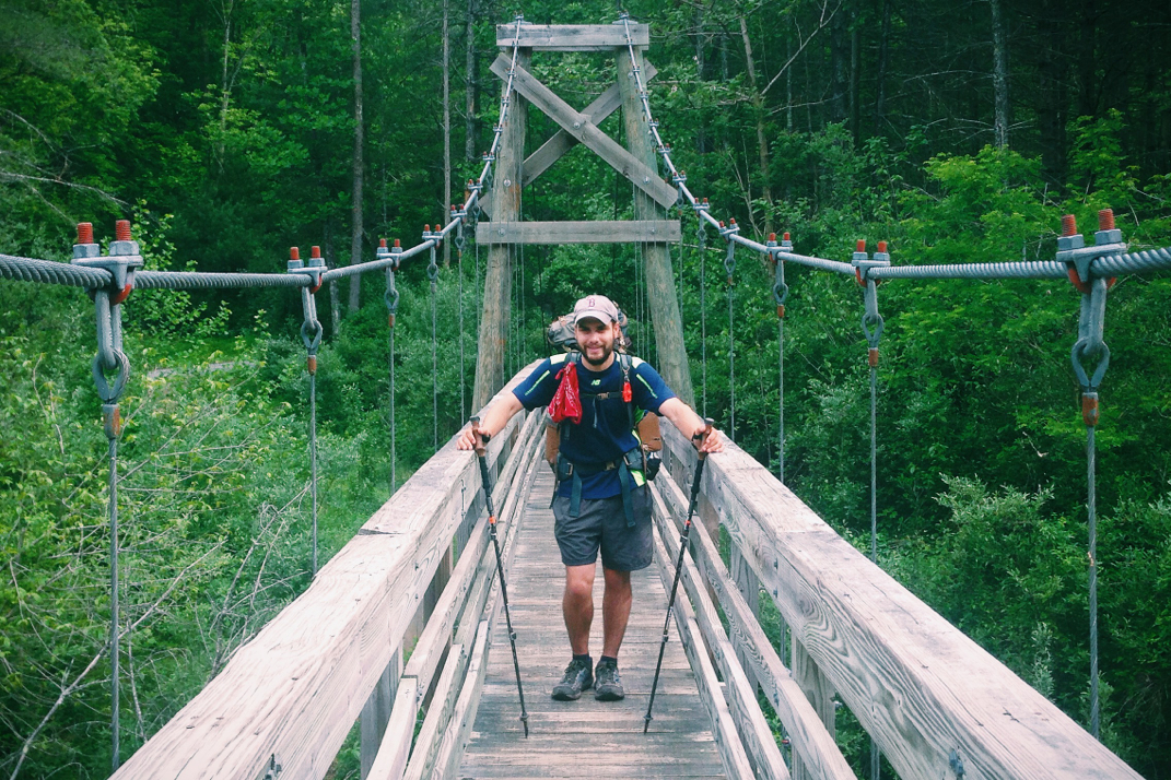
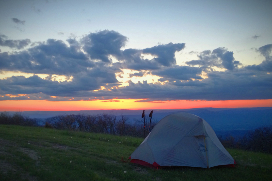
As I was packing up my sleeping bag in the shelter this morning sometime around 6:15, a head popped around the corner saying 'I caught you!' and handing over an Glacier Ice flavored Gatorade. It took me a moment to recognize this individual, as you come to learn hikers based on their trail gear and not their campsite/sleeping gear. Pneumo, who had gotten off a few days back to return to Trail Days in Damascus for some new gear, had spent two days trying to catch up to me. This is no small task with hiking, he at points was only five miles behind but that's a long ways both distance and time wise when you're walking over such difficult terrain. Regardless, he had arrived at 2230hrs last night and had brought me a Gatorade I had joked about wanting when we parted ways last week... What a guy. 

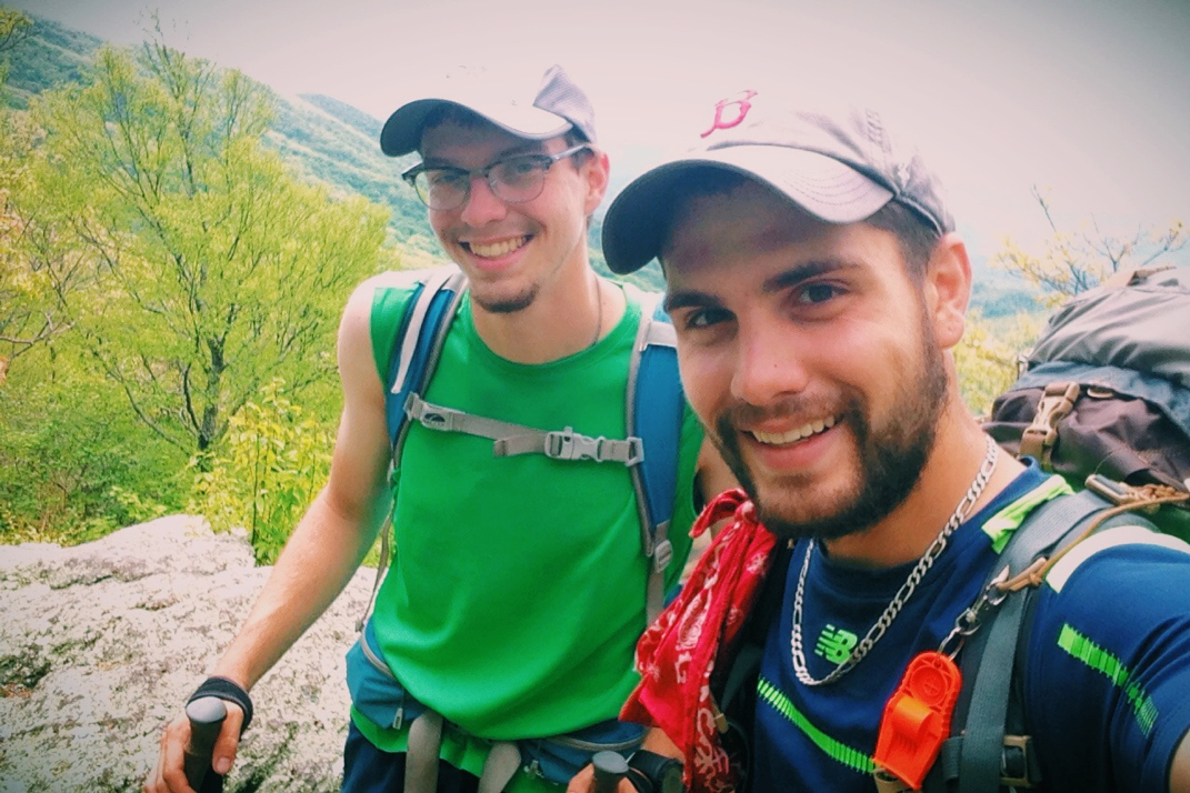
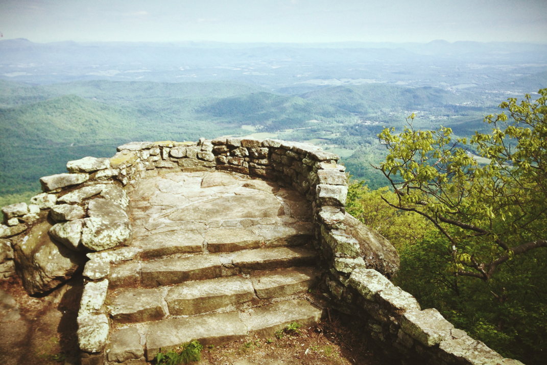
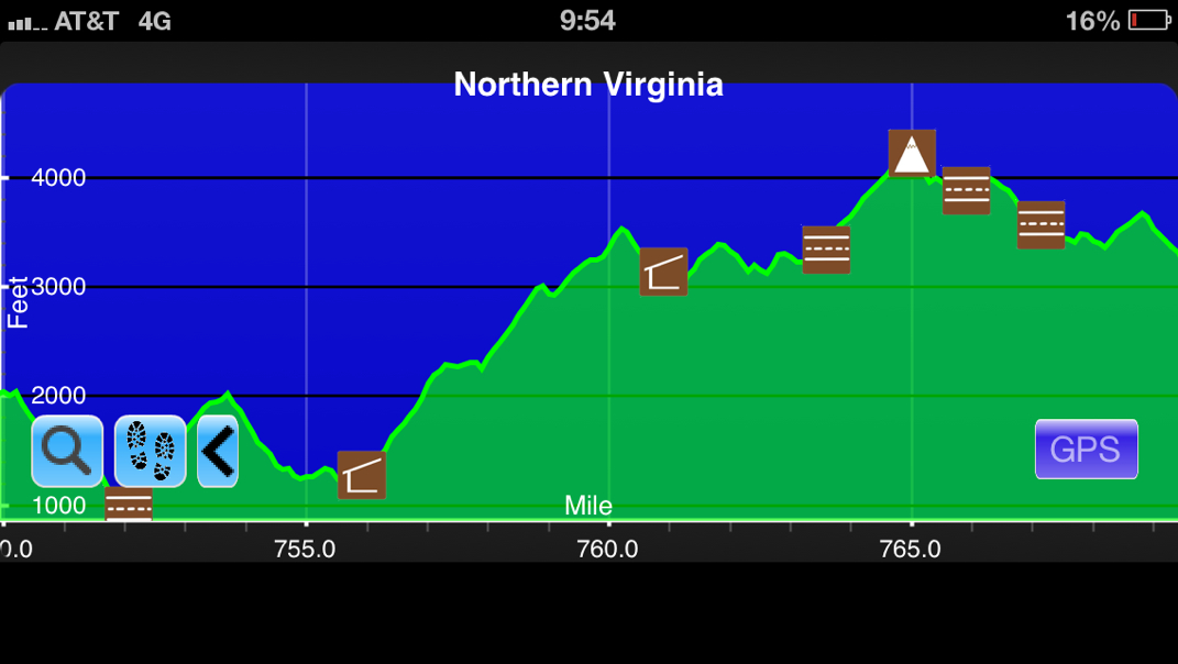
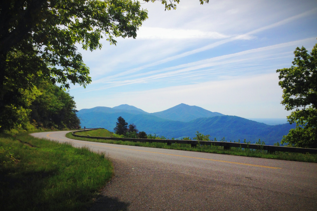
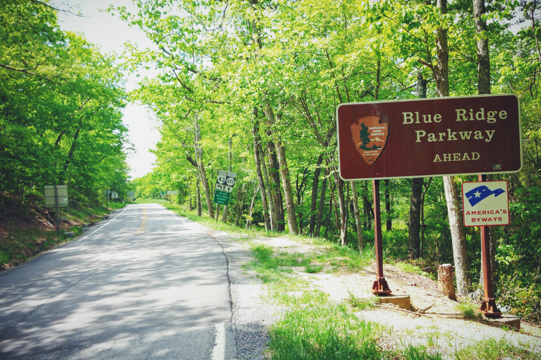
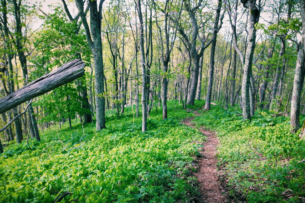
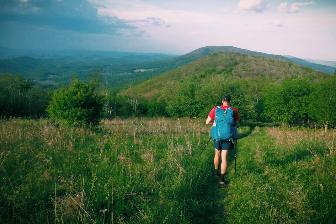
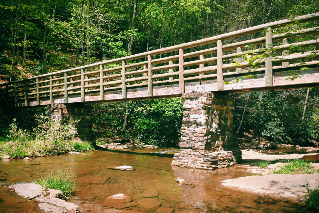
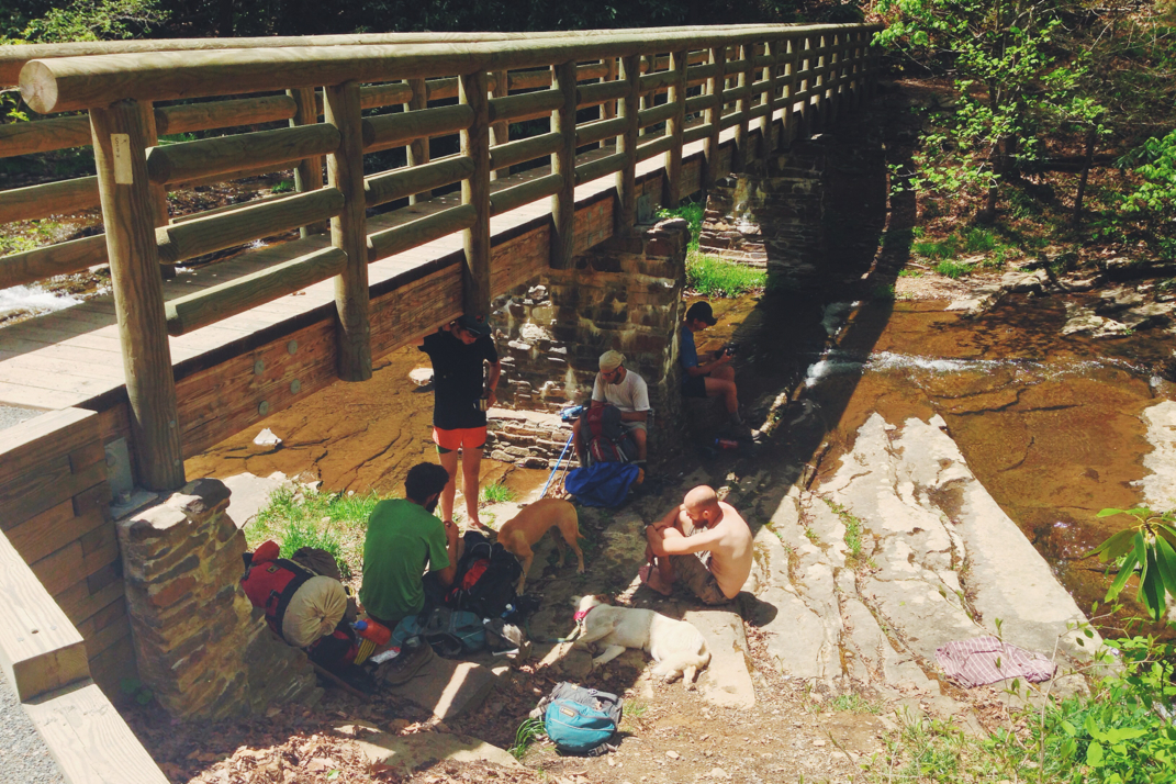
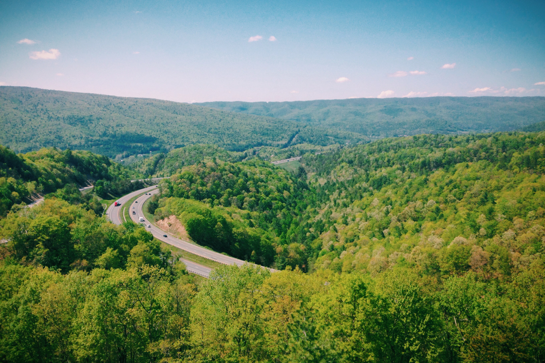
From the shelter the trail dropped down a bit, crossing over a very empty stretch of the Blue Ridge Parkway then disappearing back into the woods. A relatively smooth walk over moderate terrain with one big climb comprised the morning walk, hiking just under 9 miles before hitting the (you guessed it) unceremonious 800th mile mark. At this point I was hiking with Fletch, who hiked quickly with his longer legs and thus longer strides. I kept up, happy with the pace and company, and we talked for a few miles about finish dates, family, mentality of the trail, etc. At about 11:00 we pulled into the Brown Mountain Creek shelter where he pressed on, hoping to hitchhike 9 miles west into Buena Vista, VA, while I stopped for an early lunch and to wait for Pneumo to catch up to me. Talking with other hikers about the uncelebrated 800th mile, I joked about my end-of-hike trail magic being to carve 21 signs for the 21 '100 mile' marks, then traveling the Appalachian Trail by car and posting them at roughly the right area (knowing the trail changes in length almost annually). This way there'd be a real marker for hikers to see and smile at. I for one know I'd like to see something like that. Leaving the shelter at just before noon, Pneumo and I began yet another 3,000 foot climb over 5 miles to the peak of Bald Knob, dropping down 600' then climbing back up the same elevation change to the summit of Cole Mountain. 

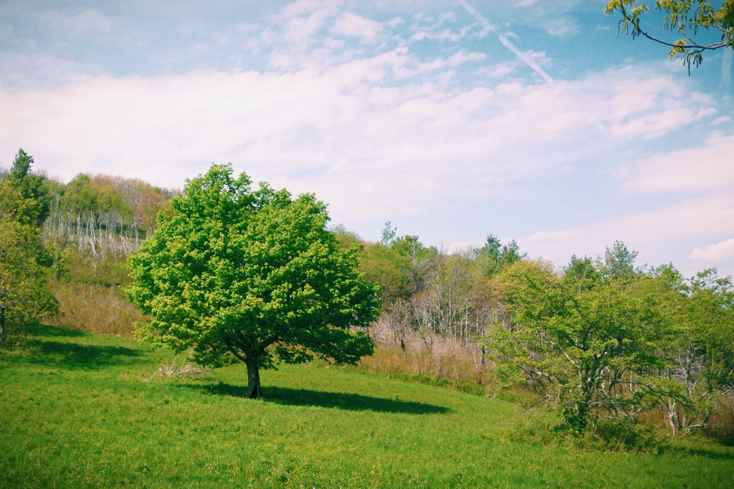
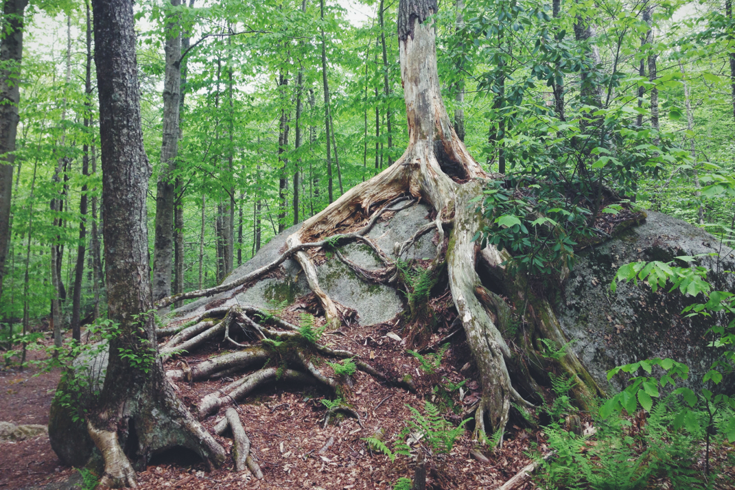
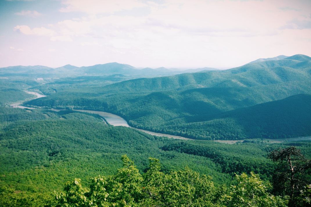
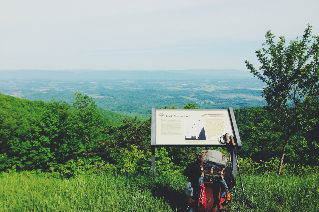
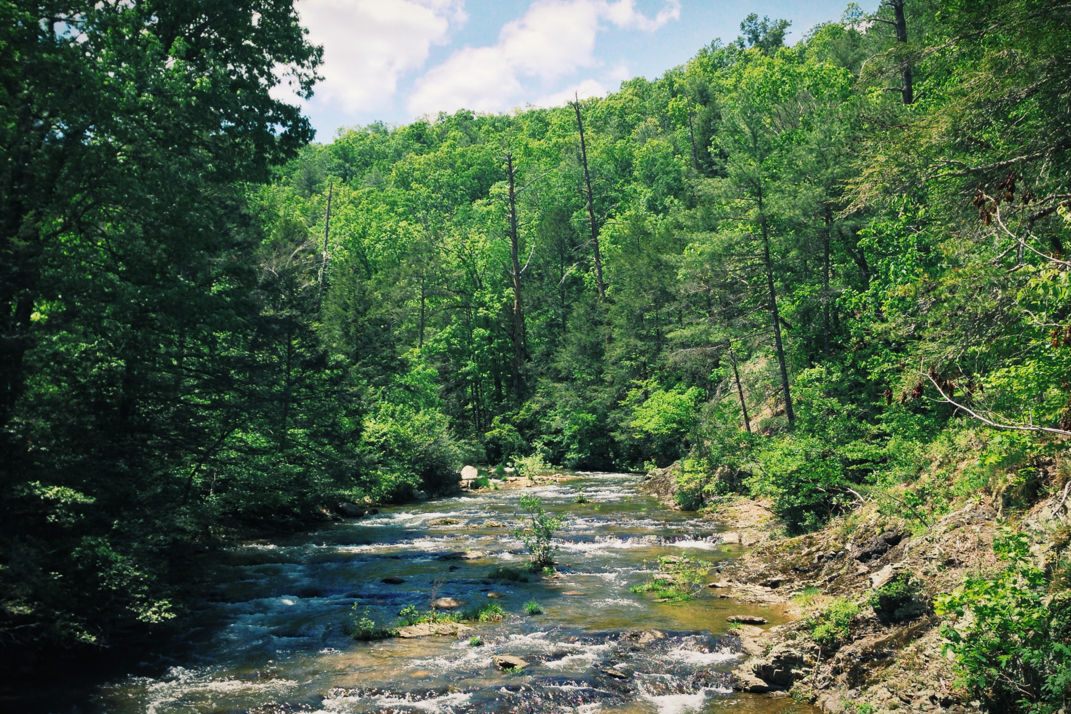
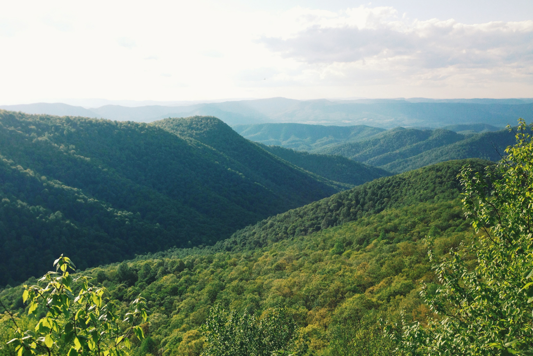
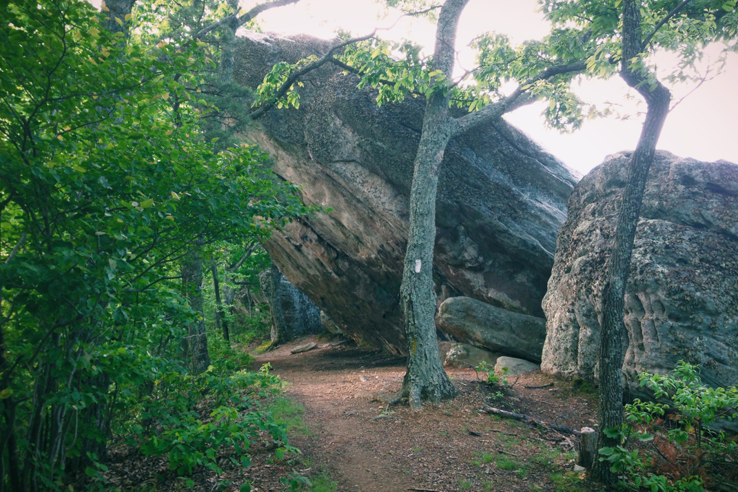
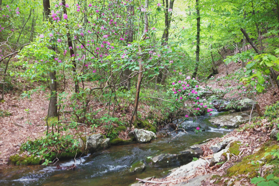
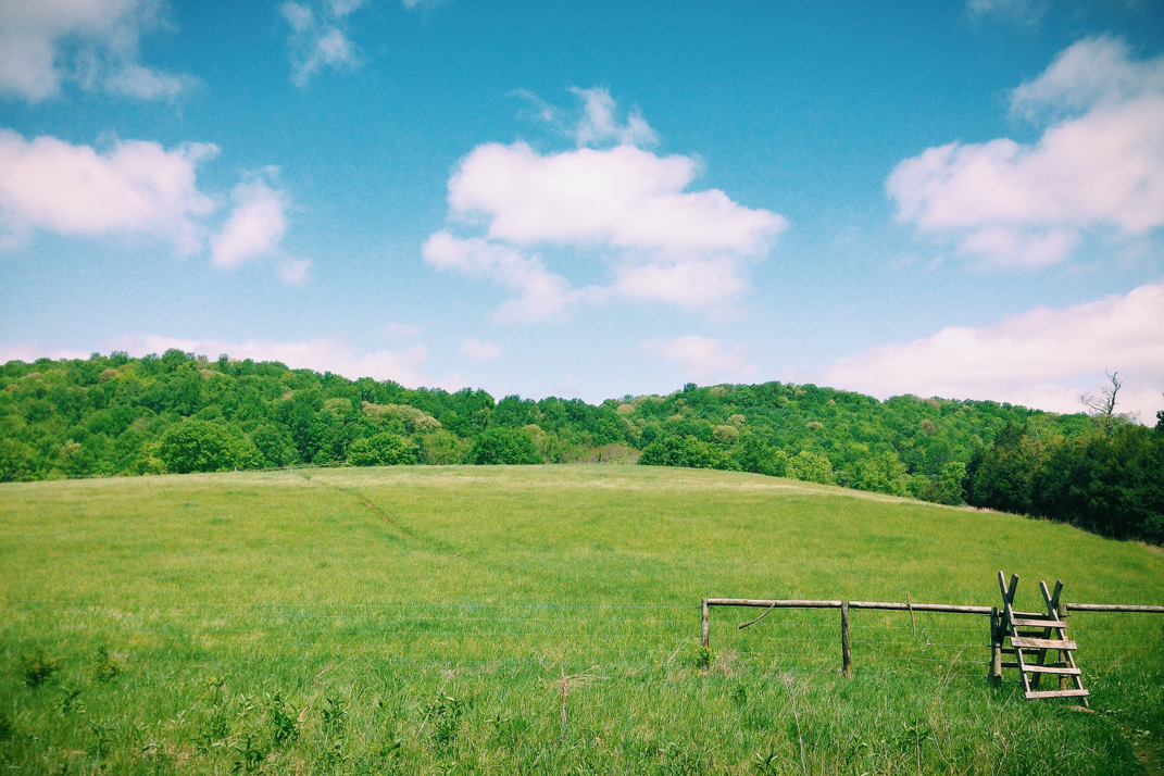
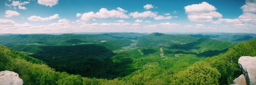
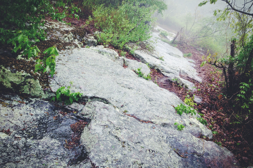
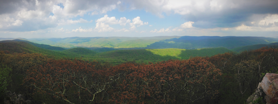
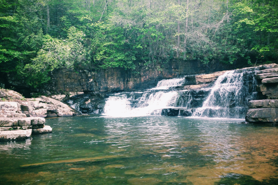
Carrying a good pace given the extremely steep grade and heat of the sun on our backs, we summited the first of the two peaks at 1400hrs. There were times where it would have been easier to 'scramble' on hands and feet to get up this trail.  At the peak of Bald Knob we passed by a group of 10 or so high school freshman and their two teachers on a backpacking trip. Exchanging Red Sox comments with the younger male teacher (from So. NH) we carried on past them, but I later learned from their other chaperone that the group is the freshman class of a private Christian high school in Pennsylvania who hikes a 36 mile trip annually with the 9th graders. Pneumo and I carried on, dipping into Cowcamp Gap and then climbing back out of it. On our ascent out, I noticed a loud noise screaming towards us, and as I turned around two Air Force jets went flying by. I'm not in the armed forces and I don't claim to know the different planes (used to know a lot, had lots of information on F-16s, 18s, etc as a kid) but these were not on a Sunday cruise kind of flight. Both plans were in a tight formation, wings tucked fully back, banking pretty steeply while blasting through between the two peaks, at an elevation of under 4,000'. Someone later suggested a military school graduation fly-by, but on a Tuesday? Seemed like it wasn't routine, but as I said, what do I know... Perhaps there was something in the news that I'm just not aware of happening. No mushroom clouds were seen from Cole Mountain's peak so I'm hoping all is well. Anyone have any insight? Anyways, we kept hiking on, with 9 miles left after the long climb of both peaks. Coming off the summit of the second mountain, we dipped down into a gorgeous field called Hog Camp Gap where we sat for a while basking in the sun and talking to other hikers. It truly looked like an amazing place to tent for the night under the stars, or even under the big tree with a picturesque swing hanging from its biggest branch. Alas, miles to be made, we hiked on. The rest of the afternoon was comprised of two pretty gradual climbs over 6 miles. Two miles from the shelter we were aiming for Pneumo and I came across a campsite along a river where a mammoth tree was growing on top of an equally mammoth boulder. I posted a photo, but it looked almost mythical with the root structure and placement. Nature sure does have a way of showing how amazing it is without any influence from us. 

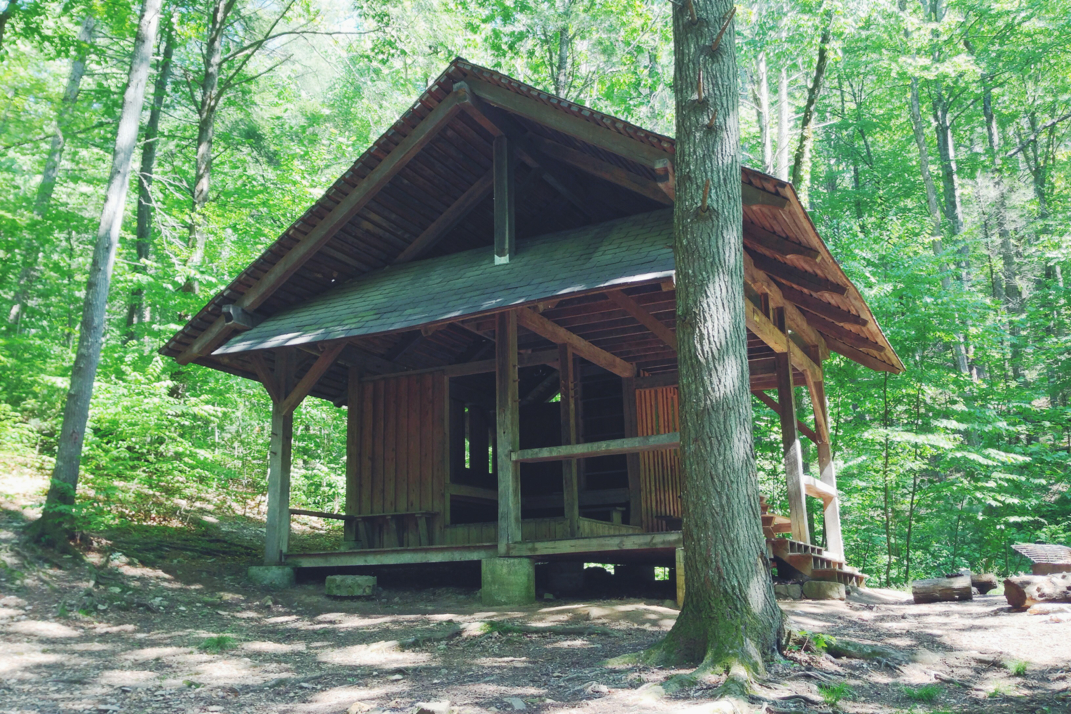
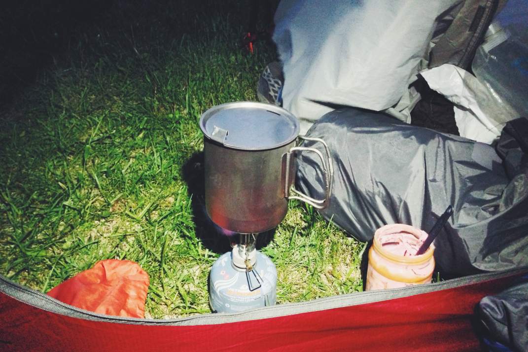
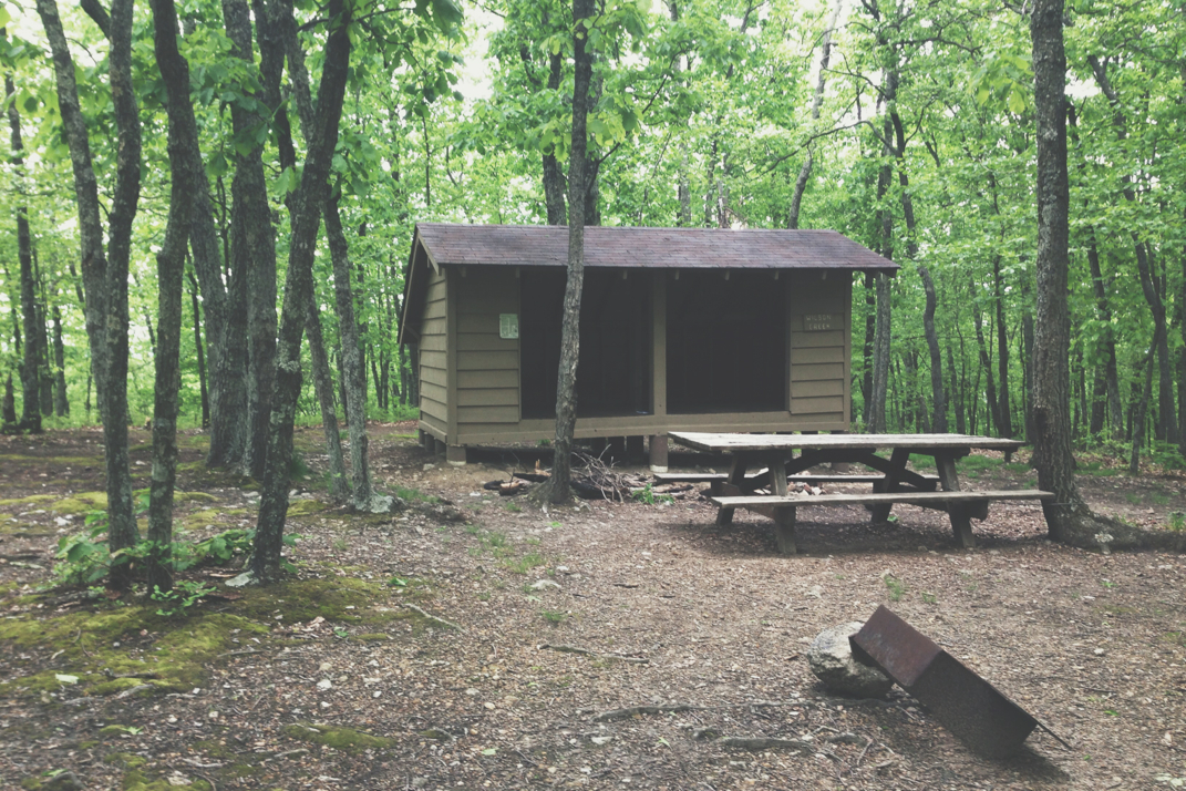
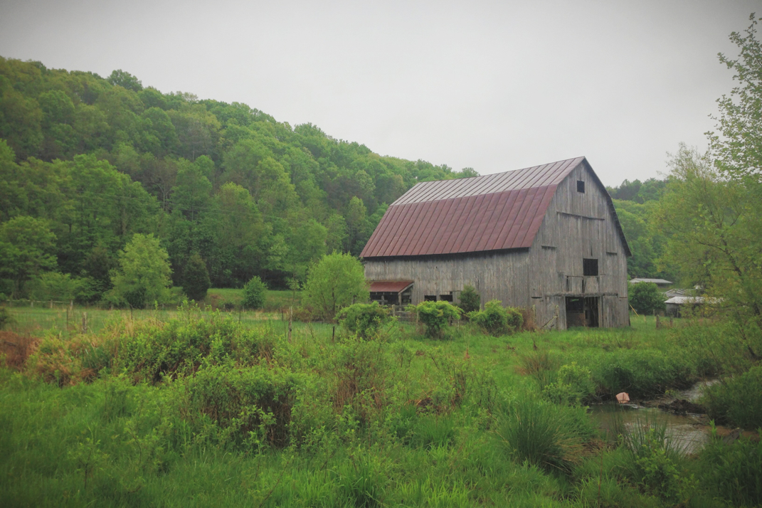
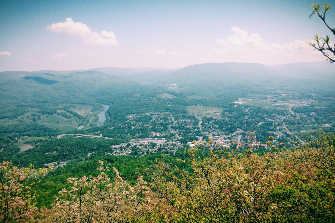
A
mile out from Seeley-Woodworth shelter, my destination for the evening, my right shin started hurting. Not badly, but enough for me to be aware of its presence. The terrain wasn't difficult at this point so I took it easy and we slowed down. Pulling into the shelter at just after 1900hrs, we said hello to the two other occupants, both section hikers, and got to work cooking dinner and collecting water. I ate a lot, and am thinking I need to adjust how much food I buy to account for these 25 mile days instead of supplying the same as I did for my 15-19 mile days from the first month of hiking. I believe there's a resupply half a mile off the trail tomorrow that offers free showers, so I'll hit that up for some trail food. If not, there's Waynesboro, VA in two days where I could hitchhike in, resupply, and hit up a place like Buffalo Wild Wings or a pizza joint to feel a bit human. As of now the plan is to enter into the Shenandoah National Park on Thursday, which will be a great feat in the grand scheme of Virginia. I'm 15 days into the state, and only have 202 miles left to go. The Shenandoah section will be an exciting new section of trail, home to some welcomed and different terrain. 
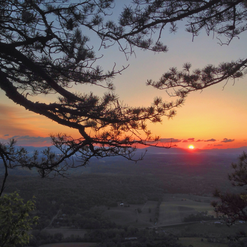
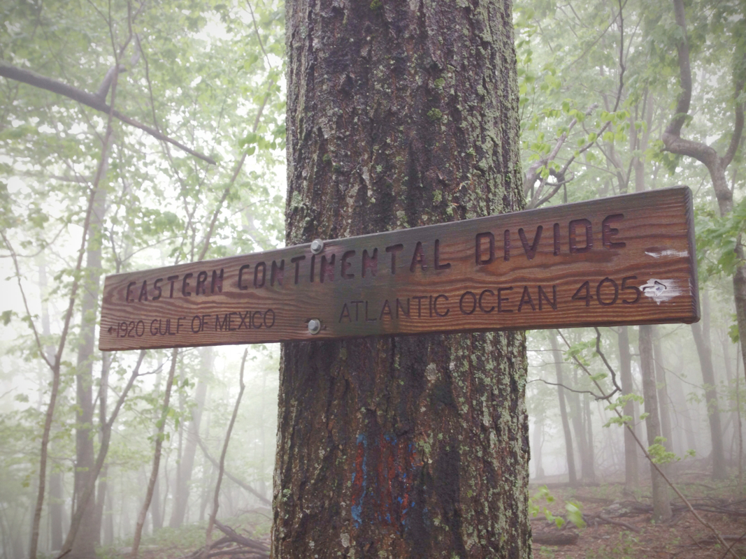
I
t was great having someone to hike with and talk to today. I've got a feeling Pneumo and I will hike together for the next few days at least. No more talking aloud to myself! Storms are predicted for tomorrow, but as I write this (0130 AM) the skies are clear above the shelter. We shall see what tomorrow brings. There's a 3,000' drop in elevation from The Priest mountain, the last point at which the Appalachian Trail is over 4,000 feet until Vermont. From the gap below the trail climbs right back up... Surprise surprise. 

One day at a time, one foot in front of the other. 

Picture
Bridge Crossing
Picture
Cole Mountain Crossing
Picture
Pneumo and Myself
Picture
Picture
Hogpen Gap
Picture
Nature Being Amazing
Picture
1 Comment

I Spoke Too Soon

5/20/2014

3 Comments


Day: 46

Day mileage: 25.5

AT total mileage: 791.6

Time: 10 hours 

--

Had I taken a chance to look at the map of today's terrain, I never would have ended yesterday's blog with 'hopefully a little less upward'. As it turns out, the end to my day today was remarkably alike the end to my day yesterday. But we'll get to that. 

I slept in this morning, and it felt wonderful. I had rolled my alarm back to 6:30 or so, and simply laid in bed once it went off.  Drifting back to sleep on and off, I finally got up around 8 and started packing up camp. It was a bit chilly at the top of Apple Orchard Mountain, but the sun was brilliantly shining down. I had been visited by lots of daddy long leg spiders the night before, so I shook my tent rather vigorously before packing it up. Eating some breakfast and brushing my teeth, I began hiking at 8:45 or so. I stopped at the shelter a mile down the hill (where I'd intended to spend the night originally) and signed the log book while filling up my water. The next shelter north was 13 miles away, which is where I'd stop for lunch. There was some decent descents between here and that shelter, and one large climb up  Highcock Knob. The trail still would follow along the Blue Ridge Parkway for a while, not nearly as closely as yesterday, before dipping down into the valley below. After leaving the shelter I stopped at a scenic vista looking down from Thunder Ridge, when I heard another hiker come up. I turned around to say hello, and discovered a young deer standing 15 or so feet behind me. I quietly said hello and she stepped back a bit, but after seeing that I wasn't moving abruptly she moved back to where she was. At our closest, we were less than 10' apart before I said goodbye and carried on. 

After climbing over Highcock Knob, the descent to Matt's Creek shelter was long and steep. Despite a late start and wanting to make up for it with quicker miles, I had to pace myself so as to save my knees. I reached the shelter (which of course was empty, alike the one before it) at 1330hrs and ate a quick lunch before heading on. There was a beautiful river but the mosquitoes were enough to detract from my desire to stay. I continued on, losing a few hundred feet in elevation before the trail paralleled the James River (elevation 636 feet, the lowest we've been in a long time) before crossing the James River Bridge. Privately funded and dedicated to a former thru-hiker and his wife, a couple who ultimately would be the first people to complete the coast-to-coast American Discovery Trail in 1997, the bridge is the largest pedestrian-only bridge on the Appalachian Trail. After crossing, the trail passed by a few leisurely fisherman along the water before beginning its climb back out of the riverbed. There was a shelter two miles from the river's edge that I stopped at to refill my water supply, where I saw the first real group of hikers I've seen in days. Getting water here was crucial because from this point forward the next water supply is 9 miles ahead at the next shelter. The trail forces my hand in these situations; I'd maybe not like to do 25 mile days, but stopping at this shelter would have netted only 16. Had there been water between I might have found somewhere around 22 or 23 miles, but instead I have to carry on. Alas, with 2 liters of water, I began a 3,000 foot climb over three sequential peaks to the summit of Bluff Mountain. Total distance would be 7 miles or so, with two miles being comprised of ridge walking. 

The climbs were steep and long, switchbacks that seemingly curved around half the mountain before changing direction. I kept a steady pace. Those who remember my blog entry on my 35 mile, 10 hour hike into Damascus might remember the graffiti I saw at a shelter that day: Practice Momentum. I was singing my favorite going-uphill-keep-a-good-pace song, a duet between John Mayer and Keith Urban covering The Beatles' 'Don't Let Me Down' at Clapton's Crossroads festival. Seriously, look it up on YouTube. Regardless, the climbs were long, but I had summited Bluff Mountain by 1850hrs and began the 1.8 or so mile descent to the Punchbowl shelter where I'd stay the night. One thing that was frustrating was being able to see the radar tower I slept under last night while at the summits of these peaks. Yes, it's 20 miles of hiking away, but even with my bad vision to see it frustrated me for some reason. 20 miles doesn't seem to be as much when I can physically still see where I started.  It's 1/4 mile off the trail to the shelter, but I was happy to see that there are many people here. A lot seem to be giddy and still partially hungover after returning earlier this same day from Damascus' Trail Days festival. Sounds like a good time was had by all, and that the population if Appalachian Trail thru-hikers will return to its previous numbers. 

Dinner was quick and I ate well, happy to be fed almost an hour earlier than last night. I ate with a gentlemen and his wife, Brunswick and Hopper from Indiana, as well as a Floridian named Stony G (mid-20s, began hiking Feb. 15th in snowstorms and plans to take 7 months in order to experience all the seasons), and a British hiker named Fletch who hikes at the same pace as me and remembers meeting me as far back as Damascus.. It was nice to actually have people to talk to. Still having averaged around 3 mph, despite the climbs, I'd call today a good day. Tomorrow appears to have another 3,000 foot climb out of a valley in store for me, so I'm hoping an early start might make that more reasonable. 

On a quick side note- I want to thank everyone who has taken the time to reach out to me. I read every comment, and get every email; I'm just horrible at responding in a timely fashion. The readership numbers are incredible, and tracing back how people have discovered the blog shows the power of the Internet. Please continue to share it with coworkers, friends, and family. I'm not even halfway done hiking yet (yikes...) so there's plenty more writing to come if you're all still interested in reading. Also, for those who have so graciously offered hospitality or trail magic, please let me know when I'm nearing your location. Unfortunately my geographical sense is limited to big cities and what shelters I'll pass on any given day. If I'm a week (figure 22-25 miles a day) from you, please let me know via email. Thank you all again. 

Bedtime for me. There's only three of us in the shelter, everyone else is tenting, so snoring should be minimal and a good night's rest in store. Tomorrow, I walk.... But you knew that already. 

Picture
"The Guillotine"
Picture
Picture
Bambi
Picture
James River Footbridge
Picture
James River Valley
Picture
Bluff Mountain Summit
3 Comments

Sunday Challenge

5/19/2014

7 Comments


Day: 45

Day mileage: 31

AT total mileage: 766.3

Time: 11 hours 

--

Tim the 'Tool Man' Taylor (TV's 'Home Improvement') would introduce today's blog by enthusiastically saying: "Everybody know what day it is?!" To which a large studio audience would reply: "Sunday Challenge Day!" As you well know this is a written blog so there's no studio audience, so I'll just be reminding you that today was Sunday Challenge. Today followed suit to the weeks before, and fit the 'challenge' aspect to a T. Not only did my hike incorporate distance (31 miles), and time (11 hours), but it also had some serious climbing. Between mile 21 and 31 I hiked over 5,400 feet of elevation gain. On a normal day on the trail this would be a serious workout, but to do it after already having done 7 hours and 21 miles of hiking, it was a mammoth undertaking. 

I slept relatively soundly given the fact that the hiker named Symphony was snoring louder than almost anyone I've ever met. I woke up early but didn't get out of bed until around 6:45, at which point I packed up my gear, eating a Pop-Tart before hitting the trail. Having looked at the elevation plot for the day, I knew that my first 15 miles or so wouldn't be strenuous. The next 100 miles of trail cross over the Blue Ridge Parkway quite frequently, and during times when it does the trail is relatively fair and even. After a slight 3 mile climb of 1,000' or so out of the Wilson Creek shelter, the trail leveled off and meandered along for my first hours on the trail. The first time the trail crossed with Blue Ridge Parkway (labeled BRP on maps) it caught me off guard. You exit the woods onto a perfectly paved two lane road, with no direction as to where the trail rejoins the woods. It took me 5 minutes or so to figure out where I was supposed to be, a small inlet off the road some 600 feet down the parkway, very poorly marked. For the next 6 miles or so the trail would dance alongside the BRP, never more than 200 feet from the road itself, although dipping above and beyond the elevation of the pavement. It was quite strange to hear the somewhat constant hum of cars and motorcycles buzzing by. I spent my morning hiking at just around 3 mph, a product of the terrain, and daydreaming. A lot of people ask what I think about all day and I know we've covered the fact that it isn't soul searching or curing famine or disease. Today I was daydreaming about.... You guessed it.... Driving. Seeing the curved road, gorgeous vistas, and 'sporty' Sunday cars out driving, it was hard not to get lost in the thought of having my own car down here. 

Speeding down straightaways in 4th gear, never even touching 5th or 6th, eyeing a tight left turn ahead, punching in the clutch and thrusting the shifter forwards into 3rd, feeling the engine braking while the rev needle sweeps the dial, seatbelt tightening around me as both hands grip the wheel, into the turn with only an 18" guardrail keeping me from disappearing off a cliff, wide and sticky summer tires gripping the hot road while flirting with the solid yellow line, sport suspension banking into the turn at speeds still easily twice the marked limit, holding fast as the vehicle tracks like a roller-coaster car on rails, out of the turn and back into a straightaway, gas pedal practically to the floor as the tach cruises up towards redline before depressing the clutch and throwing the shifter back into 4th as the car pulls away and continues racing off towards the next turn on the curvaceous and perfectly paved scenic parkway...

I've said it before and I'll say it again. I miss driving. 

Anyway. Eventually the trail left the roadside and climbed up a thousand feet or so where I came across the Cove Mountain shelter. I stopped there for lunch, alone again, as I still haven't seen anyone else on the trail. I lingered a bit longer than I should have however I wasn't too concerned in the moment. It was just after noon and I had hiked 15 miles. Truthfully, looking at the elevation gains ahead, I wasn't too eager to hit the trail.  I took a self portrait at that empty shelter, much in the way that Christopher 'Alexander Supertramp' McCandless did during his Alaskan adventures before his demise in the early 90s. I have no intentions on dying here but I figured I should start taking self portraits. I pressed on, with a thousand foot drop in elevation to a gorgeous creek running past the trail. From there I climbed pointlessly, per usual, a thousand feet before dropping back down into a gap. Stopping briefly at Bryant Ridge shelter for a snack, I marveled at the size (20+ hiker capacity) and craftsmanship of this shelter. A post and beam structure with open floor plans, it truly was gorgeous. The fun began here, with the next 10 miles including nearly a mile of elevation gain. When I left the Bryant shelter I had been hiking for 7 hours and 22 minutes, having hiked 21 miles, and it was 1600hrs exactly. My fear was making the next 10 miles before dark, as I wasn't sure the speed I'd be able to maintain while climbing such heights over such distance. I set off at an even and fair pace, and was surprised to still make just over 2 miles an hour. I've attached an elevation plot below so you can see the climbs, but it basically went up a thousand feet before shortly leveling off and then climbing again- 4 separate times, with smaller climbs interspersed. At 1800hrs I passed by Cornelius Creek shelter but didn't stop, determined to make it the next 5 miles to Thunder Hill shelter before dark. I had to stop and get water, as the supply at Thunder Hill was noted on the maps as 'inconsistent', and then continued climbing up Apple Orchard Mountain towards its peak and an FAA tower. There's a picture of that below as well, and if you're interested I'm willing to bet that my friend Dave will at some point comment on this post with a link to what kind of radar tower it is.  I reached the summit at 2010hrs exactly, and looked at what was to be a gorgeous sunset. I took some photos and rushed on, determined to make it the mile to the shelter. About halfway to the shelter I had a change of heart, deciding I'd rather watch the sun set. I can hike as far and as quickly as I want, but to pass up the opportunity for an unobstructed sunset view at the top of a mountain overlooking the Blue Ridge Parkway, that'd be very unlike me. Despite my distance from the peak I turned around and quickly hiked back up, knowing I had very little time before the sun actually set.

I sat on the grass at the summit of Apple Orchard Mountain, listening to the birds chirp and FAA radar whir behind me, and watched a beautiful sunset across the valley and mountain ridges. Setting up my tent, I cooked a broccoli and cheese pasta in the vestibule, staying warm with my lower half snuggled into my sleeping bag. Bed will be late tonight, probably 2230 or so, but I had a great and challenging day, proving my capabilities to myself, and ending the day with a beautiful sunset. 

I don't know what tomorrow shall bring... certainly onward, and hopefully a little less upward. 

Picture
Belated photo- Yesterday's Sunrise
Picture
15 miles of Elevation
Picture
Picture
Roads for Driving & Dreaming
Picture
Picture
Jenning's Creek
Picture
Bryant Shelter
Picture
Picture
Picture
Apple Orchard Peak - FAA Radar Tower
Picture
Vestibule Cooking
Picture
Sunset
7 Comments

1/3 Of The Way

5/18/2014

4 Comments


Day: 44

Day mileage: 20.3

AT total mileage: 735.3

Time: 9 hours 

--

First off, my excuse for the lower mileage is the amount of time I spent in town today, and general frustration with the trail as the day went on. Now that we have that settled, let's re-cap:

I woke up without the assistance of my alarm at a few minutes before five o'clock this morning. I've yet to decide if this is a good thing or not. I packed up camp, not needing to be as quiet as normal, since there was a strongly flowing river next to our campsite which created a good amount of ambient noise to mask the sounds of my breaking camp.  I was packed up and on the trail by 5:45, at about the same time that J-Rex was turning her headlamp on to start packing up as well. The first thing I noticed about this morning's early hiking was that it wasn't as annoying as most of its kind. What I came to discover was the complete lack of rhododendron plans, meaning no spiders, meaning no cobwebs across the trail. I hiked quickly, keeping my fleece North Face jacket on for almost an hour of hiking before taking it off. Per the weather report I read this morning, temperatures had dropped to just below 40 degrees last night. It was *cold* both waking up and hiking in these temperatures. At about 6:15 I pulled off the trail to a rocky outcrop and witnessed the last few minutes of dawn before the sun crested the mountain range across the valley. These moments, before the hustle and bustle of the world begin for the day, are the ones I enjoy being awake and alone on the trail for. It was an absolutely gorgeous sunrise, sorbet colors painting the sky. After taking in the view for a few minutes, I continued on the trail. 

The 10 or so miles into Daleville, VA weren't exceptionally hard, just rocky and rolling hills. I maintained a good 3 mph speed and neared into town at just after 9 AM. My biggest priority for getting there so early was to make it to the post office before they closed, keeping in mind the bankers hours on Saturdays. I was hoping to hitch a ride, but with the building being just over a mile from the trail I didn't want to cut my timing too close in case I had to walk. I exited the trail after finding a little trail magic in a decorated ammo can, and ventured over to the Sunoco station on the side of the road heading out of town. The only guy getting gas wasn't a local, so I began my walk to the post office. About 1/4 mile out of the gas station I slowed my walking at an intersection, hoping to catch a red light. Sure enough the intersection cycled and my lane's light turned red. I waited for a car to pull up and immediately asked the driver and his wife if they were passing the post office. He made a motion of yes, and I hopped into the bed of their truck for a ride the rest of the way.  Their small dog in the back seat spent most of the trip with its face against the rear window staring at the strange guy in the back of the truck. They dropped me off and after thanking them, I headed inside to mail home a few pounds of gear I don't need. The nice post office lady actually gave me a smaller flat rate box (a size they don't advertise or leave out for consumers) and saved me $5 in shipping, which allowed me to buy stamps as well. As I was walking out I asked a gentlemen also leaving if he was headed back into town, to which he replied no but he'd be happy to take me. We made small talk as he drove me to the grocery store, I thanked him and we parted ways. Before the grocery store I visited a hiking outfitter in the same shopping center. For $40 I was able to purchase a smaller hip belt for my bag, as I've lost enough weight that the medium size that my backpack came with wasn't fitting anymore. I've been padding it for a few weeks with foam to get it to hold. Money well spent. I then hit up the grocery store, probably buying too much food, but after checking the maps I don't know the next time I'll physically walk through a town. For $41 I walked outside and sat in the sun while my electronics charged at an outlet I found after crawling behind a row of exterior vending machines. 

I hit the trail at 1, but got distracted and made a few important phone calls to friends. Actually hiking by two, I had 11 miles to go to the shelter I wanted to reach. The initial climb out of town was pleasant, and I reached the first shelter at almost four miles in around 3:30. I passed no other hikers, and met only one guy at the shelter. His name was Muttenchops and he's a multi-year hiker of the Appalachian Trail. His mother also lives in Beverly, MA and he frequently hiked Harold Parker, a state forest up the road from me. We chatted and I said goodbye, still with 7 miles to make before my day would be through. From the shelter I descended down, walking along an even ridge for a while before making a sharp descent down into a low gap. Annoyingly, this process would repeat a few times. 6-700 foot drops in elevation between ridges, cross a river with few rocks above water due to the recent rain, climb the 6-700 foot inclines back to another ridge, then repeat the process. I was very frustrated, and although I hadn't done much mileage today I was still rather tired. Clouds had moved in and the temperatures dropped, wind picked up and the whole experience was generally unpleasant. 

I eventually made it to Wilson shelter, where I unsurprisingly found myself alone. All in all I saw not one hiker on the trail today, with Muttenchops being the only guy I ran into at all. I believe that everyone is back in Damascus for the last days of Trail Days. I cooked dinner, realizing that I didn't eat anything while in town earlier - I really regret not getting a pizza or something. Sitting at the picnic table alone eating my dinner, I was entertained by a group of deer playing around in the woods around the shelter, no more than 40 feet away. As I was packing up I was joined by a section hiker named Symphony (for his snoring, apparently) and then later a couple thru-hiking also arrived. With my sleeping bag set up, I said goodnight and climbed into bed. Temperatures are supposed to drop back into the low 40s tonight, so I'm sleeping with my fleece jacket on. 

Tomorrow looks to have some good climbing towards the end of my day, but it should be a decent day on the trail. Also, interestingly enough, I've now completed just over 1/3 of the trail, so at least I've got that going for me. 

Picture
Rock Formations
Picture
Picture
Picture
Picture
Blair Witch Project Shelter
4 Comments

Mile 700 & McAfee Knob

5/17/2014

0 Comments


Day: 43

Day mileage: 23

AT total mileage: 715

Time: 10.5 hours 

--

The rain continued on late into the night, at times blowing into the shelter with big gusts of wind. I tightened my mummy style sleeping bag over my face leaving just enough room for my mouth to breathe cold fresh air, and slept soundly throughout the night. Waking up an hour before everyone else, I quietly redressed & packed up my backpack, doing my best to not disturb anyone. I think one of the hardest parts of being a thru-hiker is not just hiking on exceptionally rainy days, but even more so waking up when the rain has stopped and putting on clothes that are soaking wet still. Cold, wet fabric that sticks to your skin as you try and put it on, along with soft and dry socks being slid into damp and cold shoes. This is where the 'going gets tough'. Despite this, I layered up with my fleece jacket and even my fleece hat in an effort to combat the cold morning and occasional wind, and headed out onto the long side trail from the shelter to the Appalachian Trail. 

The rain from the day before was immediately evident. The ground was soaked, leaves moist with beads of water, at many points throughout the day the trail was still a running river. For the first five miles out of the shelter the trail was in a steep and elongated climb to Dragon's Tooth, a 3,000' summit, equally as rocky as the trail on the climb up. Despite the Rain having moved on, the sky was still overcast, the temperatures cold, and wind absolutely present, as I stood at the top with my jacket on. The descent from Dragon's Tooth took a long time, wet slippery and steep rocks that required some serious care and articulation in order to get down. There were points where steel ladders had been drilled into the rock in order for hikers to get down 10' ledges without dying in the process. All the while I'm thinking to myself how glad I am that I'm not a southbound hiker (having to go up this), and how fortunate I am to not have had to climb down it in yesterday's torrential rain. As the descent continued, I saw something I've been waiting to see since leaving Springer mountain 43 days ago- the rhododendrons are officially blooming. Gorgeous pink flowers spilling out from the branches of these gigantic plants, it was quite the site to see on my dreary morning of hiking. Getting down off Dragon's, I crossed through a few pastures, as well as Virginia State Route #785, the unofficial marking of the 700th mile of the Appalachian Trail. True to form, no party was to be had. Climbing through more pastures and back up into the woods, the trail followed along a ridge for 4 more miles before dumping out into a parking lot for day hikers to leave their cars in. I was able to call my mom who's currently in Idaho, but cut our conversation short when I spotted trail magic going on. 

In the parking lot alongside Virginia 311 was a red Volkswagen Beetle, two guys, grocery bags from Dollar General, and a cooler. After introducing themselves as Tim and Joe, the latter of which was a 2010 thru-hiker, I was offered food from a selection of Little Debbie snacks as well as a PBR or rum & coke. Being around noon, I went for a Zebra Cake (sugary snack cake) and a cold beer. Who ever thought that this would constitute a lunch?!  I sat in the parking lot with them and a few other hikers for close to an hour, again longer that I'd like to stop, but the reasoning was twofold. On the first hand conversation with former thru-hikers is great, and on the second, my dSLR lens had moisture in it from the damp air and rain the day before. In order to dry the fog off the inside of the lens, it needed to sit in the sun for a while. I propped it up against my bag pointed towards the sun and let the heat do its thing. After a while there was no moisture residue left, and I packed up my bags thanking the guys profusely. From 311, it's a 3.8 mile climb up to McAfee Knob, one of the more famous vistas on the Appalachian Trail, and the 'best view in Virginia'.  This knob is an exceptionally popular tourist destination for day hikers, so the trail that's usually occupied by smelly, dirty, beard-growing guys (and gals) was swarming with perfume and deodorant lathered day hikers from a variety of places. Despite the topographical map showing the climb as steep, I'm almost entirely sure the American Disabilities people would have rated the trail to the summit as 'handicapped accessible'. It was the most gentle of slopes, taking just shy of 4 miles of trail before spitting you out at a gorgeous rocky vista overlooking the Virginia mountain ranges and the valley below. A cantilevered rock, McAfee Knob is famous for the photo of families and individuals standing on the edge, seemingly miles over the ground below them. At this point in the day the skies were a gorgeous blue, the fog having burned off, and there were a few Toy Story clouds lingering in the air. If you've ever seen Pixar's 'Toy Story' you might be able to envision the perfectly shaped fluffy clouds I'm referring to. I hung out for a while with a few hikers, also speaking with a weekender from Iran who was very interested in the details of the trail, but with the time already after 1530hrs, I took some photos and pressed on.

Passing by some gargantuan rocks that must weigh in at a hundred tons, the trail crept down off the Knob opposite the direction that day hikers would return to their cars. Just like that, the trail was mine again. Passing by a newer and larger shelter, I kept going along listening to a local country radio station with my headphone (singular, I like to be able to hear people coming up from behind and otherwise be aware of my surroundings). After a short while of a rolling section of trail, it began climbing again on its way up to Tinker Cliffs, a half-mile section of trail that literally walks along stone cliffs hundreds of feet above the forest floor below. By this time it was 1730 or so, and the wind was picking up as clouds settled back in.  I was careful with every step not to trip and fall to my demise. After coming back off the cliffs and into the woods, I descended into the next gap, ultimately passing by the shelter I'd originally aimed for to instead camp a quarter mile further down the trail with a few hikers I'd met earlier in the day. Setting up my tent I officially introduced myself to World Leader from Missouri, J-Rex from coastal NH, and Voodoo from Beverly, MA. I was blown away to learn that Voodoo, an almost-dreadlock sporting girl in her mid 20s, had left a career at G.E. in the aviation engineering department.... What an amazing job path. Conversations amongst the four of us were lighthearted and comical around a lazy fire, lasting only until headlamps were necessary at which point we all retired to our tents. 

My plan is to be up around 5 and on the trail by 6. Daleville, VA is 10 miles from this campsite and I need to make it to the post office before they close at noon. I'll sleep quickly and hope to pull into town by 10 at the latest, in case I need to walk the mile out of the way to USPS. Hopefully my weekend trail magic luck will kick in and someone will give me a ride. Regardless, I'll sleep well after a long but great day on the trail. Another day of sunshine and most of my stuff will actually be dry again!

Picture
Rocky & Steep Descents
Picture
Rhododendrons Blooming
Picture
Picture
Picture
Me on McAfee Knob
Picture
International Harvester rusted in the mountains
0 Comments

Ark Building 101

5/16/2014

1 Comment

 
Day: 42
Day mileage: 23
AT total mileage: 692
Time: 9.5 hours 
--


Remember when you were in grade school, perhaps you'd sit around the dinner table with your parents, and dad would inquire as to how your day was? I'm going to run that scenario now, with my dad (obviously) taking on the persona and voice of Ward Cleaver, while I'll (also obviously) play the timeless role of Beaver Cleaver. 
Mr. Cleaver: Well Beav, what'd you do today?
Beaver: Well, gee Dad, I went hiking in the woods. Seeing as you have always taught me that I need to be a self sufficient kinda guy, I thought I'd try to live on the land. 
Mr. Cleaver: Well now Beav, that's the kind of maturity I like to see. Wally, you hearing this? So anyway Beaver, what'd you do in the woods?
Beaver: Well dad, I practiced my ark building skills. 
Mr. Cleaver: How and why do you have ark building skills?
Beaver: Well gee dad, seeing as it was raining holy hell and I was genuinely afraid of drowning in the mountains, I thought I'd build an ark. A big one, too, with enough room to save the animals. Deer, turkeys, snakes, bobcats, birds, chipmunks, wild hogs, ponies, bulls and cows, squirrels, you know... Animals!
Mr. Cleaver: Beav, aren't you forgetting bears?
Beaver: Nope! Haven't seen any yet so I'm beginning to believe they don't actually exist on the Appalachian Trail. 


/end scene. No point in dragging that out any further. 
--
Had I been 4 years old, adventurous, armed with a fashionable set of blue rubber boots with yellow duck decals that went up to my knees, and perhaps even with a gigantic umbrella (the kind a four year old thoroughly believes would allow him to fly like Mary Poppins should he attempt to jump from great heights), today would have been a phenomenal day. Puddle jumping would have occurred immeasurable times, and the smile on my face would be perfectly suited for a four year old boy splashing in puddles and rain. Alas, my friends, I'm not four. I had no awesomely fashionable blue duck boots, and no Mary Poppins umbrella. Armed with a 33 pound backpack, waterproof socks (more on that later), and dedication to walking, I ventured into the world hoping for the best with today's precipitation. 
It began raining at just before 5 am. In that moment, as I was awake, I muttered a profanity under my breath (great way to start the day, no?) and decided to scrap my plans of making it 31 miles to the 700th mile of the trail today. Instead I went back to sleep, getting up finally at 6:50 Quietly packing up so as to not disturb the others in the shelter, I was on the trail at 7:30. Descending down off the mountain where the shelter resided, I made it only 2 miles and into the middle of a pasture before the skies opened up a bit more. Gradually at first, it was a light rain for a half hour or so, but enough that the long unkempt grass of the fields soaked my shoes. Crossing between abandoned barns and over two low-trafficnstate roads, the trail continued up through more pastures. It was about this time, halfway to the next shelter, that the serious rain started falling. In a matter of minutes my waterproof socks had inches of standing water, my clothing was entirely soaked through, hat drenched, waterproof bag cover barely able to fight off the amount of water falling. It was horrible. The rain would continue in this monsoon fashion for hours without an intermission of any sort. At one point I passed the 'largest tree in the southern half of the Appalachian Trail', a gigantic one with an 18' circumference right alongside the trail, but I didn't even stop to look. Snapping a photo as I quickly hiked, I continued on without missing a beat, rushing to get my phone back safely covered and out of the rain. 


The 3 miles from the beginning of the monsoon to the next shelter included a thousand foot climb up to the next ridgeline. The forest was dark, pine needles everywhere, and the torrential rain was falling at a fast enough rate that the trail had become a rushing river of mud, debris, and rocks, at times inches deep causing me to nearly dance my way up the mountain. Despite my rushing it still took just over an hour to reach the sign for the shelter. My plan was to stop there, dry off, put on my rain coat, and eat a small breakfast. Upon reaching the sign I learned that the shelter was 1/2 a mile down a steep trail, ultimately meaning I'd have to climb a half mile back up to continue on. I decided against this plan, heeding the warnings written in Sharpie on the sign, and pressed on another 6.5 miles to the next shelter. While I wish I could say hiking got easier, it of course didn't. After crossing the Eastern Continental Divide, which I'm embarrassed to admit I don't remember existing, the ridge on top became entirely rock faces, slanted at 45 degrees, covered in moss, soaked from rain, and exceptionally slippery. It was at this point that I found the limitations of my NB 1210 Trail Runners. Using my trekking poles as outriggers, my speed slowed to a mile an hour as I tried to traverse the miles of rock without falling. Eventually the trail cut back into the woods, and I carefully rushed down the 2,000 foot descent to the next shelter. When I arrived there the rain had backed off a little bit, but was still coming down with force. I holed up in the back corner, put my fleece on as insulation against losing all my body heat, and ate everything I could find. I'd walked 13 miles without eating or drinking, simply due to not wanting to stop in the rain. I shared the shelter with a few other hikers who didn't want to venture out into the rain. 
Although I probably shouldn't have, I sat in that shelter for over an hour just because it was dry. Eventually I came to the notion that 13 miles wasn't a good enough day, and I'd have to push the extra 10 over the next mountain in order to be done for the day. Redressing in my rain clothes I headed back out, frustrated that I'd be making another 2,000' climb out of the gap I'd hiked down into. It was about this point that I was made aware of some very painful chaffing on my thighs due to the wet fabric of my shorts which subsequently made the next 10 miles exponentially harder with every step. I continued climbing, however, and reached the summit of the mountain rather quickly. On the top was a monument to Audie Murphy, the most decorated soldier of WWII, who died in a plane crash nearby to the memorial site. After reading the plaque I continued on, with only 5 miles left to the shelter I'd be staying at. By this point the rain was trickling, though my shoes were still drowning in gallons of water and my hands were as wrinkly as a child who spent an entire summer day in a swimming pool. I descended the steep mountain to yet another gap, where I refilled water and then began the last 1.3 mile climb (unsurprisingly) uphill to the Pickle Branch shelter. It was about the time that I began this ascent that the sky opened again and I was soaked through (my clothes had nearly dried) yet again, forcing me to almost run the mile to make it to the shelter. In an act of fate that fits perfectly with the rest of my day, the shelter itself is a 1/2 mile jaunt off the Appalachian Trail, through a windy side trail that eventually brought me to a small shelter with just enough space for me to squeeze in. Though it was only 1900hrs, all but two hikers were asleep, so I had to be quiet while trying to cook dinner and set up my stuff.


Today sucked. I wish I knew how to build an ark because I would have just sailed it downstream in the mountains. It's exceptionally hard on moral to face a day like this and still want to leave my sleeping bag tomorrow morning. Alas, it's part of the trail. Maybe tomorrow will be sunny, the trail's funny like that. Also- interesting fact... Remember how I said that Pneumo and Jellybean were walking 6 more miles last night to the next shelter, and wanted me to come? Well after reading the trail logs it looks like those fools pushed on till 3 AM, hiking a 40 mile day. I'm so glad I said no to that activity. 


Anyway. Fingers crossed for a dry day of hiking tomorrow. Hope you're all enjoying your warm houses, hot showers, and non-dehydrated meals. 
Picture
Picture
Slippery Slopes
Picture
Picture
Memorial Site
Picture
Picture
No Hang Gliding
1 Comment

Snakes On A Plane

5/15/2014

2 Comments


Day: 41

Day mileage: 23

AT total mileage: 669.0

Time: 9.5 hours 

--

Since Samuel L. Jackson is obviously a frequent reader of my blog, I thought I'd dedicate today's title to his flop of a movie. In the interest of full disclosure however, Samuel L. Jackson does not read my blog. Yet.

Despite the lightning of last evening, I don't think it ever actually rained a drop. I woke up as I usually do at about 2 am and stayed awake until just shy of 3, a weird habit that I've had off and on for a few years now, probably due to my work schedules. Regardless, I finished writing yesterday's blog and went back to bed. The next time I awoke it was to the noise of Pneumo packing up his tent right around dawn. Feeling refreshed I also started packing up, being sure to stay quiet so as to not wake up Drew who we were sharing the campsite with. As I was eating breakfast I was entertained by a lone white tail deer who was playing around in the woods no more than 20 feet behind our campsite. When I'd move around she would scamper off, only coming back once I'd sat down again for any length of time. 

On the trail by 6:30, I hiked for only a mile before Jellybean and his puppy Lucy showed up behind me. He had tented a quarter mile south of us, arriving at his campsite at midnight after spending the day in town working via his laptop before continuing to hike out of town.  As a web developer, he mails the laptop from town to town so he can work while not taking away from his time at campsites. We talked for a while before I let him pass while I stopped to post the blog once I had service. I continued on from there for a few miles before the trail dipped down into a gap where I met up again with Pneumo and Jellybean at Pine Swamp Branch shelter. I stopped quickly to use the privy, where I was joined by a decently sized snake. It scared the shit out of me (see what I did there?), but I think he was equally surprised because he immediately slithered back through a hole in the wall. I filtered a few liters of water before heading on, the last of the three of us to leave the shelter. Having stayed at a campsite between shelters, we had a nice gap of hikers both in front of and behind us that allowed me to mostly hike on my own throughout the day. The trail meandered on an almost flat grade for a few miles before crossing a bridge and heading up towards the next ridge. Less than half a mile before the bridge I was happily walking along, audibly singing The Beatles' "Lady Madonna" for some reason, when my heart nearly stopped. I had mentally processed rather quickly that the stick in front of me across the trail actually was black and had scales. For the second time in 30 minutes I was face to face with a snake, this one much much larger. I took a step back instinctively before reaching for my camera to photograph it. I spoke to him about what I was doing, and explained that as soon as I had dSLR and iPhone photos I'd be stepping very widely around him and carrying on my way. His silence undoubtedly indicated his understanding and I kept to my word, moving on quickly after snapping some pictures. From there it was up a very steep climb of 1,000' or so over a mile to the Bailey Gap shelter, where I stopped for an early lunch. By this time I was just shy of 10 miles into my day. 

After Bailey Gap the trail continued to climb and the terrain although not steep was exceptionally rocky. As I'd mentioned a few days ago, this is the kind of stuff that makes ankle twisting easy, so I was slow and cautious traversing it. When possible to safely do so I sped up my pace, eventually coming across one of the only water sources on this ridge, where I met a hiker named Double R. A recently retired man originally from Maine, he used to work for "the railroad" as he put it, and now lives in Houston. We spoke for a while about costs of living, his work, and the history of Texaco oil, as he said he frequently drives by the hometown of the company. I surprise myself sometimes at how quickly I can get a life story out of someone I meet. After a half hour or so of conversation and drinking lots of water, I said goodbye and carried on. Double R only does 12 miles a day, having started in early March, so I doubt we'll run into each other again. The trail continued on for a few more miles before crossing over a dirt road with a parking lot for day hikers. Running parallel to the pedestrian path for a few hundred feet, the Appalachian Trail eventually merged with it, making me laugh at the stupidity of having us not walk on the pedestrian path in the first place. The logistical planning of this mammoth dirt trail is something I'll never be able to comprehend, but sometimes the stupidity of its routing is quite comical. Back into the woods and on the real, non-day-hiker Appalachian Trail, the path descended into another gap where a third shelter existed a few miles down the mountain. Losing 2,000 vertical feet over a few miles, I ended up at the War Spur shelter where I had one last snack, again reunited with Pneumo and Jellybean as well as a few other hikers. Pneumo and I headed out together, and I hesitantly walked on towards a pain in the ass climb out of the gap we were in. 

For the next 3 miles the A.T. climbed the same 2,000 feet it had just descended on the other side of the gap. The trail was exhausting, as the pitch was upwards of 17 degrees horizontally as we climbed up. Step after step, sweat pouring down my face, I desperately wished that the thunder I'd been hearing from intermittent dark clouds all day would come true on an unspoken promise to pour torrentially on me as I hiked. It was miserably difficult to ascend out of this gap. I'm not even embarrassed to admit I stopped a few times on the way up to double check I wasn't going to have some kind of cardiac issue. After 19 miles already hiked, I was allowed to be tired and pissed at the trail for this pointless climb. Pneumo, as you may have guessed, was getting a kick out of my audible frustration towards the inanimate Appalachian Trail. We summited Kelley Knob before, you guessed it, descending half the elevation we had just climbed, in order to reach Laurel Creek shelter. Upon arrival we met back up with Jellybean and four-legged Lucy, who were packing up to hike 6 more miles to the next shelter. Pneumo was going to join them, and both guys urged me to come along. Physically I'm completely capable, it would have made today a 29 mile day, but I had no interest. I was in camp by 1730 and was ready to call it a day. I'll catch up to them tomorrow. 

I ate dinner with an older hiker named Quabbin Trekker from Orange, MA who's a veteran and part of a group called Warrior Hike, another soldier hiking group that gets soldiers on the Appalachian Trail every year. He actually used to work in the town I live in at the National Guard base. The world is incredibly small. We talked for a while as I cooked, dehydrated risotto with chicken and parmesan cheese, and were later joined as a few other hikers arrived. I'm sharing an 8 person shelter with 3 other hikers, all new to me, and there are two tents. The numbers are surely thinning. After conversing until after dark about trail experiences and infamous hikers (Carver was mentioned) we turned in for bed. 

Against the grain of my typical operation, I don't know where I'm planning to hike to tomorrow. Rain is a threat apparently, which will obviously be an influential factor in the matter. Regardless, I'll get some good sleep and reevaluate in the morning.  Hopefully the shelter's critters tonight will be limited to mice, as my daily exposure-to-slithering-reptiles quota has been already been exceeded. 

Onward & upward with the sun. 

Picture
Snake!
Picture
Rocky Terrain
Picture
Virginia Ridges
2 Comments

Pearisburg, VA

5/14/2014

2 Comments


Day: 40 

Day mileage: 25

AT total mileage: 646

Time: 10 hours 

--

I slept wonderfully at Wood's Hole last night. Surprisingly enough nobody really snored, and the mattress was comfortable enough that I was able to sleep on my side, which is how I normally do in the real world. On my Thermarest air mattress (Cascade Designs NeoAir for those interested) I often have pain in my left hip if I sleep on that side. I'm not sure why, but I deal with it by simply not sleeping that way. Anyway, great night of sleep and I was up around 5:20 to start my day. Knowing that I still had to pay for my night, I laid in my sleeping bag until just after 6 at which point I got up to cut my hair before the rest of the hikers awoke. The trimmers that the hostel has are great, but they didn't have a #1 blade attachment (1/8") which I usually use. I instead had to use a #2 blade, which essentially did absolutely nothing as it's the length my hair is already. Oh well, I tried. After a quick shower to rinse off the short trimmings of hair, I packed up my freshly laundered clothes and ate a quick breakfast before wandering in the main house and finding the husband (husband/wife owners) in order to pay. I picked up some fuel for my stove and two post cards as well, with the total coming to $51. All in all not too bad for the night and amenities, but still sort of steep in my eyes. Whatever though, I've spent much less than most/what I was told to expect to spend, so I'm okay with it. It was a good experience regardless. 

I was the first person to get back on the trail when I left around 10 minutes till 8. With a 1/2 mile uphill climb on the dirt road back to the trail, I had plenty of time to get excited (read: immediately regret getting out of bed) before hitting the trail where I'd have the amazing opportunity to ascent out of yet another gap!  How lucky I am. The climb from Sugar Run Road was a nice gradual morning climb, netting only 600 feet in elevation gain. I hiked two miles before coming across a relatively deserted Doc's Knob Shelter. Jetcat and another hiker were there, and I shared the details (food menu) of Wood's Hole. As I've said before, food is without a doubt the no. 1 conversation piece amongst hikers. I stayed for only 10 minutes before pushing on, as I had 8 miles to go before entering Pearisburg, VA where I unfortunately needed to stop. It wasn't to my liking to have to hop off the trail shortly to get some food, but with the next town 100 miles away I needed to be cautious about how thin my food supply would grow. I decided to play it safe and stop even for just $10 in food. Keeping a quick pace on the morning's ridges, I reached Angel's Rock, a rocky outcrop with views down over Pearisburg. It was here that I met two older gentlemen, one of whom filled me in about the town. He also informed me that in winter months a bobcat lives in the caves of the rocks behind the scenic vista. We hiked for a while together, and as we were talking I was more formally introduced to 70 year old Lee. Originally from Virginia, Lee spent many years living local to Boston's North Shore as he worked in finance at Sylvania lightbulbs in Danvers.  Moving back down here last September after his retirement, he hiked 50-60 miles a week in these mountain ranges to stay entertained during his free time.  He offered me a ride into town if I needed one, and we hiked the 3 miles downhill while discussing some of my favorite topics: cars, vintage Coca-Cola, and petroleum history. We became quick friends, I asked questions about his time at Sylvania, and he easily kept my pace. When we reached the street where he was parked, he offered to drive around and pick me up a mile downhill so I could finish that section of the trail. I thanked Lee profusely and continued through the last mile downhill. At the bottom of the trail was a different kind of trail magic, a large box with a half dozen brand new fuel containers. Despite having just purchased one, and wishing I didn't, I took a container as a backup. 

Not more than a minute later, Lee pulled around in his 5-speed 2.0t Volkswagen (important to note the engine as we discussed that it probably has the same engine as my Audi) and helped me load my backpack into the trunk. Although town is only 1 mile from the trailhead, I was exceptionally grateful for the ride as it saved me a steep walk uphill and a whole two additional miles of walking round trip. Arriving at the Food Lion grocery store, Lee asked how much I needed to buy. Replying that it wasn't much at all he kindly offered to stay in the parking lot and then to drive me back to where he had picked me up. I thanked him again and ran in to quickly complete my shopping. Simple stuff: bagels, pop-tarts, hand sanitizer, granola bars, and most importantly three 32oz bottles of blue Powerade. As I've mentioned, blue Powerade is my favorite in-town treat. I ran back outside and hopped in the car. As we headed back to the trail, Lee offered to stop at Hardee's and Dairy Queen in case I wanted some fast food while in town. I felt guilty about taking up any more of his time, knowing he wanted to make it to a Virginia Tech baseball game, so I turned down his offer. Back at the trail I stored my food, and Pneumo arrived just in time to get a photo of Lee and I with my real camera. I thanked Lee for the millionth time, and gave him a business card with a link to this blog. What a great guy who made my hike into town that much more enjoyable and my day 1,000x easier. Lee, if you're reading this, thank you again. 

The climb out of Pearisburg was once again obnoxious. Steep as all hell and going on for a few miles, I had to stop a few times to catch my breath and remove general woodsy debris that were stuck to my sweaty arms. It was right back at 80 degrees today, and once again it seemed as if there was no point in my having showered earlier this morning. Despite the shade allowed by tree cover heat and humidity were everywhere, with the temporary relief of a cool breeze being a rare occurrence. Pneumo and I hiked together up this section, as its always good to have a second person to help keep a steady pace up these kinds of climbs. Five miles from the base of the trail in town we crossed a grassy bald as a dark storm cloud moved across the valley next to us. Snacking while talking with southbound hikers, we hung out for half an hour or so before beginning the 6 mile hike to the campsite we'd chosen last night. In order for that campsite to work we'd need to stop a mile after the shelter to fill up on water. The downside to hiking these ridges is the lack of fresh springs. The spring at mile 640 would be the last one for 14 miles. Filling three liters, we carried on at a steady pace with great conversation for the quickly passed remaining mileage. 

We arrived at the campsite, 25 miles from Wood's Hole, at 1930hrs. We're sharing it with a solo NOBO hiker named Drew who was already here and cooking. I set up my tent and cooked dinner as the sun sank in the sky, talking with Drew and Pneumo as I ate. When we were done eating we did a 'shake down' with my pack. Shake downs are when hikers go through a backpack and come up with as much stuff to send home as possible. My bag weight has been annoying lately and I'd asked for some assistance picking things to ditch. I'm stubborn about some things, for example a 6 ounce waterproof/crush proof case for my dSLR camera memory cards, but the guys were pretty understanding. All in all I believe we came up with 5 or so pounds to ditch. The general rule of thumb is that unless you use it every day, or every other day, it goes away. A month in I'd accumulated little things that certainly add up in weight. While I've got 100 miles until I can get rid of a lot of this stuff at a post office, it's still good to know there was room to ditch things. Pneumo wants to do another shake down round on my bag after he gets back from Trail Days.

Solid day of hiking in the heat, and as of now I'm comfortable with the mileage. Again, I'm passing many groups of people every day who I've never met before. Doing higher mileage makes it like (as one hiker said) 'going to a new high school every day' where all these hikers have their established groups and we kind of just show up one night and leave the next day. Alas I don't dislike this, as I'm challenging myself and I did in fact come here as a solo hiker. There's also a good enough group of us longer-distance hikers that there is some camaraderie between us.  As we did my shake down, lightning was visible on the horizon from our vantage point on the ridge. Once in my tent, and as I write this, the fabric is frequently illuminated by the electric bolts of lightning close by. Apparently there's a forecast of bad weather coming by, but for now it's just more of the same heat. Tomorrow morning I'll pick a destination for the day and head off. 

I can't believe it's day 40. Having covered 646 miles in that time with 2 neros and 1 zero, I've still averaged over 16 miles per day.  I think often of the excitement of getting to Harper's Ferry (the unofficial halfway point) and very much look forward to that day. The trail's been quite exciting thus far, and as I've said before it's really to the point now of being a mental challenge to put up with the isolation from 'real life' for a few more months. 

Anyways, bedtime, with distant lightning bolts and a big moon as my nightlight. 

Picture
Picture
Town in the Valley
Picture
My new friend Lee
Picture
Ridge Walking with Pneumo
2 Comments

Wood's Hole Hostel

5/13/2014

0 Comments


Day: 39

Day mileage: 23.2

AT total mileage: 621.5

Time: 10 hours 

--

Despite my body naturally waking up at 5 AM, I laid in bed for a half hour before falling back asleep. Closing my eyes finally at after 10 PM last night didn't give me much hope of rising before the sun to begin my day. I got out of my tent at 6:30 to find many had left, and after eating and packing up I was on the trail by 7:30. Today's mission was rather simple: 7 miles to a road which allowed a hiker to walk 0.5 miles east to Trent's Grocery, then another 15 miles to the very popular Wood's Hole Hostel. Despite the 'simplicity' of this, I got distracted more than once with pretty things to look at, sights to take in, and impending laziness in the (literal) heat of the day.  To my frustration, it took me much longer than expected to get where I was going. 

From last night's' shelter the trail descended shortly and I again passed the 600 mile mark, this time with my backpack strapped on my back. After crossing a small paved country road it turned back into the woods, where at 7:45 AM I was greeted with trail magic. A few hikers had their car and were camped on the trail handing out sodas and cupcakes, including a banana nut variety that were delicious. After talking for a few minutes and thanking them, I hiked on and began the steady climb out of the gap and up to the ridge where the next 5 miles would take place. Once atop, I stopped to post yesterday's blog and call my exceptionally awesome & supportive mom to wish her a happy belated Mother's Day. I had mailed a card early last week, don't worry, but let me take this moment to wish all mothers reading this a happy belated Mother's Day as well. Good. Now that that's done... The miles on the ridge flew by. I descended from the mountain tops back into the valley below, completing the 7 miles from the shelter in just over 2 hours. After crossing a rather large A.T.-volunteer built suspension bridge, I stood on the pavement of another state road. Walking east on the road for half a mile brought me to a small single-pump gas station with 'Trent's Grocery' attached, where I bought a few items for hiking food as well as a made-to-order double cheeseburger, grilled ham & cheese, and a half gallon of milk. I happily sat outside with a half dozen other hikers, enjoying my early lunch. When I went in search of a trash can I rounded the corner of the building and saw two 6' diameter, mid-60s Gulf gasoline signs propped against a garage at the adjoining property. I rushed inside and asked the cashier about them, and he informed me that the station used to be Gulf branded when his grandmother opened it. Apparently many people make offers on the signs but they're a family thing. Too bad, else I may have bought one. 

After an hour or so, having finished my short term food goodies, I hiked back to the trail and continued on. Two miles uphill from the road I split off the trail half a mile to the west to a popular place called Dismal Falls, a waterfall that a dozen or so hikers were coming and going from, cold water rushing over ancient rocks with deep pockets where people were diving into. It was hugely tempting to stay there, lying in the sun with good company and gorgeous surroundings, but alas I had places to be. I said goodbye to people, many of whom I won't see again as they're hitchhiking back to Trail Days tomorrow. 

Brief explanation- every year mid-May Damascus, VA has 'Trail Days'. An unbelievably large celebration of all kinds of Appalachian Trail hikers both past and present, nearly 30,000 people descend on the tiny town for a long weekend of partying, parades, vendor booths, food, and general A.T. talk. Many currently hiking are stopping to hitchhike back to Damascus in order to make the event. I thought about it, and decided that at this point I'm nearly 200 miles ahead of Damascus, with no real interest in going back. Should I complete the trail, I'll return in the future when I'm not restricted by time off the trail. Regardless, it sounds like an amazing weekend, and that will be big news in the trail world come Thursday through Sunday of this week. 

Carrying on... The trail climbed ever so gradually for the next five miles, walking under many more rhododendron plans, sometimes up to 10 feet tall arching over the trail. Despite the greenery of the world around them, none of these hugely popular plants have begun to bloom with their gorgeous flowers yet. At mile 613 I stopped at the Wapiti Shelter for a quick snack and to chug two liters of water before an obnoxiously challenging climb to begin the 'end' of my day. With only 7 miles to hike after Wapiti, two of those were spent with an exceptionally (seriously...) steep climb 1,700 feet out of the valley below. This is some of the most sustained steep climbing I can remember in recent weeks. In the afternoon sun it was torture, with sweat pouring down my face. Taking 40 minutes to reach the top after several times muttering 'this might kill me' to my attentive audience of trees, the trail leveled out a bit and began a 5 mile ridge walk, still with some climbs and falls. At this point it was around 1700hrs  and I was growing frustrated with the time I was making. As I said earlier, distractions didn't help today. I pressed on, cautious with my desire to rush, as the trail continued over some very rocky sections. The threat of rocky sections at the trail at the end of the day is twofold- first, the constant threat of an ankle or knee twisting in a way that could quickly end my trip; second, continually analyzing the terrain to make sure I didn't step on some variety of venomous reptile exposing himself in the cooler warmth of the afternoon sunlight atop a rock on on the trail. Processing all of that while rushing downhill- not for the faint of heart. 

Eventually the trail dropped and climbed enough times for one day, and spit me out onto Sugar Run Road, a dirt road extending 20 someodd miles into the woods from the nearest town. After chugging another liter of water, I hiked half a mile to the east and came across Wood's Hole Hostel, where Jellybean and Pneumo were sitting on the porch, hands in the air as if disappointed in how long it took me to get there. They had placed bets that I'd be in around 3... It was 6:30! I explained my 'distractions' and they laughed. I snagged a bunk in the bunkhouse and went into the main cabin to introduce myself to the caretaker and owner and sign up for a place to stay. I was also sold on buying into dinner, a $13 meal that was AYCE (all you can eat) Mexican food, a huge salad, homemade bread, and ice cream. The bread was absolutely heavenly, made along with all the other food, by the young woman who owns the hostel with her husband. I sat on the porch with new and old friends (Tigger from Damascus was also here) and watched the sun go down over the hundreds of acres of their farmland from the porch of the bunkhouse. There was also some entertainment when the pigs got out of their pen and were running around the yard.  The hostel is a working farm, based around a log cabin that was built in 1880. With a matching addition, open floor plan, massive wood beams, and a 2.5 story cathedral ceiling library/living room, it's a gorgeously quaint place in the mountains. The bunk house (photo below) is equally old. 

I took a long, hot shower in the outdoor shower stall, changing into my clean clothes and putting a load of my disgusting hiking attire into the laundry. I also splurged a bit and bought a homemade smoothie from the caretaker Stonebear with vanilla ice cream, fresh strawberries, bananas, and blueberries. Served in a quart-sized mason jar it was absolutely delicious and a filling end to my day. Sitting in a rocking chair on the porch I laughed along with many others as the hair trimmers were used to cut off all of Tigger's long hair, down to a Tinkerbell kind of haircut. At around 9:30 I headed upstairs in the bunk house, ready for bed in my sleeping bag, nicely laid out on a squishy mattress. There are probably a dozen mattresses up here, tightly packed together with 15" fans on the ceiling moving air around in the loft. I love the ambient noise of a fan at night, so I'll sleep without headphones until someone starts snoring. 

Not sure what kind of mileage I'll do tomorrow, as I'm not sure what time I'll leave Wood's Hole. Regardless, I'll just keep walking, because that's what I'm here to do. 

:)

Picture
Suspension Bridge
Picture
Snack Time
Picture
Picture
Dismal Falls
Picture
Wood's Hole Bunkhouse
Picture
Guiding the pig home
0 Comments

Sunday Challenge

5/12/2014

1 Comment


Day: 38

Day mileage: 30

AT total mileage: 600.0

Time: 10 hours 

--

As you've read along with my hike for over a month now, I think you've learned that I enjoy challenging myself. True to form, never wanting for things to get dull, today was a 'challenge' day. When I looked at my guide book last night I noticed there'd be a lot of ridge walking with today's hike.  It certainly wouldn't be flat, but there'd be only a few elevation gains of a thousand or so feet, while the rest would be repetitive 200-400' gains and losses. I also happened to notice that Mile 600 wasn't that far away from me. In my head these facts melded perfectly to create a challenging day for myself, and of course I couldn't back down from a challenge- even if it was from myself. 

I climbed out of my tent this morning (8 am start time, don't even want to talk about it) to a thick curtain of fog, and drizzly surroundings as rain clouds continued to be dreary. This was not true for the entire day though, about two hours into my hike the sun burned off the fog to reveal perfectly blue skies and scarce puffy white clouds throughout the horizon. It made me think of a moment where a man is standing in a barn with everything covered in dust, hesitantly pulling a cloth cover off what the want-ads listed as an 'old Chevy', to find a pristine matching numbers '66 Corvette sitting there. Behind the fog and the imaginary dust were beautiful surprises, just waiting to be discovered. Thanks for following along with that long analogy. 

Ridge-walking for a few miles before dropping down into a gap was a great way to start my morning. I was challenged to be sharp minded so early as I hopped over boulders across the trail. Covering 5 miles to the shelter in just over an hour and a half, I ate a second breakfast and met a hiker named Weatherman. I'd read his name in log books, but this was the first time we were in the same place. He's actually from New Bedford, MA, and sports a Sharpie-drawn 7 day forecast on his arm showing the weather as sunny and 75 every day. He's quick to show this off, as it's the visual aid with his trail name. I laughed. I also saw Zig and his dog Zag, and Jellybean with his puppy as well. Talking about our days, Jelly and I had about the same game plan. I departed after 10 minutes or so, and began the steep climb out of the gap to the top of the next ridgeline. As the heat rose, I walked 5 miles along this line, gaining and losing elevation every thousand feet or so before ultimately dropping down to another gap that was home to a dirt country road. Crossing over the bridge that allowed the trail to connect to the road on the other side of a river, I found a cooler with some York peppermint patties which were delicious under the hot sun. Sitting around for lunch, I talked with Zig while playing around with his puppy Zag. 

I didn't linger there, despite the appeal of swimming, as there were miles to be made. I rinsed my face off with water from the river, applied some more sun screen to my shoulders and tattoos (at 80 degrees outside, I'd taken my shirt off 7 or so miles into the day) and climbed the steep escape from the gap back up to the ridge lines.  The concern at this point was a sign that was posted at the bridge staying that the river was the last water supply for 18 miles. I had loaded up with 3 liters of water and 1 of Gatorade that I had been saving since town two days ago. I was cautious to limit my intake but still drink enough to not be dehydrated on the hot day. About 7 miles after the ascent from the gap with the bridge, I exited the woods onto a dirt road where there were 6 crates, each filled with 4 gallon water jugs. Trail Magic. In the heat of the day I chugged two liters of water before refilling them from the magic supply and leaving a 'thank you' for the providers in Sharpie on a piece of paper. From there the trail took an interesting twist, walking over 2 miles on dirt road and then pavement, crossing a bridge over what I believe was I-81. I had heard it miles before up in the mountains, and initially thought the noises of the highway was a beehive nearby. I guess that's when you know you spend too much time in the woods. Crossing over the interstate and walking another 1/2 mile down paved road, the trail turned back into the woods and repeated another very steep climb up to a ridge where the rest of the day would walk. At 1500hrs I passed Helveys Mill Shelter, not stopping as it was 1/4 mile off the trail, much too far to walk for no reason. Shortly after passing the sign for the shelter's trail, I came across a young couple with two very young children, who offered me 'cookies and candy' from the backpack the youngest child was strapped to mom in. Thanking them profusely, I enjoyed a cookie and a tootsie-pop, though I couldn't resist biting into the lollipop... I had no patience to find out how many licks it takes to get to the middle. 

The late afternoon went by slowly. I kept a solid pace, but stopped often in the heat. At certain points during trail climbs, more liquid was falling off my face than that of a 13 year old girl who just found out Justin Bieber was being deported back to Canada. It was hot, plain and simple. My '48 Hour Triathlon' deodorant had been negated less than an hour after being applied this morning.  I kept my legs moving, and arrived at my intended shelter at 1938hrs, at which point I dropped my backpack and continued another half mile North on the trail in order to attain half of today's challenge. The 600th mile exists 1/2 mile past the shelter, and I refused to walk this far without crossing that line today. I marked the trail with sticks, as I've taken to doing for the past few hundred miles, and turned around to get back to the shelter in order to cook dinner before it got too dark. 

Both challenges were completed: I crossed the line of mile 600 on my 38th day of hiking the Appalachian Trail, just 4 1/2 days after crossing mile 500. I also hiked 30 miles in order to attain the first part of the challenge, without starting at 5 AM and still maintaining a 3 mph average. Well done, self. 

Tomorrow's an easy 20 mile day, and I think I'll be staying at a hostel just off the trail. In the morning I'll stop by a grocery store for minor resupplies before carrying on. I'm hoping to get a hair cut and a shower at the hostel at the end of the day. With the heat we've been facing lately, I can truthfully say that I smell horrific, sweaty, and generally disgusting. Like a smiling thru-hiker 600 adventured miles into the Appalachian Trail. 

Picture
Picture
Picture
Hiker Trolls
Picture
Skeletons! (Deer?)
Picture
Virginia
1 Comment
<<Previous
Forward>>

    SUBSCRIBE

    Join Over 2,000 Readers On The Search For Adventure!

    Delivered by FeedBurner


    Author

    Hey there! I'm Ryan McKee, a free spirited adventurer, photographer, and digital media creator who calls North Carolina home. I travel incessantly, carry a camera with me everywhere, and am always dreaming of my next big trip.

    Picture

    SOCIAL MEDIA

    Picture
    Picture

    SPECIAL THANKS To

    Picture
    Picture
    Picture
    Picture
    Picture
    Picture
    Picture

    Archives

    October 2019
    September 2019
    August 2019
    August 2018
    July 2018
    June 2018
    February 2018
    December 2017
    November 2017
    October 2017
    September 2017
    August 2017
    July 2017
    June 2017
    May 2017
    March 2017
    February 2017
    January 2017
    December 2016
    November 2016
    October 2016
    August 2016
    July 2016
    April 2015
    September 2014
    August 2014
    July 2014
    June 2014
    May 2014
    April 2014
    March 2014
    February 2014
    January 2013


      Quick Survey

    Submit

    Categories

    All
    Allagash Wilderness
    Appalachian Trail
    Banff National Park
    Bears
    Canada
    Caribbean
    Connecticut
    Georgia
    Greece
    Hiking
    Italy
    Jasper National Park
    Jeeps
    Katahdin
    Long Trail
    Maine
    Maryland
    Massachusetts
    New Hampshire
    New Jersey
    New York
    North Carolina
    Overland
    Pennsylvania
    Photography
    Sailing
    Tennessee
    Travel
    Vermont
    Virginia
    West Virginia

    RSS Feed

ADVENTURES

Trans-Canada Overland Expedition
The Long Trail
Appalachian Trail
Bicycling Across America

Overland Build

Meet The Jeep
Backcountry Gear
​Modifications & Installations

Everything Else

Read The Blog
Photography
Guest Book
Contact

Picture
© COPYRIGHT 2019
​All Rights Reserved