Day: 46
Day mileage: 25.5
AT total mileage: 791.6
Time: 10 hours
--
Had I taken a chance to look at the map of today's terrain, I never would have ended yesterday's blog with 'hopefully a little less upward'. As it turns out, the end to my day today was remarkably alike the end to my day yesterday. But we'll get to that.
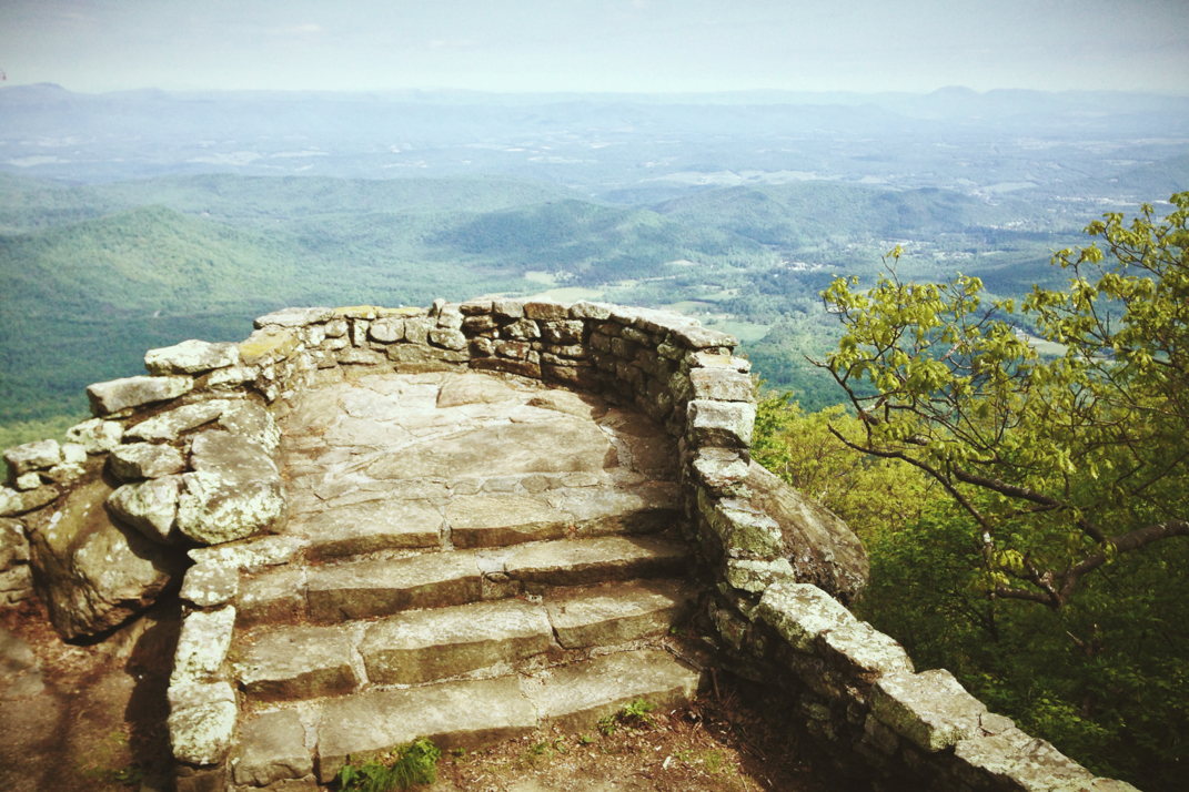
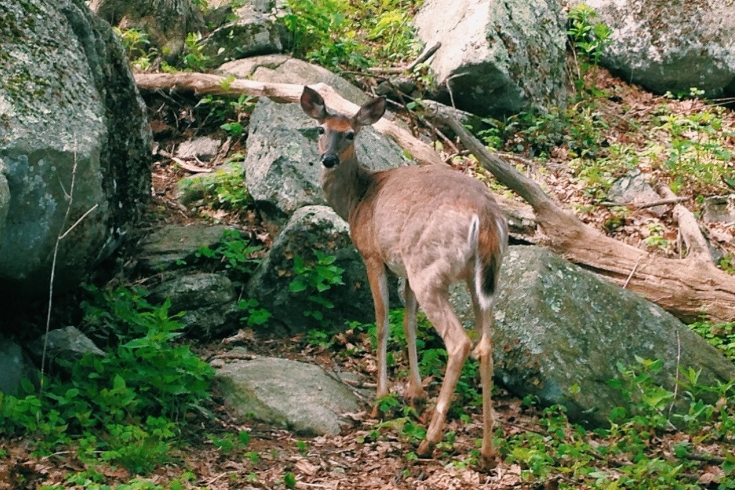
I slept in this morning, and it felt wonderful. I had rolled my alarm back to 6:30 or so, and simply laid in bed once it went off. Drifting back to sleep on and off, I finally got up around 8 and started packing up camp. It was a bit chilly at the top of Apple Orchard Mountain, but the sun was brilliantly shining down. I had been visited by lots of daddy long leg spiders the night before, so I shook my tent rather vigorously before packing it up. Eating some breakfast and brushing my teeth, I began hiking at 8:45 or so. I stopped at the shelter a mile down the hill (where I'd intended to spend the night originally) and signed the log book while filling up my water. The next shelter north was 13 miles away, which is where I'd stop for lunch. There was some decent descents between here and that shelter, and one large climb up Highcock Knob. The trail still would follow along the Blue Ridge Parkway for a while, not nearly as closely as yesterday, before dipping down into the valley below. After leaving the shelter I stopped at a scenic vista looking down from Thunder Ridge, when I heard another hiker come up. I turned around to say hello, and discovered a young deer standing 15 or so feet behind me. I quietly said hello and she stepped back a bit, but after seeing that I wasn't moving abruptly she moved back to where she was. At our closest, we were less than 10' apart before I said goodbye and carried on.
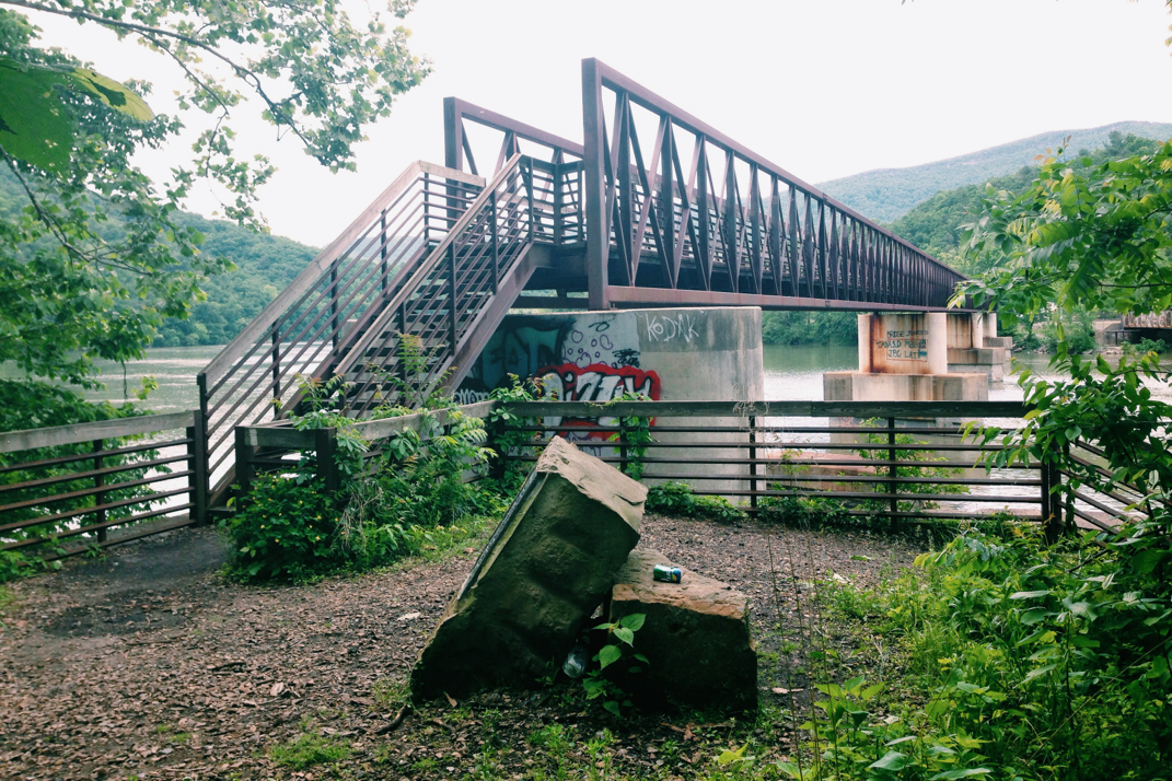
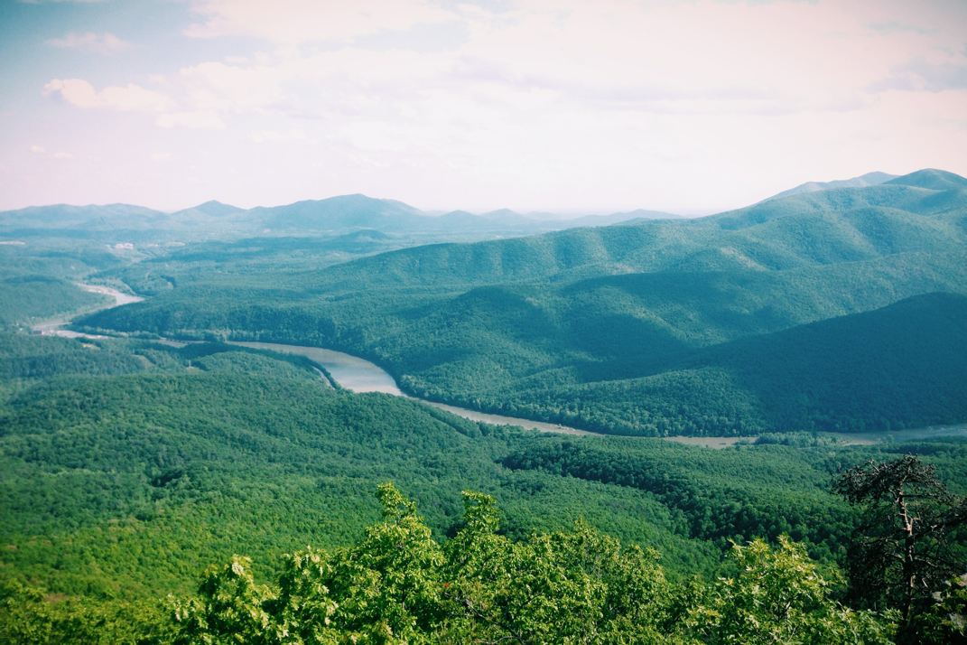
After climbing over Highcock Knob, the descent to Matt's Creek shelter was long and steep. Despite a late start and wanting to make up for it with quicker miles, I had to pace myself so as to save my knees. I reached the shelter (which of course was empty, alike the one before it) at 1330hrs and ate a quick lunch before heading on. There was a beautiful river but the mosquitoes were enough to detract from my desire to stay. I continued on, losing a few hundred feet in elevation before the trail paralleled the James River (elevation 636 feet, the lowest we've been in a long time) before crossing the James River Bridge. Privately funded and dedicated to a former thru-hiker and his wife, a couple who ultimately would be the first people to complete the coast-to-coast American Discovery Trail in 1997, the bridge is the largest pedestrian-only bridge on the Appalachian Trail. After crossing, the trail passed by a few leisurely fisherman along the water before beginning its climb back out of the riverbed. There was a shelter two miles from the river's edge that I stopped at to refill my water supply, where I saw the first real group of hikers I've seen in days. Getting water here was crucial because from this point forward the next water supply is 9 miles ahead at the next shelter. The trail forces my hand in these situations; I'd maybe not like to do 25 mile days, but stopping at this shelter would have netted only 16. Had there been water between I might have found somewhere around 22 or 23 miles, but instead I have to carry on. Alas, with 2 liters of water, I began a 3,000 foot climb over three sequential peaks to the summit of Bluff Mountain. Total distance would be 7 miles or so, with two miles being comprised of ridge walking.
The climbs were steep and long, switchbacks that seemingly curved around half the mountain before changing direction. I kept a steady pace. Those who remember my blog entry on my 35 mile, 10 hour hike into Damascus might remember the graffiti I saw at a shelter that day: Practice Momentum. I was singing my favorite going-uphill-keep-a-good-pace song, a duet between John Mayer and Keith Urban covering The Beatles' 'Don't Let Me Down' at Clapton's Crossroads festival. Seriously, look it up on YouTube. Regardless, the climbs were long, but I had summited Bluff Mountain by 1850hrs and began the 1.8 or so mile descent to the Punchbowl shelter where I'd stay the night. One thing that was frustrating was being able to see the radar tower I slept under last night while at the summits of these peaks. Yes, it's 20 miles of hiking away, but even with my bad vision to see it frustrated me for some reason. 20 miles doesn't seem to be as much when I can physically still see where I started. It's 1/4 mile off the trail to the shelter, but I was happy to see that there are many people here. A lot seem to be giddy and still partially hungover after returning earlier this same day from Damascus' Trail Days festival. Sounds like a good time was had by all, and that the population if Appalachian Trail thru-hikers will return to its previous numbers.
Dinner was quick and I ate well, happy to be fed almost an hour earlier than last night. I ate with a gentlemen and his wife, Brunswick and Hopper from Indiana, as well as a Floridian named Stony G (mid-20s, began hiking Feb. 15th in snowstorms and plans to take 7 months in order to experience all the seasons), and a British hiker named Fletch who hikes at the same pace as me and remembers meeting me as far back as Damascus.. It was nice to actually have people to talk to. Still having averaged around 3 mph, despite the climbs, I'd call today a good day. Tomorrow appears to have another 3,000 foot climb out of a valley in store for me, so I'm hoping an early start might make that more reasonable.
On a quick side note- I want to thank everyone who has taken the time to reach out to me. I read every comment, and get every email; I'm just horrible at responding in a timely fashion. The readership numbers are incredible, and tracing back how people have discovered the blog shows the power of the Internet. Please continue to share it with coworkers, friends, and family. I'm not even halfway done hiking yet (yikes...) so there's plenty more writing to come if you're all still interested in reading. Also, for those who have so graciously offered hospitality or trail magic, please let me know when I'm nearing your location. Unfortunately my geographical sense is limited to big cities and what shelters I'll pass on any given day. If I'm a week (figure 22-25 miles a day) from you, please let me know via email. Thank you all again.
Bedtime for me. There's only three of us in the shelter, everyone else is tenting, so snoring should be minimal and a good night's rest in store. Tomorrow, I walk.... But you knew that already.



 RSS Feed
