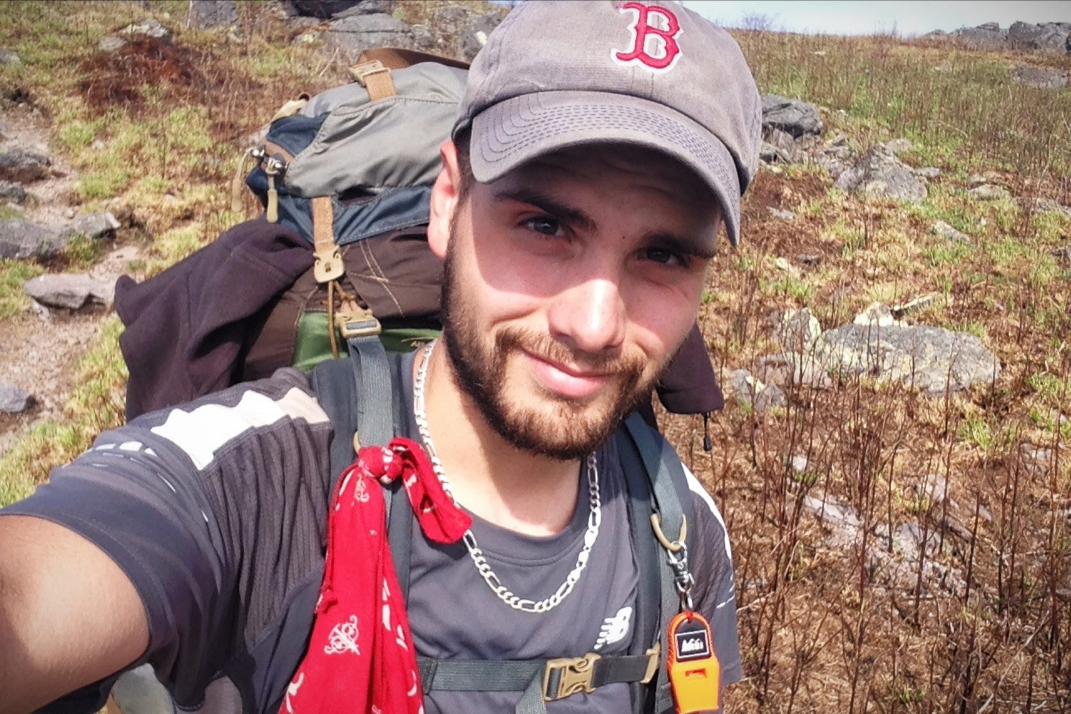
2180miles
  • Home
  • Adventure Blog
  • Overland
    • Meet The Jeep
    • Mods & Installs
    • Overland Gear
    • Trip Reports & Videos >
      • Allagash Winter 2019
      • Greece Adventures 2019
      • Overland Expo East 2018
      • Allagash Wilderness 2018
      • Trans-Canada Overland 2017
      • QB-5 Adventure 2017
  • Long Trail
    • Trip Summary
    • Photojournal
    • Hike Statistics
  • Appalachian Trail
    • Trip Summary
    • Photojournal
    • Gear Talk
    • Hike Statistics
    • Financial Planning
  • Bicycling America
    • Trip Summary
    • Photojournal

Quarter Of The Way

5/11/2014

2 Comments


Day: 37

Day mileage: 23.5

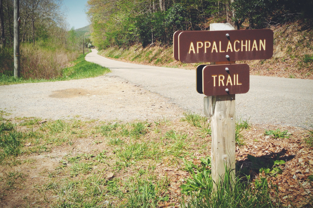
AT total mileage: 571

Time: 9.5 hours 

--

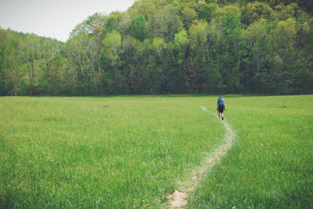
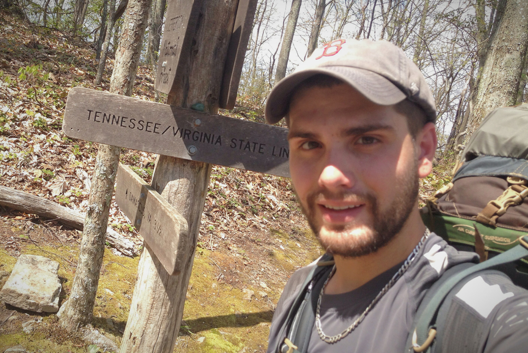
Less than 5 minutes after departing my campsite this morning, I walked over the unmarked mileage point of 1/4 the distance to Maine. This fact is both thrilling and daunting. It also means, however, that even with slower first weeks of mileage I'm still hiking faster than I thought, so that's cool. 

It turns out that I wasn't the only one who threw in the towel to the weather last night. I was on the trail sort of late, around seven, and passed a handful of tents scattered on the side of the trail as I started my hike. Speaking with others later we all laughed at the lack of actual rainfall overnight despite the doom and gloom in the forecast we'd heard. There was a pretty steep climb from where I'd rented that then dropped down into Reed's Creek where I was able to get some water before a 1,000 foot up & over kind of climb. At the peak of said climb I ran into Red Turtle and Jetcat, the first of whom I've met a few times before. He's a career Army vet (picture Sgt. Brody in Showtime's cable series Homeland) who began hiking in March with his 75 year old dad. They were doing 10 mile days consistently until his dad's knee problems got the best of him and he was urged to return home by medical providers. Since then Red Turtle has stepped his game up and has caught up with hikers who long ago passed him. Jetcat, on the other hand, is a blonde about my age who grew up in southern Florida, although she now lives an hour outside of San Francisco. Despite their slower pace, I walked with them for a while enjoying the conversation as Turtle talked about his 3 sons, Afghanistan , and hiking, also taking some time to dispense advice on life, raising children, and marriage.  He seems to be quite the guy. 

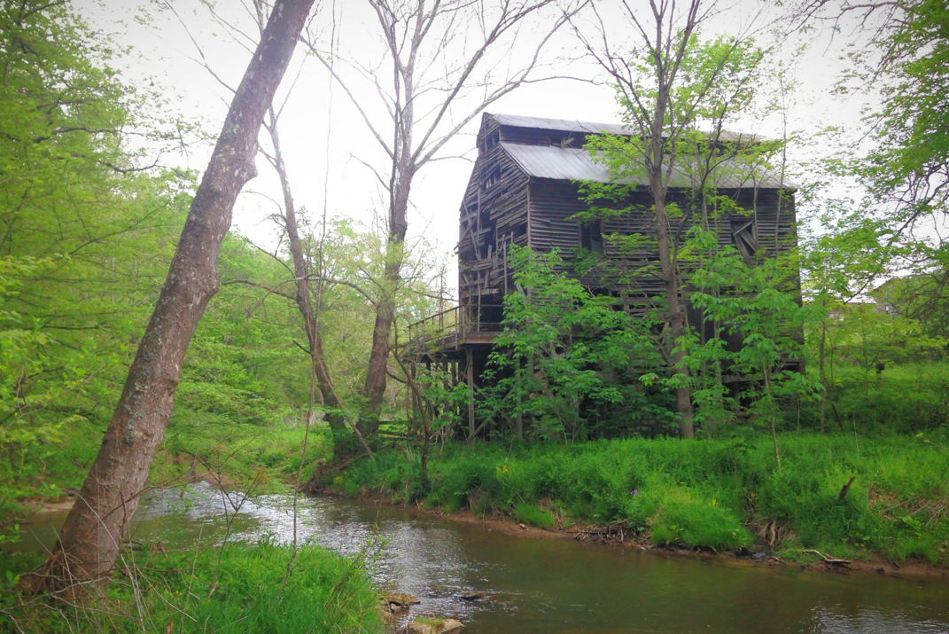
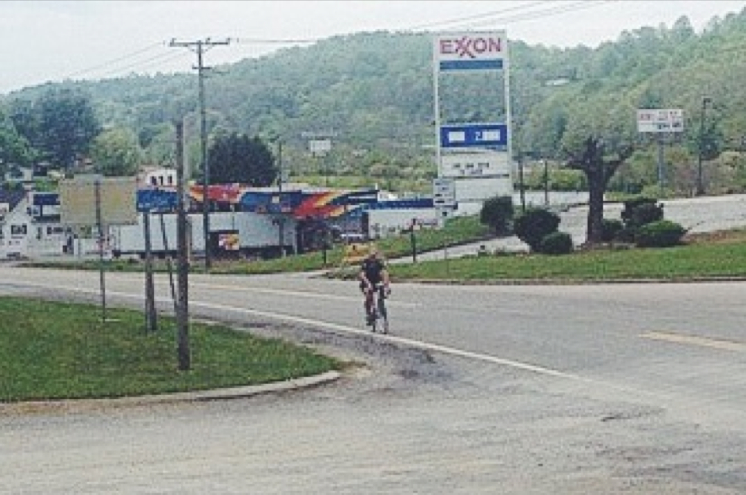
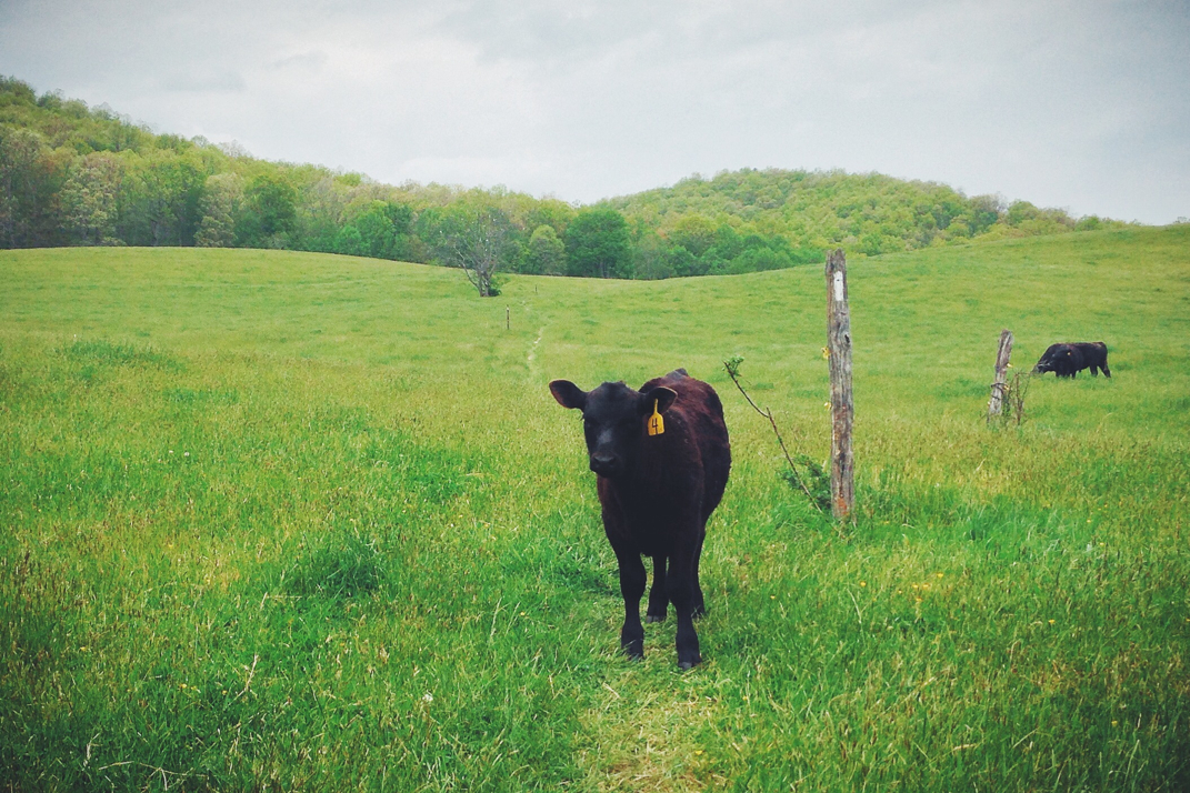
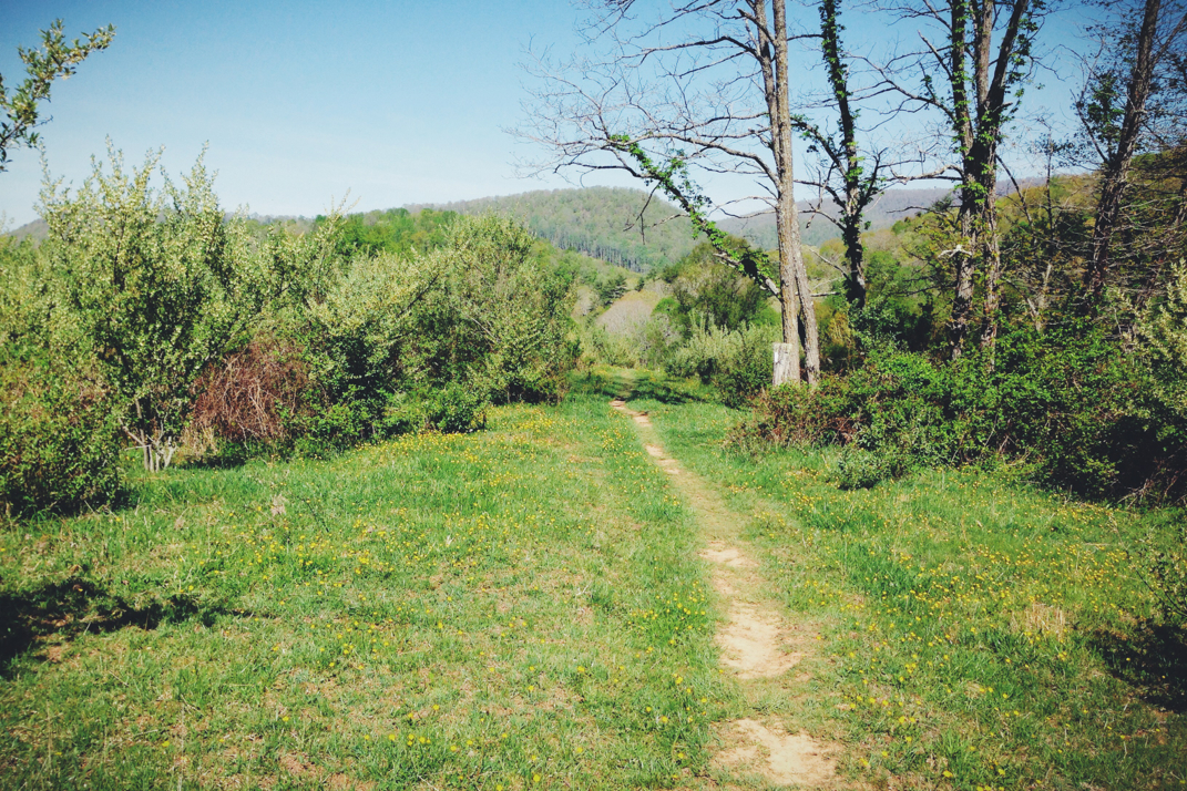
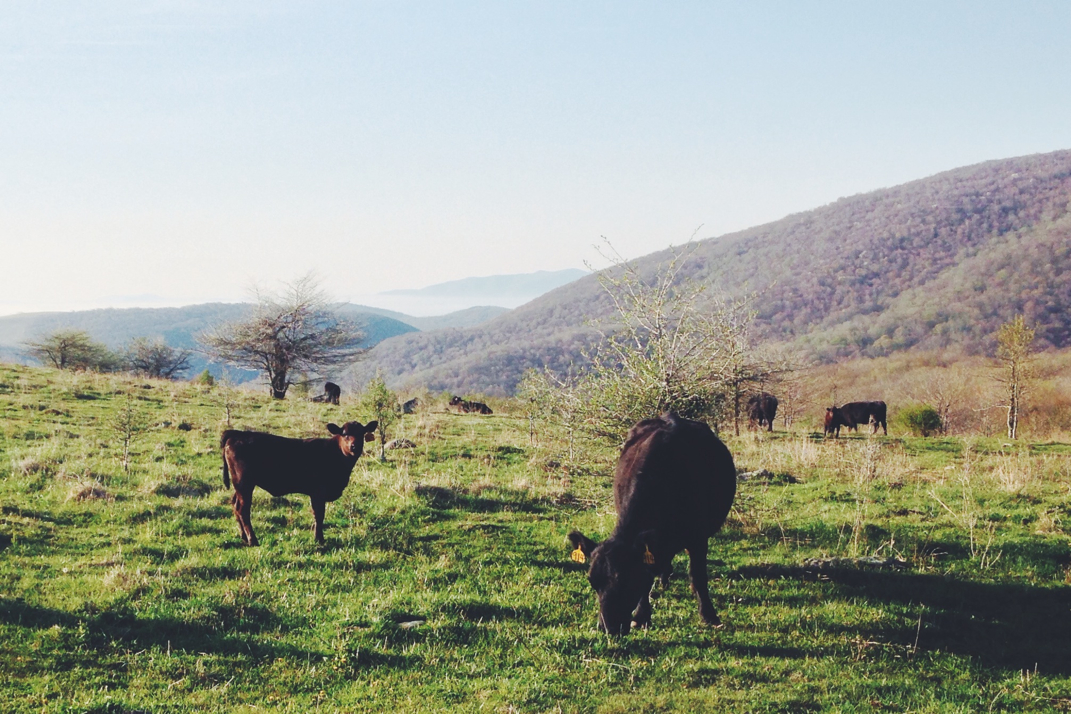
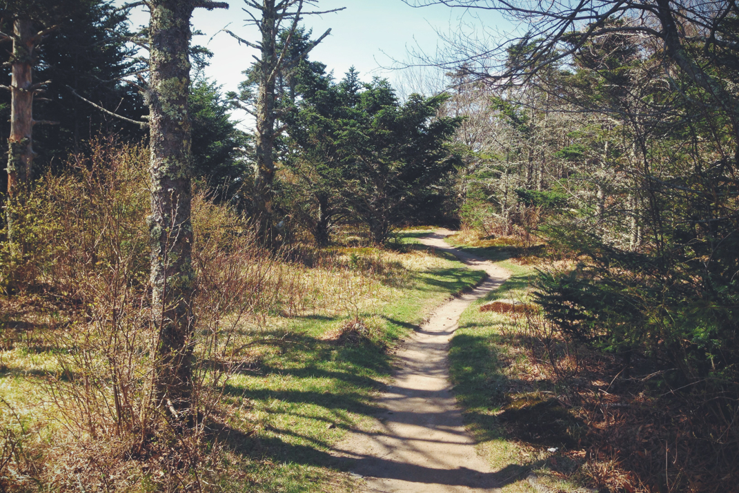
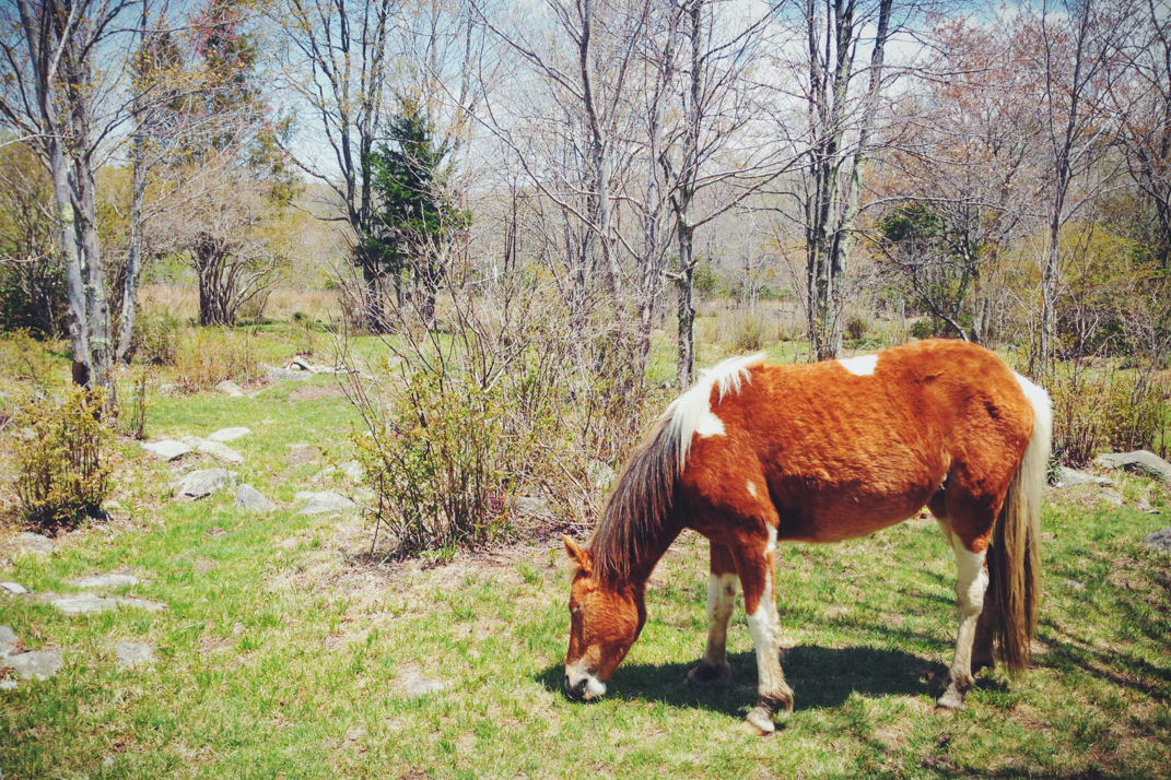
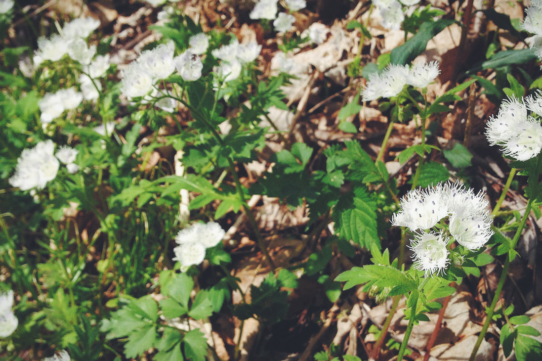
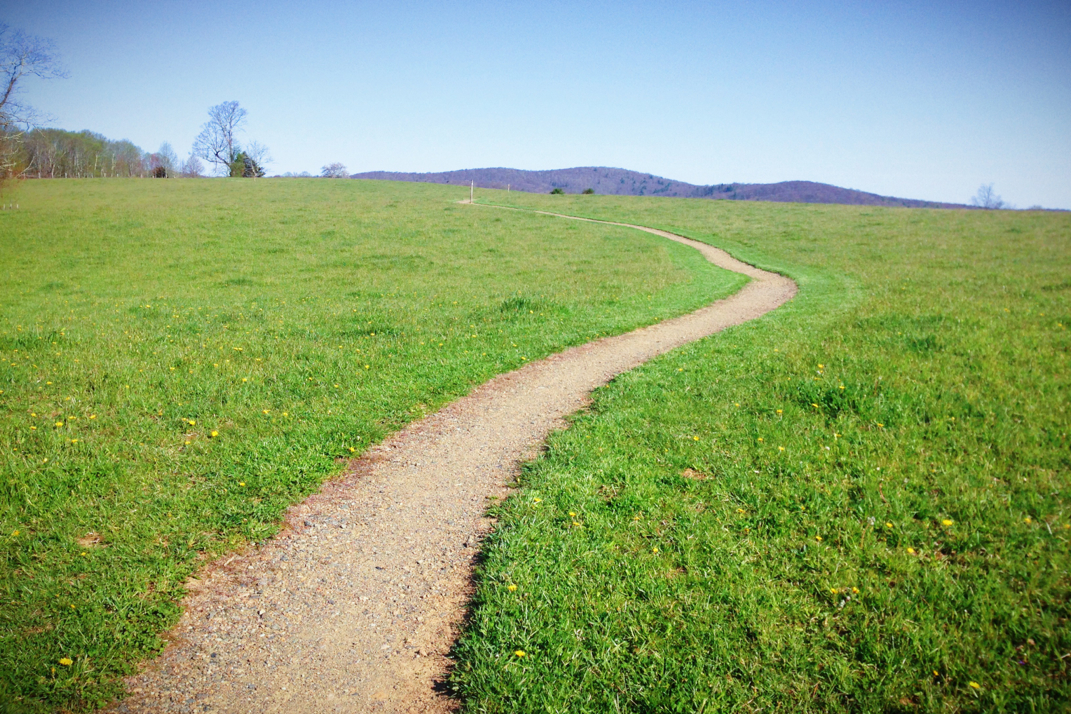
As that peak dropped back down into the valley, we exited into another farming field where for the first time on the trail I saw a real farmhouse / barn / silo set up. We're far enough north now that these are turning into working farms, and it reminds me of the many that we'd see when cycling across the country in 2007. Hiking through rolling hills of another pasture, the skies started getting a bit darker and we soon after ducked back into the woods. Quick time was made through there until we snaked along a wide river, crossing a bridge and walking across the water from more farmhouses. At some point in here it started drizzling, but due to my rain cover already being on my pack I simply carried on. It was another 10 minutes or so, as we were hiking through another open field, that massive cracks of thunder and bright lightening occurred, and the rain came down by the bucketload. I quickly said goodbye to my slower paced friends and got back to my normal speed, hoping to make it to the next shelter quickly. Unfortunately there was a decent climb in front of me but I powered through it, passing a half dozen hikers on my way up, before pulling into the Knot Maul Shelter and setting up shop to eat lunch in the protection from the elements. Someone had also carried up the latest Cosmopolitan magazine, so I read a great article on how to take a 'sexy selfie'... These are the kinds of pressing issues the first world is concerned with.

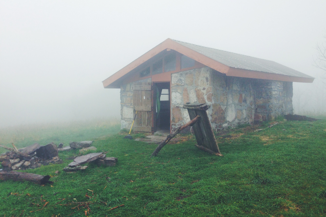
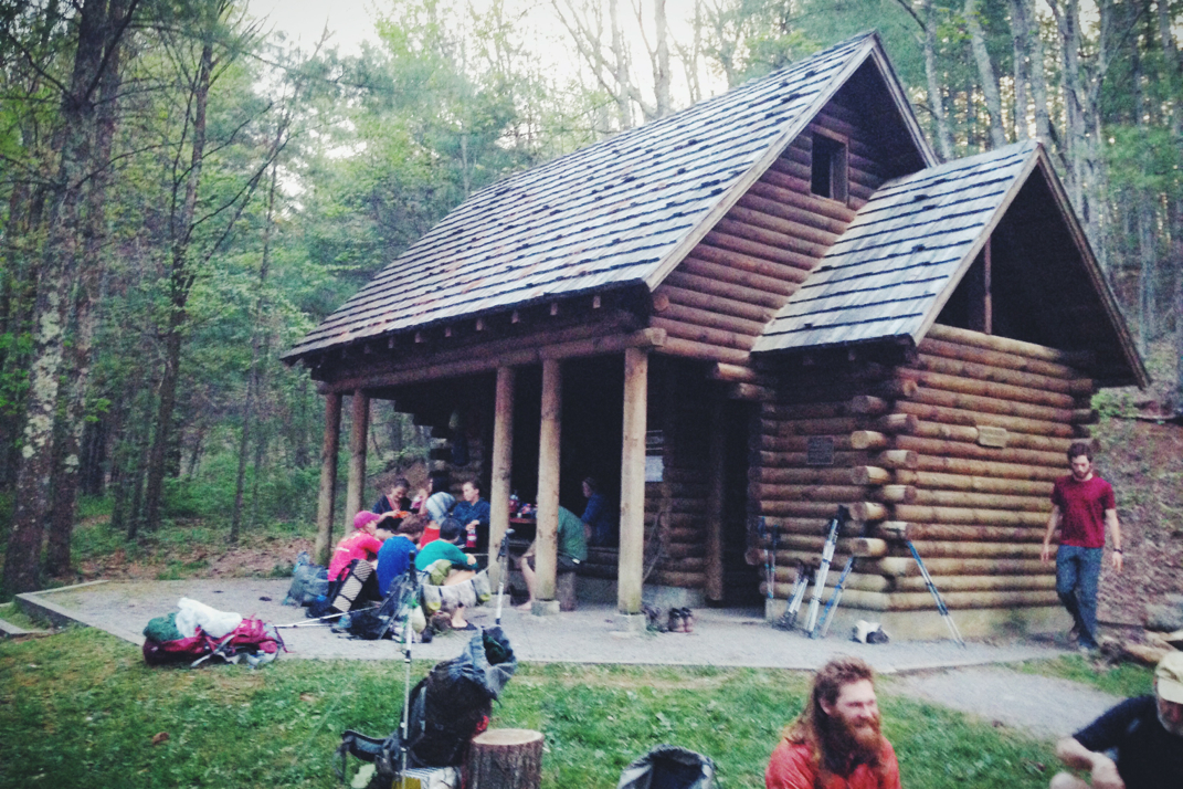
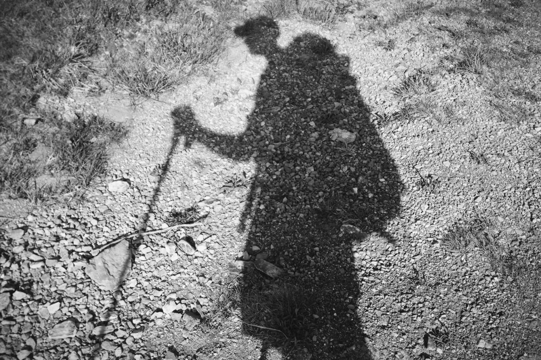
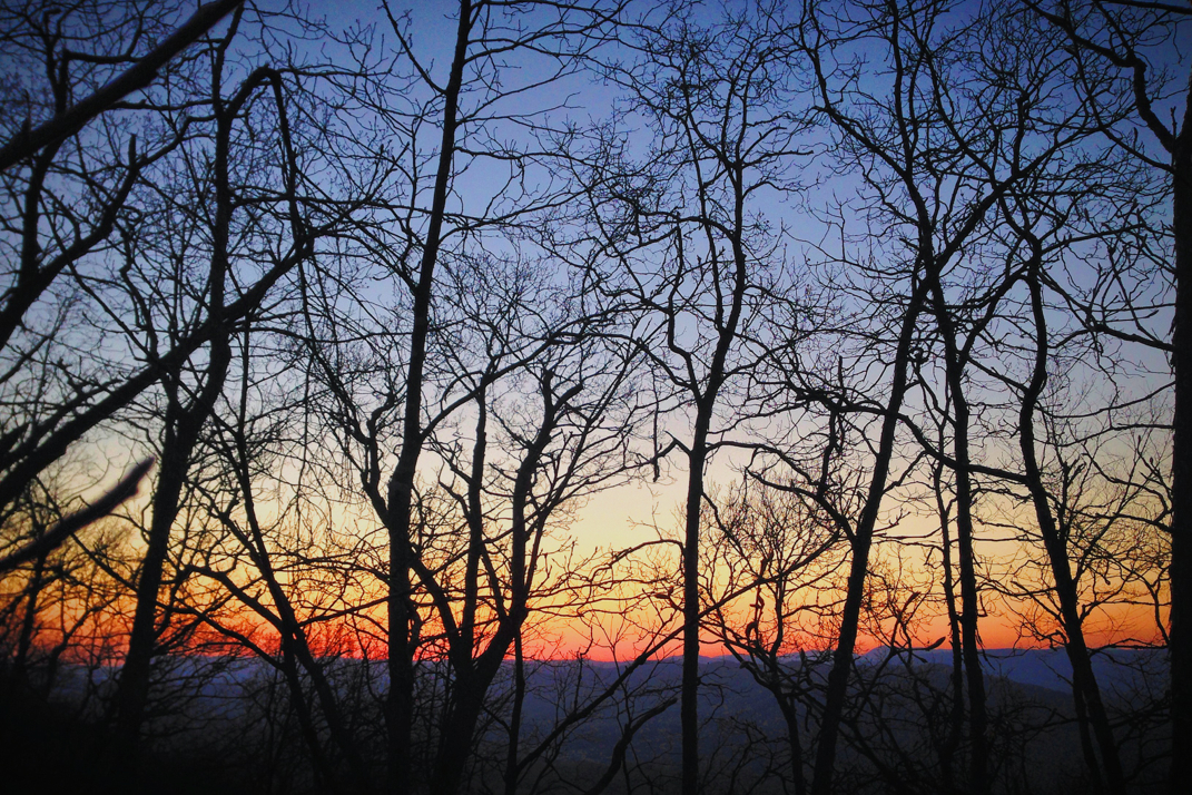
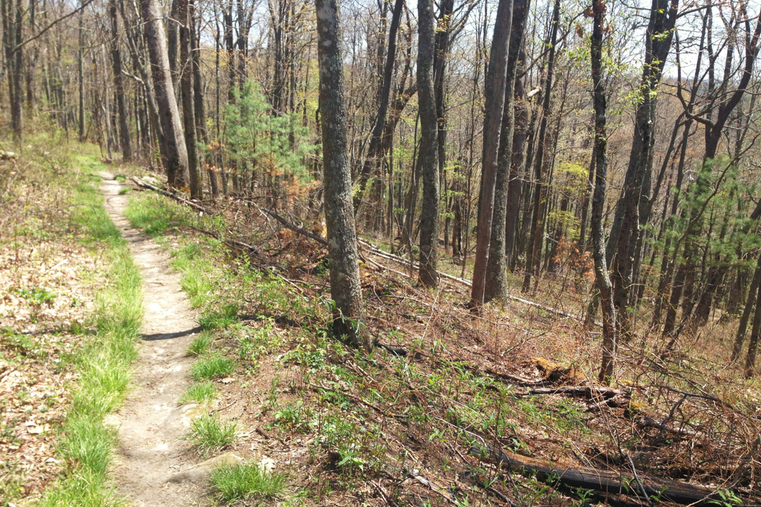
Despite the innate desire to remain covered from downpours when the opportunity presents itself, I packed up my gear after eating lunch and pressed on in the rain. The afternoon's hike was slated to include a 2,500' climb over nearly 6 miles to an old shelter atop Chestnut Knob. I ran into a hiker named Pneumo, who's probably in his early 20s, and we spent a while talking as we pressed on in the rain towards the climb. His name, I found out, comes from Pneumothorax, the medical term for a collapsed lung... Which he had just a few weeks before beginning his hike. Scary stuff to then hit the trail where medical attention isn't immediately available. We walked on and eventually split up when he stopped for water. The climb up the Knob was steep and included many 'stairs' that volunteers build into the side of the mountain to make the climb easier and try and ward off erosion. These are logs inserted into the trail, but they're horrible for hikers as there's no way to maintain momentum with them and the step is often much larger than a typical stair step. It requires a lot more effort than many would like to additionally exert. Despite this I climbed on, eventually coming to an open field towards the top of the mountain. I had to stop at a spring for water as the guide book said it was the last water source for almost 14 miles. Loaded up with 4 liters I pressed on, just in time for some very heavy fog to move in (surprise surprise, a peak of a mountain and I'm fogged in). I eventually made it the 2 remaining miles to the Chestnut Knob shelter, a 4 sided stone building with a front door that used to be the fire warden's cabin. In the fog it looked like an early Everest base camp building. My plan was to stop for a snack before continuing on, but there was a sign on the table urging hikers not to eat and instead to carry on down the mountain for a 'Hillbilly Feast: all day for hikers' in a gap that was 2 miles downhill. I put my pack back on and practically ran down the mountain, hoping that I'd make it before they packed up, as it was already almost 4. 

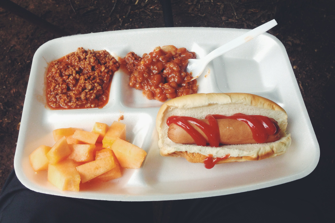
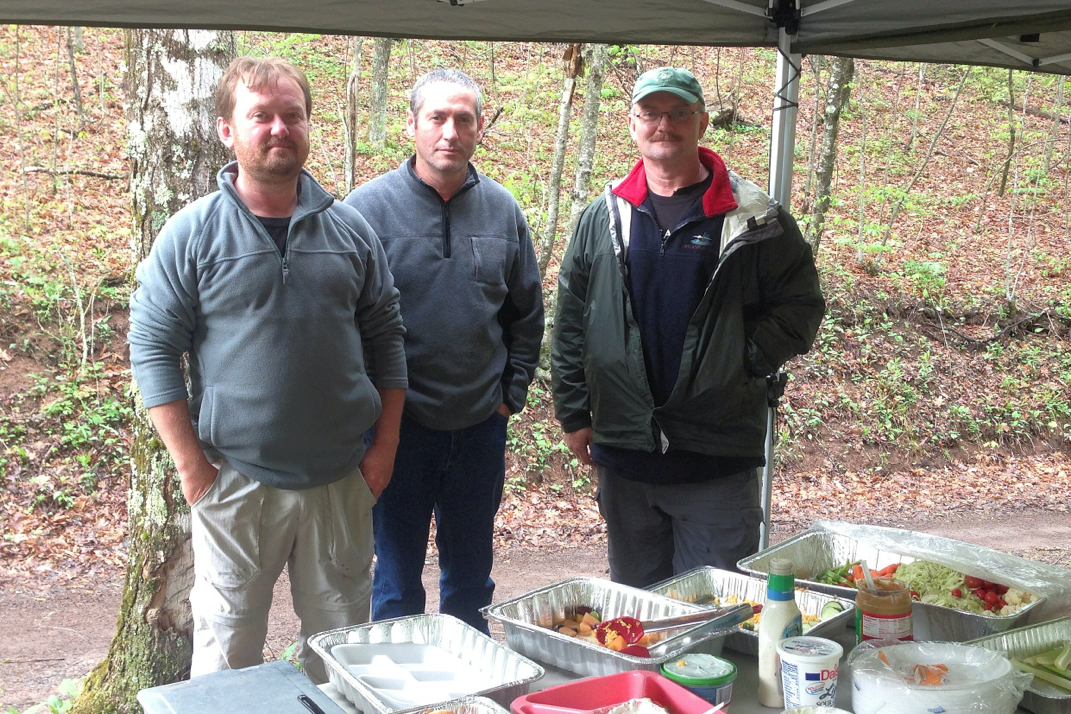
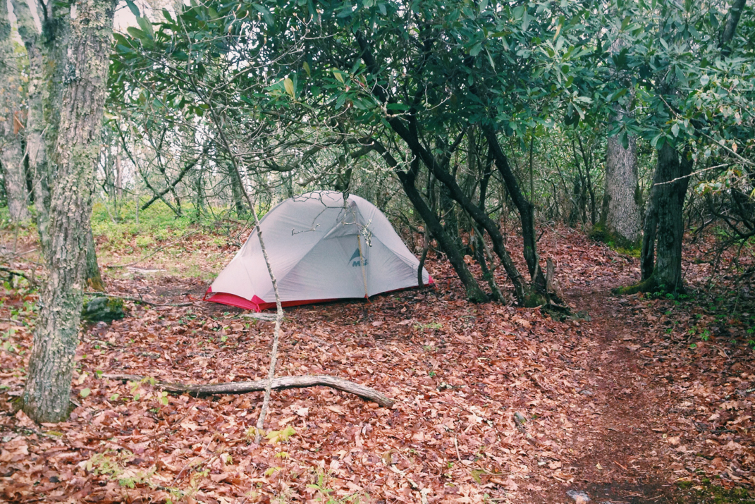
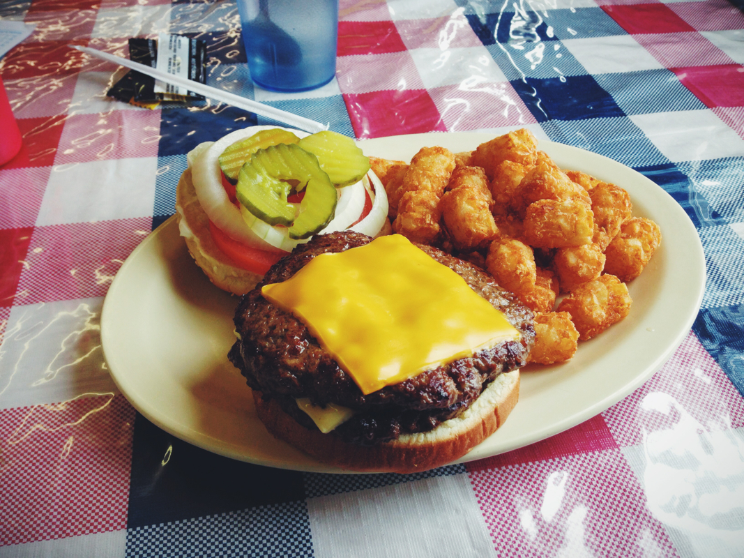
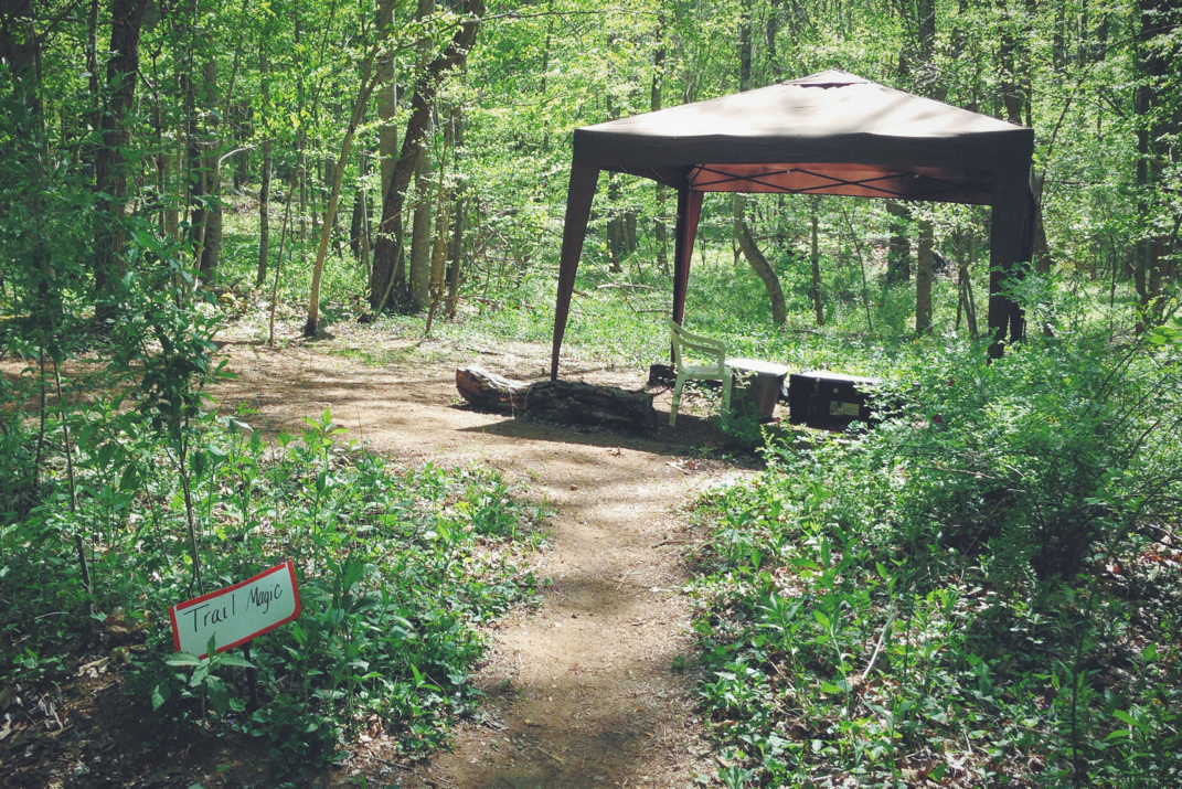
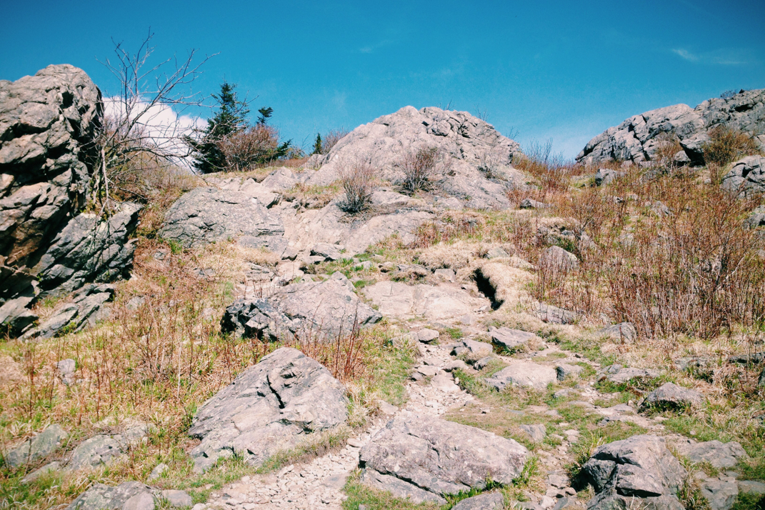
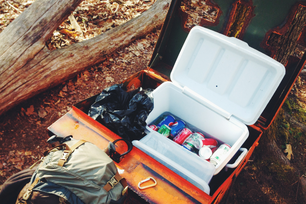
The Hillbilly Feast was still in swing when I arrived and saw many familiar faces. Organized by three cousins, it's the brainchild of a previous 2,000 miler named Freak who section hiked the entire trail over 5 years. There were platters of typical BBQ food and fruit, as well as sodas. Quite the treat for the still-rainy Saturday afternoon. I hung out there for an hour or so, having already done 20 miles of hiking, before pressing on. The next shelter was still 9 miles away, and with no intentions of making it that far I decided I'd find a campsite as I went along. After a steady climb out of the gap I spent an hour and a half ridge-walking over a very rocky section of trail. For a brief while the sun shone through and it felt great. I came across a small one-tent site at about 1900hrs and decided not to push my luck with darker clouds that were moving in. I stopped and set up camp, giving a liter of water to 2 hikers passing who had none and were pressing on, and climbed into bed. About 10 minutes after getting situated in my tent it started raining, and I felt good about my decision to stop. 

Long night of sleep, and there have occasionally been shadows from the moon dancing on the fabric of my tent from the rhododendron tree I'm perched under. Tomorrow the weather's supposed to be a bit better, so we'll see how far I get. 

Either way, I'll be more than a quarter of the way to Maine. 

Picture
Old farm building
Picture
Chestnut Knob Shelter
Picture
Foggy Mountaintop
Picture
Hillbilly Feast
Picture
Gracious Hosts (Freak is on the left)
Picture
Rhododendron Camping
2 Comments

Where's The Beef?

5/9/2014

0 Comments

 
Day: 36
Day mileage: 16.5
AT total mileage: 547.5
Time: 6.5 hours 
--


I'm unsure as to whether or not today went as planned. 
I happened to be stuck next to the loudest snoring hiker at the entire shelter last night. Her trail name is Texas Tornado, and luckily despite her exceptionally loud noise making, my headphones kept me in a quiet little world of my own. On a full stomach of pizza I slept wonderfully, waking up a few minutes before my alarm at 5:00. Knowing that I only had 11 miles to hike  before arriving at the restaurant UPS would deliver my package to, I laid in my sleeping bag for an extra half hour before deciding to get up. Mind you at this point daylight was more than an hour away, so I packed up my stuff with the red glow of my LED headlamp.  After refilling my water and eating the last slice of pizza (intentionally saved for breakfast) I hit the trail at 6:10. 
While I'd love to say I was out of the gate maintaining my fun 3 mph average, I instead was quite slow. I managed to get 1/2 a mile down the trail before needing to stop and address a blister that might be forming on my right heel. I had tried to dress it with a simple band-aid before leaving, but stopped on the trail and emptied my bag out to find my sheet of moleskin to cover the hot spot with. I continued on, making it another half mile before I found a cooler with cold sodas and apples inside. Thrilled, I drank a Sprite and ate a delicious piece of fruit before heading on up a steady incline. At the top, my phone started making noises of incoming texts and e-mails, and I stopped to post yesterday's blog. As you can see, I was very easily distracted... It took me two hours to walk three miles. Again, I wasn't really concerned with this fact so I just kept on walking.  After a few miles of pointless hills the trail descended down into the valley below where after snaking along a stream for a while, I came upon the Chatfield Shelter. 7 miles into my day it was a great point to stop and eat a Pop-Tart, with only four miles left to go until town. It was around this point that the noseeums and flies started becoming prominent, likely due to nesting along the stream. I walked quickly with my head down, hoping the brim of my hat and breathing through my nose would protect me from consuming any of these aerial nuisances. What I will say is that the woods smelled amazing right about this point. The fragrance people at Yankee Candle would have had a field day with bottling this deliciously warm lemon/pine scent. That's all I have to say about that. 
As the trail leveled out in the valley it crossed over the side lawn of the Lindamood School, built in 1894. This one room schoolhouse is now part of a museum, but also has many boxes and coolers of trail magic in the front of the classroom. Not only were there cold drinks available, but also leftover wrappers of chips from previous hikers snacking, and a large box with shampoos, conditioners, stamped postcards, and many other day-to-day items hikers might find themselves needing. You're reading this correctly- in my first 8 miles of hiking today I came across two separate trail magics. Apparently when you complain to the Blogosphere, people listen and respond.  I signed in the Lindamood trail log with a sincere thank you before carrying on towards town. 
At this point Comfortably Numb had caught up to me and we hiked together through two miles of rolling fields before crossing train tracks and ending up at our destination. Two interesting thing to note about this time in the fields: 1) I'll be checking for ticks later. Tall grass. 2) there was one point where after crossing the train tracks we came across a baby stroller haphazardly left on the side of the trail in tall grass, with a small toy monkey left in the stroller basket. After looking around and listening for any noises or clues to a baby being nearby, we somewhat hesitantly continued on. Being such a strange and disconcerting sight, apparently other hikers called the police and the state police came shortly after we were there, but believe it's a prank by local townspeople to freak hikers out. 
The resupply point here is a convenience store section of a Sunoco gas station. I stopped by quickly for a Powerade (my favorite reentering-the-real-world-after-hiking purchase) and then rushed to The Barn restaurant to see if UPS had arrived yet. They hadn't, and the waitress informed me they "typically do between 2 and 6" so I sat down to eat lunch. The special to get here is the Hiker Burger, comprised of two 8 oz patties, all the typical toppings, one slice of American and once slice of Cheddar cheeses. I also got tater tots, because how often is that an option?! The burger went down quickly, and soon after I found myself laying on the front lawn of the restaurant, eating candy peach rings, waiting for Brown Santa (this is a name from many years on JeepForum.com that we'd use to refer to UPS when they were delivering Jeep parts). I talked for a long time with newlywed thru-hikers Gilligan & Ginger (http://missionoutofabackpack.blogspot.com) about their plans for the trail, what gear was working for them, and life in general. Not long after the sky started becoming overcast and as the cars and trucks marched by on I-81 right beside me, the clouds kept moving in with the threat of thunderstorms. 


I picked up a few days of snacks at Sunoco, knowing that I'll be at an actual grocery store as soon as Monday to get real food. The UPS driver pulled into town at about 3, and I literally hopped on a bicycle & chased after him to get my package faster. This was quite the sight to see, and (poor quality) photos do exist. After the new back plate was installed in my backpack, I hit the trail as the rain started trickling down.  This was around 3:30. I told myself I'd hike until 7 and see where that got me mileage wise, but with a stomach full of food and a few hours off it was hard to push myself for any speed climbing out of the valley.  At one point while walking through a sprawling cow pasture I performed interspecies communication with a very young calf who was standing in the trail and didn't want to move. We were only 5 feet away from each other and I kept talking to him about the weather as the rest of the cow heard watched on. He eventually stepped aside, and all parties left with positive memories of the experience.  As the rain picked up more steadily I found a spot on a mountain a few miles out of town where cell service was available and pitched my tent hoping to get it up and habitable before the worst of the rain started coming down. My tent is erect some 16.7 miles from where I began, one of my shorter days in recent times. I'm not exactly thrilled, but my intentions by ending early were good. It sprinkled rain for the rest of the early evening, and I napped until 10 or so before waking up and finishing writing this. At the moment it sounds like there's no rain at all, despite the weather reports saying scattered showers and storms every hour for the next week or so. I'll cross my fingers that doesn't come to fruition. 


My plan is to get a good night's sleep, at least 12 hours, and hit the trail early. I'll hike a bit longer tomorrow to make up for today's lack in mileage, and hopefully the 'storms' will keep temperatures down a bit to make doing so a bit easier.  I started by saying I'm not sure if today went as planned or not. I'm not sure if I expected to get my normal 20-23 miles in or even less, but there's part of me that's disappointed with a mid-16s number. C'est la vie, mileage isn't everything. Luckily I've got some time to walk tomorrow. And the day after. And the day after...
I'll close by sending a big heartfelt thanks to Keon and the great customer service team at Granite Gear who got me the part I needed to keep hiking in less than 48 hours. I truly appreciate the work you out into getting that done. Definitely a company that's as great as their products. 
Back to sleep for me. Interestingly enough this is my first night tenting alone in my 5 weeks (today's the start of week 5!) on the trail. Certainly puts a guy's auditory sensors on high alert. 
Picture
Picture
Lindamood Schoolhouse
Picture
Picture
Picture
The Barn
Picture
Tater Tots.
Picture
Chasing UPS
Picture
Broken backpack piece
Picture
Excuse me, sir...
0 Comments

Partnership Shelter

5/9/2014

2 Comments


Day: 35

Day mileage: 19.3

AT total mileage: 531

Time: 6 hours 

--

I eventually fell asleep, and slept on and off throughout the night. When my alarm went off at 5:30 I started slowly packing up, attempting to be quiet although my ground pad seemed to be making more noise than normal. With a granola bar in me I hit the road, just about the time the sun crested over the mountain ridges in the distance. The trail from the Hurricane Mountain Shelter descended a thousand feet over 2 miles before turning around and climbing for many miles. At this point the impending heat was already apparent, and I was sweating before 7 AM. Half an hour later I was stopped to take my shirt off, not wanting to soak it through. I hate this kind of heat, and temperatures were expected to hover around 90 degrees today. 

After two hours, keeping up with my recent 3 mph average, I was 6 miles into my shortsighted goal of reaching the shelter 9 miles away by 9:30. At one point around this time the trail emerged from the woods to cross a state road, and upon the reentry into the forest there was a styrofoam cooler of trail magic. My heart rate increased. Excitement boiled over inside of me. I opened the lid and was elated to find a cardboard box of Blue Moon seasonal beers. In a wonderfully mean twist of fate, the box was empty, as every beer had been consumed by a hiker ahead of me. Now, you're obviously saying to yourself "Well Ryan, according to your timeline this means you'd be consuming a beer at 8:30 AM... Are you serious?" To answer you, wise reader, heck yes. Lest not forget the (loosely quoted) immortal words of Stephen King's character Andy Duphrane (The Shawshank Redemption) after he tarred the roof of a local factory: "Cause after all, nothing makes a man feel more free than a cold bottle of suds on a hot summer day". Good point, Andy. At 8:30 AM I was already soaked from an extremely vigorous morning workout, and I would have killed for there to be an ale in that cooler with my name on it. Alas, it wasn't in the cards for me today. 

I crested that climb and then dipped back down into a lower crevice where the Trimpi Shelter was located 0.1 miles off the trail. I stopped there to have a second breakfast, sign the log book, and refill my water. At this point I was consuming a liter an hour to try and stay ahead of the heat. I allowed myself 30 minutes there before pressing on, with 9.1 miles already completed and 10.2 miles left to go for the day. Not wanting to be stuck in the likely horrific afternoon heat, I was back on the trail at 10 AM and pressed on. My goal was initially to be at the shelter I'd end my day at by 1300hrs, but I needed to be lenient with myself due to the heat. The trail descended the mountain and emptied out into another pasture, however I doubt this one has been occupied in a long while. One structure still existed on the property, but it looked as if the wind from a hearty sneeze might complete its demolition.  Upon exiting the pasture the A.T. followed along a dirt road for 1/4 mile or so. Halfway up the road there was a small sign pointing out a 10x10 pop-up tent and coolers of Trail Magic! A second opportunity for awesomeness, I was immediately disappointed to find out that all that remained was a zip loc bag will small tortillas. No drinks, no snacks, just a trash bag of disposed wrappers, which hammered the last nail into my coffin of broken trail magic dreams. I later wrote in a shelter log 'Trail magic sucks when there's no magic... Then there's just 'trail', and we all know I had that to begin with. Plenty of it.' I'm not ungrateful of the thought and intended kindness. Just bitter over the second magical letdown of the day. Probably irritable due to the heat as well. 

Walking along for another mile, I crossed over a large wooden bridge and crossed over a 2 lane state road before disappearing into the woods again. A small climb opened the trail up for what became a mile of completely level hiking. At one point this section had obviously been cleared as some kind of road, traveling past sprawling farm fields. As I walked along the sun dutifully made its way across the sky, causing me to spend a while thinking about how amazing that fact in itself is. The sun doesn't complain, doesn't wake up late, doesn't miss birthdays or other special events. It's always there, only letting you down when you make the mistake of hanging out with it too much in a given timespan. We've never replaced it, it's never needed a tune-up or any warranty repair, it just keeps on working as it's done for immeasurable generations before us. How many things in history have been there every day, and have never been replaced? Salt water... fresh water... clouds... The moon... the sun... It's a damn good reliable thing, and the world's obviously lucky to have it.

Yep. These are my life-changing, self-reflecting, come-back-a-different-person kinds of thoughts. 

My remaining miles passed slowly. My three mile per hour average was virtually nonexistent as the heat of the day was coming down in full force. I walked up a few 3,500' mountains (big hills? I'll work on differentiating these kinds of things..) at a pace of 2 mph, allowing the heat to get the best of my physical exertion. I stopped at one point to double check the status of my backpack's part that's being shipped to a restaurant I'll walk by tomorrow, and snacked a few times, majorly procrastinating my mileage. The pack as it's configured now (the only way it can be until my replacement part arrives) would be perfect for a small man with a frame of about 5' 2", and as such is horribly uncomfortable.  The hip belt is where it normally rests, but the sternum strap cuts across nearly under my collarbone. There's no way to make this thing tolerable, and today I'll end up wrestling with it for 19 miles. Luckily I'll only travel 11 tomorrow before being in place to intercept the new part. I hiked along a few ridgelines, fidgeting in discomfort, sweating under the midday sun. At this point it was hot enough that even on easier, almost flat ridge sections the slightest misstep in my walk would jostle mature beads of sweat on my brow enough to send them plummeting to the forest floor in front of me. It was plain old hot. I begrudgingly continued along the remaining 2 miles and arrived at the Partnership Shelter at 1400hrs. All things considered, this still isn't bad timing to walk 19 miles. 

Partnership is a one-of-a-kind place. Located immediately next to the Mount Rogers National Recreation Area Visitor's Center, there's not only a shower, real restrooms, vending machines, and a two floor log cabin style shelter, but also the ability to call local pizza places for delivery. I hung out for an hour or two snacking and enjoying comical conversation with hikers who had returned from town (Marion, VA) before ordering some food with Comfortably Numb for delivery. Dinner tonight was a (still piping hot) large BBQ Chicken pizza and ice cold Coca-Cola. 45 minutes after hanging up the free land-line phone at the visitor's center - side note: when was the last time you didn't have to dial an area code? It's been *quite* a while, but it was unnecessary here - our two hot pizzas were delivered to the shelter. This AND a shower, albeit somewhat chilly, were the icing on the cake for my hot day in the mountains. 

I was the first person arriving here who will spend the night. Due to a gap of sorts between shelters there initially weren't a lot who joined me. Eventually we had 22 hikers here, occupying both floors. I'm on the lower level and am watching the shadows of a campfire dance on the walls of the shelter. Later in the evening Soleil and her dad Cinqo showed up after inadvertently doing a 24 mile day. I congratulated him and later in the night he and I spoke for a while about the Autobahn, BMWs & Audis, Paris, Barcelona, travel, and our work. I eventually said goodnight and turned in, as the sun had set and bedtime was calling my name.

Tomorrow I'll hike 11 miles to a state road crossing that leads hikers into Atkins, VA. I won't be heading into town, instead I'll set up shop at The Barn Restaurant where I'll get a lunch and wait around for the UPS truck to arrive with my part for my backpack. Hoping that they arrive at a decent hour, I'll then head on another 8-9 miles before the end of my day in order to keep my mileage near 20 for the day despite my waiting around. Fingers crossed that this goes smoothly. 

Music & bedtime for me. The sun will be back around again before I know it. 

--

Edit: It was brought to my attention that I mistook my measure of time when referincing the speed of light in my post the other day. I used minutes, it's actually seconds. That's what I get for being an audio guy trying to talk light science. Apologies to anyone who lost a trivia round due to my mistake.

Picture
Bridge over Troubled Water
Picture
Picture
Broken Dreams
Picture
Picture
Yummmm
Picture
Partnership Shelter
2 Comments

I Would Walk 500 Miles

5/8/2014

4 Comments


Day: 34

Day mileage: 23

AT total mileage: 511.7

Time: 10.5 hours 

--

My plan to rise early failed miserably. The alarm went off at 5 AM, and I got out of my sleeping bag at 5:45. I packed quickly and hit the trail at 6:30 with the intention of putting in some good mileage today. 

The trail followed through more of the enchanted forest type of woods, descending down into Elk Garden from Buzzard Rock. Crossing over a two lane state road, I passed through a gate and into a sprawling pasture filled with cows. After taking a photo of a baby cow I cautiously hiked around 'mudpies' through the field for a mile or so before tucking back into the woods.   At the edge of the pasture the trail entered into Jefferson National Forest, and began a four mile but relatively easy climb up Mount Rogers. Although the trail side-skirted the top of the mountain, there was a 1/2 mile side trail which have hikers the opportunity to summit the highest mountain in Virginia, coming in at 5,729 feet.  Not long after entering into a bald section just shy of the peak's side trail, I came across yet another first on the A.T. Entering into the Grayson Highlands, hikers find themselves smack in the middle of packs of wild ponies.  I ran into Soleil, her dad Cinqo (he's visiting from Germany to hike for 5 days), and some other local section hikers, and a group of 15 or 20 ponies. Some were sunbathing, some grazing, and some were right up in person with us seeing if we had any snacks. Despite not having anything for him to eat, I became good friends with a pony who I quickly learned liked having his ears scratched.  There are a few good photos of this happening. 

After spending a while with the ponies, including a very young foal following its mother around, I continued on another mile to the Thomas Knob Shelter.  I had a late breakfast, as it was 10 am or so, and spoke with Cinqo about his work. He's an air traffic controller who after working for decades in the US moved to Germany to train new controllers. While I don't know a ton about air control, I fly frequently and have read a lot about what he does. He was surprised to find out that I'm aware of the '7 mishaps' rule for commercial airline crashes (this is an aviation rule stating that airplanes don't just crash, and that 90% of the time there are 7 individual mistakes that are made between 1st officers and the pilot before a plane will crash). We discussed the Malaysian jet at length, and he agreed that my theory is plausible. It was enjoyable and thoroughly stimulating conversation.

I kept hiking, with a few miles on the Grayson Highlands left in front of me.  It was very difficult at times to follow the trail, as the Highlands are more of a visitor park than a true Appalachian Trail devoted area. Signage was at times non-existant, and I got frustrated at chasing down the trail.  Once I managed to stay on track, the Highlands took me through some very interesting terrain. It was very dry terrain that was broken up by some serious rock climbing, at times scrambling on all fours to get my weight up and over boulders and massive rock faces.  There was one point where the trail cut literally between two massive rocks, 20 or so feet high on both sides, in a tight fit known as Fatman Squeeze. I stopped upon exiting the park to speak with a day-hiker who also thru-hiked in 2003. When I went to put my bag on, the right shoulder strap snapped out of the skeletal frame of the bag, not only breaking in one place but three at once bIf you've been following for a while, you'll remember that this happened 2 weeks ago just outside of Hot Springs as well. Of the 5 mounting options for the strap, I'm now limited to one single space.  Exceptionally angry, I got both shoulder straps to match their mounting positions, and hurried on to the next shelter, worried the whole time about what I'll do to fix this problem. Unfortunately, being in a national park, there was no cell service for me to call Granite Gear (bag manufacturer) to get a new one sent out. A quick lunch at the Wise Shelter and I was back on the road, aiming to get another 10 miles under my belt before the end of the day. 

Immediately before the Wise Shelter, something rather exciting happened... Mile 500. It seems to me like just the other day that I posted about mile 400 being attained. (Realistically it was Friday, so it was in fact pretty recently). Once again it was incredibly unceremonious, so I took a few minutes to break up some fallen sticks and mark a big '500' on the trail as a point for other hikers to celebrate at. Soleil later told me she was excited to see it, and was happy that I put it on the trail. I simultaneously can't believe I'm already this far, and yet I still have so far to go. 

I flew through the rest of my afternoon, arriving at Old Orchard Shelter at 1530hrs and snacking before continuing on the 5 more miles to the Hurricane Mountain Shelter that's on the other side of a large elevation gain as the trail climbed out of another gap with an empty state road. I climbed this 1,500' climb at upwards of 4 miles an hour, hoping to reach the top with enough time to call Granite Gear if I had cell service. My concern was missing the 5pm closing time that most east coast businesses have.  At 12 minutes past 5 I crested the top of the mountain and rejoiced to hear my phone go off with noises of incoming texts and emails. I quickly called Granite Gear (I learned they're Minnesota based) and they'll be overnighting me a replacement exoskeleton piece for my bag, shipping it to a restaurant in Atkins, VA that accepts hiker mail. I'm not sure what this will cost me, I did have to pay for the quick shipping, but it doesn't matter to me. If this current piece shits the bed I'm dead in the water, so having a new part on Friday will allow me to continue on without worrying.

I descended a mile down into a crevice between two mountains, full well expecting to find a shelter full of hikers cooking their dinners. I couldn't have been more off: the Hurricane Mountain Shelter was completely vacant. I had the place to myself. I was slightly thrilled, slightly saddened to not have any of my friends here. I cooked dinner, and set up my tent inside the shelter to ward off any invasions from mice. I read through the log book as I ate and packed up my bag before brushing my teeth and getting ready for a long and good night's sleep. Unfortunately, we can't all be that lucky. 

I had the shelter to myself literally until a few minutes before I intended to go to sleep, at which point Crankster showed up. This wouldn't have been a problem but another hiker named Blacksmith also came... I don't care for his company, and he's exceptionally loud.  It was rather annoying that he continued talking well past dark, which goes against the 'hiker midnight' rule of sunset. I kind of wish I'd had the place to myself just so I could sleep in peace. As I type this they're chatting, loudly enough that I can hear them despite my headphones being in with music on. Grrrrr. 

Regardless- tomorrow I'm aiming for a place called the Partnership Shelter where there's a shower available, and a local pizza place that will deliver to the shelter. I'm going to try and hike early to beat the supposed 90 degree heat that's anticipated.

I would walk 500 miles, and I would walk 500 more. 

Picture
Baby Cow
Picture
Wild Ponies
Picture
Playing with Ponies
Picture
Grayson Highlands
Picture
Rocky areas of Grayson
Picture
Fatman Squeeze
Picture
500th Mile
Picture
Wild Pony
Picture
Sheltering Alone
Picture
Big bulls
4 Comments

Virginia Creeper Trail

5/6/2014

0 Comments


Day: 33

Day mileage: 21

AT total mileage: 489

Time: 10 hours 

--

Today was a beautiful day for hiking, so I took my time meandering through the mountains of southern Virginia. 

My alarm went off (again in my headphones so as to not disturb anyone) at 5 AM. I snoozed for a few extra minutes before waking up and quietly breaking my tent down. Despite what you might think, it's incredibly hard to do so in an area with 15 other tents closely packed together when every piece of equipment is made of lightweight and subsequently loud fabric.  I took my time, brushed my teeth and filled my water bottles in The Place's kitchen sink, and hit the road. Everyone else was sound asleep when I walked off the property at 6. I walked down the middle of Main Street (because you can do that at dawn in small towns) and stopped in at an Exxon station to see if they had bagels- the one item I couldn't find at Dollar General- which they didn't. I ate a Pop-Tart and drank a Coke sitting on the curb in front of the filling station, and chatted with a hiker named Comfortably Numb. He's a name I know from the shelter log books, and is a 3x thru hiker who's messing around on the trail as he transitions between jobs. We gathered up our stuff and walked out of town, another town where the A.T. literally is the sidewalk, until the trail turned off into the woods. He's blue blazing the trail so he went another way when we split. 

The departure from the paved road in Damascus led the trail to climb an absolutely unnecessary 1,000 feet in elevation (unnecessary due to the fact that it immediately dropped back down 1,000 feet to the same road it parted from 3 miles before). The heat and humidity moved in quite early, and I was very happy during the times that the trail remained on the backside of the mountain and out of direct sunlight.  Towards the base of the mountain, for the first time on the trail, I also encountered an official detour from the normal route. Apparently in the poor weather this spring a large pedestrian bridge got wiped out making a river impassable. Via the detour the trail crossed over US Route 58 and entered into a state park that's home to river fishing and a pedestrian walking/cycling path. After a half mile or so the Trail ducked back into the woods, taking a more challenging path of rocks and ascents, yet still somewhat paralleled the pedestrian path, known as the Virginia Creeper Trail. They crossed paths repeatedly, at one point sending me back in time with an exceptionally nostalgic smell. It took me a while to come up with a way to describe it, so here it goes: points of the Creeper Trail smell the same as when you were a little kid, walking down the train tracks on a hot summer day throwing stones or horsing around with friends. That scent of hot tar or sealant... it really threw me for a loop. After spending some time in the woods, the Appalachian Trail actually walks on the Creeper Trail for almost two miles. The trail is relatively flat, a packed stone pathway 10 feet wide or so, that carves between mountains alongside a quick paced and at points white-capped river.  There are multiple cantilevered 'piers' of sorts for fisherman to stand on and fish into the river. Many cyclists rode by me, some with families and others just leisurely riding along. Crossing on a very large bridge over the river, I realized why it reminded me of childhood summer days on the train tracks... The Virginia Creeper Trail actually used to be a train route, and the 'occasional' smell I was reminiscent of was at bridges, which were the originals built for trains that had been repurposed. I'm so observant, as you can tell. In talking to a local I learned that the Virginia Creeper was actually the name of the exceptionally slow train that ran through this area, hauling logs to larger cities from the mills. 

Ducking back off the Creeper Trail, I climbed for just under an hour to the Lost Mountain Shelter. I arrived there at 1300hrs or so, about 15 miles into the day. Remember: Sunday's speed marathon had a purpose, and now I'm back to wandering at a leisurely pace. I ate a quick lunch in the shade at the shelter and spoke with a husband and wife and their friend, all in their early sixties, who are three members of a 12+ member thru-hike group from 1996 who still go out section hiking together, and meet up once a year around the country just to see each other again. I hope to maintain trail friendships like that. While normally I'd be happy with a 15 mile day, I didn't like the idea of being done with nearly 8 hours of sunlight left. I wrote in the shelter journal for Whitey and Moe telling them I'd miss them and they were more than welcome to keep walking to catch up to me for dinner, despite having a good idea that neither would. I departed the shelter and a mile or two down the trail crossed over another state road. These. Roads. Make. Me. Indescribably. Miss. Driving. Perfectly paved, sweeping and banked corners, carving through the mountains...... I can't wait to drive again. Why are there no roads like this up north?! I digress. The trail climbed for a while before another tricky cow-proof fence gate appeared, leading the trail through a gorgeous open field with a dozen or so black cows absentmindedly hiding from sunlight in the shade of some low trees.  

As strange as it sounds, I spent a long time in this field.  There were so many brilliant trees waiting to be photographed that I just wandered and snapped pictures. It sounds strange, and I'm very aware of that, but there are times in life where I think a photo of a tree just speaks volumes to the life it's lived. I found a few favorites, and then continued on, stopping shortly to speak with two older guys section hiking this region. I really enjoy talking to other hikers about their trips, and after a good conversation I continued on. A challenging 2,000' climb over 4 miles brought me through some amazing scenery before opening up to the bald at Buzzard Rock just before the summit of White Top Mountain. On the climb up I walked through acres, literally miles, of very young Queen Anne's lace. It was absolutely beautiful to look at as I walked, reminding me of Dorothy & the Tin Man walking through the poppy fields on their way to Oz- almost an enchanting scene. I continued on, not stopping due to the hundreds and hundreds of bees swarming over the plants, busy at work with pollinating. At times it sounded as if I was in an open cockpit of an early military prop plane, being dive-bombed by Kamikaze bumblebees. How's that for a visual? I can thank them, however, for keeping me at an accelerated pace as I climbed the mountain in fear of being attacked by the little buggers. At last I escaped their constant threat (there probably was no threat, they seemed impartial) into the open grasslands of Buzzard Rock, turning around to see brilliant panoramic views of Southern Virginia.  Snapping a few photos and soaking up the sun in the cooler air of the 5,000' elevation from atop the second highest A.T. peak in Virginia. 

Another mile of hiking brought me to a primitive campsite on the opposite slope of the mountain. I'm camped along with Comfortably Numb and Crankster, the latter of whom is a section hiker who took a few months off from work as a traveling ICU RN to finish her hike to Maine. Dinner was a delicious Spanish rice dish, and I got into my tent shortly after finishing. Tomorrow has some exciting stuff in store, and I'll look to make it another 20+ mile day. 

One day at a time. 

Picture
Detour Map
Picture
Picture
Railroad Bridge
Picture
I love this tree.
Picture
Enchanted Forest
Picture
Picture
Hiker Silhouette
Picture
0 Comments

Damascus, Virginia

5/6/2014

3 Comments


Day: 32

Day mileage: Absolutely None

AT total mileage: 468

Time: 0 hours 

--

Today's blog post is dedicated to Colonel John S. Pemberton, the least known yet most successful pharmacist in the world, who in 1886 introduced the world (well, more accurately only Atlanta) to his soft-drink concoction which later became known as Coca-Cola.  128 somewhat turbulent years later it is now the largest beverage company on the planet, one of the most recognized phrases in the world (second only to 'ok'), served in more countries globally than are members of the United Nations, and operates more vehicles worldwide than FedEx and UPS combined. For those who know me well, you're aware that I'm absolutely in love with the company history and advertising history of Coca-Cola. Well, a year ago on May 5th I decided for no reason whatsoever to give up my occasional drinking of the product. One month became two, two became six, and at some point I decided just to go a year without consuming a drop. Today my friends, that year came to a close, and I once again tasted the amazing and completely unhealthy beverage that so many people enjoy every day. I didn't just settle for a can or plastic bottle, true to myself I drank Coca-Cola from a 10 oz glass bottle with pure Mexican cane sugar that my mother so wonderfully mailed to me in Damascus just for this momentous occasion.  Birds sang, children cheered, angels got their wings. It was a joyous occasion... So, Mr. Pemberton, this is for you my friend. 

/end rant. 

This is what a zero day feels like. 

I 'slept in' and woke up around 8 to a few tents being broken down, although it seems most hikers are staying for the day. When I got out of my tent I was greeted by the warmth of sunlight, and some very early trail magic. Gumby, the previous thru-hiker from last night's adventures, had brought us a gallon of milk, Cinnamon Toast Crunch cereal, orange juice, apple pie, glazed honey buns, and ice cream sandwiches for breakfast.  I decided in that moment that heaven had arrived just outside my tent's vestibule. I ate this gourmet breakfast with half a dozen other hikers, profusely thanking Gumby for his trail magic generosity. 

My day was pretty lazy, all things considered. I apologize in advance if this post is bland in comparison to most.  I wandered back and forth throughout town a lot, as once again the Main Street is no more than a 1/2 mile from end to end. Despite the hype the town gets from hikers it's truly a tiny southern no-traffic-light town. I met up with Whitey and Moe when they arrived around 11, and we at lunch at a restaurant called the Blue Blaze Cafe (blue blaze is hiker lingo for a side trail off the A.T.) while Whitey waited for his dad to arrive from Richmond. Moe also was exceptionally generous and bought me my lunch today without telling me. What a guy. Upon finishing, I wandered over to the post office where I ended up having to wait 50 minutes for them to re-open after lunch. A few days ago I left my camera battery charger at the Kincora Hostel and nobody has been able to find it. Despite searching and crossing my fingers, I ended up pulling the trigger (with some computer assistance from home) on a new one from Amazon which was shipped general delivery here to town for me. I'm now able to charge the camera which is insanely good news for myself as I'd cry without that ability. 

I took some time this morning and removed a fair bit of clothing from my backpack. I'm mailing home about a pound of stuff, mainly long-underwear layers that are no longer necessary due to the 80-90 degree forecasts. I'll likely get them back when I arrive in the White Mountains a few months from now. I got a flat rate box and sent all that home for $11 or so which certainly won't break the bank. From there it was Dollar General to resupply some food, with the next trail town being about 80 miles from Damascus. I also picked up some general items like shampoo and toilet paper to donate to The Place just to help the Methodist church out with the great service they provide. A leisurely afternoon spent hanging around the hostel and a quick dinner back at Blue Blaze where they offered $2 Mexican beers in honor of Cinco de Mayo. The place was full of hikers, and it's truly exciting to know almost everyone. Many of them came up and congratulated me on my day yesterday... Apparently it was quite a big deal on the trail with people behind me. 

Unfortunately there's no cell service so in order to be connected to the world via the 'Town Wide Wifi' (I call bullshit) I have to sit on the sidewalk in front of one of the stores on Main Street. I'm sporting a new set of New Balance Leadville MT1210 trail runners, thanks to NB's Ms. Desto, and am fully stocked on sugary goodness to share with fellow hikers thanks to a box my folks mailed me. 

Easy day, but honestly I'm ready to be walking again. So instead of trying to make things up to entertain you, I'll retire for the evening and have some sort of thrilling adventure when the sun comes back up to write about tomorrow. 

Onward & upward, as I say. 

Texaco

Picture
Mail!
Picture
New 1210s!
Picture
Heaven in a Bottle
Picture
Picture
3 Comments

One Long Day

5/5/2014

6 Comments


Day: 31

Day mileage: 34.5

AT total mileage: 468

Time: 10.75 hours 

--

When I woke up this morning the only light was that of the stars, a crescent moon, and the street lamps glowing in the valley below. The birds, bears, and other wildlife were still asleep, and hikers were fast asleep buried in their sleeping bags, all chilled by the cold of the early morning hours. It was 4 am. I fastened my LED headlamp to my head and began quietly removing my gear from the shelter. I'd carry my sleeping bag 30 feet away before packing it into the stuff sack. I'd carry piece by piece from the shelter to my bag, away from everyone so as to not wake them. I signed the shelter log book as 'out 2 hours before the sun', and hit the trail at just before 5 am. I actually went so far as to carry my air-inflated sleeping pad 1/8 of a mile or so before deflating it on the forest floor, knowing that the rush of escaping air upon deflation would likely wake a sleeping body. Today's early rise was very specifically goal oriented. 

The trail was pitch black. My 140 lumens of headlamp was enough to illuminate the world in front of me, leaving everything else in complete darkness. I found my pace for the morning as I ate a Pop-Tart, knowing I needed something in the variety of food to get me through until my normal breakfast time. As I walked I unknowingly engaged in a game of 'chicken' with moths and other bugs on the trail, as I walked forward they'd fly as close to my headlamp as possible before darting left or right to avoid a collision. Cobwebs spanned across the trail but in the end I was in complete silence, alone in the woods.  About an hour before sunrise the sky began its transformation as a watercolor painting, dark reds and oranges appearing low on the horizon. For a few miles of uphill the trail would skirt around the ridgeline, sometimes dipping down into the ravine below before climbing back up top. At one point it stayed low long enough that I was nervous I'd miss the exact moment of sunrise. In the cold darkness of the morning, my breath visible with every exhale, my body barely noticed the steep inclines I was hiking. Eventually the sun crested the mountain ridges on the horizon, and light raced across the valley at its remarkable 186,000 feet per second. Slowly the world came to life, birds chirping, street lamps turning off for the day, and hikers waking in their tents. 

I arrived at Iron Mountain Shelter at 7:15 AM, more than 7 miles down the trail from where I started, meaning I was hiking at just over 3 miles an hour. My goal was not to stay and rest, simply to eat something and quickly move on.  I signed the guest book, listening to tired hikers talk over their breakfasts, poured on hand sanitizer (lots of Norovirus going around) and was back on the trail in less than 5 minutes. One important thing to mention is a piece of graffiti that was written boldly across the front of this shelter. No profanity, no art, just the words 'Practice Momentum'... This became something I thought about & strived for throughout the day.  I continued on, quickly hiking through some easier terrain, stopping to get water before coming across a bright orange steel box sitting on the side of the trail. Messages taped to trees around it informed hikers that it was trail magic from a local church, wishing health, happiness, and the 'discovery of a closer relationship with God' during your hike. The homemade box had crosses cut out with a plasma torch, and was stocked with an ice filled cooler containing Coca-Cola, Pepsi, and Mountain Dew. There was also a Tupperware container with Little Debbie  pastry snacks, and a spiral notebook detailing the elementary school girls responsible for the trail magic. They simply asked that after taking a drink and some food that you write in your trail name and where you're from so they can keep track. Last year their trail magic reached hikers from 43 states and 11 countries. 

A mile or so after the magic, the trail came out of the woods to Tennessee Rt. 91, where after crossing the road hikers entered through a 'Cow & Horse Proof Gate' (this took me more than a minute to figure out how to get into, so I'm sure it is in fact farm animal proof) a large farming field. The trail continued on through private property, acres and acres of lusciously green grass, perfectly manicured for the rolling hills. After a mile of farmlands and countless views back over the valleys of Tennessee nestled between mountain ridges, the trail inevitably meandered back into the woods, climbing up a thousand feet in elevation before stopping at Double Springs Shelter. I arrived there at 10:02, 5 hours after beginning my hike, now with 15 miles under my feet for the day. I was thrilled with this information, knowing it meant I was maintaining a very quick pace and on track for my long day. I ate a McDonald's double cheeseburger, now around 36 hours old and still delicious, and spoke to a hiker named Hog Driver (from Lynn, MA) and he was flabbergasted with my attained mileage. I also found there to be some beautiful irony with eating a double cheeseburger at Double Springs shelter... It fits.  The trail continued to climb up from the shelter, and I flew by Hog Driver as I continued on. The trail took to higher ridges, elevations changing by 200-500' before dipping back down and repeating the climbs. I call these parts of the trails PLUDS or Pointless Little Ups & Downs. It's tiring to ascend and descend so repeatedly with nothing really gained. Regardless, I walked on. At one point, around 19 miles into the day, I stopped and removed my left shoe and sock, noting some discomfort with one of my toes. Wanting to fix any problem areas before they became blisters, I created a duct-tape condom of sorts for my toe... Problem solved. I'll be getting my new New Balance 1210s via mail drop tomorrow so this isn't a huge issue. I continued along and rolled up to the Abingdon Gap Shelter, 23 miles into my day, at 1 pm exactly. (Slightly disappointed I was down from my 3 mph due to blister treatment). The shelter was empty except for a section hiker named Cellphone who I spoke with while I ate another cheeseburger. Today was about consuming frequently and stopping infrequently to keep the calories and energy coming in. I sat for less than 10 minutes before filtering some new water and getting on my way. 

The last 10 miles of my day had some climbs and then a sloped descent into the next town. I was slowing at this point, but after hiking for 9 hours and having 26 miles under my feet, I was understanding of why and allowed myself to slow a bit. At mile 463, I officially crossed out of Tennessee for the last time, and entered into Virginia: State Line #4. Less than 4 miles from there I walked onto the paved streets of Damascus, Virginia, a hugely notable town on the Appalachian Trail, at 4:15 PM. I made it. My goal, decided a few days ago, was to hike an insane 34 miles today in order to make it to Damascus on my 31st day of hiking the Trail. I have officially made it from Springer Mountain, the southern terminus of the Appalachian Trail, to here in one month. This isn't the fastest time (nor am I going for the fastest time) but it's something I'm exceptionally proud of.  I later learned that hiking from the shelter I spent the night in at all the way to Damascus is also known as the 'Damascus Challenge' on the trail, so I guess I completed that too. Good for me. 

I immediately stopped at the Dollar General on Main Street and bought (4) 32oz Gatorades which were consumed on site. I ran into Soleil who was talking with a thru-hiker from 2011 named Gumby. He's section hiking bits and pieces currently, and bought us a pizza as we sat and talked. A University of Central Florida from the same year I graduated from college in Orlando, we talked for a while and he offered us his car to run any errands. I thanked him profusely for the pizza and offer, and made my way to where I'd be spending the night. The Place (actual name of the establishment) is a large house run by the Methodist Church where hikers and Transcontinental bicyclists can spend the night in a bunk or tenting in the yard for a donation of $6. I set up my tent and was apprised by the caretaker, trail name Bayou, of the 2,000 someodd rules The Place has, then wandered up and down Main Street for a while. I again ran into Gumby and Soleil who invited me to go see a movie, an opportunity to feel human again, which of course I agreed to. I put on some deodorant as I'd yet to shower the 34 miles worth of grime off myself, and we headed out to see the new Captain America film. Afterwords we stopped by Wendy's for some fast food (it's so nice to eat something hot that doesn't require boiling water) and then returned to The Place around 10:30, way past 'hiker midnight' and subsequently my bedtime. 

It was a crazy day. I doubt I'll ever walk that far again on this trip but who knows. I'm not in much pain, which is great to know. I think this is the ultimate proof that my 'trail legs' have been established. Today I walked just under 4x the distance I walked a month ago on my first day of hiking. I'll shower and get a good nights sleep, and celebrate my mileage by taking a Zero day tomorrow here in Damascus. It will be nice to just sit around with no purpose. Tuesday morning I'll pack up and head back into the mountains, with 1,700 miles or so still out in front of me, only attainable a mile at a time.

Whew. What a day. I'm still smiling. 

Picture
Sunrise
Picture
Trail Magic
Picture
Acres of Farmland
Picture
Picture
Entering Virginia
Picture
The Place
Picture
When Calories Don't Matter
6 Comments
Forward>>

    SUBSCRIBE

    Join Over 2,000 Readers On The Search For Adventure!

    Delivered by FeedBurner


    Author

    Hey there! I'm Ryan McKee, a free spirited adventurer, photographer, and digital media creator who calls North Carolina home. I travel incessantly, carry a camera with me everywhere, and am always dreaming of my next big trip.

    Picture

    SOCIAL MEDIA

    Picture
    Picture

    SPECIAL THANKS To

    Picture
    Picture
    Picture
    Picture
    Picture
    Picture
    Picture

    Archives

    October 2019
    September 2019
    August 2019
    August 2018
    July 2018
    June 2018
    February 2018
    December 2017
    November 2017
    October 2017
    September 2017
    August 2017
    July 2017
    June 2017
    May 2017
    March 2017
    February 2017
    January 2017
    December 2016
    November 2016
    October 2016
    August 2016
    July 2016
    April 2015
    September 2014
    August 2014
    July 2014
    June 2014
    May 2014
    April 2014
    March 2014
    February 2014
    January 2013


      Quick Survey

    Submit

    Categories

    All
    Allagash Wilderness
    Appalachian Trail
    Banff National Park
    Bears
    Canada
    Caribbean
    Connecticut
    Georgia
    Greece
    Hiking
    Italy
    Jasper National Park
    Jeeps
    Katahdin
    Long Trail
    Maine
    Maryland
    Massachusetts
    New Hampshire
    New Jersey
    New York
    North Carolina
    Overland
    Pennsylvania
    Photography
    Sailing
    Tennessee
    Travel
    Vermont
    Virginia
    West Virginia

    RSS Feed

ADVENTURES

Trans-Canada Overland Expedition
The Long Trail
Appalachian Trail
Bicycling Across America

Overland Build

Meet The Jeep
Backcountry Gear
​Modifications & Installations

Everything Else

Read The Blog
Photography
Guest Book
Contact

Picture
© COPYRIGHT 2019
​All Rights Reserved