
Day: 33
Day mileage: 21
AT total mileage: 489
Time: 10 hours
--
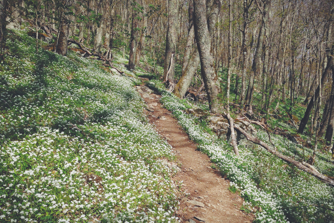
Today was a beautiful day for hiking, so I took my time meandering through the mountains of southern Virginia.
My alarm went off (again in my headphones so as to not disturb anyone) at 5 AM. I snoozed for a few extra minutes before waking up and quietly breaking my tent down. Despite what you might think, it's incredibly hard to do so in an area with 15 other tents closely packed together when every piece of equipment is made of lightweight and subsequently loud fabric. I took my time, brushed my teeth and filled my water bottles in The Place's kitchen sink, and hit the road. Everyone else was sound asleep when I walked off the property at 6. I walked down the middle of Main Street (because you can do that at dawn in small towns) and stopped in at an Exxon station to see if they had bagels- the one item I couldn't find at Dollar General- which they didn't. I ate a Pop-Tart and drank a Coke sitting on the curb in front of the filling station, and chatted with a hiker named Comfortably Numb. He's a name I know from the shelter log books, and is a 3x thru hiker who's messing around on the trail as he transitions between jobs. We gathered up our stuff and walked out of town, another town where the A.T. literally is the sidewalk, until the trail turned off into the woods. He's blue blazing the trail so he went another way when we split.
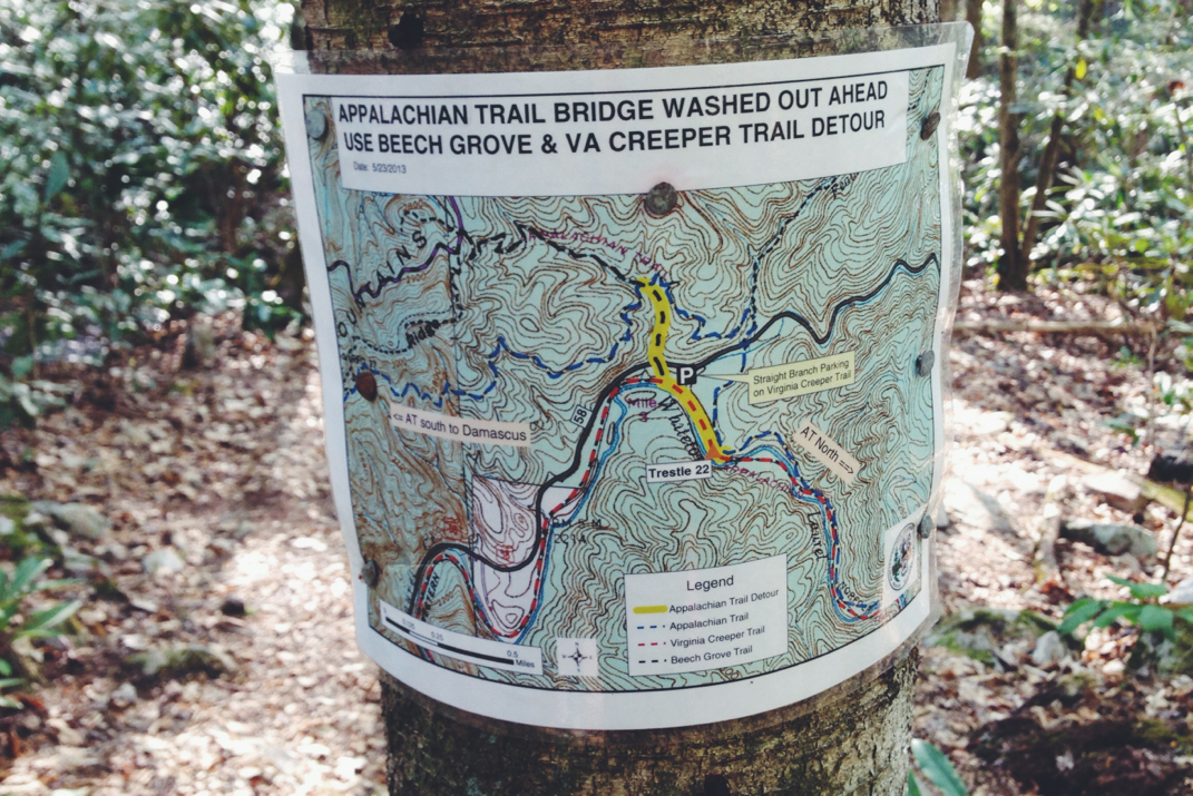
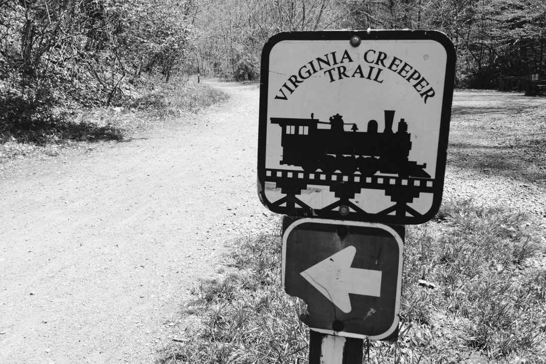
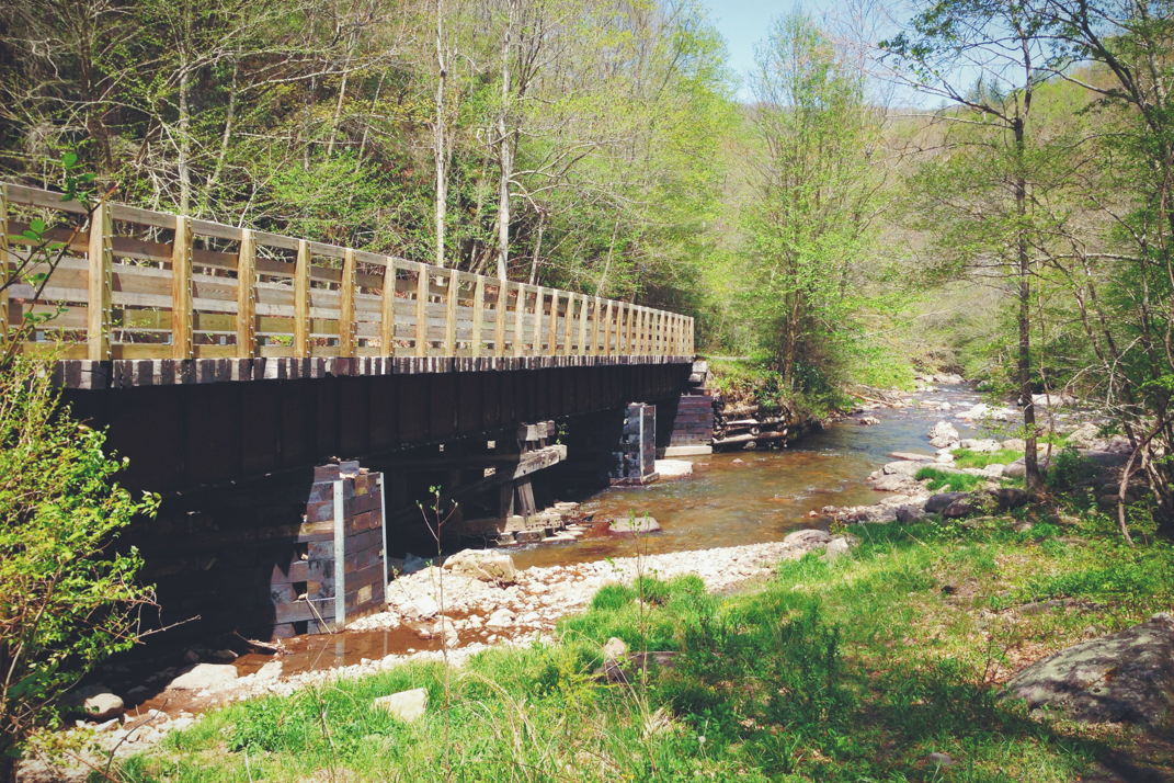
The departure from the paved road in Damascus led the trail to climb an absolutely unnecessary 1,000 feet in elevation (unnecessary due to the fact that it immediately dropped back down 1,000 feet to the same road it parted from 3 miles before). The heat and humidity moved in quite early, and I was very happy during the times that the trail remained on the backside of the mountain and out of direct sunlight. Towards the base of the mountain, for the first time on the trail, I also encountered an official detour from the normal route. Apparently in the poor weather this spring a large pedestrian bridge got wiped out making a river impassable. Via the detour the trail crossed over US Route 58 and entered into a state park that's home to river fishing and a pedestrian walking/cycling path. After a half mile or so the Trail ducked back into the woods, taking a more challenging path of rocks and ascents, yet still somewhat paralleled the pedestrian path, known as the Virginia Creeper Trail. They crossed paths repeatedly, at one point sending me back in time with an exceptionally nostalgic smell. It took me a while to come up with a way to describe it, so here it goes: points of the Creeper Trail smell the same as when you were a little kid, walking down the train tracks on a hot summer day throwing stones or horsing around with friends. That scent of hot tar or sealant... it really threw me for a loop. After spending some time in the woods, the Appalachian Trail actually walks on the Creeper Trail for almost two miles. The trail is relatively flat, a packed stone pathway 10 feet wide or so, that carves between mountains alongside a quick paced and at points white-capped river. There are multiple cantilevered 'piers' of sorts for fisherman to stand on and fish into the river. Many cyclists rode by me, some with families and others just leisurely riding along. Crossing on a very large bridge over the river, I realized why it reminded me of childhood summer days on the train tracks... The Virginia Creeper Trail actually used to be a train route, and the 'occasional' smell I was reminiscent of was at bridges, which were the originals built for trains that had been repurposed. I'm so observant, as you can tell. In talking to a local I learned that the Virginia Creeper was actually the name of the exceptionally slow train that ran through this area, hauling logs to larger cities from the mills.
Ducking back off the Creeper Trail, I climbed for just under an hour to the Lost Mountain Shelter. I arrived there at 1300hrs or so, about 15 miles into the day. Remember: Sunday's speed marathon had a purpose, and now I'm back to wandering at a leisurely pace. I ate a quick lunch in the shade at the shelter and spoke with a husband and wife and their friend, all in their early sixties, who are three members of a 12+ member thru-hike group from 1996 who still go out section hiking together, and meet up once a year around the country just to see each other again. I hope to maintain trail friendships like that. While normally I'd be happy with a 15 mile day, I didn't like the idea of being done with nearly 8 hours of sunlight left. I wrote in the shelter journal for Whitey and Moe telling them I'd miss them and they were more than welcome to keep walking to catch up to me for dinner, despite having a good idea that neither would. I departed the shelter and a mile or two down the trail crossed over another state road. These. Roads. Make. Me. Indescribably. Miss. Driving. Perfectly paved, sweeping and banked corners, carving through the mountains...... I can't wait to drive again. Why are there no roads like this up north?! I digress. The trail climbed for a while before another tricky cow-proof fence gate appeared, leading the trail through a gorgeous open field with a dozen or so black cows absentmindedly hiding from sunlight in the shade of some low trees.
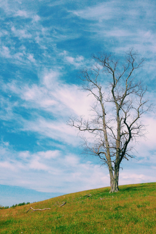
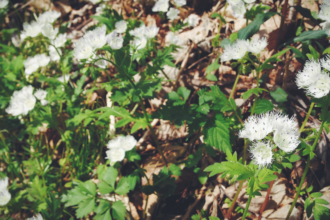
As strange as it sounds, I spent a long time in this field. There were so many brilliant trees waiting to be photographed that I just wandered and snapped pictures. It sounds strange, and I'm very aware of that, but there are times in life where I think a photo of a tree just speaks volumes to the life it's lived. I found a few favorites, and then continued on, stopping shortly to speak with two older guys section hiking this region. I really enjoy talking to other hikers about their trips, and after a good conversation I continued on. A challenging 2,000' climb over 4 miles brought me through some amazing scenery before opening up to the bald at Buzzard Rock just before the summit of White Top Mountain. On the climb up I walked through acres, literally miles, of very young Queen Anne's lace. It was absolutely beautiful to look at as I walked, reminding me of Dorothy & the Tin Man walking through the poppy fields on their way to Oz- almost an enchanting scene. I continued on, not stopping due to the hundreds and hundreds of bees swarming over the plants, busy at work with pollinating. At times it sounded as if I was in an open cockpit of an early military prop plane, being dive-bombed by Kamikaze bumblebees. How's that for a visual? I can thank them, however, for keeping me at an accelerated pace as I climbed the mountain in fear of being attacked by the little buggers. At last I escaped their constant threat (there probably was no threat, they seemed impartial) into the open grasslands of Buzzard Rock, turning around to see brilliant panoramic views of Southern Virginia. Snapping a few photos and soaking up the sun in the cooler air of the 5,000' elevation from atop the second highest A.T. peak in Virginia.
Another mile of hiking brought me to a primitive campsite on the opposite slope of the mountain. I'm camped along with Comfortably Numb and Crankster, the latter of whom is a section hiker who took a few months off from work as a traveling ICU RN to finish her hike to Maine. Dinner was a delicious Spanish rice dish, and I got into my tent shortly after finishing. Tomorrow has some exciting stuff in store, and I'll look to make it another 20+ mile day.
One day at a time.


 RSS Feed
