
Day: 48
Day mileage: 29
AT total mileage: 845.5
Time: 11 hours
--
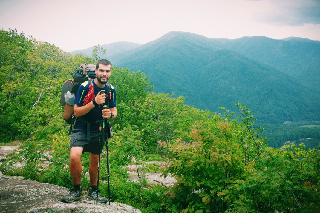
The summit of The Priest mountain was the last time the Appalachian Trail will be at an elevation of over 4,000 feet until Vermont. As a hiker of said trail, this is exhilarating news. Let's be honest though, you don't think the trail would let me off that easily, do you?
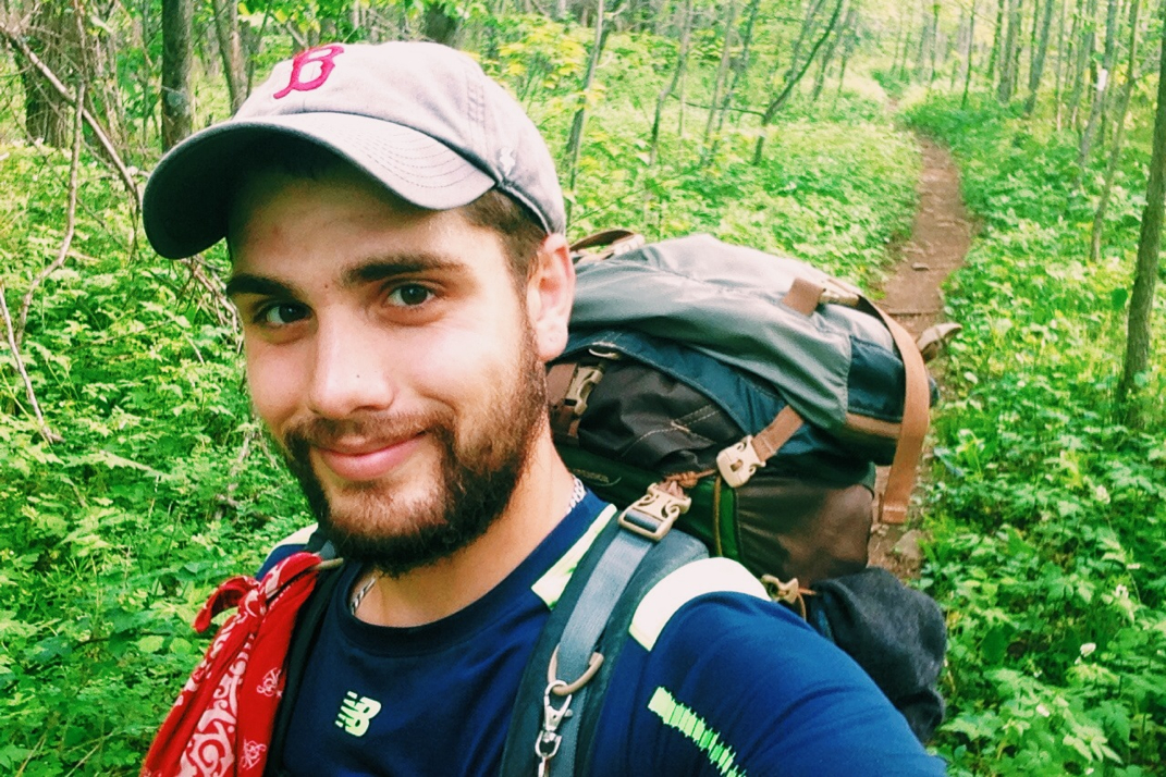
I slept horribly last night. Around 12:30 Fletch woke up, stumbled out of the shelter, and began vomiting incessantly for a good minute or two. The combination of this and the bright glow of his LED headlamp made it hard to stay asleep, and as a result I was awake until almost 3. This made it exceptionally hard for me to warrant getting out of bed when Pneumo checked to make sure I was alive at 6 AM. I was undoubtedly reluctant to wake up, let alone get out of my warm sleeping bag, let alone put on my shoes and hike the long day we'd planned to do. Alas, my job out here is in fact to walk a distance every day so I woke, rose, and donned my shoes. In packing up I frantically searched for my Sawyer Squeeze water filter, which I ultimately discovered had been accidentally kidnapped by a hiker named Valkarie as she packed up her cookware the night before. Tragedy averted. Fletch set up his tent in the middle of the night and was asleep when I left the shelter. I assume he has Norovirus or a 24-hour bug that many hikers have gotten. I'm grateful that he didn't stay the rest of the night next to me in the shelter, but I feel bad for him. There's probably not much worse than being disgustingly sick in the middle of the woods all while being pretty much entirely alone. I wish him well.
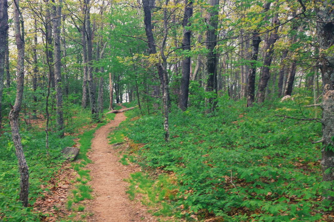
Pneumo and I hit the trail around 7:30, with a smooth hike for the first few miles. Meandering up and down for a while we made an ascent of a few hundred feet before dropping into Cash Hollow gap where we ran into 5 hikers being dropped off for a 'slack pack'. In thru-hiker lingo, slack packing is when a hiker's bag is transported by car between two sections of trail for them, allowing them to hike the A.T. without the weight of their bag slowing them down. While some view it as cheatin, I totally see where the appeal comes from, especially with the terrain we faced today. Climbing out of Cash Hollow, the trail ascended a thousand feet to Priest Shelter before beginning a very long, very steep descent. Priest Shelter is a bit of a landmark, as the shelter log is more comical than any other on the trail. Instead of normal journal entries, hikers 'confess' to sins of the trail. Some such confessions include not digging a full 6" deep when digging a cathole for using the bathroom, while others confess to only having hung a handful of bear bags (to keep food from being stolen by bears) while camping. Some are too, shall we say, colorful... to post for such a wide Internet audience. Anyways, we stopped to snack at the shelter and read the log before beginning the 4 mile descent of over 3,000 feet down into the valley below. It was around this point that we crossed from the Jefferson National Forest, which we'd been in since the Greyson Highlands at mile 490, and entered into the George Washington National Forest. As I mentioned before, the summit of The Priest would be the last mountain over 4k feet until Vermont. Per usual with the Appalachian Trail, there was still some fun in store.
The descent off Priest was exceptionally steep, comprised of many rocks that required some careful attention with every step. After a mile or so of this it eventually became the expected switchbacks, although steeper than normal. Due to the lack of sleep the night before, I stopped at one point just to close my eyes for a few minutes. Upon reaching the bottom of the mountain the trail crossed a suspension bridge and began an 6.3 mile climb that would net nearly 3,500 feet in elevation gain, with the final peak of Three Ridges mountain measuring in at 3,970 feet... See what I meant about the 'fun in store'? No more mountains over 4,000 feet, but immediately after that stat we'll have you climb a 3,970 footer. Just great! Pneumo and I had reached the top of Three Ridges mountain in 2 1/2 hours total, not bad for 6.3 miles of straight climbing. Exhausted, we sat at the summit with hikers named Cornwall (from England) and Cowboy (from Texas). Having never met them before, I made conversation with Cowboy and learned that after the hike he's using his GI bill to move to Key West, buy a boat, and become a dive instructor. His plan is to live at a slip in the harbor on his boat and take tourists out. Looks like I'll now have a friend in Key West. I congratulated him on following through with his biggest dreams, as I think that's a rare thing in this world. I also added in that his story reminded me of a Kenny Chesney song, to which he laughed. While we were up at the summit we were treated with yet another military jet fly-by. Thank you to Andy for the explanation of yesterday's mountainous 'buzz the tower' as Maverick from the film Top Gun would say.
Coming down almost 1,000 feet from Three Ridges, Pneumo and I stopped at Maupin Field shelter for some snacks before carrying on the 11 miles left in our day. The campsite we had discussed the day before was at mile 845.5, meaning a long day when the elevation changes were factored in. We pressed on, and the trail was fair for the most part. A rocky section led me to a few minor trips, and my right shin starting showing discomfort. We slowed drastically due to this, and before long I started wondering if we were going to make the campsite we intended on. We crossed through fields and along a freshly paved section of the Blue Ridge Parkway at which point Pneumo teased me about driving on it. We spoke frequently throughout the day about plans for lunch in town tomorrow, as our intention is to hitchhike into Waynesboro for a small food resupply. As I've mentioned before, food is a common topic out here. We talked about family, life experiences, music, and lots of other things as the day and mood mellowed out. We were both getting tired by 2000hrs, stopping to get water along the Parkway before pressing on the last 2 miles to our intended campsite. As we sat on the side of the road filtering water, the driver of the slack-pack truck from this morning drove by and doubled back to check on us. Butch, the driver, is a local who hosts hikers and was assisting a group slack pack through the area. A very nice guy, he provided us with Gatorade and wished us luck on our hike before taking off. Pneumo and I donned our headlamps and pressed on the two miles as dark settled over the mountains and the sun disappeared behind layers of ominous clouds.
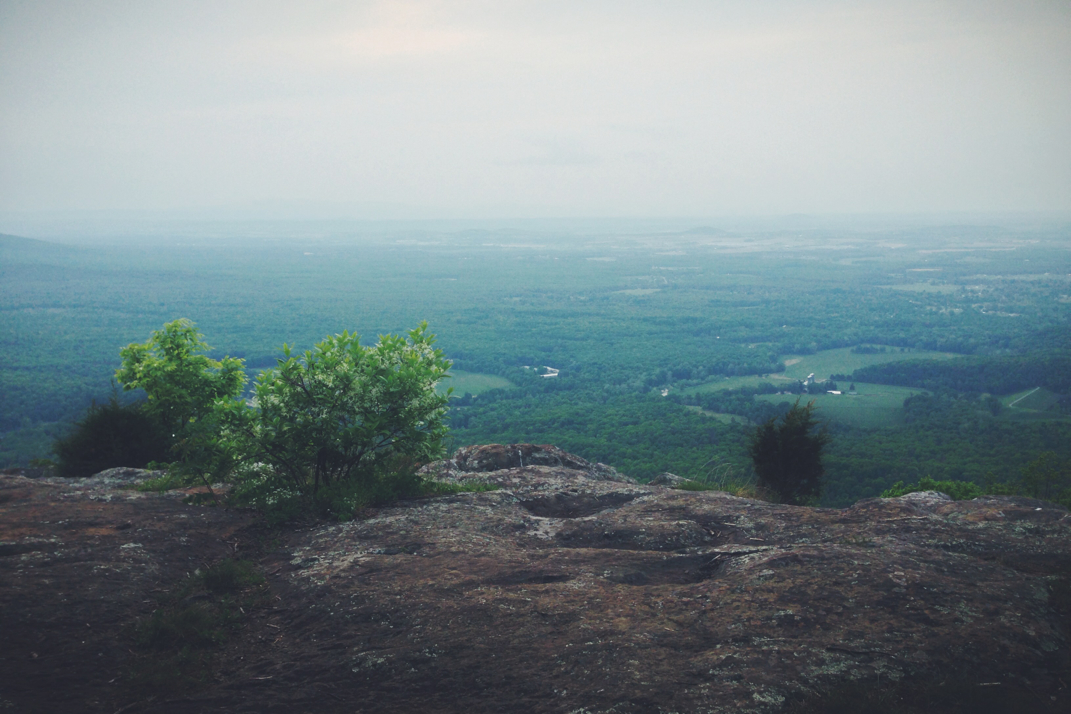
Having not night hiked since the Smoky Mountains, I forgot how strange it is to rely on LED lamps for travel. We pressed on, climbing over rocky sections, steep hills, and through dark forests as became increasingly frustrated about starting to sweat again. Pulling into the campsite at 2100hrs to find a half dozen tents (belonging to the slack packers) set up. The sky is cloudy but the lights of the small towns and dispersed cities are visible below. I cooked dinner quickly and set up my tent as small mice scurried around looking for food remnants. Finishing dinner, I climbed into bed, tired and ready for sleep.
As I finish typing this, the ominous clouds have followed through with their ever present threat of rain and thunder. Hopefully it will blow over quickly, and we'll be left with a day suited for hiking tomorrow. The plan as of now is a quick hike of the 12 miles to a road that allows hitchhiking to Waynesboro (hence the mileage today- to make tomorrow morning easier) at which point we'll visit the YMCA for a free shower, the laundromat, an all you can eat pizza place, and the Dollar General for a cheap resupply. After a few hours in town we'll head back to the trail and enter into Shenandoah National Park, the beginning of the end of Virginia. With less than 173 miles of this state left, hiking the Shenandoah's will last right up until the state line with West Virginia, and I'll cross over the halfway point of the Appalachian Trail.
Music and bedtime for me. Dawn will be here depressingly soon, but there are places to see and worlds to explore. One foot in front of the other.


 RSS Feed
