2180miles
  • Home
  • Adventure Blog
  • Overland
    • Meet The Jeep
    • Mods & Installs
    • Overland Gear
    • Trip Reports & Videos >
      • Allagash Winter 2019
      • Greece Adventures 2019
      • Overland Expo East 2018
      • Allagash Wilderness 2018
      • Trans-Canada Overland 2017
      • QB-5 Adventure 2017
  • Long Trail
    • Trip Summary
    • Photojournal
    • Hike Statistics
  • Appalachian Trail
    • Trip Summary
    • Photojournal
    • Gear Talk
    • Hike Statistics
    • Financial Planning
  • Bicycling America
    • Trip Summary
    • Photojournal

The Presidential Range

7/10/2014

3 Comments

 
Day: 97

Day mileage: 22

AT total mileage: 1,858.4

Time: 10.5 hours 

--

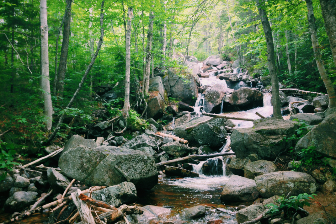
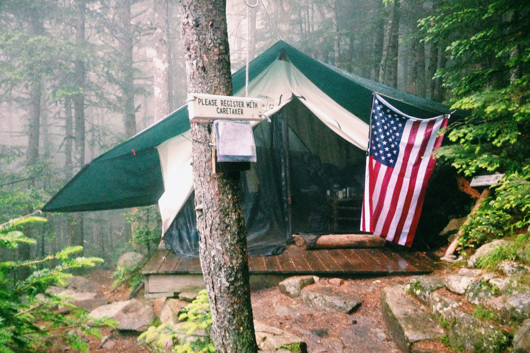
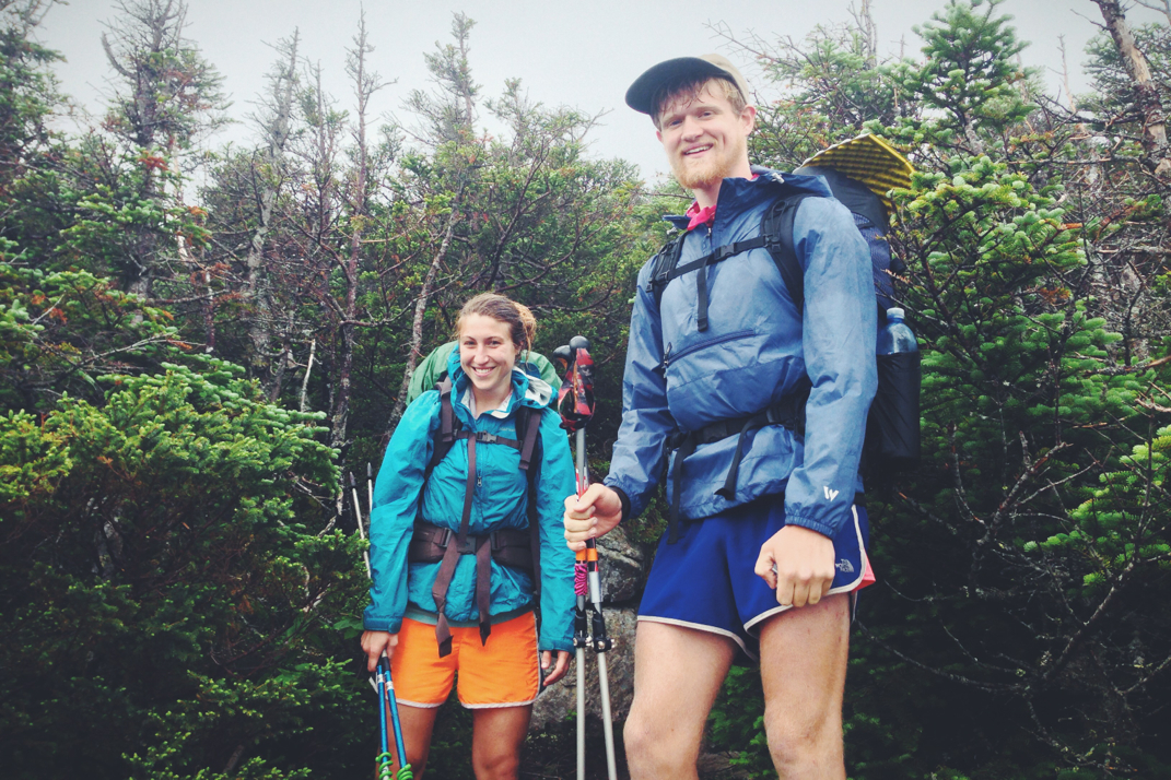
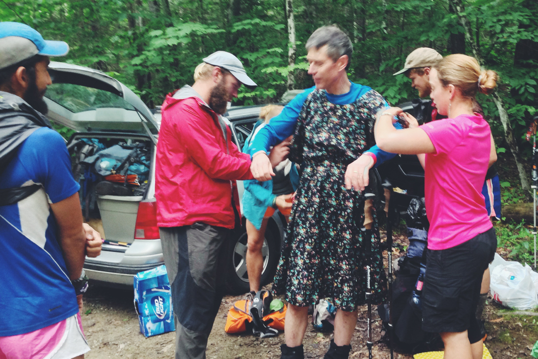
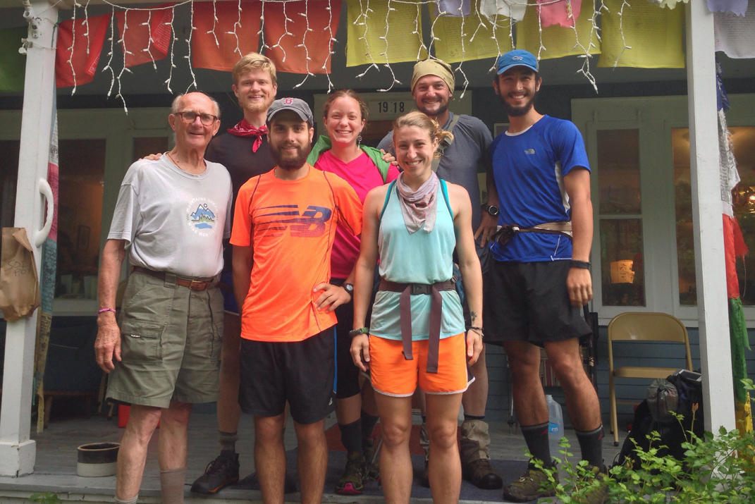
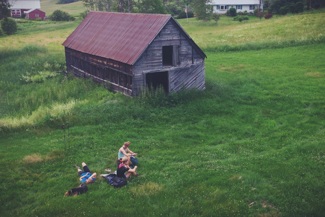
Shortly after midnight an incredible amount of rain stormed through the Ethan Pond area, pummeling the tin roof of the shelter like 1,000 children learning to tap dance.  Despite some drips from the ceiling, I fell back asleep quickly and awoke again a few hours later as the abrasive SOBO hiker began packing up. I'm not sure why, but despite the silence that the rest of us shared as some continued to sleep, she loudly began talking about her hike and her adventures through Maine. I got up and quickly packed, doing my best to avoid spending any more time around her than I had to. We ate breakfast at the designated cooking area, an AMC attempt to cut down on beer activity in the shelter areas. For whatever reason we had another late departure morning, leaving the Ethan Pond shelter around 9:30 and headed northbound. 

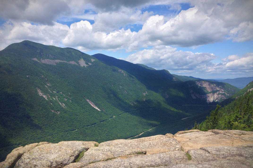
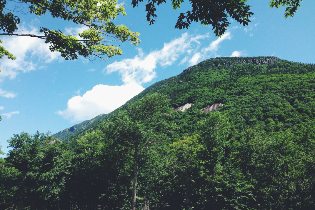
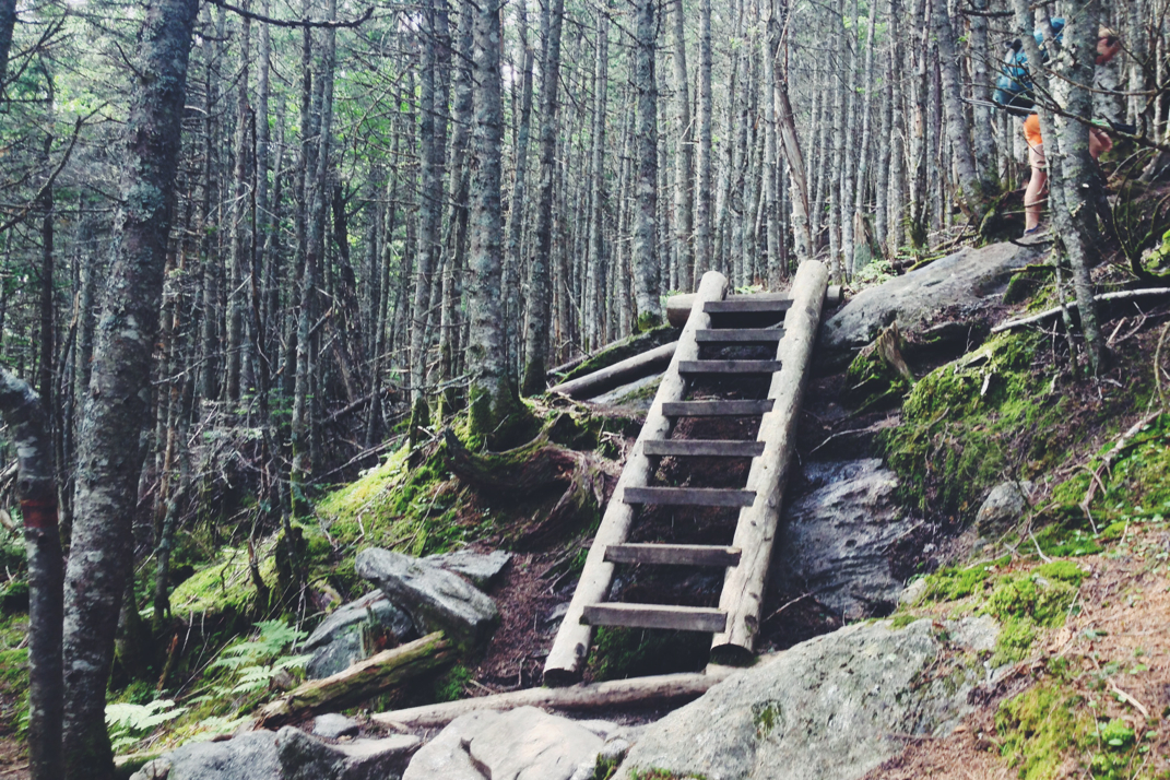
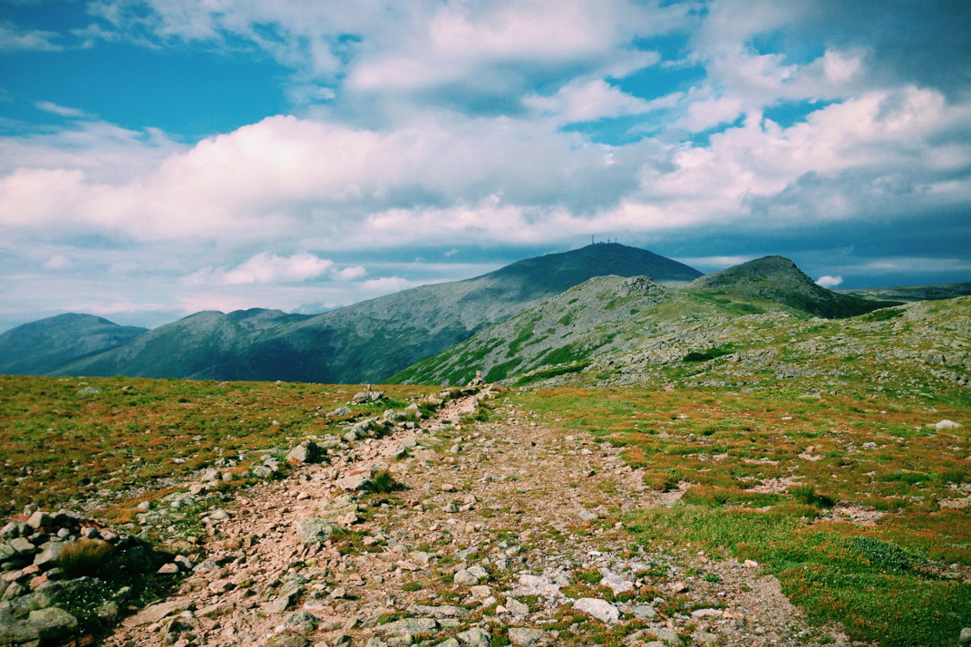
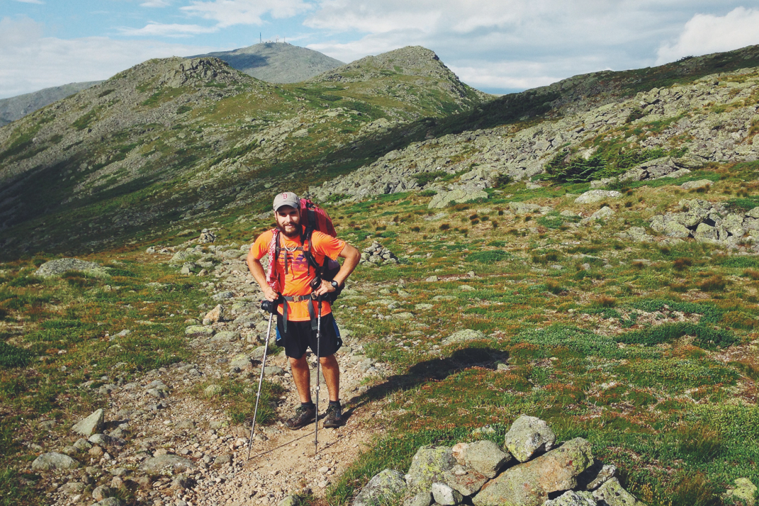
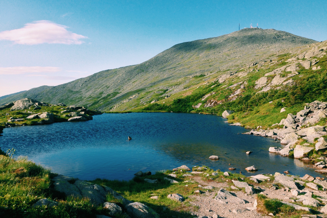
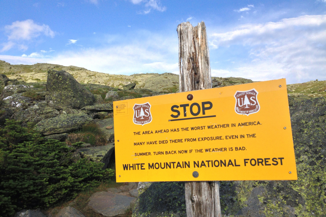
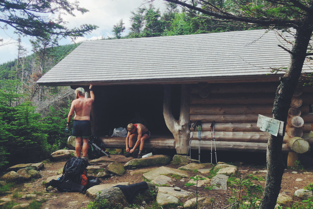
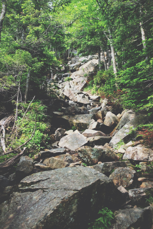
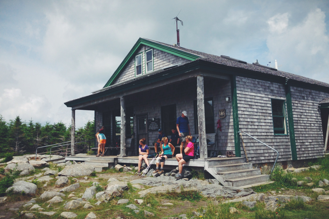
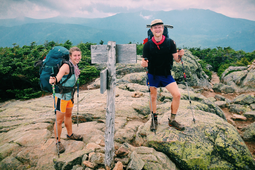
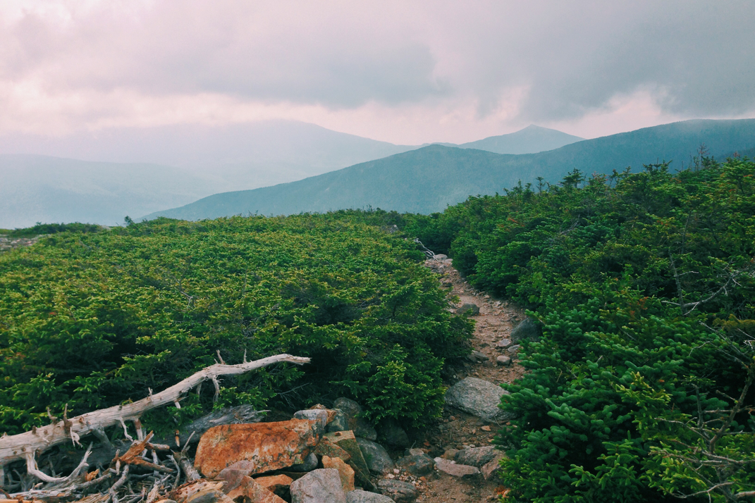
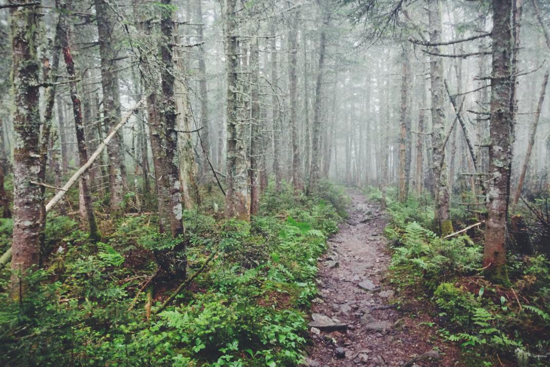
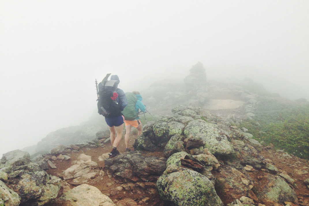
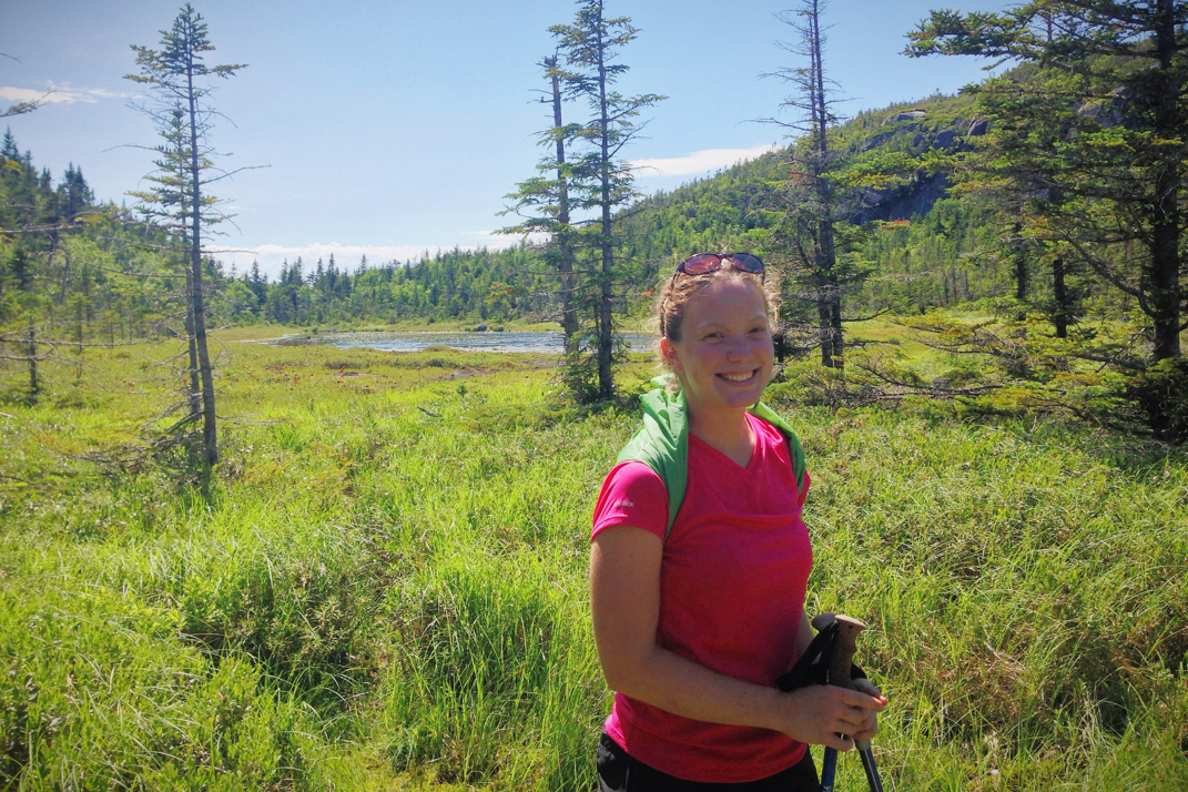
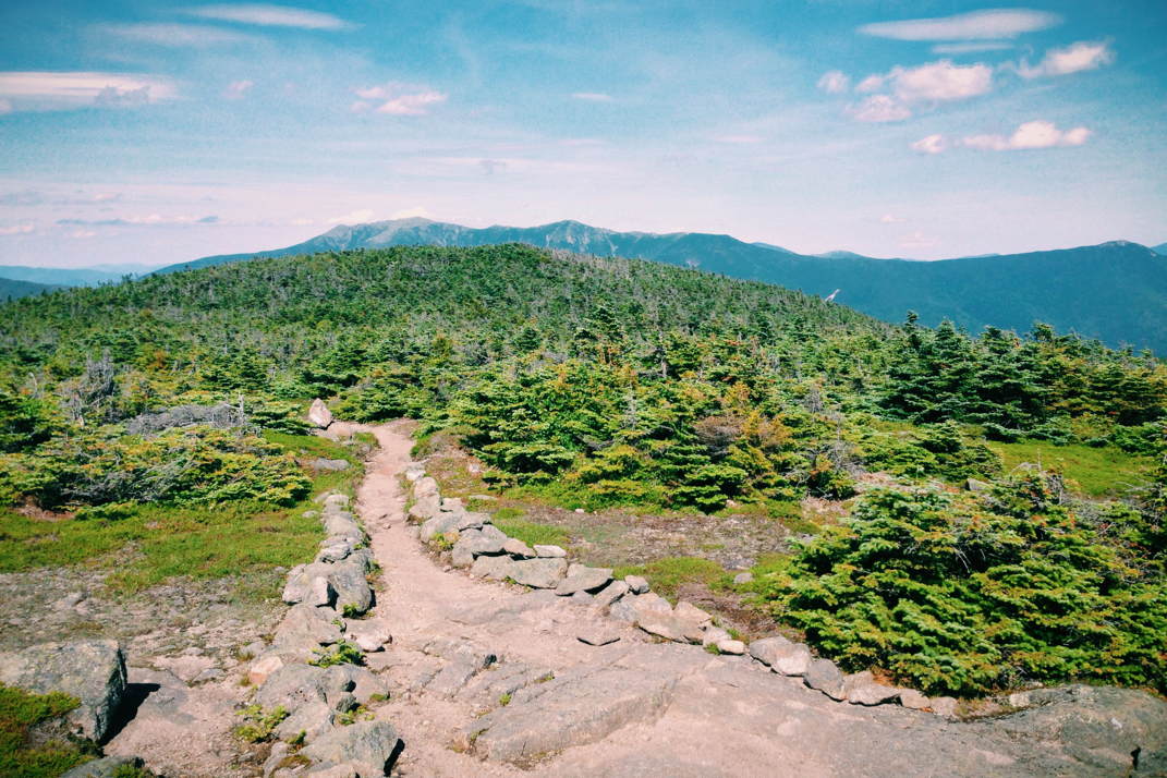
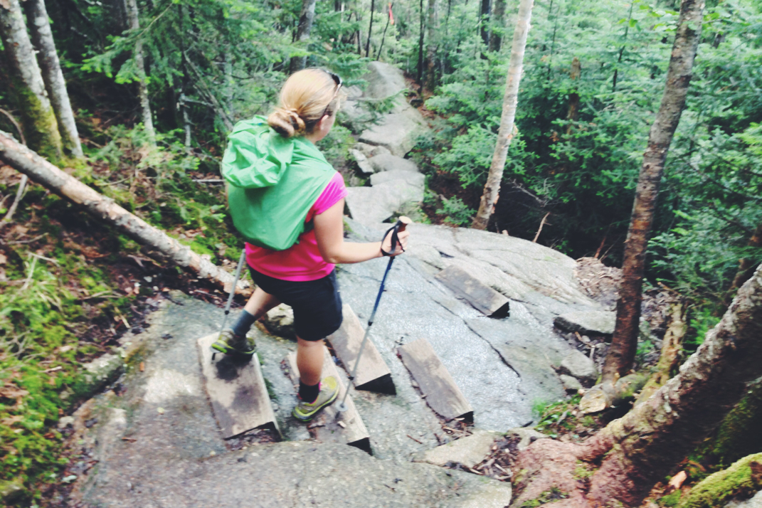
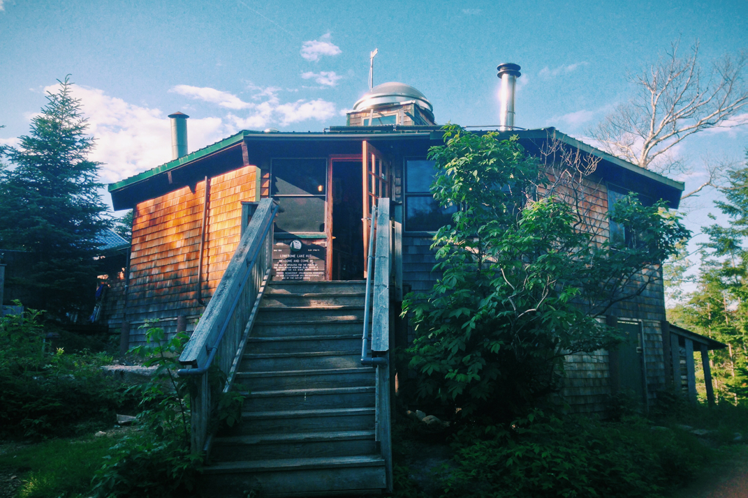
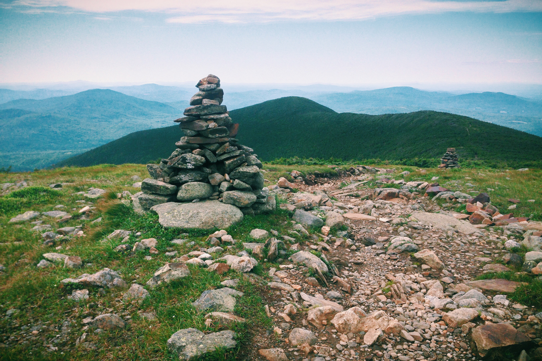
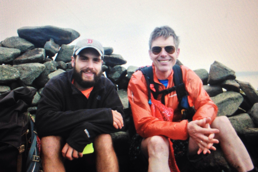
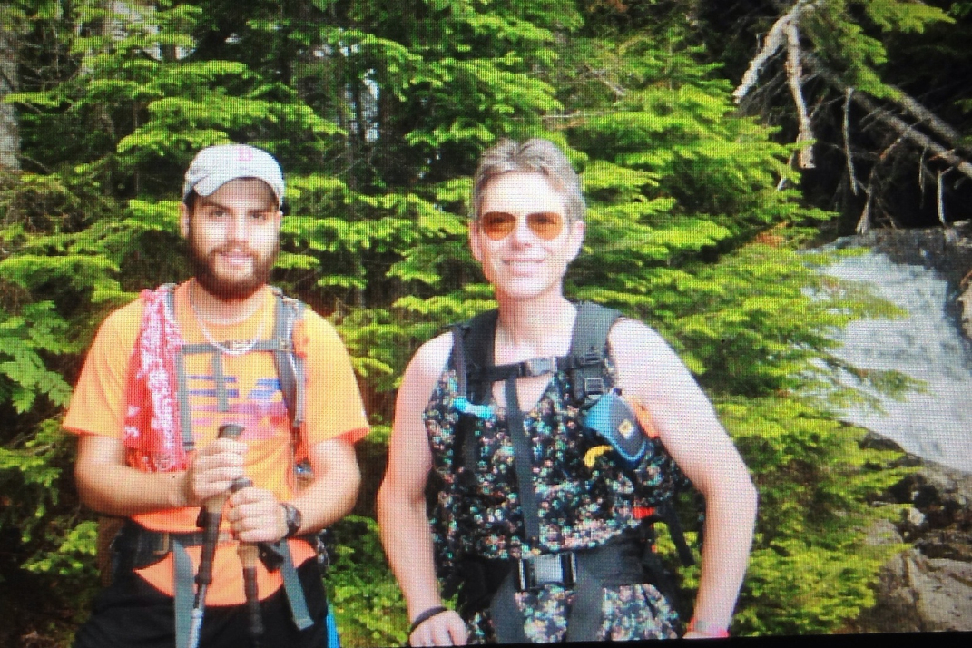
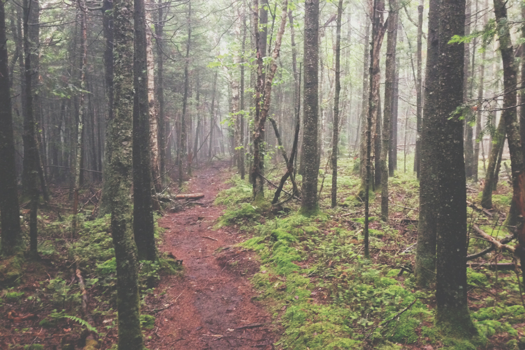
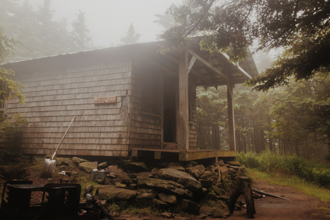
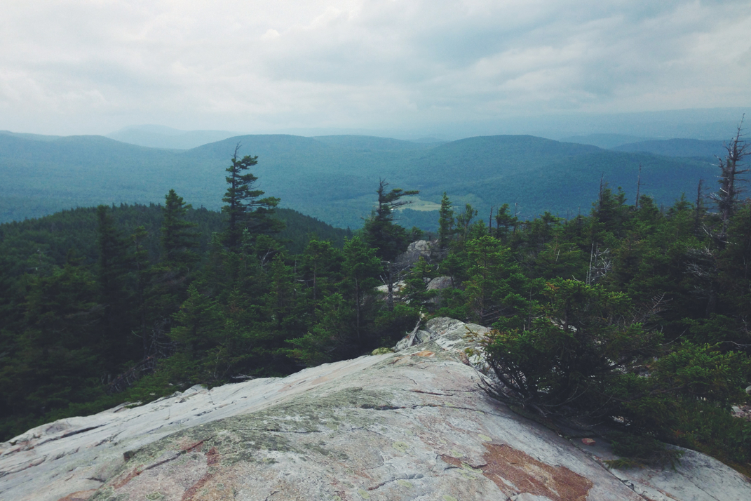
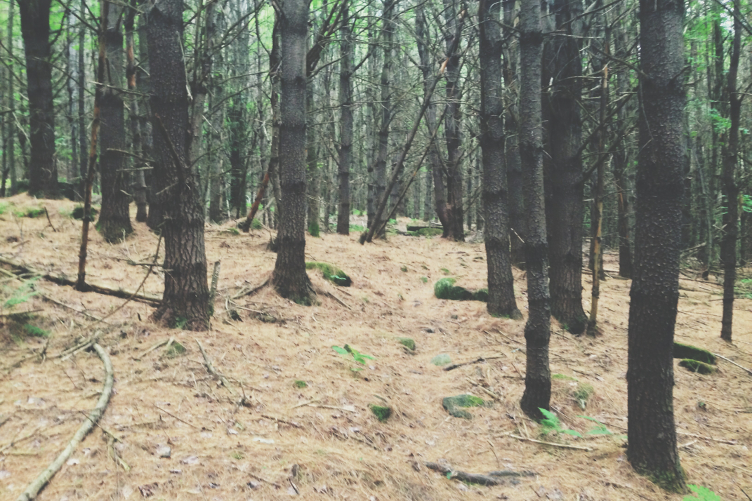
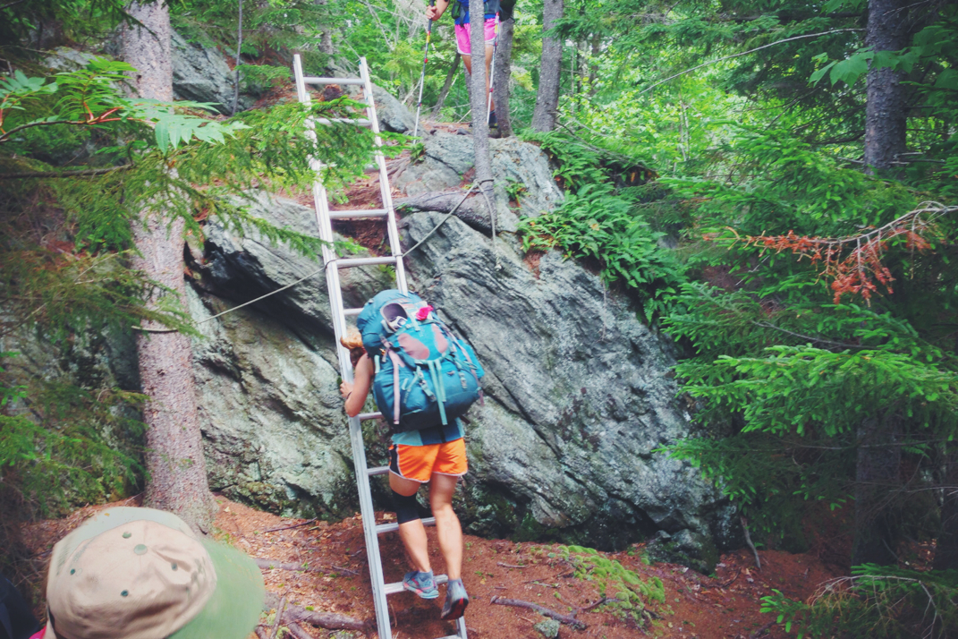
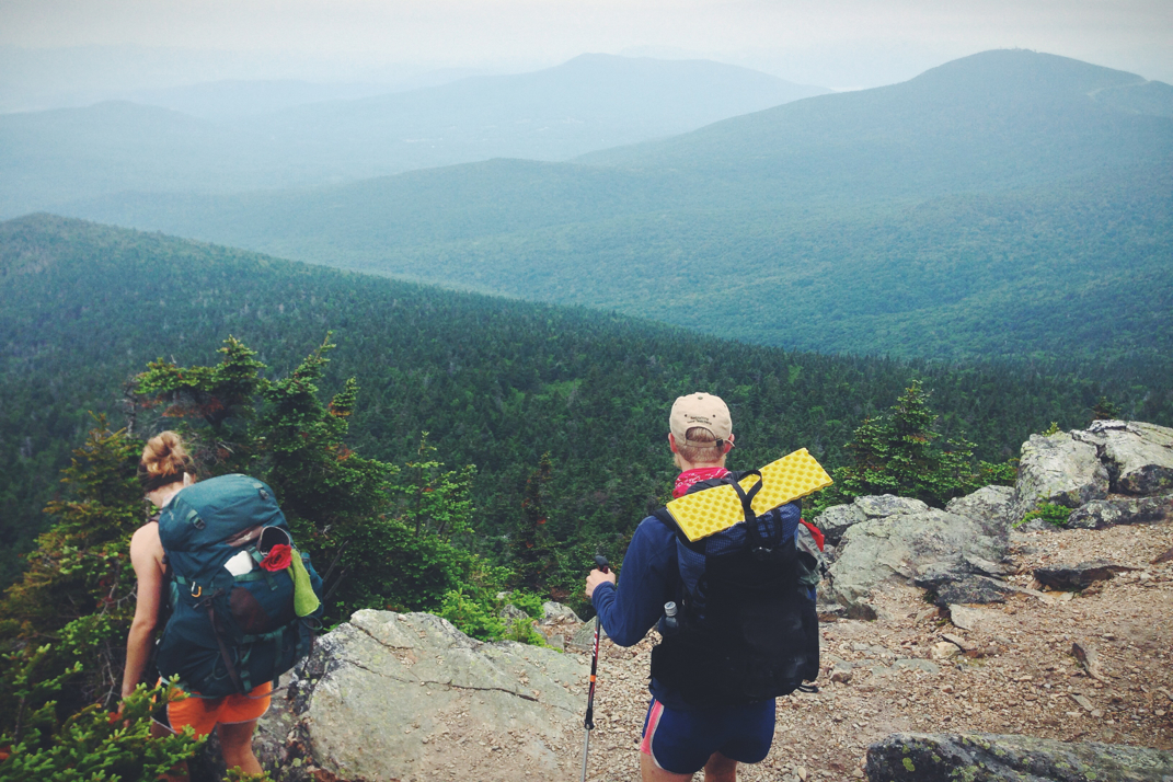
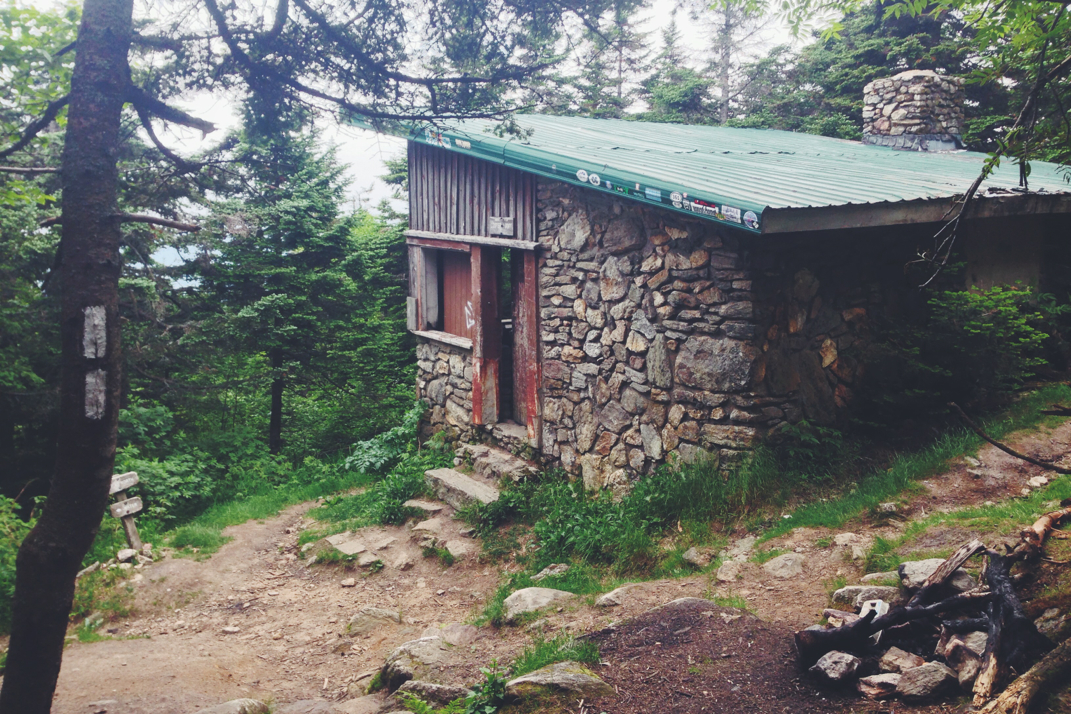
The initial part of the day would be comprised of a 3 mile drop out of one mountain ridge, crossing VT 302 and heading up the other side towards the summit of Mt. Webster.  The climb was fair but steep, a demanding ascent that netted gorgeous views from the Webster cliffs overlooking the gap below. It was difficult to hike at any decent pace, as I constantly turned around to stare out at the view. The upper portions of Webster were quite challenging, demanding hand-over-hand rock scrambles on multiple occasions.  Crossing over the peak we turned towards Mt. Jackson at an elevation of 4,052 feet, turning downhill and pushing on towards the AMC Mizpah Spring Hut. It was shortly before the hut that I got cell service and fought my phone to post the last two days of blogs. Hurrying on to catch Santa and Legs at the hut, we ate a quick lunch and pressed on for the summit of Mt. Washington.  With 6 miles to go including the summits of Mt. Pierce, Eisenhower, and Monroe, Santa pressed on alone hoping to make it to Washington's summit visitor with enough time to get a hot dog and bowl of chili that many hikers feast on during their Presidential Range traverse. Legs and I hiked at a bit of a slower rate, hiking the 3 peaks before the final ascent of Washington, stopping for a few minutes at the famous Lake of the Clouds hut to refill water. Packed with paying customers staying in the hut, we talked with two thru-hikers for a short while before hiking on. The 0.8 miles from the hut to Washington's peak would be a steep and rocky traverse in a stiff wind, constantly pushing me around and making some steps very difficult. Luckily the expected storm system didn't seem present in the sky, and nobody at the Lake hut encouraged us to not summit, so we hiked on into gorgeous and windy skies.  

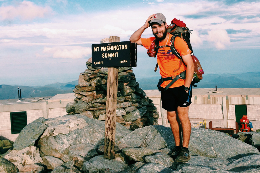
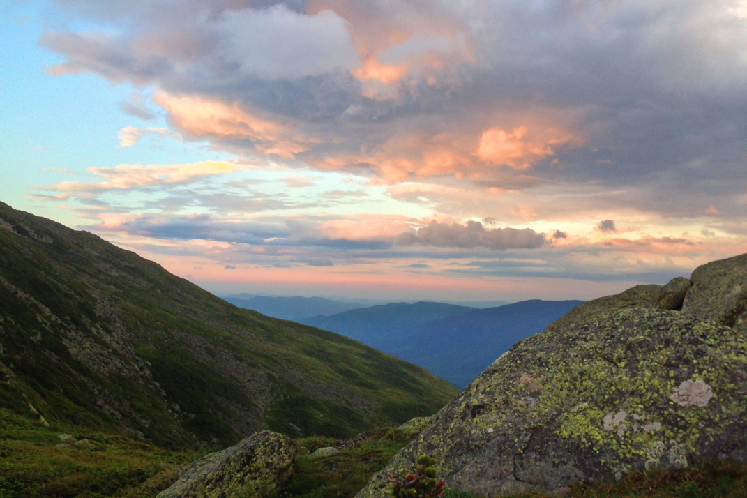
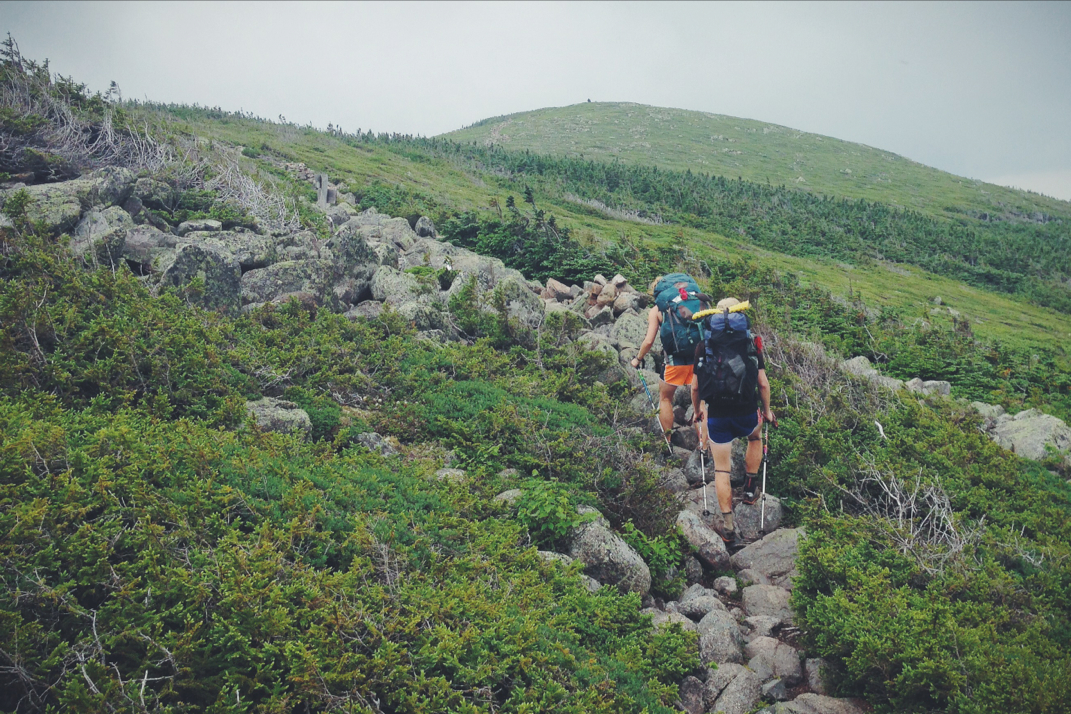
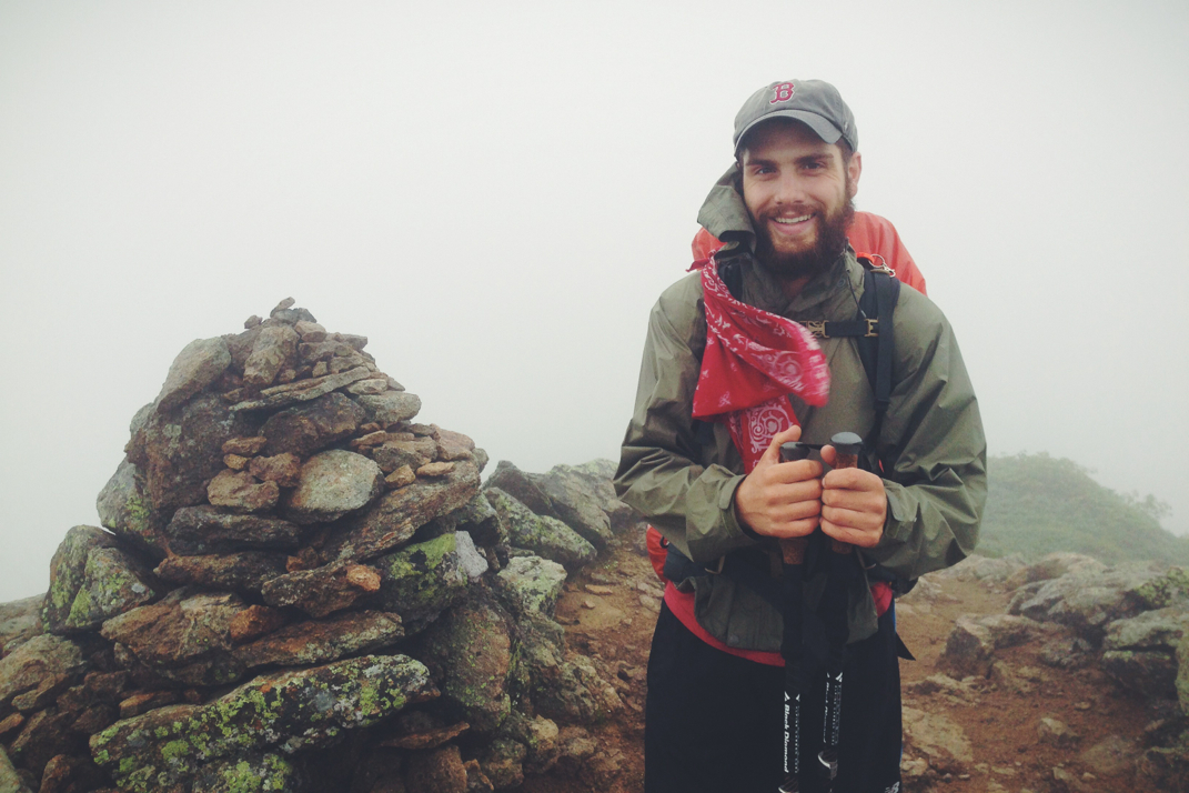
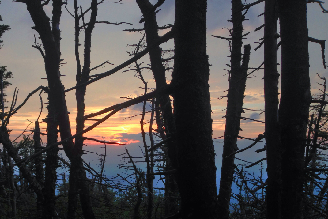
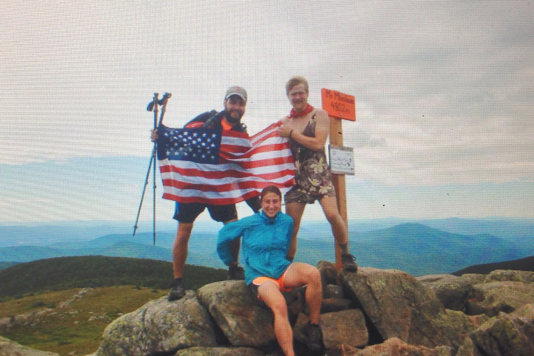
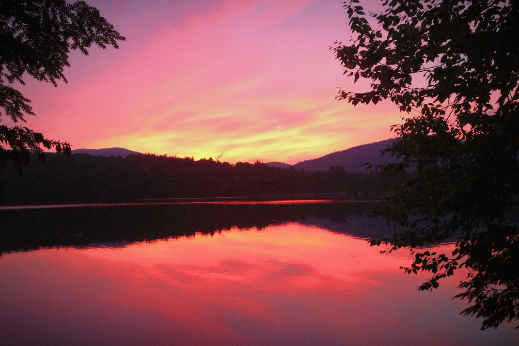
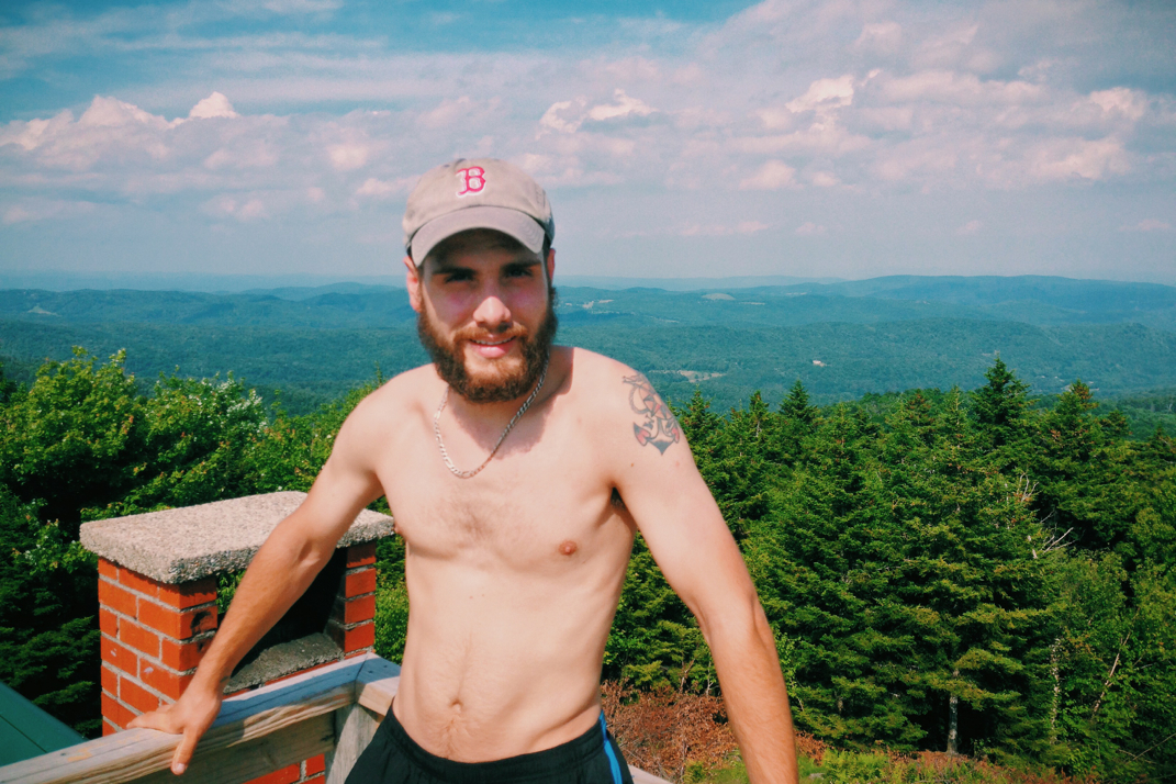
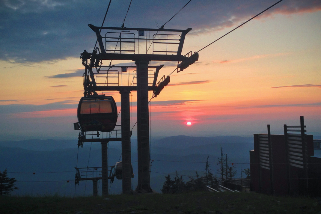
We arrived atop New England's highest peak, the second highest summit on the Appalachian Trail, shortly after 1830hrs. At 6,288 feet above sea level, the wind was insane, yanking my Red Sox hat off my head more than once. The summit was deserted as the stores had all closed an hour earlier, and after taking a few photos with the elevation sign, Legs and I headed down  the opposite side of the mountain and set our sights on Madison Springs hut located another 6 miles north on the trail.  With 16 or so miles under our belt for the day already, we wanted to slow a bit but maintained a steady pace as the sky began filling with darker clouds. The sun set in a gorgeous fashion as we crossed between the summits of Mt. Clay and Jefferson, both well over 5,000' in elevation, with the sky becoming exceptionally dark as we descended the back side of Mt. Jefferson. You're all aware that night hiking isn't my favorite activity, but this was a totally different kind of night hike. The long climb up Mt. Adams was exceptionally rocky and jagged, making for a great traverse in the pitch black. With 2 miles left to the hut we continued on, fighting against the steady wind, searching with my headlamp to retain sight of the trail. It is unbelievably hard to follow a trail in the dark when it is comprised solely of boulders with no real markings, so I spent half my time searching the darkness in front of me with my narrow beam of light for some marking on which to base my trajectory. We pulled into the hut after descending Jefferson to find the place pitch black. The time was shortly after 2200hrs, and everyone was asleep. We woke Santa up, currently asleep on the hut's dining room floor, to let him know we were alive and well then proceeded back outside to cook our dinners. Warm soup and pasta was an amazing treat in the chill of the night as occasional rain and clouds whipped quickly by the large moon, causing shadows to dance across the stone porch in front of the hut. 

We'll sleep on the floor of the dining room alongside Santa and Radio Man, as well as two southbound thru-hikers that we haven't met yet. Tomorrow will hold an unknown amount of miles, likely in the same range as today. I won't do a +30 day through the Whites, but a 22 mile hike over the Presidential range is nothing to scoff at, so I'll be proud of that. Being in a warm and wind proof building is amazing, and though we'll have to sleep quickly to be out of the way before the hut caretakers serve the paying customers breakfast in the morning, it'll be a good night of sleep. 

16 days to Katahdin. Onward & upward.

Texaco

Picture
Webster Cliffs
Picture
Picture
Picture
Picture
Headed for Washington
Picture
Picture
Picture
Holding my hat from the wind
Picture
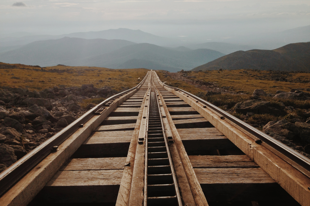
Cog Railroad up Washington
Picture
3 Comments

Gorgeous Day In The Mountains

7/9/2014

1 Comment


Day: 96

Day mileage: 14.4

AT total mileage: 1,836.8

Time: 6 hours 

--

Service has been horrible. I promise I have turned off airplane mode at the top of every peak to try and post the blog, but there isn't much by way of cell reception up here. Also, while we're in the realm of disclaimers, please don't judge my mediocre mileage through the Whites. Aside the terrain being more consistently difficult than any other region on the trail, I'm also choosing less miles to stay with the group I've spent almost a month with now. They have no interest in long mileage days, so Pneumo will always hold the 2014 record in my book for his 33 mile day through the Whites last week. Alas, I'll be leaving the group soon enough to push on for my July 26th finish atop Katahdin, so I'd like to spend as much time as possible with them before parting ways. I'm hoping Dorothy and Rocket will catch up, though I don't see it realistically happening. 

We had a delayed departure from the shelter, not for any particular reason other than laziness and the late arrival the night before. Hitting the trail around 9:30, we briefly passed by Bangarang before continuing on. The first mile of trail was exceptionally challenging, enough so to limit us to a pace of one mile an hour. The rain in days before had turned the steep and exceptionally rocky section of trail into a literal waterfall, and as we navigated northbound it was a tricky game of foot placement to not slip and fall or soak footwear. Cautiously we made the full descent from the shelter's location atop Mt. Garfield, the trail leveling off for a short while before beginning the climb up to South Twin Mountain. A half mile or so into the climb we came across the AMC's Galehead hut where we stopped for a quick bite to eat, sitting in the sun on the front porch alongside a half dozen weekend hikers. The climb from the hut was exactly 0.8 miles to South Twin's peak, with an elevation gain of 1,000'. It would again be a case of hand over hand rock climbing to ascend the mountain, but we were able to do it quickly, passing another half dozen hikers as we went along. The views looking back from South Twin's summit were unbelievable, and the sense of accomplishment in turning around and seeing Lincoln, Lafayette, and Garfield massively standing in the distance is a feeling no other section of trail has provided. We hiked on, beginning a very long descent to the Zeland Falls hut where we would ultimately have lunch. Some 6 and a half miles away, the descent was a combination of steep rocky sections, and smooth level terrain. Again passing many day and weekend hikers, we had short conversations with all of them about the thru-hike before carrying on. 

We pulled into Zeland Falls around 1530hrs, eating lunch on the front porch and filling our water in their kitchen sinks. The huts are a huge source of income for the AMC, charging upwards of $140 a night per person to be fed and sleep on a nice bunk. They're light-years beyond a shelter, and the caretakers will cook each meal for you. We have the opportunity to do work-for-stays, cleaning or aiding with chores around the hut in order to stay for free and be fed. They typically limit it to 2 people, so with the three of us we'll likely stay in shelters or tent for the rest of the trip. Snacking and moving on, we continued the descent to a level area of trail that was a welcome change in my rocky and steep day. We cruised along at 3 miles an hour through this flat section of trail, reaching the Ethan Pond shelter shortly after 1800hrs. Ideally we were aiming for more than the miles we did, but after a horrible night of sleep Santa was practically falling asleep while hiking so we called it a day. Talking with the shelter caretaker, Em-bear, we set up shop and cooked dinner. 

One of the exceptionally cool things about this point in the trip is that we are starting to come across southbound hikers. While 93% of Appalachian Trail thru-hikers begin their hike in Georgia, a brave 7% begin in Maine.  Facing Katahdin and the White Mountains first, it takes a stronger hiker who is more comfortable with isolation to attempt a SOBO hike. They usually begin in early June to mid July, finishing in Georgia between November and January of the next year. Regardless, we've started seeing SOBO hikers, and it's quite interesting to hear their perspective. Most we've run into started in the first week of June, and are now 350 or so miles into the hike. Most of them are wonderful and excited to be hiking, but the woman in the shelter this evening hiking SOBO drove me up a wall. I don't mind input from hikers who have traversed sections I haven't done... But this woman asked when I planned to be done, and upon hearing the fact that I'll summit on July 26th she proceeded to inform me that 'There's no way you can hike Maine in 14 days. No way. Not Maine. Maine's different. You won't be able to do it.' It bothered me to no end. I'm a goal-oriented, come-hell-or-high-water kind of person. I've hiked this far in 96 days. To be told by someone who has completed only one state of the Appalachian Trail, some 11% of the total trail, who only has the ability to say 'I've been through Maine'... Blood pressure built.  It took some serious tongue biting to refrain from getting exceptionally frustrated towards her, but Santa (equally frustrated) distracted me with conversation. 

We'll spend the night here, hopefully staying dry from the pending storms. I'm hoping that we have a decent day tomorrow to complete the Presidential traverse, including Mt. Washington where weather is known to change on a dime. The long term plan is to be in Gorham, NH on Friday to then facilitate getting Naila back from my folks down in Boston. From there my goal turns to Katahdin and a summit of the final mountain of the Appalachian Trail. 17 days to go. 

Texaco

Picture
Picture
Picture
The trail
Picture
Picture
Picture
Picture
Picture
Picture
Comparing Shoes
Picture
Ethan Pond
1 Comment

Climbing In Clouds

7/9/2014

0 Comments


Day: 95

Day mileage: 10.1

AT total mileage: 1,822.4

Time: 6 hours 

--

Sleeping on a mattress in Chet's garage may have been the best night's sleep I've gotten in quite a long while. He's got a great thing going here. Previously an avid hiker, he was cooking a meal on his camp stove a few years ago when the full bottle of white gas exploded and caught his entire body on fire, simultaneously burning his house down. He suffered 3rd degree burns to his entire body and was kept in a medically induced coma for 8 months while his body recovered. He's now wheelchair bound, and operates the hostel for an income and as a way to stay in touch with a passion he no longer can participate in. The hostel is donation based, and is available only to thru-hikers... He even interviews you before you're allowed to stay, asking questions about what shelters you've stayed at and what peaks you've climbed in recent days. The nice thing about yesterday was that I didn't need to be awake early. I've had a recurrence in my knee pain, something that had gone away very quickly after I bought a pair of Superfeet insoles back at the NOC in North Carolina some 1,600 miles ago. Apparently the insoles have a lifespan of 1,000 miles, so I decided it was time to replace them. The outfitter in town wouldn't open until 9:30 so I had a bit of time to sleep. 

Waking up and packing most of my stuff, I headed to town with Santa and Rocket Girl. We stopped by the outfitter where I got green Superfeet insoles (previously had orange... not sure how this will affect me, but the store didn't carry orange) and a light rain jacket. A week or so ago I had accidentally left my Marmot rain coat drying at a shelter in Vermont, and upon realizing this my friend Kamikaze gave it to a faster hiker to bring forward to me just like I had carried people's gear forward back in my quick-paced Virginia stage. Unfortunately this individual decided he didn't want to carry it, and so the jacket is at the front desk of a hiker friendly hotel in Killington, VT. That does me no good in the Whites when there are 40 mile an hour winds and incessant rain. Santa and I bought same-model rain jackets that were on sale for $32, and should do just fine for the rest of the trip. We then visited the grocery store so Rocket could resupply food for the next few days, and as she shopped Santa and I sat in wheelchairs in the back of the store and talked. We went back to the house and packed up more, waiting for Legs and Dorothy to finish their shopping in town. When they got back Dorothy reluctantly announced his decision to zero at the hostel, an offer Chet made after informing us of am the massive storm system moving in across Vermont and headed for New Hampshire. Despite the threat, Santa, Legs and I held strong and packed up to head out. Santa took off early to attempt the 5 mile hitch back to the trailhead while Legs and I had a moment with Rocket. She has been concerned lately with the group splitting up, and the likely event that she and Dorothy won't catch back up to us. We hugged and parted ways, and Legs and  I headed for the road to attempt a hitch. It took about 20 minutes for a car to pull over, a silver Volvo station wagon that offered us a ride north to the trailhead. Driven by Rob, a sustainable construction designer who implements solar and eco-friendly systems into modern homes, we were dropped off at the trailhead quickly as it's an area he has hiked. We parted ways, thanking him, and trudged off into the pending storm. It couldn't have been more than 5 minutes after leaving his car that the rain began, as we stopped and put on waterproof gear. Unfortunately it was already 1500hrs, the latest I've ever started a day of hiking. The goal today wasn't to make any notable distance, but simply to keep moving out of town and put some kind of dent in the mileage of the Whites. 

We would climb some 4,000' feet out of Franconia Notch, likely the largest single elevation climb of the Appalachian Trail thus far, though I'm not positive. In the process we would summit four separate peaks. The first 3,000 feet of climbing occurred on rocky and rooted trails as the rain came down, stepping carefully before taking weight to ensure no slipping or injuries. Passing by an Appalachian Mountain Club (I'll also refer to them as the AMC) campsite, Legs and I spoke with a caretaker named Harrison about the upcoming trail. He's paid by the AMC to watch over the tent sites and collect an $8 fee per person for spending the night there. He told us about the tenting options between here and other peaks in case we wanted to end our day at any point. We thanked him and moved on, trudging up the steep and soaked incline, eventually reaching the point where the trail splits at the summit of Mt. Liberty, and we turned onto the Franconia Ridge trail. Flat for a bit, Legs and I caught up to Santa who had kept a steady and fast pace up the first miles of climbing. We hiked on together, leaving the wooded forest behind and crossing onto the bald ascent to Little Haystack Mountain. Summiting, tapping the sign at the peak with a trekking pole and carrying on, we pressed forwards to the summit of Mt. Lincoln another 3/4 of a mile away. The bald ridge was insanely windy, the storm system in full effect blowing clouds by us and precipitation falling inconsistently. The rocky ascent that took us to the summit of Lincoln wasn't exceptionally challenging, and after repeating the process from Haystack, we carried on the remaining mile to the peak of Mt. Lafayette. Looming at 5,200 feet above sea level, this is the highest we have climbed in over 1,000 miles of trail.  The weather was in no way forgiving, winds whipping us around as we pressed towards the peak. Upon reaching the summit we hunkered down in an old stone foundation nearby, hoping to get a break the wind long enough to eat a snack before carrying on. By this point it was nearly 1800hrs and the threat of night hiking was making its way into my mind. We didn't linger long before carrying on down a 2 mile descent back into the wooded forest, protected from the wind, where we would traverse some light elevation changes before making the final climb of our day, an 800' up-and-over of Mt. Garfield. 

By the time we reached the base of Garfield it was dark, and I had already stopped to put on my headlamp. It was quite obvious what we were getting into, a 0.8 mile climb with 800' of elevation, likely meaning rock climbing up and over the top. True to my assumption, we traversed boulders and rock faced sections where water was pouring down from the rainstorms, making climbing a bit more challenging. Add in the 2 dimensional view of the world achieved by hiking with a headlamp (the light source coming from the same point as your eyes makes hiking at night very difficult for depth perception) and it was quite the journey. Summiting Garfield we found a concrete basin poured on the rocky summit, where Santa decided he wanted to spend the night. Legs and I carried on down the mountain to the Garfield shelter, and after an equally rocky descent we arrived around 2130hrs. Only 2 other hikers were here, and we quietly cooked dinner before heading to bed. 

I'm not sure what our mileage tomorrow will be, but I'm at an interesting place in my hike now pertaining to distance. I've got 18 days left on the Appalachian Trail, and roughly 360 miles to go. I'd like to do some slower days through the Whites to both enjoy the views and spend time with these two that I'm hiking with. Likely when we exit the Whites I'll speed up to give myself an achievable minimum average of miles to hike through Maine. Either way, we're here. The Whites are the pinnacle of the trail, shy of Katahdin's summit. As the saying goes for thru-hikers, when you reach the White Mountains you've done "80% of the distance, 20% of the effort". I'm hoping for the weather to hold out for the next day or two, as summiting Mt. Washington in unfavorable conditions isn't on my bucket list for the trip. Fingers crossed, but I'll take it as it comes. 

Onward & ever upward. 

Texaco

Picture
Picture
With Chet
Picture
Saying bye to Rocket
Picture
Picture
Picture
Picture
Franconia Ridge
Picture
Picture
0 Comments

Mile 1,800

7/7/2014

0 Comments


Day: 94

Day mileage: 16.3

AT total mileage: 1,812.3

Time: 7.5 hours 

--

When my dad and I parted ways yesterday afternoon, I gave him a few pieces of gear I've gone without using for weeks now. My goal was to try and cut down on some of the weight I was carrying, so I sent home excess clothing and other stuff, including stripping my tent down to just the rain cover and pole system, basically giving myself a giant umbrella. This would normally be fine, save for the gigantic gusts of wind and dry duff on the low elevation forest floor that essentially turned my tent-like shelter into a snow globe of leaves. Regardless, I was asleep at an exceptionally reasonable hour, and stayed asleep until shortly before 4 when I woke up for the day. The sun rose and eventually everyone packed up, heading for the trailhead parking lot where we would eat breakfast and prepped for the day. Dorothy, Legs, and Rocket would continue slack packing with Bangarang while Santa and I decided that it was time to load up and start carrying our gear again. 

The day would begin with a 6 mile gradual climb to the summit of Wolf Mountain. The terrain was rocky, rooted, and typical of New England but allowed for a steady pace and good conversation as Santa and I hiked together. Stopping once I had service in order to post the blogs from the last few days, we then carried on to the summit where climbed a short side trail to a vista overlooking the valley below and mountain ranges in the distance.  Lingering for a short while, the four of us began the descent down to the Eliza Brook shelter where we would meet Dorothy and have lunch. As the heat of the day picked up energy levels dropped and after eating a large lunch, I laid flat across the floor of the shelter and took a brief nap while everyone talked and finished their lunches. The afternoon would include a 10 mile hike up and over South and North Kinsman peaks, a solid climb of 2,000 vertical feet. Legs took off from the shelter first, while Rocket, Santa, and I began the climb together. We skirted along a gorgeously flowing river for nearly a mile before the trail steeply turned away and began a challenging climb towards the summit. The closer we got to the south peak, the more difficult the climb became. I actually went so far as to collapse both of my trekking poles, strapping them to my pack in order to facilitate some serious hand over hand rock climbing. Thankfully it was an absolutely gorgeous and clear day, but there were absolutely visible reminders of the monsoon rains that have swept through the region in recent days. At points it was necessary to wedge the edge of a single shoe into a 1" jutting ledge in a rock face in order to extend a hand upwards to pull yourself to the next level of trail. As we had been told by northbound thru-hikers who had done this already, Kinsman is more of an upper body workout than a leg workout. Regardless, summiting the southern peak gave us unbelievable views of the ridgelines in the distance, including that of Moosilauke from yesterday's climb. Continuing on after fitting my iPod & headphones for some afternoon motivation, I hiked alone the mile of trail to the north Kinsman peak. From here there were panoramic views of Mt. Washington and the rest of the Presidential mountain range. Soaking it in for a moment, that unbelievable feeling that I did in fact walk here, I took a deep breath before heading on. Another 6 miles of trail, mainly downhill, would bring us to another trailhead parking lot where Bangarang would pick us up. 

One of the highlights in my day was on the descent from the northern peak of Kinsman. Nestled down in the lower shadows of Kinsman is an Appalachian Mountain Club building called Lonesome Lake Hut. A destination for weekend hikers year-round, they operate in the summer as an outdoorsy hotel of sorts, charging upwards of $125/person for a night of a home cooked meal and a bunk house stay in the mountains. Having hiked and stayed there many times as a Boy Scout many years ago, it was unbelievably nostalgic to be there again. I had even planned ahead and had my dad bring up my 12+ year old Lonesome Lake hiking shirt.  Despite my excitement, the hut staff was completely impartial to the arrival of Rocket & myself, and offered us nothing by way of running water or anything of the sort. We later heard from a shelter caretaker that the hut employees were quite cold to hikers on a regular basis, so I felt a little bit better. Hiking alongside the lake, with Washington's barren summit towering above, Rocket and I descended the remaining 2.7 miles of easier trail down to the parking lot where Bangarang was meeting us. He was taking us to the home of a local hiker who had converted his garage to a hostel of sorts. Chet's Place has bunks and carpeted floors, refrigerators and showers, washing machines and countless food and clothing items that others have left for hikers to use. We arrived there after piling 6 people and backpacks into the Jetta station wagon, and met the gracious and welcoming Chet who invited us into his home. A quick shower and change of clothes allowed me the feeling of normalcy for a moment, and we headed into town as a group for a dinner of pizza and buffalo wings at a local restaurant.  Back to the house and into my sleeping bag atop a comfy mattress, it was time for bed. 

Tomorrow the storms are starting to move in from the Great Lakes, so I'll be interested to see where we end up in the mountains. Hiding from lightning storms will be interesting 4,000 someodd feet up. Regardless, with a limited amount of days left, I'll be hiking again come tomorrow. For what it's worth, I'll mention now that regularity of the blog posts might be compromised as we move further north. The cell service is extremely limited, and will likely get worse as I move up into Maine this upcoming weekend. That being said, I hope you know I'll do my best to get them up and on the web in a reasonable time. So yeah. That's that. 

Some photos for your enjoyment. It truly is gorgeous up here.

Texaco

Picture
Picture
Picture
South Kinsman Summit
Picture
Wooden stairs on rocky descents
Picture
Lonesome Lake Hut
Picture
Lonesome Lake with the Presidential Range
Picture
My dinner.
0 Comments

No Visible Panty Lines

7/6/2014

3 Comments


Day: 93

Day mileage: 8

AT total mileage: 1,796

Time: 4.4 hours 

--

I apparently have made a habit of inviting my father to join me hiking in days with strange trail traditions. If you remember back a few weeks, he tagged along hiking on Naked Hiking Day. Today, he joined us on a day where the guys traditionally wear dresses while climbing Mt. Moosilauki. I can't tell you the origin of this tradition, but it certainly is a weird one.  So there's the backstory on the title of today's blog, a title specifically requested by my father.

We woke up rather late this morning, with few people stirring before 7 AM. I of course was not this lucky, but was able to close my eyes again after waking up at 5. Packing up gear in the damp air of the morning, we somewhat slowly got things going, and I carried a minimal amount amount of unneeded gear up to Bangarang's VW station wagon to load up for another day of slack packing. After being informed of the dress tradition by Santa and Dorothy, my dad decided he would also wear a dress while hiking the mountain. I'm not sure I've ever rolled my eyes so drastically, but sure enough he wiggled into Bangarang's thrift shop floral printed dress. It was absolutely hysterical to watch him be adjusted by Rocket and Radio Man, and I truly loved how easily he was interacting with my friends. Once he was situated, Legs, Santa, my dad and I headed off the 0.3 miles to the parking lot at the base of Mt. Moosilauki. A truly fitting entrance to the White Mountains, Moose (as I'll affectionately shorten it to) is a 3,300' climb over 3 miles to both a southern and northern peak.  The climb was strenuous but absolutely fair, a long but evenly sloped ascent over typical rocky and rooted New England terrain. As we made our way up in elevation it was quite obvious how the vegetation was changing to match the exposure to weather.  Typically sized greeneries and leafed trees traded places with low lying vegetation and bare pine trees, obviously tortured by winters atop the mountain. We stopped every twenty minutes or so for a quick break, only ever long enough for a drink or snack, then carried on at a great pace further up the mountain. Luckily due to the grade of the mountain's trail, there was very little flooding or muddy areas on the path, making for an easier ascent than many of the ones we encountered the day before.  As the wind severely picked up, we hiked on, reaching the southern summit of Moose in just under two hours of hiking. Turning left onto the carriage trail that skirts the summit ridge-line, we hiked another mile on the ridge to the northern summit of the mountain, some 300 vertical feet higher.  The wind was howling, literally blowing my rain cover off my pack, forcing us sideways as we tried to hike. With poles situated on the down-wind side to fight back, we made it to the summit where stone bunkers have been erected by hikers as a hideout from the wind. Huddling into a waist-high bunker, we each drank a celebratory beer left over from our underwhelming July 4th celebration the night before. Snapping a few photos in the frigid wind, literally almost being blown over at the summit while trying to take a photo, we packed up and headed down the bald peak and set our course back towards the wooded area of the trail. 

The descent would take another 2 hours to hike, an exceptionally tough section of trail that was rocky and unbelievably steep at many points. Bangarang, who has done this descent before, affectionately calls it the knee buster. He can't be that far off, my legs were killing me by the time I reached the trailhead parking lot some 2,000' below the peak. Having hiked by a gorgeous waterfall that parallels the Trail for half a mile or so, there were many scenic vistas that made the challenging descent worthwhile. Reaching the parking lot where my dad's car was left overnight, we dropped our gear and met Bangarang with his car. I'd end up driving him the half-hour trip to the southern side of Moose so he could climb it himself, then I would return his car to the northern lot to be there after his descent. During the hour it took me to drive him, Legs worked on Naila. The puppy has had some issues with the pads of her feet recently, and has made them worse by licking them in camp at night. The best thing for her is time off the trail, so we've been brainstorming solutions for where to keep her as we go through the Whites. Ultimately my dad ended up taking her home with him for a week or so, giving her time to rest as we complete the difficult terrain of New Hampshire. Legs will then pick the dog up in a week or so and get her back on the trail. Piling into my dad's car, we ran errands through town including a delicious lunch and a quick stop at Price Chopper to resupply food for the mountains. Once everything was settled and we had done our errands, the four of us and the dog returned to the trailhead parking lot at about the same time that Rocket, Dorothy, Radio Man, and Bangarang emerged from the woods having finished their Moosilauke climb. We sorted our gear, I ended up sending a few pounds of stuff home with my dad, who parted with the dog around 1900hrs. We eventually found a campsite with enough space for our group, and got our gear situated.  This is the first time in 3 weeks that I've actually set up my tent, as we've been staying solely in shelters.  We sat around for a while, but I was in a strange mood, quietly retired to my tent, and went to sleep rather early. 

It was phenomenal to share my first White Mountains climb on my Appalachian Trail trip with my dad. As I've mentioned before he's an exceptionally avid hiker in these woods, so it was great to have him along. He was very patient and invaluable in our quasi town-day assisting with the resupplies, and it was great to be able to hike with him again (despite his doing it in a dress). I don't much mind the short day, it was the right decision to keep the group together instead of pushing to the next shelter, and allowed time for vital organization in town. Tomorrow we'll hike on, summiting Mt. Wolf and South Kinsman, working our way through the White Mountain range, closing in on Maine and ultimately Katahdin. 

On with the sun in the morning. 

Texaco

Picture
Getting outfitted
Picture
Dad, Santa, Radio
Picture
Moose
Picture
Picture
Picture
Picture
Picture
Picture
Picture
3 Comments

Entrance To The Whites

7/6/2014

0 Comments


Day: 92

Day mileage: 29

AT total mileage: 1,788

Time: 10.5 hours 

--

Believe it or not, I have officially been on the Appalachian Trail for 3 months. This thought is mind boggling to me.  To put it in perspective: on my one month anniversary of starting I was in Damascus, VA, mile 468. On my two month anniversary of starting I was in Rausch Creek, PA, mile 1,177. Here, on month three, I'm standing in New Hampshire at mile 1,789 with less than 400 miles remaining in my Appalachian Trail journey. 

I woke up this morning somewhat disoriented to where I was. You would too if you were sleeping on the carpeted floor of a guy you met in a grocery store parking lot some 15 hours earlier.  What I hadn't fully grasped the night before, likely due to my tiredness and general lack of regard given my state of soaked clothing & soul, was that The Ice Cream Man was simultaneously hosting a 4th of July weekend for his family. Not only did this man gave 8 hikers and a dog sleeping in his home, but also nearly a dozen family members staying there as well. There are very few people in this world who would do such a thing, and for that reason Bill Atkinson will forever be a memorable part of my thru-hike. He and I unsurprisingly got along flawlessly, a retired psychiatrist from Harvard Square in Cambridge, MA, we shared a good sense of sarcasm and enjoyed a few quick witted talks throughout the morning. He even went so far as to invite me to sit down with his family for some pancake breakfast as other hikers packed up. We snapped a few photos with Bill, ultimately hugging goodbye, and hiked on into an overcast day that didn't appear to have much promise in its future. 

The first few miles of trail passed quickly, an easy meandering bit of trail through the woods. Santa and I hiked together, again with less pack weight due to the generosity of Bangarang to slackpack us for the day. As Santa and I have hiked a lot together lately, the conversations have ranged from school to family, work, career paths, and most notably today, plans of action during a potential zombie apocalypse. With Legs setting an insanely quick pace up front, carrying only a fanny pack with minimal gear, we flew up the mountain together for a while before she took off into the distance. Climbing Smarts Mountain would include nearly 6 miles of trail, putting us at just under 3,500 feet of elevation.  We reconvened as a group at an old fire warden cabin atop the mountain. With a cold breeze blowing and heavy fog blanketing the summit, it was chilly enough to warrant a fleece jacket as we ate lunch.  Each leaving the cabin at different times, I put in my headphones and turned up the music, flying down the mountain at over 4 miles an hour. I'm not sure why this was my approach to the descent, but I was practically jogging down, sliding in mud and having a grand old time. I passed everyone that started before me, and arrived at the base of the mountain, 4.2 miles from the summit, an hour later. 

Upon reaching the bottom, Legs caught up to me and we began the next ascent, another 5 mile climb of just under 2,000 feet. We climbed at a quick and steady rate, summiting a rocky face peak overlooking stunning views of the mountain ranges below. Lingering only long enough to soak in the vista, we carried on the 3.3 miles to the base of the mountain where we were to meet Bangarang and get our gear back. As we descended, the skies began getting darker and the wind picked up a bit. Stopping only to get water once, we made it to the road crossing at NH 25C where we waited under some trees alongside the road for Bangarang to return from delivering a hiker to town. Twenty or so minutes later Santa arrived, soon after followed by the Volkswagen loaded up with our gear. After quick conversation with Bangarang, we realized we were both headed for the same shelter tonight, meaning he would be able to drive our slackpacked gear all the way to our final destination.  At this point in the trail Rocket and Dorothy ended their day, getting in the car with Bangarang and heading for the shelter while Santa, Legs, and myself hiked on. With 11 miles to go and ominous clouds appearing in the sky above us, it was a real concern that a storm system would move in and wash us out for the second night in a row. Luckily we hiked quickly, fighting a losing battle against insane amounts of muddy water that occupied the space that once resembled the trail. There was one point where I stepped in omud so deep that my legs disappeared to halfway up my calf muscle. While this scenario sucked as it was, it got slightly worse when I attempted to pull my left foot out of the murky brown-watered sinkhole, and my heel began lifting out of a shoe that was still most certainly stuck in the depths of the mud. I caught myself by grabbing at the only available branch of an exceptionally weak pine tree, a decision which netted me an aroma reminiscent of Christmas on my hands for the rest of the evening. Hiking over one final summit for the day, we descended to the road crossing of Route 25, beginning one more mile of climbing up to the Jeffers Brook shelter where we would spend the night. After crossing the road the three of us encountered an issue we haven't yet come across... a rushing river with no bridge. Debating for quite a while in the foggy darkness of dusk, Santa and I eventually followed Legs' lead of forging her way across the high volume river. With water well past my knees, it was a frigid body of water undoubtedly in a condition amplified by the volumes of water that have fallen from the sky in recent days.  It was somewhere around this point in my day that we crossed officially into the White Mountain National Park.

Arriving at the shelter I met up with my dad who came up to the Whites for the weekend to do some hiking with us. Despite the varied hours of arrival, we all (Rocket, Dorothy, Legs, Santa, my dad, Bangarang, Radio Man, and two other hikers) fit into the large single level shelter. Eating some boiled hot dogs and cracking open a can of beer in honor of the 4th of July, we talked for a while in the shelter before each turning off our headlamps and moving towards bedtime. Tomorrow will be the first climb of the Whites, Mt. Moosilauke, a grand 4,800 foot mountain that officially marks the southern entrance to the famed White Mountain range. 

Off to bed now after a wonderfully long day of hiking, an enjoyable reminder of the hiking days from earlier in my adventure. I can't believe that in 3 months on the Appalachian Trail I've officially entered the White Mountains, with less than 400 miles to go before my terminus at the peak of Mt. Katahdin. 

Onward, without a doubt. 

Picture
Bill's Croquet
Picture
Picture
The gang with Bill
Picture
Picture
Picture
Picture
0 Comments

State Thirteen: New Hampshire

7/5/2014

2 Comments


Day: 91

Day mileage: 19

AT total mileage: 1,759.0

Time: 7.5 hours 

--

The night in the garage passed quickly, and I woke up early per usual feeling exceptionally tired. Packing up and thanking Betsy as she headed off to work, Legs, Santa, and I headed back up the hill to the Thayer house to meet up again with Rocket and Dorothy. There were a few hikers awake when we got there just before 7, and Dorothy informed us that Rocket Girl hadn't slept well at all. She was going to try and sleep in for a while longer, a decision that was fine with me as I was exhausted as well. Eating breakfast on the porch with everyone, a list was made of things that needed to be purchase at Eastern Mountain Sports in town, as one of the Thayers had offered to drive a load of hikers in to make some purchases. As I didn't have anything I needed to buy, I proceeded to flatten myself on the wood decking of the porch next to Naila as she napped, and caught up on a few hours of sleep as Dorothy, Santa, and Legs went into town.  Waking up nearly two hours later, still comfortably entwined with the puppy, I took another shower in the Thayer's guest bathroom and got ready for some actual hiking. It wasn't until 11:30 or so that the gang arrived back from EMS and began packing up to hike out. Saying goodbye to the wonderfully hospitable Mr. Thayer, I caught up to my friends and headed towards New Hampshire. 

We would end up with 4 miles of road walking before the Appalachian Trail would turn back into the woods. Descending from a higher vantage point on the side of the mountain where the Thayer household was, we crossed under Vermont's I-89 and over the Connecticut river on a bridge that had the letters 'VT-NH' stamped in the side of the concrete. With nearly a dozen of us hikers gathered there we took a group photo - officially having completed the 12th and entered the 13th state of the Trail. Cars honked and we cheered, and I added to the festivities by mounting my amazingly awesome American flag on my trekking pole and flying it as we walked into Hanover center. The trail walks down Main Street in town only after traipsing through a bit of the Dartmouth University campus. We took a quick detour and followed Santa to the university's library where in the 'Tower' room, there was some kind of filming of Harry Potter. I'm not sure the exact details as it's very much second hand information, but the tower room in the air conditioned library was a wonderful place for us to stand for a while on the hot summer day. Exiting the library and finding ourselves back in the insane heat and humidity of the otherwise beautiful summer day, we were approached by a grad student named Shelby who was interested in interviewing us for a project she's working on. She said she was willing to hike along with us so as to not slow us down, and would meet us on the edge of town before the trail ventured back into the mountains. We hiked down Main Street, passing by hundreds of people out enjoying the gorgeous day, and found our way out to where the trail left the paved road. Situated around this area is a Co-Op grocery store, which was perfectly placed for me to buy a liter of Gatorade before continuing on with the day. Standing in the parking lot as a group we were approached by an older gentlemen who asked if we were thru-hikers. Introducing himself as The Ice Cream Man, a famous individual on the Trail, Mr. Bill Atkinson invited us to stop by his house for ice cream and a game of croquet some 16 miles north on the trail when we arrived later in the day. Noting Naila's discomfort in the heat, he also offered to take her for the afternoon so she wouldn't have to climb mountains. We thanked him profusely, finished our shopping, and met Shelby to continue hiking while she interviewed us.  The terrain for the day would include two serious climbs of over 1,200 feet each, a challenge in the heat of the late afternoon. Shelby did a great job keeping up with us, and I was actually rather quiet in responding to her questions. She spent about 3 miles hiking moderate terrain in our well-polished group before hopping off the trail at a road crossing that would allow her a quick hitchhike back into town. We hiked on, beginning the first of the two serious climbs. I hiked most of this alone, for reasons I'll now explain.

There are many approaches to the Appalachian Trail. Some people hike 2,000 miles or so, some complete all 2,185.3 miles. Some hikers skip sections via 'blue blazing' meaning to take side trails that might skirt summits or cut out more challenging terrain. There's 'yellow blazing' which means to utilize a car or hitchhike to skip mileage and jump ahead by a fair distance. 'Aqua blazing' refers to a fun and common practice of canoeing through the Shenandoah National Park, bypassing some 100 miles of trail.  There's also a common practice called 'slackpacking' a play on slacking and backpacking, where hikers will leave their full backpacks with a trail angel or hostel owner and carry bare essentials for a day instead of every piece of gear, getting their packs back at the end of the day so they can camp normally.  It's important to follow up this information by informing you of a very important phrase that's synonymous with long distance hiking- HYOH- or, hike your own hike. There is no right or wrong way to go about this adventure, and in the end it is only each individual hiker that can judge whether or not they have successfully thru-hiked the Appalachian Trail. I happen to be in the somewhat strict camp with regards to what constitutes a thru-hike. I have worn my backpack for every mile I've hiked, I've not missed 0.1 mile of trail, and I don't much feel good at the thought of having it any other way. In the end, though, it is the opinion of each individual.  Does physically hiking any distance of the trail over 2,000 miles constitute a full hike? Is it the same accomplishment even if you've utilized different avenues to make things a bit easier on yourself? I'm not sure that it is, but that's just me. 

If you'd like to comment below on your thoughts, I'd be very interested to hear. Reason for bringing this up is that the option of a slackpack was presented by a thru-hiker with a car named Bangarang. He offered to drive our packs to the road crossing just shy of the shelter where we would stay, then give us our gear back. I was exceptionally back and forth on this despite the eager nature at which my friends all accepted his offer. It felt wrong. In the end I compromised- still carrying my backpack with important gear and the like, taking out things like my sleeping back and tent which I wouldn't be needing for the afternoon. I still carried a weighted pack. I found this to be a somewhat reasonable alternative, that didn't leave me feeling horribly guilty. 

The first climb went smoothly. I did most of it alone as the others were literally running the trail with the newfound freedom of no backpack whatsoever. I eventually caught up to Rocket and Santa, noting from a vista that some serious storm clouds were moving in. An hour or so later after descending into a gap below, the sky got insanely dark in a very short period of time. Distant thunder became much closer, and the sky literally turned a sickly looking green color. At this point it was 1900hrs or so, but the darkness of the environment around us gave the impression it was much, much later at night. I stopped to put my headlamp on, a decision based on my poor vision in the dark woods and the desire to not stop during torrential rain to search for it in my backpack. It wasn't 2 minutes afterwords that the heavens opened and all hell broke lose on the Appalachian Trail. Torrential downpours were accompanied by incessant lightning and thunder in the distance, some 4 or 5 miles away. Pushing at an insane pace towards the summit, wanting to get the climb over with and find somewhere dry to stop, we hiked the steeply sloped mountain at nearly 3.5 miles an hour, a rate that's rather beyond my usual uphill speed, and way beyond Rocket's comfort zone.  We stuck together as a group, three LED headlamps marching through walls of water in the pitch black of the woods, a sharp contrast to the ghastly green hue of the sky above. At one point the cracks of thunder and lightning measured out to be less than 1/4 mile away as we neared the wooded summit of the 2,600' peak. One crack of thunder was loud enough to leave my ears a bit sore, likely having been well over 110 decibels, and the closest/loudest episode we encountered. The three of us trekked on, beginning the uncomfortable descent of what was quite literally a river gushing with rainwater and drowning what should have been the Appalachian Trail. I did my best to entertain my two friends, singing and doing anything I could to keep spirits up despite the absolute misery of the situation. At around 2100hrs we neared the bottom of the mountain, approaching a state road crossing. In this moment, Rocket cheered loudly. Following her lead a loud and low pitched scream came from the darkness ahead of me as Bangarang quickly emerged from behind a tree, causing me to jump some 4 feet in the air, subsequently scream, and involuntary throw my trekking poles at him. Laugh all you want, but if you were the first person in a group hiking in the pitch black and someone jumped out from behind a tree and screamed, you'd jump like an NBA star too. 

Bangarang led us the 0.1 miles off the trail at the road crossing to Bill Atkinson's house. In light of the ferocious storm, we were offered to spend the night. His porch was already full of hikers, but Legs, Rocket, Santa, and myself were given space on the living room floor. Cooking a dinner quickly, we still didn't make it to bed until 2330hrs or so. It wasn't an exceptionally long day, but having started well after noon o'clock and hiking through an insane storm, I think we did just fine. It's insane to think that I'm almost there. Some 425 miles from now I'll be standing atop Katahdin. If nothing else, that'll give me something to dream about tonight.

Somewhat dry on the living room floor of a trail angel and living legend of the Appalachian Trail, it's time for bed. Life is mysterious that way- from a grocery store parking lot on a hot summer afternoon to a full house of friendly people some 8 hours later while the world outside gets soaked in precipitation... I've literally found a port in the storm.

Texaco

Picture
VT/NH State Line
Picture
Picture
Picture
Hitchhiking
Picture
Ice Cream Man's House
2 Comments

Roller Coasters & Trail Angels

7/4/2014

0 Comments

 
Day: 90
Day mileage: 20.1
AT total mileage: 1,740.8
Time: 7.5 hours 
--


The night in the barn was stifling at points, hot and still air sealed in as we were all filled into a tiny area of the expansive (and very much occupied) floor space.  I was apparently exhausted from the day before, and didn't end up waking up for good until nearly 7:00 AM.  By that point Rocket, who felt guilty about not making it to where Dorothy hiked on to the night before, had left almost a half hour earlier in order to make it up to where he was.  The three of us who remained hit the trail around 8, with some seriously steep climbs ahead of us and the coming heat already exceptionally present in the morning air.  The terrain for the day would look like the heart rate monitor readout- steep climbs, steep descents, and very little level hiking. Combined with the weather that was already suppressive, it would turn out to be another frustrating and taxing day on the northern section of the Appalachian Trail. 


Santa and I hiked the entire day together, beginning with an abruptly strep climb out of VT12, a hell of a way to warm up in the morning.  I don't mean to sound like I've been endlessly complaining about these past few days of trail, but it truly is much more physically demanding to climb and descend 1,000' hills (for lack of a better geographical word) than to ascend a 4,000' peak over a few miles then hike on ridges of different elevations before descending. Regardless, we hiked on at a completely acceptable 2.5-3 miles an hour, exerting an immense amount of effort to overcome the mountains placed before us. At some point during the hike Naila joined us, an indication that Legs was close enough ahead that the dog could painlessly run back and check on us.  She ended up hiking alongside us for long enough that we adopted her into our hiking group, cautious so that she didn't encounter road crossings on her own. Half a dozen miles into our day, with sometimes excruciating heat, it was timely that we crossed by the Cloudland Market.  Some 1/4 mile west of the trail, the Cloudland is an organic farm of sorts, with a small store and a large function hall and restaurant. A pastel yellow farmhouse sitting atop rolling grassy hills nestled between mountain ridges, Cloudland appears to be newly renovated with gorgeously stained structural posts visible throughout the place, intertwined with modern sheet rock as a nod of the hat to older farm construction styles.  When we arrived Santa and I dropped our packs, taking Naila around the side of the building and spraying her down with the hose and spigot as she stared at us with a look of complete dissatisfaction despite the heat. We set her up in the shade and made our way inside there we discovered an array of locally made ice cream and drinks available. Each urchasing a pint of strawberry ice cream and a strawberry-rhubarb soda, we made our way back to the expansive wraparound porch to eat in the shade with Naila before heading on. 


The rest of the day would consist of more roller coaster mountains, disgusting combinations of heat and humidity, large and overgrown field crossings undoubtedly full of ticks, and rocky descents following steep climbs. Around 1400hrs we emerged from the woods to find Legs walking the trail, at this point following a paved town road, headed to meet up with Rocket & Dorothy. They were situated at the home of a trail angel family, the Harts, across a bridge and beside a large river. Arriving there we were offered cold sodas and a dip in the river, which many locals jump from the bridge above the water down into. Being one for adrenaline rushes, I immediately stripped down to only my shorts and began the 200' walk to the area of the bridge deemed safe to jump from. With some convincing, Santa and Legs decided to jump as well, so we hopped the railing and lined up on the ledge facing the water some 40 feet below. Hesitantly, Santa went first, followed by myself and Legs. I'm not one to think twice about this kind of activity, and very much enjoyed simply letting go of the railing then jumping towards a free fall into the quickly moving river below. The fall was exhilarating, and only my feet hurt as I hit the water. Swimming in place as Legs jumped, I then made my way over to the edge of the river and climbed up on the rocks to dry in the intermittent afternoon sun. One jump was enough for each of us, as we still had mileage to make before the end of the day, so we headed back to the Hart's house where plans for the afternoon were made. As Dorothy had spent a bit of time at the house that day, he was aware of a trail angel whose house we could stay at for the night in Hanover, NH, another 10 miles down the trail. We agreed to this, watching ominous storm clouds move across the sky above us, and began to hike on. It would only take an hour or so before the skies opened up nearly instantly, dumping gallons of water onto us as we hiked along, it became the second time in a week that 'embrace the suck' came to mind. Eventually we reached the point of the trail where it turned out of the woods onto paved road, bringing us towards Hanover. At the end of each driveway was a cooler of sorts, an endless variety of trail magic from residents. The second house on the left would be where Rocket, Legs, and Dorothy had made it to, so Santa and I walked up the driveway to the gorgeous home of the Thayer family. An incredible couple providing trail magic of infinite proportions, the Thayers open their house up during hiker season to anyone passing by, offering beer, sodas, hot showers, electronics charging, and even rides into town if need be. Not wanting to impose, I took them up on a quick shower to warm up from the cold rain, then sat on their massive porch with a half dozen other hikers passing the time over a couple beers 


Our plan for Hanover had actually been loosely determined many days ago. If you remember the group of UConn grads that we met while canoeing back in Vermont, then you may remember that one of them had offered some trail magic when we got to Hanover. The girls have been texting him organizing this, and the plan was that he would pick us up and take us to resupply and get a few drinks while we were local. Sure enough, Parker stayed true to his word and arrived at 1930hrs to pile us into his car for the trip into town. After resupplying a bit at a Shaws grocery store, we made our way downtown to a place called Three Guys BBQ. A nice bar/pub located underground via a seemingly out-of-place door reminiscent of a prohibition-era speakeasy, we made our way down and ordered a variety of food and drinks as the Red Sox and the Cubs played on every television. I ordered a Sam Adams summer ale, an insanely delicious appetizer of bleu cheese stuffed meatballs in a peach glaze with pickled onions, and a 1/3 lb 'American' burger with cheese, bacon, and a fried egg.  We ended up hanging out there until just after 2200hrs, then headed back to the Thayer household. Thanking Parker for everything he did, we ventured up to the porch to settle out doing laundry, then split ways. Due to arrival times and limited capacity, only Dorothy and Rocket were able to stay at the Thayer's house. Luckily there is an unbelievably large network of trail angels locally, and the three of us remaining were able to secure a space just down the road at a trail angel named Betsy's home where we would sleep in the garage for the night, Naila included. 


The garage was stuffy, much alike the barn where we slept less than 24 hours before, but was dry and free- two things that can't be looked past. We set up our gear and laid down on the concrete floor, which hopefully won't be exceptionally uncomfortable. Tomorrow we will actually cross into New Hampshire, then hike on an undetermined number of miles to an undetermined place. As July 4th rolls around I'm pushing towards the White Mountains where I'll be able to hike with my dad over the weekend. My hope is that the tropical storm and potentially building hurricane don't interfere with that.


Tomorrow we hike, but for now I try and sleep. I can't believe we're going to be in New Hampshire. 


Onwards & upwards :)


Texaco
Picture
Cloudland Ponies
Picture
Cloudland Market
Picture
'When in doubt, the A.T. always goes up'
Picture
Ice cream snacks
Picture
Insanely tall pine trees
Picture
Naila looking majestic
Picture
Jumping Bridge
Picture
Picture
Collapsed barns
Picture
Picture
Rainy forest floor
Picture
0 Comments

Barn Storming

7/3/2014

1 Comment


Day: 89

Day mileage: 20

AT total mileage: 1,720.7

Time: 8 hours 

--

First off, I'm sorry this is a day late. I didn't have the time at the end of a very tiring Tuesday (or Wednesday) to write about the details of the day. I figured I at least owed it to myself and you to wait to write it when I could focus more. So. That's all well and good.

My horribly unfortunate new habit of waking up at 4 AM played a part in my exhaustion today. Having fallen asleep shortly after 1, I was left with a mere three hours of sleep before my eyes opened and there was no turning back. Luckily, Mother Nature made it worth my while. At 4:30 this morning the sky began an amazing transformation, from dreary and grey to a brilliant fire-like red and orange, rays of light being captured by clouds as dawn broke over the Vermont sky. The colors lasted less than 10 minutes but were gorgeous enough to drag my tired butt out of bed, locate my new camera and the tripod I carry, and find myself a spot on a log by the water to photograph the short lived moment. As the colors faded and the bland look of morning returned, I ate breakfast and began packing up, intentionally waking Rocket in the process so that we could attempt to beat the suppressive heat forecasted for the day. We were on the trail by 6:30, and the humidity was already quite present. 

Leaving the lakeside where we had camped, the trail descended a few hundred feet before beginning a h[i]llacious climb out of the Killington valley. Some 1,300' in elevation gain, the two of us went at a pace set by Rocket, and we happily took a few breaks to let our heart rates return to normal before pressing on. Summiting the peak and then beginning the descent to the next shelter some 8 miles into the day, the group would reconvene for what ultimately became a long and relaxing break. After a night of limited sleep, I actually managed to fall asleep on the hard wooden floor of the shelter for the majority of the time we were there. Eventually leaving the shelter, the trail made a few more abrupt climbs and descents, which I hiked at a steady and quick pace with Santa. It was around 1400hrs that we arrived at The Lookout, a one story stone building that once was a shelter on the Appalachian Trail. Now privately owned, it's an in-the-works renovation being completed by private owners. The open floor plan, loft, and cathedral ceilings accompany a large front porch and a constructed widow's walk atop the building which boasts panoramic views of the Green Mountains, valleys of Vermont, and most notably the distant shadows of New Hampshire's White Mountains. After a half hour or so of time atop the roof, Legs and Rocket arrived and we all ate lunch. I took another quick nap in the shade on the porch before we packed up and moved on. At some point during the day Rocket had caught us all off guard by suggesting a 28 mile day, which with the stifling heat and slow hiking became increasingly challenging to try and complete. We hiked on, with Dorothy distancing himself in front to try and complete the remaining miles in less time. 

At around 1800hrs the remaining four of us emerged from the woods at Vermont's route 12 to find a few sprawling farmlands decorated with large and well utilized barns. Sitting in the grass of one of the barn's side properties, a hiker named Milkshake emerged from behind a gigantic swinging red door of the barn, informing us that the place belonged to a 'hiker friendly guy' and we could likely spend the night there. At this point in the day patience was wearing thin with Rocket Girl, likely due to the horribly unforgiving terrain we had spent all day hiking through, and the discouraging thought of 7 more miles of climbing before reaching our intended destination. There's a saying with hikers that 'the trail provides', meaning that when you truly need something, oftentimes you'll be greeted with trail magic or gifts from other hikers that help you in your time of need. By the time we were sitting next to that barn on Tuesday night, we needed a place to stay... The trail provided. Owned by an incredibly outgoing and kindhearted man named Daniel, the barn has been home to nearly 7,000 hikers over the course of the 21 years he's owned the property. He is not advertised in any of the guide books, but simply lets the 'good hikers' find themselves there via word of mouth. After seeking permission from the tenant of the house on the property, we set our gear up in the barn and headed across the street to a small vehicle bridge crossing over a stream. It was here that we decided to cook dinner, away from the hundred something year old barn. Daniel came over and introduced himself, excitedly asking us about ourselves and telling us about the property. The barn itself is an old post and beam structure with dimensions in the 40x80 range. A whopping four floors tall, I spent some time wandering through it and was practically in heaven. With an appreciation for vintage barns, architecture, collections of miscellaneous items, and signs, this was my kind of place.  Built with massive 10 and 12 inch beams held together with pounded pins at joints, the expansive floor space was created with more large planks of wood spanning from one side to the other. The main floor was home to lots of woodworking equipment, shelves of construction books, and other random nick nacks, while lower floors stored equipment and machinery, and the vaulted ceilings of the uppermost level housed ladders and a large pulley lift to haul equipment up from lower points in the building via trap doors. Speaking with Daniel as we cooked dinner on the bridge, he gave us a brief history of the area that had been washed out two years ago when Hurricane Irene blew through and destroyed Vermont.  Ironically, the property he owns used to be a Gulf station decades ago. I later asked about any signage and he said he has the original sign somewhere in the barn... something might work out between us there. 

Daniel invited us to help ourselves to anything we needed, and upon parting gave us the invitation to go swimming at the local lake in Woodstock, VT. After a long day of sweaty hiking we of course took him up on the offer, cleaning up our dinner supplies and piling into his Ford truck for the 7 mile drive to the General Store in the center of town. By the time we arrived it was nearly 2030hrs, but the diminishing sunlight was enough to illuminate the lake as we dove in and swam. The feeling of the cool water on an exceptionally humid day was incredible, and I was extremely content to just float in the water as Dan filled us in on his life. In his early 50s, he's an architectural restoration contractor, having worked on many notable federal buildings and churches alike around the country. We dried off after a while and piled back into the truck for the drive back to his farm, Naila lying in the bed with the 5 of us buckled into the cab. The Red Sox game was crackling over the radio, and the warm summer air was blowing in through the windows of the truck. It was a picturesque ending to a day that had practically emotionally broken some of the group after grueling terrain and weather. As the day wound down and dusk settled into the darkness of night, Santa, Legs, Rocket, and myself stood on the road at the edge of a farm field watching immeasurable numbers of fireflies illuminate the rolling hills in front of us as heat lightning lit up the sky. These are moments you can't make up, and moments that you may have never dreamed you'd be experiencing- things that the Appalachian Trail presented me with tonight.  

The night will be spent sleeping on the floor of the barn in a big pile, four hikers and the dog.  I was frustrated during the day with the lack of agreement towards our mileage plan, and mid-day had very much wanted to stop at the Lookout cabin for the night. Had there been a local water source, I might have let the group hiked on and caught them at a later date. Regardless, the day continued and we made a new friend with an incredible trail angel who turned our spirits around. Tomorrow will push us on towards New Hampshire with a 20-something mile day, starting off with some more serious climbs and nearly unbearable humidity.  Nearly to state #13. Holy crap. 

Texaco

Picture
Lake Sunrise
Picture
Picture
Lunch Lounging
Picture
Inside The Lookout
Picture
View from the Lookout
Picture
Picture
Emotionally Exhausted
Picture
The Barn
Picture
Picture
I promise I'm not as malnourished as this makes me look.
1 Comment

Mile 1,700

7/1/2014

0 Comments


Day: 88

Day mileage: 13

AT total mileage: 1,701.2

Time: 3.5 hours 

--

I woke up at the exact same time as Santa and Legs, each of us exiting our gondolas and dragging our sleeping bags to the deck of the gondola lift. The time was 04:30 AM, and in 45 minutes we would watch the sun crest the horizon, 180 degrees from where we watched it disappear the night before. In the time between sunrise and our moving out to the deck we would watch the clouds dance across the sky as the sun began coloring them with deep reds and orange hues. Nodding on and off as time passed, we watched the sun appear over the distant mountain ridges, and then each fell back asleep. The wind was blowing fiercely, but we each hunkered down in our sleeping bags and drifted off for a few more hours of shut eye. It wouldn't be until after 7 that Rocket would wake us, a reminder that there were miles to be hiked. 

Packing up lethargically, we eventually began the trek down from the summit of Killington. The cold wind continued, but a t-shirt and shorts were all that were necessary as the physical demands of descending the rocky and steep trail we'd come up the day before kept us plenty warm.  After countless careful steps and lots of precise placement with trekking poles, we made it down to the lodge where we had almost stayed the night before. Two other thru-hikers had tented nearby, but nobody actually occupied the stone shelter. Passing by it we continued down the mountain, losing some 2,500' in elevation over the next 7 miles. We stopped briefly on the way down at a shelter for a small snack, then trudged on to the bottom of the mountain. The plan for the day was to hike into Killingon, VT for a resupply, as well as to grab my new camera and Legs' food box from the post office. We would also stop by a state park shower house where hot water was available to the tune of 50 cents for 5 minutes.  Unfortunately (a rather silly business move, I'd think) there was no change machine, so we were limited to the small amount of change any of us carried. I'd by lying if I said that 5 minutes time was enough to wash and rinse a hiker's body of dirt, grime, and general grossness.  Despite that, the challenge to become at least partially clean lay in front of us, so we used the 5 minutes time to the fullest and did what we needed to do. Donning our town clothes (I wear my Superman shirt, the girls have dresses, Dorothy- a guy- in bright pink shorts and Hawaiian shirt, and Santa his rain gear) we hiked another mile downhill to the crossing in the trail that would take us 0.4 miles to Base Camp Outfitters. A hiker friendly store that caters to outdoor activities of all kinds in the Killington area, I had my camera mailed here to pick up. Rocket exchanged some lifetime-warranty socks, and we plugged in our array of electronics to charge on the porch.   Jim, a friend of my folks and close friend of Diane and Mike, owners of the outfitters, had been kind enough to leave me a 6-pack of local beers and some Gatorade in the store fridge, which was exceptionally nice for a hot summer afternoon. Introducing myself to Diane and Mike, we made ourselves at home on the business' front porch. Diane offered to drive us to the two some-odd miles to the laundromat/pub, aptly called the Scrub-a-Dub Pub, to do laundry and get lunch. Putting in our load, which we've taken to washing as a whole, we went upstairs and ordered an array of cheeseburgers. Pricing reflected that of a northern ski town, but were fair in relation to the amount of food provided. I had a few beers, and after our laundry was done, we began the few miles of road-walk back to the outfitter. The time was already 1800hrs, having flown by as we took care of little town tasks, and we were debating the planned 7 mile hike out of town to the next shelter. 

The problem with our wonderful plan was that it was late enough into the day that hiking said distance may have been unreasonable. The first mile or two out of town was comprised of a 1,300' climb, and nobody had been to the small gas station/deli/market to pick up food for a resupply. It was about this time that Finn, a recurring character in the past few weeks who has been absent from the storyline due to hiking with another group, had met up with a lady-friend and called to offer us a ride to Wal-Mart to get our food. Due to the prices likely being significantly cheaper and the variety of food much larger, we agreed to have him pick us up and take us. Unfortunately, while extremely helpful, this added nearly an hour to our day and caused us to return to Base Camp (literally) around 2030hrs. Packing up our newly purchased food and storing fully charged electronics, we hiked in the dark down to the edge of Kent Pond. Tucked back on the trail a few hundred yards was an opening large enough for us to fit a few sleeping bags, and we all decided to cowboy camp on the edge of the lake. We hung out for a few more hours listening to music and telling stories, eventually drifting off to our beds around midnight. 

Tomorrow we'll hike on, though the heat is forecasted to be 91 degrees without factoring humidity. Miserable hiking weather if you ask me. We'll get as far as we get, likely with an afternoon break of a few hours, and continue on tomorrow. It's hard to believe July 1st is here. Come Thursday I'll be 3 months in from Springer Mountain, just shy of 1,800 miles further north on the trail. 

Onwards & upwards, per usual. 

T

Picture
Sunrise over Killington
Picture
Beginning the Descent
Picture
The Lodge
Picture
Dorothy's Town Clothes
Picture
New camera!
Picture
Thanks Jim!
Picture
Return from Scrub-a-dub Pub
Picture
Unhappily riding in the trunk.
Picture
0 Comments
Forward>>

    SUBSCRIBE

    Join Over 2,000 Readers On The Search For Adventure!

    Delivered by FeedBurner


    Author

    Hey there! I'm Ryan McKee, a free spirited adventurer, photographer, and digital media creator who calls North Carolina home. I travel incessantly, carry a camera with me everywhere, and am always dreaming of my next big trip.

    Picture

    SOCIAL MEDIA

    Picture
    Picture

    SPECIAL THANKS To

    Picture
    Picture
    Picture
    Picture
    Picture
    Picture
    Picture

    Archives

    October 2019
    September 2019
    August 2019
    August 2018
    July 2018
    June 2018
    February 2018
    December 2017
    November 2017
    October 2017
    September 2017
    August 2017
    July 2017
    June 2017
    May 2017
    March 2017
    February 2017
    January 2017
    December 2016
    November 2016
    October 2016
    August 2016
    July 2016
    April 2015
    September 2014
    August 2014
    July 2014
    June 2014
    May 2014
    April 2014
    March 2014
    February 2014
    January 2013


      Quick Survey

    Submit

    Categories

    All
    Allagash Wilderness
    Appalachian Trail
    Banff National Park
    Bears
    Canada
    Caribbean
    Connecticut
    Georgia
    Greece
    Hiking
    Italy
    Jasper National Park
    Jeeps
    Katahdin
    Long Trail
    Maine
    Maryland
    Massachusetts
    New Hampshire
    New Jersey
    New York
    North Carolina
    Overland
    Pennsylvania
    Photography
    Sailing
    Tennessee
    Travel
    Vermont
    Virginia
    West Virginia

    RSS Feed

ADVENTURES

Trans-Canada Overland Expedition
The Long Trail
Appalachian Trail
Bicycling Across America

Overland Build

Meet The Jeep
Backcountry Gear
​Modifications & Installations

Everything Else

Read The Blog
Photography
Guest Book
Contact

Picture
© COPYRIGHT 2019
​All Rights Reserved