
First off, I’m a year overdue in writing this. That said, better late than never, so here we go.
The North Maine Woods is an incredibly unique place consisting of more than 3.2 million acres of privately-owned land abundant with trees, rivers, and almost entirely undeveloped land, located 100 miles north of Bangor and some 6 hours north of Boston. Wikipedia describes it as “a thinly populated region is overseen by a combination of private individual and private industrial owners and state government agencies, divided into 155 unincorporated townships within the NMW area.” and almost enthusiastically notes, “There are no towns or paved roads.” As reference for anyone who followed along with my 2014 Appalachian Trail thru-hike, the southern end of the Woods borders the edges of Baxter State Park.
Last August our Jeep/overland club got together for a five-day trip through Maine’s Allagash Wilderness and the aforementioned North Woods as our annual summer trip. A lot of the group are recurring faces from our 2017 QB-5 Overland trip, including myself and Dani, Brendan, his dog Jackson, Bob, Jessica, their boys and dog Niko, and Shaun and Jenny. All together we had two Jeep JKU Wranglers and two Jeep WK2 Grand Cherokees, two roof top tents and two teardrop trailers. It’s a group that travels well together and this trip was no exception to our adventures in years past.
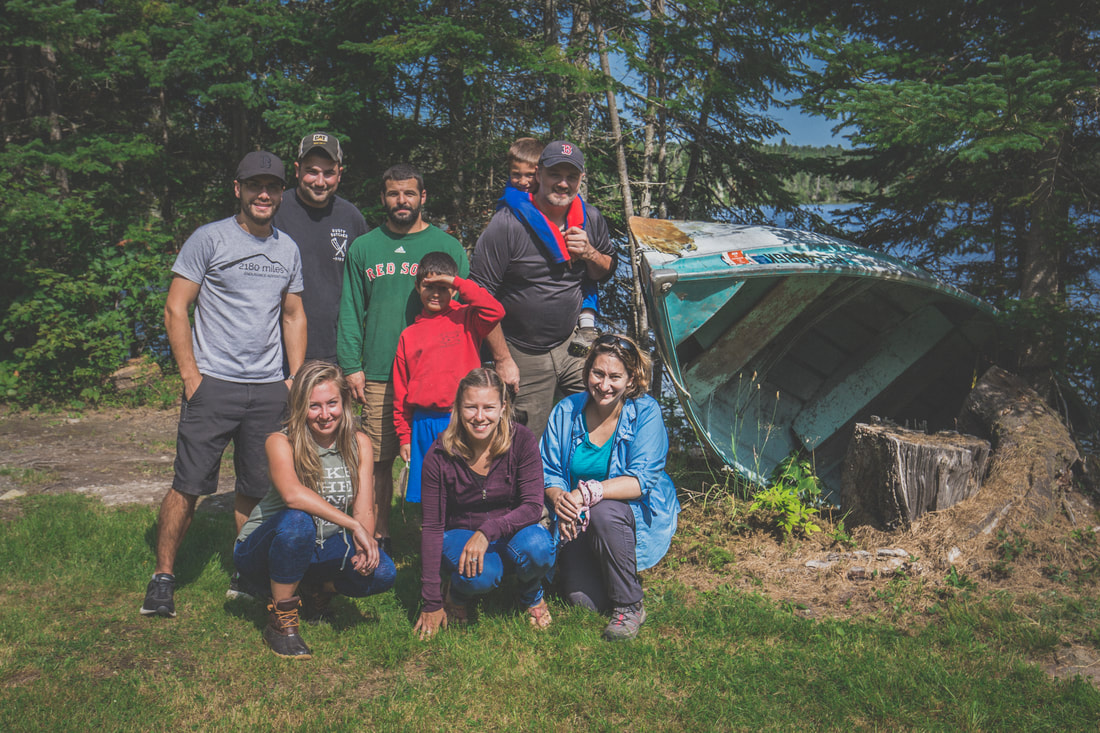
The 2018 North Maine Woods Crew
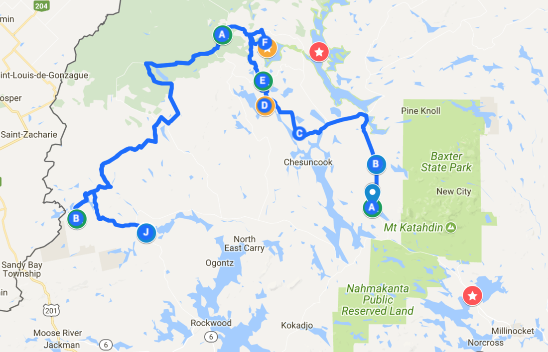
Brendan (back row, second from left) and I worked over the course of a few weeks drawing up a route, referencing data and maps from this group’s 2016 trip through some of the same regions. For those that have never heard of, visited, or planned a trip through this remote section of Maine, it’s unlike anywhere else in the US. With no established towns the areas are instead divided into a grid and labeled by location on a horizontal and vertical axis. For example, one of our campsites might be located in an area called T3R10, or further northeast at T12R15. Once we established where possible campsites were, we’d plot out exact GPS points and then begin stringing trails and roads together to create a route.
Having enough data compiled for a 5-day, 4-night adventure through one of the most remote places in America, we then turned to mapping gas stations, hospitals, and general “SHTF” waypoints in the event of an emergency. As far as the North Maine Woods goes, you’re basically on your own shy of a MedFlight chopper. Fuel, food, and first aid must all be carried on-board the vehicle, and redundant supplies for parts and troubleshooting are all on a bring-what-you-need basis. The route spanned a respectable 800 miles (including the drive to/from home) and gave us 3.5 days inside the Allagash Wilderness to explore, hike, swim, and relax.
With the maps digitized and the details detailed, it was just an inpatient waiting game until our date of departure.


 RSS Feed
