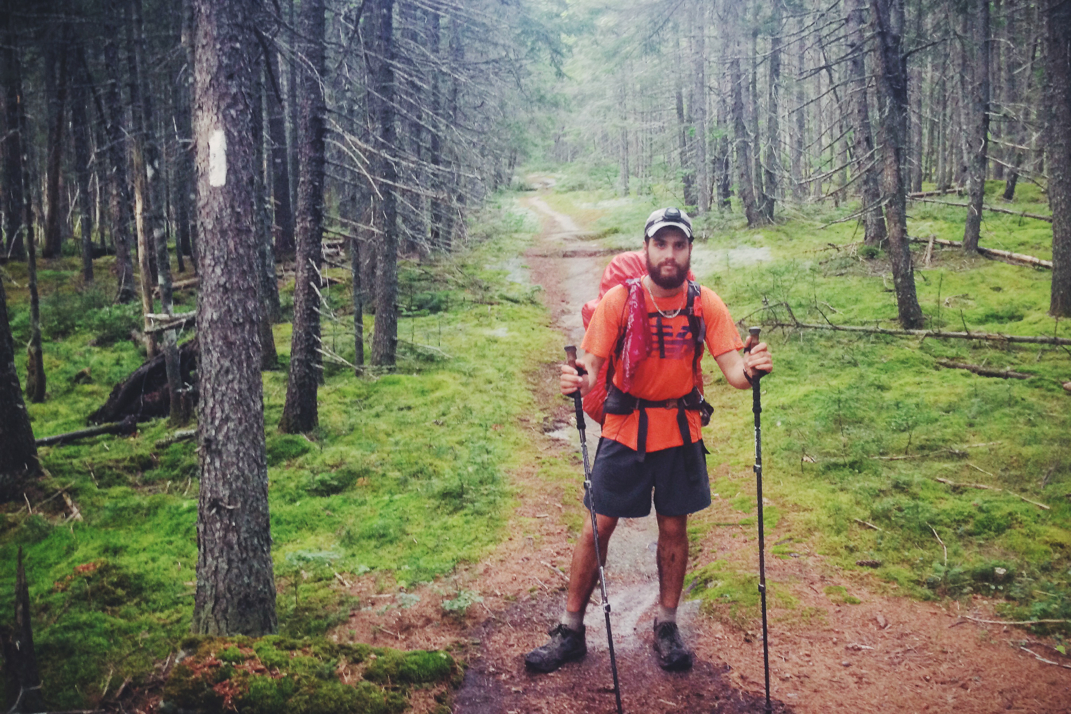
2180miles
  • Home
  • Adventure Blog
  • Overland
    • Meet The Jeep
    • Mods & Installs
    • Overland Gear
    • Trip Reports & Videos >
      • Allagash Winter 2019
      • Greece Adventures 2019
      • Overland Expo East 2018
      • Allagash Wilderness 2018
      • Trans-Canada Overland 2017
      • QB-5 Adventure 2017
  • Long Trail
    • Trip Summary
    • Photojournal
    • Hike Statistics
  • Appalachian Trail
    • Trip Summary
    • Photojournal
    • Gear Talk
    • Hike Statistics
    • Financial Planning
  • Bicycling America
    • Trip Summary
    • Photojournal

Appalachian Trails

7/22/2014

0 Comments


Day: 108

Day mileage: 23

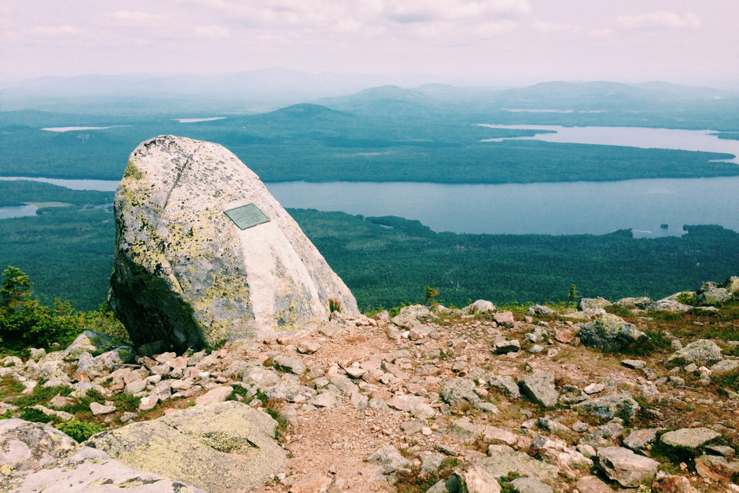
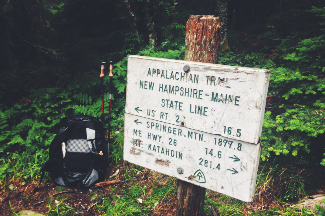
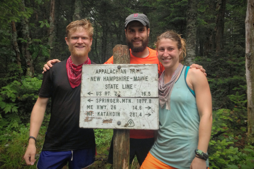
AT total mileage: 2,052.8

Time: 9 hours

--

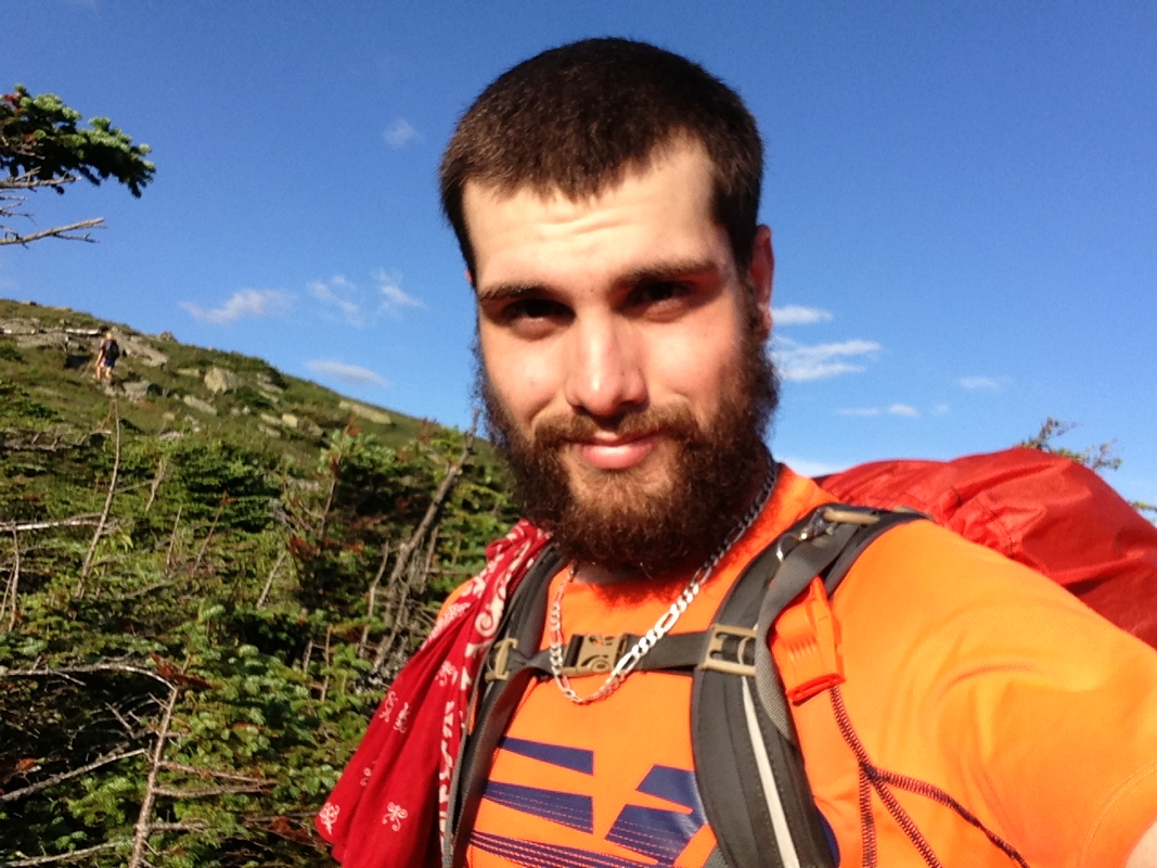
I woke up to the realization that today was day 108 on the Appalachian Trail. When I had been hiking with Pneumo and Jellybean, this was the day I had intended on finishing Katahdin on. It's a bit upsetting for me to know that that won't be happening, that I missed that self-imposed mark, but alas I hiked a different hike after meeting Rocket Girl, Dorothy, Blue, Legs, and Santa back in New York. The last 600 miles have been much more enjoyable, so I don't regret my choice to slow my pace, but it certainly is interesting to reflect on the fact that I could have been done by now. Soon enough, I suppose. 

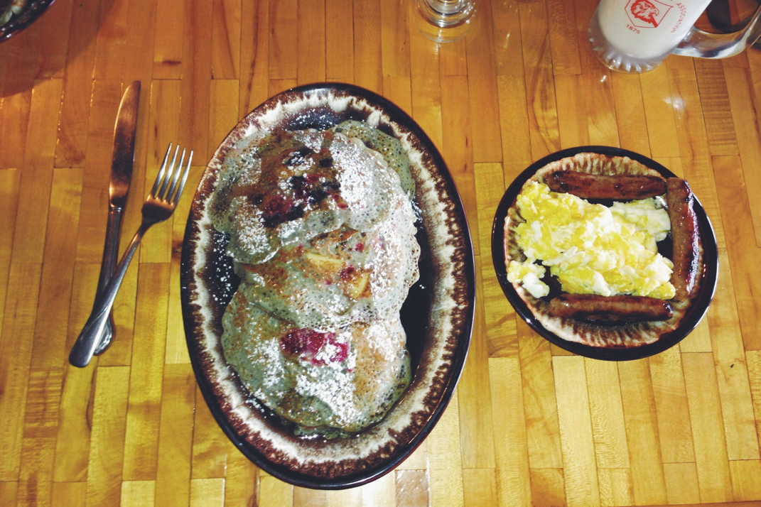
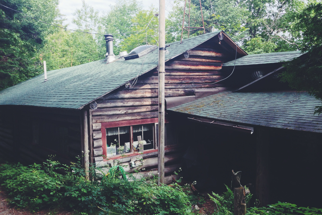
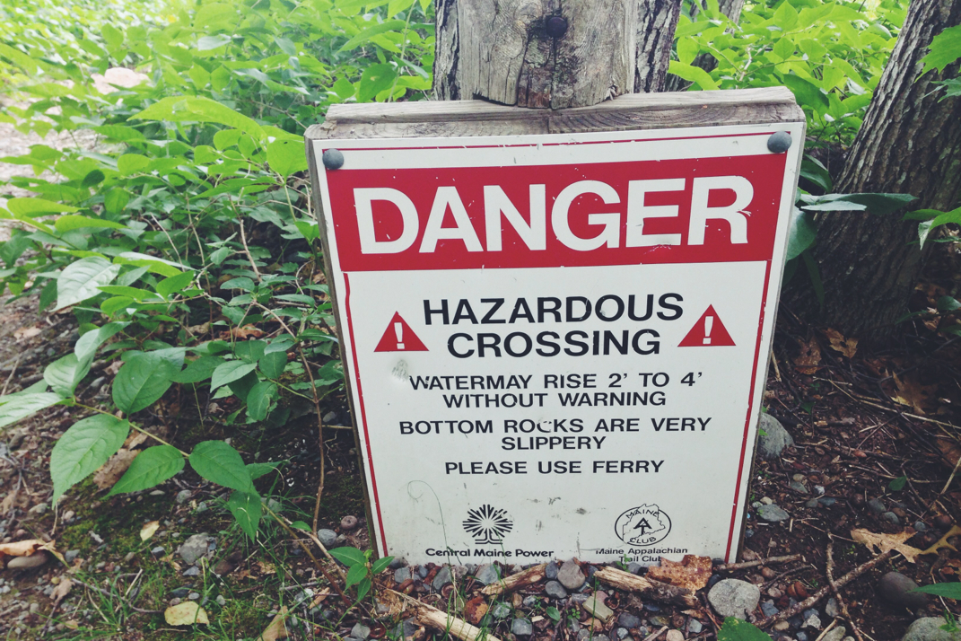
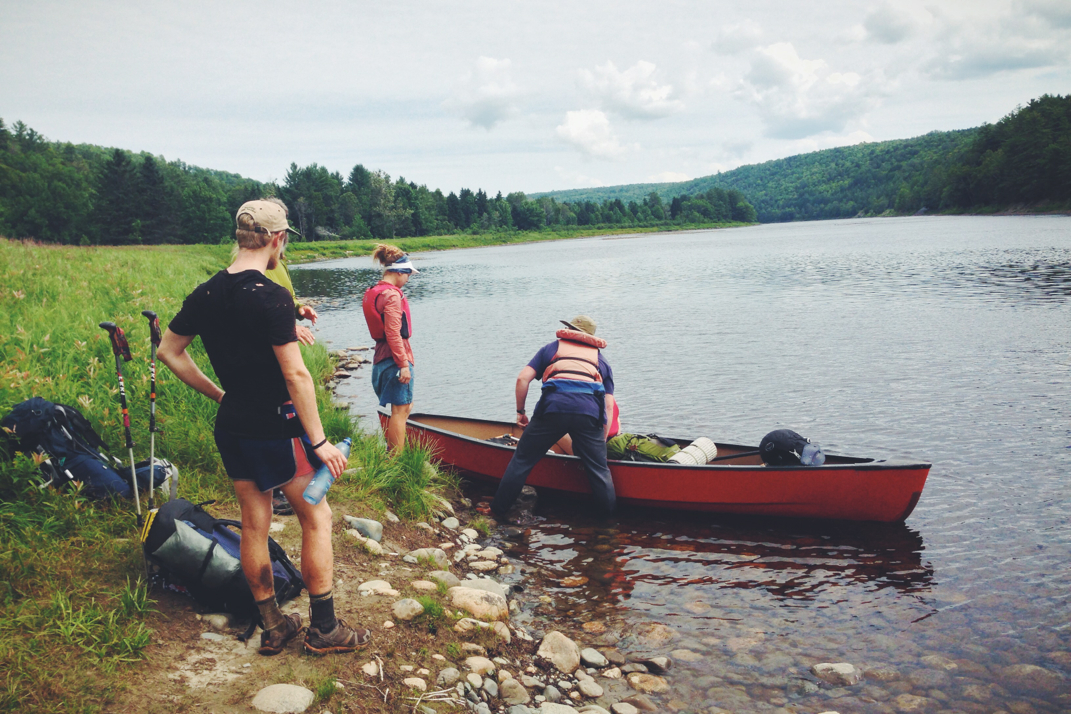
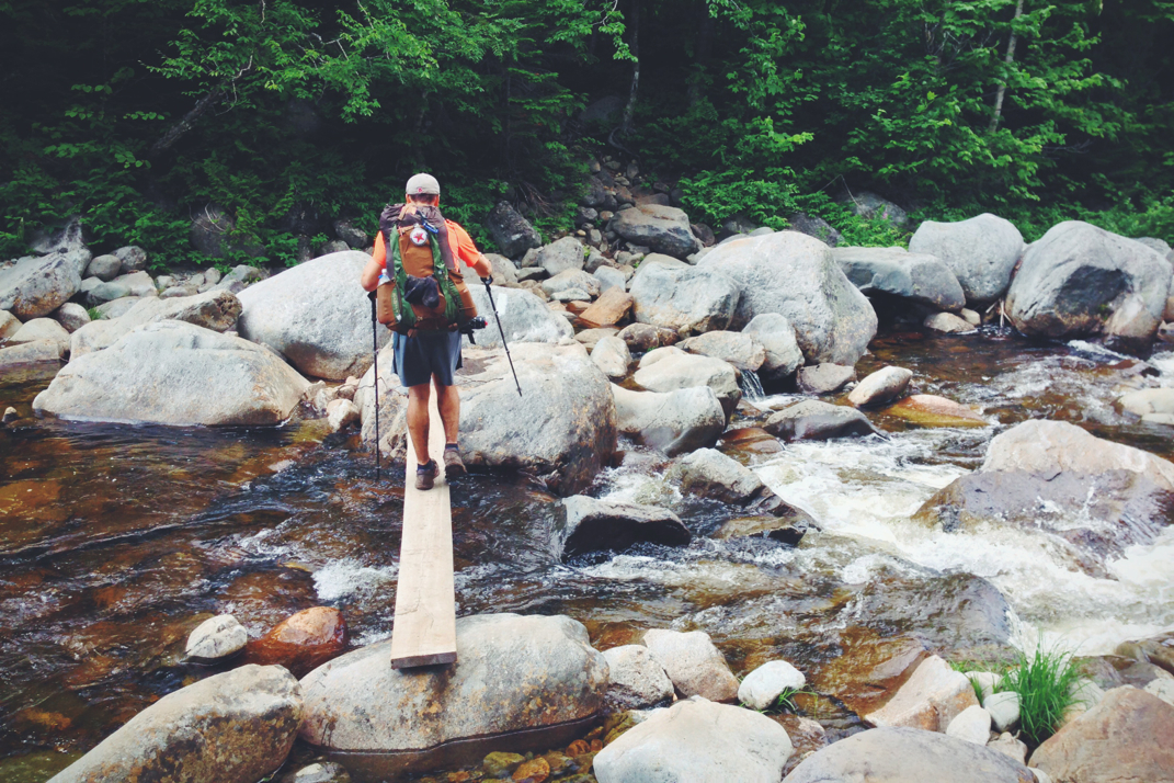
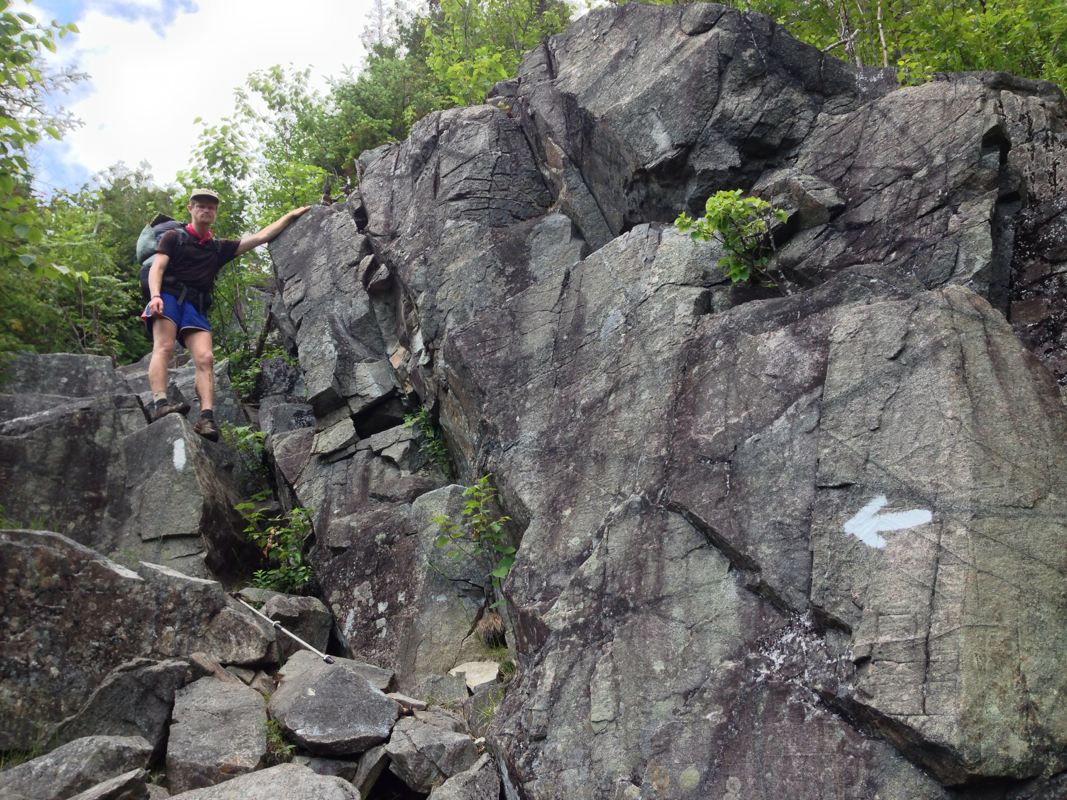
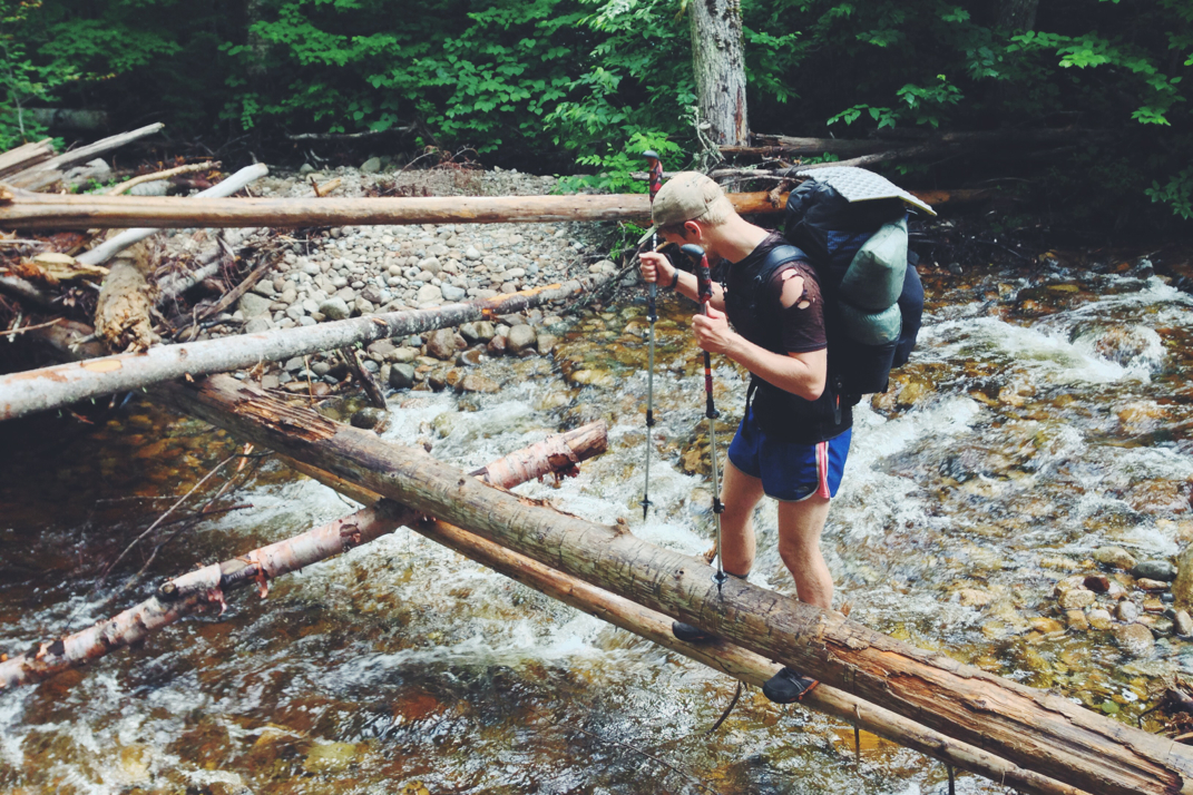
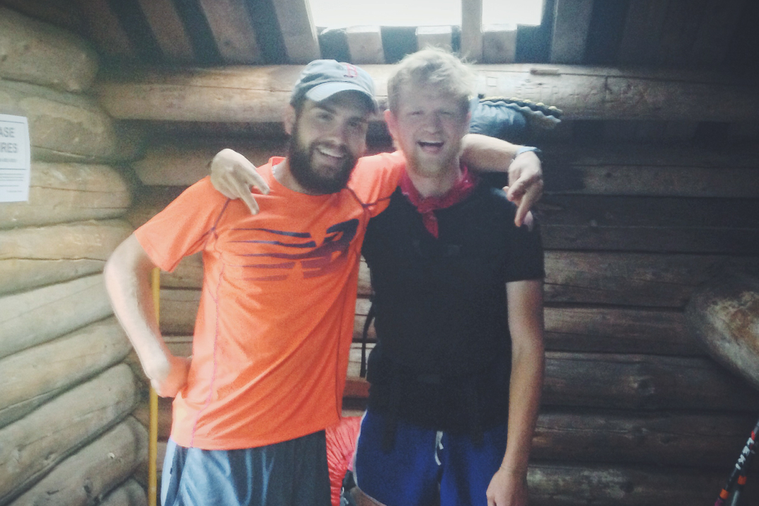
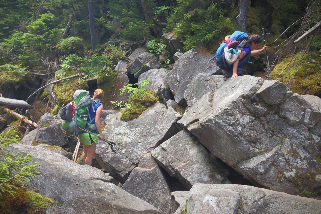
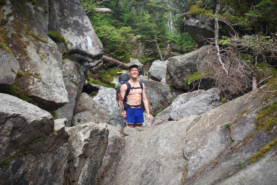
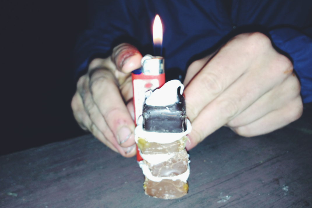
We left the shelter at 0700 and followed a blue-blazed side trail 0.3 miles to Harrison's Pierce Pond Camp. Known on the Appalachian Trail for the 'Patriotic Pancakes' I thought it was absolutely necessary to stop in. Owned by the kind spirited Tim Harrison, his camp & lodge is a relaxing place in the woods of Maine, comprised of log cabin buildings, where many go to vacation. For $12 he offers a breakfast of 12 patriotic pancakes (red raspberries, blueberries, and apple chunks comprising the red, white, and blue aspect) with sausage, eggs, milk, and orange juice. Santa and I sat and talked with thru-hikers One-Day and Fun Size as we waited for breakfast. Both are NOBOs, and Fun Size actually used to live only a few miles away from my parent's house... Ironically, Tim grew up in the town 5 miles north of mine as well. The pancakes came and were delicious, as breakfast is my favorite meal and he did an outstanding job preparing it. We ate and talked for a while before packing up and heading on, hiking away from the lodge as Mr. Harrison played a gorgeous rendition of 'Strawberry Fields Forever' on his electric piano. Just 4 miles down the trail we would have to cross the Kennebec River, a wide body of water that requires a ferry service to cross. Due to an uphill hydroelectric dam, the water levels can rise 2-4 feet with no warning whatsoever, and have claimed the lives of hikers over the years who attempt the crossing on their own. The ferry is a free service provided by a local outdoors center, but only operates between 9-11a and 2-4p. We left Tim's place, thanking him for a delicious breakfast, and hiked on for the river to make it before 11 when the ferry would suspend service. The hike was mainly downhill, a welcome start to my morning, and we arrived just in time to be the last occupants of the ferry (a canoe) before the operator Hillbilly Dave took off for lunch. Signing the outdoor's center waiver, Dave proudly explained that he is actually the only location on the entire Appalachian Trail that has the demographic data and name of every thru-hiker, something not even the ATC can claim. We thanked Dave after an uneventful and short ferry ride, and continued on with our hike, beginning a 6 mile gradual climb up to the Pleasant Pond lean-to where we would have lunch. A mile or so out from the shelter it began raining, and we pulled in just in time to avoid the more dramatic downfall of water. Eating lunch, Fun Size and One-Day hiked in and joined us, we chatted casually for a bit before packing up and heading on, a 1,000' climb awaiting us just a tenth of a mile north of the shelter. 

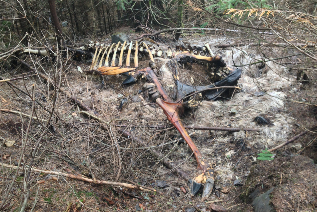
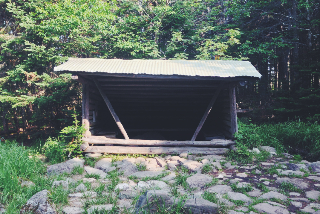
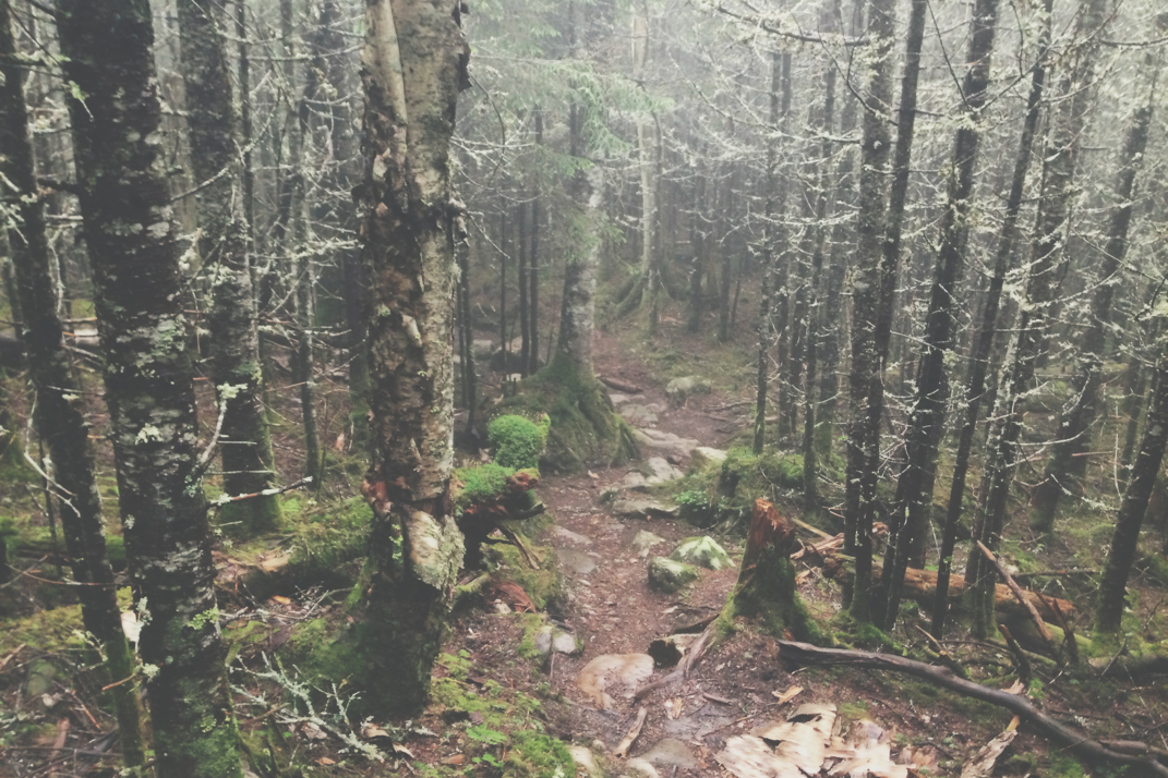
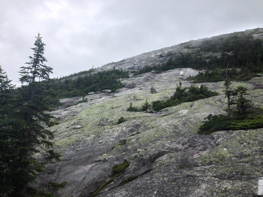
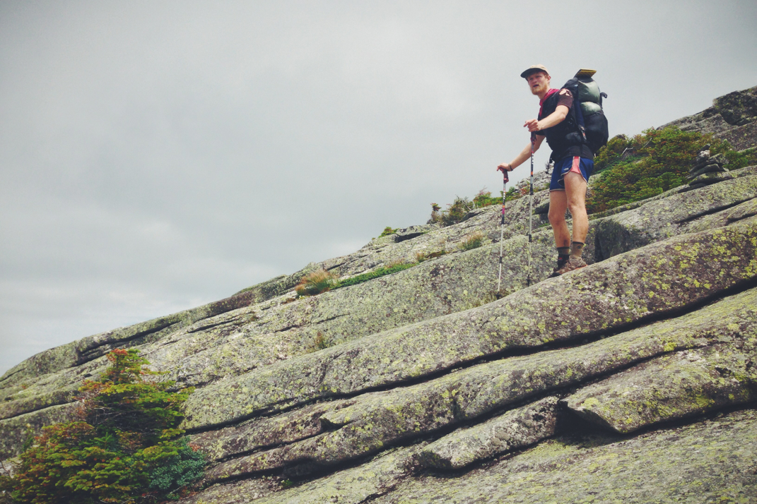
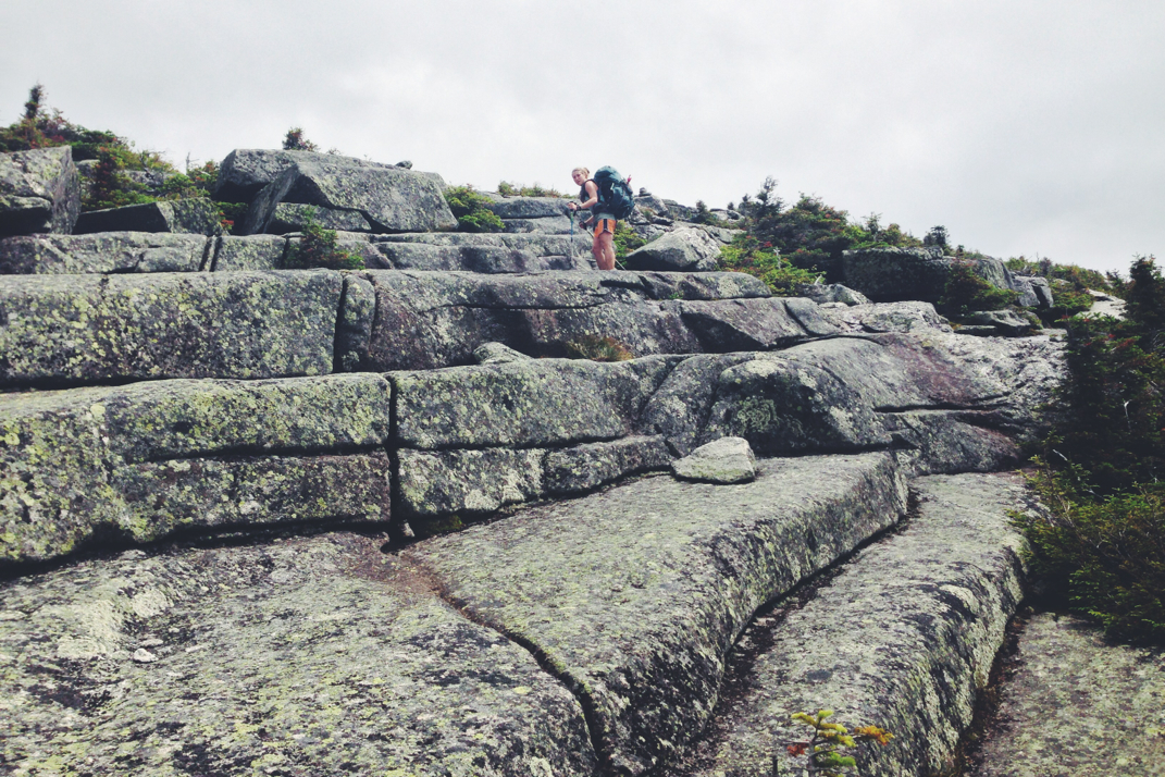
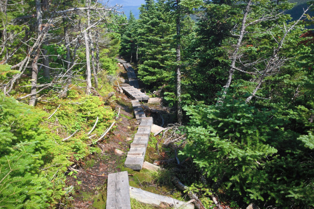
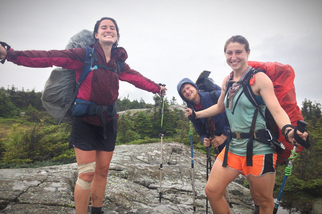
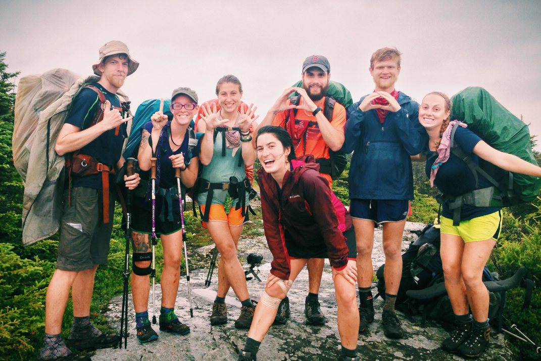
As usual with me and Santa hiking together, music was needed for the ascent of Pleasant Pond Mountain. One of our favorite things to do, mainly to see how people react, is today Taylor Swift on the external speaker and hike along singing every word aloud. Imagine it- a gorgeous, damp pine forest with two bros hiking along singing T-Swift... We're quite the sight to see. Towards the summit of Pleasant Pond we came across a moose carcass on the side of the trail, the skull eerily placed atop what was left of a broken tree. Having only seen one moose so far on this trip, a large beast whose presence at a power line clearing was not something I would have expected, I've since seen a few dead moose randomly in the woods. Snapping a few photos we hiked on to the summit as the rain continued intermittently. After summiting Pleasant Pond we descended a few hundred feet and crossed over the rocky summit of Middle Mountain, stopping when I realized I had cell service. At this point Santa was exhausted, and as I did my best to post back logged blog posts, he napped face down on the bare rock of the mountain. Getting only two blog posts up, a victory based on the standards of Maine cell service, it began raining more steadily so we hiked on. It wasn't five minutes later, just before re-entering the woods from the wet and exposed rock, that my feet slid out from under me and I struggled to stay standing. In a quick moment of flailing I actually managed not to fall, but again hurt my back in the same area I had hyperextended the muscle a week before. Instantly my day was changed for the worse as mobility and comfort level decreased dramatically. Stepping forward with my right foot became strenuous, and any kind of exertion of my back was more painful than anything in recent memory. The descent off Middle Mountain took a while as I cursed Maine and the Trail, and after a gruelingly uncomfortable 7 mile stretch of wet terrain, we came across the Bald Mountain lean-to. Literally hobbling into the large and empty shelter, Santa offered that we spend the night there instead of trying to push on. At any other point in the trail I'd have said yes, but we had miles to make and I was not about to end up 15 miles shy of my intended destination... We simply hadn't come far enough that day. I took an ibuprofen, and we passed by Fun Size and One Day for the final time as we headed up the trail, having decided to stop at the next shelter, some 9 miles shy of our original destination. I spent most of the next climb, a 1,500 foot ascent of Moxie Bald Mountain, continuing to audibly hate the Appalachian Trail. The painkiller did little to solve my problem initially, and many high leg lifts required to traverse uneven terrain were strenuous on my body. Combined with everything going on, my exhaustion, and the trail as it exists in Maine, I began talking with Santa about how the trail wasn't fun anymore; it had lost its appeal and my love affair with it had ended. He was a phenomenal guy to hike with me listening to me rant, truly understanding and trying to offer help, though I wasn't having it. My state of mind was such that I was simply over the hike, with no interest in it anymore. 

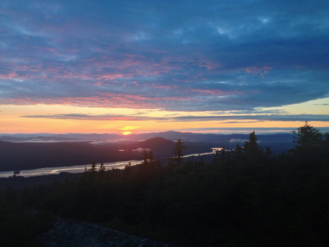
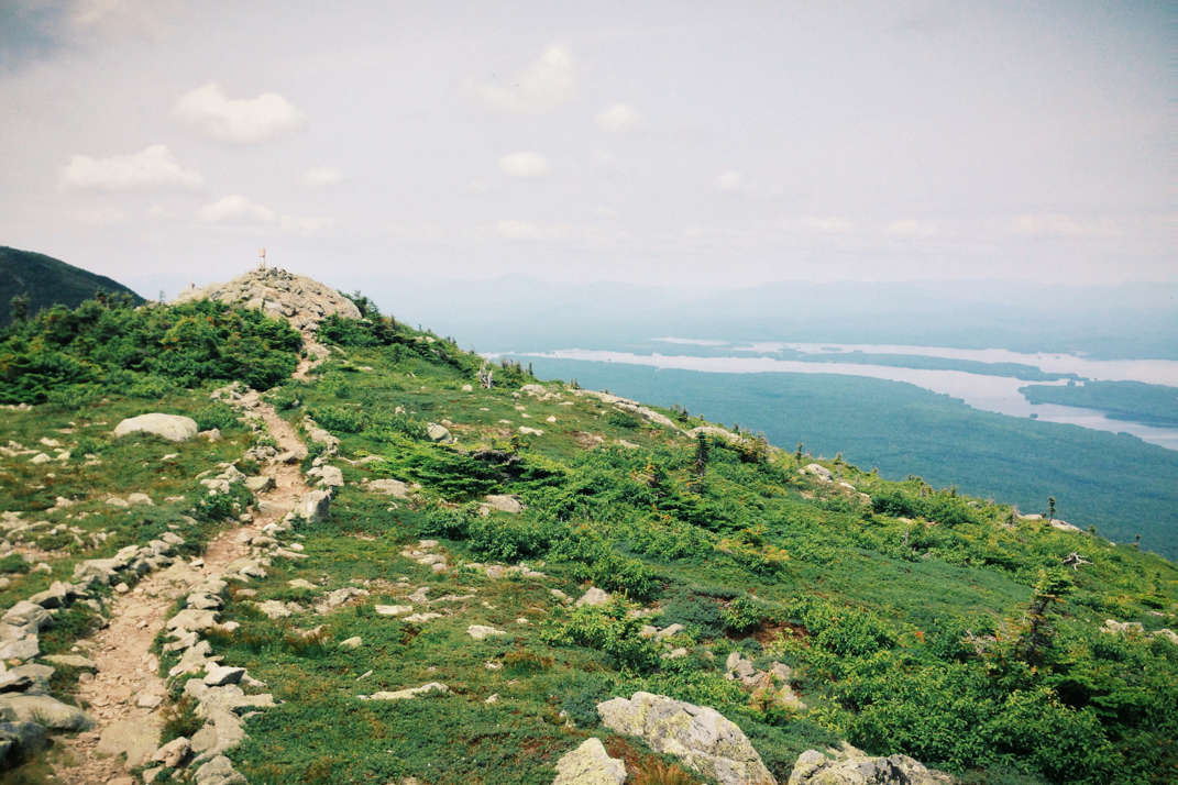
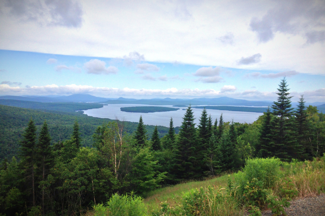
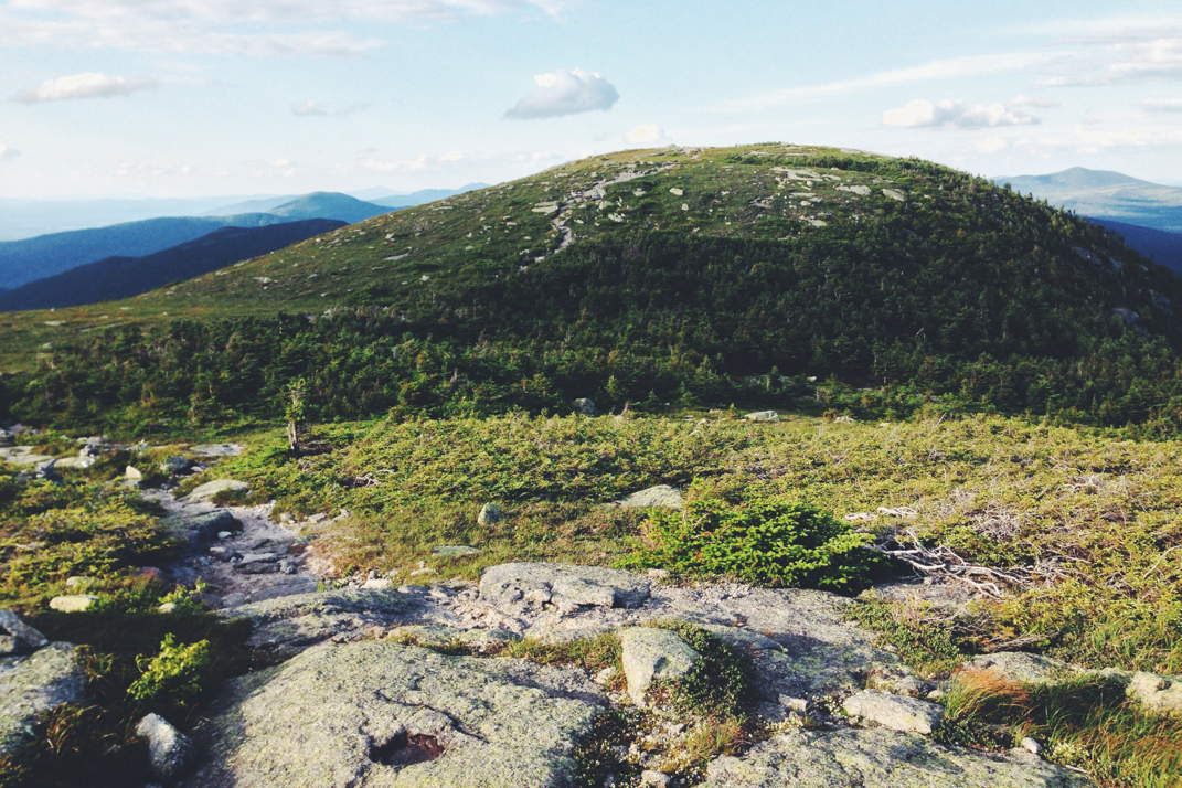
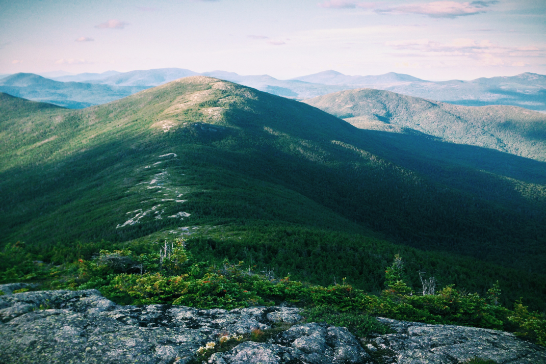
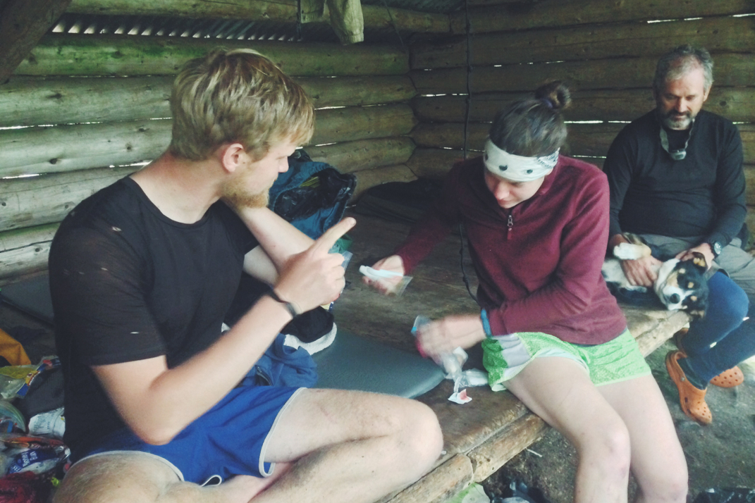
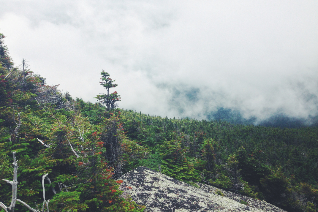
We came across a blue-blazed side trail about a half mile from the summit, with a sign offering us to bypass the mountain's peak and wrap back around to rejoin the A.T. on the other side. Santa encouraged me to take the bypass, reminding me that there were a few hundred more feet of climbing and that we could get to the next shelter earlier and I could get off my feet. Having not missed a section of trail yet, I was not about to let pain and a climb overcome me, so we hiked on following the white blazes to the summit. Reaching the rocky and exposed bald around 2010hrs, we were greeting by gorgeous panoramic views of rivers, lakes, and mountain ridges in front of us, and decided to linger and cook dinner as the sun set over the world in front of us. In the moments of the sunset, my problems with the trail disappeared a bit. The 800mgs of ibuprofen had kicked in, and the world was a slightly better place than it had been earlier. The sorbet colors of the sky were mesmerizing, and as the sun disappeared behind the horizon we packed up and headed on to complete the final 2.5 miles downhill to the Bald Mtn. Pond lean-to. About halfway down the descent Santa caught me off guard by wandering quickly off trail and vomiting profusely into the bushes.  He didn't much want to talk about it, and thought it may have been an adverse reaction to the dinner he had cooked and the olive oil he put into it. We hiked on into the darkness, a combination of the end of dusk and abundant tree cover, and arrived at the shelter around 2130hrs to find two NOBO hikers still awake. With plenty of room in the shelter we settled in next to them and talked for a while, having never met either hiker before. 

Tomorrow we'll hike 18 miles into Monson, ME, the last town before the 100 mile wilderness. I'll be picking up a mail drop that West sent me from Rangely, which will have enough food to get me through to Katahdin. We'll have a bite to eat at the Lake Shore hostel in town, then will hitch back out to the trail and continue on with the final stage of the adventure. Hopefully Santa is feeling better come morning, as we've got quite a bit of mileage to get in before the small post office closes at 1615hrs tomorrow afternoon. The painkillers are wearing off as I'm starting to fall asleep, so I'm hoping my back isn't too sore tomorrow. We shall see.

My love affair isn't exactly over, but it's dwindling. I can say without a doubt that I'm ready for this hike to come to an end. Soon enough, I suppose. 

Picture
Pancake Breakfast
Picture
Harrison's Cabin
Picture
Picture
River Crossing
Picture
Moose Carcass
Picture
Not Amused.
Picture
Picture
Moxie Bald Sunset
0 Comments

Mile 2,000: Maine Marathon Day #3

7/21/2014

0 Comments


Day: 107

Day mileage: 31.5

AT total mileage: 2,030.5

Time: 12.5 hours

--

As usual the sunrise came far too early.  Starting to pack up camp around 6:30, I woke up Santa so that he could also begin packing. We were joined as we sat eating breakfast on the pine needle floor by a weekend camper who wanted to hear about our adventures on the trail. Talking with her for a short while we then said our goodbyes and headed for the trail. With a very long day ahead of us it was important to get some good mileage in quickly.

The first order of business for the day would be a 2,100' climb up to Horns Pond lean-to where we had intended to be the night before. The climb was steep and very rocky, making me exceptionally happy that we didn't attempt it in the dark with headlamps. A mile out of the campsite we came across a small wooden carved sign on a tree marking the 2,000th mile of the 2014 Appalachian Trail, an incredible milestone in my hike. To think that I've walked 2,000 miles is almost unnerving, but there's an immense sense of pride in having done so. With only 185.3 miles to go, we trekked on after snapping a few photos. For those that have a keen eye for detail you may have just picked up on the fact that the trail is 2,185.3 miles long and my website is 5.3 miles short... In the interest of full disclosure I figured it was easier for people to remember a website where the digits ended in a multiple of ten. Anyways, we climbed the boulder-ridden ascent and made it to the shelter in an hour and a half. Nestled between two large ponds was an entire compound comprised of tent sites, a caretaker cabin, a day-use shelter (originally constructed in 1936 by the CCC), and two large sleeping shelters. Santa and I stopped at the sleeping shelters for a bite to eat and talked with a SOBO hiker for a little while before hiking on. From Horn Pond we would ascend 1,000' in under a mile to the summit of North Horn mountain, then dip down a few hundred feet and climb back up to the summits of the Bigelow mountains. Relatively simple but strenuous climbs, we first summited West Bigelow peak at an elevation of 4,145 feet above sea level.  Both this and Bigelow Avery peak will be the last two mountains over 4,000' in elevation until we reach Katahdin in a week. Comprised of rocky summits, both mountains are clearly marked with alpine zones where fragile vegetation clings to rocks. As such it's clearly marked to stay on trail to avoid disturbing the plant life. Descending to a low ridge and climbing back up to the second peak, Bigelow Avery peak, we stopped at a plaque explaining the name of the mountain. These peaks provided some truly incredible views, impeccable panoramic sights of mountain ranges and endless lakes, ski mountains and small towns in the distance, an amazing reminded of why we hike the trail. The solitude and beauty of these alpine ridges provide a view on life that many will never experience. 

A quick and as-accurate-as-I-can-manage-without-Google history lesson... While Benton McKay is viewed as the father of the Appalachian Trail, proposing the idea in the 1920s after a day hike in Vermont, it was also largely thanks to Myron Avery that the trail actually became a reality. The two worked together throughout a decade with the CCC to bring the idea to life, though Avery is much less of an A.T. household name than Benton. This peak was marked with a nice bronze plaque dedicating the mountain to Myron, which after reading we turned north and descended down the mountain. 

Our next challenge would be Bigelow Junior, a mountain some 7 miles later, but first we would lose 2,000' in elevation down to Safford Notch where Santa and I would eat lunch. As we came out of the alpine zone we descended into a thickly wooded pine forest with many many boulders. The lower we got the larger the rocks became, until we found ourselves face to face with boulders I can only describe as the size of icebergs, mammoth hunks of rock strewn about gvttvtdddthe forest floor, towering over us as dcefffcdppwe hiked around and through them. We stopped for lunch in the Notch, bombarded by mosquitoes that Santa enjoyed spraying with 100% deet and freezing them in place. Finishing our food break and heading on, we began a long gradual climb to Bigelow Junior, the last real peak of our day. At just over 3,000' in elevation it paled in comparison to the larger Bigelow peaks, and offered no amazing views. As such we continued on beginning a long descent to Flagstaff Lake in the valley below. The 5th largest lake in the state, Flagstaff is a popular destination for weekenders and boaters, but was remarkably calm for a Saturday in July. We would follow the trail around the lake for a few miles before climbing two successive 'hills' - 400 and 800 feet respectively, then dropping down to another lake where we would find the shelter at which to eat dinner. We carried an amazingly quick pace on the forgiving trail and arrived at West Carry Pond lean-to around 1830hrs. At one point I asked Santa if he was comfortable with the pace to which he replied "No, but it feels productive so don't slow down." We were moving. Talking with a NOBO hiker named Glitz as we ate, we then packed up and headed on. With 10.2 miles remaining and darkness only 90 minutes away, we knew night hiking was going to be a reality. Grabbing my headlamp, we hiked on into the night. 

The thick forest cover made it difficult to see as dusk settled over us, and even with the headlamp the thick vegetation growing into the trail was cause for caution. Mud and puddles made for slippery terrain, and caution was exercised as we went along. At one point shortly before 2100hrs I was stepping onto a foot bridge over a boggy area when my right foot slipped out causing me to fall. My right ribcage smashed into the bridge, made of two halves of a tree next to each other, and I twisted my back when I fell down onto the ground. My first concern was of course the dSLR camera on my waist belt after which I rolled over, not unlike a beached whale, and lay there for a while as Santa repeatedly asked if I was ok. Having hurt my back a week ago slipping on rock while still in New Hampshire, I again hurt the same muscle that I had hyperextended the first time. He helped me up and we sat there for a while as I embraced the inevitable pain. Hiking on we were much more cautious and though it became difficult in the thickly wooded darkness, followed the trail and arrived at the shelter around 2230hrs. Though I wish I could say I was surprised, three people occupied a shelter with space for 8 so haphazardly that there was no room for us to fit in. This made me rather angry as I inflated my air mattress to cowboy camp for the third night in a row, and I passive-aggressively wrote in the shelter's log book about the issue of SOBO hikers occupying shelter space like it's their own bedroom. 

We'll sleep next to the shelter tonight, again, and tomorrow will attempt another long day. There's apparently a lodge of sorts nearby that serves pancakes in the morning, so we might try and swing by there to get a good start to our day. All in all, having not hiked a 30+ mile day in over a month, I feel good. It's really nice to know I'm still physically capable. 

Bed now, under dark skies and bright stars. 

Texaco

Picture
Picture
1936 Shelter
Picture
Picture
Picture
Picture
Mile 2014
0 Comments

Maine Marathon Day #2

7/21/2014

0 Comments


Day: 106

Day mileage: 23.4

AT total mileage: 1,999.0

Time: 9 hours 

--

I was interrupted from my sleep repeatedly throughout the night as hikers emerged behind the shelter to pee. We were equally surprised to see each other, and I never realized how many people relieve themselves immediately behind the place where we sleep. Regardless, the night passed quickly and I awoke at 5:30 to begin packing up for the day. I had to rouse Santa a few times before he actually woke up, and we were on the trail by 7:00. 

Descending 1,500 feet first off in the morning, my knees (doing much better, by the way!) were unhappy with the sudden descent. Reaching the Orbeton river at the bottom of the mountain, we rock-hopped across the wide body of rushing water and began our climb up the other side. Over 3 miles we would ascend 1,800 feet to the summit of Lone Mountain. Stopping in at Spaulding Mountain lean-to for a snack and meeting some SOBO hikers, we continued on with another 1,000' climb to the peak of Spaulding Mountain before descending back down a few hundred feet to a ridge that we would follow for 2.5 miles. We hiked by a few weekend hikers throughout the day, making small talk and telling them about our journey. Passing by a bronze plaque marking the last completed section of the Appalachian Trail from Georgia to Maine, we continued on skirting the summit of Sugarloaf Mountain, a famous northeast skiing area. From here the trail would plummet 1,500' over seriously rocky terrain, dropping us to the Carrabassett river. We would cross here on a 2x10" board and then begin the long trek up to the summit of South Crocker mountain. This climb was obnoxious as there were multiple false-summits and the humidity was stifling, but we summited rather quickly and pressed on towards the North Crocker mountain summit and beginning a horribly long 6 mile descent to Maine Rt. 27 which would lead us towards the town of Stratton. The trail to the road from the north summit wasn't challenging, wasn't rocky, and wasn't overly rooted. The frustration came from the fact that it was the most gradual grade imaginable, which is why the 3,000 foot descent took miles and miles to complete. It got to the point of being annoying simply because it felt like we weren't going anywhere. Eventually we hit the road crossing, turning our efforts to hitching a ride 5 miles west into Stratton. 

It took only about 10 minutes to get a ride, and my American Flag never came out to help with the job. A middle aged guy in a pickup truck pulled over to get us, having us hop in the back as he had woodworking equipment in the cab and was towing a hydraulic wood splitter behind the truck. The wind felt amazing as we sat in the bed traveling along at 55 miles an hour, a different kind of freeing feeling that isn't attainable on the trail. Dropped off at the general store we quickly resupplied and headed across the street to the White Wolf motel where we heard dinner would be good and cheap. It was nearly 1900hrs, later in the day than we had anticipated being there, and we did our best to order quickly and get back to the trail. Despite effort on our part it took nearly an hour for my mozzarella sticks and chicken quesadilla to make it to our table, and Santa grew restless as the service was quite horrible. As we waited to pay our check one of the couples we saw day hiking hours before came in to pick up their take-out dinner, and we talked for a while about the Appalachian Trail. The couple (I apologize, I later realized I never got their names) are in the process of hiking the New England 3,000' peaks. As dusk was settling in over Stratton, Santa and I were concerned about hitchhiking the 5 miles back to the trail. I felt a bit awkward asking, but approached the young couple to see if they had a car that could bring us back to the trail. They said of course, simply that they would need to move some stuff around in they're awesomely predictable Subaru; adventurous people seem to always drive Subaru or Jeep vehicles.  We were back at the trailhead 10 minutes later and after thanking them we parted ways. 

Santa and I made it 2.5 miles into the woods to a large campsite alongside a river. We're cowboy camping for the second night in a row, and in the morning will begin by hiking the 3.2 vertical miles up to the shelter we had intended to be at tonight. I'm not thrilled that we aren't making the mileage we intended, but the meal break took too long to warrant a risky climb in the dark.  The plan tomorrow is for a big day, so hopefully a good nights sleep is attainable. 

We shall see how things work out. 

Texaco

Picture
Picture
Picture
Picture
Picture
Missing Hiker from 2013
Picture
Late Arrival
0 Comments

Maine Marathon Day 1

7/20/2014

3 Comments


Day: 105

Day mileage: 28.4

AT total mileage: 1,975.6

Time: 11 hours 

--

As you can see from above, the push has begun. In what I'm calling the 'Maine Marathon', I'll be hiking this kind of mileage on a daily basis for the next week in order to make Katahdin by the 25th for a summit on the 26th. Most days during this time will be over 26.4 miles, hence the name of the challenge. While most hikers have slowed their pace immensely at this point, my desire to finish the Trail in a good number of days is huge. It had never crossed my mind until I began hiking with Pneumo and Jellybean all those miles ago as they both were pushing for sub-90 and sub-100 day hikes respectively, which made me realize I could easily finish under 120 days and even under 110. With two more zero days and a few more low mileage days than I had ever planned on, sub-110 is out of the question for me. It would require 35 mile hikes every day for the next week which I'll be quick to admit is not something I'd ever want to do, though I'm sure if I truly tried I could pull it off. Alas, with the schedule of my folks to come get me in Maine and my reasonably hikeable mileage, I'll be finished on 114, leaving me with a less impressive sounding sub-115 day hike. Yes, 114 is impressive in its own right, but I suppose you'd have to actually know me in real life to get my obsession with numbers and the way they sound- 110 would have been much better. But now I seem like I'm insane, so let's move on...

My goal had been to wake up around 4:30 and push on from the shelter we stayed at as a large group the night before. Unfortunately it was a damn cold morning in the mountains and no such departure was doable as I was quite comfortable in my sleeping bag. In the end it worked out, as everyone was happy to see I was still there when they woke up. I packed up and ate with the group before heading out, having asked Santa one more time if he wanted to press on through Maine with me be ultimately said he didn't believe he was capable of the mileage and would pass on the opportunity, meaning I'd hike the last 200-something miles alone. Saying goodbye and hugging everyone I headed off into the woods, having returned to the Lone Ranger mentality that I spent most of the mid-Atlantic section hiking with. A few minutes down the trail Santa caught me, explaining his wishy-washy decision making skills and saying he would hike the 17 miles to the Rangely, ME road crossing before making his decision. The group was getting off in Rangely to get a hotel room and relax for the night while my plan had me pushing on another 11 miles. He and I flew through the terrain at a clip I was much happier with than that of previous days, conquering over 10 miles of trail by noon, a feat that I felt hadn't been accomplished in quite a while. Sitting on a park bench overlooking a gorgeous vista of mountains and lakes Santa called his parents and ultimately decided in the moment that he would be finishing the Appalachian Trail with me at my marathon pace. This was truly a relief for me as I believe that to pull this kind of mileage consistently I'll need some moral support. We hiked on to the next shelter (where I had planned on spending the night before) and ate lunch with West and Gentle Spirit, two of the guys from the large group we've spent the last few days with. Eating quickly and heading back for the trail we ended up seeing the girls one last time as they pulled into the shelter. We said goodbye for a second time and left, ultimately being the last time we'll see them until they summit Katahdin in a few weeks time. 

The afternoon flew by on level and somewhat rocky terrain, dropping us at the Rangely road crossing around 4 PM with 10 miles left to hike until we reached the shelter we were aiming for. Crossing over the road the trail began a gradual climb up past a large shelter with a famed cribbage board in a dual-toilet privy. Sounds strange, but this is in fact the Appalachian Trail so I'd expect nothing less. Sure enough, two toilet seats are positioned 3 feet apart with a cribbage board drilled down between them. There's a carved sign on the outside of the shelter that says 'Your Move'. We ate quickly at the picnic table, gearing up for the climb ahead. The trail immediately began the ascent towards Saddleback Mountain, a 4,120 foot peak that would require 2,000 feet of elevation gain from the shelter. From there it would dip and climb again to the peak of The Horn, dropping a thousand feet and then ascending again to Saddleback Junior. These three climbs, each happening 20-something miles into our day, were exhausting and very windy. At the peak of Junior the sun set over the mountain ridges across from us, as the sky became a watercolor painting and darkness settled over us. Headlamps turned on, we continued the 2 remaining miles to the Poplar Ridge lean-to. Side note: in Maine, shelters are called Lean-Tos. 

Arriving around 2130hrs, we found the campsite and shelter half-full with hikers. It frustrates me (again) that the shelter was only half occupied, but people had their stuff strewn about leaving no room for anyone else to move in. Santa and I set up our sleeping bags behind the shelter and cooked a quick dinner before settling into our beds. The stars are incredible, as they usually are in the middle of Maine, and sleep will come easy. The plan for tomorrow will be a 27 mile day with a fair amount of climbing required, meaning it will be a physically stressful day. That's to be expected, I suppose. No way to do this kind of hiking without it being demanding. 

Onwards. 

Texaco

Picture
Picture
Picture
Picture
Picture
Picture
Picture
3 Comments

Soaked & Tired

7/20/2014

0 Comments


Day: 104

Day mileage: 12.8

AT total mileage: 1,947.2

Time: 6 hours 

--

Sleeping in rain storms is usually a relaxing experience. That being said, it was immediately apparent to me that something was wrong when I woke up at 2 AM in the tarp tent, the sound of torrential rain pouring down outside, and my lower body feeling soaking wet.  The tent was protecting from rain from above, but was doing absolutely nothing to keep the pool of water on the ground from soaking through my sleeping bag. By design the tarp tent is lighter than a traditional tent by cutting out the 'tub', or the fabric that goes under you and has a wall and bug net. It's simply fabric that goes over you and comes down to the ground. As such when the immense volumes of water began collecting outside, they very easily slid under the edge of the tent and began drenching me and my gear. Initially I was too tired to truly react, but in a conscious effort to keep my down sleeping bag dry, got out of it and held it tightly on top of my body as I continued to lay in the cold water. Another half hour of this led to extreme discomfort, and I eventually got up and moved towards the shelter. Legs' sleeping pad kept her high enough above the ground to not be in water, so this was an issue only I was facing. I walked to the shelter barefoot in the mud and darkness, certainly seeing enough space for me to slide in had some careless hikers not been strewn about the limited floor space. Instead I was left solely with an 8" wide board lying on the ground, covered by the shelter, as a place for shoes to dry. I moved people's footware and positioned myself precariously on the board with my damp down sleeping bag over me, attempting to get a few more hours of very light sleep. In 104 days on the trail I've never had my gear wet like this, and believe me it's unpleasant. With days of rain in the forecast I was very nervous that nothing would dry out. Regardless, come morning when the first few hikers left the shelter, I moved up onto the normal sleeping platform and went back to sleep until 8 AM. 

After packing up my wet gear and heading out into the continuing downpour, I began what would be a relatively short day of hiking. As I've mentioned, the terrain in Maine has been absolutely horrible for productive hiking. The trail is littered with jutting roots and rocks, deep thick mud that literally will remove a shoe from your feet, and countless fallen trees that threaten to knock you flat on your ass as you walk into them due to watching your every step and never looking up. There's no feasible way of hiking at an even rate, and my speed has dropped to 2 miles an hour at most while traversing these sections. The terrain began with an immediate drop down to 1,000 feet before crossing a river shooting straight up another 1,500'. In the rain these kinds of climbs are extremely dangerous, rocky and hand over hand climbing become slippery and every step poses a threat with wet moss and the like. Legs and I were hiking together, playing leap frog with Joules, Santa, and Canary as we went along. Reaching the summit of 'Moody Mountain' we then descended the same elevation we climbed, crossed another river, and began a climb of over 2,000 feet to the summit of Old Blue Mountain. It's important for me to note that 'river crossings' in Maine have come to mean a totally different thing than those of other states. Where typically southern regions would have infrastructure of bridges, Maine typically requires fording the river, often times up above your knees as you walk through the rushing cold water. It's quite the different experience, but also allows a bath of sorts as the gush of water rinses your shoes and lower body of mud. Reconvening as a whole group on the road opposite the riverbank, we began the long climb up Old Blue. Stopping at the 'scenic vista' to look out into a mess of fog, we continued on quickly with the sole intention of making miles. 

There has been a lot of debate recently amongst Santa and Legs about their involvement in my hike. With my need/desire/goal of making it to Katahdin's summit on the 26th of July (meaning a 114 day thru-hike) they have seen that there's a required mileage of sorts to be done in that time period. A few days ago in Gorham it required hiking 21 miles a day but as we have slowed due to terrain and weather, completing many less miles, I now need to hike 25 miles a day to be at K on the 26th. As such, they have very little interest in joining me, not that I blame them in the slightest. I haven't wanted to part ways with them either despite knowing my needed mileage average has skyrocketed, and I've continued to do shorter days just to stay with them longer. After meeting Joules, Canary, Violet, West, and two other hikers Gentle Spirit and Mary Posa, it's been even more difficult for me to move on. With the tension and debate of Santa and Legs not being sure about hiking on with me, it has been frustrating for everyone. I've repeatedly told them I don't want to change their hike or have them resent me for pushing large miles at the end of their journey. The influence they have had, the positive change they had on my hike, it has been unbelievably important for me as a person and my hike as a whole. Looking back, had I not slowed down to hike with them I would have been done with the A.T. back in the second week of July. By slowing down I made an incredible group of friends who I truly believe I'll have a lifetime bond with. I'll need to hike on at an unbelievable rate, but in order to make the situation easier I debated simply moving on in the middle of the night so there was less issue. Legs yelled at me when I told her I'd considered this plan, so I'll be staying one more night before making my 250 mile push for the finish line. It's yet to be seen whether or not Santa will come along. This topic was the majority of the conversation throughout the rainy day of hiking. 

After summiting Old Blue the trail hiked along a ridge for a few miles, hiking over the peak of Bemis Mountain and descending to the Bemis Shelter shortly thereafter. Legs and I stopped in for lunch only to find the rest of the recently formed large group sitting inside out of the rain. By this point it was already 1600hrs, a result of a late start, wet shoes, soaked terrain, deep mud, roots, rocks, damped moral, and general disinterest in hiking. I made the executive decision to not push on the 8 more miles to the next shelter as I had planned, and instead crawled into my sleeping bag. From here out the daily mileage will be insane, so I might as well try and enjoy one more night. We hung out as a group for hours before headlamps turned off and left us with a dark shelter. Sleep will undoubtedly be quick, and with the morning I'll part ways from Legs and Santa for the final time, moving on towards the end of my hike. The plan is to drive back to Baxter State Park where Katahdin resides and re-summit the mountain with them when they finish; the same plan holds true for Dorothy and Rocket Girl who intend to finish a day or so later (Aug. 1 or 2). In the end I'll get my fancy finish date of under 115 days, the average thru-hiker taking 150-180, and I'll still be able to stand atop the mountain with these people who have made my hike into the experience I'll remember. The best of both worlds, I suppose. 

Sleep for now, miles in the morning. 

Onwards & upwards. 

Texaco

Picture
Soggy Trail
Picture
Repairing Santa's cuts
0 Comments

Belated Apology

7/18/2014

5 Comments

 
Hey everyone!


I wanted to send a quick note and apologize for the lack of posts lately. After leaving Gorham last week the service dropped immediately. Despite trying at the tops of mountains for any kind of cell reception, it seems that only Verizon covers this region of the country (I'm on AT&T). The viewership this past week has been through the roof so I appreciate you all checking in to see if there are posts.


Santa and I have parted from the main group and are pushing ourselves through Maine in record time. Separating from the group was not easy, was not desirable, and has been difficult to deal with. Despite that, it was necessary as I have set goals for myself and in the end the right decision was to do what's best for me. I'll be driving back to Maine to resummit Katahdin with Legs, Rocket, Dorothy, Blue, Joules, and Canary on the 1st of August. Long days have limited my writing time so I'm a few days back logged, but am working to have posts to put up when I have service. I'm currently on wifi in a restaurant in Stratton, ME. The plan is to 'Marathon' Maine, hiking 26-32 miles every day despite the difficult terrain in order to summit Katahdin on the 26th of July, which will be my 114th day. I had been aiming for 110 but the camaraderie of the group I was with was far more important than just completing it in a time period that sounded good. The days are exhausting but as you all know I'm one for a challenge... 1,000 miles in 5 weeks, 60 miles in 20 hours, etc. As such, this will be a grand finale to an amazing hike. We're a few miles shy of the 2,000 mile mark as I write this, with only 7 days left until I'll arrive in Baxter State Park where Katahdin resides. Next Friday my folks will meet me up there, and come Saturday morning my dad will summit K with Santa and myself. The weather lately has been as much of a challenge as the terrain, unforgiving and at times excruciatingly difficult, but I'm pressing on towards the end.


Thank you, as always, for your continued support. Words do no justice to the influence and motivation your readership, comments, and trail magic have given me over the past 2,000 miles of adventure. In 185 miles I'll have no more walking to do, but please do hang around for some closing blog posts. As far as the next week I can't guarantee being able to post anything, but I'll be writing so you'll have something to read for a few days after my summit.


Onwards, and ever upwards.


Ryan 'Texaco' McKee
Picture
5 Comments

The Rain Continues

7/18/2014

0 Comments


Day: 103

Day mileage: 16.5

AT total mileage: 1,934.6

Time: 8 hours 

--

Sleeping nearby to the parking lot at Grafton Notch was an interesting idea. Having been in the woods for a few days with no road crossings of any kind, it was quite strange to hear logging trucks lumbering (see what I did there?) by at all hours of the night. Waking up at a decent hour I headed out to our picnic bench and ate breakfast while Legs and Santa woke up. A few day hikers trickled into the parking lot, each asking how far we had hiked. Ten minutes or so before we departed for the day we were approached by a man named Hydro who invited us over to his pick-up truck for soda and fruit before we began our day. It was an awesomely pleasant surprise to have trail magic, as usually it dwindles in the north. Standing by his truck I passed on the selection of Pepsi-Co products, being a Coke guy and all, instead choosing a cold Samuel Adams Summer Ale. Paired with fresh cherries and a banana it wasn't exactly the most healthy of meals, but I wasn't all that concerned. Hydro is from southern Maine and owns some hydro-electric facilities, is a very avid hiker and is eager to attempt the Appalachian Trail when he sells his business. We talked for quite a while before finally pressing on at nearly 10 AM. 

The climb out of Grafton Notch wasn't horrible, a moderate and only somewhat rocky climb that many day hikers and families use regularly. We powered up the 2.5 miles to the shelter we had originally aimed for the night before, running into NOBO hikers Gentle Spirit and Mary Posa who were friends of the two I hike with. We stopped there shortly before beginning the 1,000' climb to Baldplate West and East peaks. The east peak is known as one of the most popular hiking destinations in Maine due to the 360 degree panoramic views of the mountain ranges, although after the strenuous climb up we were mostly fogged in, save for a few intermittent moments of clearing where we could see lakes off in the distance. With wind chill being a key factor we didn't linger long, instead pressing on towards the slippery and rocky bald faced descent off the east peak. From the summit's elevation at nearly 4,000' we would drop to just over 2,000, stopping at a newer shelter for a quick lunch. We passed many southbound hikers, each eager to hear about the trail ahead and equally eager to give us their opinions of Maine. Climbing a few hundred feet out of the Frye Notch shelter where we ate, the trail went up a rooted and rocky section before making the descent into a riverbed below with gorgeous waterfalls where we would ultimately find the back road into Andover, ME. Our goal had been to be here a day or two earlier but the terrain and weather threw an unexpected curveball into our mileage plans. A practically deserted road with no cell service to speak of, we waited nearly 40 minutes for a single car to pass, a large construction pick-up which we were able to get a ride the 8 miles into town with. I was exhausted and slept for most of the windy drive, waking up as we pulled into the General Store in Andover center. The plan would be to resupply for a few days, get a hot lunch, and get back to the trailhead to push another 10 miles for a day total of 21. 

The resupply was rather expensive, as I spent nearly $40 between a few days of snacks and two hot lunches. A box of raisin bran cereal cost me $5.75 for a 13 oz box, just to give you an idea. That being said however, it was absolutely the only option for food, so I paid the price they asked. For lunch the three of us got the 'special', two 8oz burger patties with four slices of cheese and bacon. I also got a buffalo chicken parmesan sub to take on the trail with me for dinner. Returning back outside with our hot lunches to eat at a table they had on the covered deck, we watched the sky downpour and lightning crack in the distance. This really boosted moral for hiking, let me tell you. We became rather lethargic as a group, and didn't end up hitching out of town until nearly 1800hrs.

Our ride out was with a woman named Gloria, and was an... adventure... of its own. The windshield was spidered in a few places, a result of her having hit a moose recently. She offered me to lower the sun visor if it made me feel better to not see the cracks. The drive down the windy and poorly paved road was unnerving from my vantage point in the passenger seat as she swerved around trying to answer the phone. I literally reached for the steering wheel at two separate occasions as she looked away in order to avoid driving off the road or into an oncoming car. Regardless, we arrived back at the trailhead around 1830hrs and began an elongated climb out of the road gap. The plans of 10 miles had been dashed due to timing, so we agreed that 6.5 to the Hall Mountain shelter would be enough.  After hiking for an hour or so together we came across a dilapidated cabin next to a pond, practically gutted with obvious remnants of heavy drug use over the years. We decided against staying there, as I'm sure there were dead bodies somewhere in the walls. After we left, Santa hiked on quickly to avoid any more exposure to the rain, and I stayed back with Legs at a pace she was more comfortable with. The darkness settled in and we donned headlights, struggling to keep with the trail as it became foggy and overgrown. The two of us eventually arrived at the shelter near to 2200hrs, finding the tiny structure occupied by 5 hikers with plenty of space for two more to squeeze in had they been conscientious of other people's needs. Southbounders are not yet keen to the game of Hiker Tetris in shelters, as their groups are so small. We set up Legs' tent in the rain, a large tarp-tent that dwarfs my own, but provided somewhere dry to stay. 

Tomorrow we'll hike on. At some point I'll leave this group to continue my trek to Katahdin, a hike that will now have a bit of a challenge in the mileage due to my procrastination of leaving the group and also due to the lower than expected mileage recently. Terrain has been frustrating and challenging, but I'm hoping to either become more accustomed or at least more tolerant of it. We shall see. 

Onwards & upwards, drenched with rain for the 3rd day in a row. 

Texaco

Picture
Trail magic with Hydro
Picture
Picture
Santa!
Picture
Rocky Balds
Picture
Picture
Genius!
Picture
Picture
The drug cabin...
0 Comments

Mahoosuc Notch

7/18/2014

1 Comment

 
Day: 102
Day mileage: 14.1
AT total mileage: 1,918.1
Time: 8 hours 
--


The rain continued through the night, making me glad we stayed in the shelter. Eventually waking up to find Violet, West, Joules, and Canary having packed up and departing for the day. They were happy to inform me that that the sun was shining and the sky was blue, leaving me hopeful for a good day with hopefully dry rocks which would make some of the traverses much easier. It wasn't until writing in the log book of the shelter that I realized it was the 14th of July, and thus realized if was my good friend Santa's 22nd birthday. Jumping over and hugging him, I then proceeded to blast Taylor Swift's song '22' on my iPod and speaker while dancing around singing along with Legs, doing my best to be foolish to get a smile on the guys face. Throughout the rest of the day I'd spend many occasions reminding him of his own birthday, and informing southbound thru-hikers of the momentous occasion. 


We were on the trail around 8, immediately climbing upwards to traverse some bald-faced mountains. From the top of the first mountain, Goose Eye West peak, we could see nearly the entire day of terrain ahead of us, easily able to pick out mountains that matched the elevation profile I had seen in the book. Climbing Goose Eye was a challenge, a rocky and very steep traverse that at points required ladders and steel rungs pounded into the granite. Upon reaching the West peak we turned and hiked a mile along the ridge to the eastern peak before descending across a bog to the next range. Dipping down to just below 3,000' we came across the Full Goose shelter, a large single level building with plenty of space for probably 12 hikers. Eating lunch here with Joules, Canary, Violet, and West, hanging out for a half hour or so before continuing on towards Mahoosuc Notch. An area known as the 'most fun and most difficult' area of terrain on the entire Appalachian Trail would be the next traverse. We began Mahoosuc by rapidly descending another 800' further down into the Notch. Comprised of three sections of trail the Notch is basically a boulder field of mammoth proportions. Massive rocks, some the size of small houses, are piled on top of each other creating caverns and passage ways between open areas of the trail. In the lower parts between boulders the temperature dropped severely, repeatedly being cold enough for us to hike on ice and snow while in the deep crevices. There's a challenge associated with Mahoosuc, where hikers attempt to traverse the incredibly unique terrain in a 'record time' of sorts. Despite a large group size we actually did quite well, making it through the one mile of rocky jungle gym in an hour and forty-five minutes. 
Leaving the Notch the trail began a hellish uphill towards Mahoosuc's Arm, a notable 1,700' climb that takes place over a mile of trail. Due to the massive amount of rainfall the many rock faces proved very difficult to navigate. It was around this time that our group was caught by another NOBO hiker named XC. As he introduced himself I realized I had met him before, and he quickly reminded me that the last time we saw each other was in the Blue Blaze Café in Damascus, VA some 1,500 miles ago. He was excited to know that he was only a few days behind me and hiked to catch up. This being the second day in a row I've seen someone I knew from a long ways back on the trail, it made me wonder who else I might run into as a result of slowing down to hike with Rocket, Dorothy, Legs, and Santa. XC went on to tell me about how others I knew were doing, and also told me stories of other hikers he met (ones I don't know) who spoke of wanting to catch up to me as I flew through the mid-Atlantic stretch. It's not uncommon to read a name in a shelter log book and get the idea of hurrying to catch someone ahead of you, but I never thought I'd be the subject of this kind of thing. Regardless, we hiked on Mahoosuc's Arm as ran began falling, arriving at the Speck Pond shelter and huddling under the covered roof. Filled with young boys on a summer camp trip, we squeezed to one side of the small shelter and immediately came to the realization that we would be hiking on. With two more big climbs in the day it was solely Legs and Santa that wanted to hike on with me. We summited Old Speck mountain before making a rapid descent down to a parking lot at Maine Rt. 26, also known as Grafton Notch. 


Debating the 2 miles uphill from the notch to the next shelter, the three of us decided to stay put and sleep in tents near to the parking lot. Santa and I dragged a picnic bench over towards the side of the parking lot our tents were set on, and we cooked dinner as a little family. Singing 'happy birthday' to Santa, we then set him up with chocolate and cake frosting, allowing him to build a cake that any dentist would cringe about. Comprised of Three Musketeers, Snickers, and Milky Way chocolate treats, he applied cake frosting between each layer before eating the whole thing in one bite. We packed up dinner as rain began falling, calling it a night and residing to our tents. Hopefully the weather tomorrow will hold out and we can get some good hiking in without much issue. 


Onwards & upwards. 


Texaco
Picture
Birthday Boy
Picture
Picture
Picture
Picture
Mahoosuc Notch boulders
Picture
Dwarfing Santa
Picture
Picture
Picture
Santa's Birthday 'Cake'
1 Comment

The Final State

7/18/2014

0 Comments


Day: 101

Day mileage: 16

AT total mileage: 1,904

Time: 9 hours 

--

Sleeping next to railroad tracks is an interesting thing. Luckily it was a Sunday night so there were no locomotives passing, but with an early morning dusting of rain and the full moon above, it felt like I was living in a Johnny Cash song. We woke up around 6:30 AM to a bit of a heavier rain and quickly packed up our gear to avoid the repercussions of it all getting soaked. Despite our actions to avoid getting drenched, the rain ended not ten minutes later as the clouds parted and left us with a gorgeously sunny blue sky. We laid out a piece of Tyvek ground cloth from a tent and sat on it while eating breakfast and talking about the day ahead. 

Hiking out of Mr. Cash's song and up into the mountains above was a bit more of a task than we had hoped for, a combination of a somewhat lazy day prior, the steep incline, and the stifling humidity that was present in the mid-July air. Sweating, cursing, and hiking on, we reached the bald summit of the unnamed mountain and followed where the Appalachian Trail joins along with the Mahoosuc Trail for the next 30 or so miles. We stopped at the split in the trail to have a second breakfast, lingering for a bit longer than anticipated and were joined by Joules, Canary, Violet, and another NOBO named West. The next few hours included a half dozen separate climbs and descents of a few hundred feet each, during which time we would leapfrog with the other group of hikers as we went along. They keep a bit of a slower pace so we were often ahead of them, reuniting as a large group when someone would stop for water or a snack. The day passed by quickly this way, and we all shared a bit of excitement as we began the steep 1,500' climb of Mt. Success, the final peak of New Hampshire and the marking point of mile 1,900 on the Appalachian Trail. It began raining steadily during the climb so I stopped to store my camera, not wanting to drown another dSLR in the same fashion as last time. Legs and I hiked the mountain relatively quickly together despite the rocky faces that made ascents exceptionally difficult at times. Upon reaching the top we met up with Santa and Joules, both equally excited to have crossed another hundred miles of the trail, and decided we would take a group shot to mark the occasion. The others came along shortly after, though our body temperatures dropped as we waited on the breezy and rainy bald-topped mountain. Once everyone was present we set up my camera and tripod and took a few photos, making out the numbers '1-9-0-0' with our hands to signify the mileage. 

Hiking on, we had just 2 more miles until the most important state line crossing on the entire trail. It's silly to say but I actually have chills typing this... We made it to Maine. At mile 1,903.6 of the 2014 Appalachian Trail, I crossed from New Hampshire into the final state of the trail: Maine. It's absolutely indescribably unbelievable to try and put to words the feeling of having walked here, spending days and weeks dreaming of this arbitrary goal of 'Maine' while still needing to chip away at miles daily that barely seem to affect my total. As we crossed the state line as a group we took another photo with nearly a dozen of us by the border sign. I was thinking about this as the day went on, and I'm not sure I've ever taken a photo with that many people at a state line. You'd think that further north the likelihood would be even less that it would be possible with a group but sure enough here we all are. The immeasurable pride in knowing that this is the goal, here and now, making it to Maine from Georgia by (I hesitate to say simply, given the excessive challenge that has been out in front of me) hiking, has been attained. I have now only 282 miles to go before I arrive at Katahdin, a horrifying and thrilling thought all at the same time. I'm not sure what members of this group, if any, I'll make it there with, but I do know that in the end it was absolutely the right decision to slow and hike with these friends. I do wish that Rocket, Dorothy, and Deep Blue would have been here for this moment, but they'll have their time soon enough. 

We all piled into a medium sized bunk shelter for the night to stay out of the rain. Tomorrow we'll head into the single most difficult section of the trail, Mahoosuc's Notch. I'm not sure what kind of mileage we will be able to attain given the immense level of challenge it will present us with, but I'll hope for the best. I certainly haven't been hiking the mileage I'd like to be hiking in order to arrive at Katahdin without rushing, but it's simply impossible over the terrain lately to maintain low to mid 20s every day. Luckily there should be a few sections of terrain coming up that might allow me to make up for shorter days. 

I'm in Maine. Onwards and upwards, the end is near. 

Texaco

Picture
Lounging by the Tracks
Picture
Picture
Picture
Joules, Santa, Legs
Picture
Mile 1,900 - West, Violet, Legs, Joules, Myself, Santa, Canary (L-R)
Picture
Picture
Picture
0 Comments

Almost A Zero

7/18/2014

0 Comments


Day: 100

Day mileage: 1.0

AT total mileage: 1,888.1

Time: 0.3 hours 

--

It's hard to imagine 100 days on the Appalachian Trail. For 100 days I've lived in the woods, slept on the ground of primitive lean-tos, and filtered water from streams and springs in order to stay hydrated. For 100 days, I've hiked the Trail. I'll proudly admit that I never imagined being this far along on day 100, but that's a whole other story altogether. 

The initial plan (you obviously expected this statement, as a 1 mile day is rather pathetic) was to head out early after another post office visit to get a package Santa was expecting, and a quick breakfast. Like many people, lazy Saturday morning syndrome kicked in and we didn't end up waking until 8:30 or so. I showered for a third time, taking everyone's laundry with me and washing everything in Old Spice body soap. It wasn't the most ideal situation, but saving the hour at the laundromat by skipping their washing machine was worth it. There's a photo below of the color of the bath water between clean and dirty water that sums up the immense amount of grime we collect pretty well. Hopping out of the shower and packing up my bag, we left the motel just before 11. Walking the mile down Main Street with all of our gear, we stopped at the laundromat to put our clothes in the commercial dryer while we went in search of food. Deciding on Pizza Hut for the cost vs. serving size ratio, we stopped in to have pizza and breadsticks, talking about the trail and watching YouTube videos on our phones. It sounds anti-social, but we have many moments on the trail of referencing shows/movies/clips and don't often have the chance to actually watch them. After eating we went back to the laundromat, removing our clothes from the dryer and calling Golden Waldo (the gentlemen who picked us up yesterday from the trail) for a ride back to the trailhead. He came by shortly after we called and dropped us back at the White Mountain Hostel alongside the A.T. where many other hikers were staying. 

A gorgeous white colonial servicing thru-hikers, the White Mountain is owned by a lovely woman named Marnie and assistant managed by a great guy named Eric. Our initial plan was to drop off some excess food in the hostel's hiker-box, an area most facilities offer for hikers to leave gear or food for others to pick through. When I say initial plan, you might find it blatantly obvious that things diverted from this. We ended up sitting in the driveway for a while, I spoke with Eric about photography while Legs and Santa spoke with a hiker named Violet about the trail. Soon enough we had pulled patio chairs up and were deep in conversation, music playing on a portable speaker, and a beer or two being passed around. What was to be quick stop at the hostel became an elongated one, including cooking dinner on our camp stoves in the driveway and watching the animated Dreamworks film Shrek in the living room at the hostel. I was completely taken aback when two hikers hopped out of the hostel van shouting my name... I hadn't the slightest clue as to who they were, but as it turns out it was a hiking couple named Caveman and Litefoot who I literally have not seen since Tri-Corner Knob shelter in the Smoky Mountains nearly 1,600 miles ago. It was amazing to talk with them, know that they're still on the trail, and hear stories about how at different points they have been anywhere from a month to just a few days behind me. Around 2200hrs the three of us packed up and headed out of the hostel, saying goodbye to Violet as well as our new friends Canary and Joules, two girls that have been hiking NOBO together since March 1st.  The nearest shelter north was 11 miles including a thousand or so feet of climbing so instead of attempting that, we hiked a mile or so north to a dirt road skirting a railroad track and set up our sleeping bags under the stars and full moon. 

Tomorrow we'll hike on, wrapping up our 13th state and venturing into the final miles of trail. The next few days are known to be the most difficult section of the entire Appalachian Trail, a stretch that slows many northbound hikers due to the challenging terrain and rock climbing. My hope is that the weather holds out long enough for us to make this traverse without getting stuck in any precarious situations, but I suppose we'll take it as it comes. Also, for those interested in an update on Naila, she'll be leaving my folks house in Mass tomorrow (Sunday) and coming up to New Hampshire. Originally our plan of getting to town was to borrow Bangarang's car and drive to Boston to get the dog, but a lovely woman named Donna who reads my blog offered to transport the puppy up to her home and to aid in the care of her paws for a little longer. I think this will be perfect for both Legs and Naila so that neither have to worry about the care or worsening of her paws over the terrain in front of us. 

Less than two weeks to go.

Texaco

Picture
Dirty Laundry
Picture
Hitchhiking through town
0 Comments
<<Previous
Forward>>

    SUBSCRIBE

    Join Over 2,000 Readers On The Search For Adventure!

    Delivered by FeedBurner


    Author

    Hey there! I'm Ryan McKee, a free spirited adventurer, photographer, and digital media creator who calls North Carolina home. I travel incessantly, carry a camera with me everywhere, and am always dreaming of my next big trip.

    Picture

    SOCIAL MEDIA

    Picture
    Picture

    SPECIAL THANKS To

    Picture
    Picture
    Picture
    Picture
    Picture
    Picture
    Picture

    Archives

    October 2019
    September 2019
    August 2019
    August 2018
    July 2018
    June 2018
    February 2018
    December 2017
    November 2017
    October 2017
    September 2017
    August 2017
    July 2017
    June 2017
    May 2017
    March 2017
    February 2017
    January 2017
    December 2016
    November 2016
    October 2016
    August 2016
    July 2016
    April 2015
    September 2014
    August 2014
    July 2014
    June 2014
    May 2014
    April 2014
    March 2014
    February 2014
    January 2013


      Quick Survey

    Submit

    Categories

    All
    Allagash Wilderness
    Appalachian Trail
    Banff National Park
    Bears
    Canada
    Caribbean
    Connecticut
    Georgia
    Greece
    Hiking
    Italy
    Jasper National Park
    Jeeps
    Katahdin
    Long Trail
    Maine
    Maryland
    Massachusetts
    New Hampshire
    New Jersey
    New York
    North Carolina
    Overland
    Pennsylvania
    Photography
    Sailing
    Tennessee
    Travel
    Vermont
    Virginia
    West Virginia

    RSS Feed

ADVENTURES

Trans-Canada Overland Expedition
The Long Trail
Appalachian Trail
Bicycling Across America

Overland Build

Meet The Jeep
Backcountry Gear
​Modifications & Installations

Everything Else

Read The Blog
Photography
Guest Book
Contact

Picture
© COPYRIGHT 2019
​All Rights Reserved