2180miles
  • Home
  • Adventure Blog
  • Overland
    • Meet The Jeep
    • Mods & Installs
    • Overland Gear
    • Trip Reports & Videos >
      • Allagash Winter 2019
      • Greece Adventures 2019
      • Overland Expo East 2018
      • Allagash Wilderness 2018
      • Trans-Canada Overland 2017
      • QB-5 Adventure 2017
  • Long Trail
    • Trip Summary
    • Photojournal
    • Hike Statistics
  • Appalachian Trail
    • Trip Summary
    • Photojournal
    • Gear Talk
    • Hike Statistics
    • Financial Planning
  • Bicycling America
    • Trip Summary
    • Photojournal

No Rain, No Pain, No Maine

4/7/2014

2 Comments


Day: 4

Day mileage: 14.7 mi

AT total mileage: 50.7 mi

Time: 7.5 hours

--

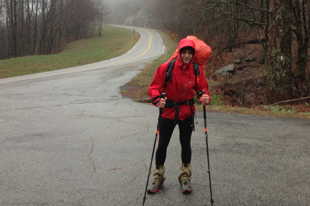
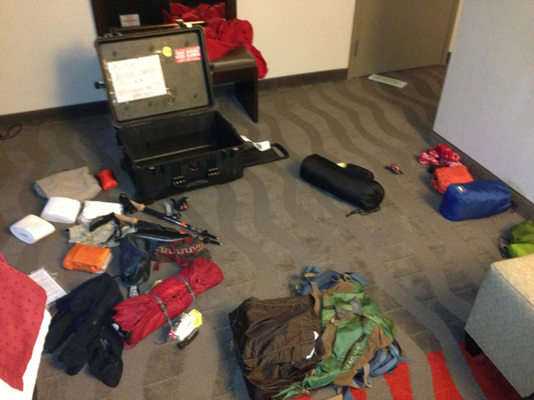
How was your Monday?  Traffic?  Lots of work left over from Friday that you tried to forget about? I feel your pain!  Woke up this morning to the continuation of rain... Big, mean, wet, unavoidable drops of liquid that had managed to soak absolutely everything overnight.  The best news? It was far from over.  As I hobbled across the tent site in my cheap Walmart sandals, I yelled to Kevin to make sure he still wanted to hike with me. My theory is that I'm going to get wet eventually, so I might as well start now. He agreed, and we begrudgingly struck our tents as Charles slept in, warm and dry, on the other side of the site - maybe he's a genius. In the process of striking my tent, it managed to get wet as well, which wasn't ideal, but acceptable only due to the fact that I divided my backpack with a trash compactor bag (waterproof) so that my down sleeping bag would stay dry. Threw everything together soaking wet, put my waterproof and bright orange pack cover on, and hit the trail... Or what would normally be a trail, but in this case was a raging river. 


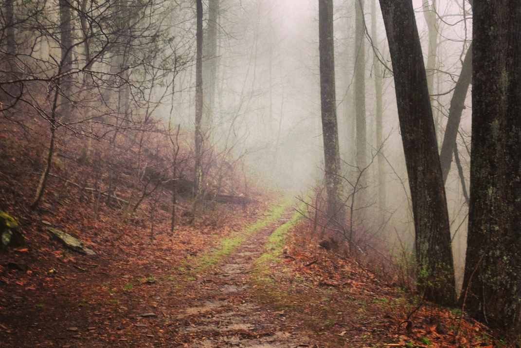
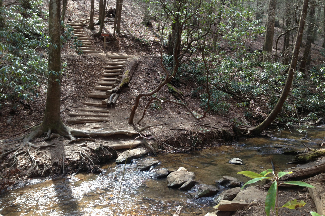
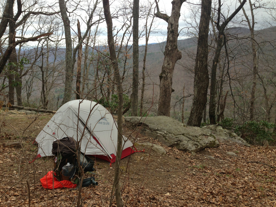
For the next 4 hours we hiked up, down, and across mountains, in flowing rivers. And I mean they had enough force to them that I actually filled my water bottle (to be filtered) directly from the 'trail' river.  It was everything but exciting. I will thank my mom, however, for the waterproof socks. Those made a hell of a difference today. Anyway, we pressed on, passing many camp sites with tents still erect, saying 'Goodmorning!' to hikers inside them, and informing person after person about the weather and our findings on the trail.  For the next few miles we carried on across a ridge-line in the mid 3,000' range.  This only amplified the already ideal weather conditions... Rain was joined by 35 mile an hour winds and temperatures in the high 30s to produce little bits of sleet pelting us from the right hand side as we were blown around, rain gear flailing (seemingly helplessly, yet appropriately given the conditions) as we went along.  A while later Charles passed us, still keeping is 3.5 mph pace, and yelled out he'd meet us at the next shelter for lunch. The tops of those ridges were something to be seen, though. The winds were forcing fog through at incredible rates, and many many trees have fallen victim over the years. It looks like a war zone of Mother Nature, mixed with the evil forests of The Princess Bride and The Wizard of Oz combined. 


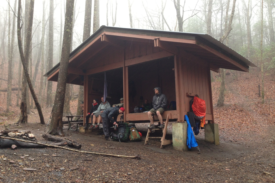
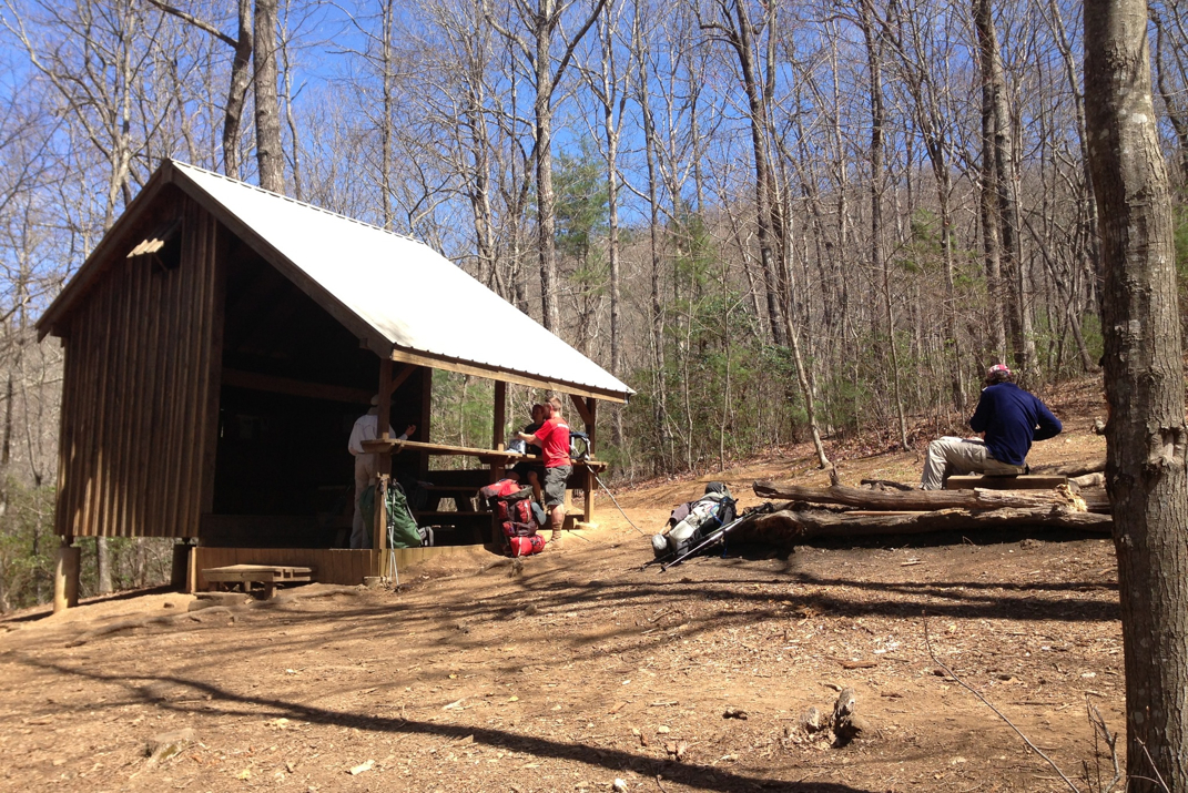
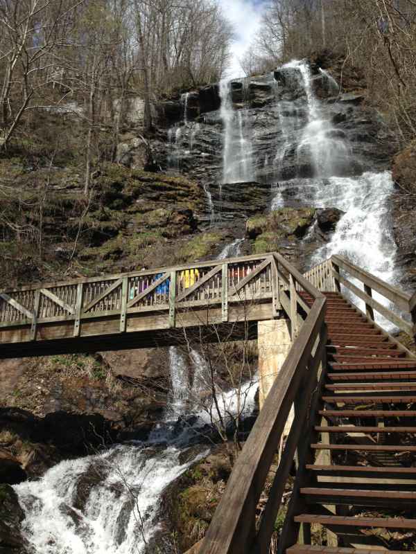
We pulled into the Low Gap Shelter at 12:15, and ate lunch with a good group of people we'd not yet met. Preacher and his girlfriend Brittany, from Maine, Sam (location unknown), and Charles. After a good meal, I started looking at the map as Kevin discussed spending the night. The aforementioned group all planned to as well since they had space at a covered shelter, which is hard to come by across the A.T. when the elements kick up.  After a short discussion I convinced Kevin we'd be warmer and further along if we headed out for the Blue Mountain Shelter, another 8 miles down the trail. He agreed, and we headed off at a great pace for an afternoon hike. With the rain still pouring down, we covered a lot of ground and saw some beautiful waterfalls along the way. We passed two folks, Odysseus and then Rachel, both who were headed into the local town of Helen, GA to a cheap motel for the night. 


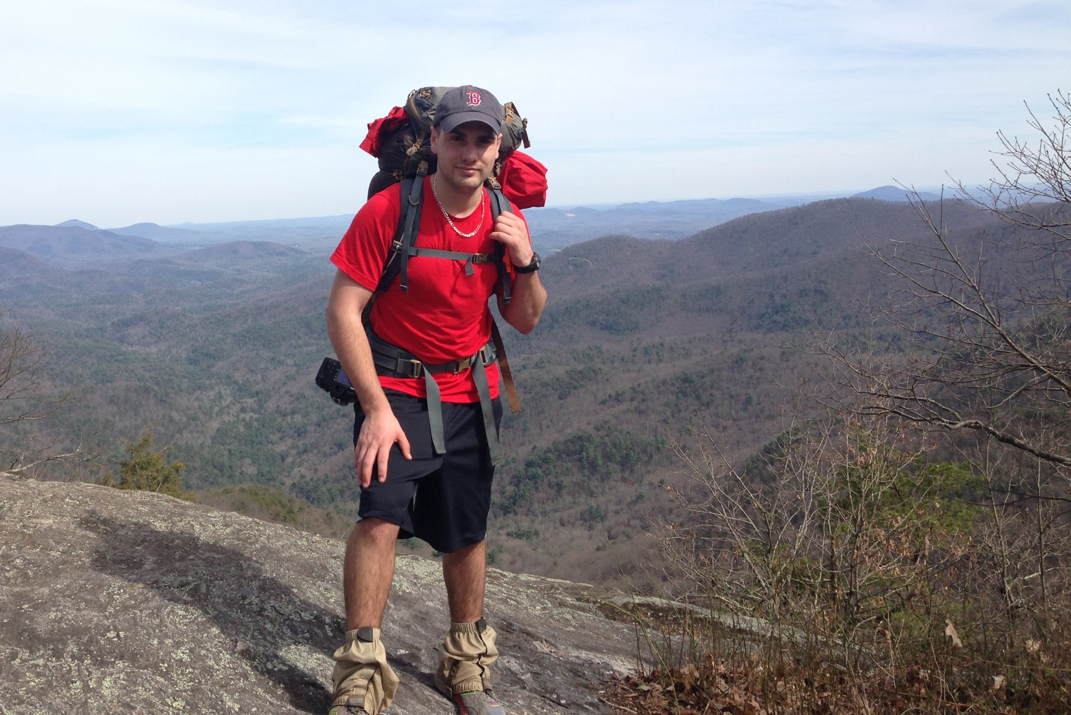
We arrived at Blood Mountain Shelter at 4:45 or so, ending our long and wet hike.  We were welcomed by a half dozen or so other hikers who had sleeping pads and bags lined up across the floor of the lean-to type building, and a fire was blazing in a covered fire pit. We sat down and began shedding soaking layers, fingers crossed that at least some of it would dry during our stay here tonight. A quick dinner led to great conversation with the group for a few hours before the sun went down. Hikers here include Jeremiah (he's not a bull frog, and was a good sport at laughing along to my likely overused pun), GQ from Boston (returns in two weeks to graduate from Northeastern, employed at the Apple store on Boylston St. in Boston), as well as Jeff (another member of Whiteblaze.com who was familiar with my blog and complimented the layout!) and his hiking partner Matt.  There are a few more whose names I didn't get. 


I still have some slight pain in my right knee on mountain descents, which I take slowly and carefully to avoid overdoing it.  I've also gotten better at long ascents without many breaks. My method has developed to more frequent short steps instead of lunges.  It keeps my heart rate lower. I also enjoyed some music today for the first time on the trail. It certainly helps keep the pace. 


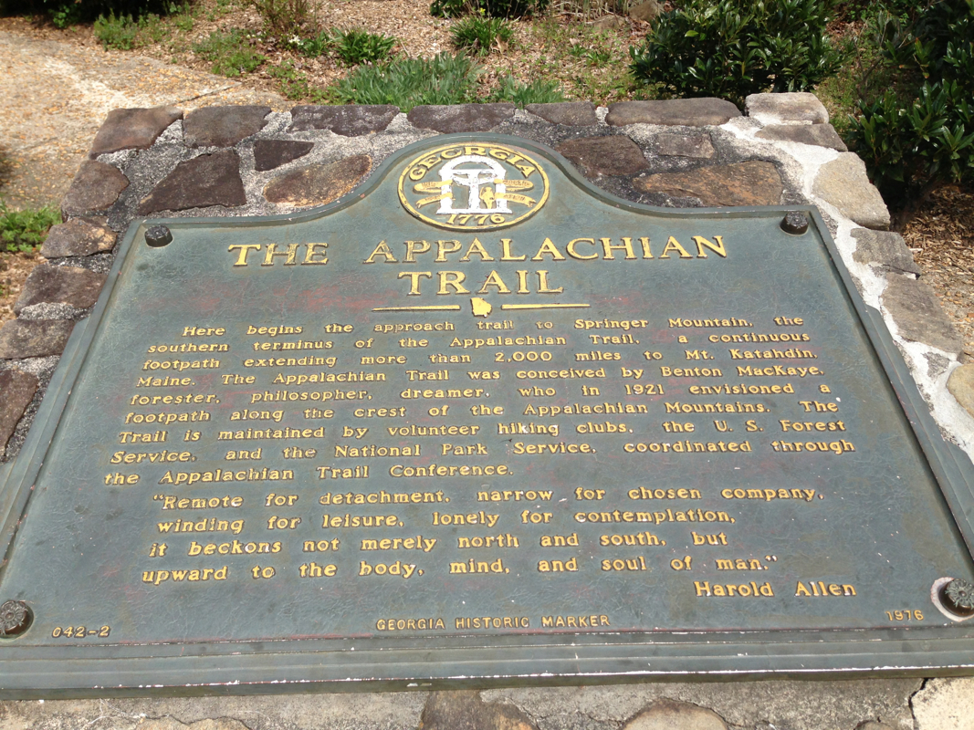
Rain's supposed to stop tonight, with the weather tomorrow being 40-55 and sunny. I'm eying a shelter that's 16 miles from here, but over 3 separate mountain passes of about 4-4,500' a piece, so we'll see. If I can make it there tomorrow night, it all but guarantees my passing into North Carolina on Wednesday, marking my first of 14 states completed.  We shall see. Stay dry, folks! 


Picture
Rain Hiking Attire
Picture
Lunch at Low Gap Shelter
Picture
Muddy Shoes
Picture
Waterfalls
Picture
Foggy Trail
2 Comments

You're Either Stupid Or Brave

4/7/2014

3 Comments


Day: 3

Day mileage: 11.7 mi

AT total mileage: 36.0 mi

Time: 7 hours

--

This morning began back at Lance Creek with the group from last night. Kevin and I packed up camp while some others were already leaving. I got a photo of the two of us with Ashli (spelling corrected from yesterday) and Just Kyle.  Today actually was a good day for group photos, I think I got a half dozen or so with the dSLR.  Once we were packed up we headed out to the creek to fill up our water supply, and ran into Chong, Jeff, and Sir Stops A Lot who we had hiked with for a while yesterday. Jeff is in his 20s and his thru-hiking, while Chong and Stops A Lot are hiking Springer to North Carolina with him. We all conversed & got a group photo as I filtered my water and enjoyed my morning breakfast, a bagel with peanut butter, and another side of ibuprofen and a multivitamin. 

Straight out of camp came a 6 mile, ~1,800 foot climb to the top of Blood Mountain. On the way up Kevin and I passed hikers Hustle & Flow from the night before, who we ended up playing tag with for the rest of the mountain. At the top was a very windy vista, and an extremely old stone shelter.  After a few photos and meeting a few other hikers (day hike and thru hikers) we began a grueling descent of the mountain. Along the way we listen to music from Hustle's phone, some nice Stevie Ray Vaughn kind of stuff, and ran across many weekend hikers with their dogs.  One dog we ran into was a one year old malamute/husky who was raised in Canada and is a trained sled dog, with quite the playful personality. Many people have mentioned wishing they had a dog with them on the A.T. so far.  We also passed a gentlemen who pointed at our packs and commented "You're either stupid, or unbelievably brave..." Time shall tell, I guess.  We dropped down to Neel's Gap, famed for a hiker hostel/general store that caters to hikers.  I picked up another canister of fuel and some instant mashed potatoes with bacon. Not much else I needed in the food department. Lunch was comprised of microwaveable frozen cheeseburgers and chimichangas, and an ice cream sandwich. I also picked up a rain proof bag to hang my food in at night. 

Most of the hikers we had traveled along Blood Mountain with were staying at the hostel for the showers/ laundry/ dry bed. There's a big storm moving in tonight and tomorrow that's aiming to drop over 3" of water on us. I don't know how many people will hike. After some quick conversation, Kevin and I decided to forge on, and put another 3 miles under our feet before we called it a day. The scenery wasn't gorgeous due to cloud cover, but there was a serenity in the long uphills. Squirrels would run alongside us, off the trail by 10 or so feet, making funny little noises, much alike the way dolphins swim in the waves of passing cruise liners. Nature sure is funny in that way.  The hope of stopping around 1600hrs was to get camp set up before the rain came.  We easily could have done more than the 11.7 miles, but after a hour at Neel's Gap it wasn't worth pushing too far today, so we're at a campsite just below the summit of Cowrock Mountain. As we were cooking, tents already up, we were joined by a guy named Charles (worked as a research analyst for the Forestry Service in Juneau, AK) and he decided to spend the night here. We got a small fire going and had enough time to talk for a while before the wind picked up and the rain moved in. 

I'm not looking forward to hiking in the rain, but I'm going to get wet at some point so who cares. No time like the present, so long as the future affords a moment or two to dry out a bit. 

Picture
Neel Gap
Picture
Microwaveable Lunch
Picture
Awaiting Rain
Picture
Hustle, Kevin, & Myself - Blood Mt. Summit
3 Comments

Lance Creek

4/6/2014

1 Comment


Date: 04/05/14

Day: 2
Day mileage: 14.8 mi
AT total mileage: 24.3 mi
Time: 8 hours

--

Today, my friends, was a good day. Despite the fact that we woke up to some crazy winds, Bill and I struck camp and had a quick breakfast before hitting the trail.  I ate a bagel with peanut butter, and drank a liter of water which also washed down 800mgs of Ibuprofen and a generic multi-vitamin.  Also before we get too far along,  for whatever it's worth, shitting in the woods is an understated art. 

Right before we parted ways from our gusty camp site, Kevin (from Day 1's summit of Springer) happened upon us and joined us for our hike. Kevin's about 25.  It only took a mile or so for it to become evident that Kevin and I hiked at a similar pace, and before long we had left Bill behind. YES this makes me feel guilty, and YES I'll have to get over it. I'm not going to make it to Maine by waiting for everyone I like.  The good news? I got a good photo of Bill and myself before we left the campsite (on the dSLR) so he will live on in infamy. I'm sure he'll do great once he loses a few pounds of pack weight. Good guy regardless, as most Maine residents I've met are.  Regardless, Kevin and I clicked and kept on trucking. 

I'll now introduce a theme that will be present from here on out.... 

Conversations with Hiking Strangers 101: 

- Breaking Bad

- Previous Jobs

- Girls

- Food 

- Gear

- Tinder (Google it, then don't be quick to judge- this is in fact the 21st century, being led by a very tech-reliant and introverted generation). 

We stopped for lunch after a few easy miles at a place called Gooch Gap Shelter... The first shelter I've seen this far as apparently I spend too much time watching where my feet will go to notice these camouflage buildings. Nonetheless there it was in all of its glory. We signed the guest book, and ate lunch with a few other guys. One was a 32 y/o Army Medic, the rest were older. One gentleman, Trail Name: Roadrunner, was starting his 5th thru-hike attempt. Turns out every time he gets to NY state, someone in his family gets sick. If it were me I'd start up again back in New York, but then again what do I know.  I had some cheese on a tortilla shell with pepperoni for lunch, with a bite of a Snickers bar that I broke up and munched on all day. Keeping at our pace we made it to Woody Gap around 3, with the intention of making it to just before Jarrard's Gap before calling it a day.  There is a mandate for a 'bear canister' or a large break/scent/bear proof box to store your food in for a 7 mile stretch between Jarrard's and Neel's Gap due to increased bear activity. By stopping just shy of the aforementioned Gap we will be able to quickly pass through tomorrow without needing to buy/carry the 4-5lb canister. 

At about 5 PM we rolled into camp after a very long and strenuous downhill (sounds like an oxymoron, downhill is easy right? Except 3 miles or so of it that works very weird muscles and gets rather uncomfortable after a while). There are almost a dozen tents pitched here, including a few men from Germany, and a great group of American hikers between the ages of 20-55 who Kevin and I joined by a campfire after we ate. I had 4 packets of cinnamon & brown sugar oatmeal. Dinner of champions, right?  It was perfect in that it required almost no water and not even a boil (I used pre-filtered water) and filled me up. Also had 16oz of lemonade from a powder packet I brought a dozen or so of. I drank about 6 liters of water today, and am doing well at staying hydrated. Finding and filtering water is not as infrequent as I'd imagined. I keep 3 liters of water with me at a time, then chug a liter at the next water source. Easier to carry it in me that on my back.  I also took a minute tonight to attempt a partial 'bathe' with my biodegradable soap and stream water. Now instead of just sweat, I smell like peppermint sweat.. And the water was about 55 degrees. Awesome. 

Tonight's campfire attendees included two early-20s couples, Hustle & Flow from SC, Tolin & Alin from New Jersey, Woodsgirl (high school counselor) from Seattle, Mudman (previous thru hiker) from Canada, Nick from Illinois, and Just Kyle/Ashley who are both previous REI employees who got frustrated with the corporate restructuring and decided now was the time to hike..  Great conversations, good laughs (I'm quite the comedian, apparently? Who knew...) and we doused the fire at 8:30 once the sun was set and temps started dropping. 


All in all, Day 2 was a success. I've not yet decided what tomorrow's mileage will be, but I'm pleased with how far we made it today. 

--

Pics: River Crossing at Justus Creek, Gooch Gap Shelter, & me at an unnamed 3,434' elevation vista around mile 22 (just after Woody Gap)

Picture
Justus Creek
Picture
Gooch Gap Shelter - Lunch
Picture
1 Comment

From The Summit Of Springer

4/4/2014

3 Comments


Day: 1

Day mileage: 10.5 mi

AT total mileage: 9.5 mi

Time: 5 hours


--

The morning resumed at the Stratford Motor Inn.  My 'Last' shower was exceptionally anticlimactic as I don't think the shower head has been replaced in 10 years or so.  I'm spoiled by the Marriott and Starwood shower heads that I so often get when traveling. This morning's left a lot to be desired, but nonetheless hot water that has an (almost) limited supply is something I'll soon be yearning for, so I enjoyed it and hopped out to get ready for the day.  The complimentary buffet at the Motor Inn was a nice combination of muffins, donuts, cereal, and juice from concentrate. Certainly enough to fill me up, as we shared the room with an older gentlemen who smelled like a strange mixture of marijuana and cigarette smoke, and my dad and I talked about adventures of the past.

Thirteen miles on rainy two lane roads brought us through some amazingly diverse landscapes and social situations. One second there'd be a large house with a few nicer American made cars/trucks, the next a barn that had collapsed in on itself a decade or two ago and had been left to rot. The whole 'welcome to Appalachia' really hit when we drove by a woman standing on the deck of her leaning wooden house, leaning in the door frame smoking, surrounded by clothes air drying on the porch with a few busted pick-up trucks on the property. It was truly an eye-opening sight. A few miles later we came across a turnoff for 'Springer Mountain' (please make note of the bullet hole in the sign photo), where the Appalachian Trail begins for northbound hikers. After turning on we were challenged (as was the rental car) with a one-lane dirt road that reminded me of something I'd take a few beginners of my Jeep club on. After a 6.5 mile 'Volkswagen Suspension Check' as I called it, out of the heavy fog came a parking lot with a half dozen cars and a handful of hikers wrapped in neon rain gear.

This just got real.

A 1 mile jaunt up to the summit of Springer allowed me to sign into the hiker registry, take the obligatory photo, and meet a few other hikers. My dad and I hiked back down, and parted ways at the parking lot.  Strange to have him drive away and know it might be a few months till I see him again.  Nevertheless I began walking with Rory from Chicago. Easy conversation and winding trails made for a quick day, and around 1400hrs we met up with Bill from Maine.  Not long after, the three of us stumbled upon 'Trail Magic' which is hiker lingo for a kind individual leaving a beer, candy bar, cold drink, etc. on the side of the trail. As you'll see in photos below, it was a pop up tent with a cooler of ice water. Very appreciated. 


So the three of us kept walking for the remaining 4 miles, continuing on to a campsite I had picked out last night as the one to stop at. There are probably some wondering why I wanted to stop at only 5 hours of walking, given the amount of daylight available (sunset was 20:00hrs).. Although I'm sure I could physically continue for further than 10.5 miles today, my goal here is to make it to Maine. I'm going to aim to stay in a 10-12 mile/day range until I get my legs in trail shape and can push further. Also, it was nice to be at camp, fed, and in bed by 7. I'm tired!  


Rory didn't make it to camp with us tonight. He at one point about a mile from this campsite said he was making a phone call and would meet up with us. He never made it here, so I wonder if he's stopping at an earlier campsite (there was one between where we split and where Bill & I stopped). So Bill and I made camp at the top of this mountain and settled in for the night. It's quite windy up here at 3,067 feet of elevation, and there has been constant rain since we got into our tents. Thunderstorms have been in and out of the area, and the wind has remained.  I'm sure It was quite comical to watch Bill and myself hang out food bag in a tree to keep it from 'da Bears' but it hangs nonetheless, thanks to a couple useful knots I've been taught by riggers on tours/show sites. Hopefully it's still hanging after the wind tonight. 


I went to sleep at 7:30 and tossed and turned before taking some ibuprofen and finally falling asleep. Woke up at 0030 and feel better, figured I'd write this. For those interested, the 'location' page is now updating with my GPS coordinates as I go. 


It's happening, guys. I'm here. In Georgia. With 'the plan' of walking to Maine.... Anyways, lights out. Aiming for 12 or so miles tomorrow with Bill. I don't know if we'll keep pace together, I think I'm in better shape than I thought, but it's fun to watch these like-minded people come and go. What an experience I'm in for. 


Until next time. 

Picture
Picture
Picture
Picture
Picture
Picture
3 Comments

Atlanta

4/3/2014

2 Comments


After a whirlwind few days home, I'm now writing from the last (quasi) comfortable bed I'll stay in for a while, at the Stratford Motor Inn, located about 20 miles from Springer Mountain (the start of the AT) in northern Georgia.  As someone who could be coined a 'frequent flier' (not entirely to the extent of George Clooney in 'Up In The Air') I'm usually pretty seamless about the packing/rental car/hotel process, but these past few days were an entirely different story. 


My normal packing is for 7-14 days at a time, and doesn't consist of everything I could ever possibly need to stay fed, warm, and alive against an altercation with a bear.  Leave it to me to plan for a trip for a year and be running around the house 2 hours before my flight freaking out about where my new box of Burt's Bees Chapstick was.... Yes, this is real life.  The bag was packed, toss-ups between how many insulating layers were needed were made, extra batteries, my GPS, knife, water filter, Chapstick... All thrown into my suitcase to be checked at the airline to keep my hiking backpack from tearing or being destroyed by baggage handlers. The Audi was dropped off at an exceptionally gracious friend's garage, where she'll slumber for a few months without me (the separation anxiety will be present for both of us, I'm sure), and my lovely end-of-year 2013 donations to the Internal Revenue Service were mailed, a record 13 days before they're due. Things were looking up.   Airport was seamless, as it should be, seeing as that's at least one thing I'm good at.  Once we got to Atlanta, I gave my dad the choice of what rental car we got. His selection of a new VW Jetta would turn out to be a curse, as the trunk release mechanism broke and it took multiple attempts at my crawling through the rear bench center arm rest to release the emergency hatch lever. Quite the experience... We seriously debated a crow bar. 


We spent today running last minute errands to AT&T to transfer my cell number over from T-Mobile in order to have better service on the trail. For those who have my number, it will *remain the same* during my hike.  We also stopped by Home Depot to make a clip-on camera mount for my Canon dSLR, and spent a bit of time organizing my pack. Weight is a bit heavy at just around 35lbs, but for the first time that's actually including a few days worth of food that we got at Wal-Mart last night. Oh how I've missed Wal-Mart SuperCenters of the South.  Plenty of people-watching to do.  After finishing up errands and a quick stop at iHop (is it spelled like an Apple product? I'm now doubting myself...) we headed an hour or so north of Atlanta to Amicalola Falls State Park where at the visitors center I signed into the Official Appalachian Trail Thru-Hiker 2014 log book. I'm officially Hiker #920. I've joined the ranks. Per their statistics, 17% of those that start this year will finish. 


We climbed the many many 'strenuous' steps up the 700' waterfall to a gorgeous vista and hotel/lodge where we soaked in the 75 degree sunny day before walking back down and finding our way to the Motor Inn. The roads around here are amazingly paved (unlike every single road in New England after this past winter) and are curvy, making me wish I had something a bit more peppy with a manual gearbox to drive. In all honesty, though, the local towns are quaint and gorgeous. Luscious green fields, falling-down and recession stricken barns, old cars, etc... I was saying aloud how it makes me feel like I'm in the History Channel show American Pickers.  Being able to spend this kind of time with my dad before leaving I think is exactly what I needed to get me mentally prepared for what's coming, and I can't thank him enough for tagging along. 


A lovely last dinner with just the two of us at Longhorn Steakhouse, complete with a 1/2 lb burger, a few Sam Adams Summer Ales, and the Sox beating the Orioles before they head back to open up Fenway tomorrow. Lights out at 2230hrs, it seems like the world's in decent shape for me to go to bed, and wake up tomorrow with quite the adventure ahead of me. 

Picture
Picture
Picture
Picture
2 Comments
Forward>>

    SUBSCRIBE

    Join Over 2,000 Readers On The Search For Adventure!

    Delivered by FeedBurner


    Author

    Hey there! I'm Ryan McKee, a free spirited adventurer, photographer, and digital media creator who calls North Carolina home. I travel incessantly, carry a camera with me everywhere, and am always dreaming of my next big trip.

    Picture

    SOCIAL MEDIA

    Picture
    Picture

    SPECIAL THANKS To

    Picture
    Picture
    Picture
    Picture
    Picture
    Picture
    Picture

    Archives

    October 2019
    September 2019
    August 2019
    August 2018
    July 2018
    June 2018
    February 2018
    December 2017
    November 2017
    October 2017
    September 2017
    August 2017
    July 2017
    June 2017
    May 2017
    March 2017
    February 2017
    January 2017
    December 2016
    November 2016
    October 2016
    August 2016
    July 2016
    April 2015
    September 2014
    August 2014
    July 2014
    June 2014
    May 2014
    April 2014
    March 2014
    February 2014
    January 2013


      Quick Survey

    Submit

    Categories

    All
    Allagash Wilderness
    Appalachian Trail
    Banff National Park
    Bears
    Canada
    Caribbean
    Connecticut
    Georgia
    Greece
    Hiking
    Italy
    Jasper National Park
    Jeeps
    Katahdin
    Long Trail
    Maine
    Maryland
    Massachusetts
    New Hampshire
    New Jersey
    New York
    North Carolina
    Overland
    Pennsylvania
    Photography
    Sailing
    Tennessee
    Travel
    Vermont
    Virginia
    West Virginia

    RSS Feed

ADVENTURES

Trans-Canada Overland Expedition
The Long Trail
Appalachian Trail
Bicycling Across America

Overland Build

Meet The Jeep
Backcountry Gear
​Modifications & Installations

Everything Else

Read The Blog
Photography
Guest Book
Contact

Picture
© COPYRIGHT 2019
​All Rights Reserved